-
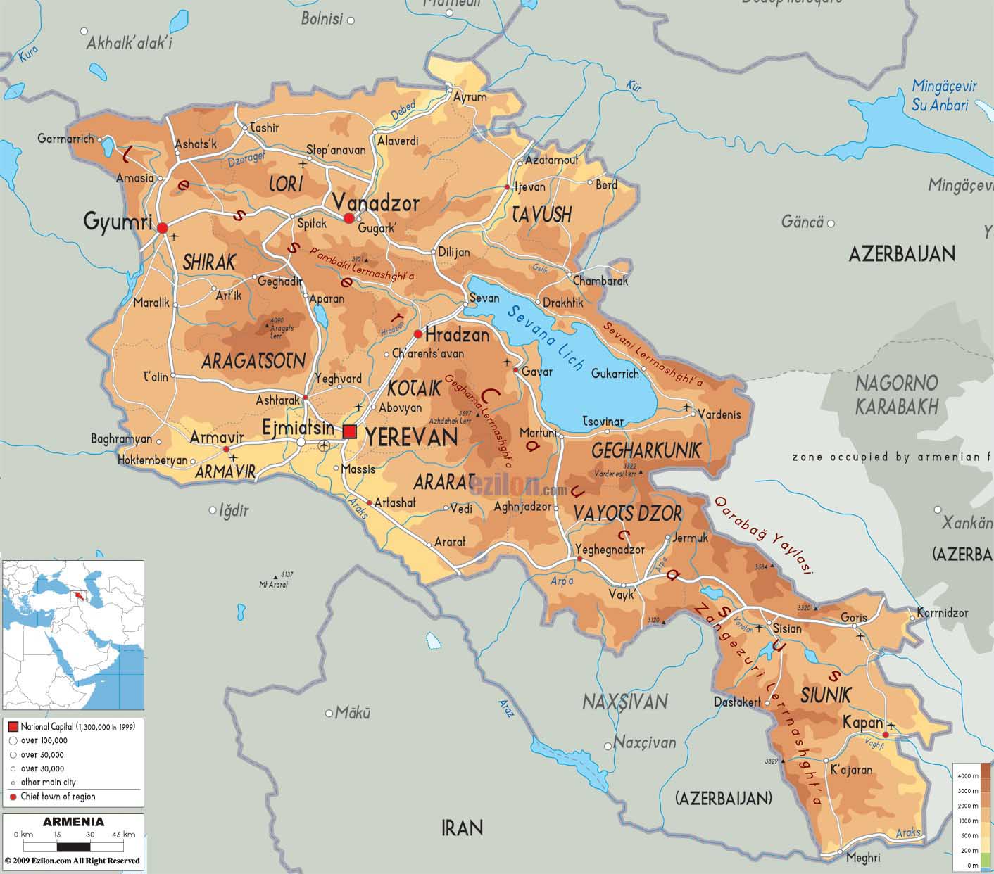
- Armenian Map
|
  -
- Mid-East Map
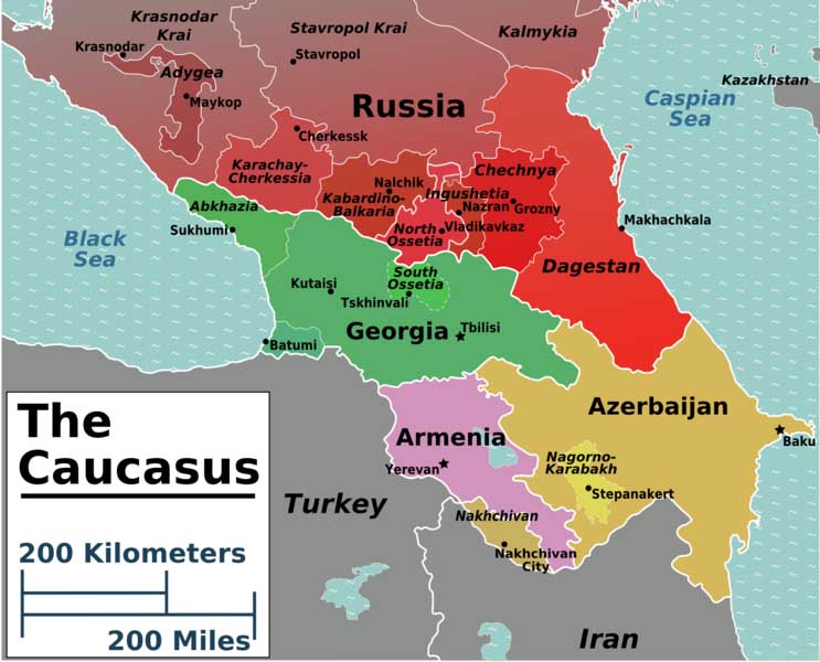
Caucasus Map
|
|
-
|
- latest picture: July 21, 2013
|
|
-
-
|
-
-
|
-
-
|
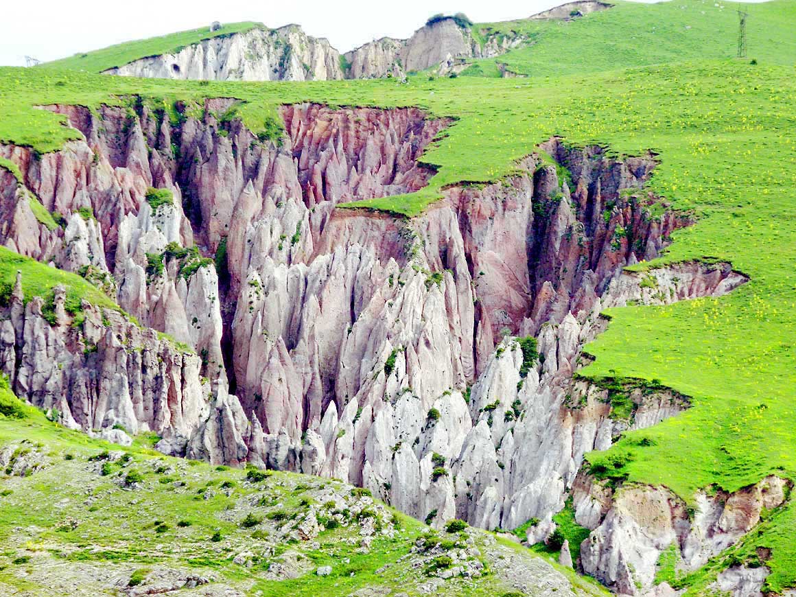
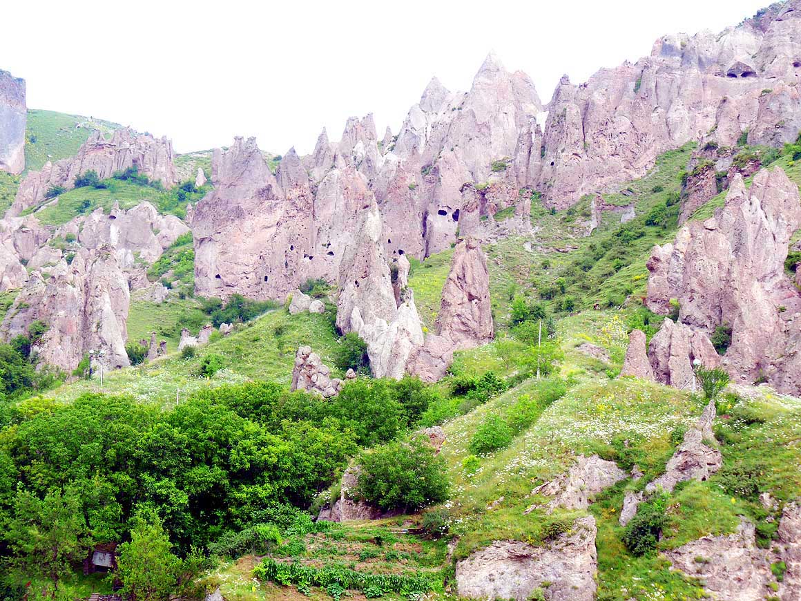
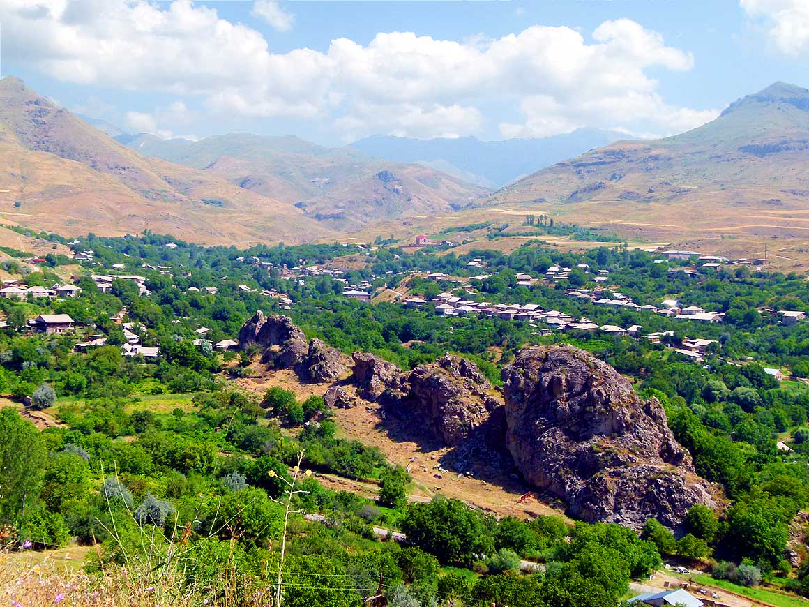
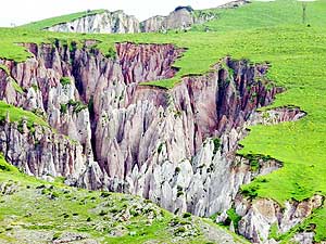
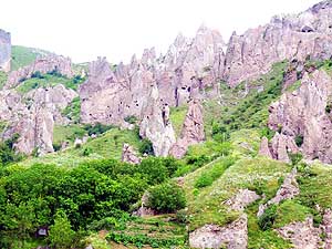
- 076
Bizarre eroded pillars of tuff stone
- rise like spears through the grassy slopes
- above the town of Goris on the road to
- Nagorno-Karabakh
|
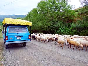
- 077
A herd of sheep crosses us unruffled.
- As always we stop. The animals are not
- screwed up by our LandCruiser and we
- enjoy watching them
|
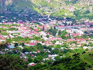
- 078
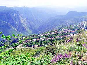
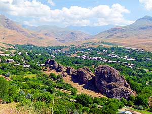
Goris, a town on an altitude of
- 4’550 ft. of about 25’000 people, lies
- picturesquely in a basin, embedded in
- greenery. It is a comfortable stopover
- between the capital Yerevan, Nagorno-
- Karabakh or the Iranian border
|
| Goris
lies picturesquely in a basin and surprises with chimneys and cave
dwellings similar to those of Cappadocia in Turkey, albeit on a smaller
scale. In this sleepy place that counts 20’000 people, we take a room in
the Hotel Christie and stock up our supplies in a small grocery store:
Beer, cheese, sausage, ham and mineral water. |
-
-
|
-
-
|
-
-
|
- 079
Chimneys and cave dwellings in
- the hillsides east of the town of Goris are
- similar to those of Cappadocia in Turkey.
- According to locals the caves of "Old Goris"
- were built and inhabited in the 5th century
|
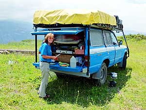
- 080
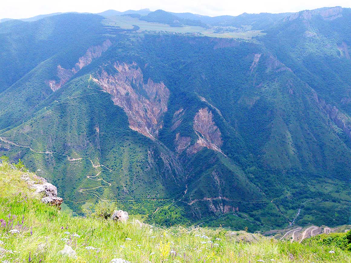
In Armenia there is no shortage
- of lonely picnic and camping possibilities.
- Liliana prepares lunch above the
- Vorotan Canyon .....
|
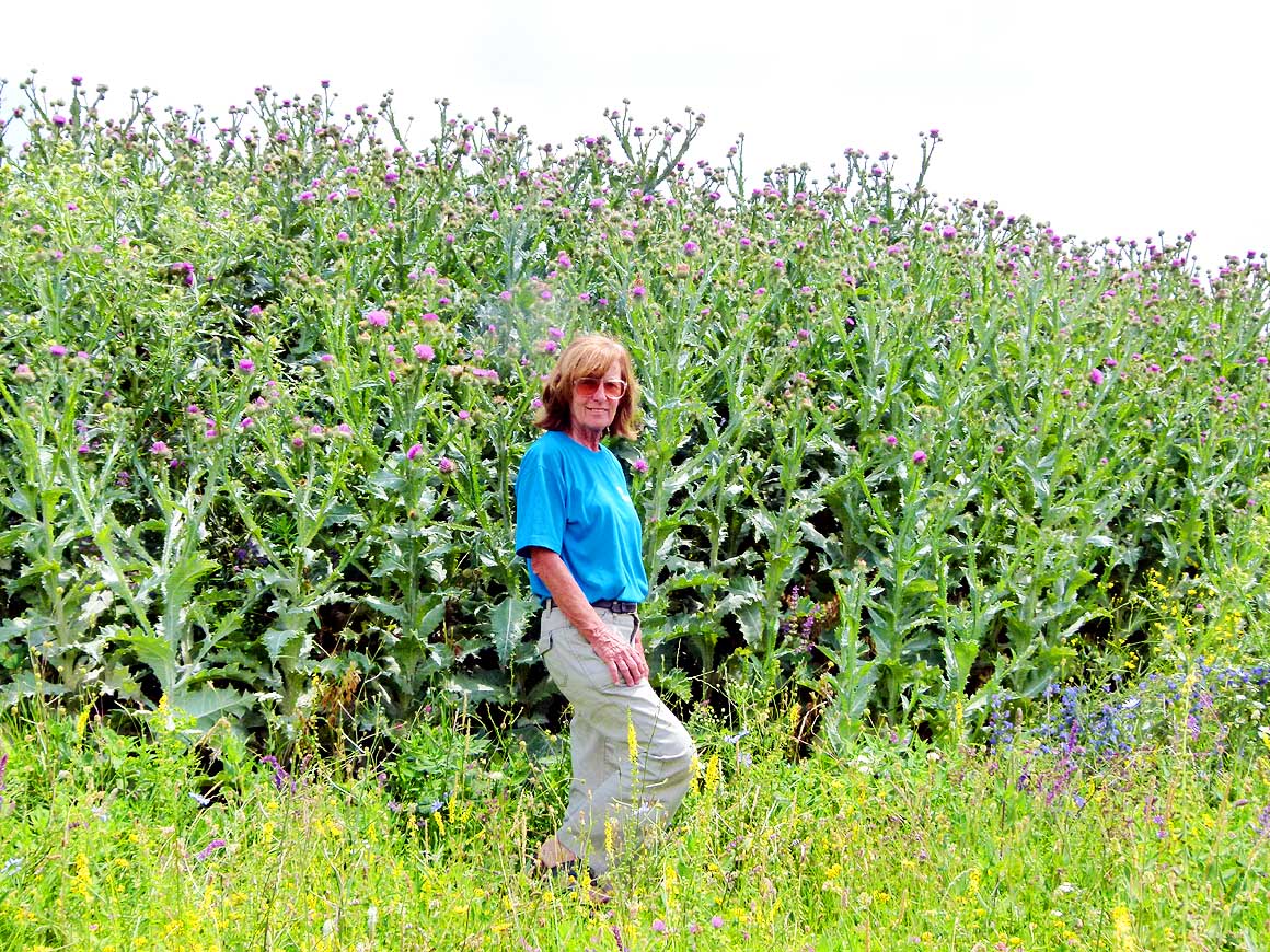
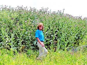
- 081
..... close to our lunch spot
- grow head-heigh tall milk thistles
- (Silybum marianum)
|
| Still
on our to-see list is one of the most beautiful monasteries of Armenia:
The Tatev Monastery, situated on a dramatic setting high up at the edge
of the 2’300 to 2’600 ft. [700-800m] deep Vorotan Canyon. We have heard
and read a lot about the obviously infamous adventurous 4x4 track
leading there and have therefore a big respect of it. |
-
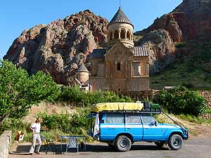
-
|
-
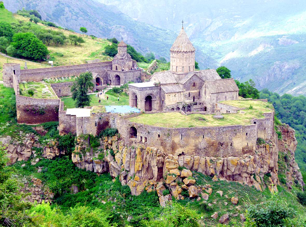
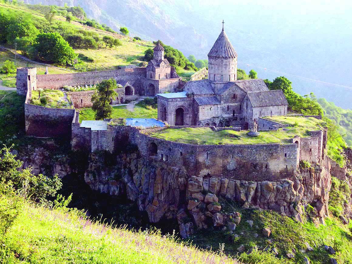
-
|
-
-
|
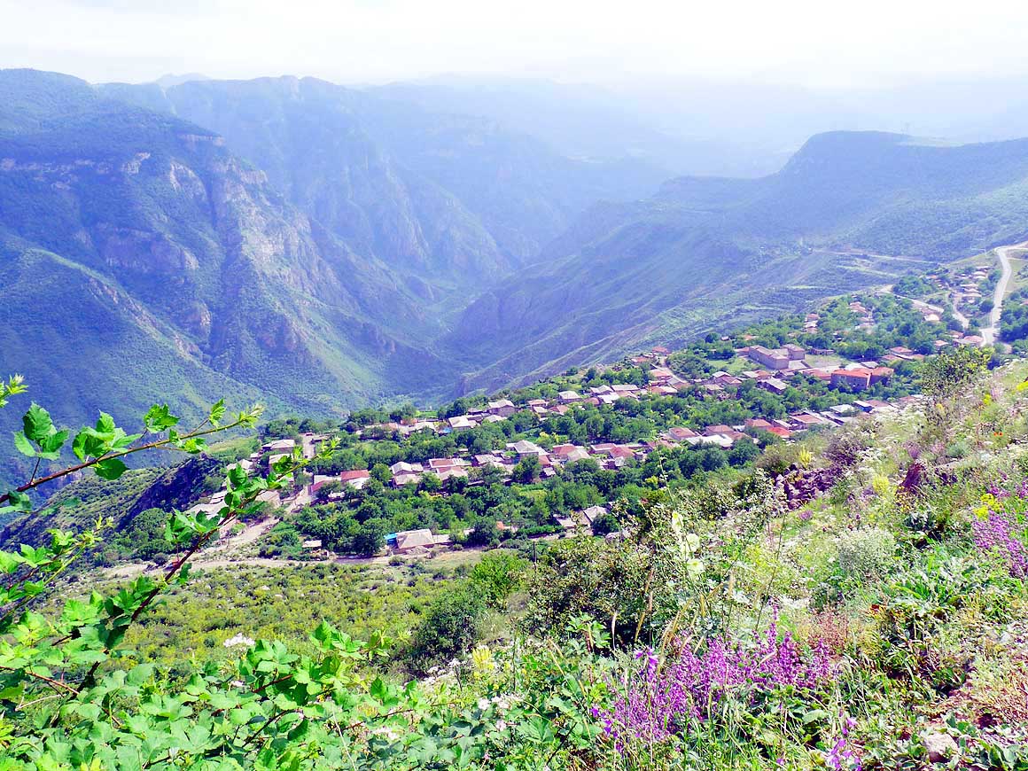
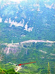
- 082
Neatly embedded into a row of
- trees lies the village of Halidzor at the
- edge of the Vorotan Canyon, from where
- a cable car runs to the Tatev Monastery
- (see picture #91 below)
|
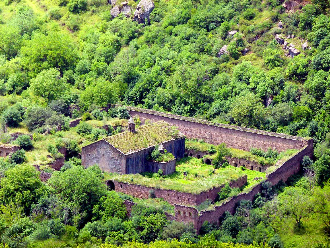
- 083
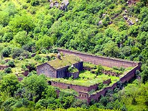
Slowly nature is taking over again:
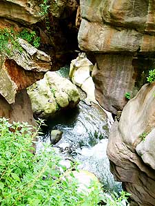
- Walled Harants Anapat Monastery at
- the bottom of the Vorotan valley, a
- hermitage that was built in the 17th century
|
- 084
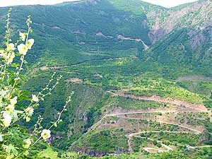
The infamous, bad and adventurous
- track with narrow switchbacks leading up
- to the Tatev Monastery is now improved
- by a relatively wide gravel road,
- manageable also by busses
|
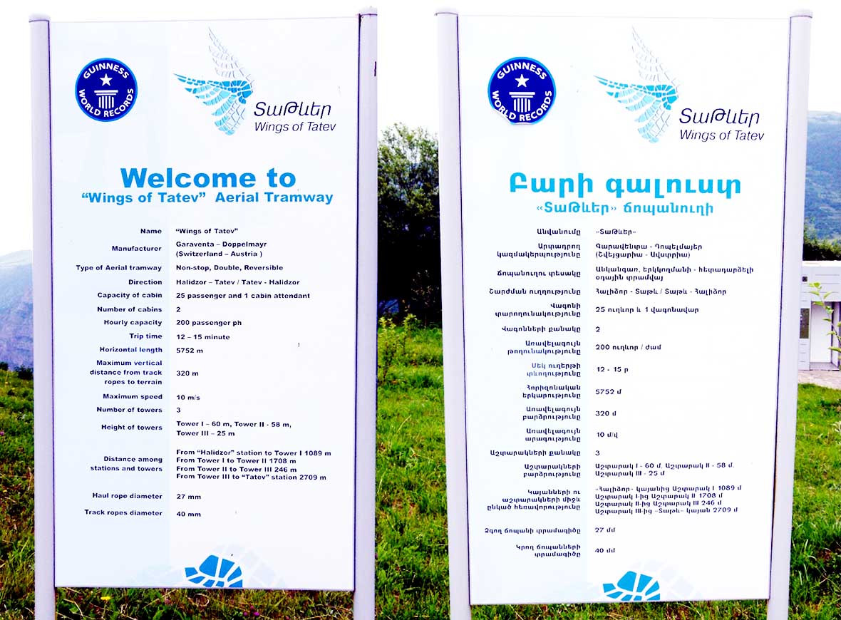
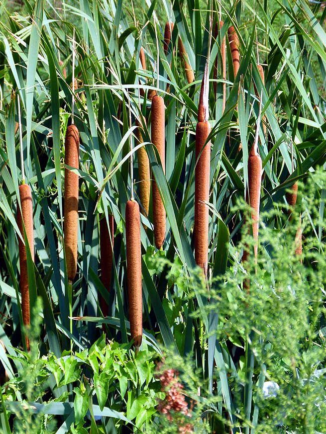
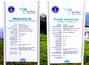
| Yes,
and then we see the Aerial Tramway and read that with each ride it can
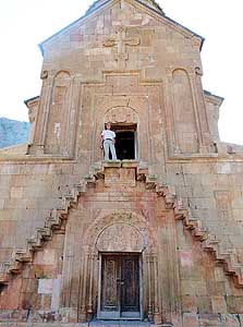
transport 25 people, that it has a length of 18'865 ft.=3.57 mi.
[5’750m] and is the "world's longest cable car line of one
section", for which it made it into the Guinness Book of Records. It was
built 2010 by the Swiss (of course!) and Austria. What tourist hustle
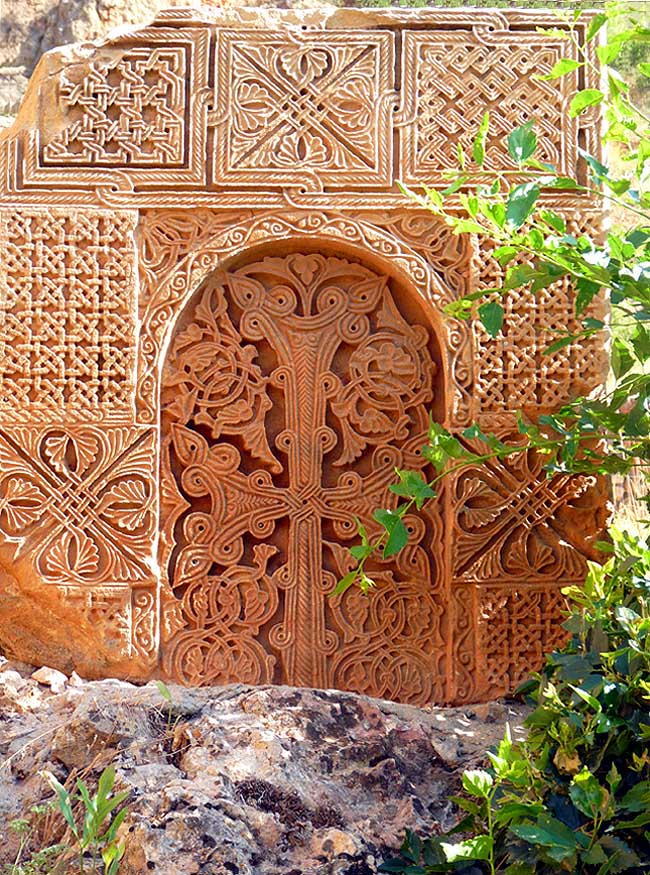
and bustle might we have to expect? |
-
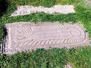
-

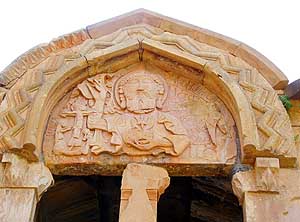
|
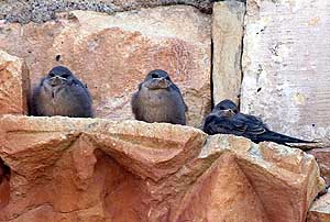
-
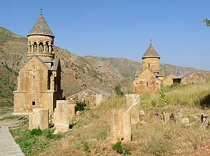
-
|
-
-

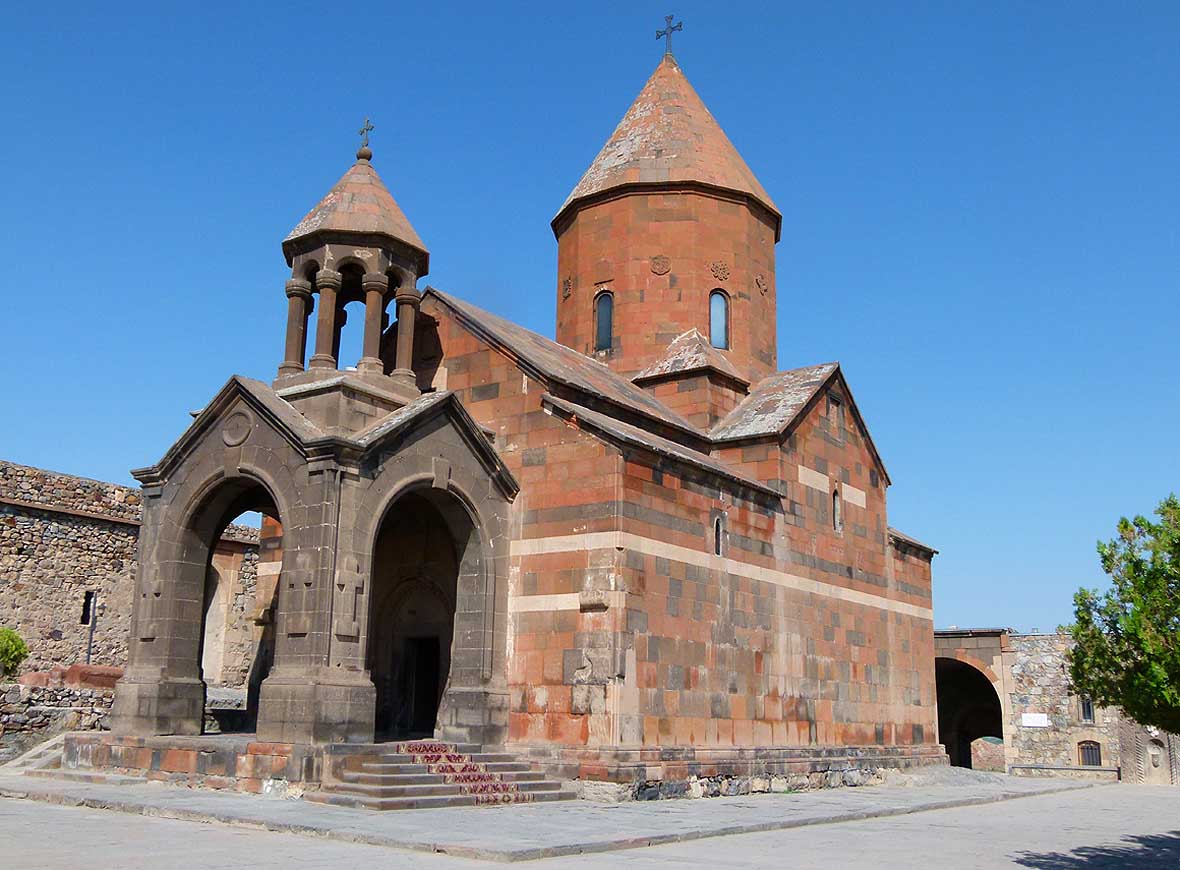
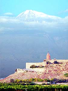
|
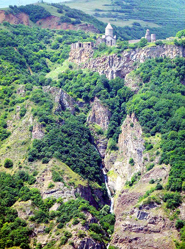
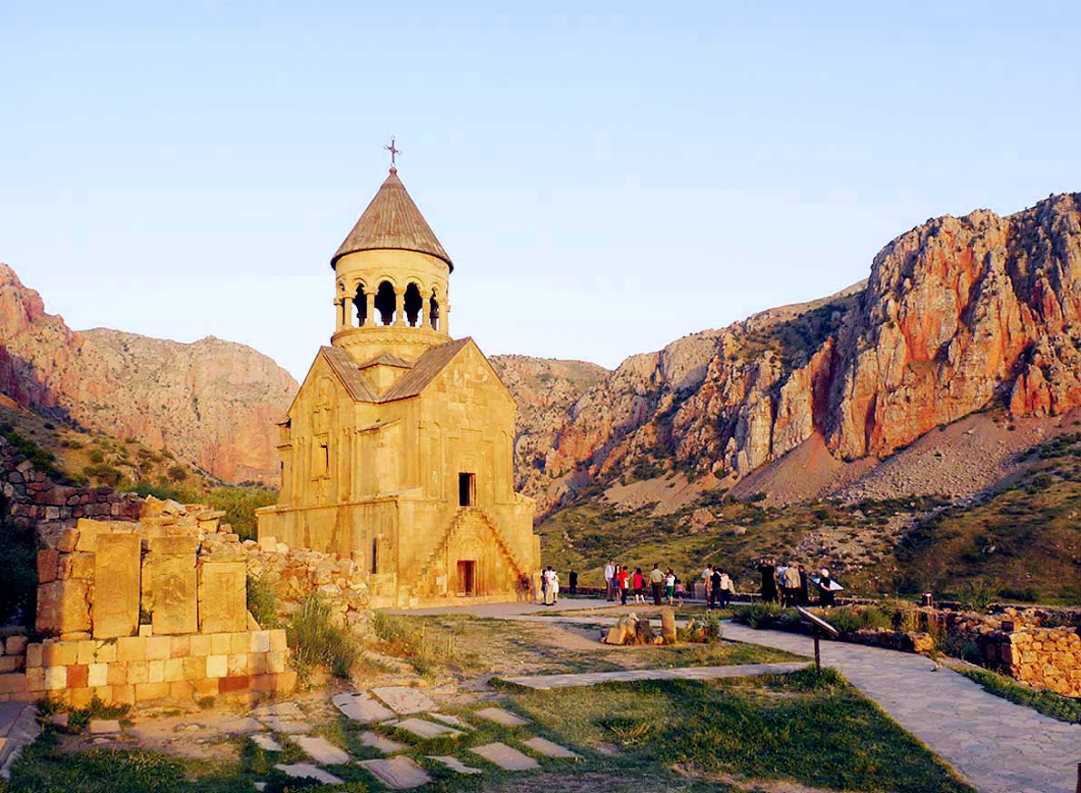
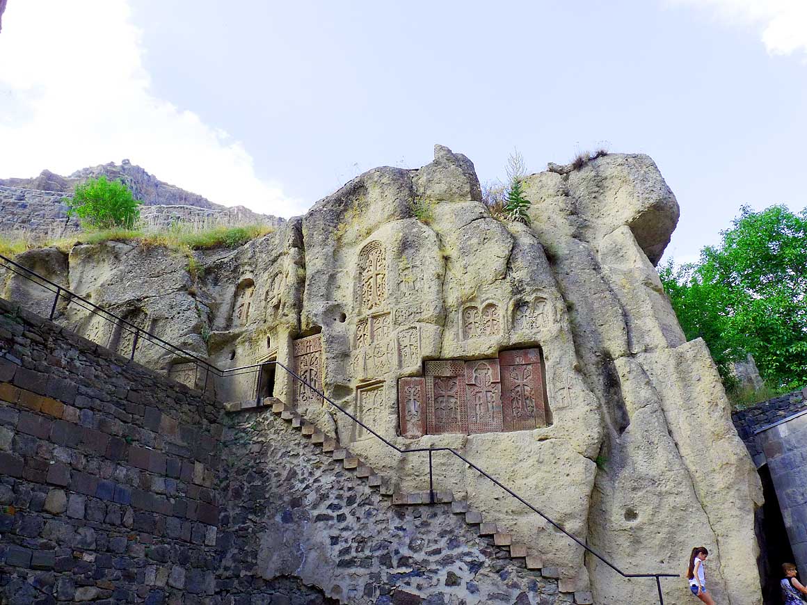
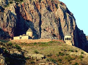
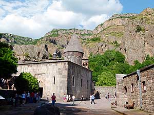
- 085
The Tatev Monastery is situated
- in a dramatic setting at the edge of the
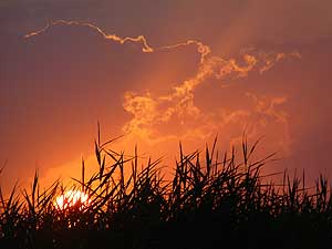
- deep Vorotan Canyon (see also picture #97
- below). It is a UNESCO world heritage
- site (picture taken at evening light) .....
|
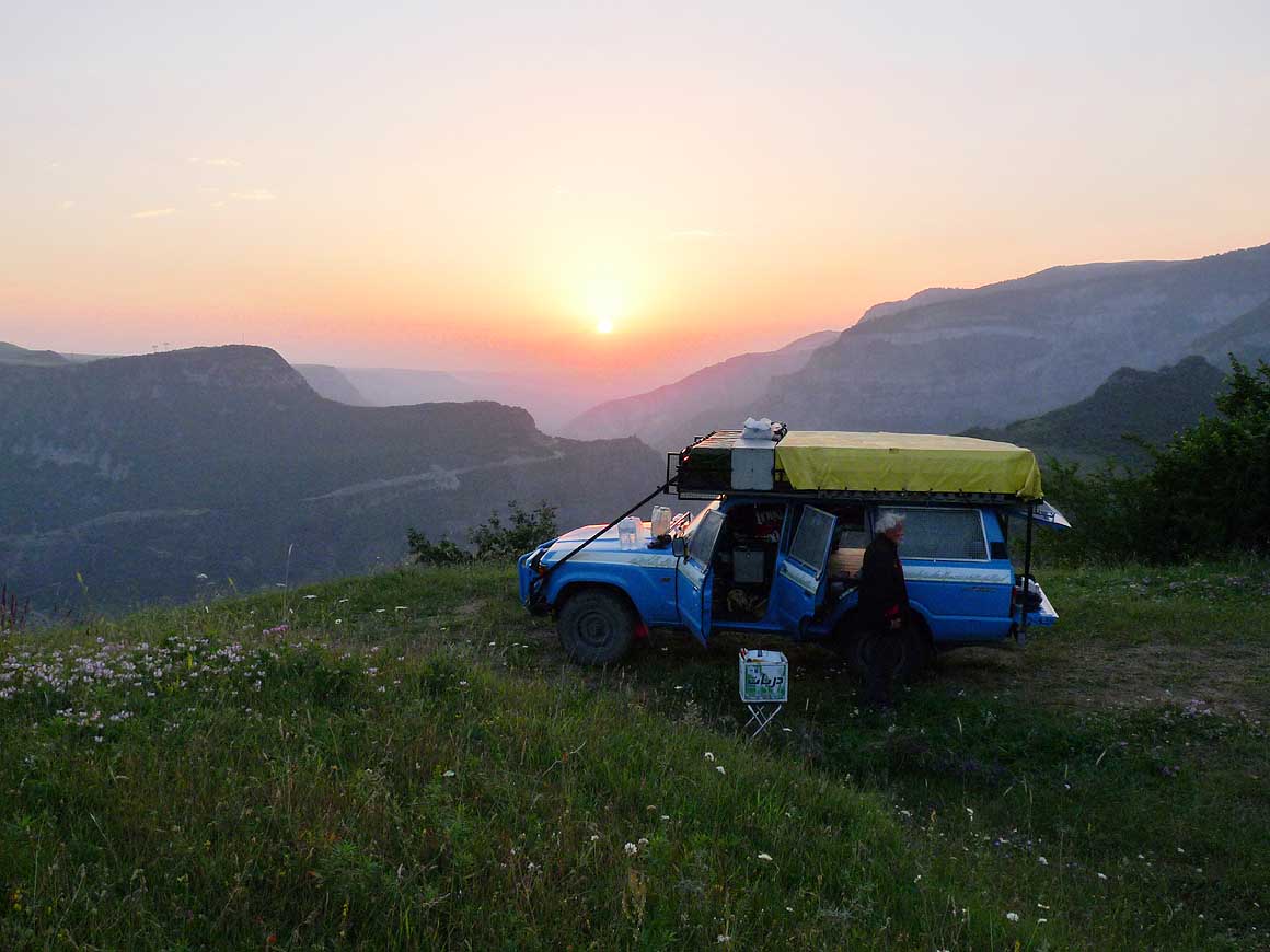
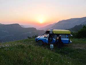
- 086
..... we camp on a tiny flat meadow
- 600 yards above the monastery. Shortly
- after we get up, the red ball of the sun
- appears behind the still dark
- mountain ridge .....
|
- 087
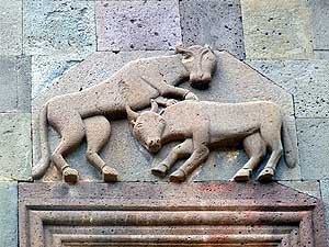
..... and gives the Monastery a
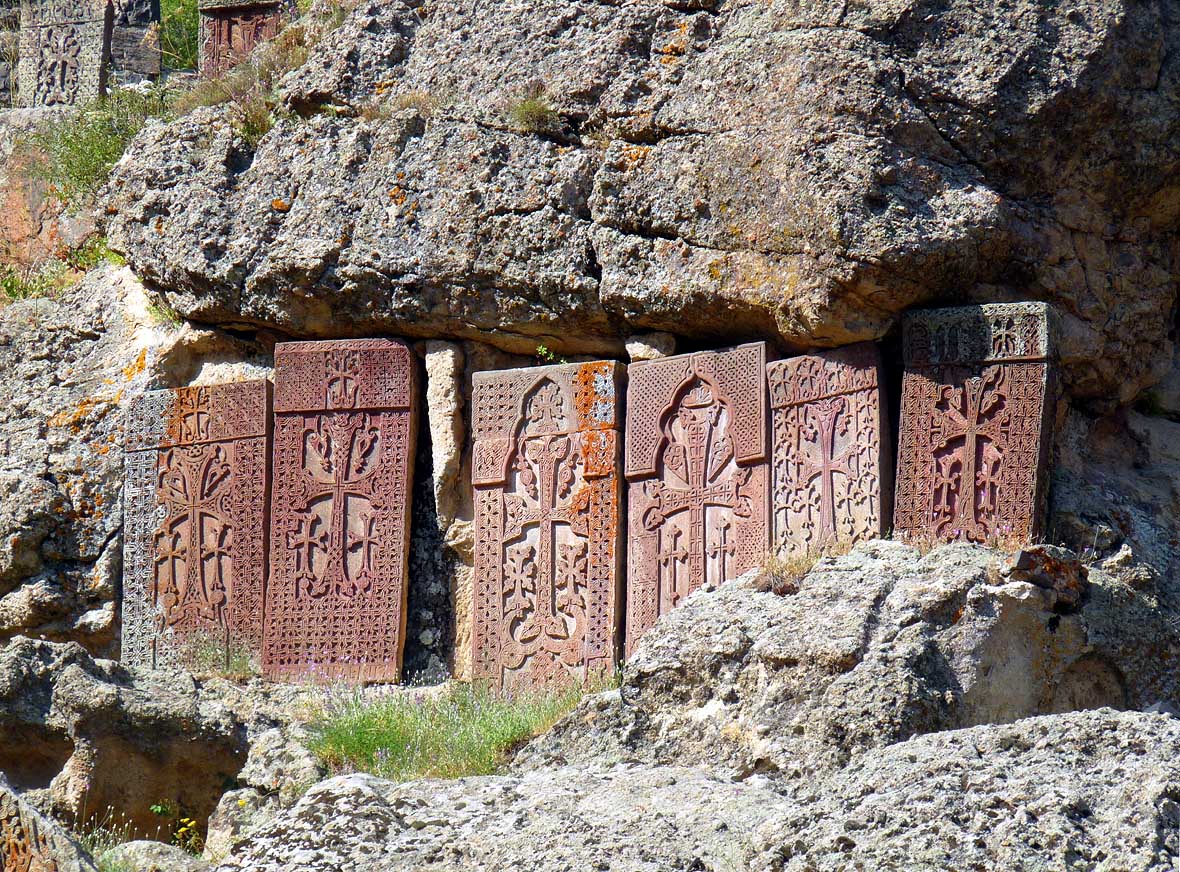
- different touch of color than the evening
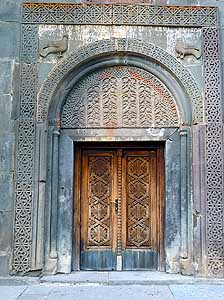
- before. Tatev is rated as one of the
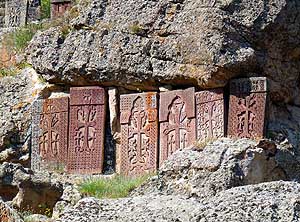
- most beautiful sites in Armenia
|
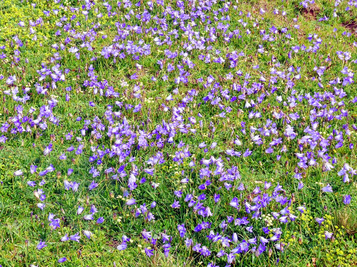
| Not
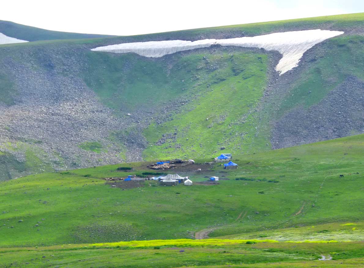
too bad – it is also advantageous for us: Today, the former apparently
rough and tough track is newly paved all the way down to the bottom of
the canyon. And the narrow switchbacks uphill have been widened by a
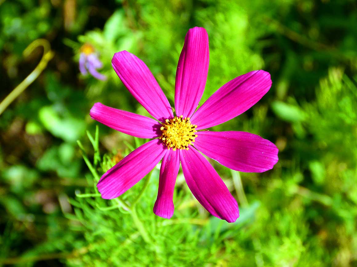
gravel road that is now also manageable by busses. Thus, the flow of
tourists is inevitable, particularly today being a Sunday of a long
weekend. Luckily we are late. Nevertheless we are flabbergasted when we
see all the parked cars, the huge coach park and the crowd. Therefore we
drive right past the monastery complex to the viewpoint uphill. What a
lovely sight! Merely a dark cloud hanging over the monastery is
dampening the mood. Hopefully it will disappear during the night! We
therefore set up camp at dusk on the tiny flat meadow spot right
alongside the viewpoint. |
-
-
|
-
-

|
-
-
|
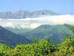
- 088
In the early morning hours a white
- cloud of fog sails along the Aramazd
- mountain range, southwest of the
- Tatev Monastery
|
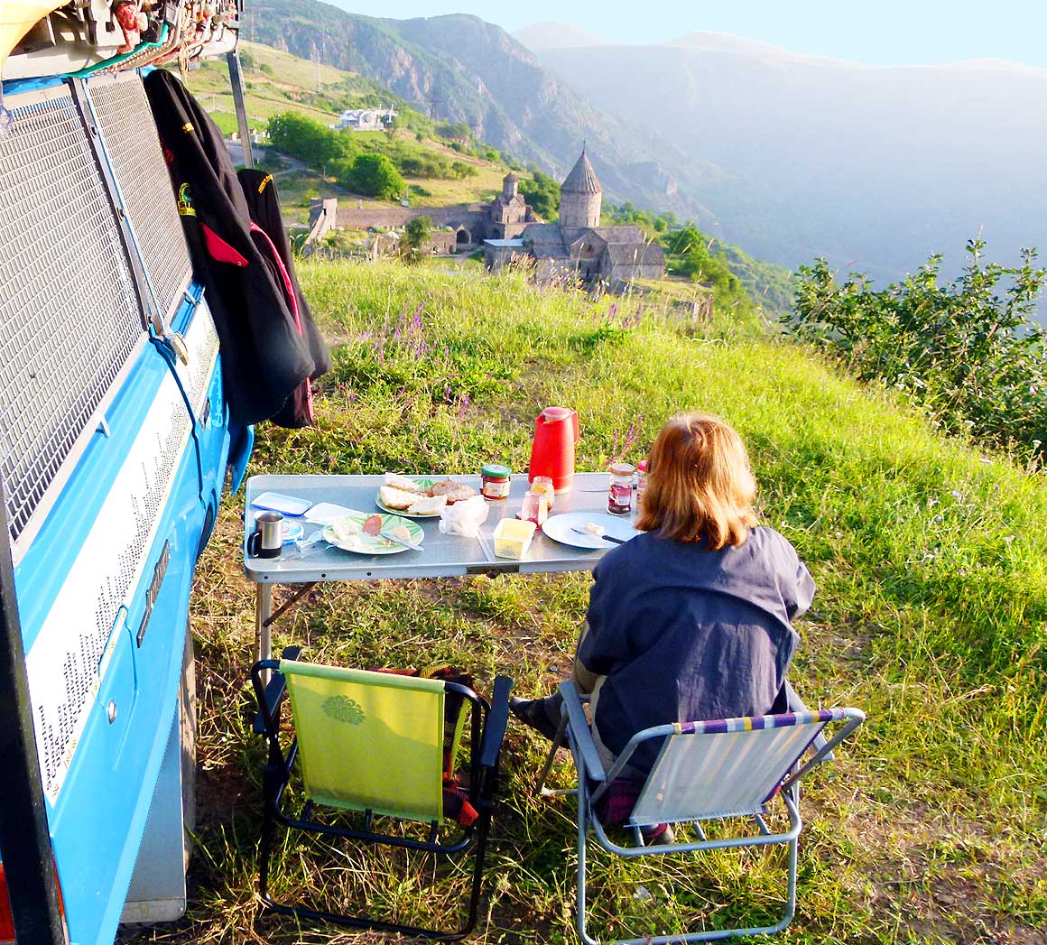
- 089
Breakfast with a stunning view of
- the Tatev Monastery, the surrounding
- mountains and the Vorotan valley. There
- is still complete silence, only the dull
- sound of the church bells echoes
- through the mountains
|
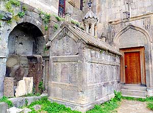
- 090
In the inner courtyard of the
- Tatev Monastery stands the mausoleum
- of Grigor Tatevatsi, a teacher in the 14th
- century, adorned with intricate carvings
|
| The
red ball of the sun rises behind the dark mountain ridge shortly after
getting up. The village is still asleep and also at the monastery
nothing is moving. The wonderful stillness is only interrupted
sporadically by the dull sound of the church’s bell echoing through the
mountains. We are sitting at our camping table and have breakfast. Emil
is cranky, but his morning mood is improving slowly. He slept badly. He
did not feel safe: “At least a dozen cars drove past and each time I
could not go back to sleep” he complains, and is annoyed about the night
spot we chose. Then he points to the cable car mountain station, built
just 200 yards away from the monastery. “It’s spoiling the whole place”
he lets off more steam. |
-
-
|
-
-
-
-
|
-
-
|
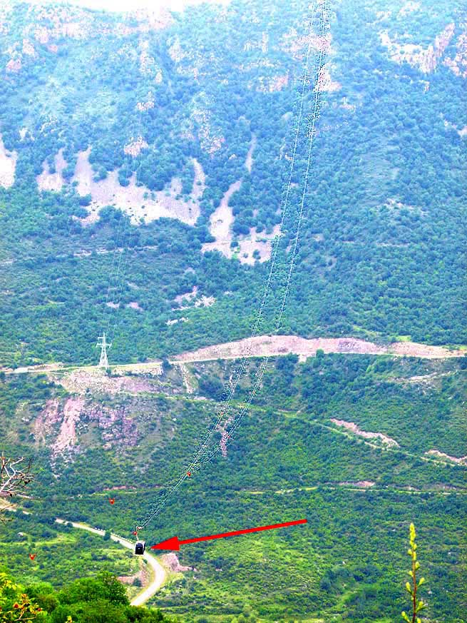
- The Tatev Monastery that earlier was accessible only by 4x4 is now connected by an
Aerial Tramway, known as "The Wings of Tatev".
- With each ride it can transport 25 people. With a length of 18'865 ft./3.57 miles it is
the “world's longest cable car line of one section”.
- This record made it into the
Guinness Book of Records. It was built by Swiss and
Austrians. Was it a gift? It’s just a pity that the summit
- station was built just 200 yards away from the Monastery – a disfigurement of the
whole place, we find
|
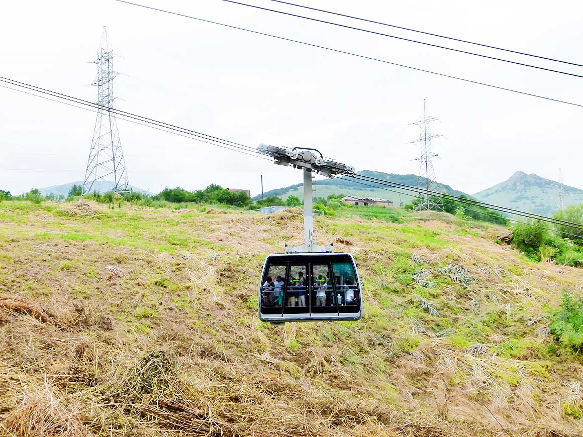
- 091
Technical description
- (Guinness Certificate)
|
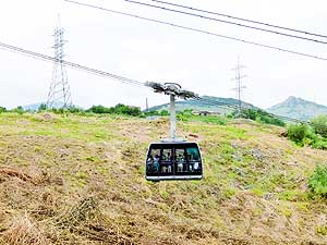
- 092
Cabin with maximum
- 25 passagers and 1 attendant
|
- 093
8'888 ft. long free-hanging rope, more
- than 1'000 ft. above bottom of the valley
|
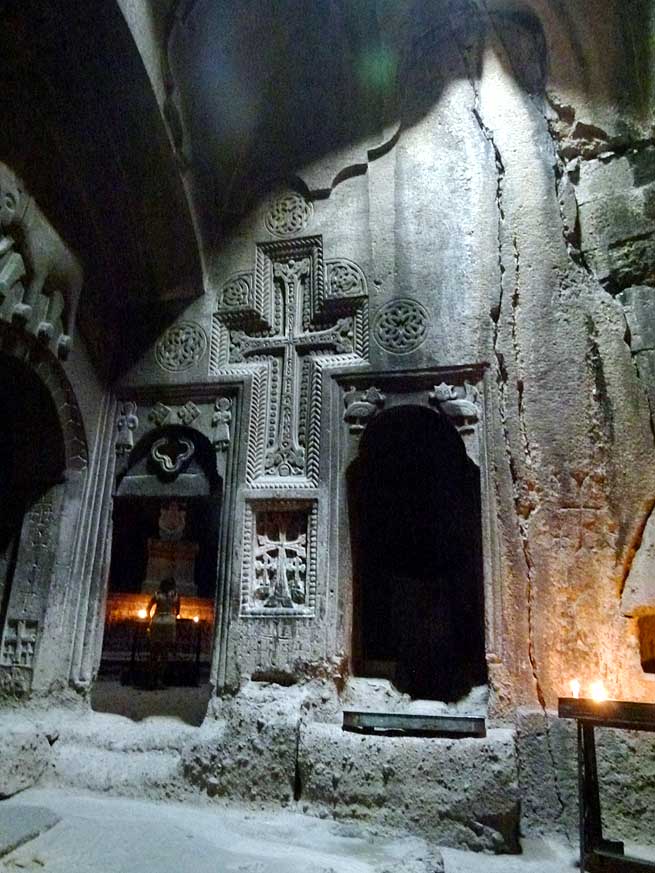
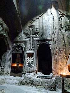
| The
air in the church is heavy with incense when we enter. Yellow thin
candles burn on the altar and in front of the images of the saints. The
more of these sacral buildings we visit, the more we have an eye for all
the wonderful details and the fine reliefs. At the back of the monastery
at the edge of the canyon with view to a sleepy little village and the
Vorotan River rushing through its narrow bed below us, we say good-bye
to Tatev, one of the most stunningly situated Armenian monasteries. |
-
-
|
-
-
|
-
-
|
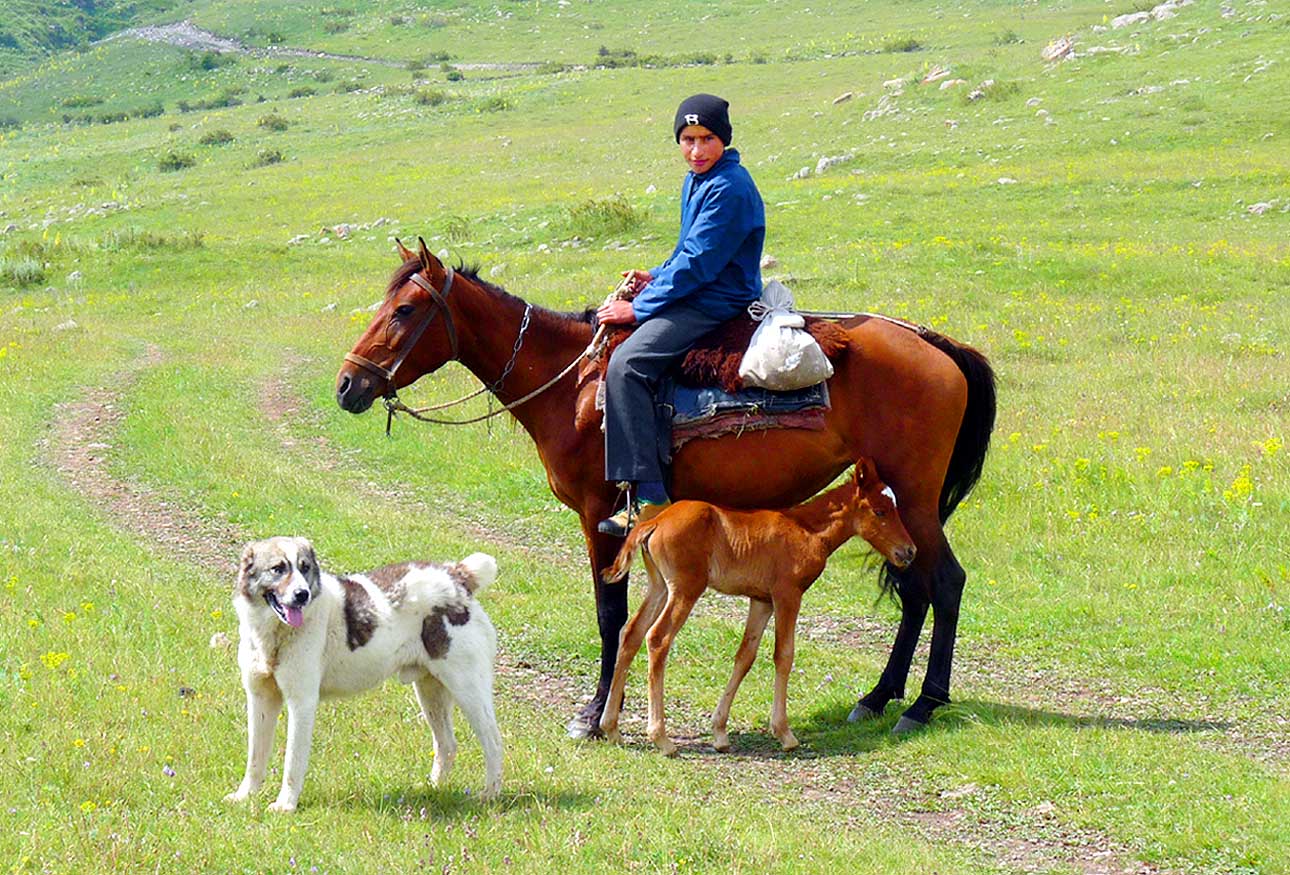
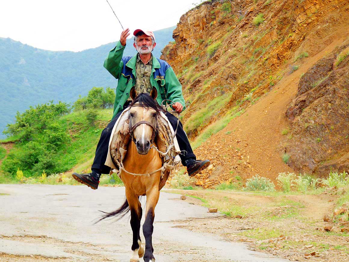
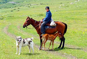
- 094
A horseman visits us galopping with
- dog and foal. We are surprised how the
- still very young foal can compete with
- the speed of probably 20 miles/h
|
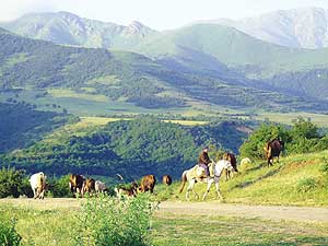
- 095
A rural scene that we often
- encounter early morning: A herdsman
- guides his cattle in the Tatev region
- to a grazing ground
|
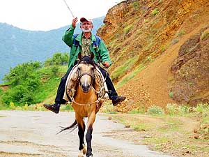
- 096
A horseman is greeting us. In
- mountain regions the horse is still an
- often used mean of transport
|
| It is
not yet the end of our monastery tour. Another jewel is awaiting us: The
Noravank Monastery. Due to the bad road condition our biggest concern
is: “Do we make it before sunset?” Emil presses the gas pedal deeper. A
5 mile [8km] long access road forks one mile [1˝km] before Areni to the
South, which we follow. After a narrow bend, an impressive rock appears,
plunged into glowing red by the late evening light. Then we already
catch the first glimpse of the Noravank Monastery nestling picturesquely
high up at the mountain face. |
-
-

|
-
-
-
-

|
-
-
|
- 097
It looks like a fairy-tale castle:
- The Tatev Monastery built on a
- natural “rock fortress” on the
- edge of the Vorotan Canyon
|
- 098
In ancient times it was reachable only
- on donkey paths: The village on the
plateau
- is Bardzravan on an altitude of 5'000 ft.
- south of the 2'300 ft. deep Vorotan Canyon
|
- 099
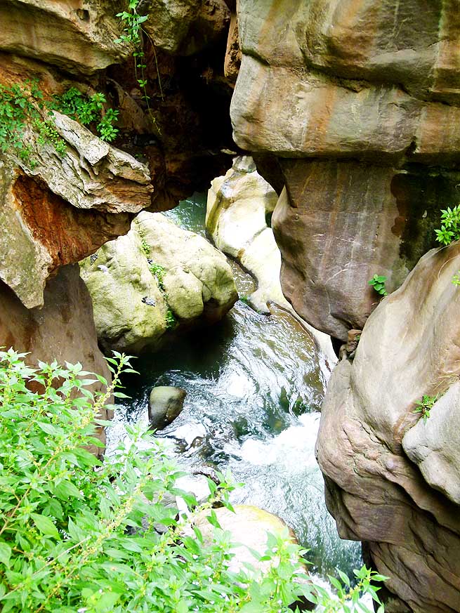
Natural pools squeezed into the
- deep canyon have been formed at the
- Devil’s (Satan's) Bridge over the Vorotan
- river, about 1’650 ft. below Tatev
|
| We
continue to hurry. Arriving at the parking we hastily squeeze our
LandCruiser into the last vacant space and grab our cameras. What a most
beautiful site and what luck to be able to enjoy its churches from the
13th century still in the soft evening light! Slowly the car park clears
and at 9.30pm we are engulfed by complete silence. The canopy of stars
and the half-moon are flashing above our heads when we relax with an
Efes beer on our camping chairs and get prepared for a cold night. We
are at an altitude of nearly 5’000 ft. [>1’500m]. |
-
-
|
-
-
-
-
|
-
-
|
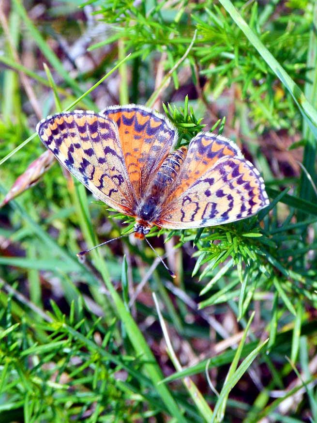
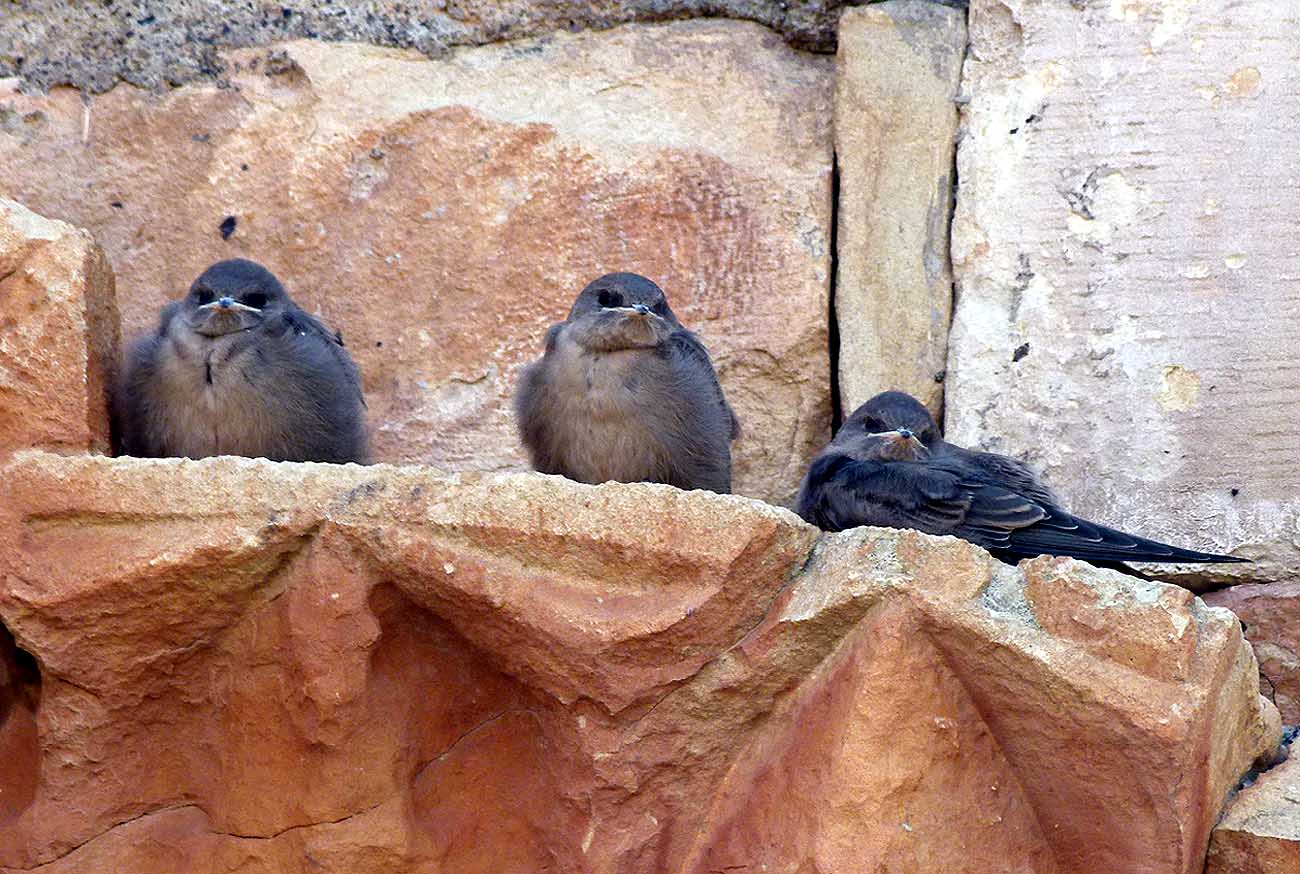
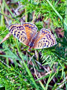
- 100
A butterfly – Glanville fritillary
- (Melitaea cinxia) – opens its wings
- and shows us its beautiful design
|
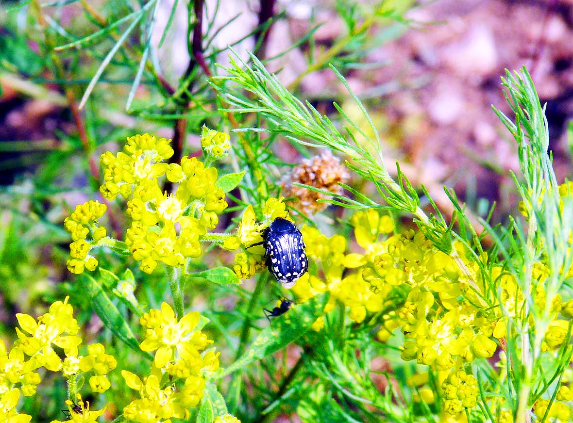
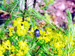
- 101
During the summer weeks it’s
- humming und buzzing everywhere:
- A black beetle on yellow flowers
|
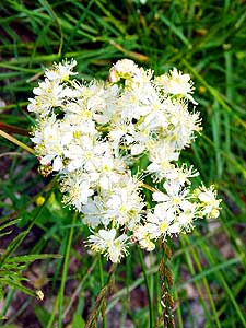
- 102
These delicate white blossoms
- would make a lovely bridal bouquet
|
| Strong
winds come up during the night shaking everything that is not nailed
down. We sleep fitfully. My dizzy spells are especially strong this
night. They afflict me lately as soon as I lay down. At 5.30am we are on
our feet again according to the saying: “The early bird gets the worm”.
Nobody disturbs us viewing the beautiful churches and carvings, watching
the white tame doves fluttering around and the fluffy swallow babies
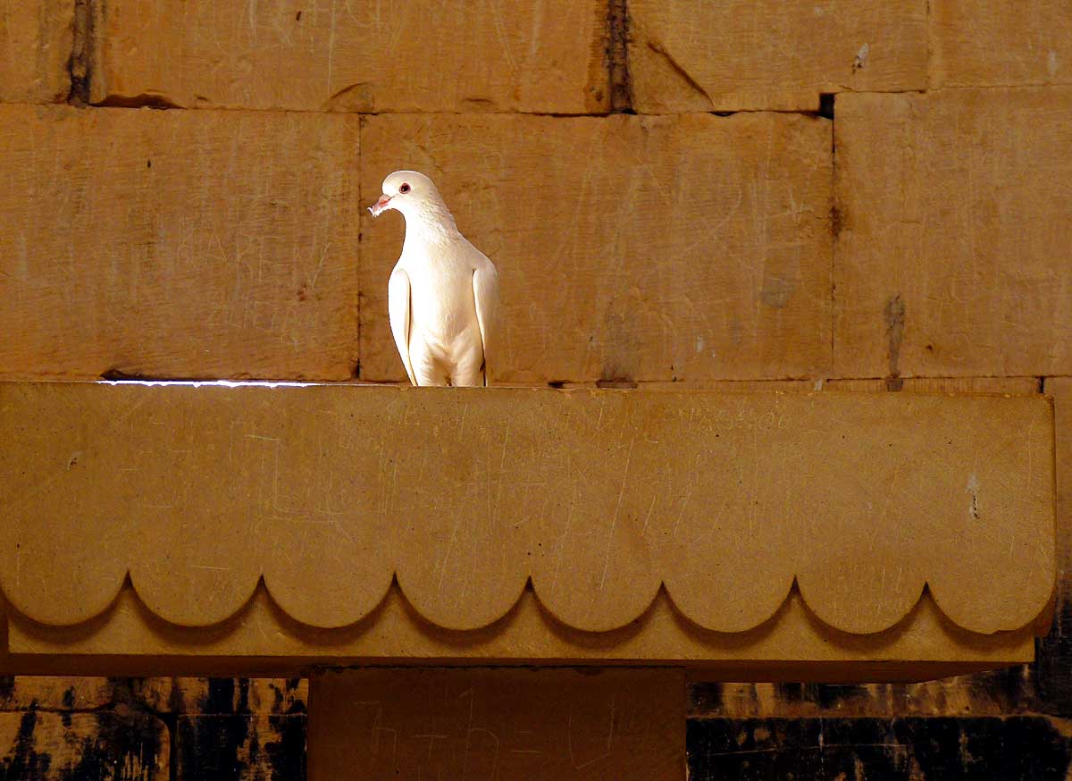
resting still a bit unsteady on the portal of Saint Gregory chapel. It
is especially these precious little moments that often enrich our
traveling life. When at 9.30am the first visitors arrive, we are ready
to drive off. |
-
-
|
-
-
|
-
-
|
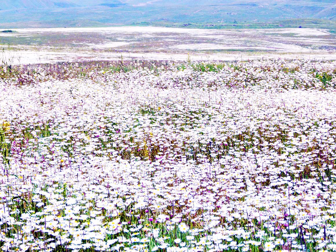
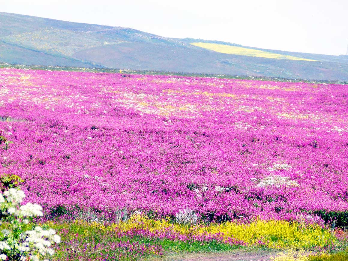
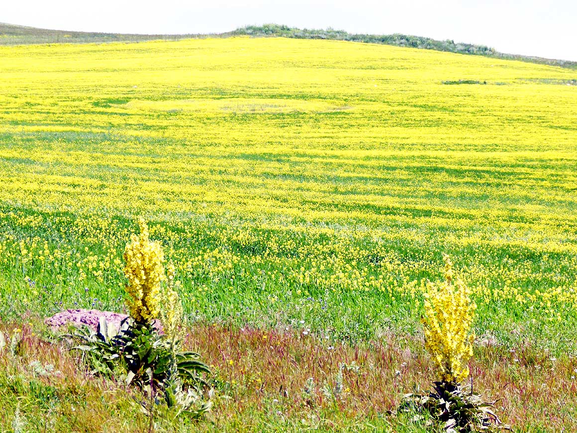
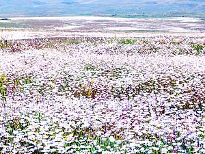
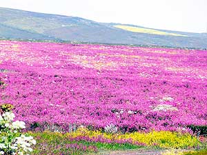
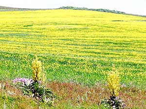
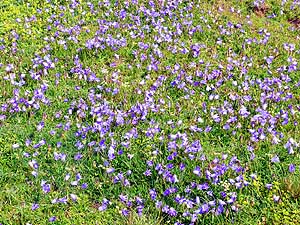
- On M2 – the only road connecting Yerevan and
Nagorno-Karabakh and Iran –
- flower carpets in white, pink and yellow stretch along the road. They compensate for the
miserable road condition
|
- 103
|
- 104
|
- 105
|
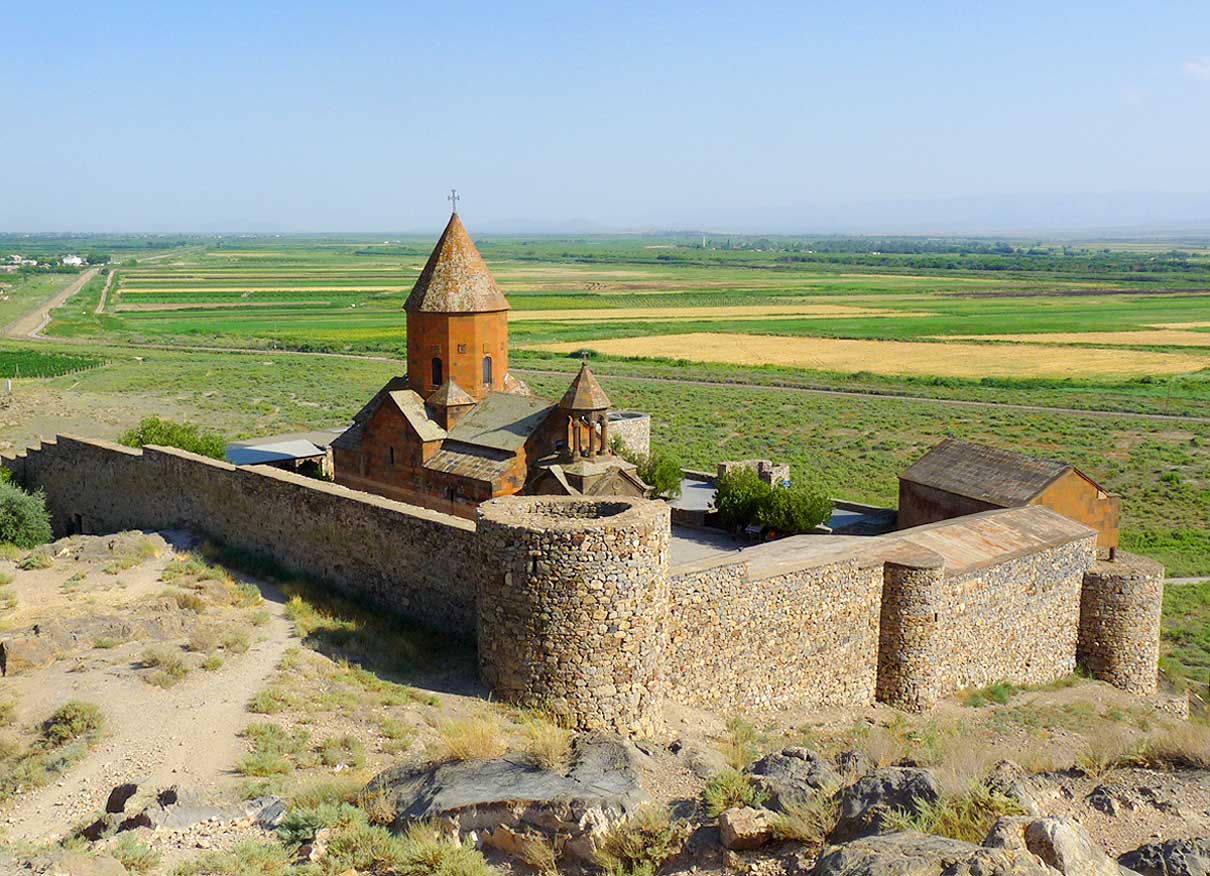
| On the
same day, 19 miles [30km] south of the capital Yerevan, we are standing
in front of another impressing monastery and famous pilgrimage site:
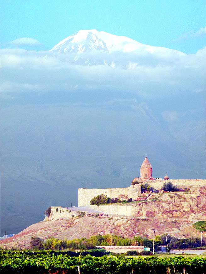
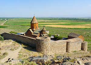
“Khor Virap”. It is especially the magnificent backdrop of the snow
covered Mount Ararat on the Turkish side that gives this monastery its
peculiar charm. Today however the majestic mountain hides in dense
clouds. May be we are more lucky tomorrow! Nearby we find a peaceful
spot in a field where we decide to camp. When the sun sets behind the
green reed belt with a yellow-red ball, we experience a unique
spectacle: The skies darken above our heads. Huge never ending swarms of
birds fly past. They are on their way to their night spots at the nearby
Khor Virap sanctuary. |
-
-
-
-
|
-
-
|
-
-
-
-

|
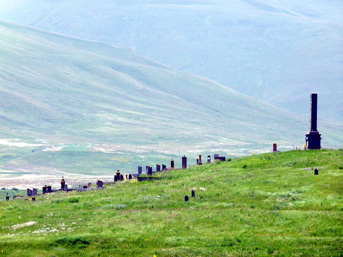
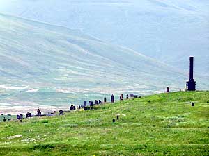
- 106
Not in a village, but in plain nature
- near the Spandaryan Reservoir a row of
- tombs are standing on a slope: A
- Christian cemetery near Gorayk
|
- 107
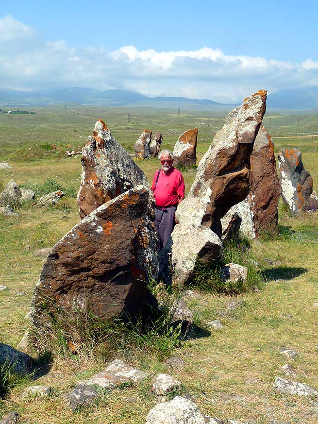
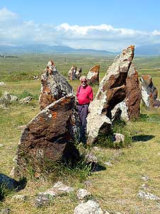
Zorats Karer, mostly referred
- (a bit exaggerated) as Armenian's
- “Stonehenge”, is located on a rocky
- promontory near Sisian. About 223 large
- stone tombs can be found in the area .....
|
- 108
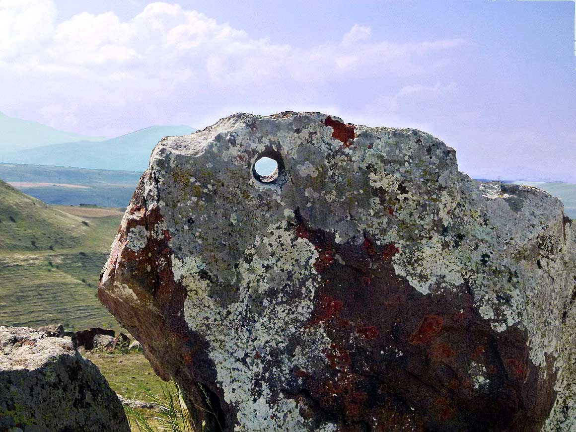
..... it is assumed that the circular
- holes in the standing prehistoric stones
- could have been used for astronomical
- observation
|
| At
dawn, we excitedly gaze direction Mount Ararat. The 16’854 ft. [5’137m]
tall and 19 miles distant snow-capped peak greets us in full glory.
Enthusiastically we climb onto the hill above the monastery. The
panorama around us could not look more peacefully: At the edge of a tiny
plateau sits the fortress-like jewel of the still “working” monastery,
just about 4’000 ft. [1’200m] from the hermetically sealed
Armenian-Turkish border along the Aras River. |
-
-
-
-
|
-
-
|
-
-
-
-
|
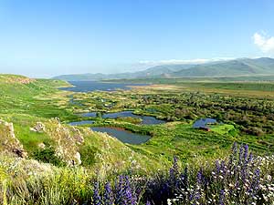
- 109
The Spandaryan Reservoir southeast
- of Gorayk was built around 1980. It feeds
- Armenian's biggest hydro power plant
|
- 110
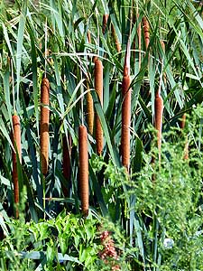
We recall cattail (also bulrush)
- (Typha angustifolia) as dry ornamental
- plants in a flower pot; here we see
- them in their natural environment
|
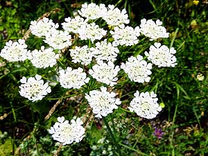
- 111
You would think that this beautiful
- flower was growing in a garden. No, we
- admire it on a meadow. It belongs most
- likely to the “carrot” family (Heracleum)
|
| Green
and yellow fields extend behind the barb wire border fence below in the
valley. They belong already to Turkey. In the distance a white minaret
of the Islamic neighbor is greeting. We still have the early morning
hours to ourselves. Only when we leave towards 9am, the first vehicle
arrives. It is a Rotel-Bus, one of those red German overlanders that we
kept meeting on all continents. |
-
-

|
-
-
|
-
-

|
- 112
The evening sun plunges the rock
- already in shiny red when we approach
- the Noravank Monastery (means New
- Monastery) that ranks as one of the most
- beautifully situated Armenian monasteries
|
- 113
We catch a first glimpse of
- this masterpiece from the 13th century,
- which was founded in the wild
- romantic Amaghu valley
|
- 114
What a most beautiful sight of the
- Saint Astvatsatsin Church in the warm
- evening light: It gleams in the same earth
- colors like the surrounding mountain walls
|
| In
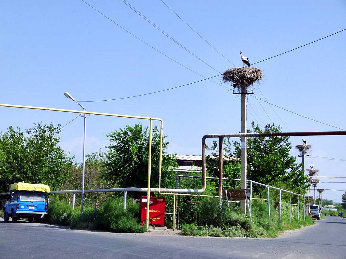
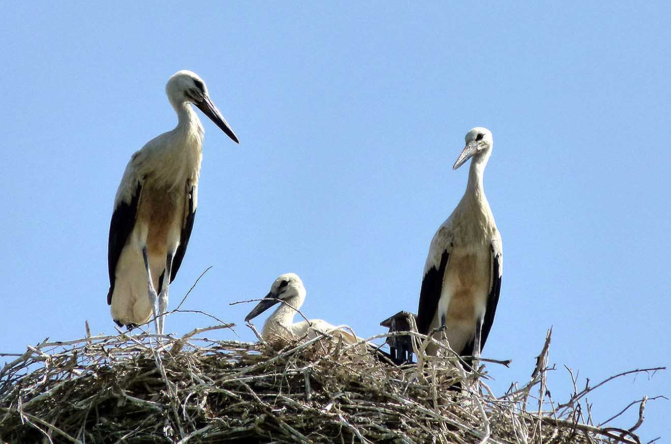
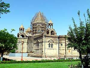
Masis we turn off to the northwest, to Echmiadzin; today the city is
also called Vagharshapat. There, another UNESCO World Heritage Site can
be admired – the Cathedral. Before, in rural Dashdavan, we first spot one
stork nest on an electricity pylon, then count ten in a row. What an
unusual sight! We are amazed about the height of some nests and enjoy
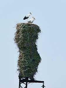
watching the families with their offspring for a while. |
-
-
-
-
|
-
-
|
-
-
-
-
|
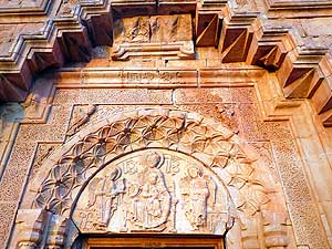
- 115
The depiction of Maria with Child
- Jesus above the portal of the Saint
- Astvatsatsin Church, flanked by two
- angels, shows that a master was at work
|
- 116
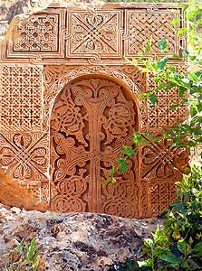
A cross stone (Khachkars)
- at the Noravank's Monastery. Again
- we stand with admiration in front
- of a jewel of an engraving
|
- 117
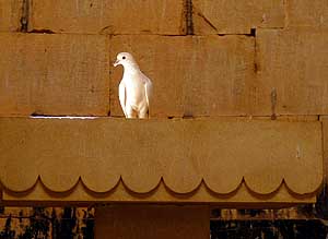
It is real and fits wonderfully
- into the chapel of Saint Gregory: A tame
- white dove caught by the morning sun
|
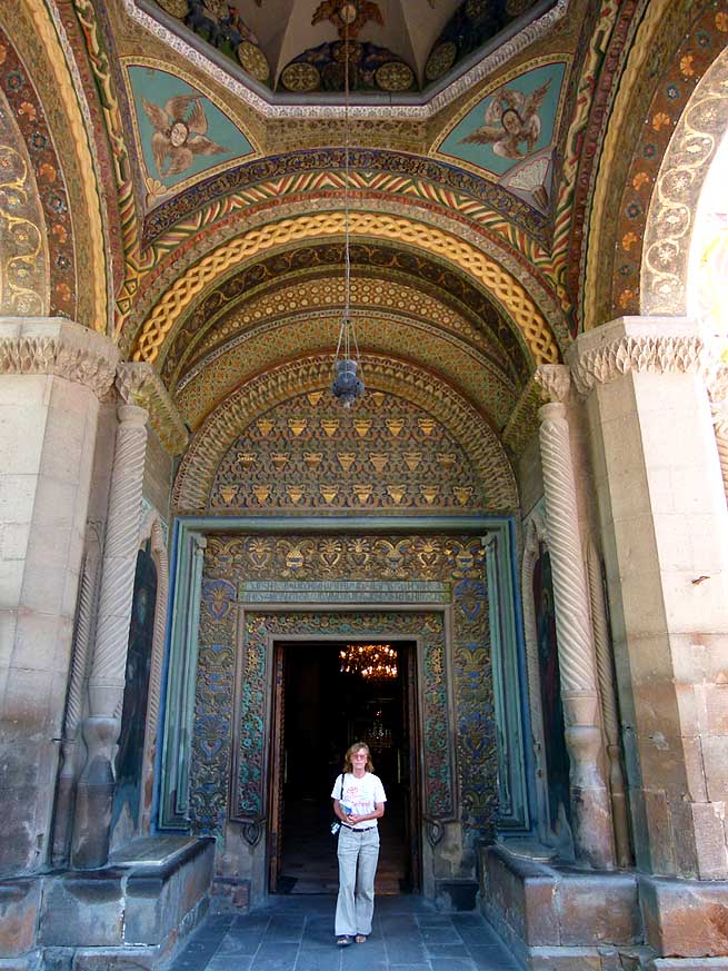
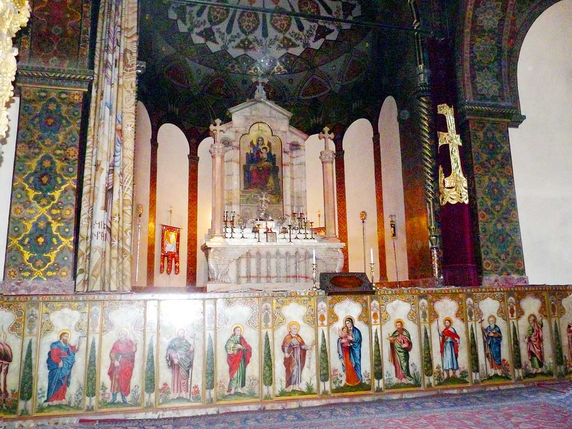
| It is
noon when we reach the “holy” city of Echmiadzin, the “Vatican of the
Armenian-Orthodox Church” about 12˝ miles [20km] west of the capital
Yeravan and stroll through the park with its shady trees and benches
that belongs to the holy place. Now and then a bearded priest in his
black robe hurries past. The cathedral ‘Mayr Tachar Surp Ejmiatsin’,
which is one of the oldest churches in the world, is under renovation.
Despite of its importance as “Armenian Holy See” it looks rather modest
from outside. In the interior however the walls are covered with
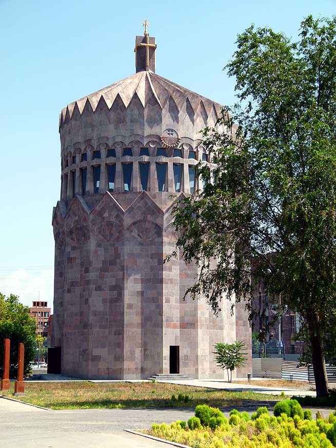
beautiful paintings and frescoes. On the northeast side is the grey
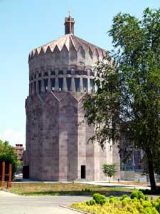
building of the ‘Apostolic Cathedral of St. Gregory the Illuminator’. It
was built in honor of the visit of Pope John Paul II in 2001. |
-
-
|
-
-
|
-
-
|
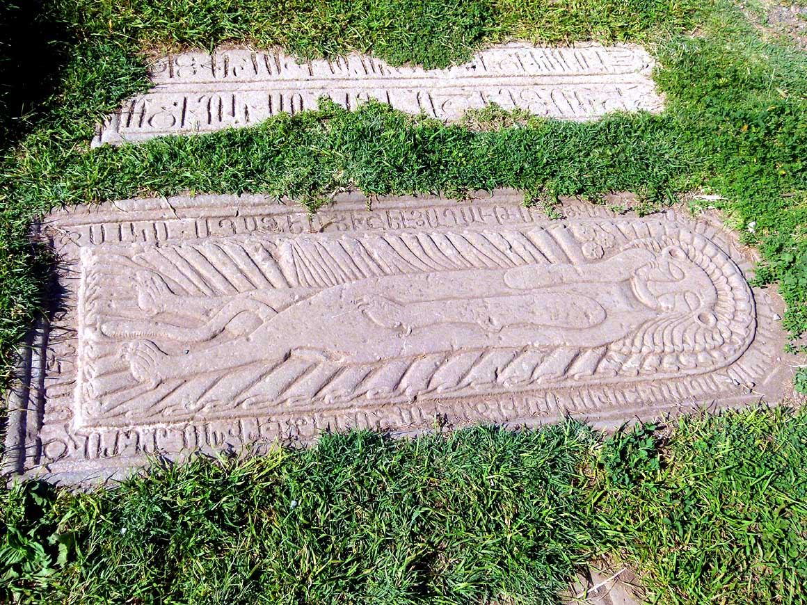
- 118
Beside the chapel of Saint Gregory
- lies a carved tombstone on the grassy
- ground showing a lion-human figure:
- It’s the grave of Elikum III Orbelian,
- son of Prince Tarsaich Orbelian
|
- 119
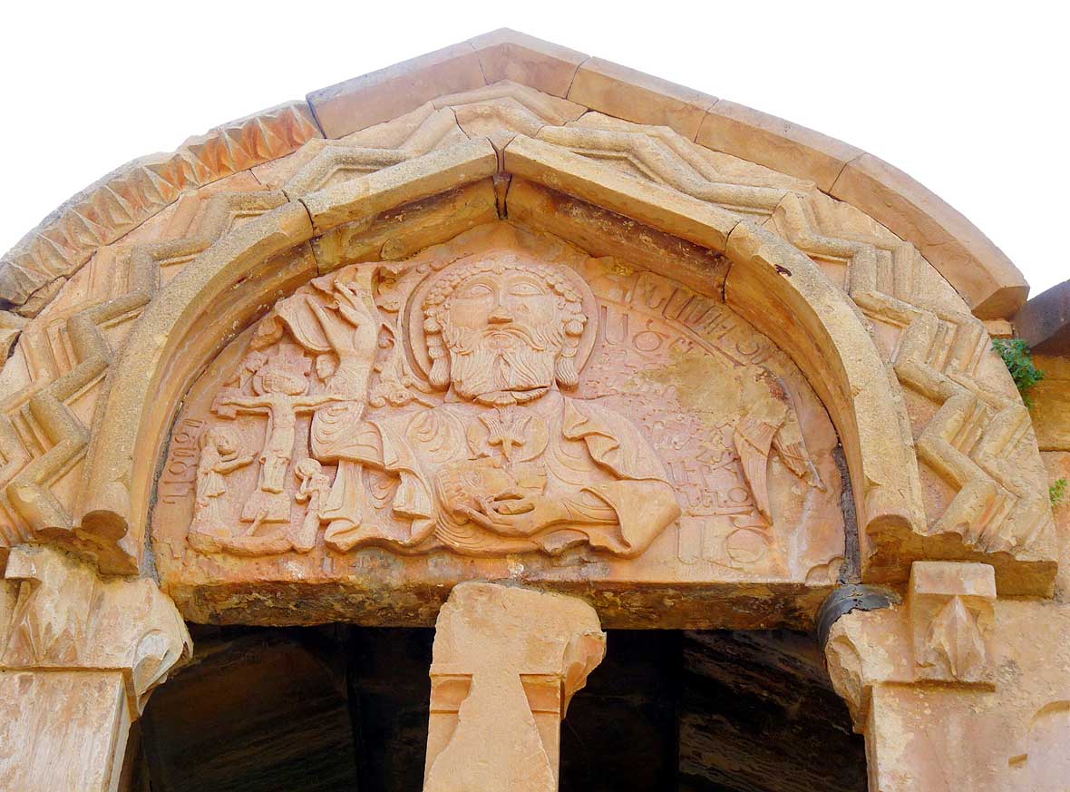
The depiction of Godfather with
- his crucified son that decorates the upper
- portal of the Saint Karapet Church is
- another lovely detail of the Noravank
- Monastery
|
- 120
Three fluffy swallow babies rest
- on the portal of Saint Gregory chapel
- and look still a bit shy into
- their young world
|
| To
navigate in the capital Yerevan without GPS is a nightmare for foreign
visitors. There is not a single direction sign, only ones to embassies
and hotels. And our city map, which we recently grabbed from a hotel in
Nagorno Karabakh, is in Russian and of little help. Therefore we decide
to transit the capital with its 1.1m people on the express highway. It
leads us through broad avenues lined with shady trees. But we still have
to ask for directions, which is not easy either, as only a few people
speak another language than Armenian or Russian. |
-
-
-
-
|
-
-
|
-
-
-
-
|
- 121
The complex of the Noravank
- Monastery in the morning light: At left
- the Saint Astvatsatsin Church; at right
- the Saint Karapet Church
|
- 122
Most tourists climb the broken
- stone steps of the Saint Astvatsatsin
- Church for a picture in front of the
- portal – so does Liliana
|
- 123
"The early bird gets the worm": At
- 5.30am we crawl out of our LandCruiser.
- The parking and the monastery complex are
- still empty. At 9.30am when the first visitors
- arrive, we are ready to leave – it doesn’t take
- anymore long until the crowd will take over
|
| On
this very day we experience a particular kindness towards us strangers:
First a private driver shows us the way, then a taxi driver. And finally
a third one guides us to the turn off to Garni, the jumping off point to
the Geghard Rock Monastery – our last sacral building in Armenia. But it
is not yet the end of friendliness. By crossing the mountain pass on
this very hot day suddenly both petrol pumps go on strike. We have to
stop several times to cool down the carburetor with wet rags to
eliminate the air bubbles inside. Once a pick-up truck stops and the
driver offers to tow us to Garni. But we still hope to make them work
again and decline with thanks. It works finally and mid-afternoon we
reach exhausted our destination. |
-
-
|
-
-
|
-
-
|
- 124
Road over the 5'890 ft. high Tukh
- Manuk pass, where the main traffic consists
- primarily of heavy trucks rolling between
- Iran and Yerevan. It follows for 25 miles
- the border of the Azerbaijani exclave of
- Naxçivan, sometimes only ˝ mile away
|
- 125
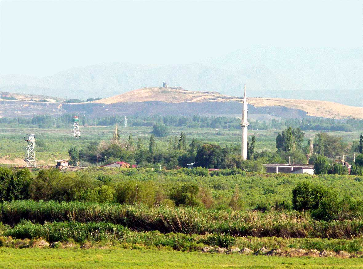
The Monastery of Khor Virap,
- 19 miles south of the capital Yerevan, is
- a famous pilgrimage site built picturesquely
- on a hill. The farmland behind the complex
- is already in Turkey. The here inaccessible
- Iranian border lies also only
- 7 miles in the south .....
|
- 126
..... the border to Turkey, which
analog
- to the one of Azerbaijan can nowhere be
- crossed, is marked with a barb wire fence
- only about 100 yards away from the
- monastery. The Islamic neighbor is greeting
- with a slim white minaret and watchtowers
|
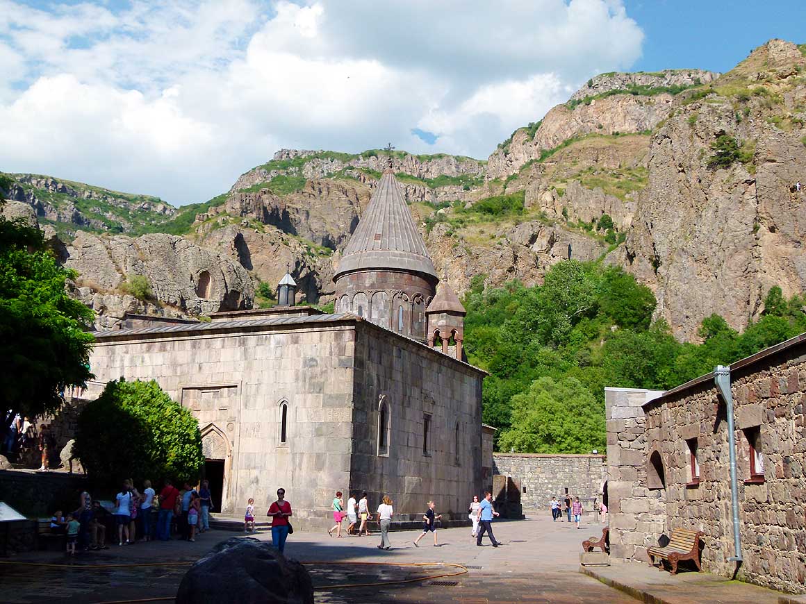
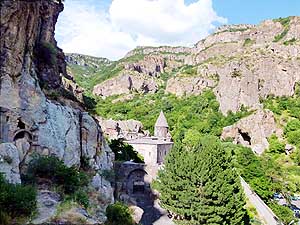
| The
Geghard Rock Monastery lies on an altitude of 6’233 ft. [1’900m] in the
scenic Azat Canyon 6 miles [9km] beyond the village of Garni. According
to history, the big complex was cut out of the rock during different
eras and has gained the status of a UNESCO World Heritage Site.
Impressive is the chapel, cut deep into the rock. With the flickering of
the burning candles, it almost looks ghostly. The silence is suddenly
interrupted by a fierce tumult. We look around: In the middle of the
holy place a group of young men are brutally beating a young monk. |
-
-
-
-
|
-
-
|
-
-
-
-
|
- 127
Khor Virap is a still a “working”
- monastery. It is also used for baptism
- or to perform a "matagh" after a wedding
- – a sacrifice, often of sheep or chicken.
- Here the Church Saint Astvatzatzin that
- is found in many monasteries
|
- 128
This is the picture book setting of
- the Khor Virap Monastery with the back-
- drop of the snow-covered 16’854 ft. high
- and 19 miles distant peak of Mt. Ararat
- on the Turkish side. The entire quadripoint
- area (Armenia, Turkey, Azerbaijan and
- Iran) is politically fiercely disputed
|
- 129
Our camp at the nature reserve
- near the monastery of Khor Virap
- offers us two highlights: swarms of
- birds returning to their sleeping place
- and a gorgeous sunset
|
| We
fear the worst. But the monk manages to free himself. Are the guys
drunk? We offer the picture to the other monks that Emil has taken of
the thugs. They appreciate it, but they don’t need it. They have noted
the license plate of their car before they rushed away. After this
disturbing intermezzo, we are not in the mood for camping in front of
the monastery. We return to Garni and take a room in the guesthouse
‘chez Yvette’. |
-
-
-
-

|
-
-
|
-
-
-
-

|
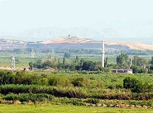
- In rural Dashtavan between Masis and Echmiadzin we first spot one stork nest on an
electricity pylon,
- then count ten in a row. We are amazed about the height of a nest
and enjoy the family with their young one
|
- 130
|
- 131
|
- 132
|
| We
like it at ‘chez Yvette’. The quietness, the fruit orchard with
apricots, apples and pears and the breakfast table in the garden that
couldn’t be richer: Even raspberries with whipped cream is served – one
more reason to stay another day. |
-
-
-
-
|
-
-
|
-
-
-
-

|
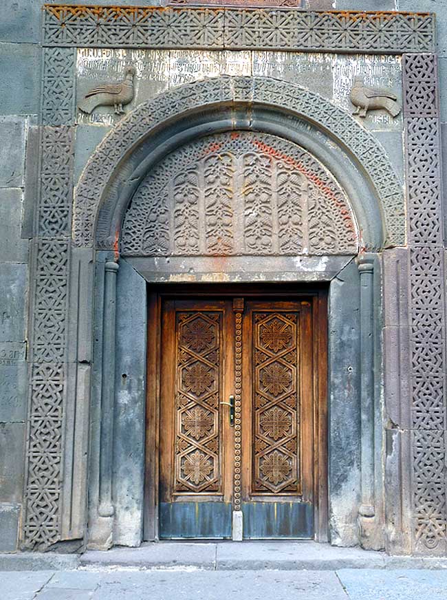
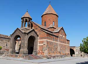
- 133
West of Yerevan lies the holy city
- of Echmiadzin, the "Vatican of the
- Armenian Apostolic Church". Its cathedral
- “Mayr Tachar Surp Ejmiatsin” looks rather
- modest despite its importance as
- “Armenian Holy See” .....
|
- 134
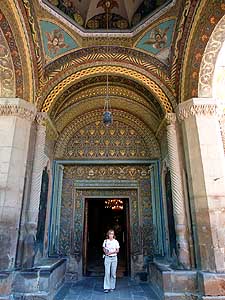
..... Liliana steps through
- the richly ornated main portal .....
|
- 135
..... the interior of the cathedral
- gleams with beautiful frescoes. The altar
- is the place where Saint Gregory the
- Illuminator saw the divine light
- strike the ground
|
| At
10am we wave good-bye to Yvette and drive back over the mountain pass to
Yerevan where we make a short stop at the Yerevan supermarket and stock
up with all kind of goodies. Then we move on. We leave the M1 in Agarak
direction observatory and Lake Kari. The small mountain lake below Mount
Aragats (13’420 ft. [4’090m] is our main goal. Luckily we do not know
what to expect on road conditions ahead. Often only manageable by 4x4
and in walking speed we fight our way up to 10’470 ft. [3’190m]
altitude. And what do we find? Nothing even close to an undisturbed
quiet mountain lake, which we have in mind. Walls and buildings
disfigure the landscape on one side. |
-
-
|
-
-
-
-
|
-
-
-
-
|
- 136
Northeast of "Holy Echmiadzin"
–
- at the Komitas Square – stands the new
- grey Apostolic Cathedral of St. Gregory
- the Illuminator that was built for the visit
- of Pope John Paul II in 2001, where he
- held also the Ecumenical Celebration
- together with Patriarch Karekin II
|
- 137
The Geghard Monastery is built
- in the scenic Azat Canyon 6 miles
- beyond the small village of Garni.
- Legend has it that it was founded
- in the 4th century – however the
- main cathedral only 1215
|
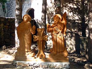
- 138
Recent sculptures of the
- Apostles Saints Bartholomew and
- Thaddeus in the Geghard Monastery
|
| In
addition, today a group of noisy militarists are present. Two of them
want to impress their girlfriends They take off coat and boots and jump
loud yelling in their underwear into the freezing cold water. What an
anticlimax! All we do is make a remembrance picture and then leave the
site. We descent to 7’220 ft. [2’200m], where we find a place to camp on
the overgrown old track, out of sight of the newer road. Below us
sparkle the sea of lit up lights of the capital Yerewan. And above our
heads the bright full moon lights up the night sky. Unfortunately soon a
chilly wind comes up, forcing us much too early into our LandCruiser. |
-
-
-
-
|
-
-
|
-
-
-
-
|
- 139
According to history the big complex
- was cut out of the rock during different
- epochs. It is also a UNESCO
- World Heritage Site
|
- 140
Very impressive is the deep
- into the rock cut chapel with its fine
- ornaments. It almost looks ghostly
- with the light of the flickering candles
|
- 141
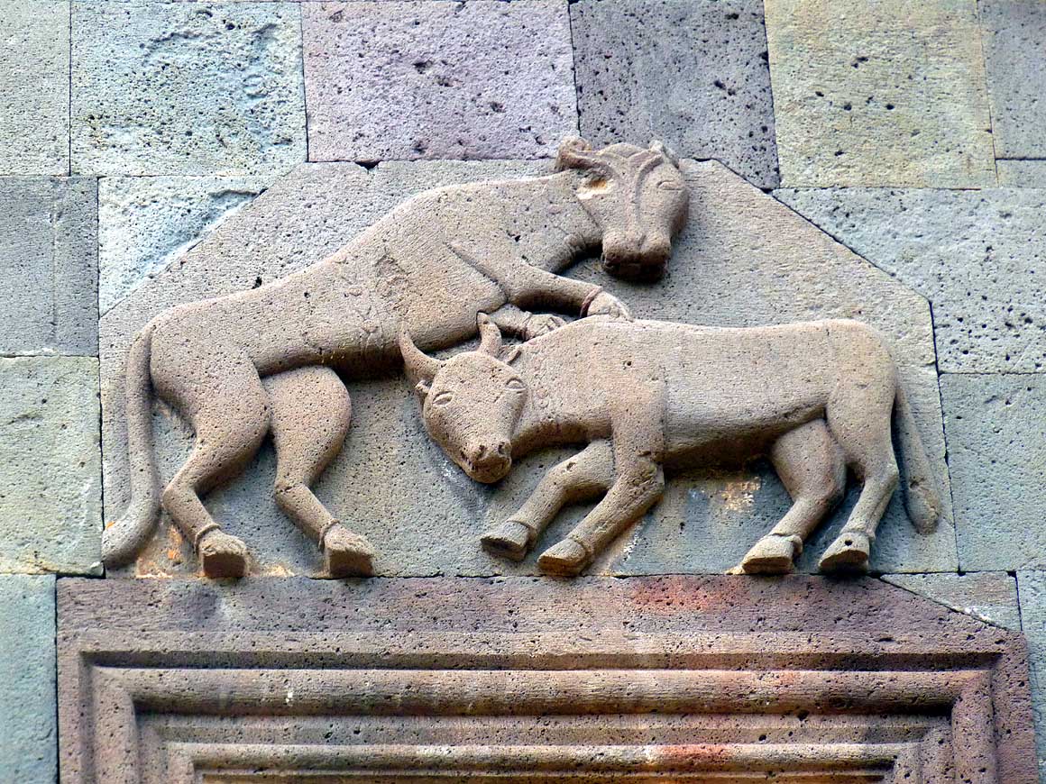
The carving of a lion and an ox
- above the portal to the Katoghike
- Church of the Geghard Monastery
|
|
Despite of complete silence we did not sleep well. Was it the altitude
or the full moon? For our camping breakfast we want to move downhill to
warmer ground. Before reaching the M1 road again, we spontaneously
follow a sign to the Fortress of Amberd, sitting north of Agarak. It
is built in the 7th century and catches our attention already from far
with its high stone walls and rounded towers. It is said that this
building technique could not be breached in those days by any army. |
-
-
-
-

|
-
-
|
-
-
-
-
|
- 142
More wonderful artwork
- (Khachkars): Crosses that were carved
- at the northeast corner of the Geghard
- Monastery into the 800 years old walls
|
- 143
This richly carved south entrance
- of the Katoghike Cathedral (main church)
- is testimony of great craftsmanship
|
- 144
On the same corner as the left picture
- #142 lean ancient "Khachkars" (carved stone
- crosses) against a wall. They all look similar,
- but each one is an artwork on its own
|
|
Situated on an altitude of 7’050 ft. [2’150m], it overlooks farms and
the trade routes of the Ararat plain. With this ancient site, our
Armenia journey comes to an end and we head towards the border town of
Bavra. A police man spots us. He follows us, stops us and points to the
jerry cans on the roof rack. ”Documents!“ he orders gruffly. “Turist
Shvejcariya” (Swiss tourist) I reply smiling. Like everywhere, it helps
also here. He then walks around our car and inspects the insurance
sticker on our windscreen. Then he walks away without losing one more
word. |
-
-
|
-
-
|
-
-

|
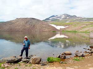
- 145
A remembrance picture of the
- unspectacular mountain lake “Lake Kari”
- at the observatory of the 13’419 ft. high
- Mt. Aragats (not to be confused with
- Mt. Ararat on picture #128 below), which
- we reached on a partly very bad track .....
|
- 146
..... enjoyed however
- the alpine flora along the way
|
- 147
Below the observatory nomads
- have set up their summer camp to let
- their sheep feed on the young grass,
- despite the chilly temperatures
- above an altitude of 10’000 ft.
|
| The
last miles to the border with Georgia lead us through nostalgic rural
villages with haystacks and cow dung piled to artful pyramids. The
latter serve as heating material. At the modest border post we are asked
to pay AMD (Dram) 8500 for the exit (approx. US$19). “What for?” I
argue, having already paid US$80 on fees and €19 on insurance at our
entry. A local guy tries to calm me down saying that they have to pay
the same amount. This is Armenia! But Armenia is also beautiful historic
monasteries and appalling road conditions. Is the country worth a visit?
Our answer is a convincing Yes. |
-
-
|
-
-
|
-
-
|
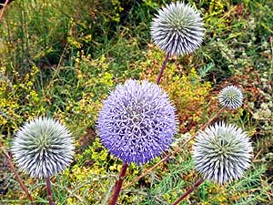
- 148
Globe thistles (Echinops)
- are developing their full beauty
|
- 149
The fortress of Amberd from the
- 7th century on an altitude of 7’500 ft.
- north of Agarak overlooks farms and
- trade routes of the Ararat plain. No army
- ever succeeded to breach its high stone
- walls and rounded towers. Left of the
- castle stands the typical Armenian church
- of Vahramashen from the 11th century
|
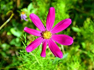
- 150
Who can resist taking a picture
- of this wonderful pink flower? Not us!
|
- Back to the 1st part of the Armenian trip:
Armenia Part 1
– July 2 to 9, 2013, from
Georgia
Part 2a to
Nagorno-Karabakh
|
-
- The "Greater"-Middle East trip 2012/13:
- Sharjah/Dubai/1st Traveler's Festival/Emirates
National Auto Museum - UAE with
car Nov. 2012 to Jan. 2013 - part 1
- Western UAE - Liwa - United Arab Emirates with car in January 2013 - part 2
- Oman 2013 - Part 1 - February
2013: Musandam Peninsula
- Oman 2013 - Part 2 - February
2013: Sohar - Muscat - Rustaq - Nizwa
- Oman 2013 - Part 3 - March
2013: Sur - East Coast - Island of Masirah - Dhofar
- Oman 2013 - Part 4 - March
2013: Salalah & Surroundings (Dhofar) - Nizwa
- Oman 2013 - Part 5 - March 2013: Western Hajar
Mountains
- Al Ain, Eastcoast & Ras al Khaima - United
Arab Emirates with our car in April 2013 -
part 3
- Iran -
Part 1: Ferry Port Bandar Abbas-Shiraz-Persepolis-Pasargad (between Persepolis and Yazd)
– May 2013
- Iran -
Part 2: Pasargad
(excl.)-Yazd-Esfahan – May 2013
- Iran -
Part 3: Esfahan
(excl.)-Chelgerd-Hamadan-Sanandaj-Orumiyeh – May 2013
- Turkey: Iran Border-Esendere-Hakkari-Van-Doğubayazıt-Kars-Ardahan-Hopa-Georgia
Border – May/June 2013
- Georgia -
Part 1: Ajaria-Gori-Tbilisi-Kakheti-Azerbaijan
Border – June 2013
- Azerbaijan:
Georgia Border-Balakən-Şəki-Lahıç-Baku-Xınalıq-Quba-Laza-Baku-Gəncə-Georgia Border – June 2013
-
Georgia - Part 2a: Azerbaijan Border-Tbilisi-Armenia
Border –
June/July 2013
- Armenia - Part 1: Georgia Border-Haghpat-Dilijan-Sevan-Tatev-Goris-Nagorno-Karabakh – July 2013
- Nagorno-Karabakh:
Armenia-Stepanakert-Gandzasar-Martakert-Tigranakert-Tnjri-Shoushi-Armenia – July 2013
- Georgia -
Part 2b: Armenia Border-Ninotsminda-Tbilisi-Mtskheta-Kazbegi-Kutaisi-Zugdidi –
July 2013
- Georgia -
Part 3a:
Zugdidi-Swaneti-Zugdidi-Abkhazia Border – July/August 2013
- Abkhazia: Georgia-Sukhumi-Tsebelda-Novyy Aton-Lake
Ritsa-Gagra-Pitsunda-Georgia – August
2013
- Georgia - Part 3b: Abkhazia Border-Poti-Ferry to Ilyichevsk/Ukraine
– August 2013
|
|
|