-
- Turkey Map
|
-
-
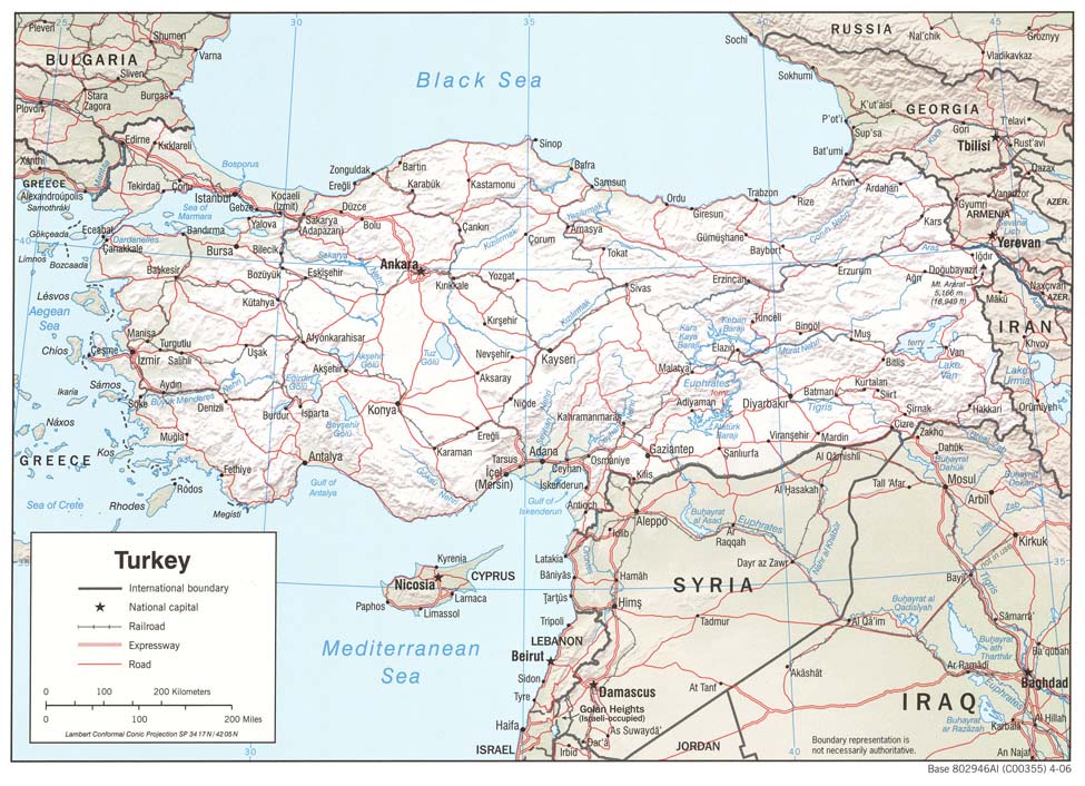
- Middle East Map
|
|
-
|
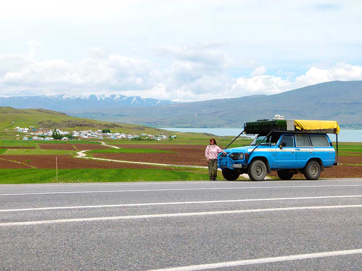
- latest picture: June 3, 2013
|
|
-
-
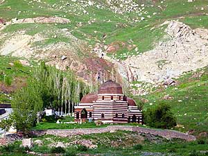
|
-
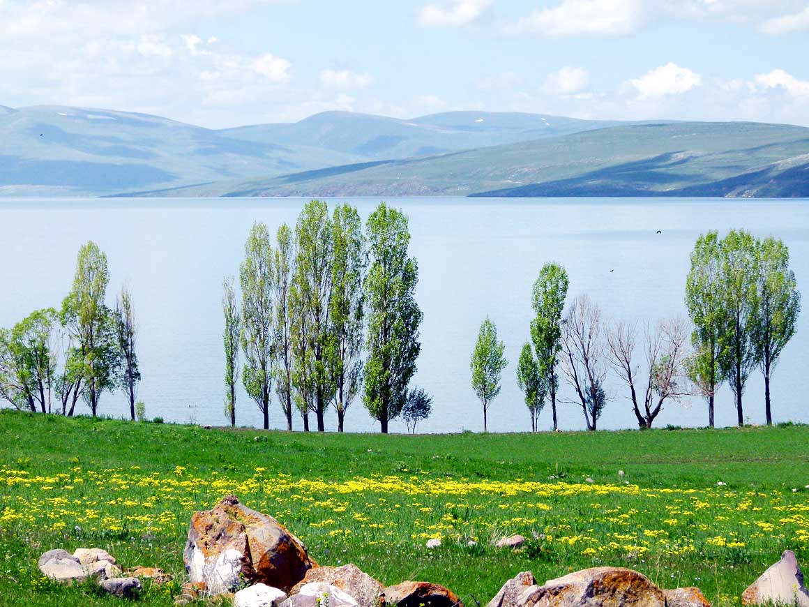
-
|
-
-
|
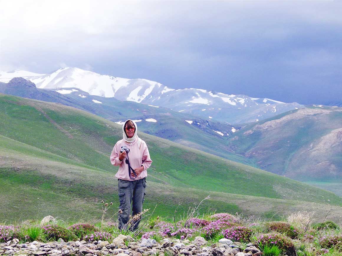
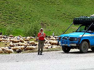
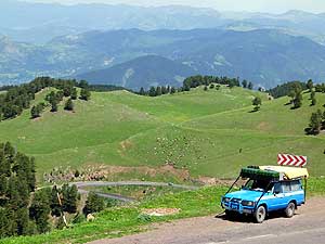
- 001
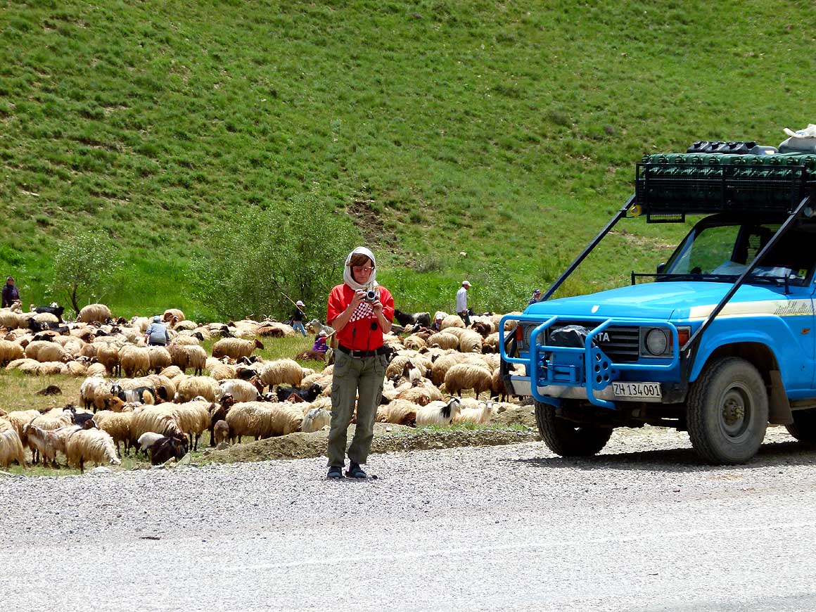
Right after Esendere – the Turkish
- border post to Iranian Sero – we meet a flock
- of sheep. Being now in Turkish Kurdistan, a
- political sensitive area, Liliana decides still to
- wear the head scarf that is mandatory in Iran
|
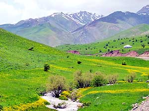
- 002
A little creek meanders through
- lush green meadows; snow covered
- mountains greet from the distance. This
- is the refreshing picture we see on our
- way from Esendere to Yüksekova
|
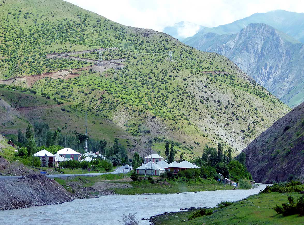
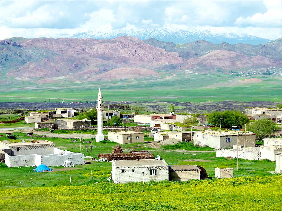
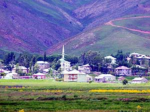
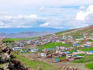
- 003
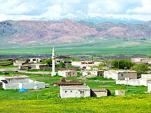
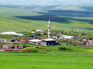
A Kurdish village: All the houses
- are built in a uniform way. They look
- clean, spacious and comfortable
|
-
|
-
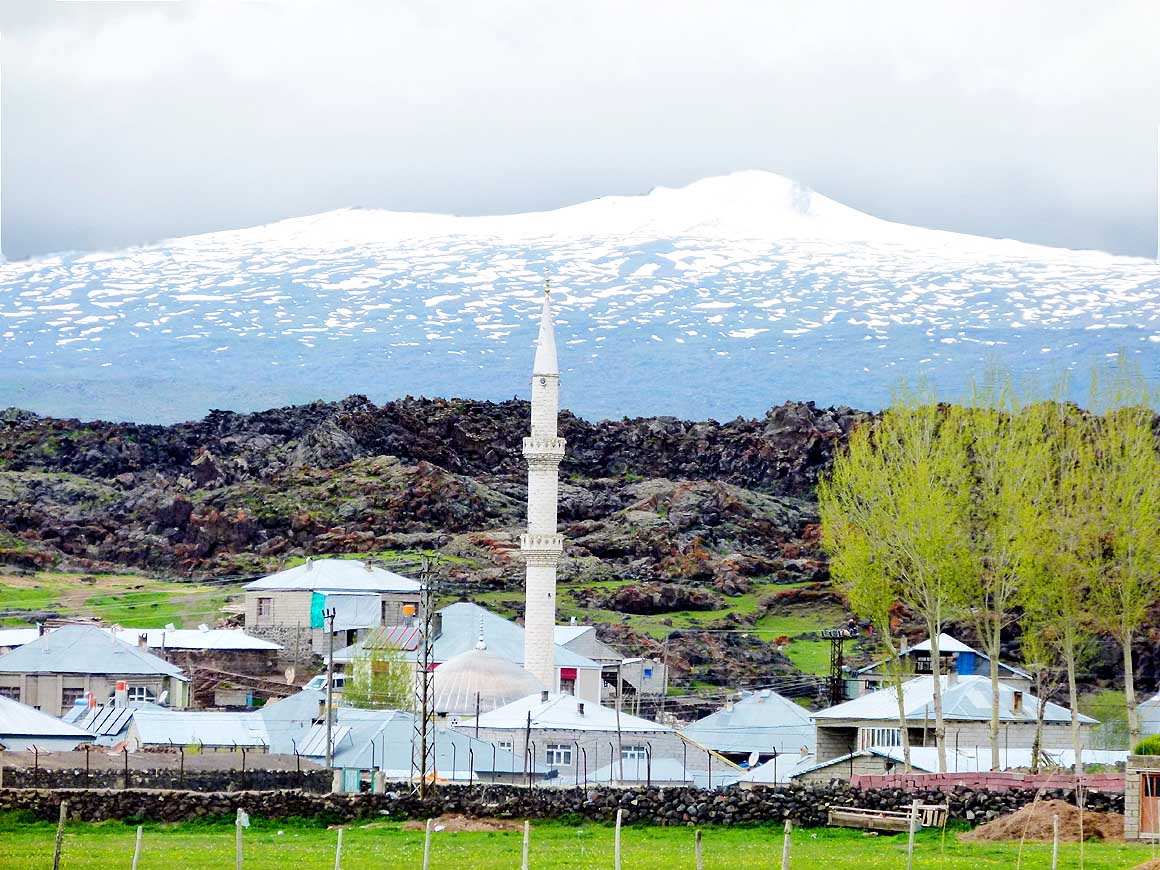
-

|
-
-
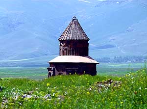
|
-
-
|
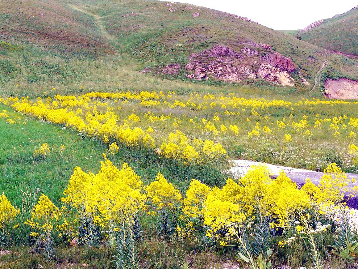
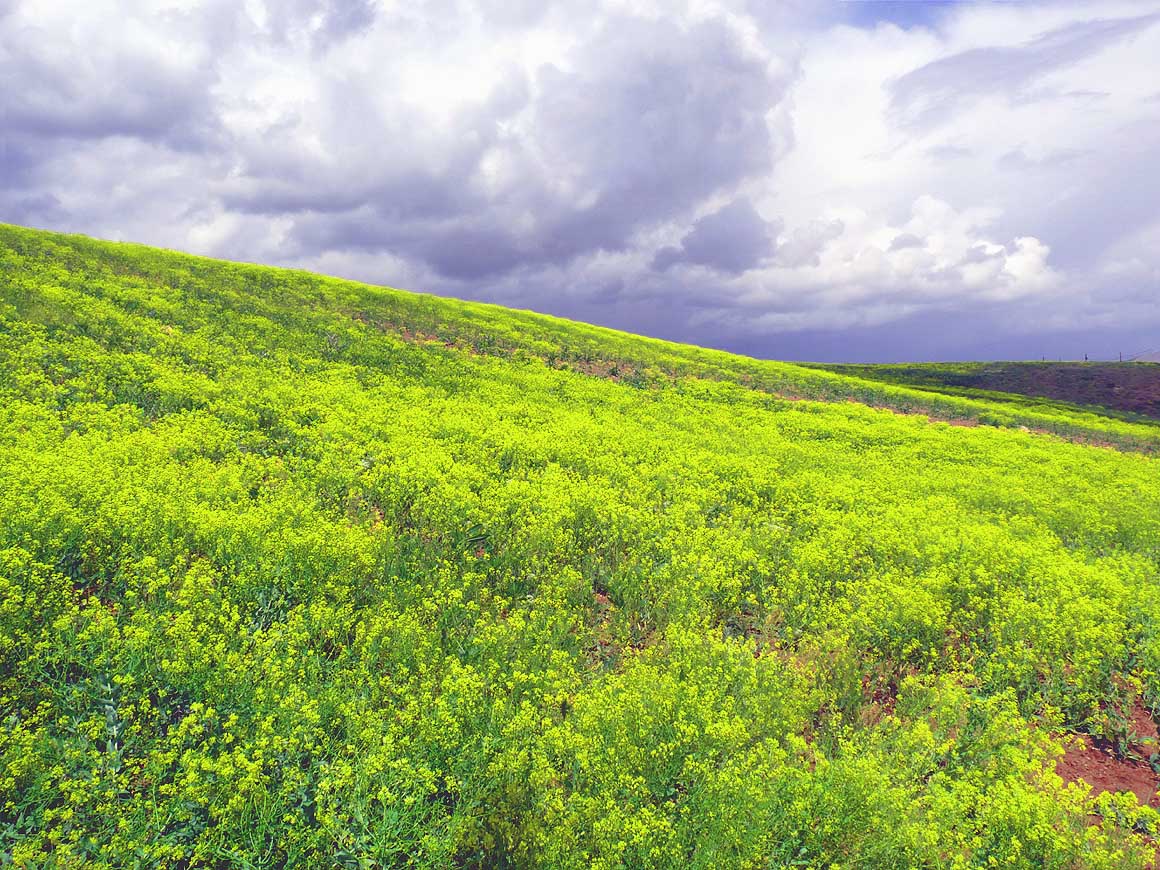
- 004
Long-stemmed yellow flowers cover
- wide areas. With their golden yellow color
- they conjure sunshine also in cloudy weather
|
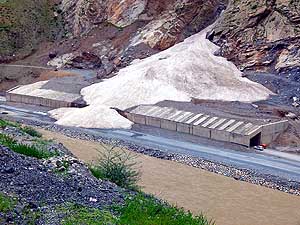
- 005
The road to Hakkari is clear of
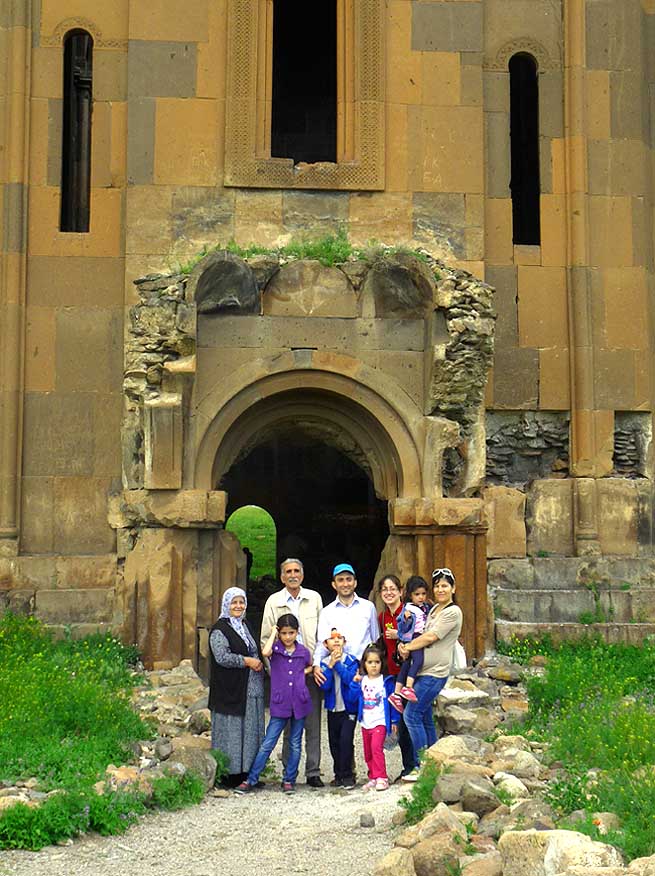
- snow. But on the avalanche barrier
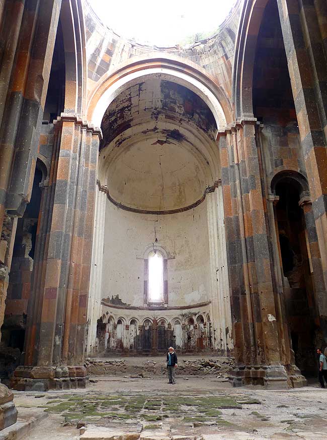
- there are still remnants of snow
|
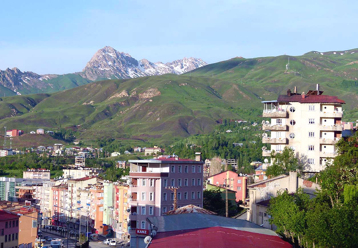
- 006
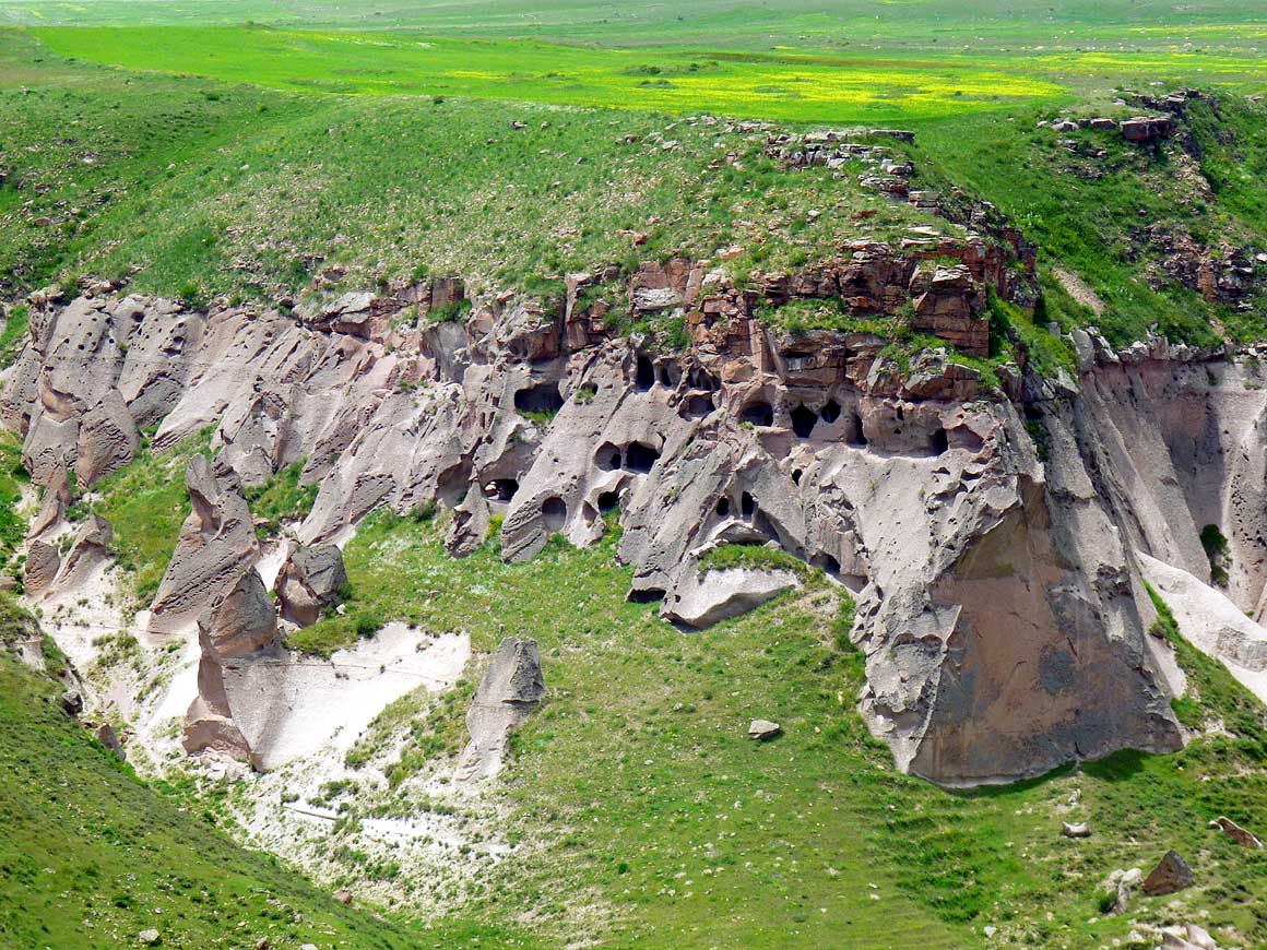
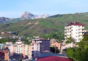
Hakkari is situated on a hillside on
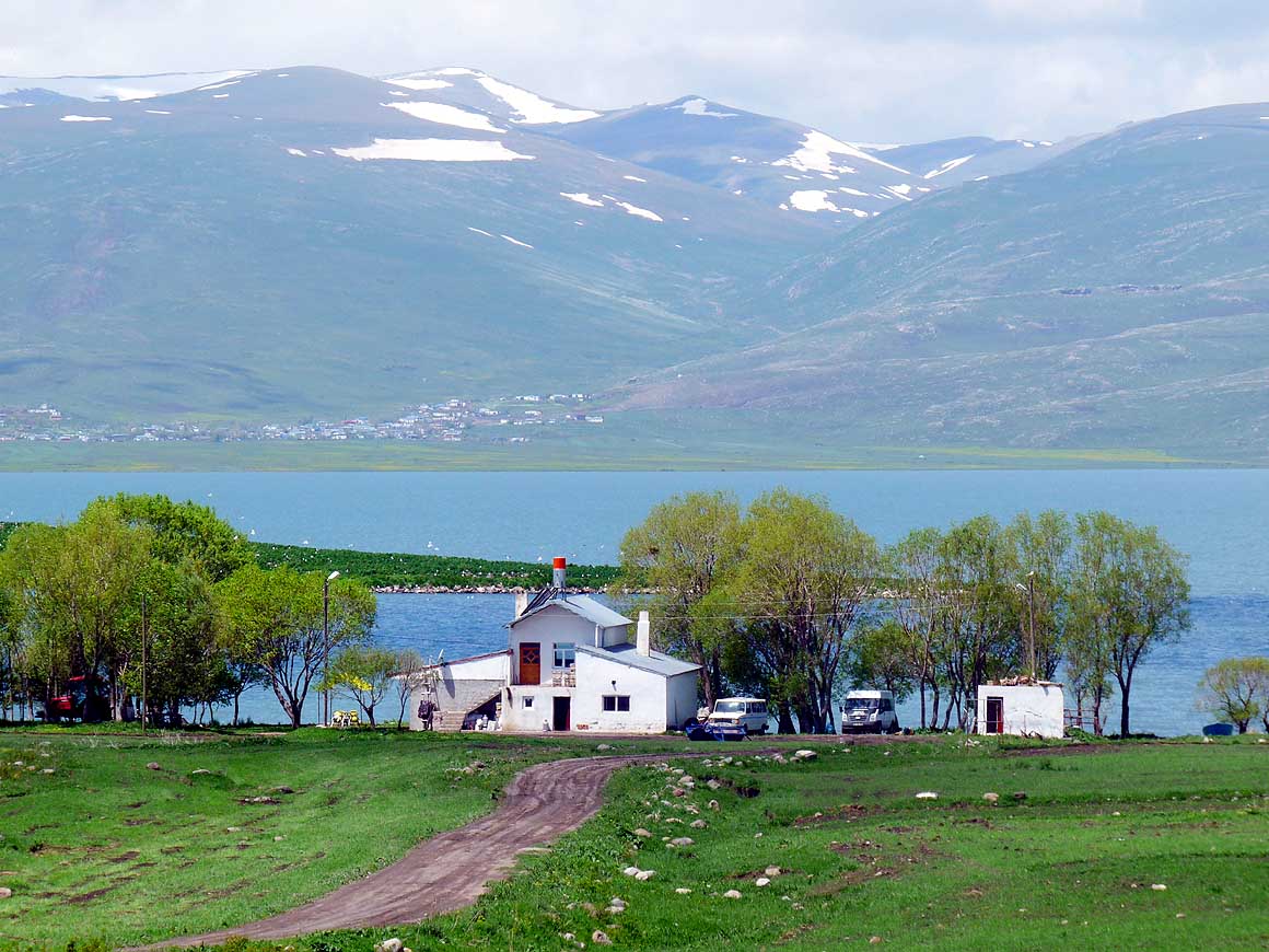
- about 5’700 ft., surrounded by impressive
- mountain scenery. In 2011 24 Turkish
- soldiers were massacred in this city.
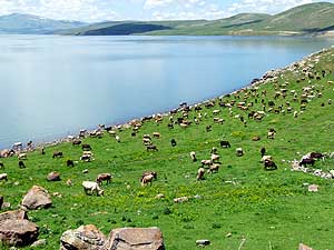
- Still today it teems with military vehicles
|
-
|
-
-

|
-
-

|
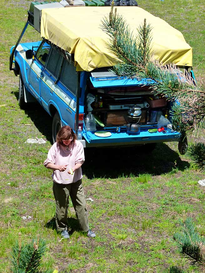
-
-

|
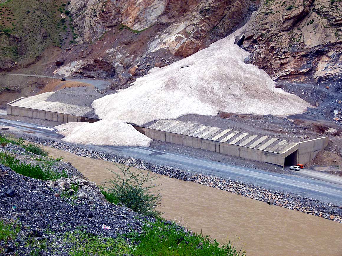
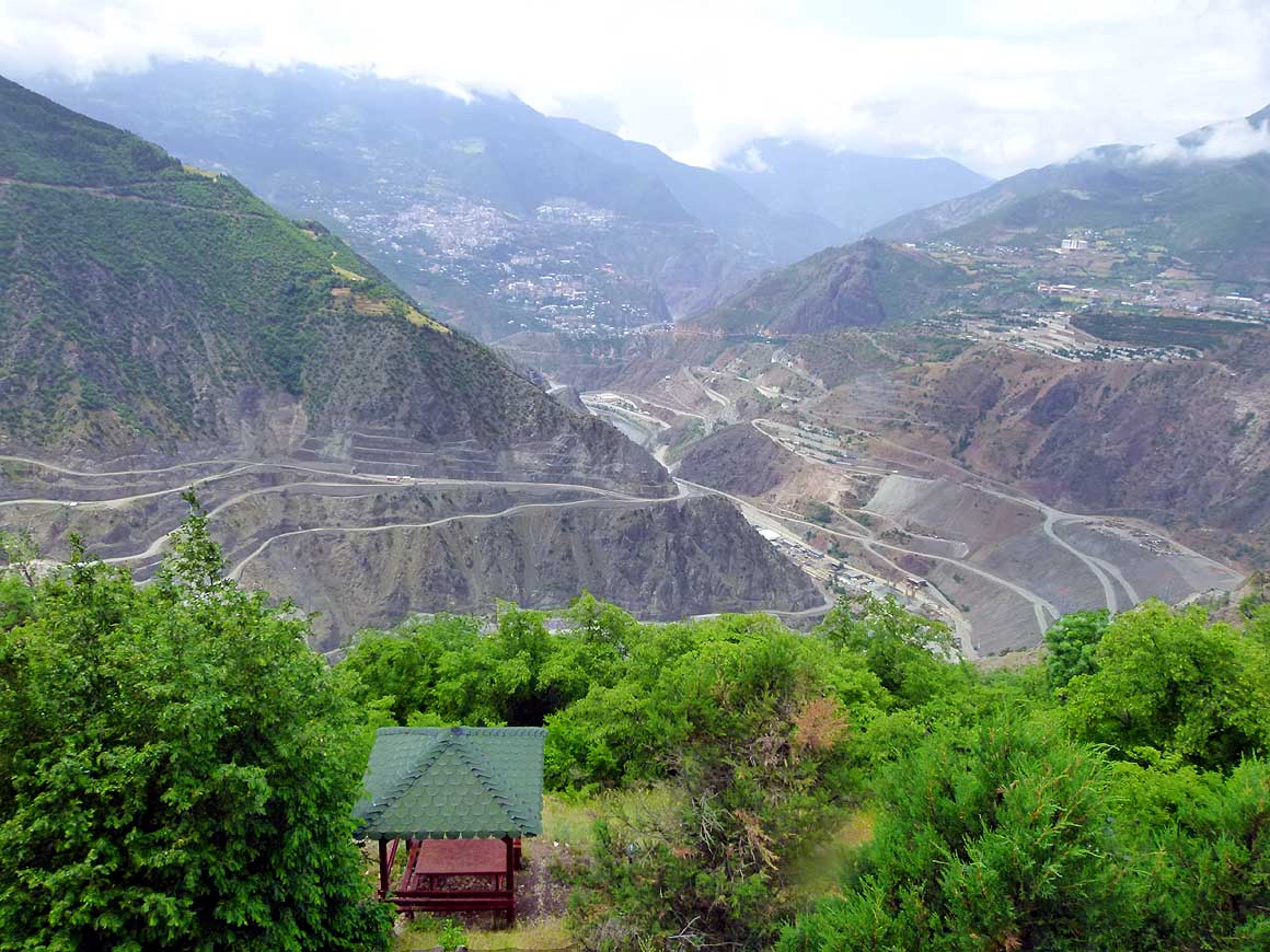
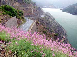
- 007
Deep gorges and high mountain
- peaks – the scenery around Hakkari
- is impressive. We stop along the road
- to take pictures
|
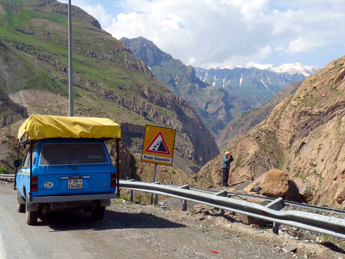
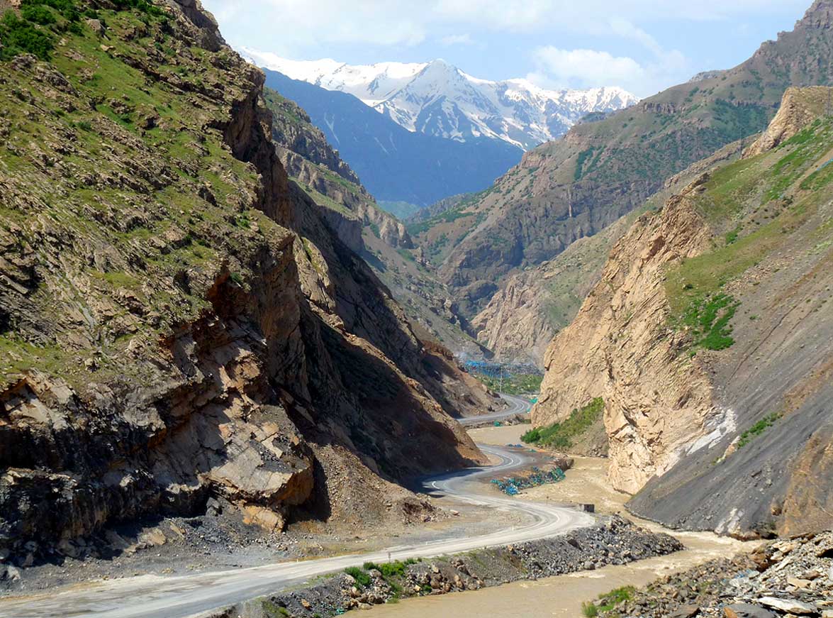
- 008
The road from Hakkari to Sirnak
- meanders spectacularly through a narrow
- gorge. It follows the border to Iraqi
- Kurdistan and is still regarded militarily as a
- very sensitive area with the corresponding
- checks and restrictions (photographing)
|
- 009
The houses of the Kurds are
- built with corrugated iron roofs.
- They glisten already from far
|
-
|
-
-
|
-
-
|
-
-
|
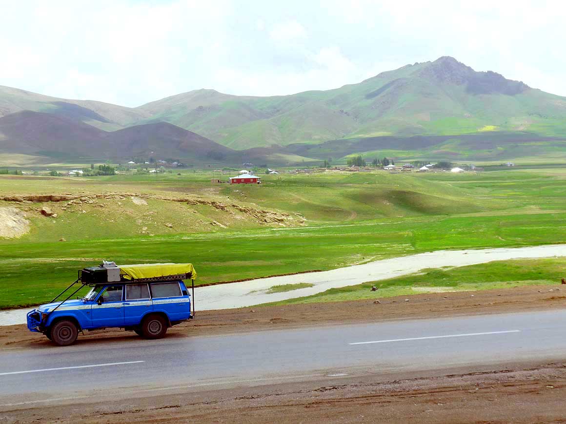
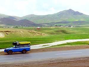
- 010
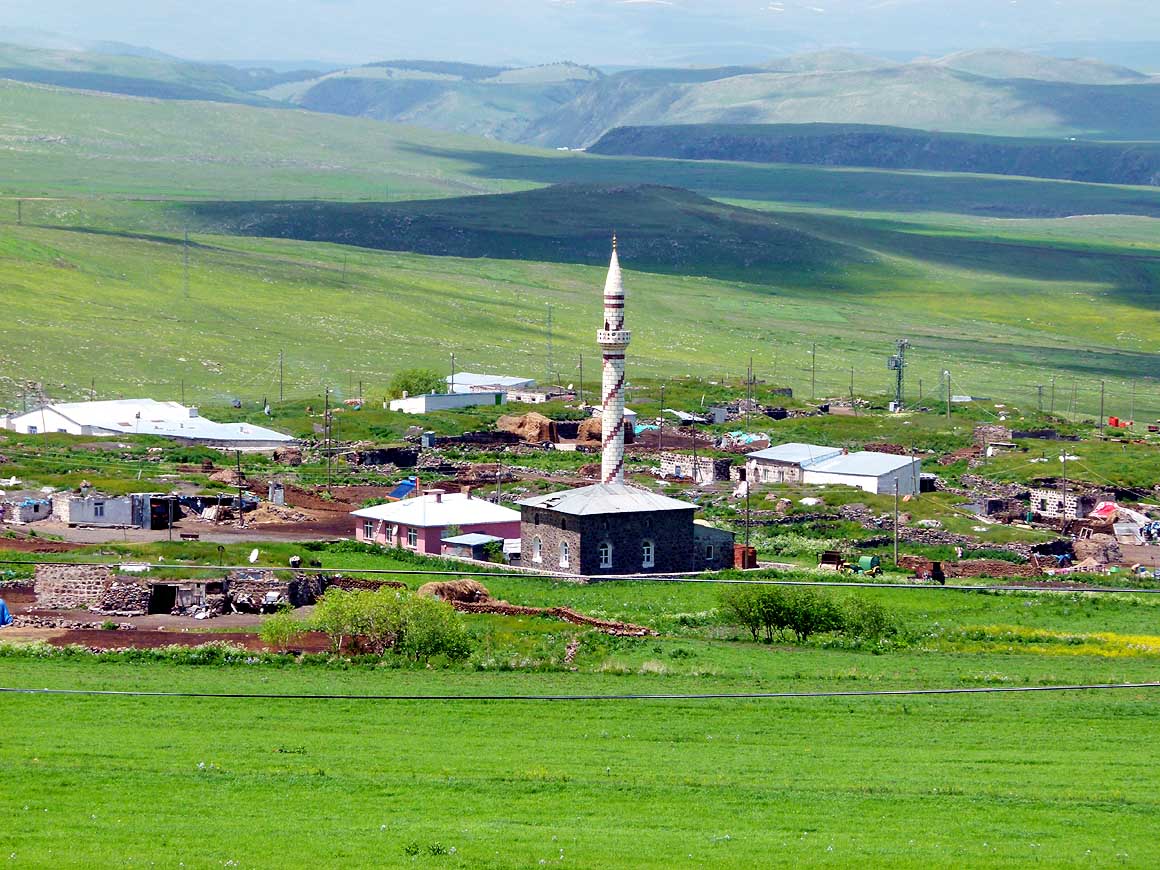
We drive past a rural Kurdish
- scene with scattered houses towards Başkale
- and Van through Southeast Anatolia. This
- region is not yet “overrun“ by tourism
|
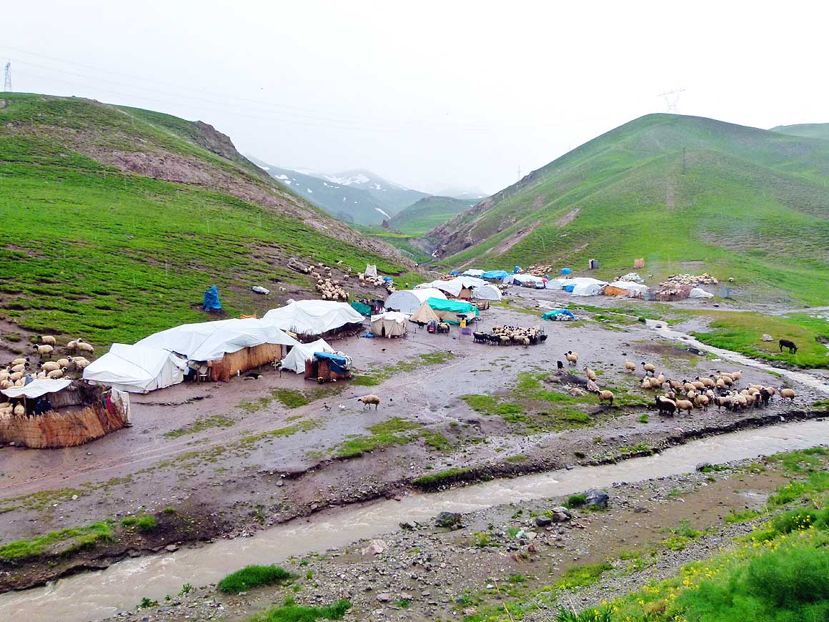
- 011
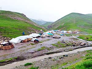
Roaming nomads set up their tents
- on a river shore between Başkale and
- the 8’957 ft. high Güzeldere mountain
- pass. The partially annoying military checks
- along the roads stop after Başkale
|
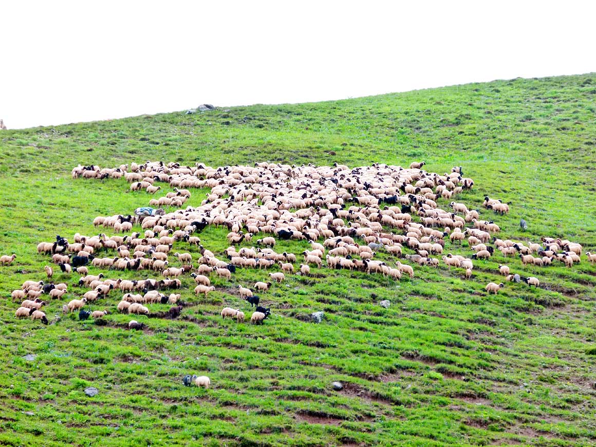
- 012
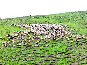
Shortly after the melting of
- snow, there are enough rich green
- pastures for sheep
|
-
|
-
-
|
-
-
|
-
-
|
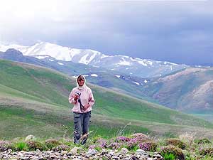
- 013
Winter has not yet retreated in the
- over 12’000 ft. high Koçkıran mountains. But
- in the valley flowers are already blooming.
- Liliana cannot resist taking a picture in the cold
|
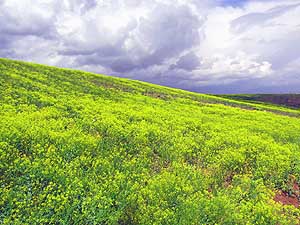
- 014
At a lower altitude a golden
- glowing floral splendor covers an
- entire hill – a feast for the eye
|
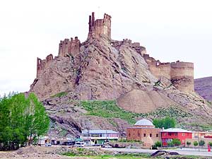
- 015
The Hoşap Castle in Güzelsu,
- built 1643, on the way to the town of
- Van on lake Van, 36 miles away
|
-
|
-
-
|
-
-
|
-
-
|
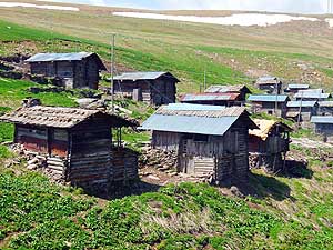
- 016
New snow has fallen during the
- night at higher elevations. The virgin
- white of the Erek mountain range
- sparkles wonderfully against the dark sky
|
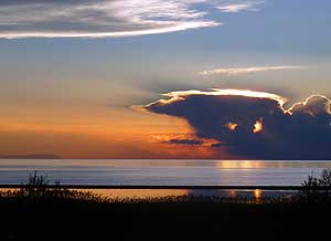
- 017
Peace lies over Lake Van at sunset.
- It has a size of 1’450 sq.mi. and is located
- at an altitude of 5’640 ft.
|
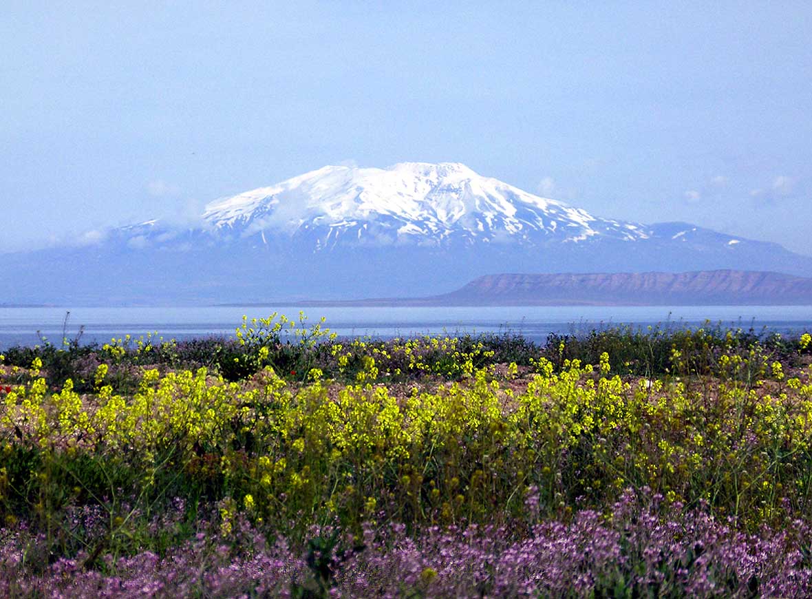
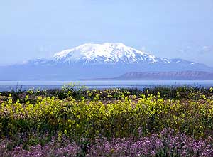
- 018
Framed by snowcapped mountains
- and blooming flower carpets, Lake Van
- shimmers in the morning sun. Opposite
- on the northwest shore Mount Süphan
- (Mt. Sipan), a dead volcano with an
- altitude of 13’314 ft., is greeting
|
-
|
-
-
|
-
-

|
-
-
|
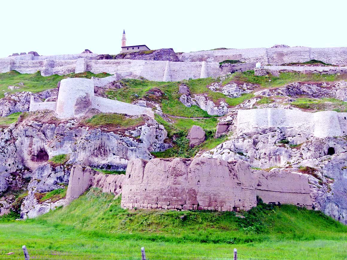
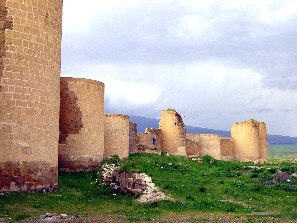
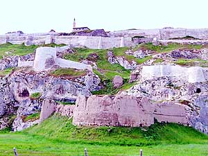
- 019
The about 0,6 miles long walls of the
- Van Fortress lie about 2˝ miles west of the
- city center of Van. At one time or another
- they were under control of Armenians,
- Romans, Medes, Achaemenid and Sassanid
- (all 3 = old-Persians), Arabs, Seljuks,
- Ottomans and Russians
|
- 020
We make a short stop along the
- way to the Tendürek pass for taking a
- picture of the peaceful village of Çolpan
|
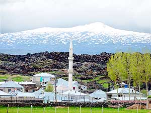
- 021
Matching wonderfully: The
- Kurdish village of Soğuksu and the
- dormant (since 1855) snow-covered
- volcano Tendürek (11'759 ft.)
|
-
|
-
-
|
-
-
|
-
-
|
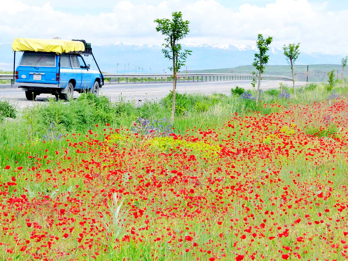
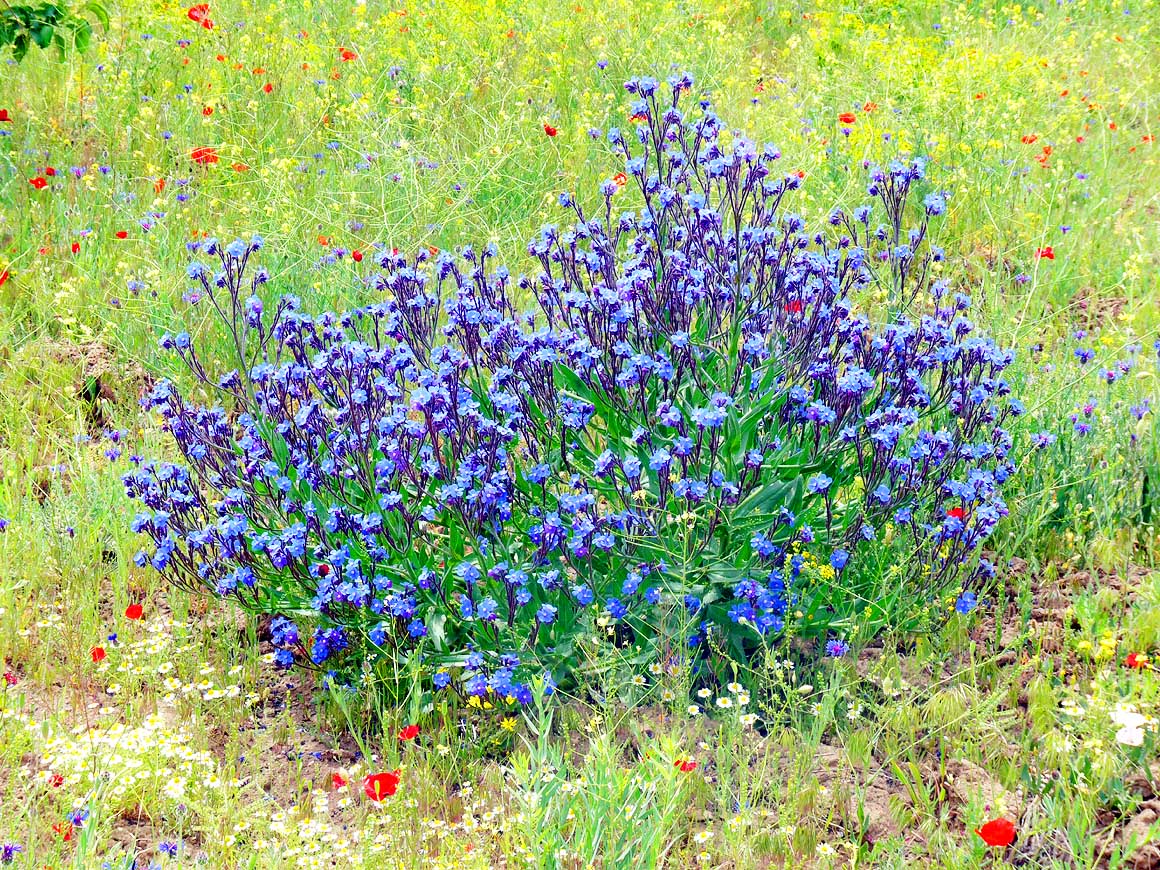
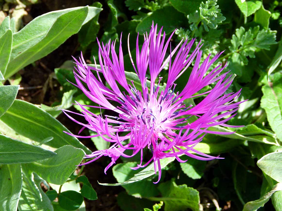
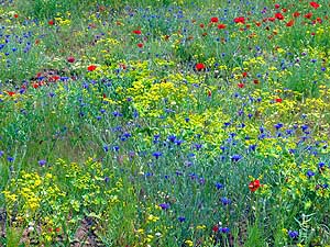
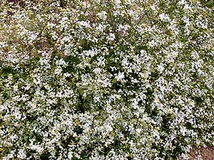
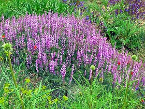
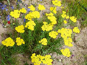
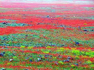
- Spring has exploded – in yellow, white, red, blue and pink. The colors and beauty
of the flowers are overwhelming
|
- 022
|
- 023
|
- 024
|
-
|
-
-
|
-
-
|
-
-

|
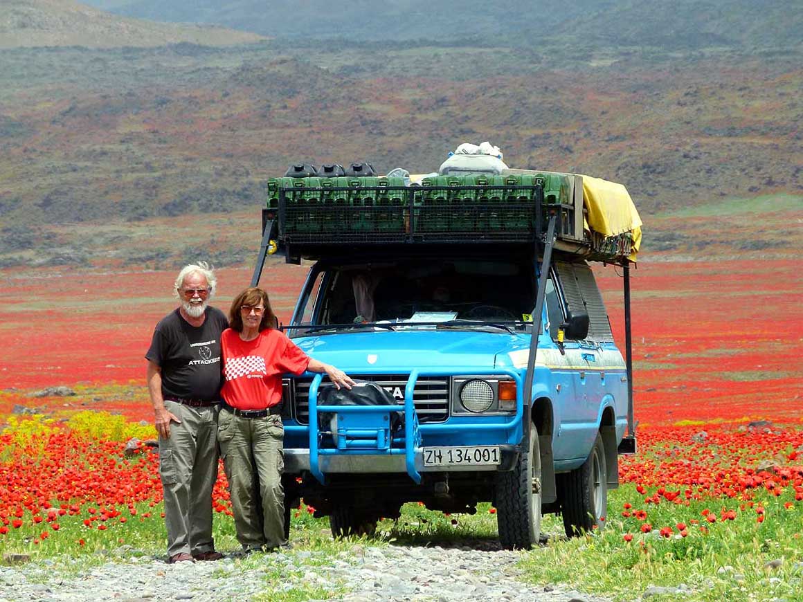
Our LandCruiser waits patiently on the side of the road while we enjoy
yellow “unknowns”, red poppies und blue forget-me-not
|
- 025
|
- 026
|
- 027
|
-
|
-
-

|
-
-
|
-
-
|
- 028
On the way to the 8’675 ft. high
- Tendürek pass: As far as the eye can see,
- there is nature and solitude. However on the
- road there is less loneliness. Here 15 Italian
- mobile homes are crossing us in a convoy
|
- 029
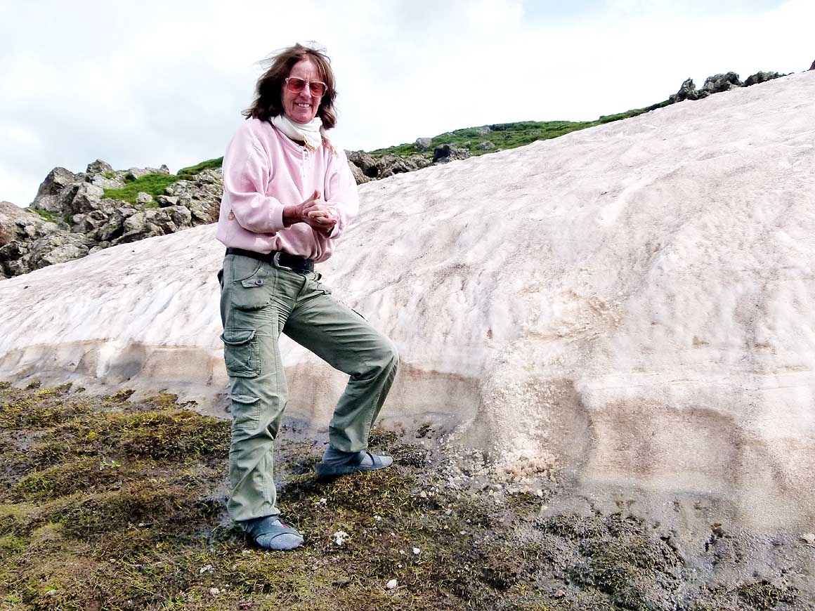
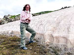
Liliana climbs to the snow wall to
- touch snow. The expression on her face
- shows how she feels; it is the first snow
- since April 3rd, 2008, at the Franz Josef
- Glacier New Zealand (picture No. 120)
|
- 030
The neat village with the
- mountain backdrop and rural charm
- – shortly before the Anatolian plains
- around Doğubayazıt that are
- at a height of 5’330 ft.
|
-
|
-
-
|
-
-
|
-
-
|
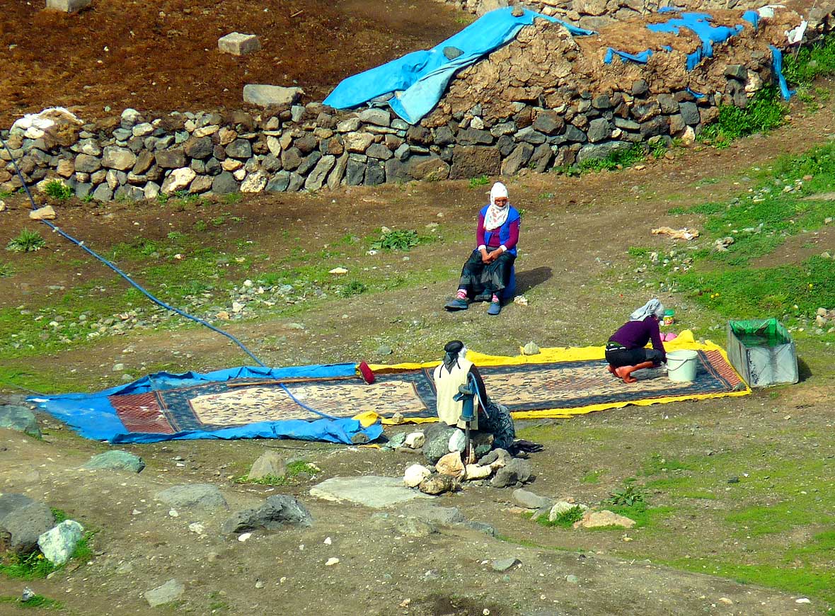
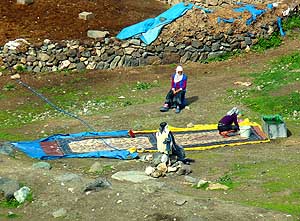
- 031
A woman is spring-cleaning her carpet
|
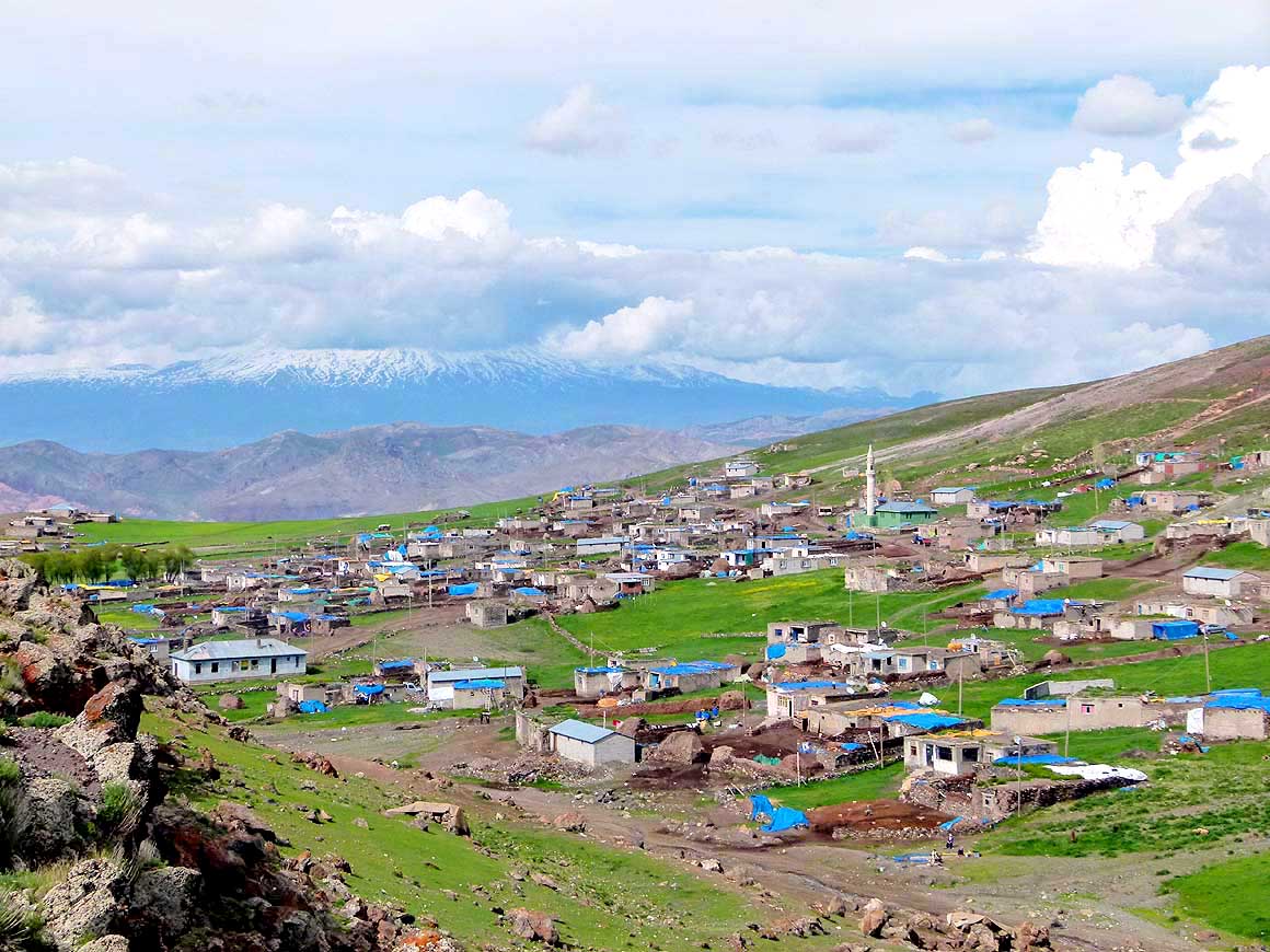
- 032
The blue of the tarps that cover
- different things is the dominating color
- in this mountain village of Somkaya,
- located about 4 miles on the north
- side of the Tendürek pass on an
- altitude of about 7'700 ft.
|
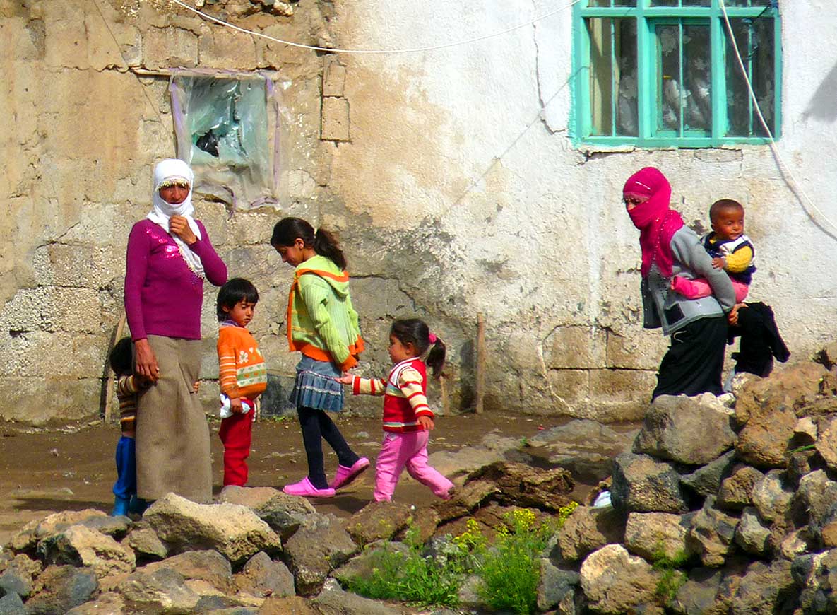
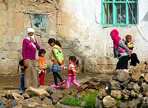
- 033
Mothers gather in front of a
- modest dwelling with their small children
|
-
|
-
-
|
-
-
|
-
-
|
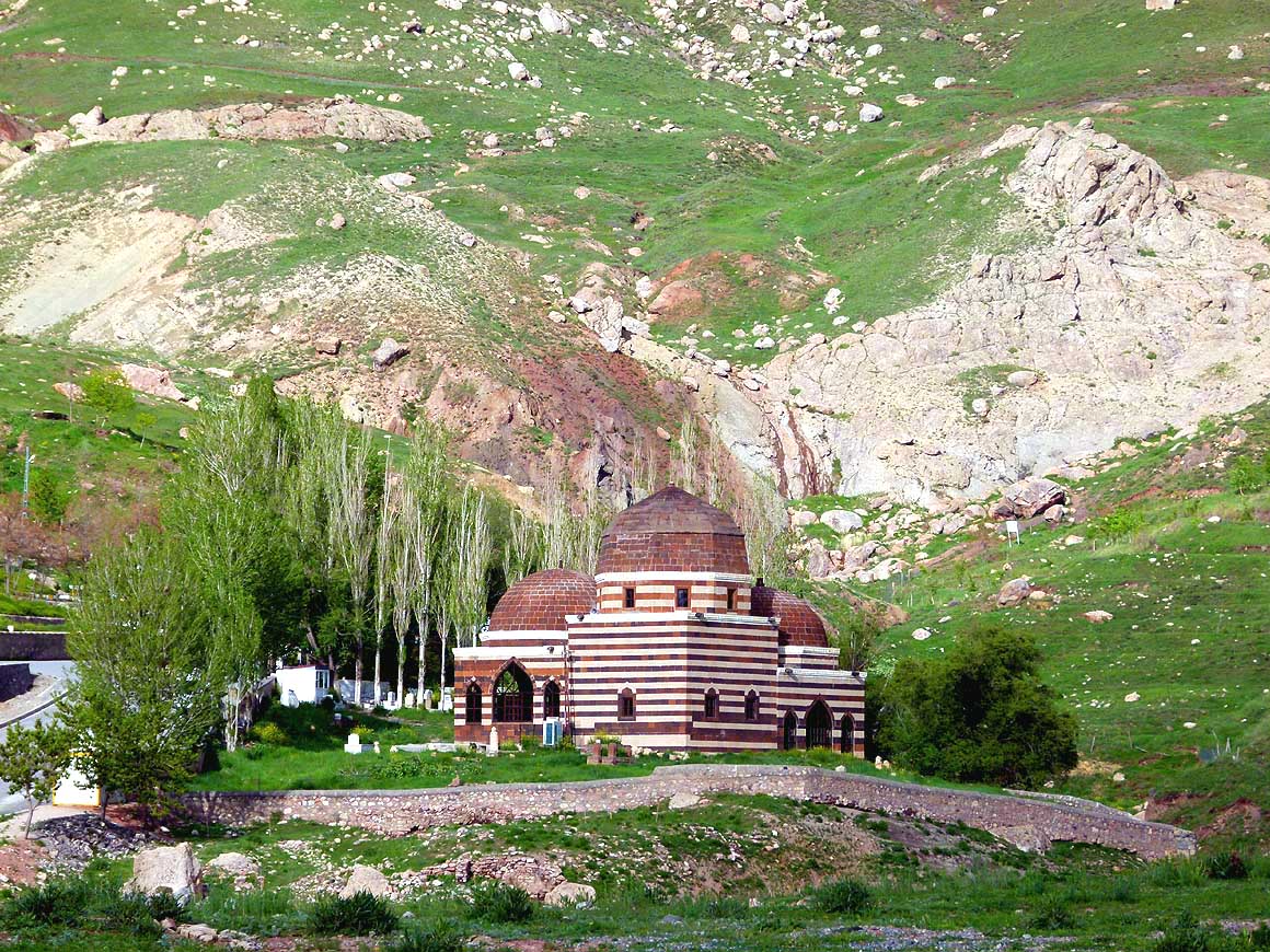
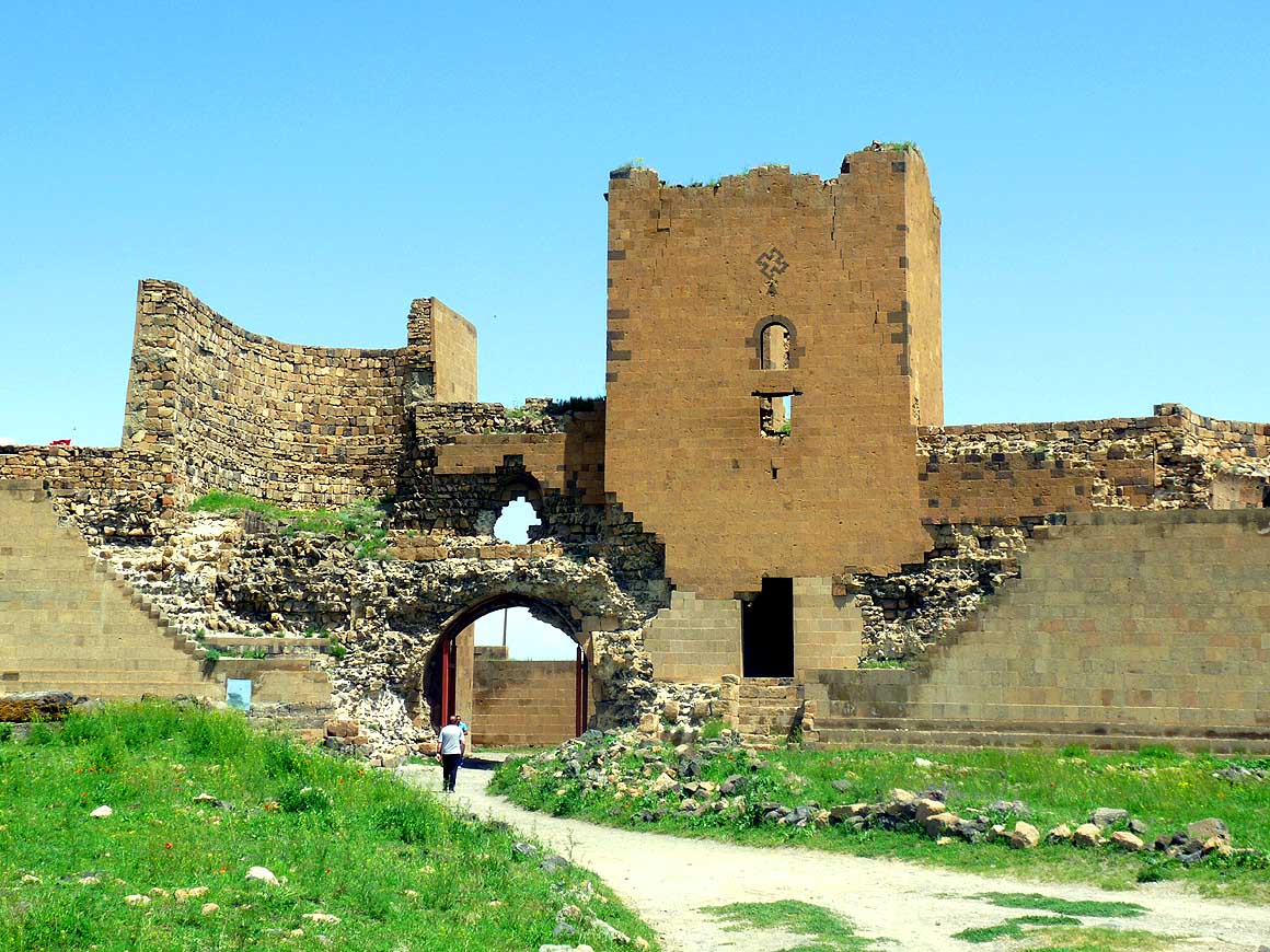
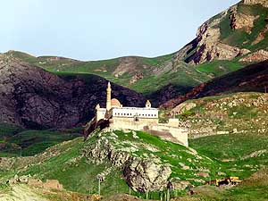
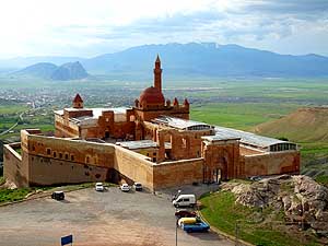
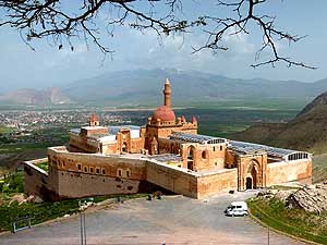
- 034
The İshak Paşa Palace – built 1685 –
- sits high on a rocky hill surveying the border
- town of Doğubayazıt with the main border
- crossing Turkey-Iran
|
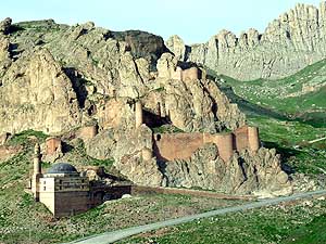
- 035
Camouflaged between natural
- rocks: Parts of the old Bayezıd Mosque
- and the Doğubayazıt Fortress close to
- the İshak Paşa Palace
|
- 036
The Ahmed-İ Hânî shrine close
- to İshak Paşa Palace – a bit further
- than the old Bayezıd Mosque
|
-
|
-
-
-
-
|
-
-

|
-
-
-
-
|
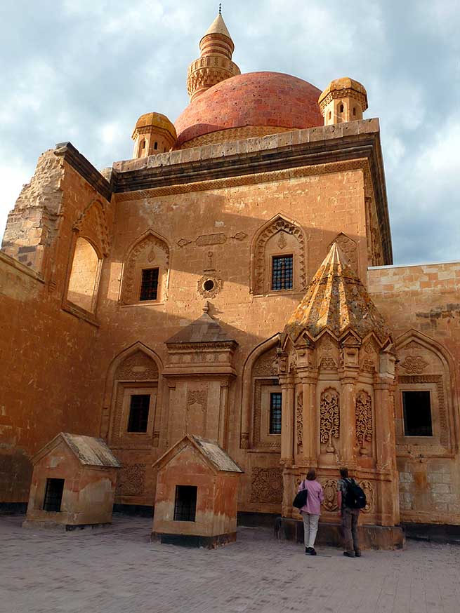
- 037
Evening light over the İshak Paşa Palace.
- It sits in a magic setting 4 miles uphill of
- Doğubayazıt. Across (behind the clouds) is
- the 16’854 ft. high Mount Ararat and below
- are the Anatolian plain and Doğubayazıt (left)
|
- 038
The second courtyard of the
- palace contains the richly decorated
- tomb of Çolak Abdi Paşa, who
- built the complex
|
- 039
Morning light over İshak Paşa
- Palace. It is a blend of Seljuk, Ottoman,
- Georgian, Persian and Armenian
- architecture. Construction began 1685
- and was completed in 1784
|
-
|
-
-
|
-
-

|
-
-
|
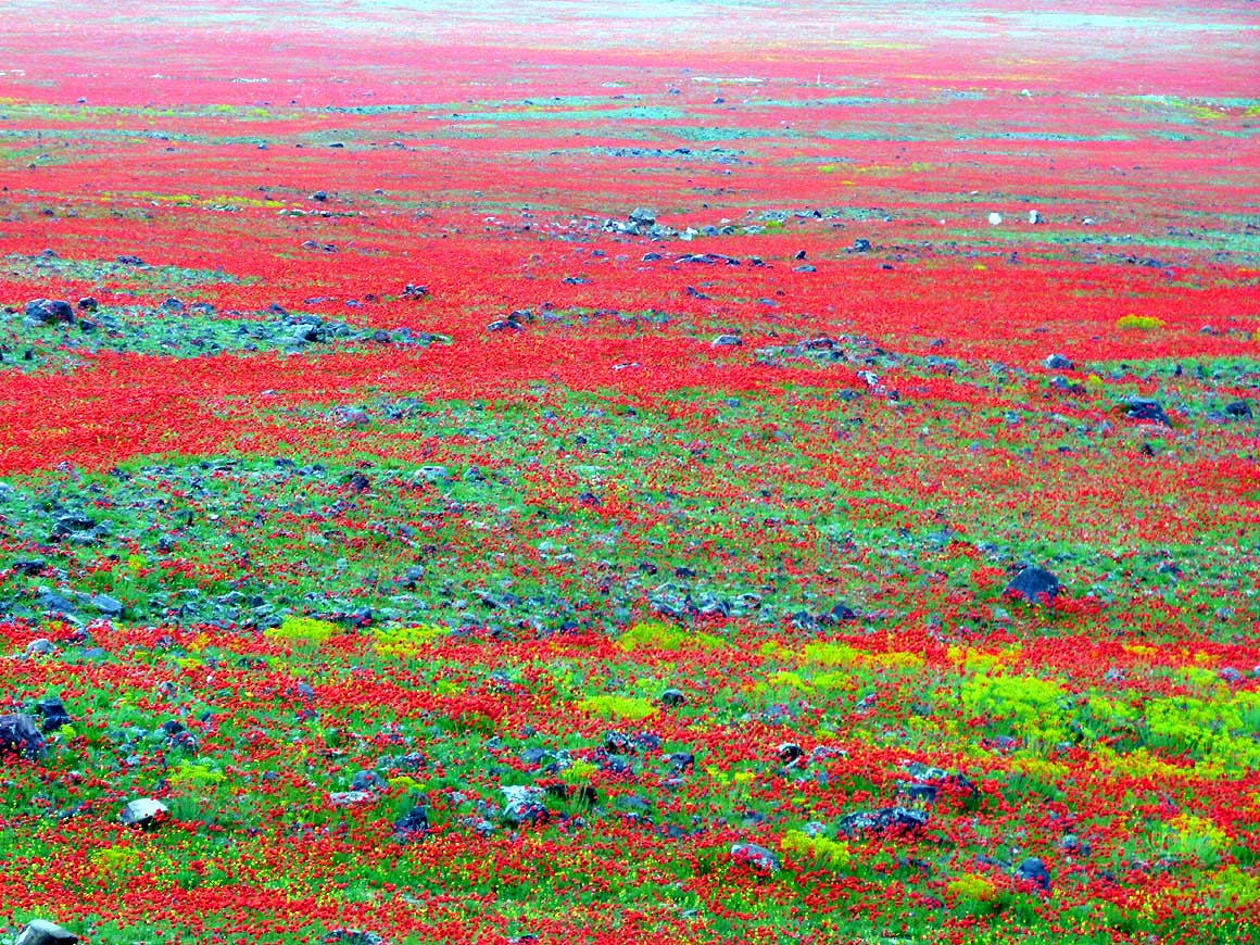
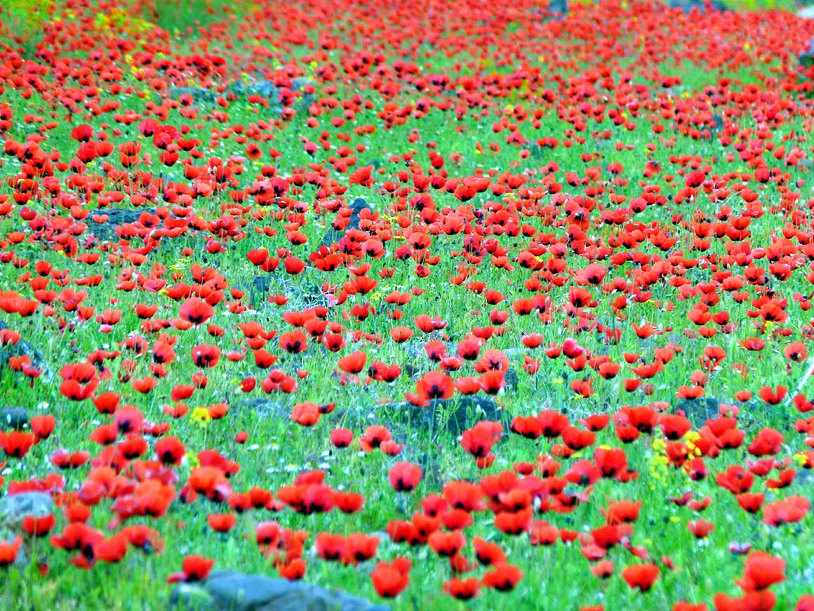
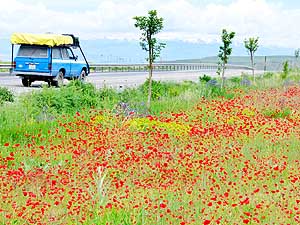
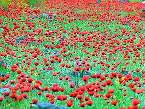
- Springtime is in full bloom: The immense carpet of bright red poppies short of Iğdır is
a breathtaking sight
|
- 040
|
- 041
|
- 042
|
-
|
-
-
-
-
|
-
-
|
-
-
-
-
|
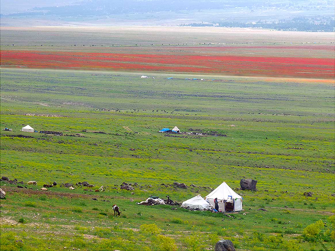
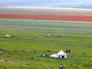
- 043
Scattered white tents of nomads add
- more spots of color to the plain before Iğdır
|
- 044
The dazzling white of this new
- mosque close to the airport of Kars
- stands out in its green environment
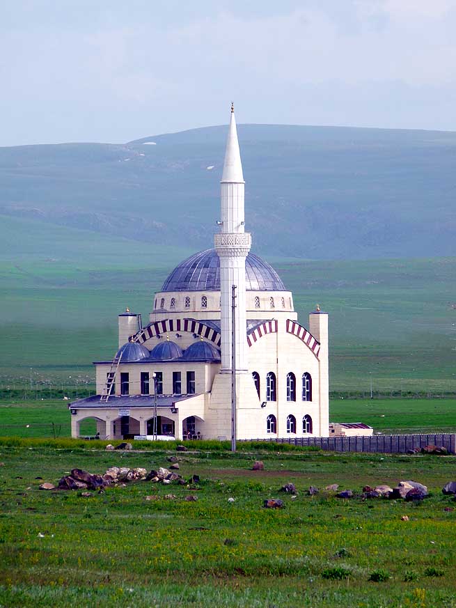
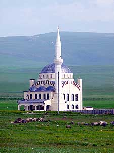
|
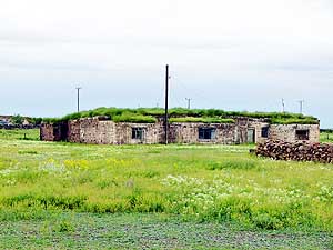
- 045
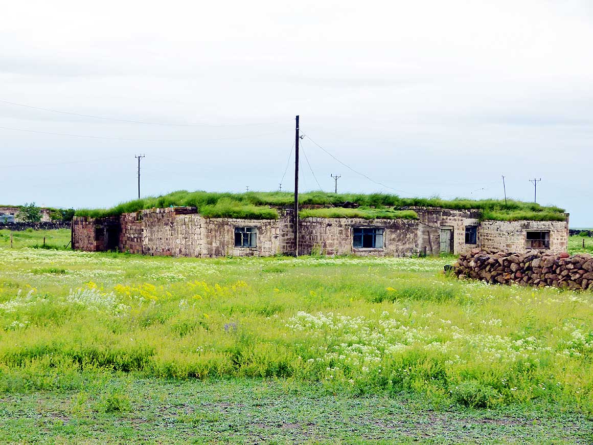
Rural at its best: dwellings with
- grass covered roofs east of Kars in the
- village of Ocaklı near the ruins of Ani,
- the former Armenian capital
|
-
|
-
-

|
-
-

|
-
-
|
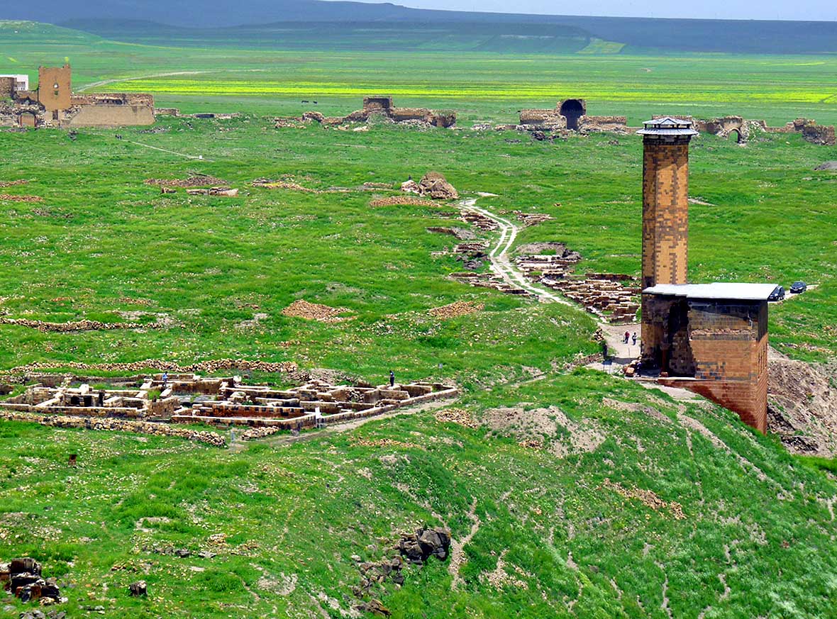
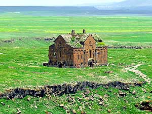
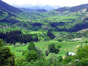
- 046
In Ocaklı Köyü, 28 miles east of
- Kars, high city walls shield the entrance to
- the ruins of Ani, the former Armenian capital
- that lies on Turkish soil since 1920
|
- 047
Ani`s "Arslan Kapısı“ is the
- entrance to the ghost city that was once
- the stately Armenian capital and home
- to 100`000 people. In power and
- glory it rivaled Constantinople
|
- 048
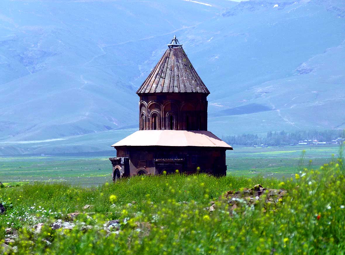
The conical roof rising from
- the undulating grass belongs to the church
- of “Saint Gregory of the Abughamrentz“
- (Abughamir) family and dates from 994
|
-
|
-
-
|
-
-
|
-
-
|
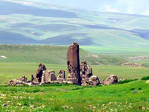
- 049
Not much remains of the church
- of “Saint Gregory of King Gagik I” dating
- from the year 998. The Turks destroyed
- 1921 nearly everything in Ani
|
- 050
The east side of the South Narthex
- of the „Church of the Holy Apostles“
- (Surp Arak'elots), which dates from 1031.
- Starting from 1064 it was used also as a
- caranvanserei
|
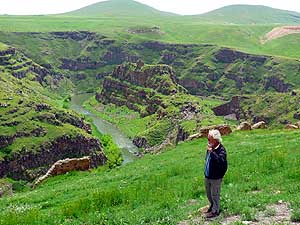
- 051
From the windswept plateau of Ani,
- Emil is overlooking the gorge of the
- Arpa Çayi River and the church “Kız
- Kalesi” (Turkish), also called “Kusanats”
- (Armenian) or “Maiden’s Castle”
|
-
|
-
-
|
-
-
|
-
-
|
- At the 350 ft. high "İç Kale" hill - the Ani Citadel - the highest point, we
pause and enjoy the eerie silence and the nature surrounding us
|
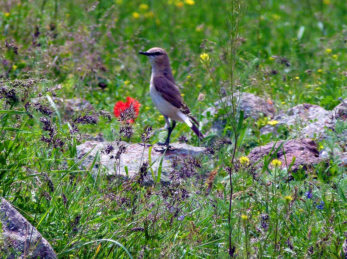
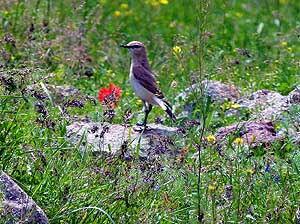
- 052
Orphean Warbler (Sylvia hortensis),
- a migrant – in winter in sub-Saharan Africa
|
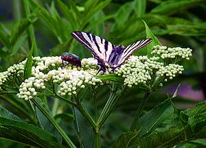
- 053
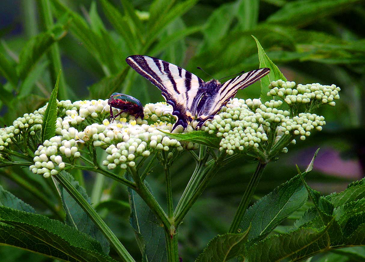
Swallowtail butterfly
- (Papilio machaon)
|
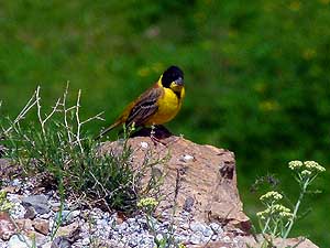
- 054
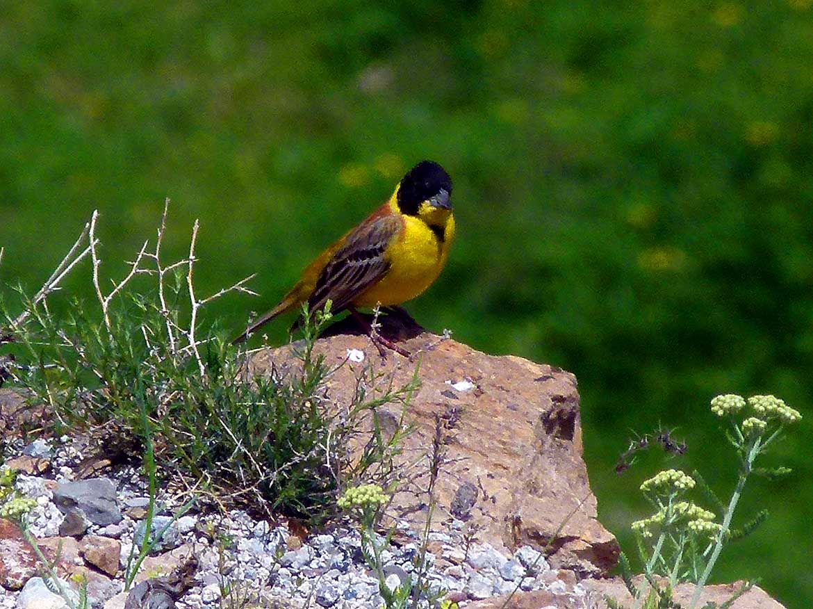
Black-headed Bunting
- (Emberiza melanocephala) also a
- migrant – but in winter in India
|
-
|
-
-
-
-

|
-
-
|
-
-
-
-
|
- 055
To the ruins of Ani`s old stone
- buildings belong also a mosque (Mosque
- of Minuchhihr “Menüçehr Camii” from
- 1072) and a former street lined with shops
- where travelers, merchants and nobles
- were bustling about their business
- in this “Silk Road” entrepot
|
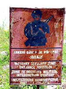
- 056
Now, all the ruins of the former
- Armenian Kingdom are freely accessible
- without any restrictions. But this rusty
- sign shows that there was (recently) a
- time when some were military security
- zones with absolute ban on photography
|
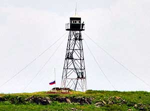
- 057
On the Armenian side across the
- Arpa Çayi River a watchtower is still
- visible, interestingly with a Russian flag
- flying at half mast and a “dummy-
- watchman” on the top
|
-
|
-
-
-
-
|
-
-

|
-
-
|
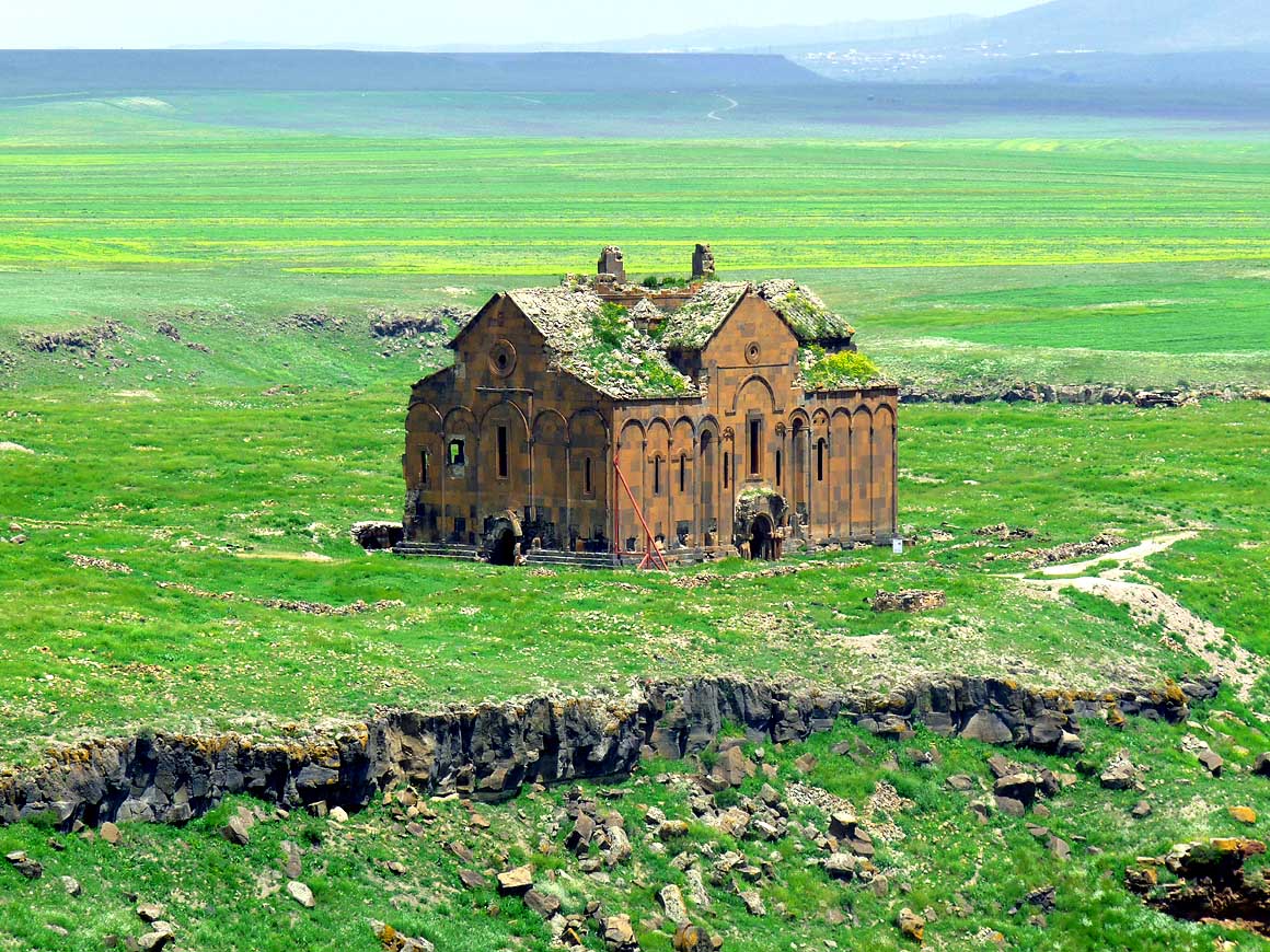
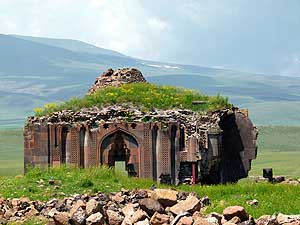
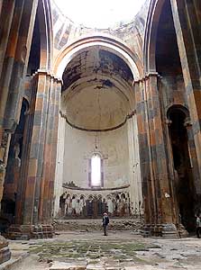
- 058
The Cathedral of Ani (Church of
- the Holy Mother of God) from 1010 A.D.
- on the plateau is the largest building of this
- ancient Kingdom. Ani was once also the seat
- of the Armenian Orthodox Patriarchate .....
|
- 059
..... at the entrance of the cathedral
- a Turkish family poses for a picture .....
|
- 060
..... and in the somewhat
- ‘hollowed’ interior Emil is standing
- a bit lost in the nave
|
-
|
-
-
|
-
-
|
-
-
-
-
|
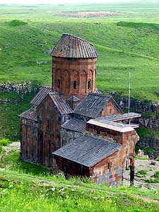
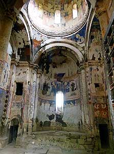
- 061
The church of “Saint Gregory of
- Tigran Honentz” (1215 A.D.) sits on the
- escarpment of the Arpa Çayi River that marks
- the border to Armenia. There is no border
- crossing at all between Turkey and Armenia
|
- 062
The fading and also partly
- destroyed frescoes in the interior of
- the church of “Tigran Honentz” are
- testimony of its former glory
|
- 063
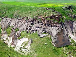
On the west side of Ani there
- are also rock-cut chambers in the
- “Tsaghkotsadzor Valley” (the
- “Blooming Gorge”), both beneath
- the plateau and the opposite walls
|
-
|
-
-

|
-
-
|
-
-
|
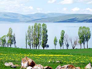
- 064
A dreamy place to live: At the
- lakeshore of Lake Çıldır near Doğruyol
|
- 065
On the north side of Lake Çıldır –
- after Akçakale – the road follows directly
- the lakeshore and reveals the unspoiled
- state of the surroundings in this region
|
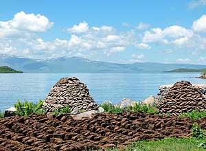
- 066
Cowpat is used as heating fuel
- in the rural areas of Anatolia. It is spread
- out to dry and then piled up into
- pyramids or fences
|
-
|
-
-
|
-
-
|
-
-

|
- 067
Cattle is grazing peacefully along
- the northern shore of Lake Çıldır. In
- northeast Anatolia livelihood depends
- on agriculture
|
- 068
There is the feeling of vastness
- and harmony at this peaceful rural village
- of Semiha Şakir in northeastern Anatolia
|
- 069
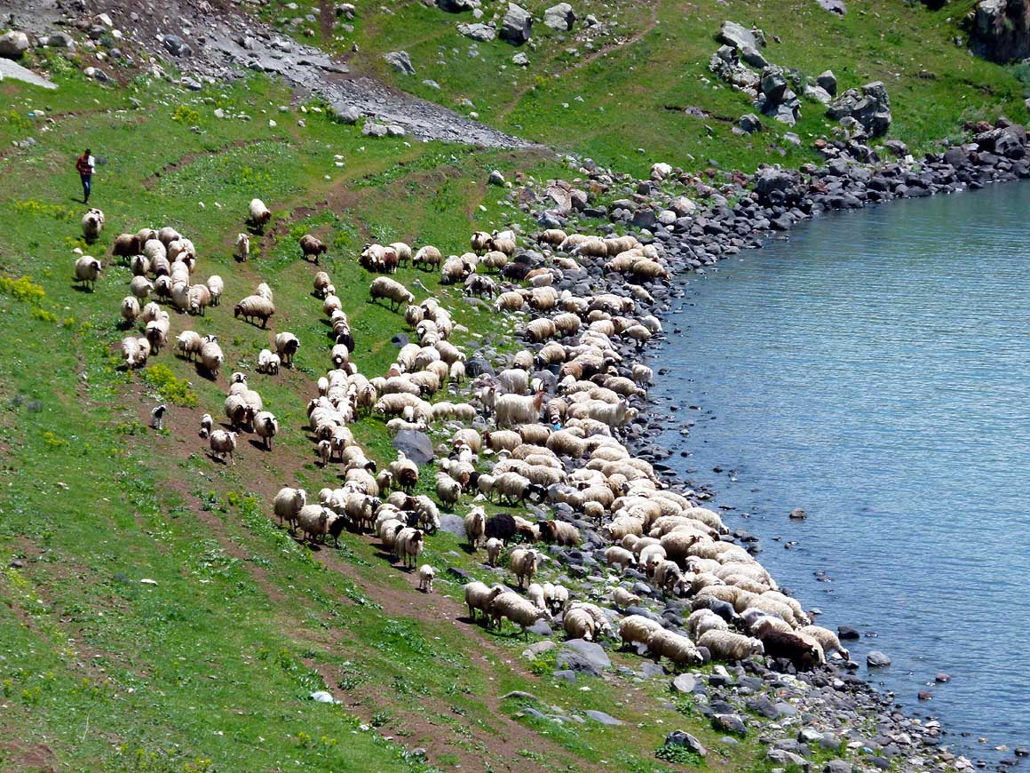
A thirsty flock of sheep rushes
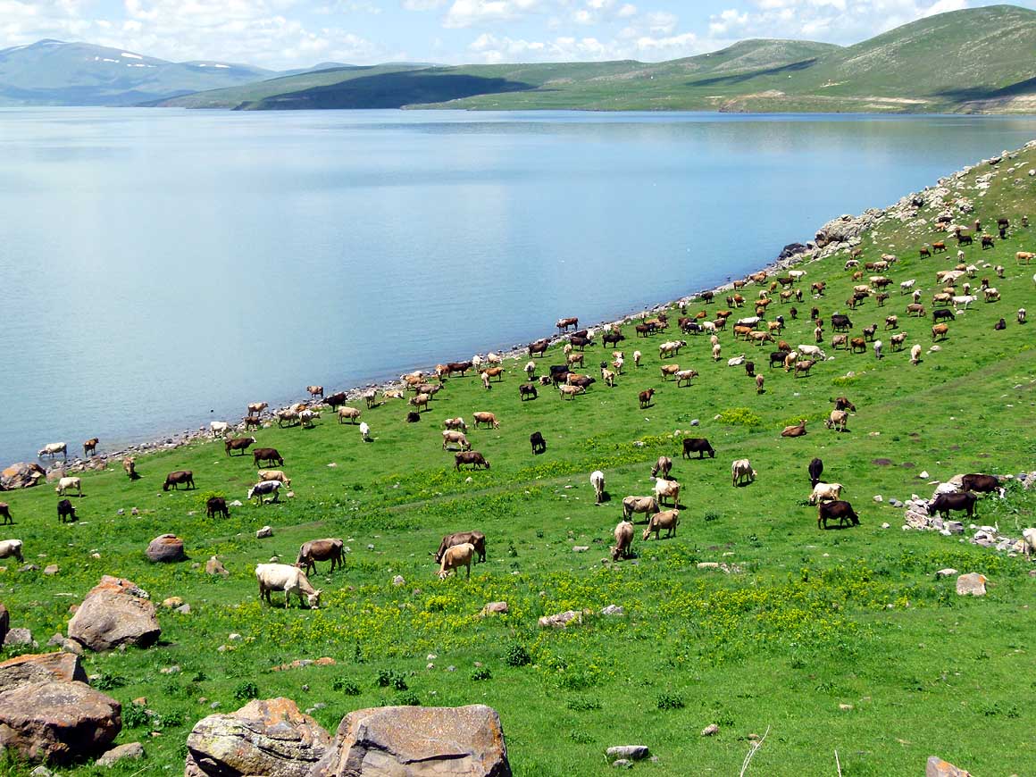
- to the shore of Lake Çıldır. Animals
- have almost unlimited space to roam
- around – also on the roads
|
-
|
-
-
|
-
-
|
-
-
|
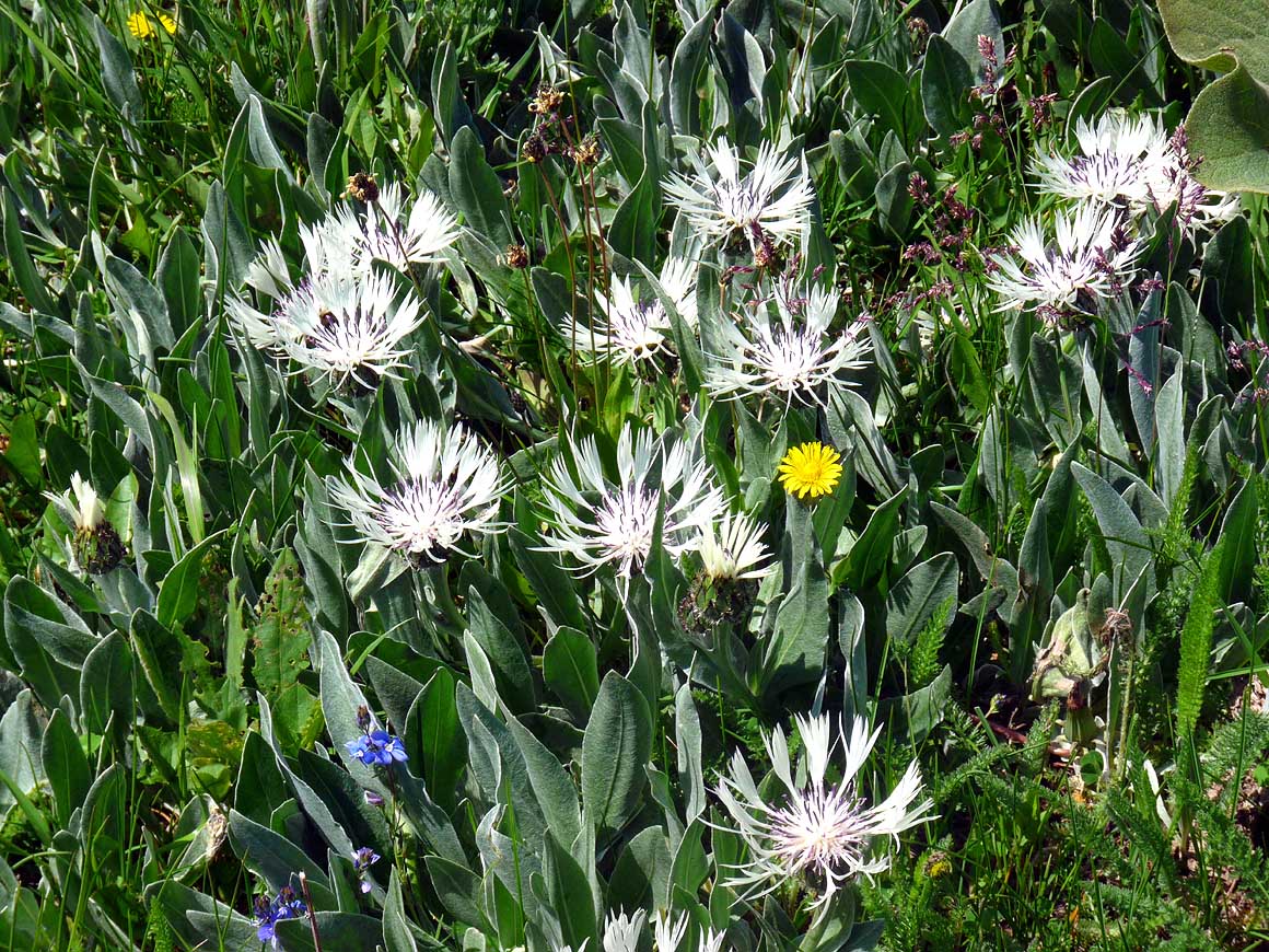
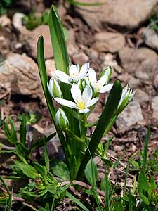
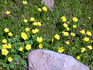
- Climbing up to the 8’662 ft. high Çam Pass and the
following “Karagöl Sahara Millî“ Park between Ardahan and
Şavşat,
- we are captivated again and again by the lovely alpine flora that burst into life
|
- 070
|
- 071
|
- 072
|
-
|
-
-
-
-
|
-
-
|
-
-
-
-
|
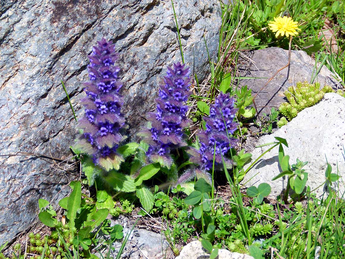
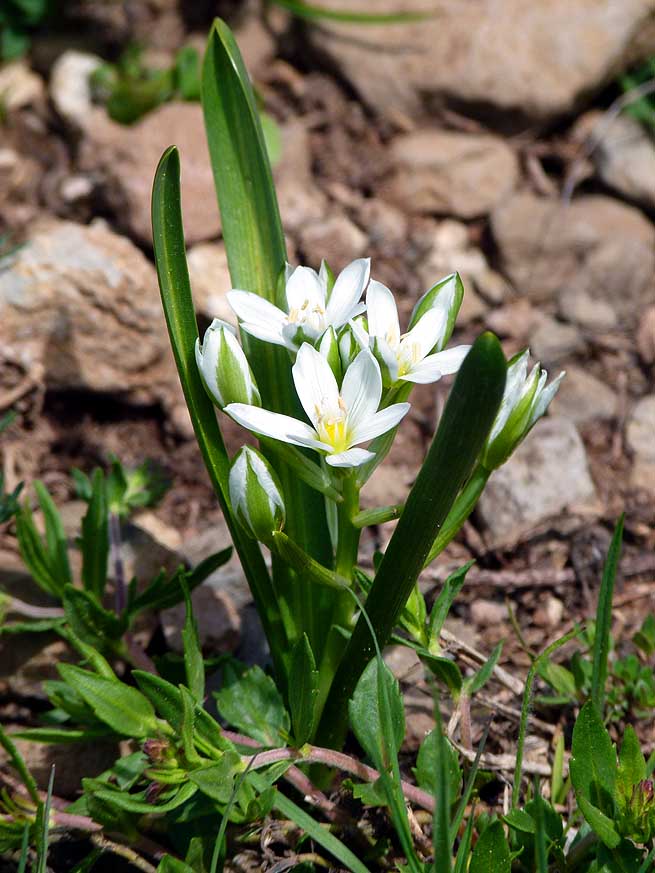
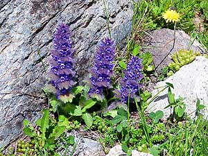
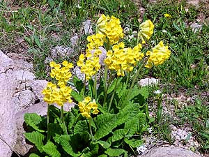
- To Liliana`s joy also cowslip (Primula veris), crocuses (Crocus) und
kingcups/marsh marigold (Caltha palustris)
- sprout on our climb to the Çam Pass – flowers that take her back to her childhood
|
- 073
|
- 074
|
- 075
|
-
|
-
-
-
-
|
-
-
|
-
-
-
-
|
- 076
From the 8’662 ft. high Çam Pass the
- road descends continuously to sea level at
- Hopa; here we are in the national park
- “Karagöl Sahara“ – in fact it doesn’t
- look exactly like the Sahara
|
- 077
Near a little pine tree forest
- Liliana makes some lunch, usually
- our last meal of the day
|
- 078
A village with simple wooden
- "chalets" nestles on a slope along the
- Çam pass. It doesn’t seem that they are
- used during the whole year – probably
- only in the warmer season. This hamlet
- is called Kocabey Yaylası
|
-
|
-
-
|
-
-
|
-
-
|
- 079
On the western side of the 8’662 ft.
- high Çam Pass the healthy pine tree forests
- and little villages remind us of Switzerland
|
- 080
We follow the spectacular road
- along the reservoir, which is dammed up
- by the 817 ft. high and 2’360 ft. long
- Deriner Dam, fed by the Çoruh river. It
- leads through stunning mountain scenery
- and many tunnels ca. 20 miles to the
- dam wall about 3 miles before Artvin
|
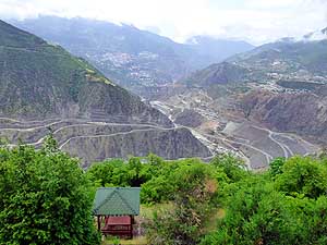
- 081
View towards Artvin (47 miles
- further is the Black Sea). There are
- still clear-up operations down in the
- Çoruh valley, because the reservoir
- started to operate only in February 2013
- (filling with water since February 2012)
|
-
|
-
- More websites from the Middle East:
- Welcome to Kuwait on March 3rd, 1996
- Yemen car trip (from Oman to Saudi Arabia)
- from May 16th, to June 15th, 1996
- Sandstorm in Saudi Arabia on February 4th, 1999
- Trip to Dubai in January and February
1999
- Oman 1999 - from mid-March to mid-April
1999
- Oman 2013 - Part 1 - February
2013: Musandam Peninsula
- Oman 2013 - Part 2 - February
2013: Sohar - Muscat - Rustaq - Nizwa
- Oman 2013 - Part 3 - March
2013: Sur - East Coast - Island of Masirah - Dhofar
- Oman 2013 - Part 4 - March
2013: Salalah & Surroundings (Dhofar) - Nizwa
- Oman 2013 - Part 5 - March 2013: Western Hajar
Mountains
- Fairytale Wedding in Dubai - United
Arab Emirates - with our car from February 7th, to
May 20th, 1999
- Sharjah + Dubai: United Arab Emirates - without our vehicle from February 19th, to 27th, 2011
- Sharjah/Dubai/1st Traveler's Festival/Emirates
National Auto Museum - UAE with
car Nov. 2012 to Jan. 2013 - part 1
- Western UAE - Liwa - United Arab Emirates with car in January 2013 - part 2
- Al Ain, Eastcoast & Ras al Khaima - United
Arab Emirates with our car in April 2013 -
part 3
- Iran -
Part 1: Ferry Port Bandar Abbas-Shiraz-Persepolis-Pasargad (between Persepolis and Yazd)
– May 2013
- Iran -
Part 2: Pasargad
(excl.)-Yazd-Esfahan – May 2013
- Iran -
Part 3: Esfahan
(excl.)-Chelgerd-Hamadan-Sanandaj-Orumiye-Turkey
Border – May 2013
- Georgia -
Part 1: Turkey Border-Ajaria-Tbilisi-Kakheti-Azerbaijan Border – June 2013
- Azerbaijan:
Georgia Border-Balakən-Şəki-Lahıç-Baku-Xınalıq-Quba-Laza-Baku-Gəncə-Georgia Border – June 2013
-
Georgia - Part 2a: Azerbaijan Border-Tbilisi-Armenia
Border –
June/July 2013
- Armenia - Part 1:
Georgia Border-Akhtala-Haghpat-Dilijan-Lake Sevan-Selim-Arates-Nagorno Karabakh –
July 2013
- Nagorno-Karabakh:
Armenia-Stepanakert-Gandzasar-Martakert-Tigranakert-Tnjri-Shoushi-Armenia – July
- Armenia -
Part 2:
Nagorno Karabakh-Goris-Tatev-Noravank-Khor Virap-Echmiadzin-Yerewan-Geghard-Gyumri-Georgia Border – July 2013
- Georgia -
Part 2b: Armenia Border-Ninotsminda-Tbilisi-Mtskheta-Kazbegi-Kutaisi-Zugdidi –
July 2013
- Georgia -
Part 3a:
Zugdidi-Swaneti-Zugdidi-Abkhazia Border – July/August 2013
- Abkhazia: Georgia-Sukhumi-Tsebelda-Novyy Aton-Lake
Ritsa-Gagra-Pitsunda-Georgia – August
2013
- Georgia - Part 3b: Abkhazia Border-Poti-Ferry to Ilyichevsk/Ukraine
– August 2013
- Socotra - without our car from February 9th to 19th, 2011:
- Part 1: Socotra trip in Yemen (East) –
Hadibo - Dihamri - Arher Beach
- Part 2: Socotra trip in Yemen (South) – Homhil - Aomak Beach - Wadi Daerhu - Dicksam Plateau
- Part 3: Socotra trip in Yemen (West) – Qalansiya - Shouab Beach - Qadama Beach - Momi Plateau - Wadi Ayhaft
|
|
|