-
-
-
|
-
-
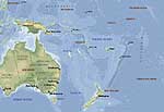
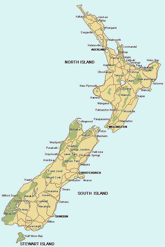
- New Zealand Map
-
|
-
-
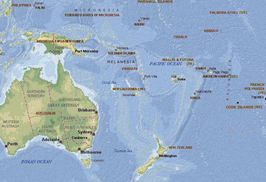
- Map of
- the Pacific
-
-
|
-
-
-
-
-
|
- latest picture: April 6, 2008
- click a picture to see details
|
-
-
|
-
-
|
-
-
|
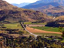
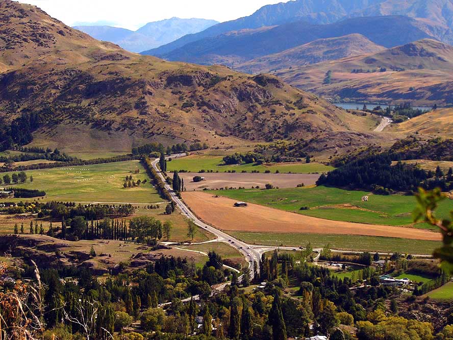
- 70
From 3’000 ft. high altitude of
- the scenic mountain road leading
- from Queenstown to Wanaka through
- the Crown Range, we enjoy this lovely
- view of the valley near Arrow
- Junction below us
|
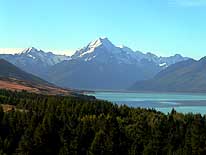
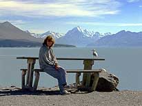
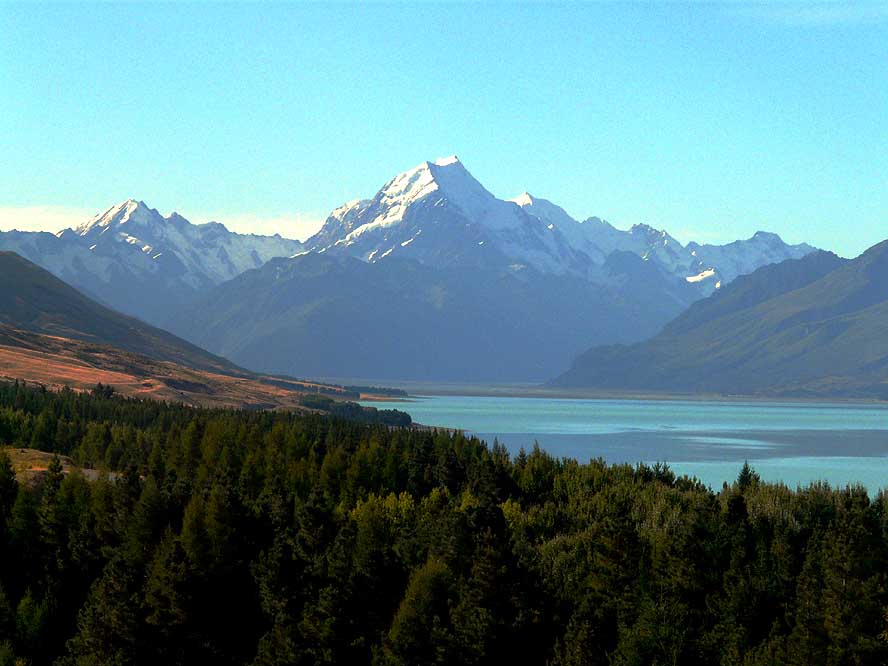
- 71
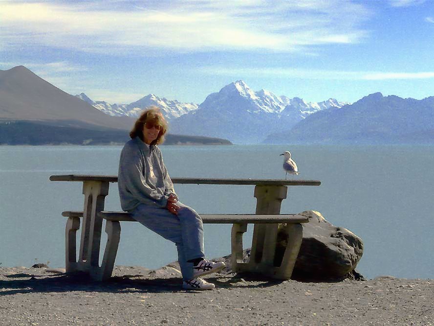
Along the turquoise Lake
- Pukaki reservoir, we are
- approaching Mt. Cook. It’s the
- highest mountain in New Zealand
- with an altitude of 12’316 ft.
|
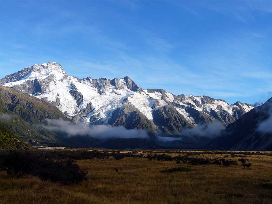
- 72
The road ends at the small
- village of Mt. Cook and we are
- standing in front of an
- impressive glacier wall
|
-
|
-
-
|
-
-
|
-
-
|
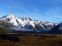
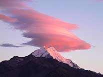
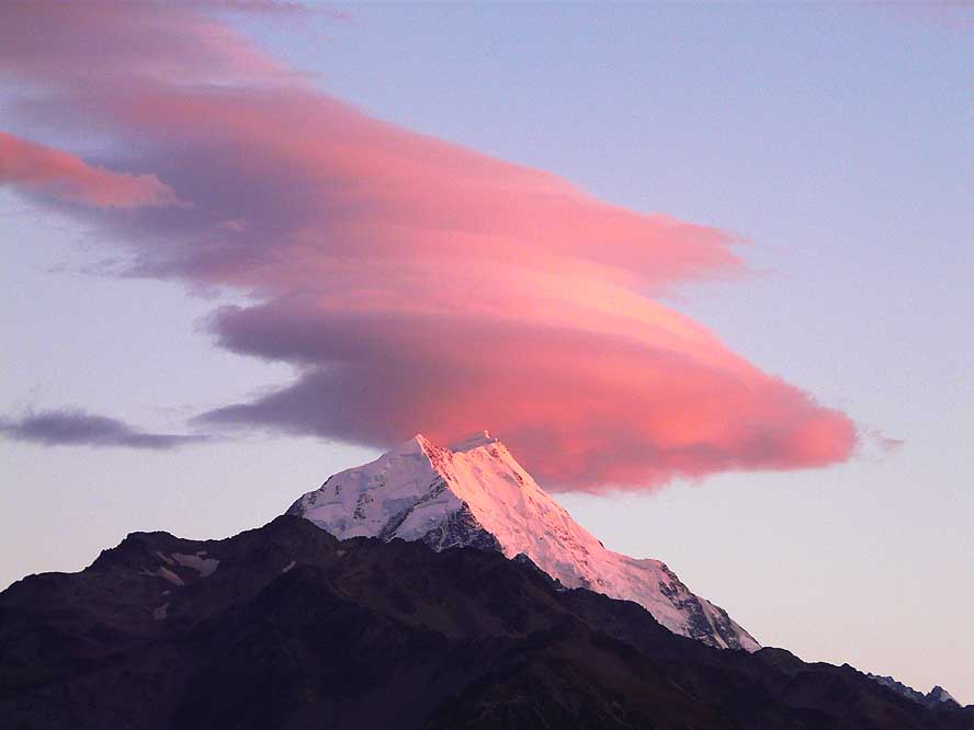
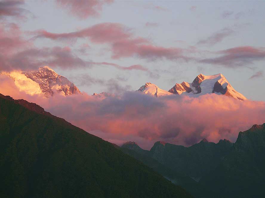
- 73
Mt. Cook reveals its
- full beauty at sunset
|
- 74
A last glimpse of the
- Mt. Cook scenery from
- Lake Pukaki High Dam lookout
|
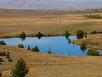
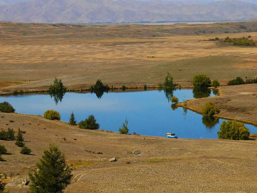
- 75
A small pond in the barren
- landscape on our way
- to Lake Tekapo
|
-
|
-
-
|
-
-

|
-
-
|
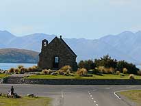
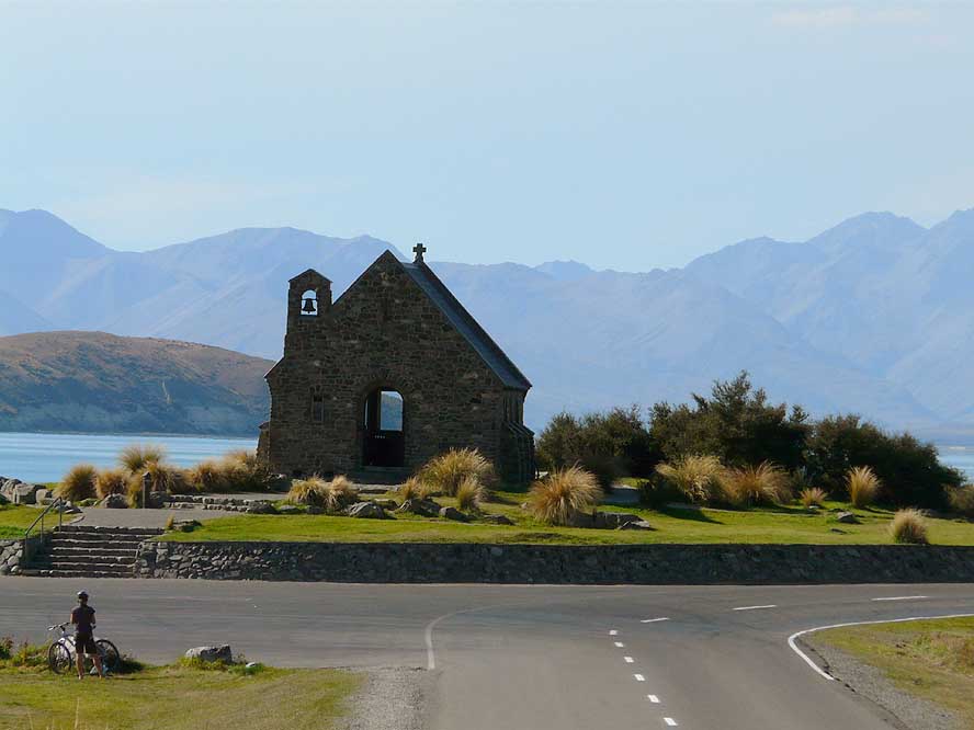
- 76
The „Church of the Good
- Shepherd” was built in 1935 on
- the shore of Lake Tekapo. Today
- it belongs to the region’s
- many tourist attractions
|
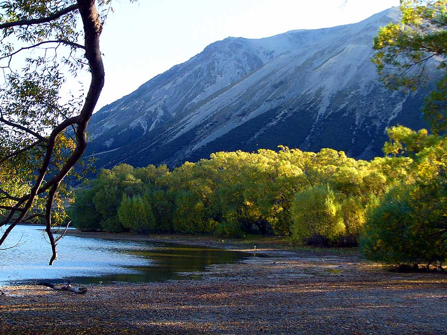
- 77
Crossing Arthur’s Pass, we
- spend a night before at Lake Pearson
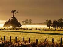
- where the willow trees are just
- changing into their autumn color .....
|
- 78
..... next morning, we
- enjoy an amazing reflection in the lake
|
-
|
-
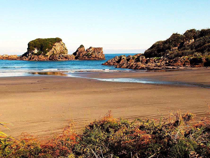
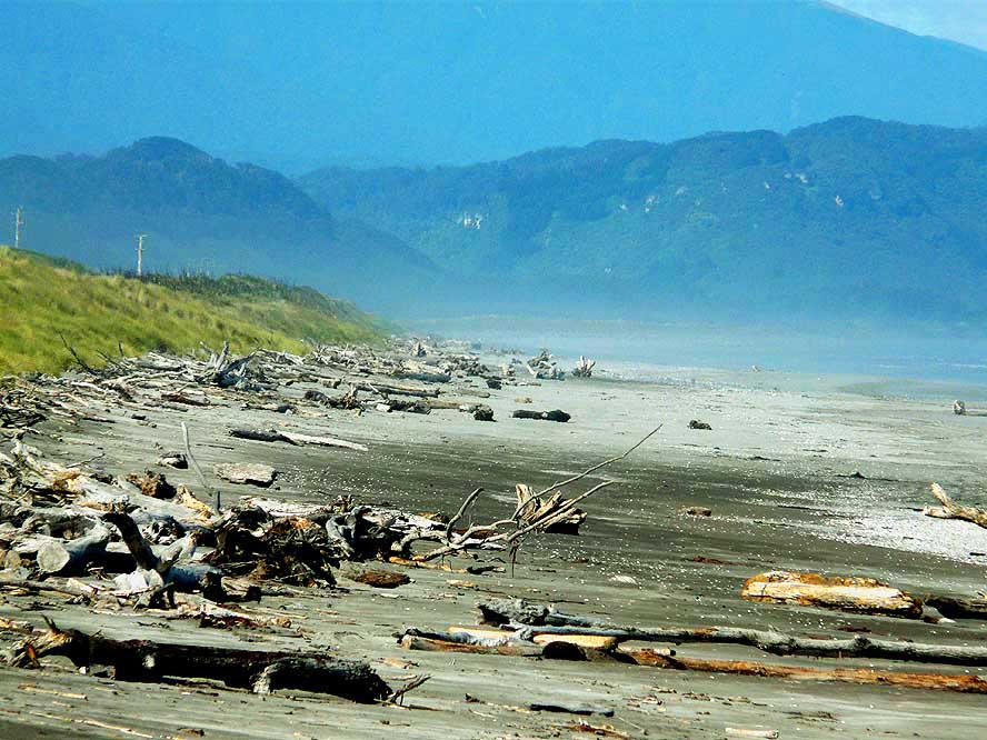
-
|
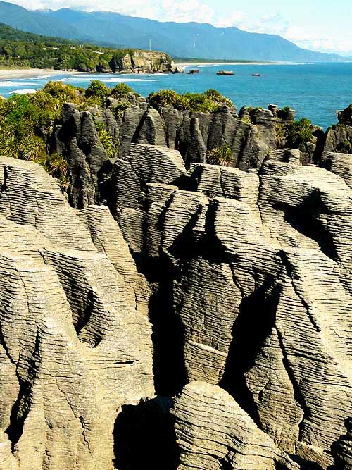
-
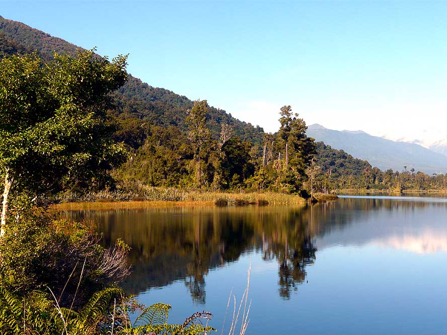
-
|
-
-
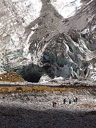
|
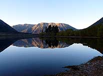
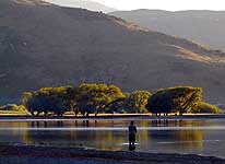
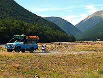
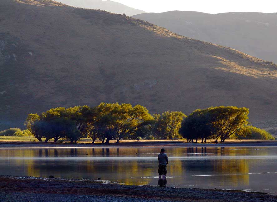
- 79
With the first rays of the sun,
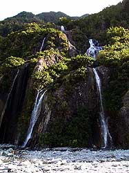
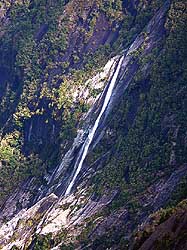
- a lonely fisherman is hoping for
- a good catch at Lake Pearson
|
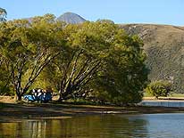
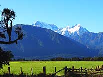
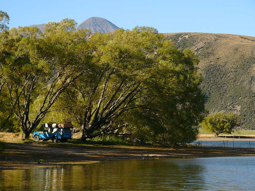
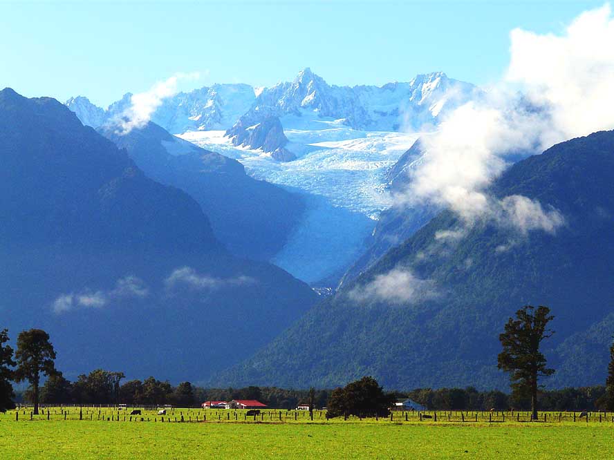
- 80
Our lovely camp at Pearson
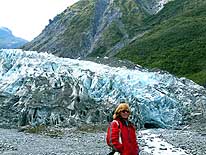
- Lake near Arthur’s Pass
|
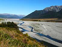
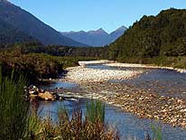
- 81
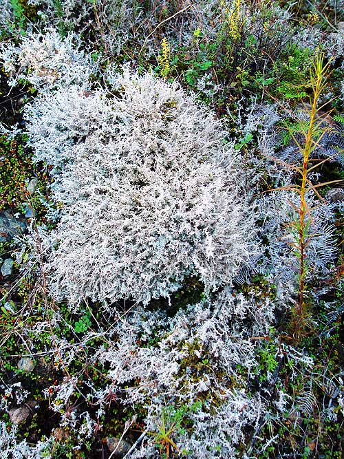
Continuing along Arthur’s Pass,
- we follow for some time the wide,
- stony bed of the Waimakariri River
|
-
|
-
-
|
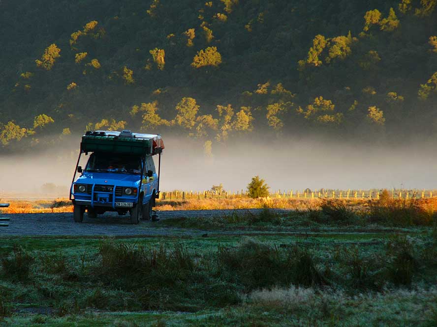
-
-

|
-
-

|
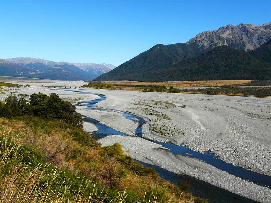
- 82
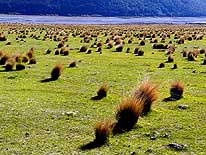
A plain with Tussock grass lies
- between the road and the river on our
- way to the 3’031 ft. high Arthur’s Pass
|
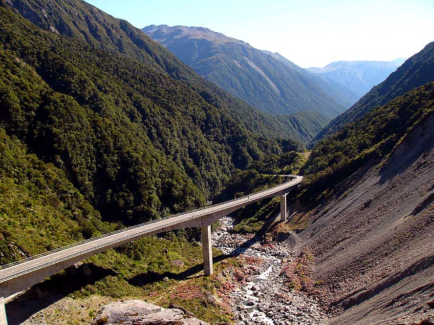
- 83
The viaduct of Arthur’s pass
- has been completed only on 1999
|
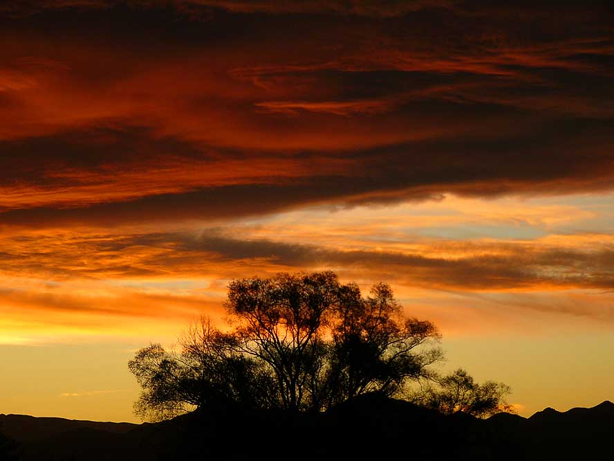
- 84
A beautiful sunset ends
- another lovely traveling day
|
-
|
-
-
|
-
-

|
-
-

|
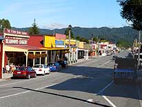
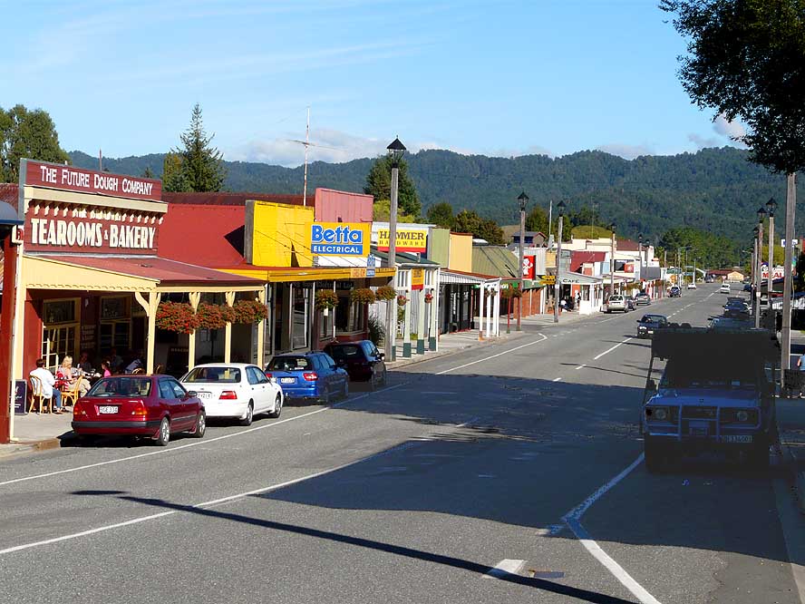
- 85
On Reefton’s main street,
- named “Broadway”, we are attracted
- by some well preserved buildings
- dating back to the 18th century .....
|
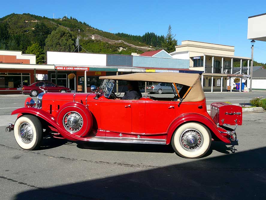
- 86
..... a vintage car, which fits
- perfectly into Reefton’s image .....
|
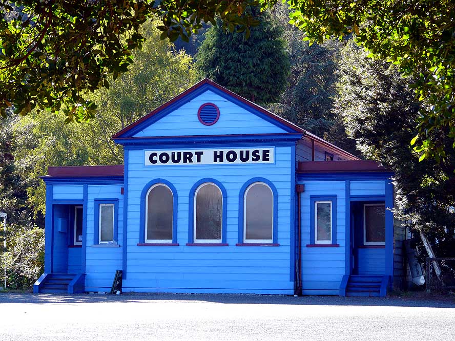
- 87
..... and the earlier old blue
- Court House that gives the
- place a special appeal
|
-
|
-
-
|
-
-

|
-
-
|
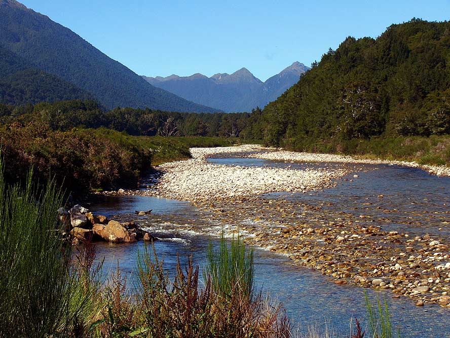
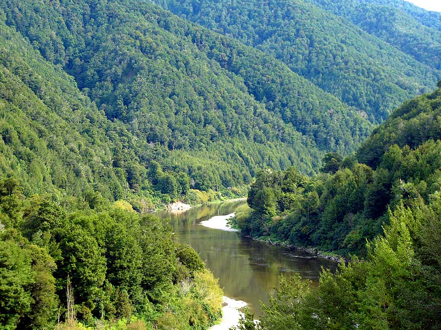
- 88
Lewis River: Through a scenery
- that recalls strongly Canada, we cross
- Lewis Pass in direction East .....
|
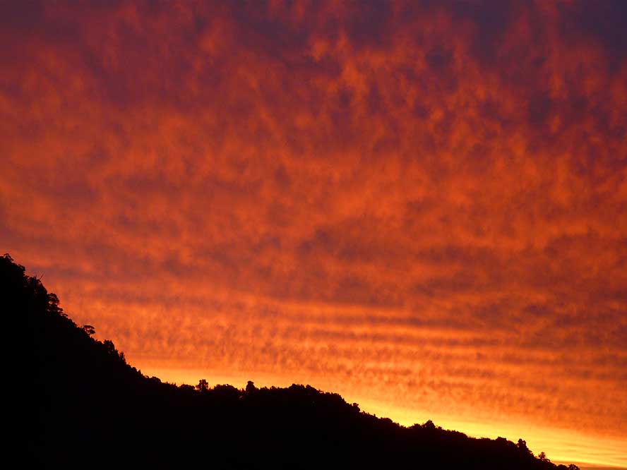
- 89
..... where we enjoy another
- amazing red sunset .....
|
- 90
..... and our breakfast on our
- bush camp in the middle
- of a dry river bed
|
-
|
-
-
|
-
-

|
-
-

|
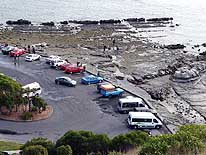
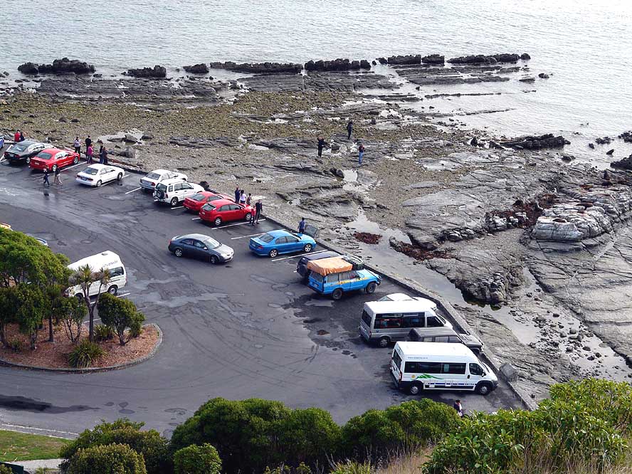
- 91
In Kaikoura, 116 miles North
- of Christchurch, we watch the colony
- of New Zealand Fur Seals basking
- on the rocks in front of the
- parking lot at Point Kean
|
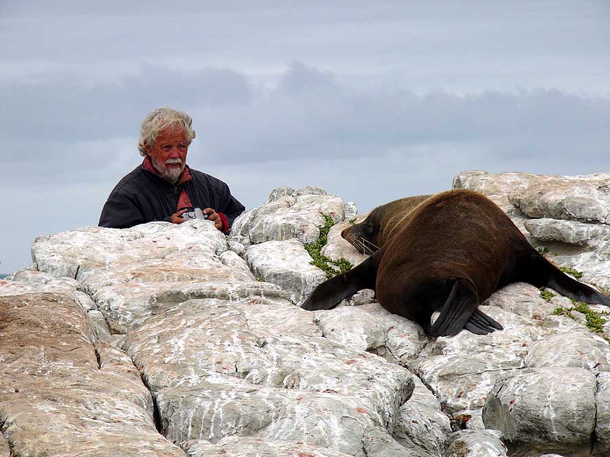
- 92
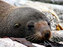
At low tide, it is possible to
- get quite close to the seals. Emil is
- taking a picture of a sleeping animal
|
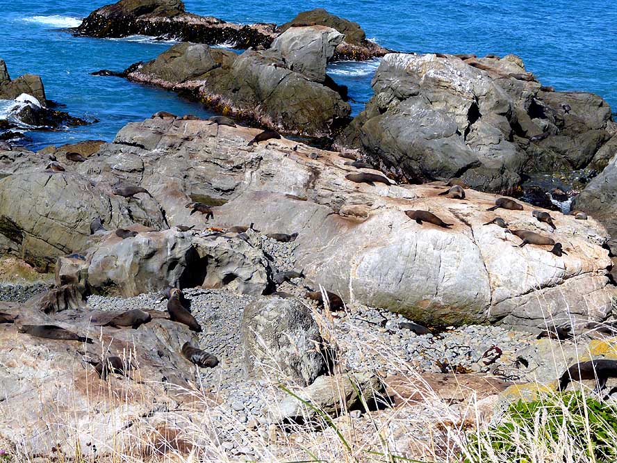
- 93
On the rocks at Point Ohau
- – North of Kaikoura – we count
- around 300 seals, many of them
- young ones. They can be
- watched directly from the road
|
-
|
-
-
-
-
|
-
-

|
-
-
-
-
|
- 94
A fur seal is basking in the sun
- at Point Ohau. A mature male
- reaches 100in. in length and weighs
- up to 440lb.; a female reaches 60in.
- and weights between 66 to 88lb.
|
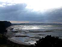
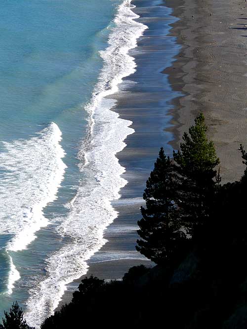
- 95
Waves are breaking at
- the Rarangi Beach near
- Blenheim in Cloudy Bay
|
- 96
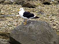
Screaming sea gulls are
- part of New Zealand’s
- wildlife along the coasts
|
-
|
-
-
|
-
-
|
-
-
|
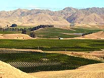
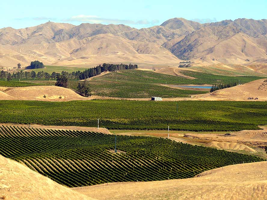
- 97
In contrast to the barren brown
- land, the view of lush green
- vineyards near Blenheim
- in the North is an amazing sight
|
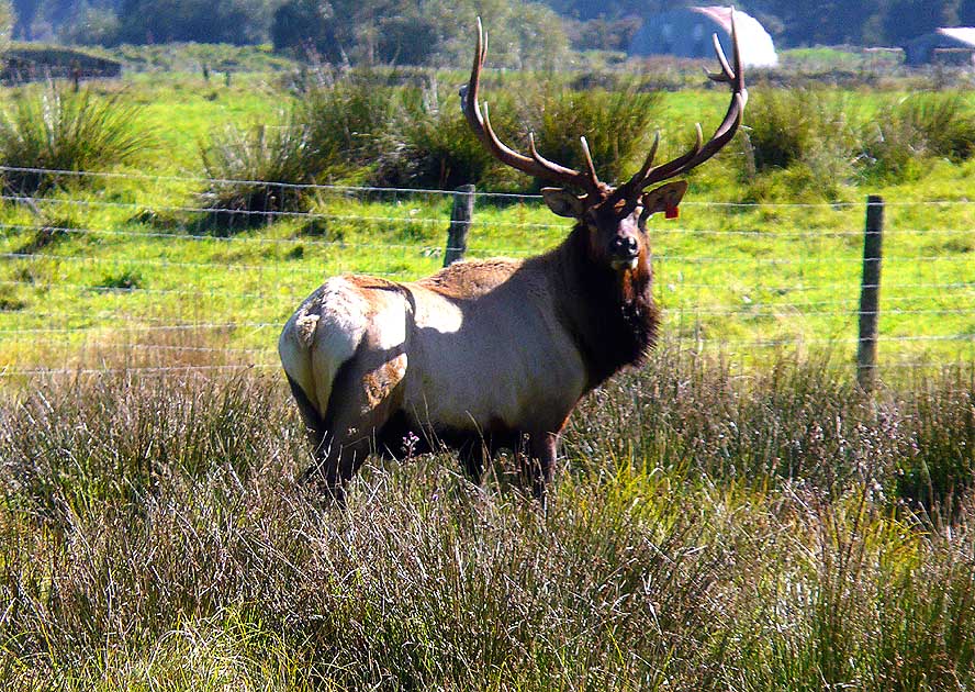
- 98
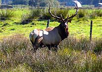
A deer on a farm land
- displays its beautiful antler .....
|
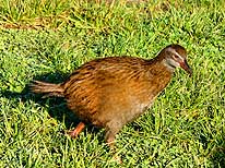
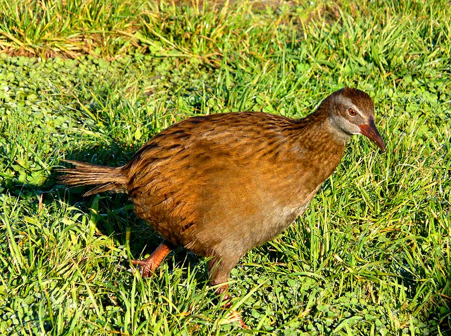
- 99
..... and a flightless Weka
- bird along the West Coast
- – known to be thievish –
- is picking in the grass
|
-
|
-
-
|
-
-

|
-
-
|
- 100
Cleared and with fir trees
- reforested patches of forest is a
- common, even if not very attractive
- sight within New Zealand’s landscapes
|
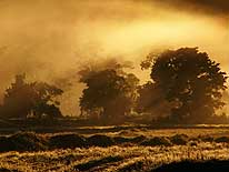
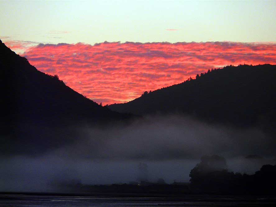
- 101
While the rising sun is
- enflaming the skies, mist is
- creeping from the Marlborough
- Sounds near Havelock
|
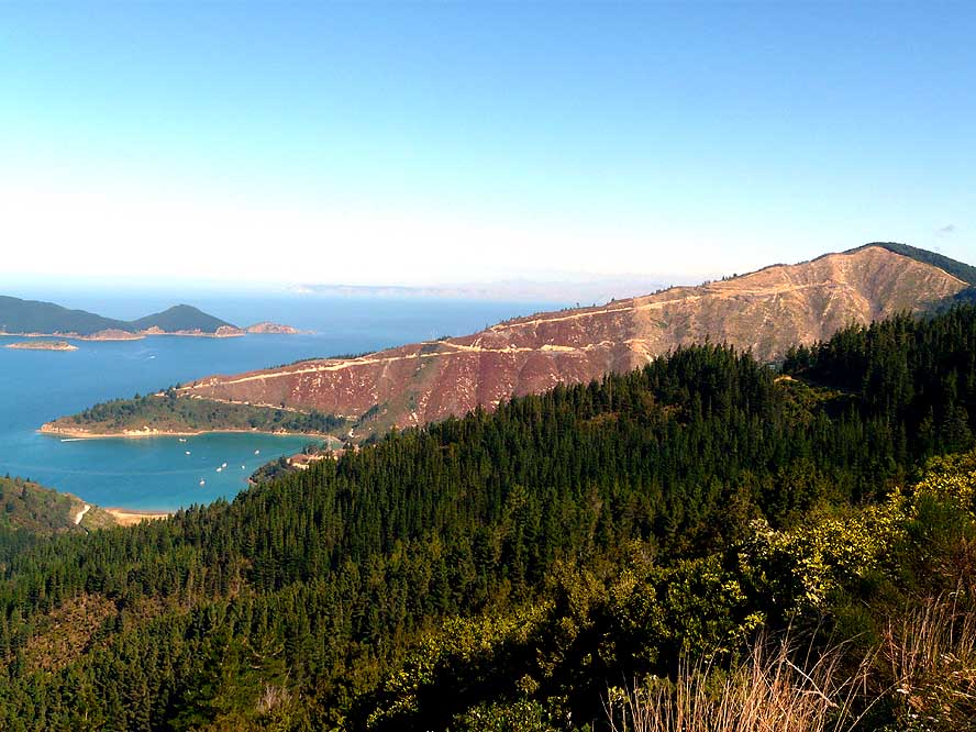
- 102
One of the many fjords
- (Mahakipawa Arm) in
- the Marlborough Sounds
|
-
|
-
-
|
-
-
|
-
-

|
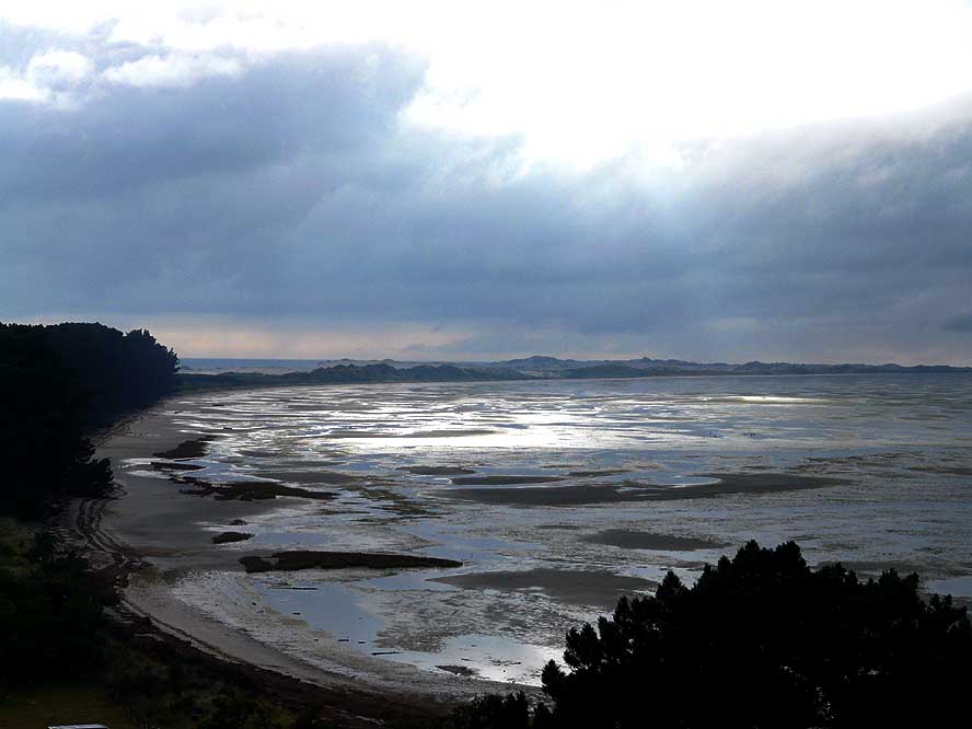
- 103
Farewell Spit, a renowned bird
- sanctuary at the most Northerly tip of
- the South Island, is 22 miles long and
- may only been visited with
- one tour company
|
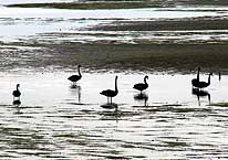
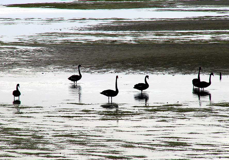
- 104
Black swans are wading
- through the shallow waters of
- Farewell Spit. Hundreds of
- these long neck birds congregate
- in this bird sanctuary
|
- 105
Peaceful scenery
- from the lookout at Cape Farewell
|
-
|
-
-
|
-
-
|
-
-
|
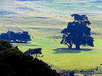
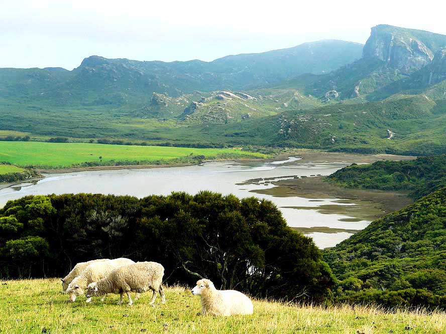
- 106
Rural scene at Cape Farewell:
- A significant tree and grazing sheep
|
- 107
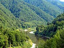
The drive through the Buller
- River Gorge to Westport on the
- West coast leads us for many
- miles through dense forest
|
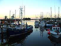
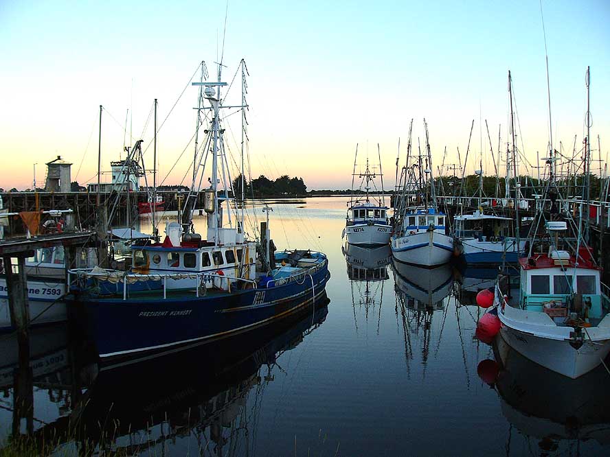
- 108
Morning atmosphere at the
- harbor of Westport on the West coast
|
-
|
-
-

|
-
-

|
-
-
|
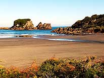
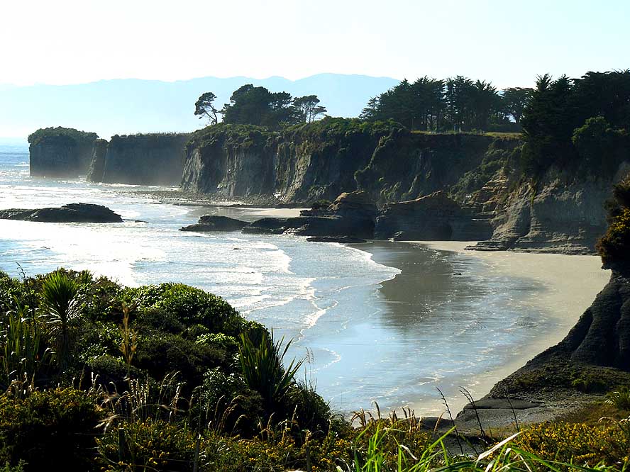
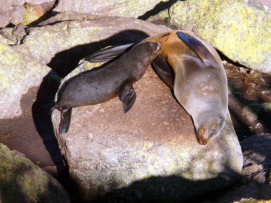
- 109
At Cape Foulwind, 10 miles
- West of Westport, a coastal stretch is
- dotted with steep cliffs and tiny sandy bays
|
- 110
At the “Tauranga Bay Seal Colony”
- near Westport, we watch a nursing fur
- seal baby from an elevated walkway.
- We count here approximately 30 animals
|
- 111
The coastal drive between
- Westport and Greymouth is very
- scenic along the cliffs
- of the Tasman Sea
|
-
|
-
-
-
-
|
-
-
|
-
-
-
-
|
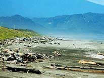
- 112
The West is known for its
- wild and surf pounded coastline
- along the Tasman Sea
|
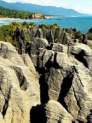
- 113
The „Pancake Rocks“
- of Punakaiki – halfway between
- Westport and Greymouth – are
- the main attraction of this
- coastline. Their look of “piled
- pancakes”gave them its name
|
- 114
Along the West coast, we
- drive past many lakes where the
- vegetation is being reflected
- in the calm water
|
-
|
-
-
-
-

|
-
-
|
-
-
-
-
|
- 115
|
- 116
|
- 117
|
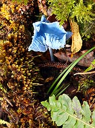
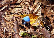
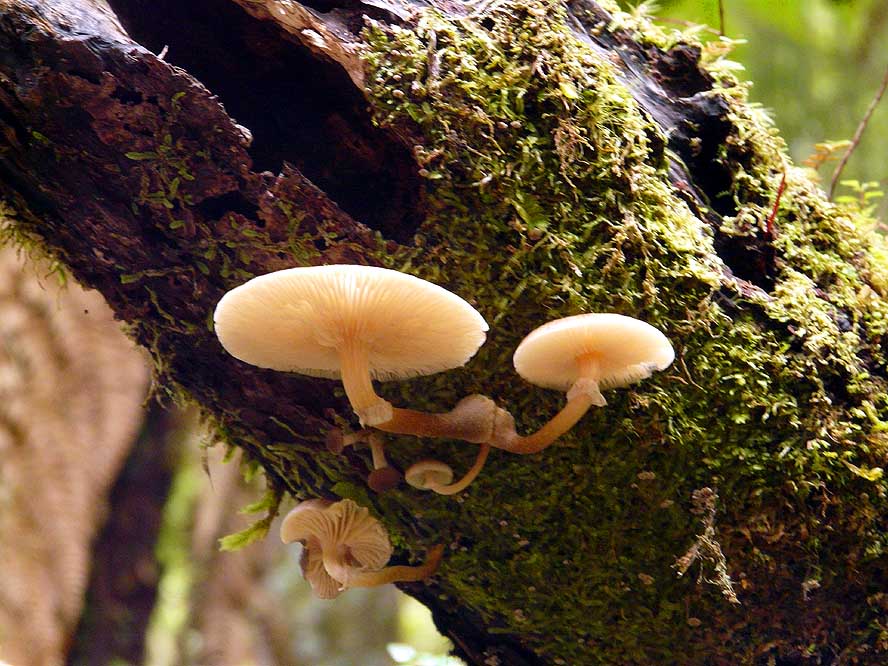
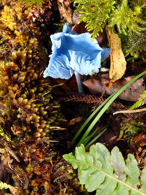
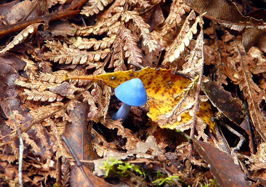
- The wet vegetation of the West produces a large variety of mushrooms. We were fascinated
especially by the blue ones
|
-
|
-
-
-
-
|
-
-
|
-
-
-
-
|
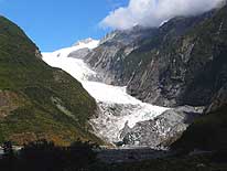
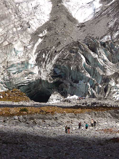
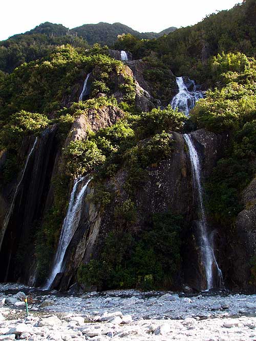
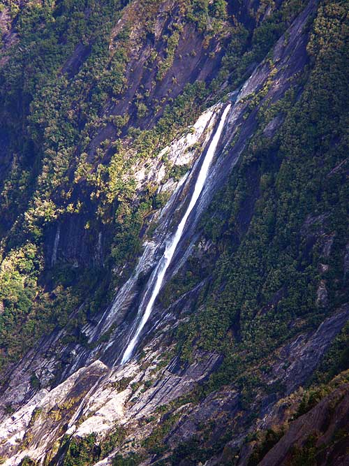
- 118
Franz Josef Glacier is known
- in the Maori language also as „Tears
- of the Avalanche Girl“. Legend tells
- that the flood of tears of a girl whose
- lover fell to death from a peak
- froze into the glacier .....
|
- 119
..... a guided tour group
- is approaching the big whole
- in the glacier – not guided “ice
- excursions” are prohibited .....
|
- 120
..... Liliana poses in front of
- Franz Josef Glacier, which got
- his name from the Austrian
- explorer Julius Haast in
- honor of his emperor
|
-
|
-
-
|
-
-
-
-

|
-
-
|
- 121
|
- 122
|
- 123
|
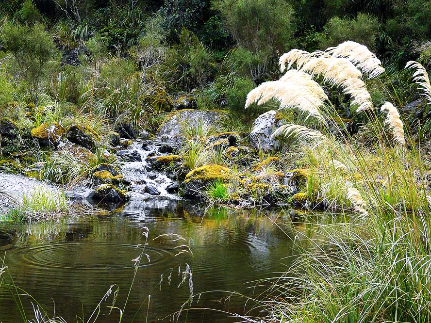
- Impressive waterfalls and lovely scenery surround Franz Josef glacier in the
“Southern Alps”
|
-
|
-
-
|
-
-

|
-
-
|
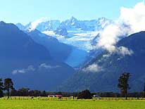
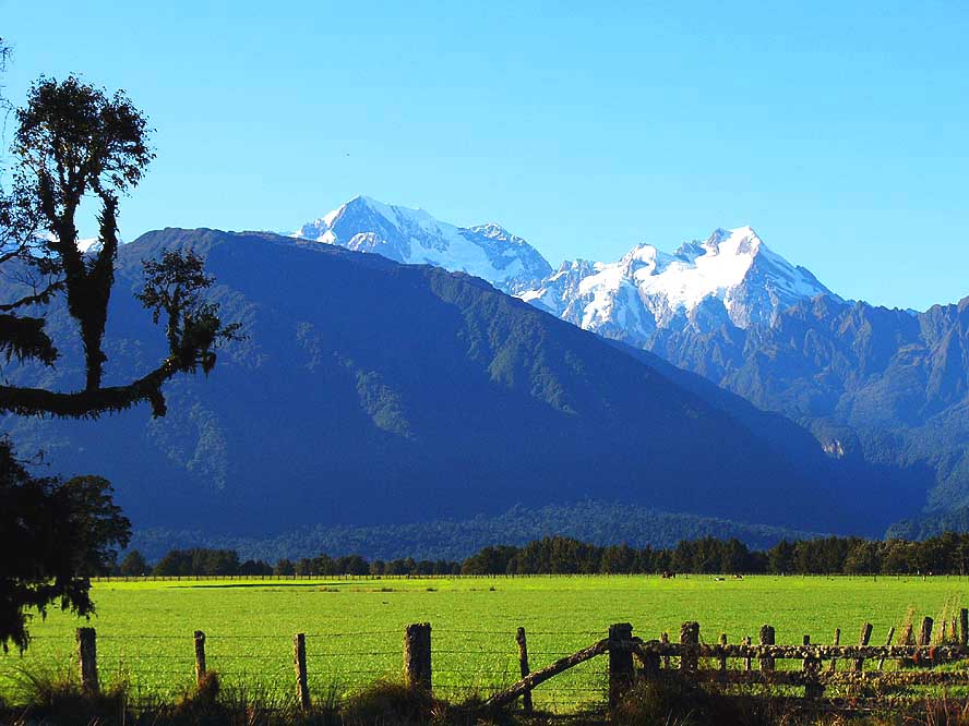
- 124
At the Mt. Cook lookout near
- the Fox Glacier Village, the snow
- covered peaks of Mt. Cook und
- Mt. Tasman greet from a blue sky .....
|
- 125
..... at sunset, they show
- another fascinating picture
|
- 126
Fox glacier at sunrise with
- peaceful pasture land to its feet,
- photographed from Mt. Cook lookout
|
-
|
-
-

|
-
-
|
-
-
|
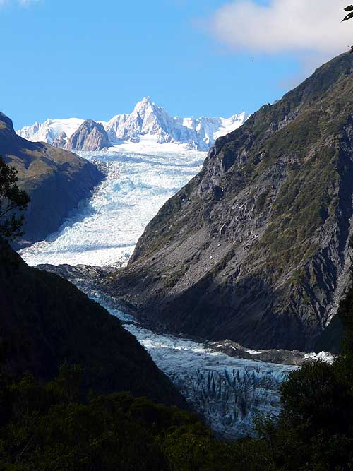
- 127
A close-up view
- of Fox Glacier
|
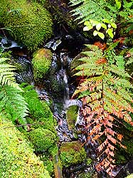
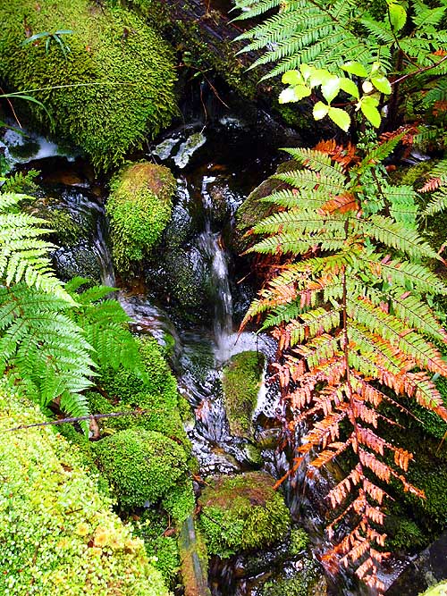
- 128
Moss and fern are
- growing in abundance in the
- wet forests of the West coast .....
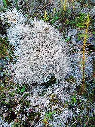
|
- 129
..... as well as
- any kind of lichens
|
-
|
-
-
|
-
-

|
-
-
|
- 130
|
- 131
|
- 132
|
- Sunrise at Mt. Cook lookout near Fox Glacier transforms the landscape into a beautiful
but unreal sight
|
-
|
-
-
|
-
-
|
-
-

|
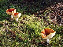
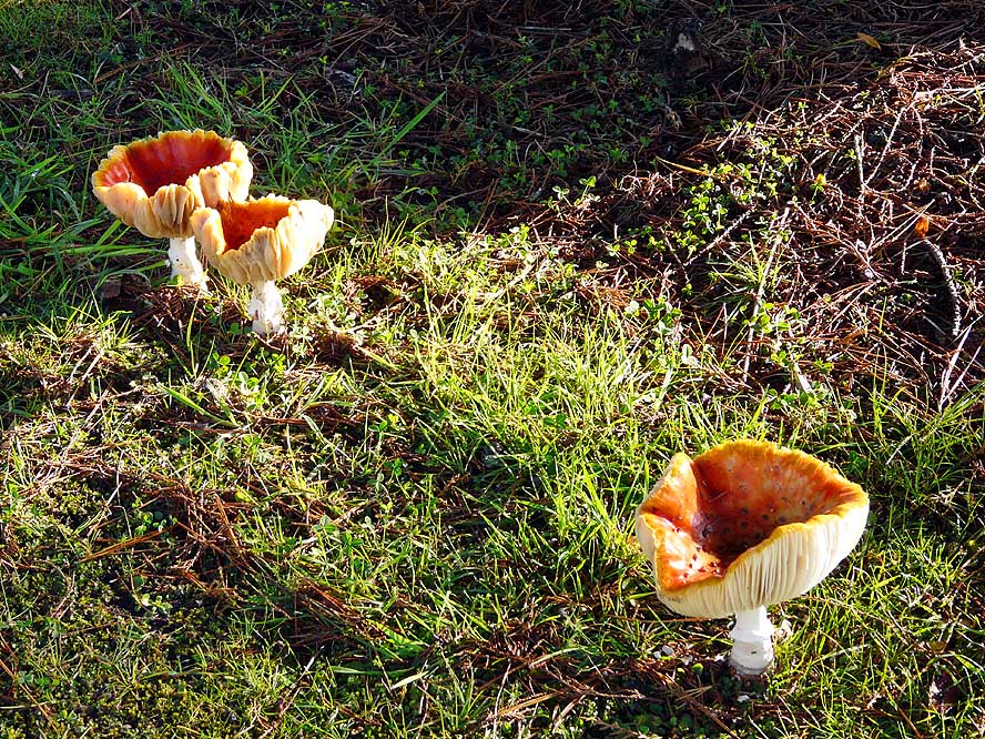
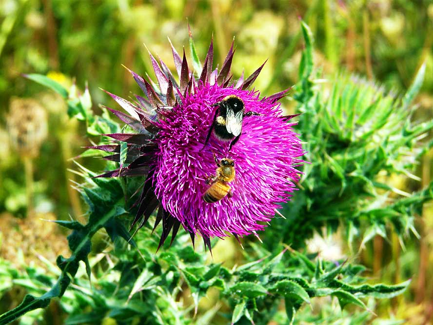
- Encounters with nature:
|
- 133
Toadstool mushrooms .....
|
- 134
..... reflections in a pond .....
|
- 135
..... flowers and insects
|
-
|
-
-
-
-

|
-
-

|
-
-
-
-

|
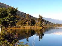
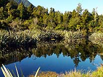
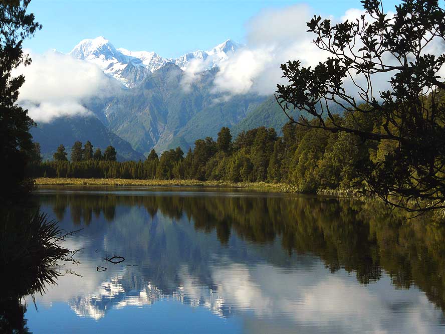
- 136
Mt. Tasman and Mt. Cook
- are reflecting in the waters of
- Matheson Lake near Fox Glacier
- at „Reflection Point“
|
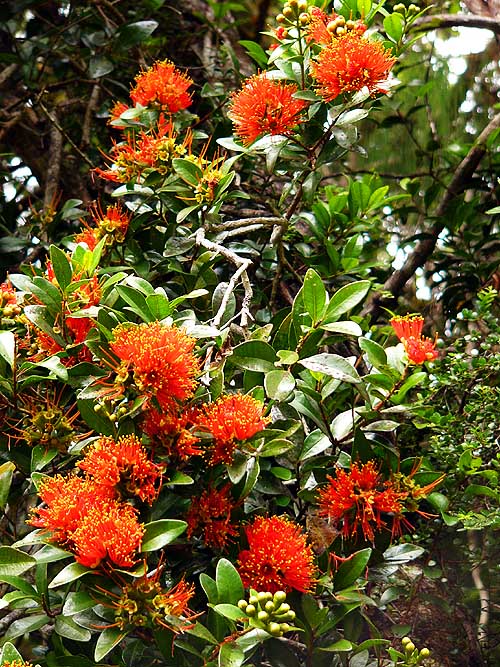
- 137
The bright red flowers
- belong to the “Pohutukawa”
- or “Christmas tree”
|
- 138
Early morning mist at
- our bush camp at Fox Glacier
|
-
|
- More websites from New Zealand:
-
-
|
- Articles in newspapers about us in New Zealand:
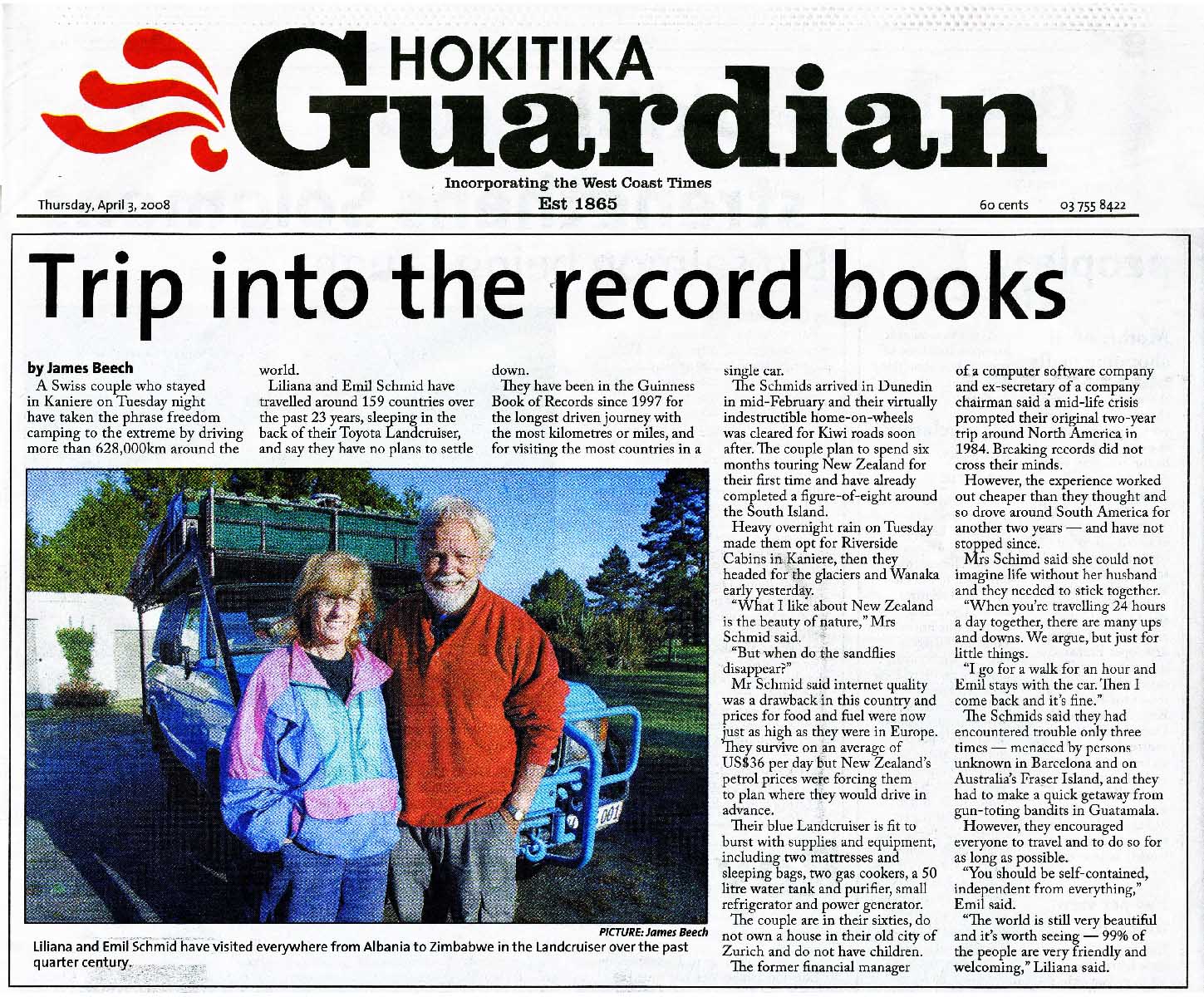
- Article: "Still
cruising after 628,000km", Otago Daily Times - February 27, 2008
- Article: "Trip into
the record books", Hokitika Guardian - April 3, 2008
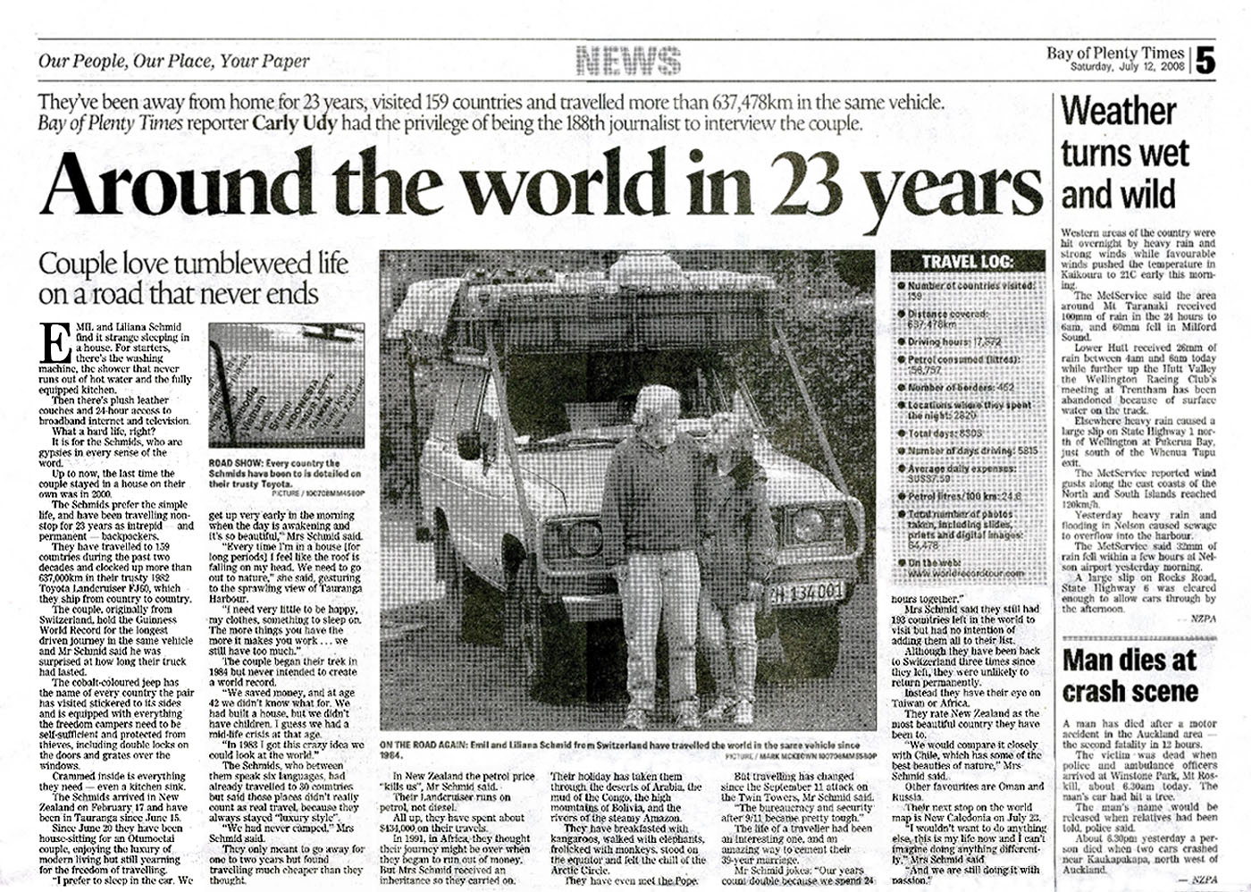
- Article: "Around the world in 23 years", Bay of Plenty Times - July 12,
2008
|


