-
-
-
|
-
-
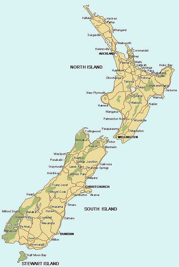
- New Zealand Map
-
|
-
-
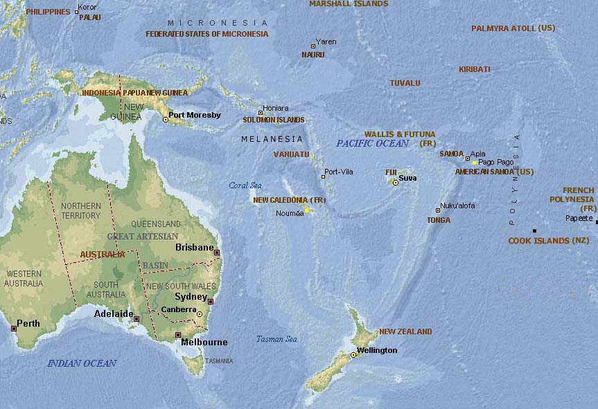
- Map of
- the Pacific
-
-
|
-
-
-
-
-
|
- latest picture: March 14, 2008
- click a picture to see details
|
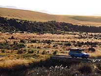
-
-
|
-
-
|
-
-
|
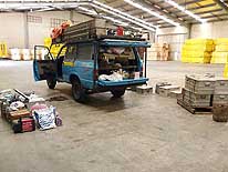
- 01
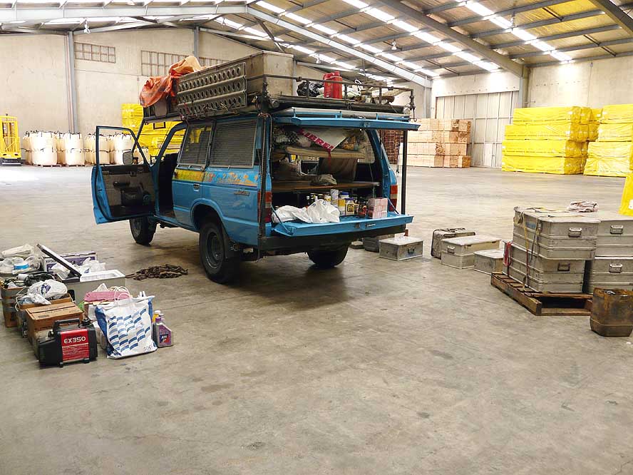
On February 19, 2008, we are
- unloading the whole content of our
- LandCruiser in a shed inside of the
- harbor of Port Chalmers near Dunedin
- to be inspected by the “MAF”
- (Ministry of Agriculture and Forestry)
|
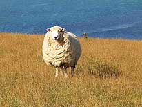
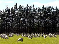
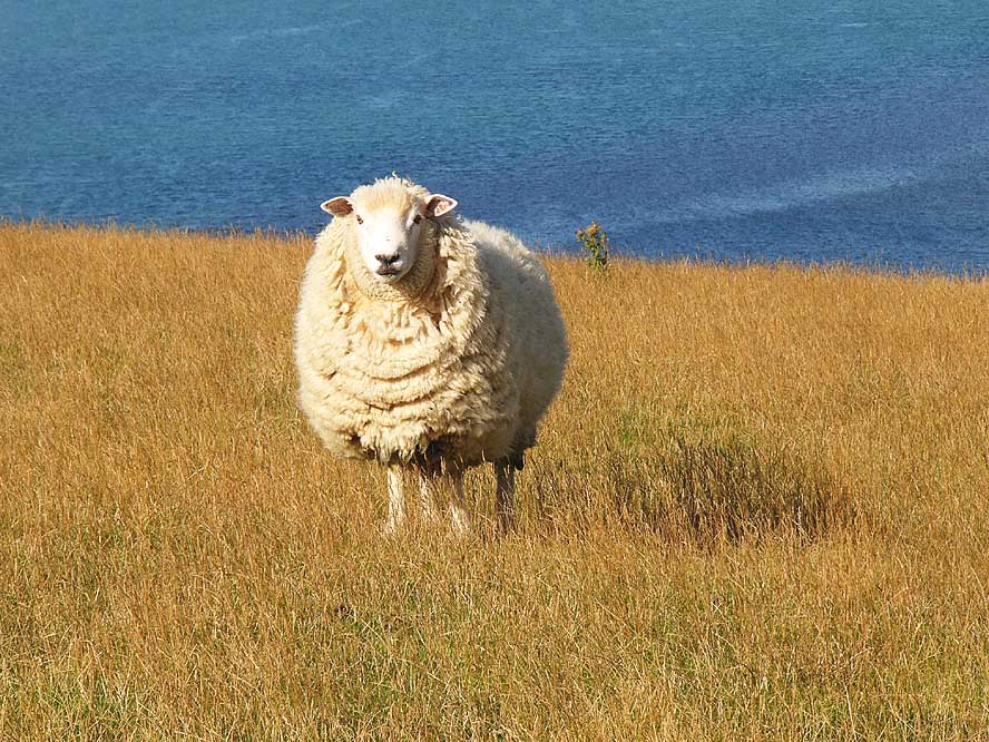
- 02
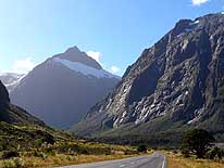
Sheep is grazing peacefully
- everywhere. This definitively gives
- us the sensation of being in
- New Zealand
|
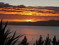
- 03
The sun is rising over Otago
- Harbour. We are able to enjoy this
- beautiful view from our room at
- “Billy Brown’s Backpackers Hostel”
- in Port Chalmers
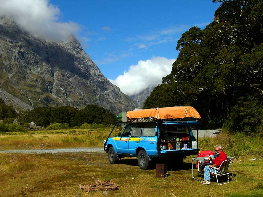
|
-
|
-
-
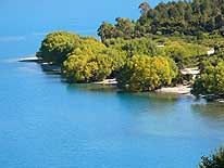
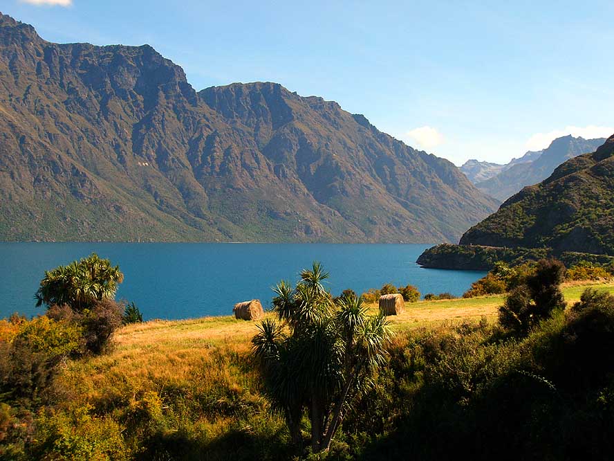
|
-
-

|
-
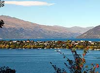
-
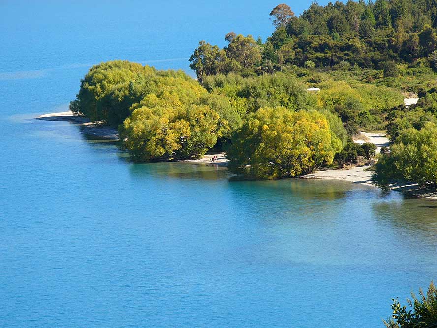
|
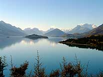
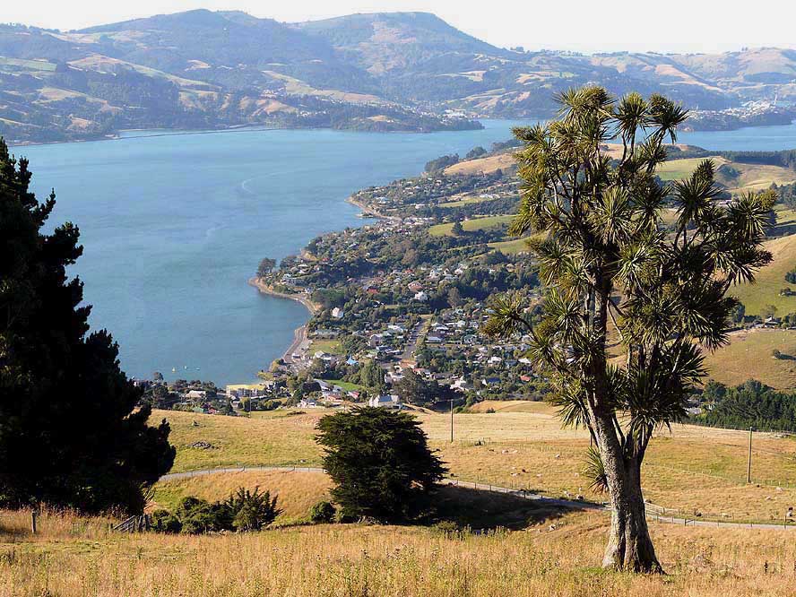
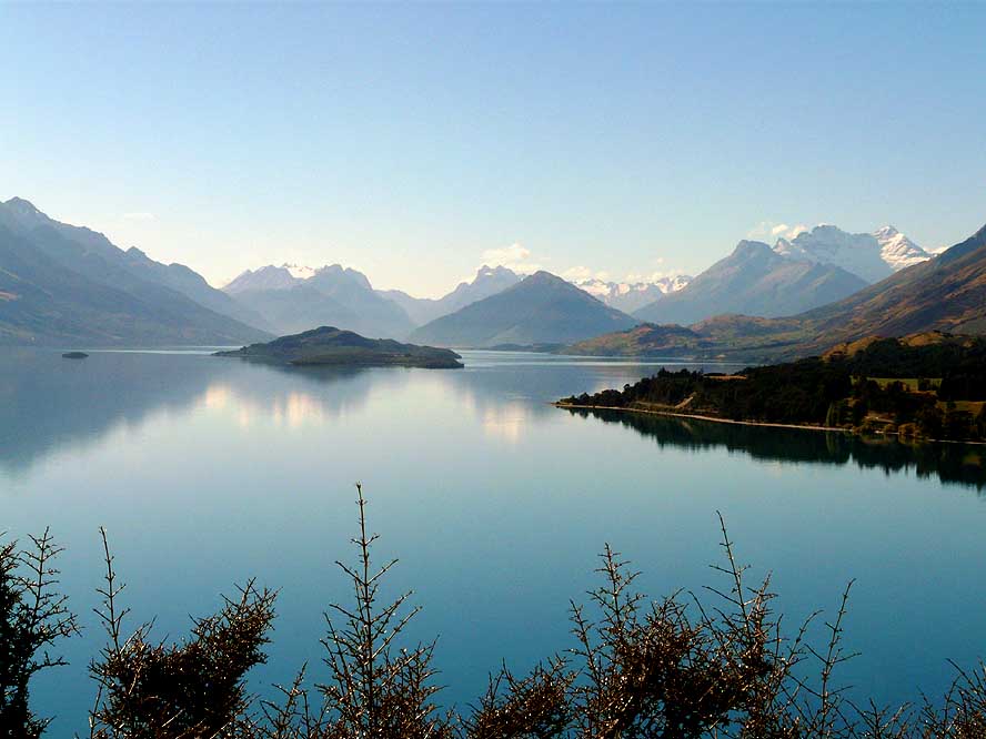
- 04
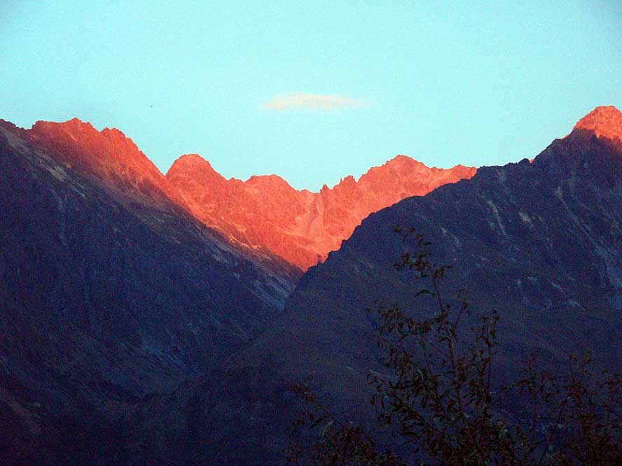
We are driving up the steep hill to
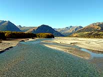
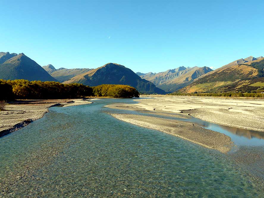
- “Billy Brown’s Backpackers Hostel”,
- from where we enjoy a beautiful
- panorama and the quietness we so
- long missed in Southeast Asia
|
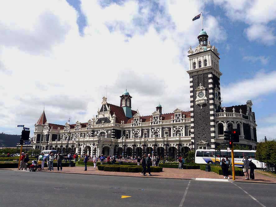
- 05
The Dunedin Railway Station
- is a master piece of this Southerly
- town and unique in its elaborate
- architecture
|
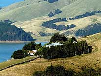
- 06
Farms protect themselves with
- all kind of fences against the forces
- of nature. We took this picture
- from the Highcliff Road on the
- Otago Peninsula
|
-
|
-
-
|
-
-
|
-
-
|
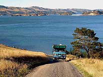
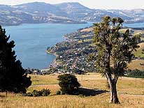
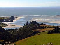
- 07
We are looking from the Highcliff
- Road on the Otago Peninsula to
- “Otago Harbour” and its settlements
|
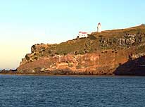
- 08
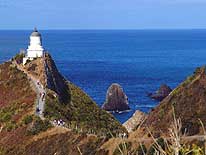
The Taiaroa Lighthouse is
- greeting from the Northern cliff
- of the Otago Peninsula
|
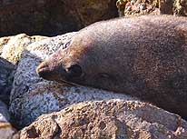
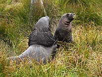
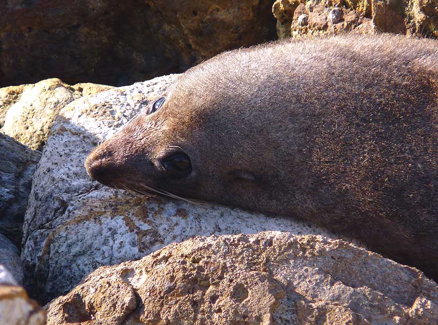
- 09
This fur seal at the mole of Aramoana,
- 12 miles North of Dunedin, just spotted
- us. We saw eight in one evening
|
-
|
-
-
|
-
-
|
-
-

|
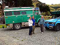
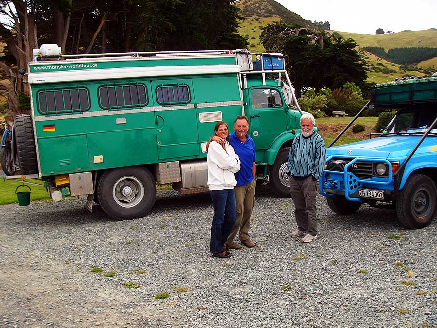
- 10
Meeting with same minded
- world travelers: In Dunedin, we
- spend a lovely afternoon together
- with Doro, Jupp and their “Monster”
|
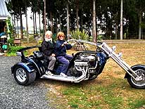
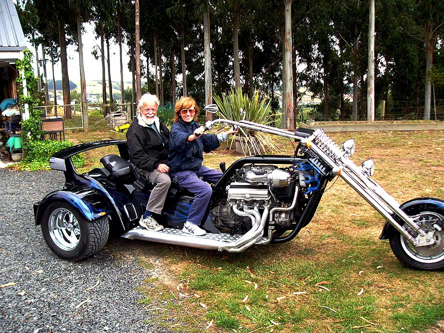
- 11
No, we did not change our vehicle!
- But we had a lot of fun with Paul, Michelle
- and Tate’s Trike, driven by a Lexus
- engine (4000cc/300 hp) on their farm
- in Abbotsford, where they kindly
- welcomed us into their family
|
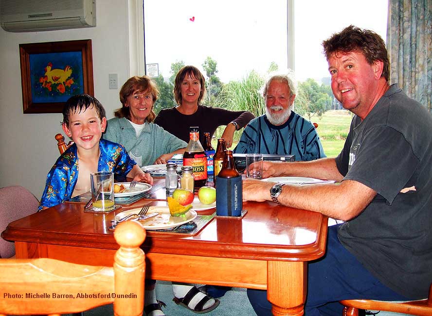
- 12
We enjoy the great hospitality
- of Michelle, Paul and their son Tate on
- their farm in Abbotsford near Dunedin
|
|
-
-
-
-
|
-
-
|
-
-
-
-
|
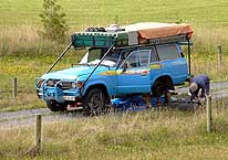
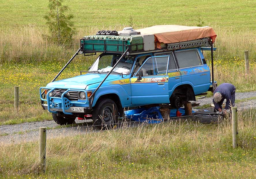
- 13
Once more we have to change
- an axle shaft. Luckily the damage
- happened on the private driveway to
- Paul and Michelle’s farm in Abbotsford
|
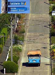
- 14
After the successful repair,
- our LandCruiser climbs up
- Baldwin Street in Dunedin,
- “The World’s Steepest Street” (?!)
|
- 15
A touch of “home country”
- (Switzerland) feeling on the farm
|
|
| 
|
|
|
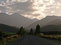
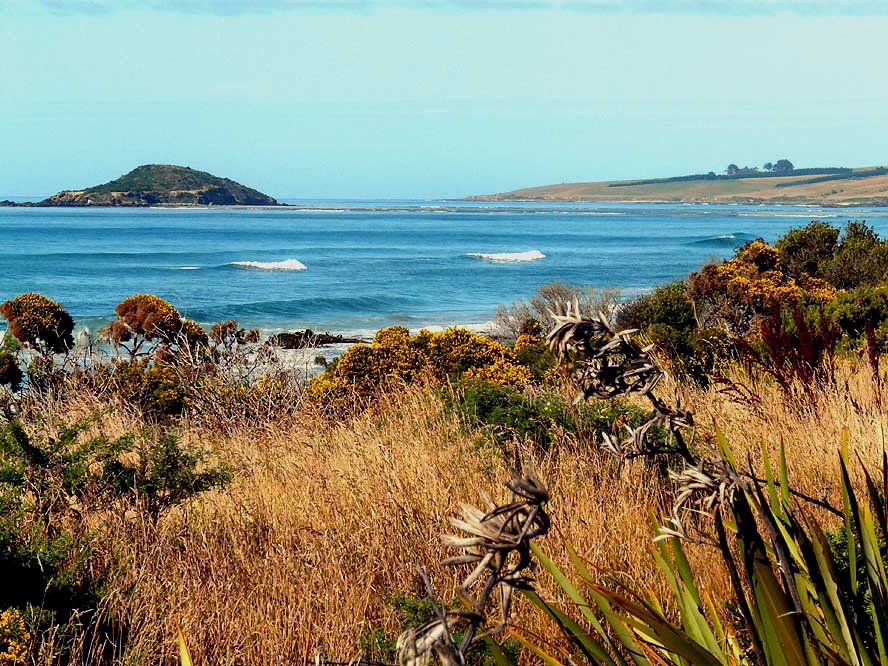
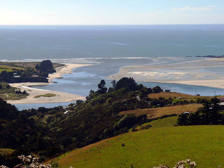
- 16
The “Southern Scenic Road”
- South of Dunedin surprises us constantly
- with new and more beautiful scenery
|
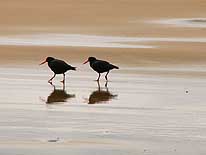
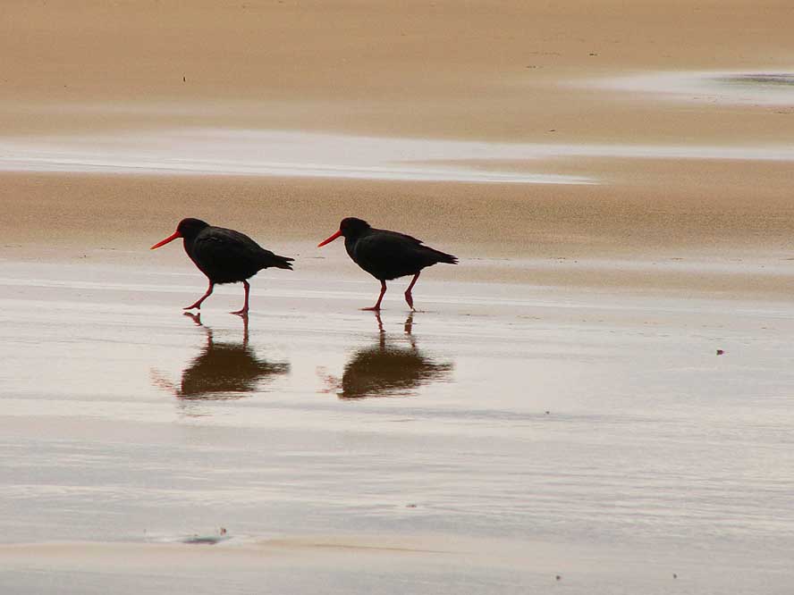
- 17
Oyster Catchers along the
- sea shore are always a lovely sight
|
- 18
Now and then we are passing
- a farm; otherwise we experience
- nature and loneliness in its truest
|
|
| 
|
|
|
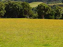
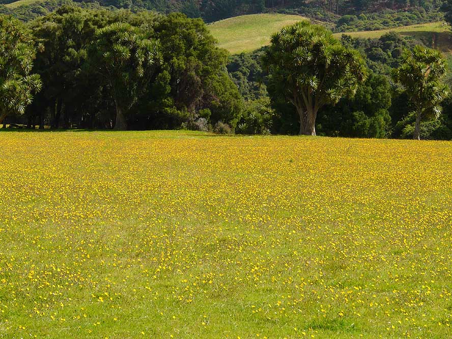
- 19
A meadow of blooming flowers
- that recalls memories of Switzerland
|
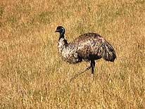
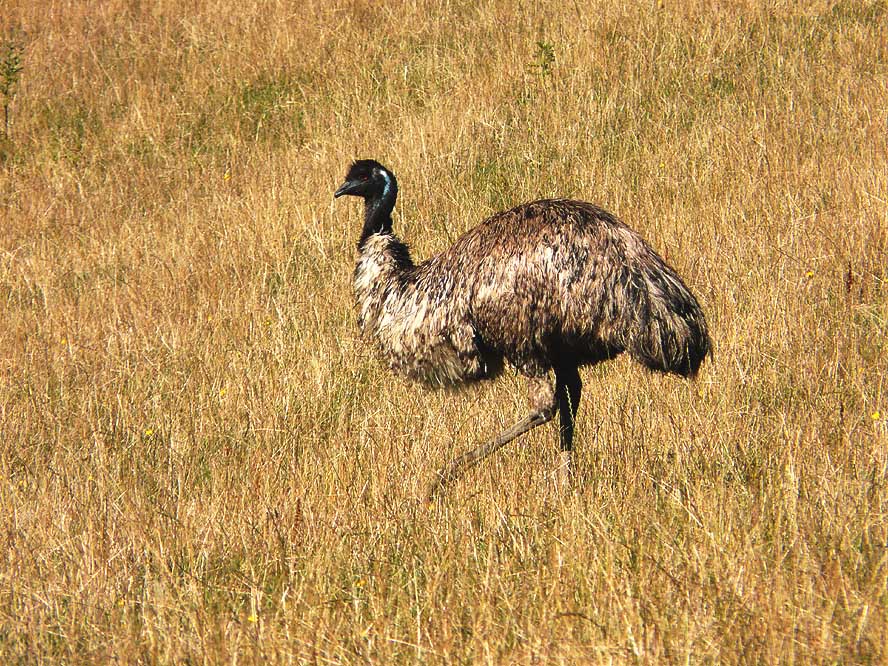
- 20
An Emu is walking peacefully
- through dry grassland
|
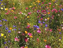
- 21
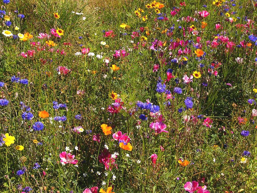
A wonderful and rare sight: An
- incredible variety of wild growing and
- blooming flowers along the road
|
|
| 
|
|
|
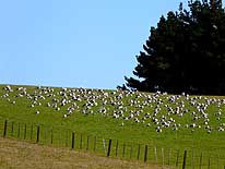
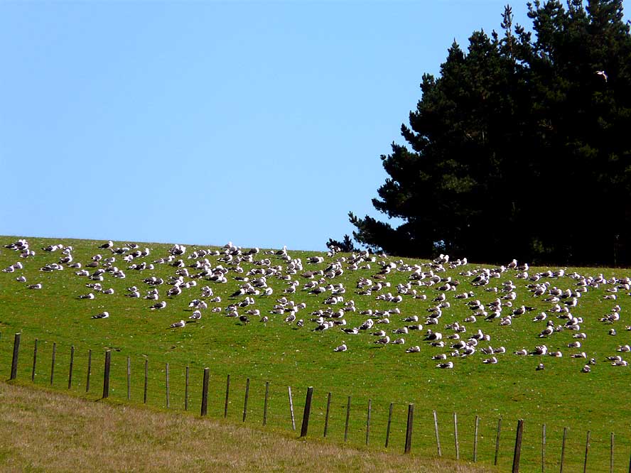
- 22
Screaming seagulls
- gather on a meadow
|
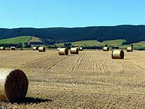
- 23
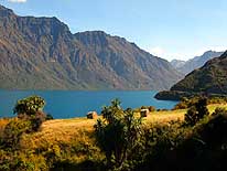
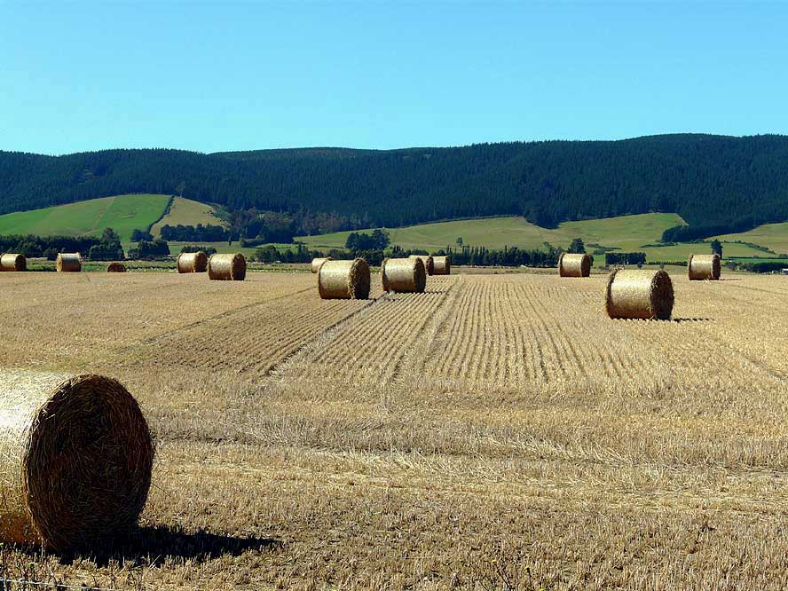
Rural New Zealand: Bales
- of hay ready to be stored in
- the barn for the winter
|
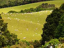
- 24
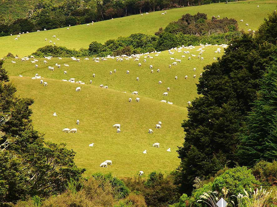
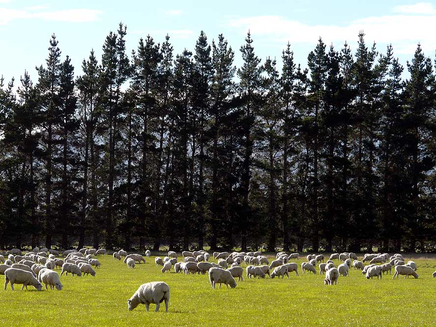
Sheep are grazing peacefully
- on a meadow. Apparently, New
- Zealand counts more than 40 millions
|
|
| 
|
|

|
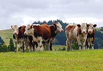
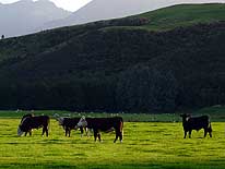
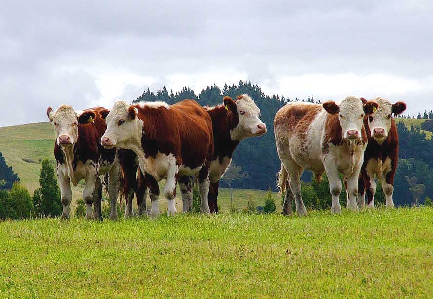
- 25
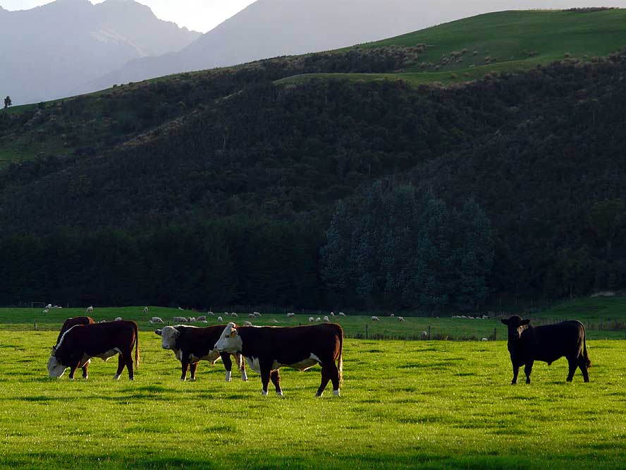
A group of cows is caught
- with the first rays of the sun
|
- 26
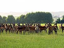
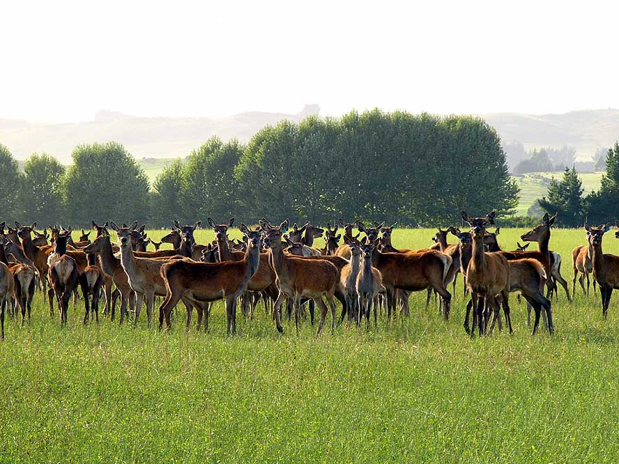
Apart from sheep and beef,
- deer meat is another source of
- income. Apparently, it is sold mainly
- to Germany and Switzerland
|
- 27
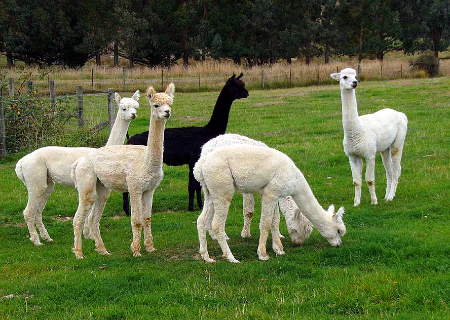
Even a group of young Alpacas
- are looking curiously towards us
|
|
| 
|
|
|
- 28
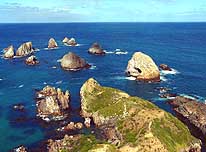
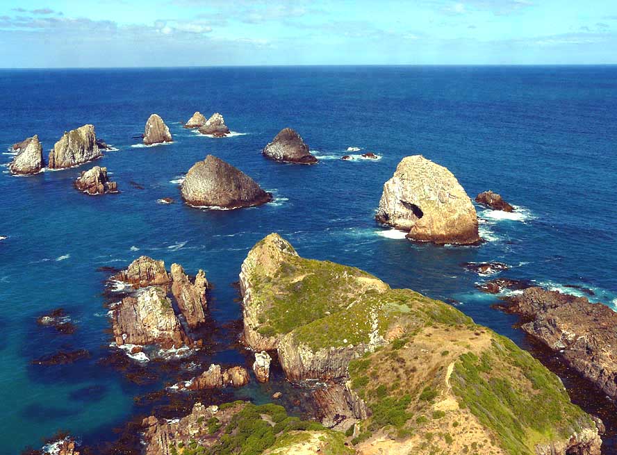
The afternoon sun is lightening
- “Nugget Point” (about 5 miles
- South of Kaka Point), which is
- battered by roaring waves
|
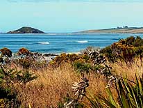
- 29
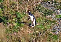
On Roaring Bay near “Nugget
- Point”, a single ‘yellow eyed’
- penguin emerged from the sea
- and hops towards its nest
|
- 30
Hit by the exact sunlight,
- these rocky outcrops shine like
- „gold nuggets“. They gave
- “Nugget Point” its name
|
|
| 
|
|
|
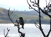
- 31
A cute little bird is sitting
- contently on a tree branch
|
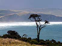
- 32
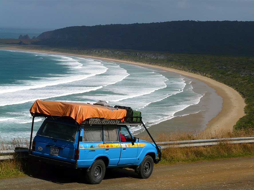
The descend to the untamed,
- lonely and wind swept Tautuku Bay
- on the Chaslands Highway ("Southern
- Scenic Route"), about 28 miles
- Southwest of Owaka. The weather
- forecast looks for a stormy cold front
|
- 33
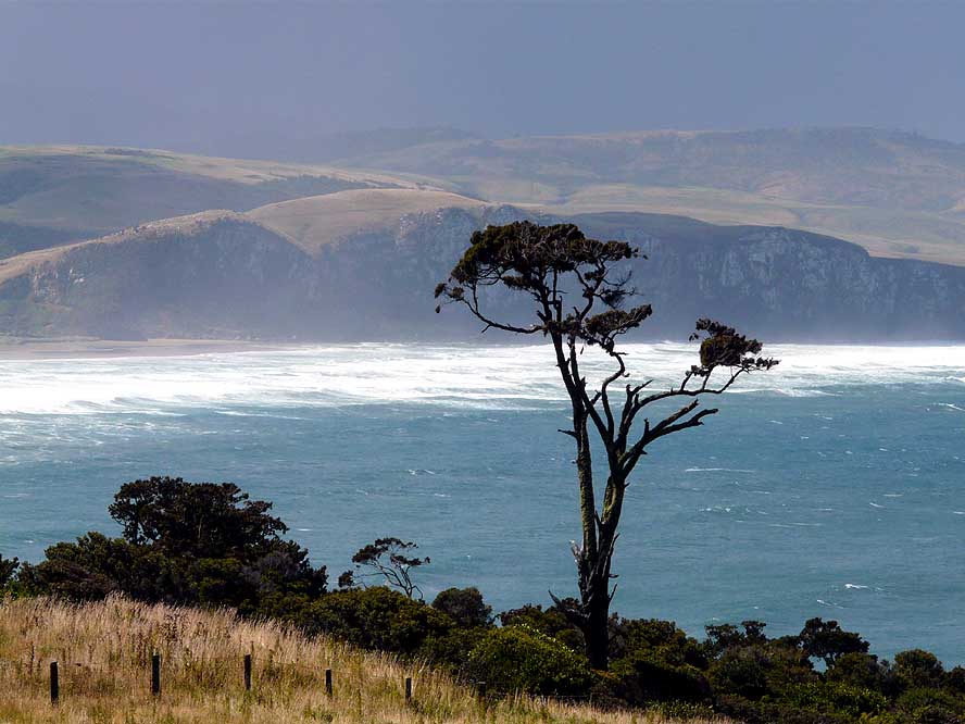
Another view over another
- lonely bay in the South (Tahakapa
- Bay, not far from Tautuku Bay),
- where stormy weather, rain and
- wind are never far away
|
|
| 
|

|

|
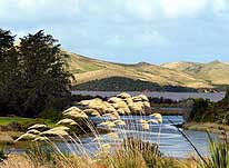
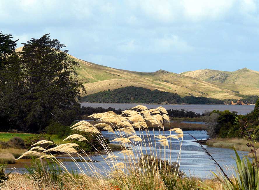
- 34
Rolling hills, ponds and “Toe Toe”
- -plants are a common sight along the
- “Southern Scenic Route” in the
- South of the South Island
|
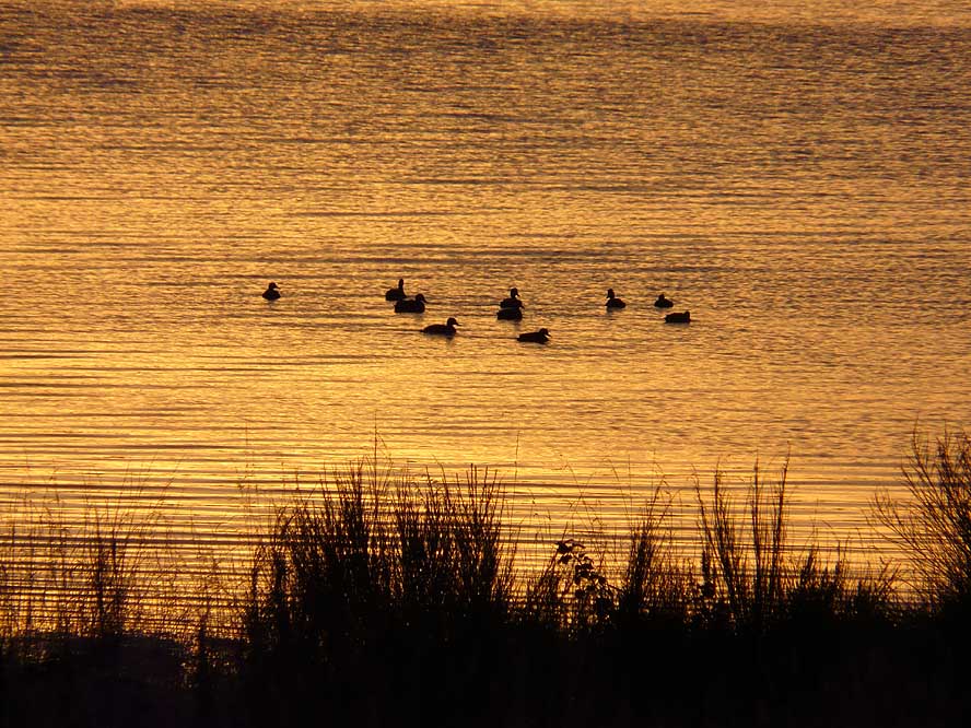
- 35
Another peaceful scene in the
- “Catlins”, the region between Dunedin
- and Invercargill: Ducks at sunrise in
- Waikawa (“Southern Scenic Route”)
|
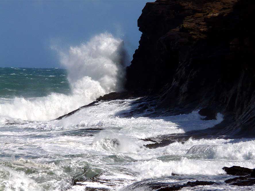
- 36
The sea is in uproar at Curio
- Bay in Waikawa. Without warning, our
- LandCruiser got its full salty shower
|
|
| 
|
|

|
- 37
An antarctic storm is
- approaching, dropping the
- temperature to freezing point
|
- 38
Across farm land, we walk to
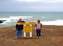
- “Slope Point”, New Zealand’s
- Southernmost point on the South
- Island, and pose for a picture
|
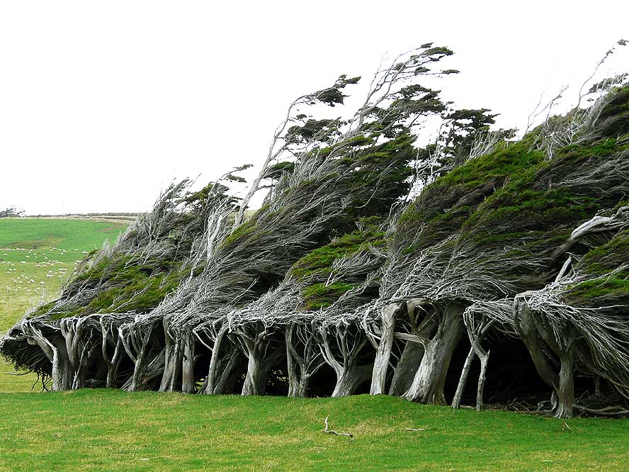
- 39
Macrocarpa trees bent from
- years of beating by fierce winds at
- “Slope Point”. They tangle their
- branches to survive and not to topple
|
|
| 
|
|
|
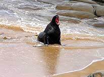
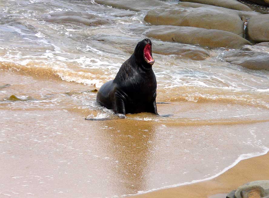
- 40
A male sea lion is emerging
- from the sea at Waipapa Point –
- Southeast of Invercargill,
- followed by its female
|
- 41
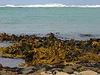
Fresh Kelp is swept in great
- quantities to the beach at
- Waipapa Point
|
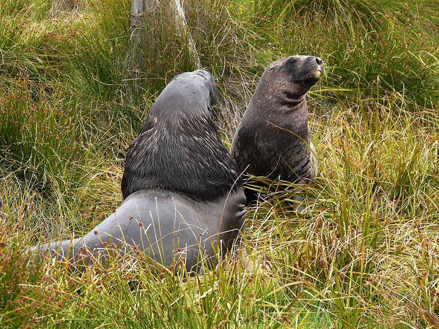
- 42
The sea lion couple crawls up
- the grass covered sand dune. It
- plays for a while, then lies
- down and falls asleep
|
|
| 
|
|
|
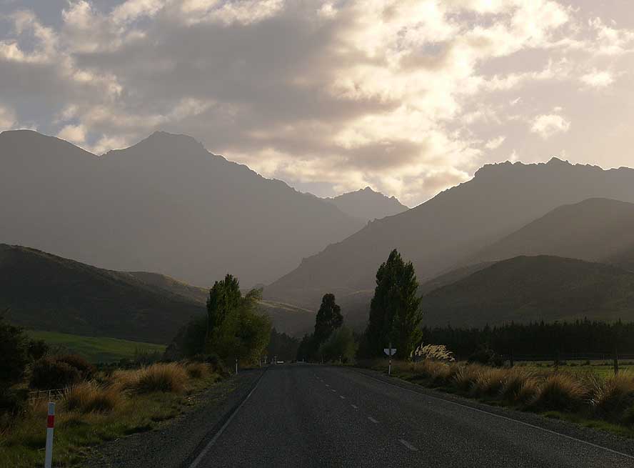
- 43
We approach the mountains in
- the East of the South Island towards
- “Milford Sound”, situated in the
- Fjordland National Park – one of New
- Zealand’s biggest tourist attractions
|
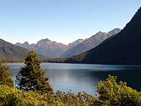
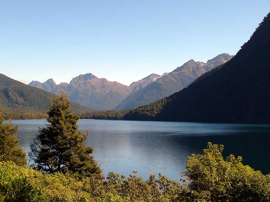
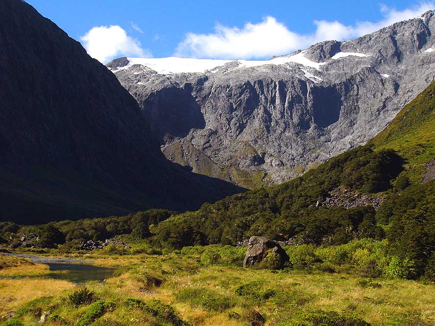
- 44
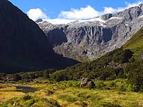
Lake Gunn – North of Te Anau
- – is one of the pristine lakes on
- our route to Milford Sound
|
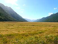
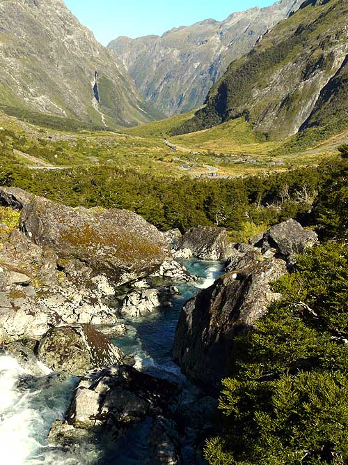
- 45
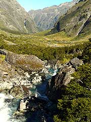
Eglinton Valley is spreading
- out in front of us with the mountains
- of the Milford Bay area already
- greeting in the back
|
|
|
|
|
|
| 46 |
47 |
48 |
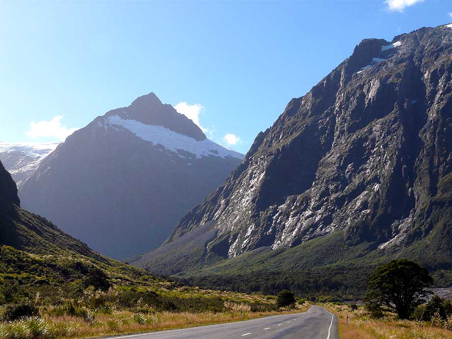
- Impressive alpine sceneries on the Eastern side of the � mile long Homer tunnel to
Milford Sound,
- drilled through solid rock between 1935 and 1953
|
|
|
|
|
|
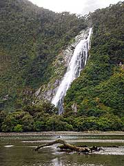
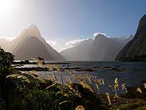
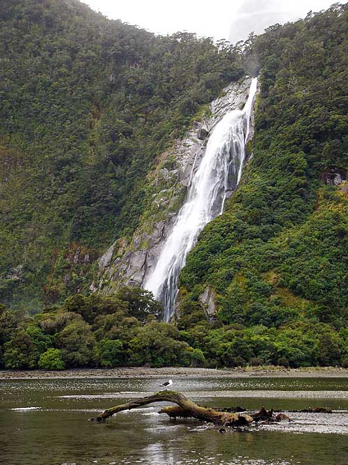
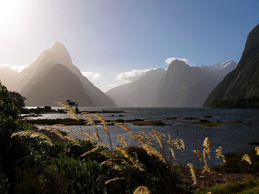
- 49
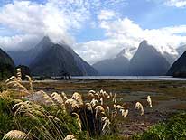
Morning atmosphere at low
- tide at Milford Sound – one of New
- Zealand’s biggest tourist attractions
- – with mountains rising vertically
- 4’000 ft. from sea level .....
|
- 50
..... and waterfalls that
- tumble from steep slopes
- into the sound far below
|
- 51
Evening atmosphere at
- high tide at Milford Sound
|
|
|
|

|
|
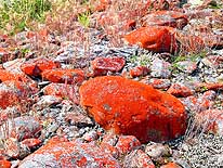
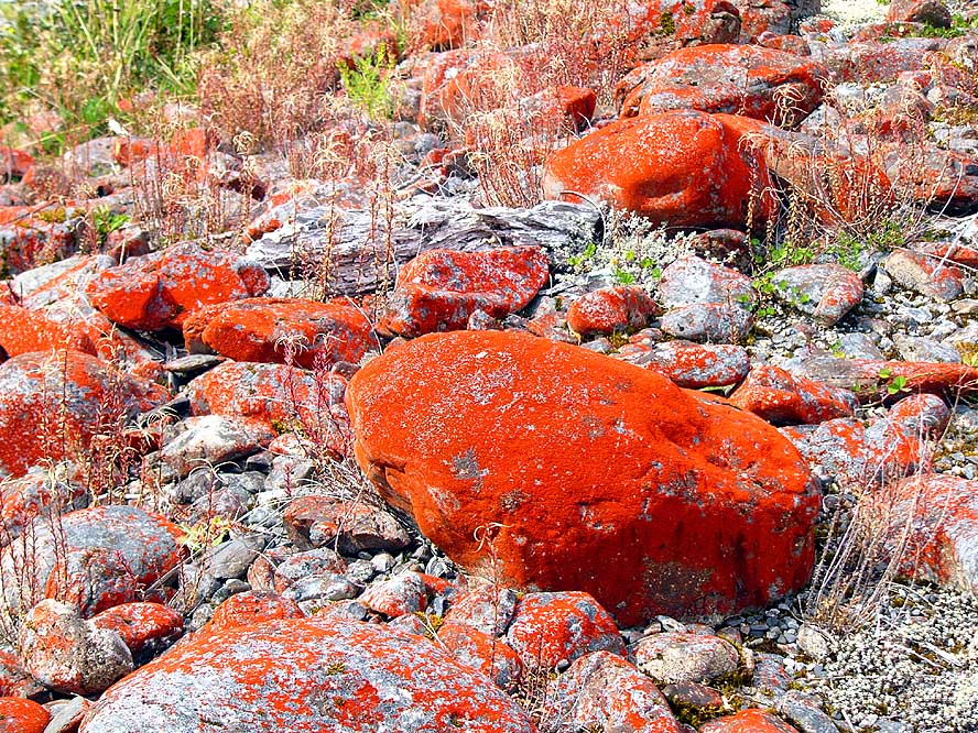
- 52
The stones and rocks in many
- of the wild mountain rivers are
- covered with deep red lichens
|
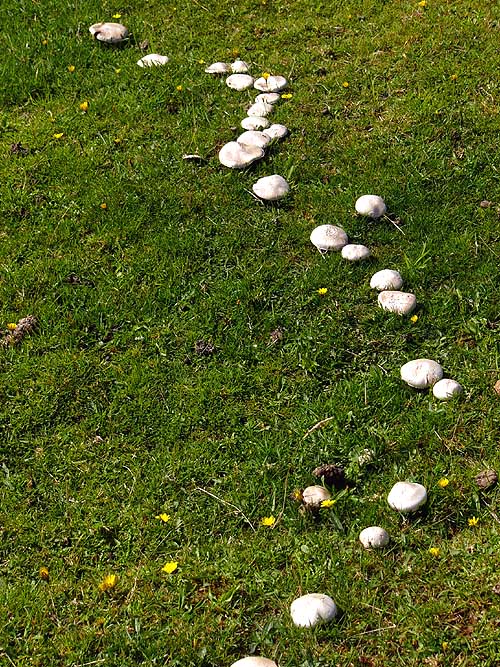
- 53
In the wet climate of
- the South Island, mushrooms
- grow in abundance
|
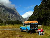
- 54
Camping life pure in the
- mountains around Milford Sound
|
|
| 
|
|
|
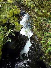
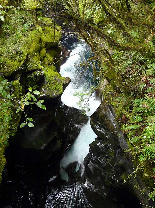
- 55
The mighty Cleddau River at
- Milford Sound pushes itself down a
- narrow gorge, called “The Chasm”
|
- 56
From Te Anau to Queenstown,
- we first drive through dry grassland
|
- 57
We are always tempted to take
- pictures of grazing sheep, so
- typically for New Zealand
|
|
| 
|
|
|
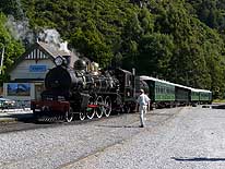
- 58
The heritage steam train in Kingston –
- called “Kingston Flyer” – on the Southern
- end of Lake Wakatipu, 30 miles South of
- Queenstown, is a tourist attraction and
- steams 11 miles South to Fairlight
|
- 59
Barren cliffs, a deep blue fjord,
- pandanus trees and distant mountain
- peaks – this is our panorama at
- lunch time at Lake Wakatipu
|
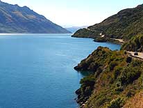
- 60
The road to Queenstown is
- winding along Lake Wakatipu and
- offers an outstanding scenery
|
|
| 
|
|

|
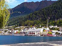
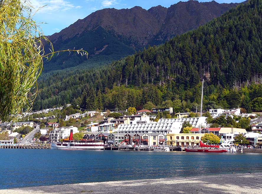
- 61
Queenstown on Lake Wakatipu –
- also know as New Zealand’s “adrenaline-
- activity-capital” – is an elegant and popular
- tourist destination. It is often compared
- (a little exaggerated?) with St. Moritz in
- Switzerland .....
|
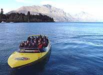
- 62
..... “Jetboating” in rivers is
- just one of the numerous
- crazy outdoor sports .....
|
- 63
..... Get your own idea, how
- easily and fast you can get
- rid of your money!
|
|
| 
|
|
|
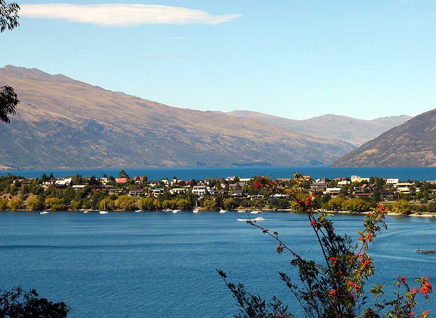
- 64
Another beautiful view:
- Kelvin Heights, rather a residential
- area opposite of Queenstown
|
- 65
The trees along Lake Wakatipu
- between Queenstown and the 30 miles
- Northwest situated village of Glenorchy
- are starting to change to autumn colors
|
- 66
A beautiful sight: The panorama
- near Glenorchy is reflecting in Lake
- Wakatipu – once more a fantastic
- stretch to drive
|
|
| 
|
|
|
- 67
The rising sun is touching the
- Humboldt Mountains near Glenorchy –
- a scene we unfortunately could enjoy only
- from within the car with closed windows
- due to the swarms of attacking sand flies
- (New Zealand’s pest of the West)
|
- 68
On our way to Paradise, 10 miles
- from Glenorchy, we cross the Rees
- River, another of the many mighty New
- Zealand rivers. In this region – besides
- some others – the movie “Lord of the Rings”
- was shot and now “X-Men” again
|
- 69
View towards Paradise,
- where the gravel road
- ends at the Dart River
|
|
- Continuations:
|
- Articles in newspapers about us in New Zealand:
- Article: "Still
cruising after 628,000km", Otago Daily Times - February 27, 2008
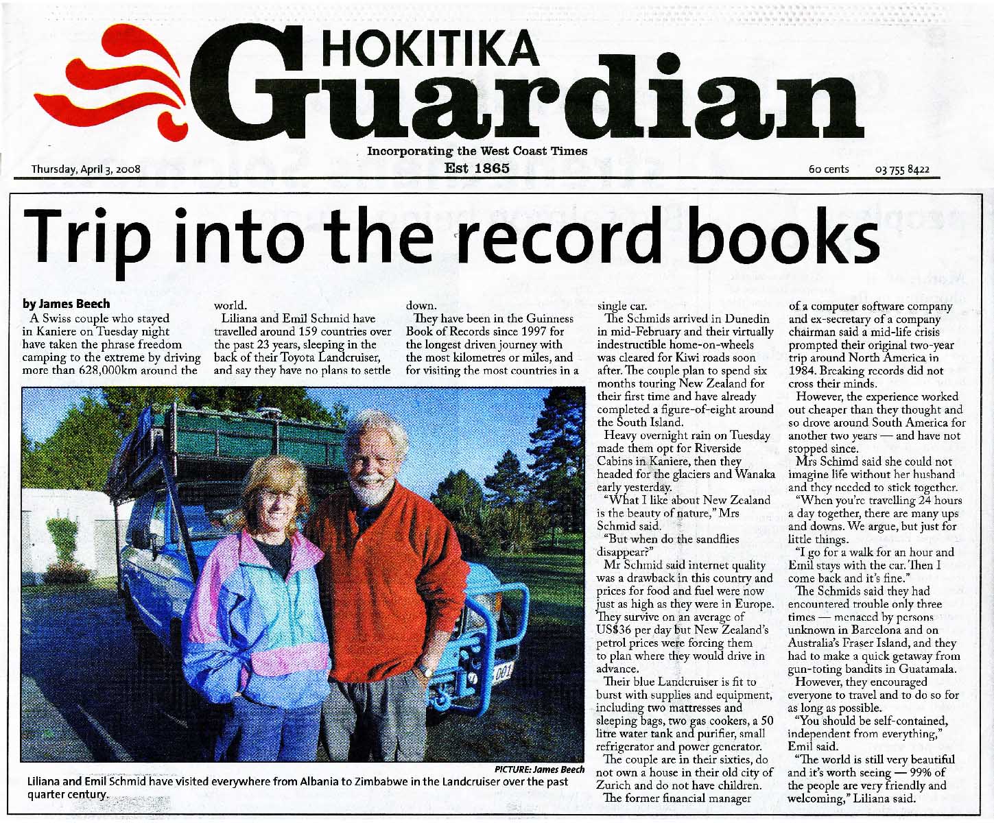
- Article: "Trip into
the record books", Hokitika Guardian - April 3, 2008
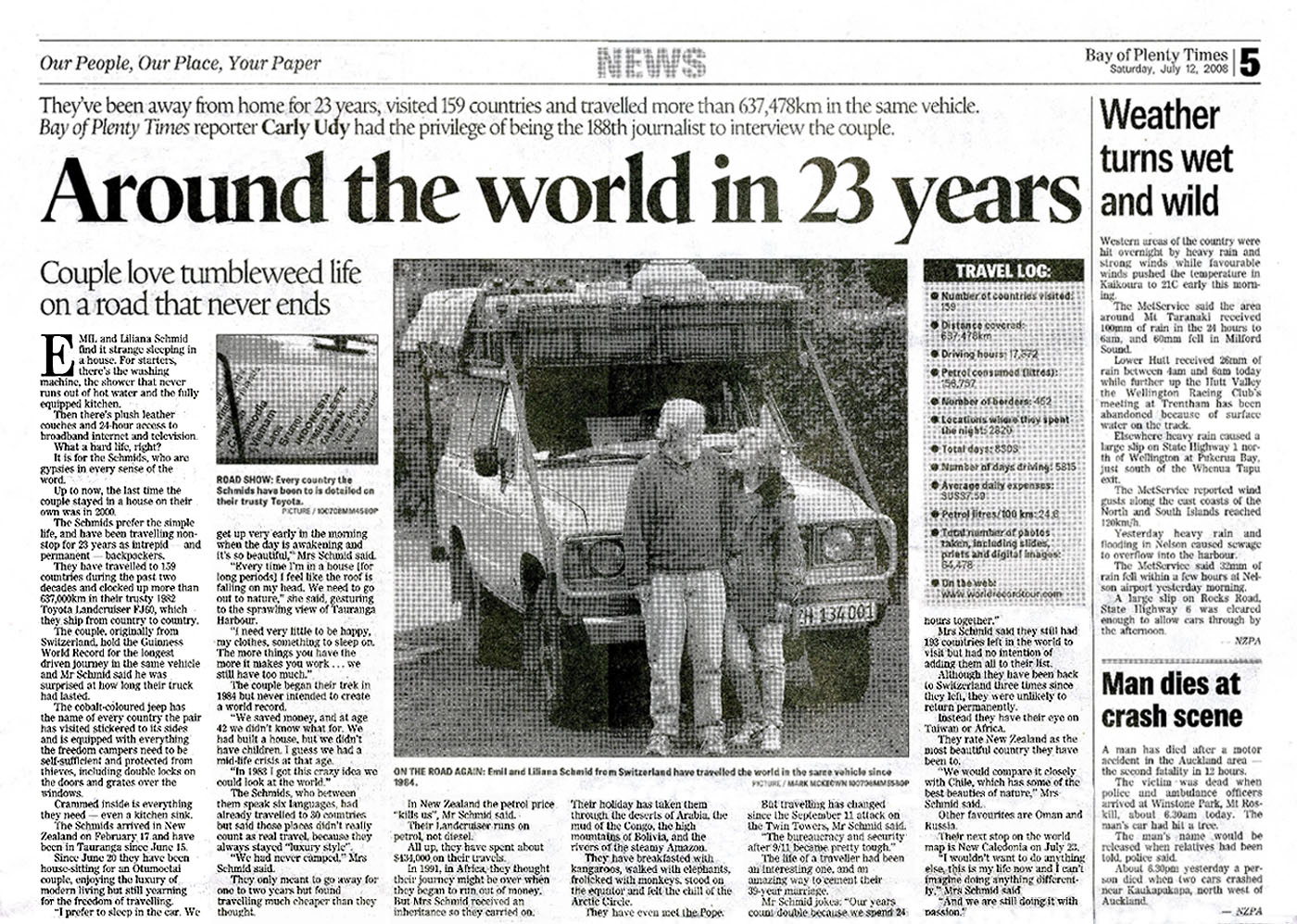
- Article: "Around the world in 23 years", Bay of Plenty Times - July 12,
2008
|


