-
-
-
|
-
-
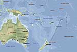
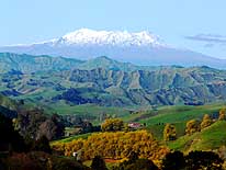
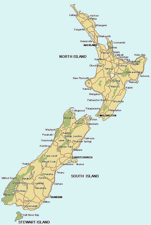
- New Zealand Map
-
|
-
-
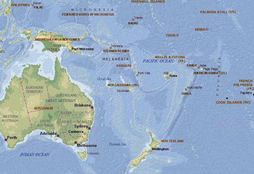
- Map of
- the Pacific
-
-
|
-
-
-
-
-
|
- latest picture: May 14, 2008
- click a picture to see details
|
-
-
|
-
-
-
-
|
-
-
-
-
|
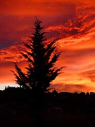
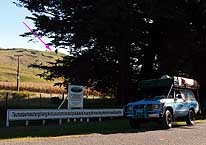
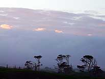
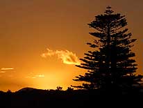
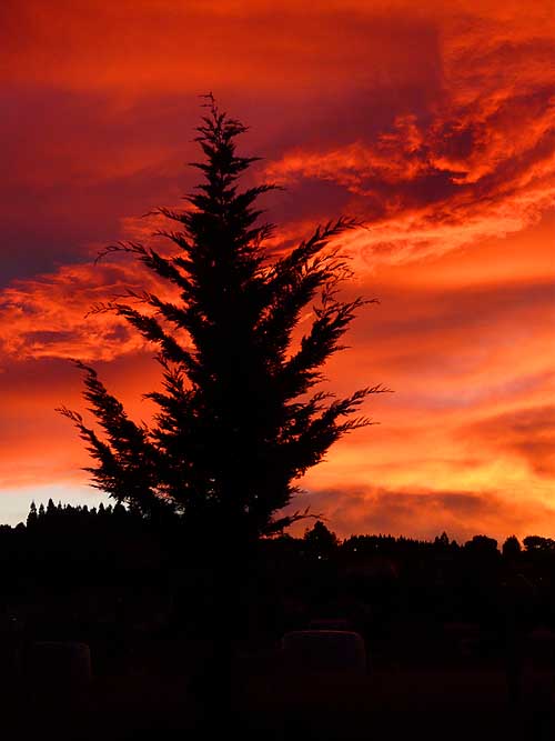
- 208
Our departure day
- from Dunedin is blessed
- with a special sunrise
|
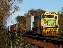
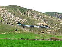
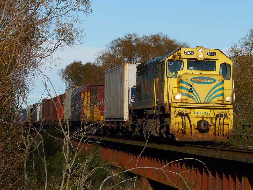
- 209
On the longest bridge of New
- Zealand, in Rakaia, one of the frequently
- circulating freight trains is approaching
|
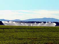
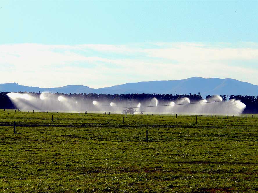
- 210
The growth of pasture is
- accelerated with a huge
- rotating irrigation system
|
-
|
-
-

|
-
-
|
-
-
|
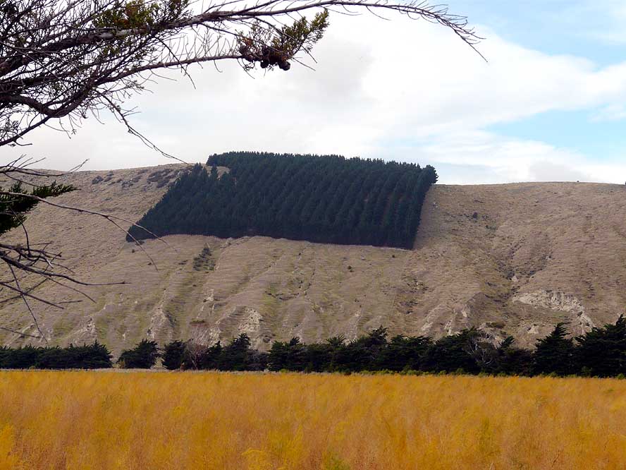
- 211
A rectangular patch of a
- reforestation that hurts our eyes
|
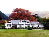
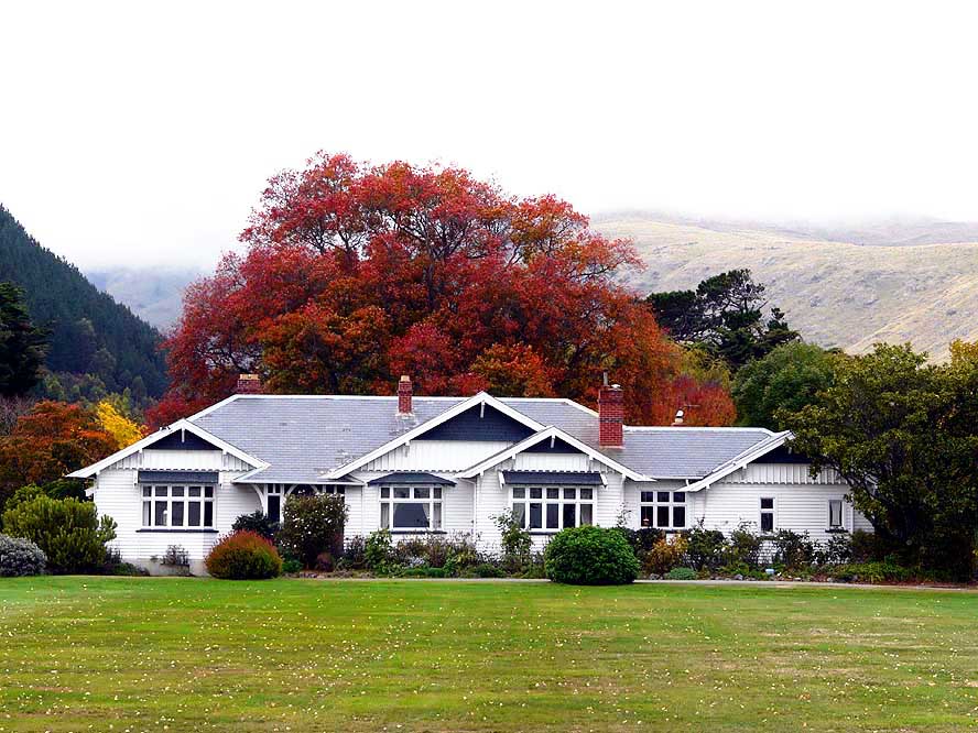
- 212
An attractive Homestead
- on the Banks Peninsula
|
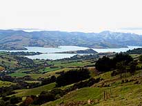
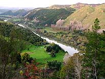
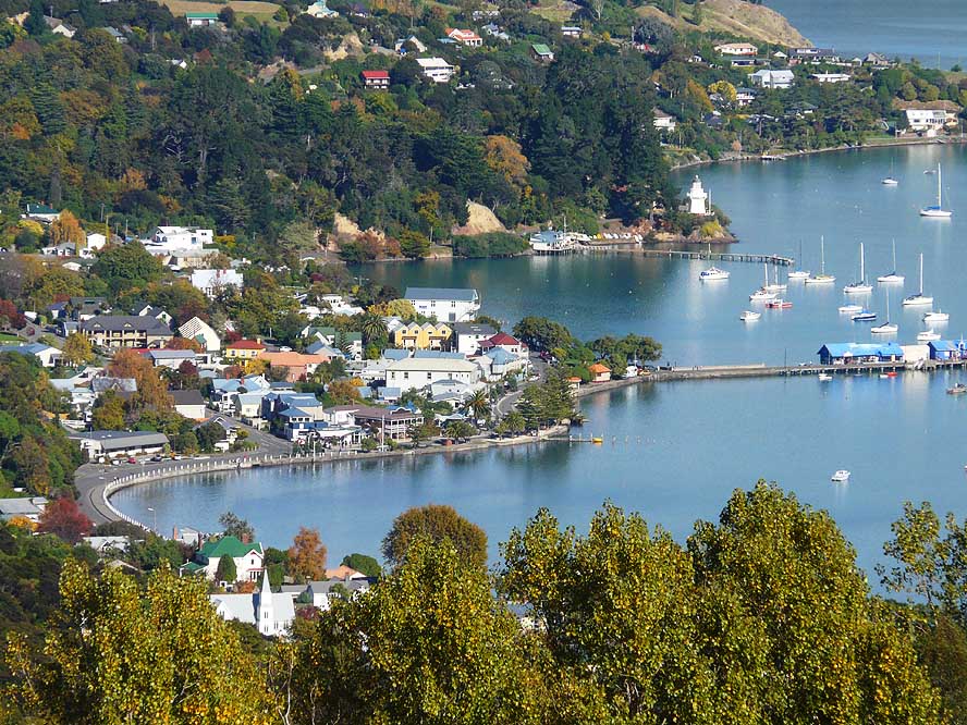
- 213
View over “Akaroa Harbour”
- on the Banks Peninsula,
- Southeast of Christchurch
|
-
|
-
-
|
-
-

|
-
-

|
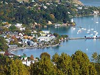
- 214
Akaroa on the Banks Peninsula
- is situated picturesquely at the lovely
- coast. It was the site of the first
- French settlement in New Zealand
- and its French charm is omnipresent
|
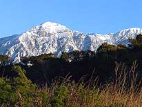
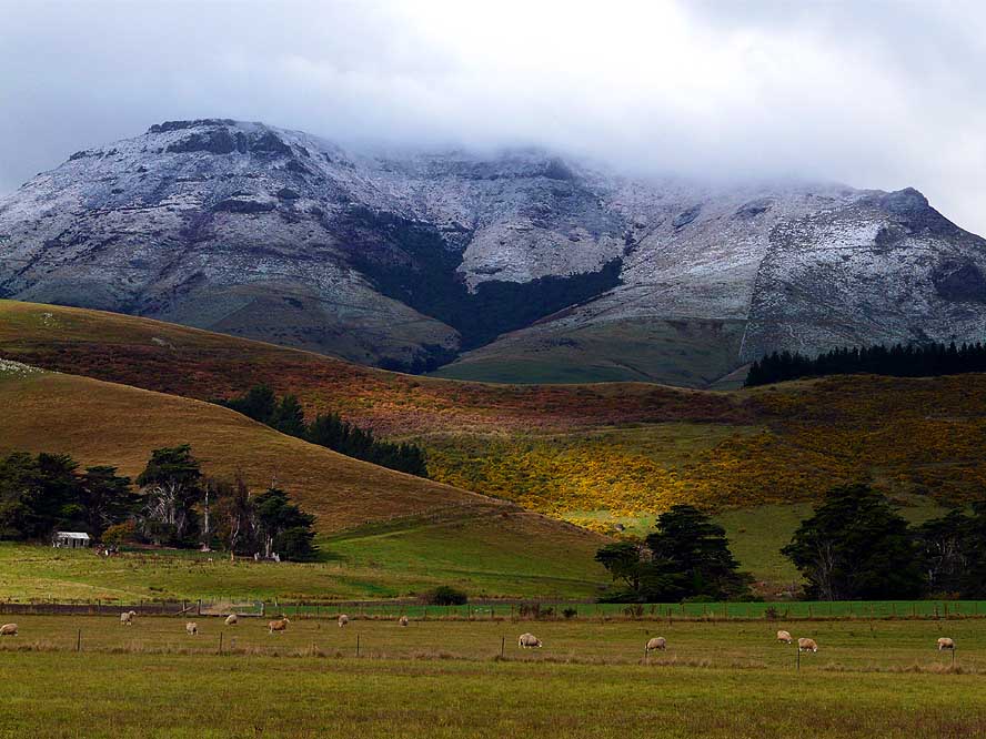
- 215
A fine layer of the first early
- snowfall on the South Island is
- covering the landscape on our
- northbound journey to Kaikoura
|
- 216
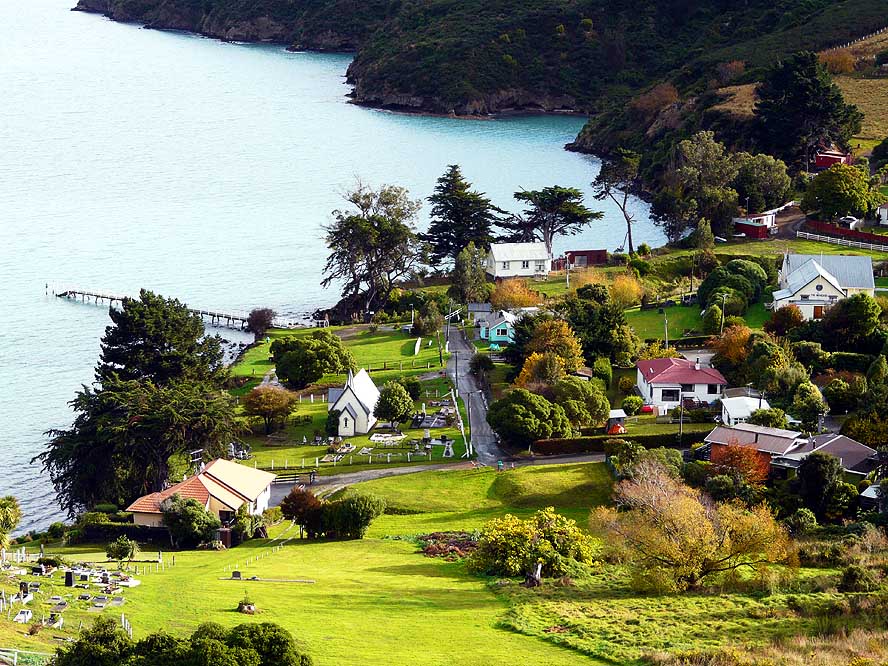
The sleepy hamlet
- Rapaki Bay is popping up on
- the winding coastal road along the
- Lyttelton Harbour to Christchurch
|
-
|
-
-
-
-
|
-
-
|
-
-
-
-
|
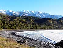
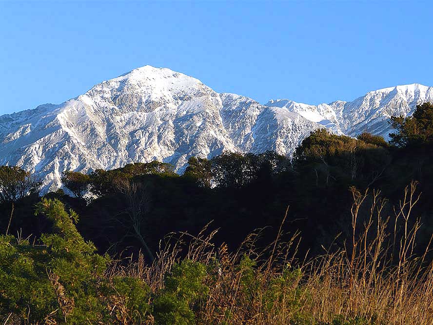
- 217
A fantastic white snow panorama of
- the Seaward Kaikoura Range is surprising
- us in the morning on our lonely camping
- spot on the Puhi-Puhi gravel road, about
- 6 miles North of Kaikoura …..
|
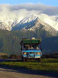
- 218
..... our LandCruiser
- poses for his first and
- only winter picture
- in New Zealand …..
|
- 219
….. back on Highway No 1,
- we enjoy the white mountain
- scenery and the splashing
- of the agitated sea simultaneously
|
-
|
-
-
|
-
-
|
-
-
|
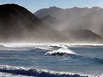
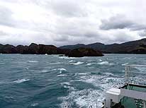
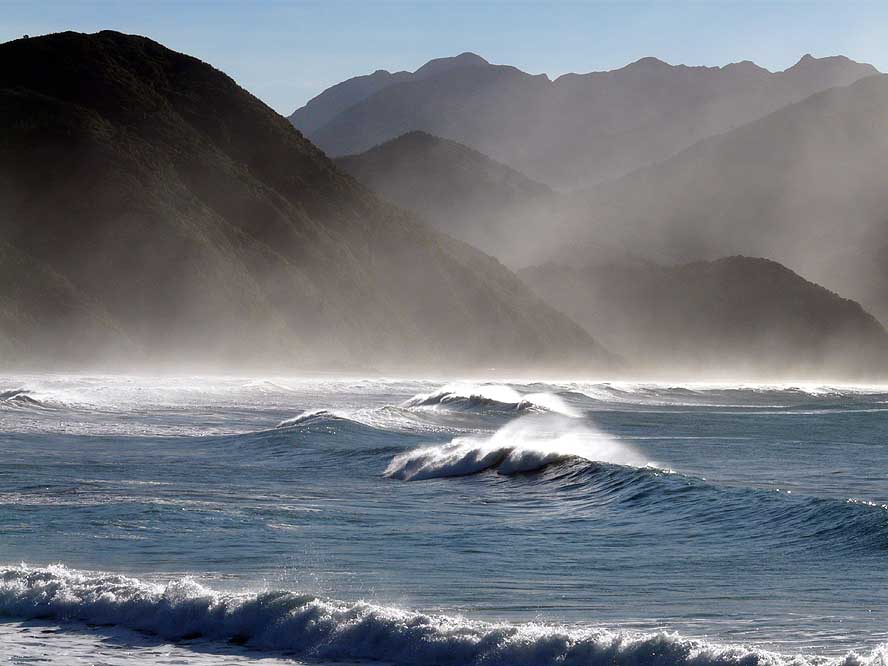
- 220
The strong wind and the
- breaking of the high waves produce
- an overwhelming spectacle as we
- follow Highway No 1 northwards from
- Kaikoura to the ferry terminal in Picton
|
- 221
Another of the amazing
- sights along highway No. 1
- to the ferry terminal in Picton
|
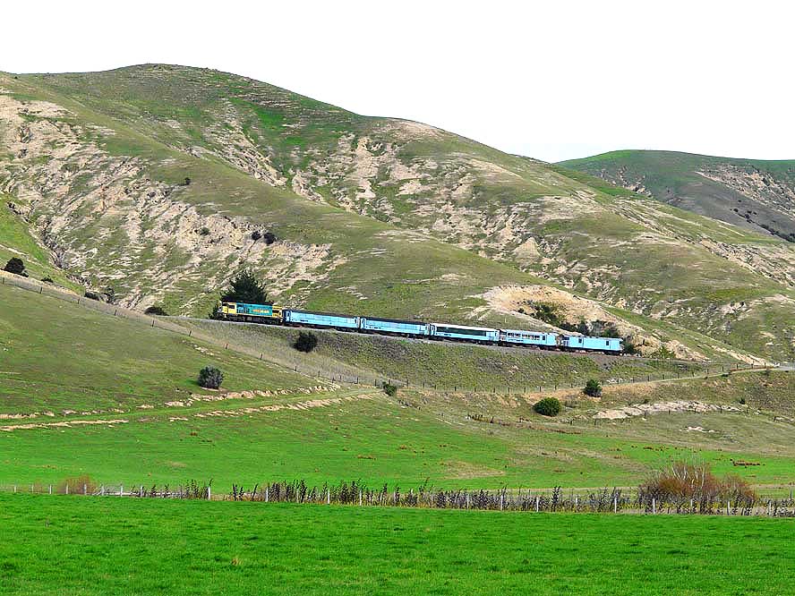
- 222
A passenger train is driving
- through the remote and barren
- region near Redwood Pass,
- South of Blenheim
|
-
|
-
-
|
-
-
|
-
-
|
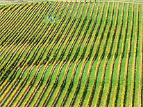
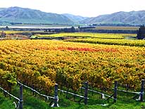
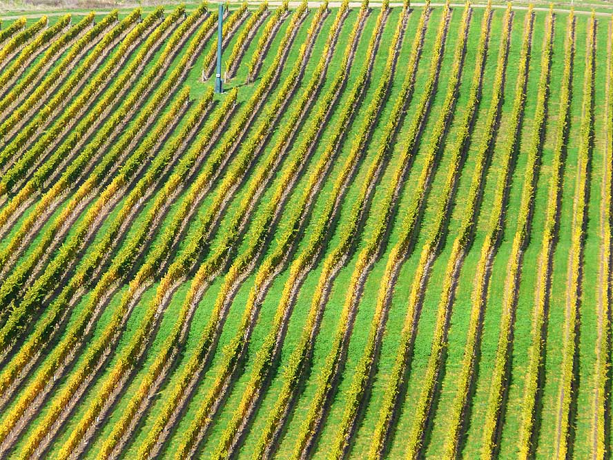
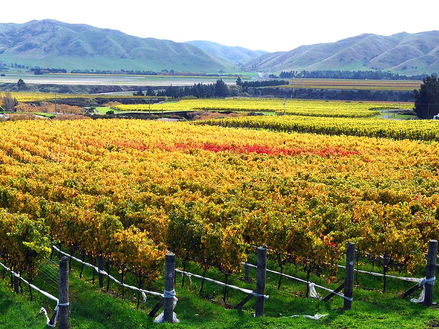
- 223
Blenheim in the North of the
- South Island, is a huge and well
- known wine producing area …..
|
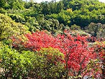
- 224
….. the green, yellow and
- red leafs of the vines give lovely
- color splashes to the valley
|
- 225
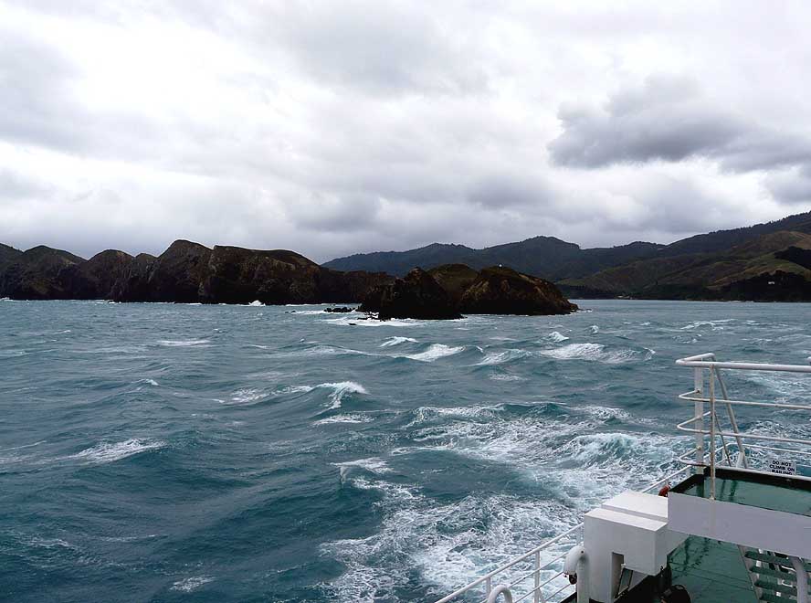
On May 5th, 2008, we say
- good-bye after 4’029 driven miles to
- the beautiful and untamed South Island.
- The ferry brings us on a rough sea in three
- hours to Wellington on the North Island
|
-
|
-
-
|
-
-
|
-
-
|
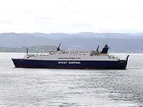
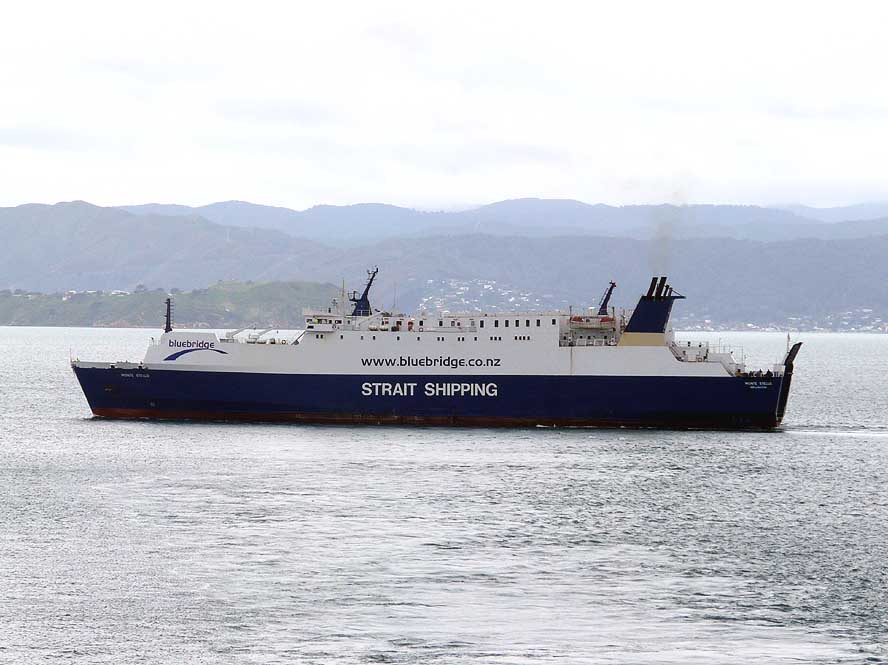
- 226
“Bluebridge” is one of the
- two ferry companies connecting
- the South and the North Islands
|
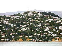
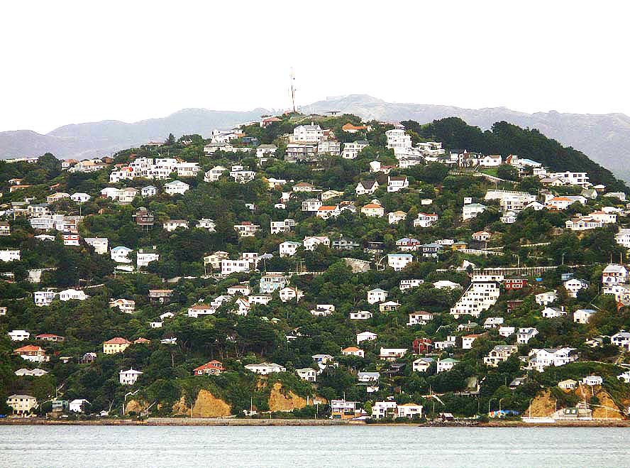
- 227
One of the residential areas of
- Wellington – the Capital of New Zealand
- – under a cloudy sky early morning,
- located at the Wellington Harbour entrance
|
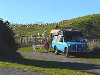
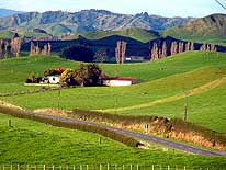
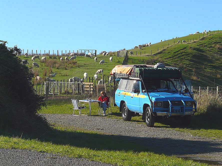
- 228
A picnic in a lush green rural
- area along Route 59 between
- Masterton and Dreyers Rock
|
-
|
-
-
|
-
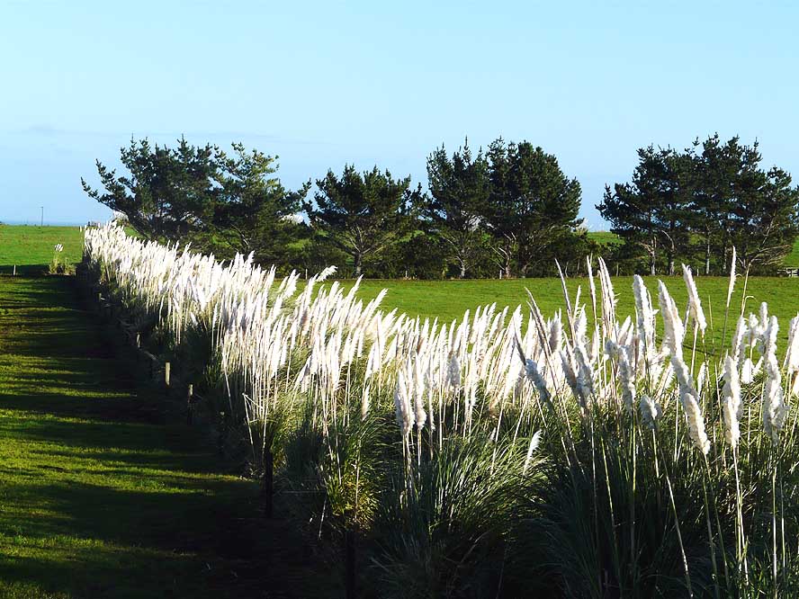
-
-
-
|
-
-
|
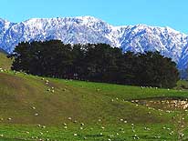
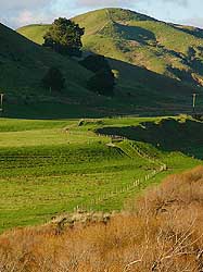
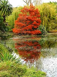
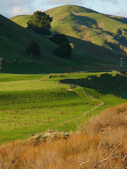
- 229
Rural idyll greets us
- around every corner
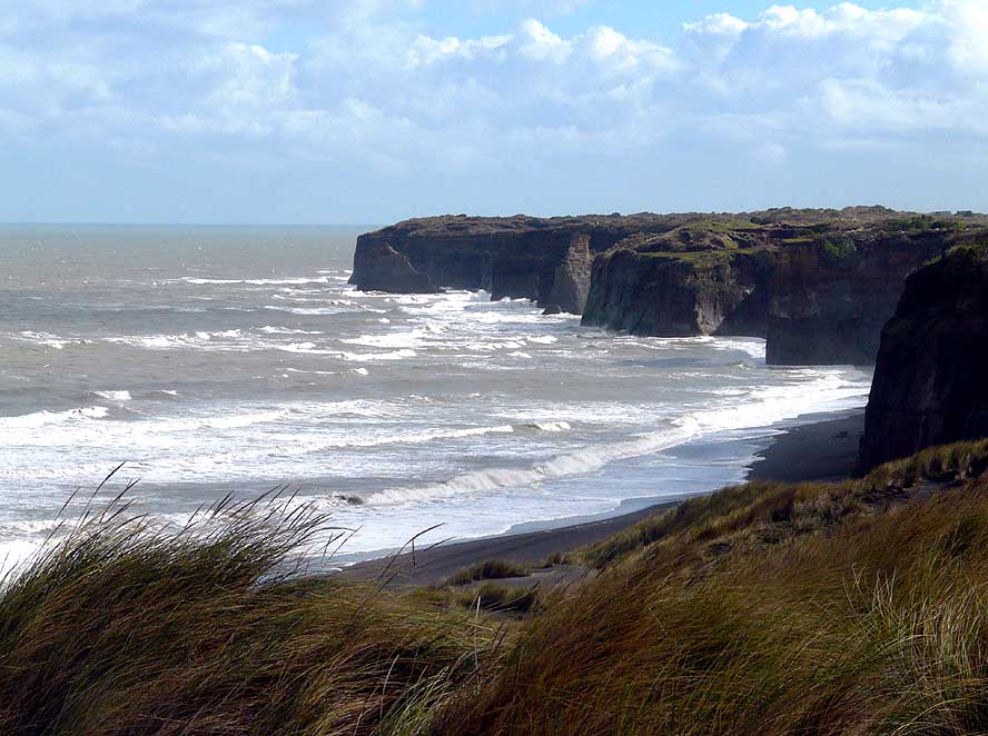
|
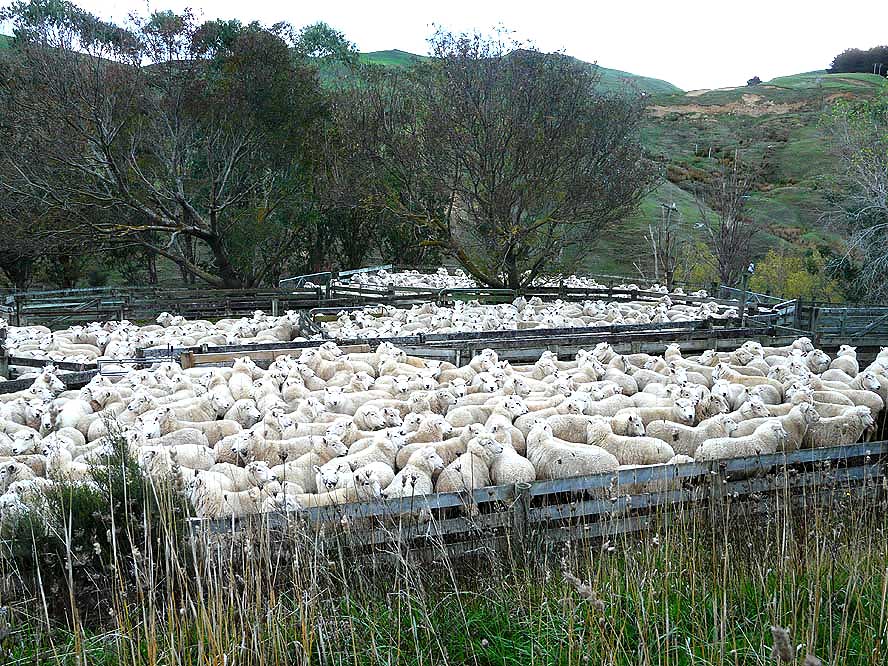
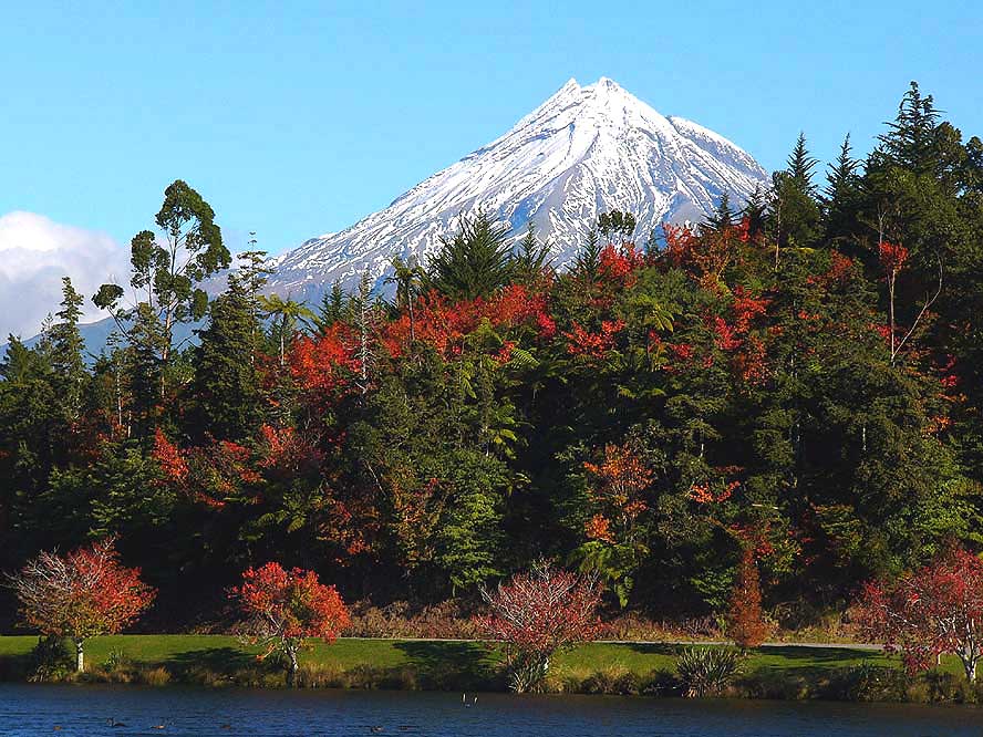
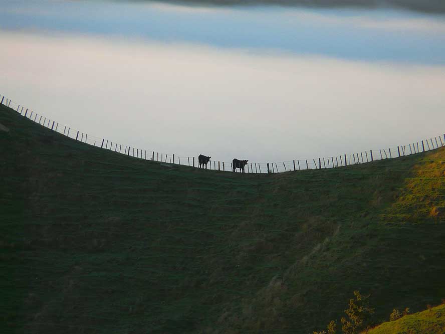
- 230
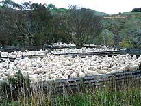
Sheep are rounded up in an
- enclosure. What is their destiny? – to
- get shorn or to end up at the butchery
|
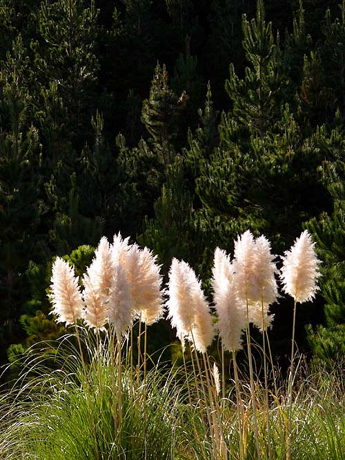
- 231
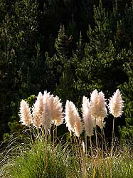
The Toe-toe grass is quite
- common in New Zealand. When the
- sun catches them, they look fantastic
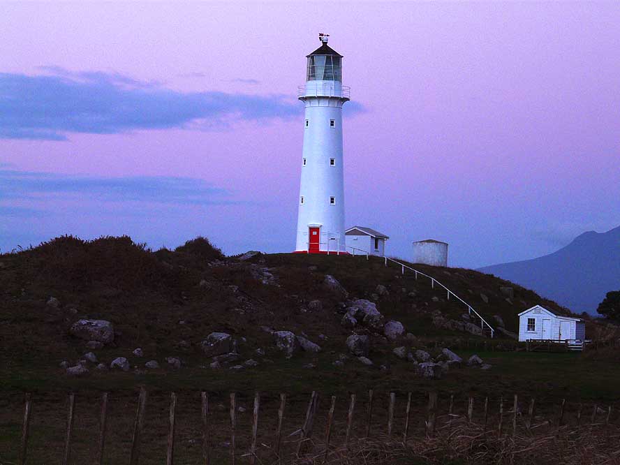
|
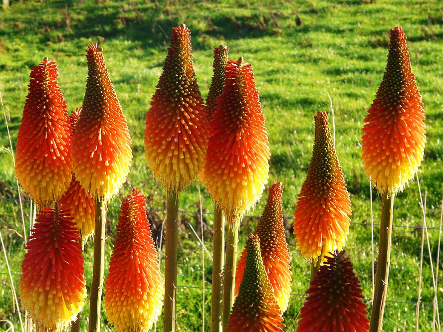
-
|
-
-
|
-
-

|
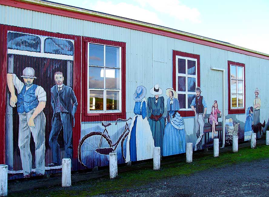
-
-
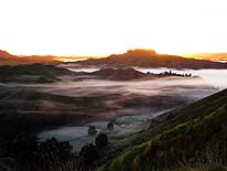
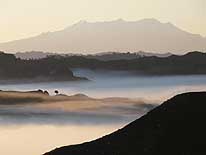
|
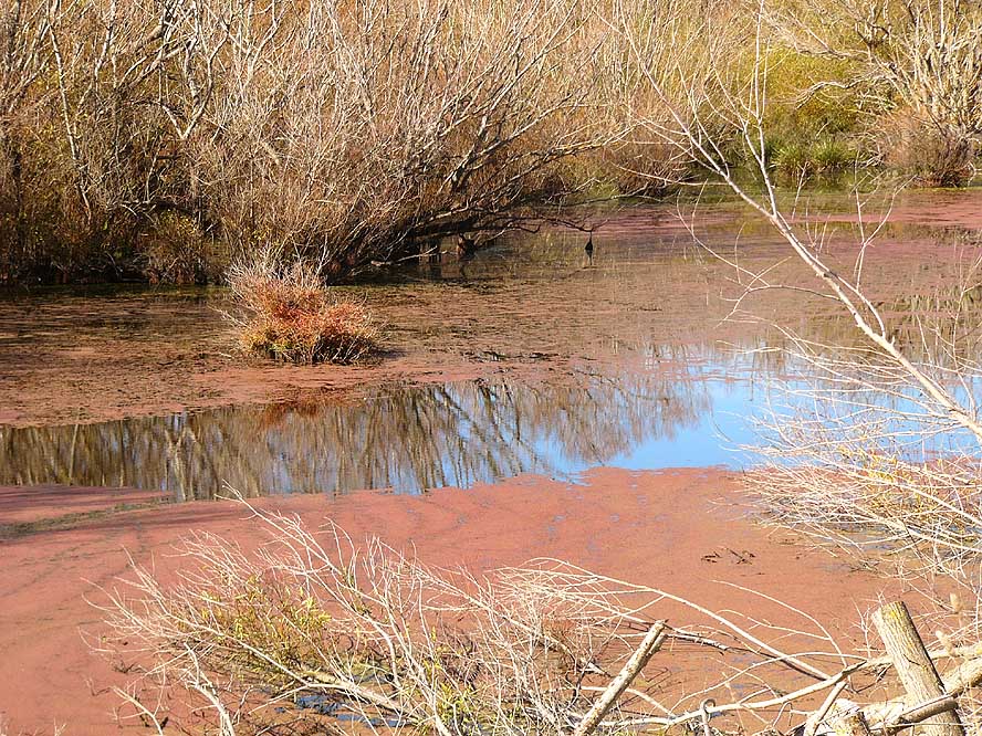
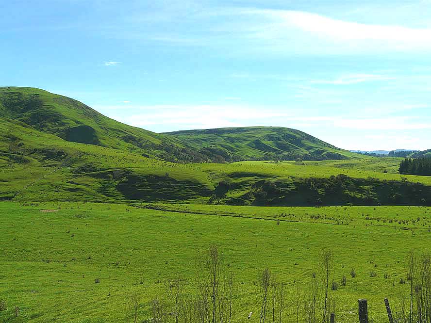
- Landscapes in contrast
|
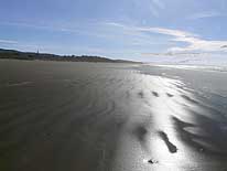
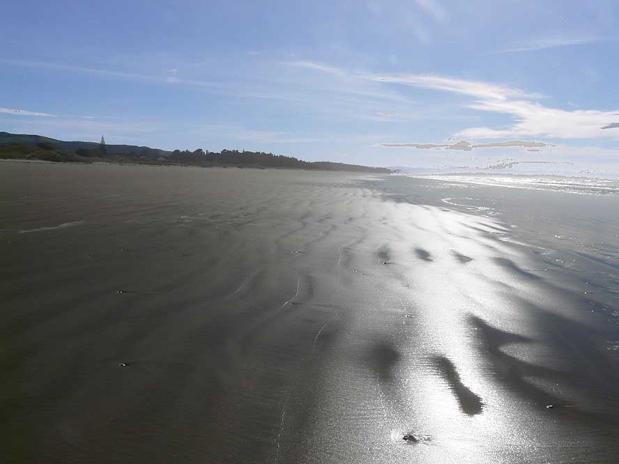
- 232
The beautiful and wide beach
- of Porangahau on the East Coast …..
|
- 233
….. marsh land with
- reflecting bushes .....
|
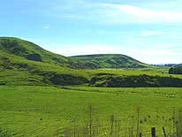
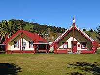
- 234
….. lush green farmland
|
-
|
-
-

|
-
-
|
-
-
|
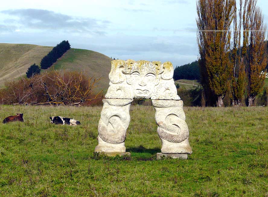
- 235
A Maori “archway” stands
- lonely on a grassland along a lightly
- trafficked mountain road that leads
- from Hastings to Taihape
|
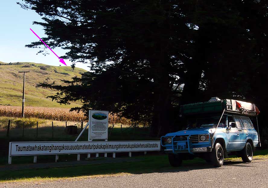
- 236
The LandCruiser with “The
- Longest Driven Journey” meets the
- „Longest Place Name“ bearing
- 85 letters near Porangahau (both
- are Guinness Book Entries):
- �Taumatawhakatangihangakoau-
- auotamateaturipukakapikimaunga-
- horonukupokaiwhenuakitanatahu�
|
- 237
From Ohakune to Wanganui
- the scenic tourist road meanders
- along the narrow Whanganui river
- valley – here at its Southern end
|
-
|
-
-
|
-
-
-
-
|
-
-
|
- 238
|
- 239
|
- 240
|
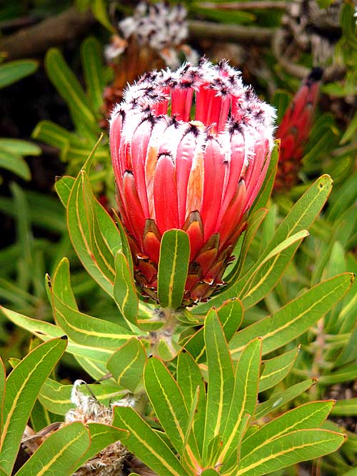
- The variety of trees and flowers in the beautifully maintained Bason Botanical Reserve
– 7 miles outside of Wanganui – is a feast for the eyes
|
-
|
-
-
|
-
-
|
-
-
|
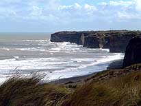
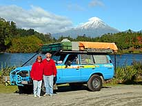
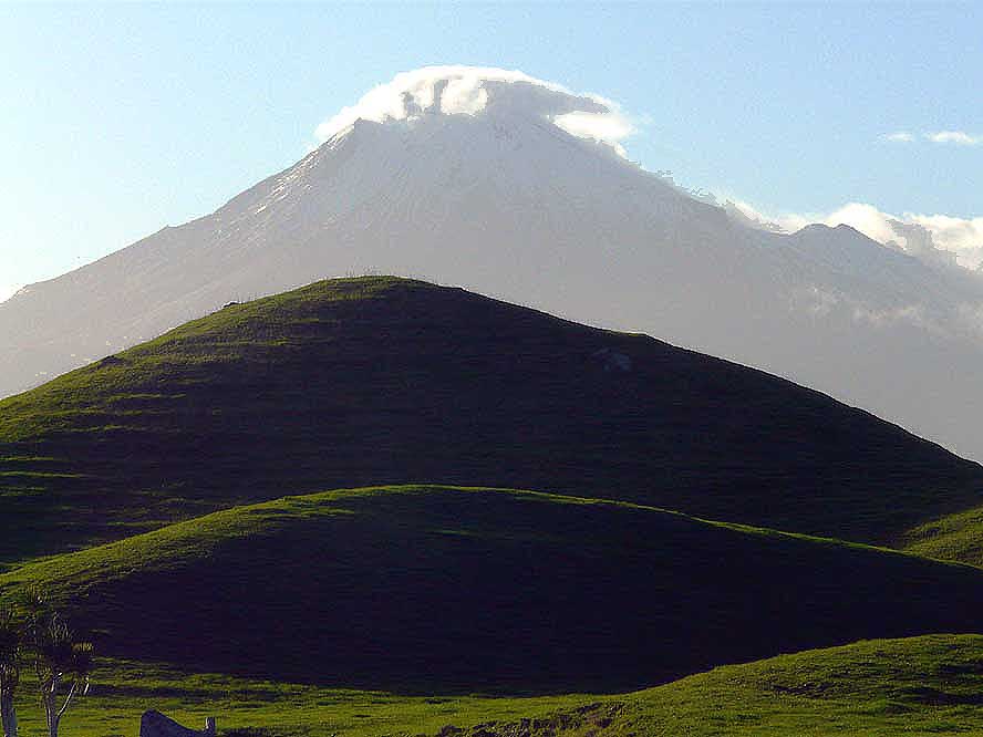
- 241
A wild part of the coast along
- the “Surf Highway“ No. 45 on the
- Western coast from Hawera to
- New Plymouth
|
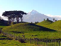
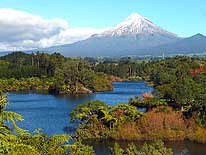
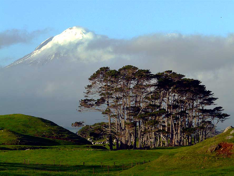
- 242
Volcano Taranaki, also called
- Mount Egmont, reveals its majestic
- beauty. The picture is taken at
- Cape Egmont towards the East
|
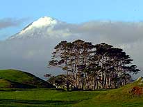
- 243
Mount Egmont (Mt. Taranaki)
- pictured from its Northwestern side
|
-
|
-
-
|
-
-
|
-
-
|
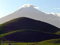
- 244
|
- 245
|
- 246
|
| The play of light at
Cape Egmont illuminates beautifully the clouds and Mt. Taranaki |
-
|
-
-

|
-
-
|
-
-
|
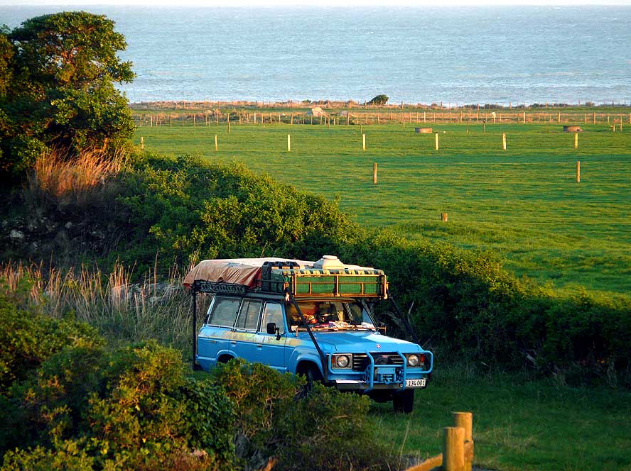
- 247
Our peaceful camping
- spot at Cape Egmont
|
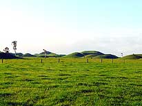
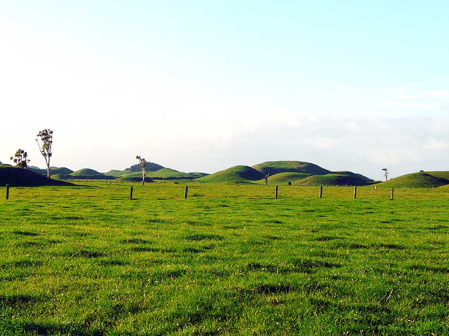
- 248
Around Mt. Taranaki (Mt.
- Egmont) many round grass “mounds“
- are scattered in the plain. Apparently,
- they were caused by the many
- eruptions of the volcano – a kind of
- “bubbles“ caused by the cooling lava
|
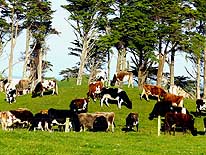
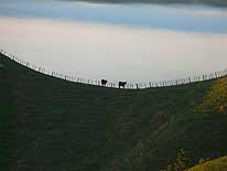
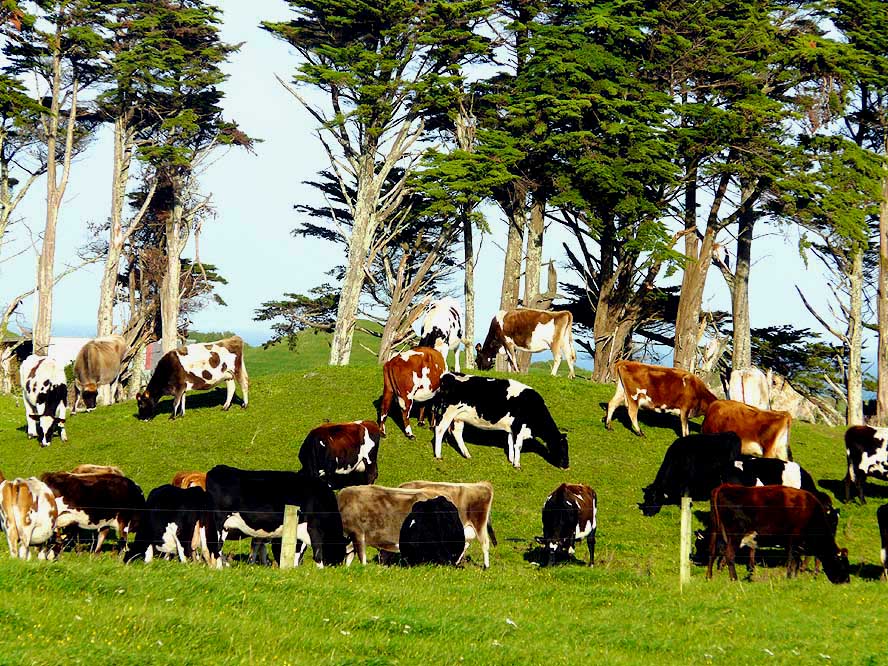
- 249
A herd of cows grazes
- peacefully on lush green pasture
- near Cape Egmont
|
-
|
-
-
|
-
-
|
-
-
|
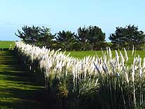
- 250
A hedge of white gleaming
- Toe-toe grass contrasts with
- the green of the paddock
|
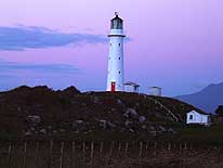
- 251
The slim white lighthouse
- at Cape Egmont rises
- towards the evening sky
|
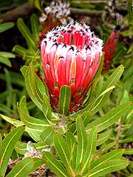
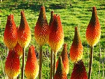
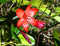
- 252
The “Red Hot Poker” (Torch
- Lily) flower with its strong yellow/
- reddish color is quite abundant in
- New Zealand, but originates
- from South Africa
|
-
|
-
-

|
-
-
|
-
-
|
- 253
|
- 254
|
- 255
|
- On Lake Mangamahoe, a few miles South of New Plymouth, we admire once more the majestic
beauty of Mt. Taranaki/(Mt. Egmont).
- Maori legend has it that Mount Taranaki and Mount Tongariro were once side by side and
fought for the love of the maiden Pihanga,
- another nearby peak. Taranaki being the loser, he fled towards the sea
|
-
|
-
-
|
-
-
|
-
-
|
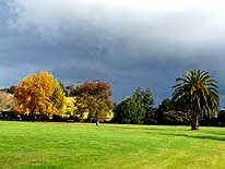
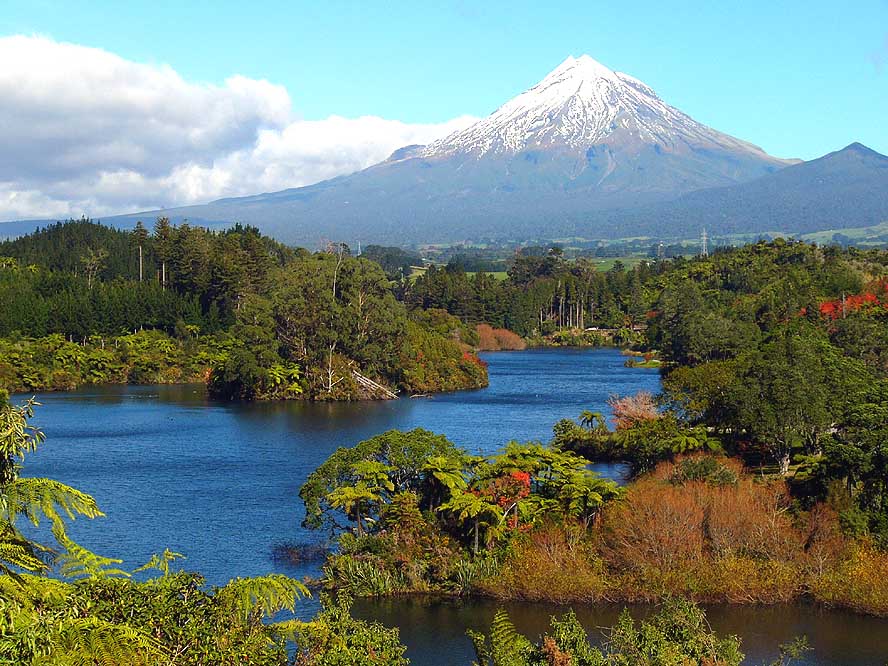
- 256
|
- 257
|
- 258
|
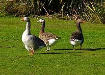
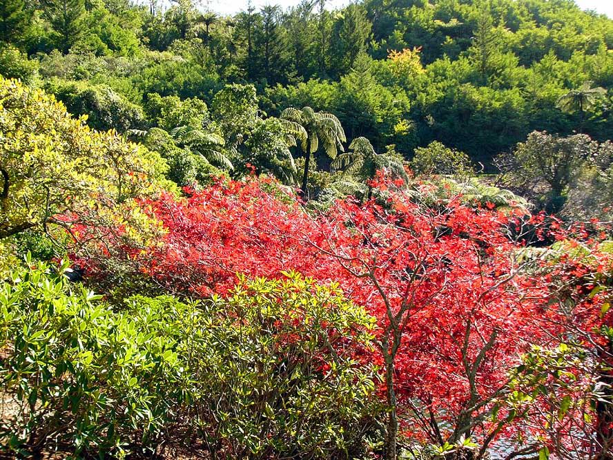
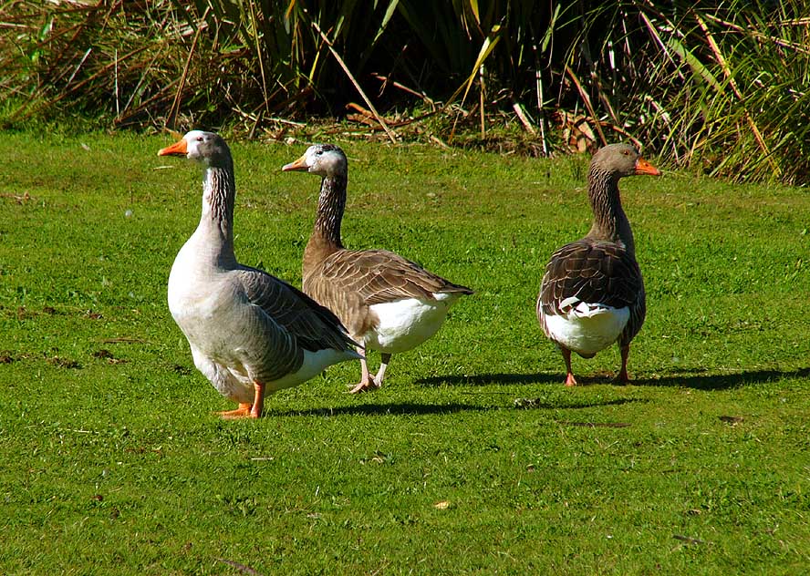
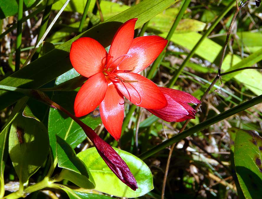
- Lake Mangamahoe near New Plymouth is – besides the wonderful sight of Mount
Taranaki (Egmont) –
- also a beautiful park with lovely trees and bushes, blooming flowers and geese and ducks
wandering and swimming around
|
-
|
-
-
|
-
-
|
-
-
|
- 259
An idyllic rural scene on the
- ”Forgotten Highway No. 43” – the
- path of the first settlers – that leads
- 90 miles through sometimes narrow
- valleys from Stratford to Taumarunui.
- It is a journey into the past
|
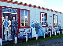
- 260
A lovely mural with scenes
- of the life of the first settlers
- stands right outside of Stratford
|
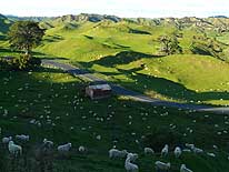
- 261
On the “Forgotten Highway
- No. 43”, there are plenty of
- lonely and remote places,
- inhabited just by sheep
|
-
|
-
-
|
-
-
|
-
-
|
- 262
|
- 263
|
- 264
|
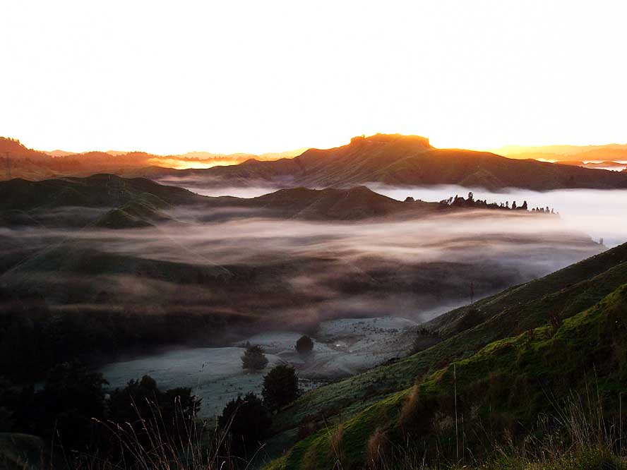
- What a sight from the Tahora Saddle on the “Forgotten Highway“:
- We experience a fantastic spectacle of colors, as the sun rises. It is an unforgettable
moment
|
-
|
-
-
|
-
-

|
-
-
|
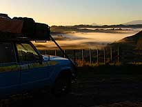
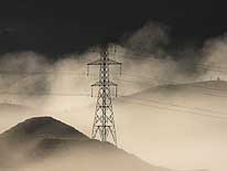
- 265
|
- 266
|
- 267
|
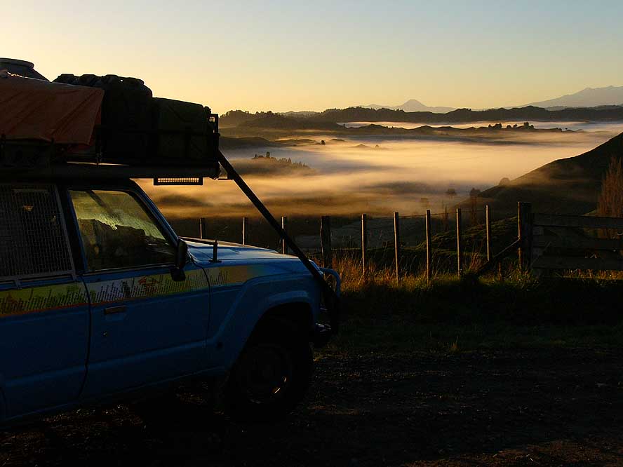
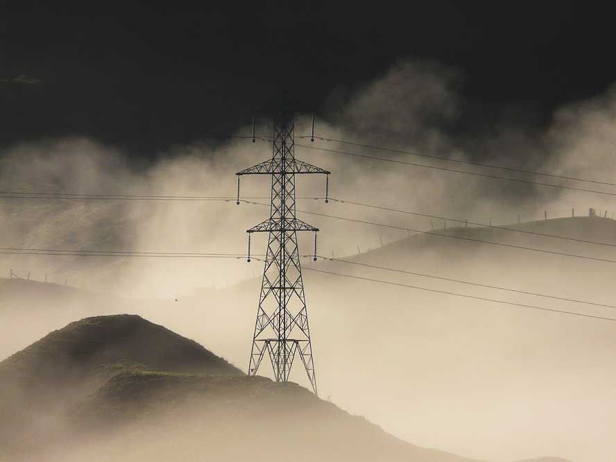
- Three other snapshots from the Tahora Saddle on the “Forgotten Highway No. 43“
|
-
|
-
-
-
-
|
-
-
|
-
-
-
-
|
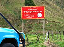
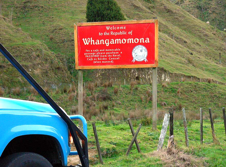
- 268
A sign in Whangamomona – a
- hamlet on the “Forgotten Highway” –
- announces that we are entering an
- independent republic. After disagreements
- with local councils, the residents proclaimed
- independence in 1989. In the Pub,
- even a passport should be acquired –
- quite a clever commercial gimmick!
|
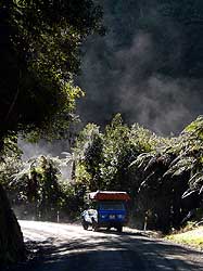
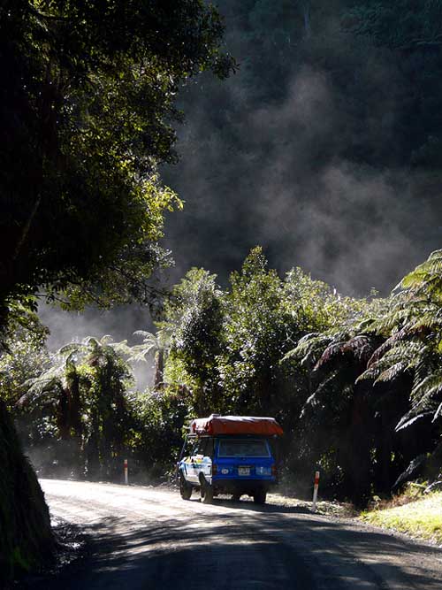
- 269
|
- 270
|
- On the “Forgotten Highway”, we drive through the luxurious
- subtropical rainforest of the Tangarakau Gorge, where it is
- steaming everywhere and where the plant growth is very copious
|
-
|
-
-
|
-
-

|
-
-
|
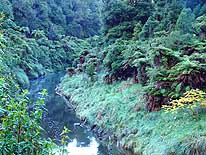
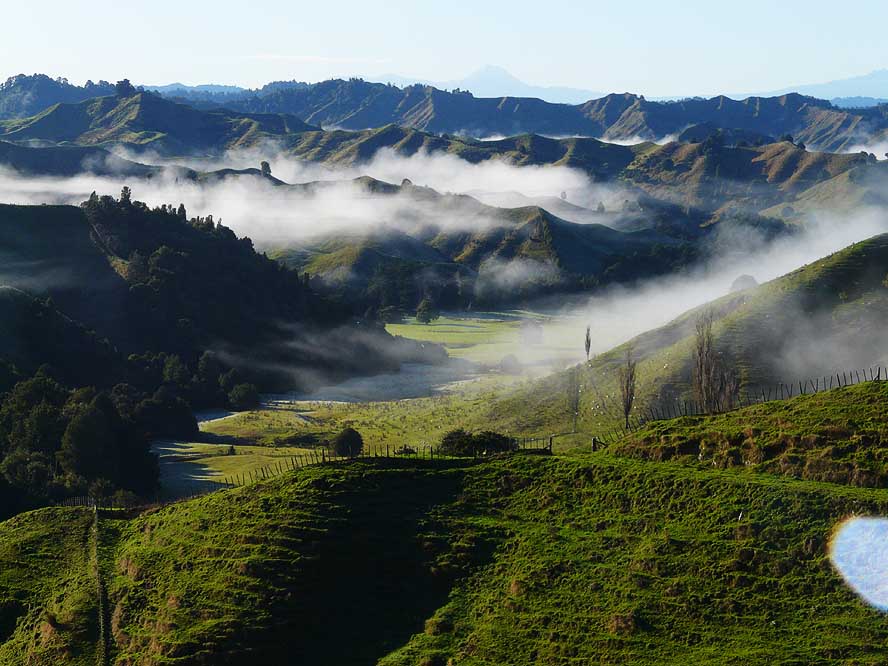
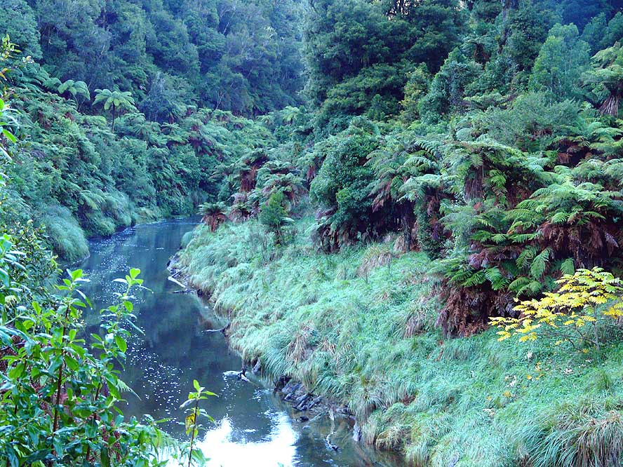
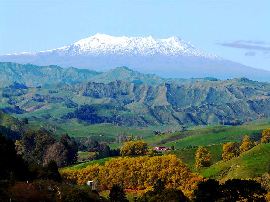
- 271
At Nevin’s lookout, the last
- one on the “Forgotten Highway”,
- the snow covered volcano Mount
- Ruapehu is greeting on the horizon
|
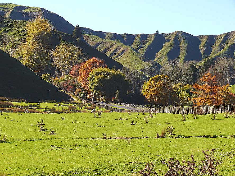
- 272
This lush green farmland combined
- with the colors of the Indian summer and
- the grazing sheep is our last picture from
- the unforgettable “Forgotten Highway”
|
- 273
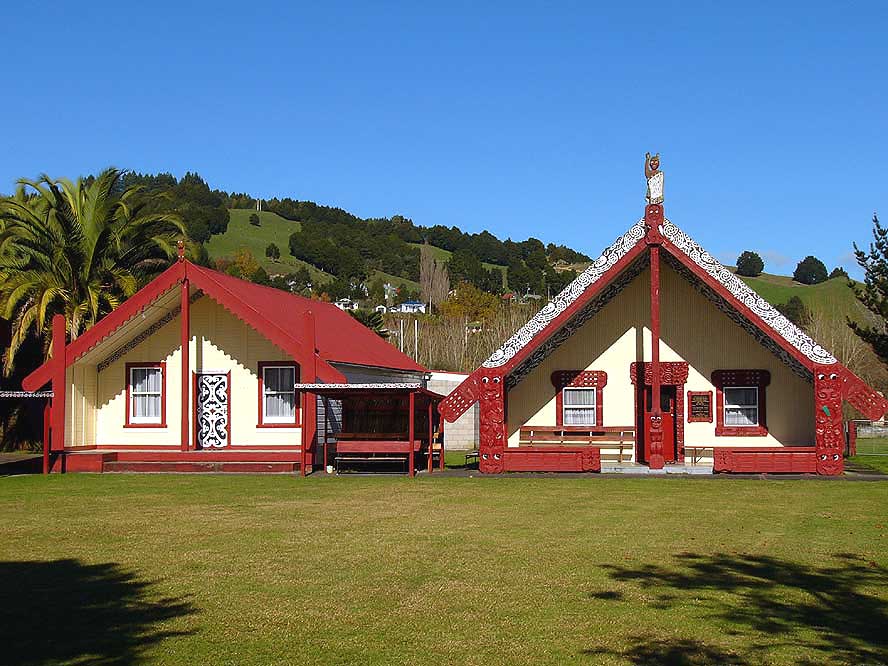
The „Marae“– the carved
- meetinghouse – is sacred to the
- Maori. This one is from Taumarunui
|
-
|
- More websites from New Zealand:
-
-
|
- Articles in newspapers about us in New Zealand:
- Article: "Still
cruising after 628,000km", Otago Daily Times - February 27, 2008
- Article: "Trip into
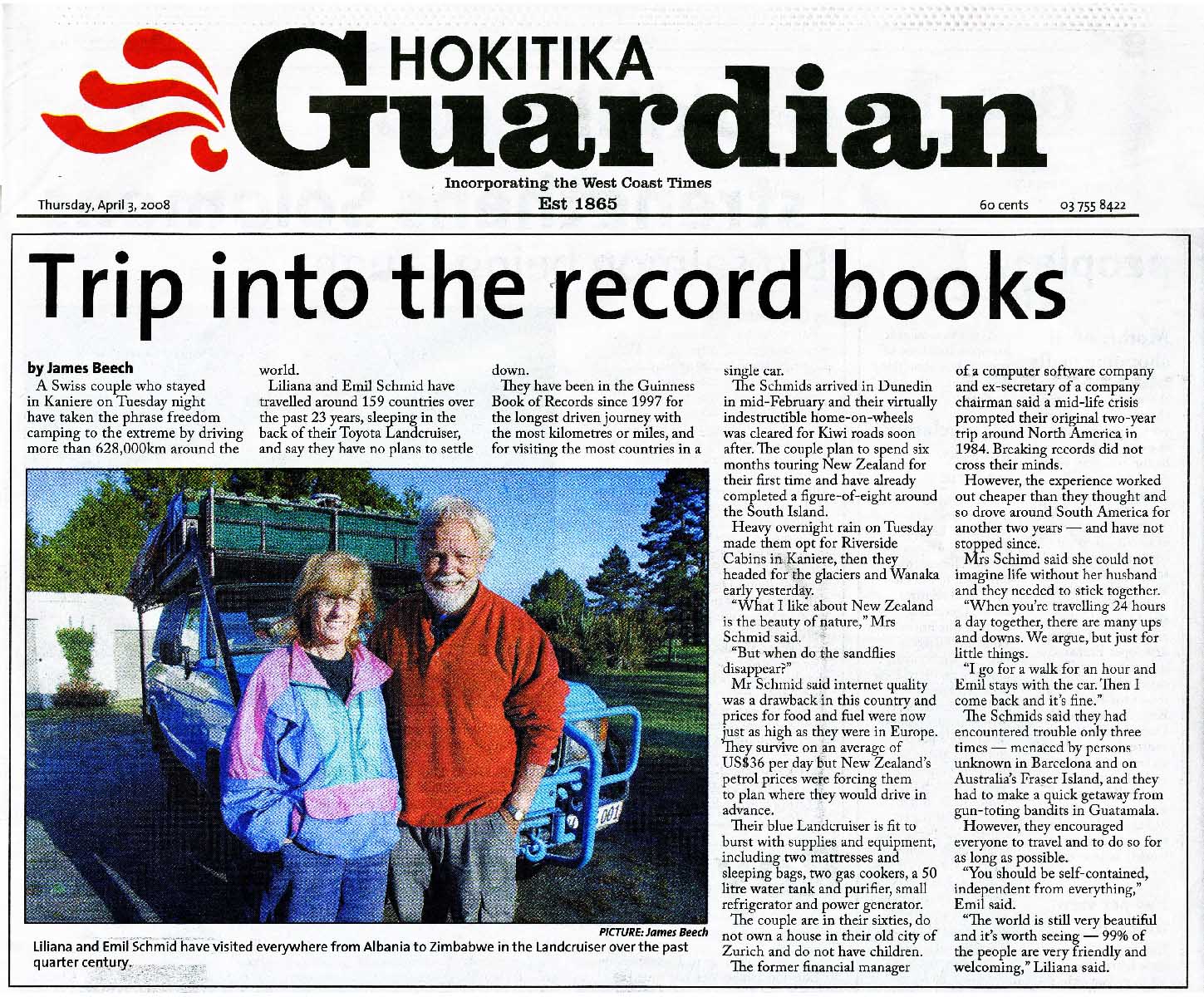
the record books", Hokitika Guardian - April 3, 2008
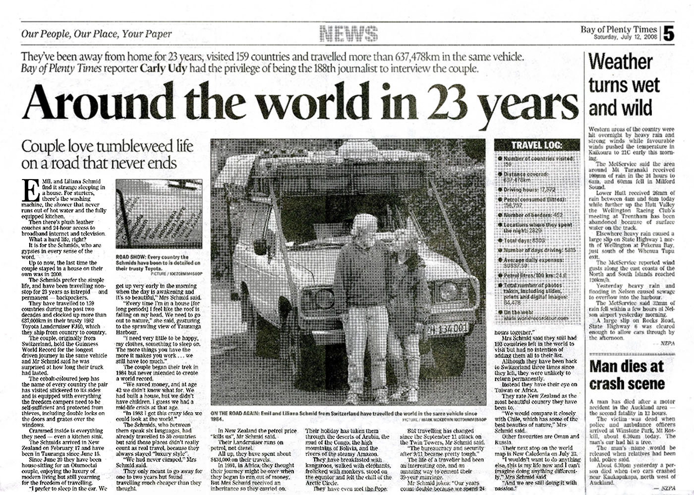
- Article: "Around the world in 23 years", Bay of Plenty Times - July 12,
2008
|


