-
-
- Papua New Guinea Map
|
-
-
- Map of the Pacific
|
|
-
|
- latest picture: September 16, 2010
|
-
-
|
-
-
|
-
-

|
- 61
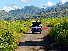
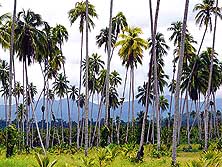
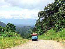
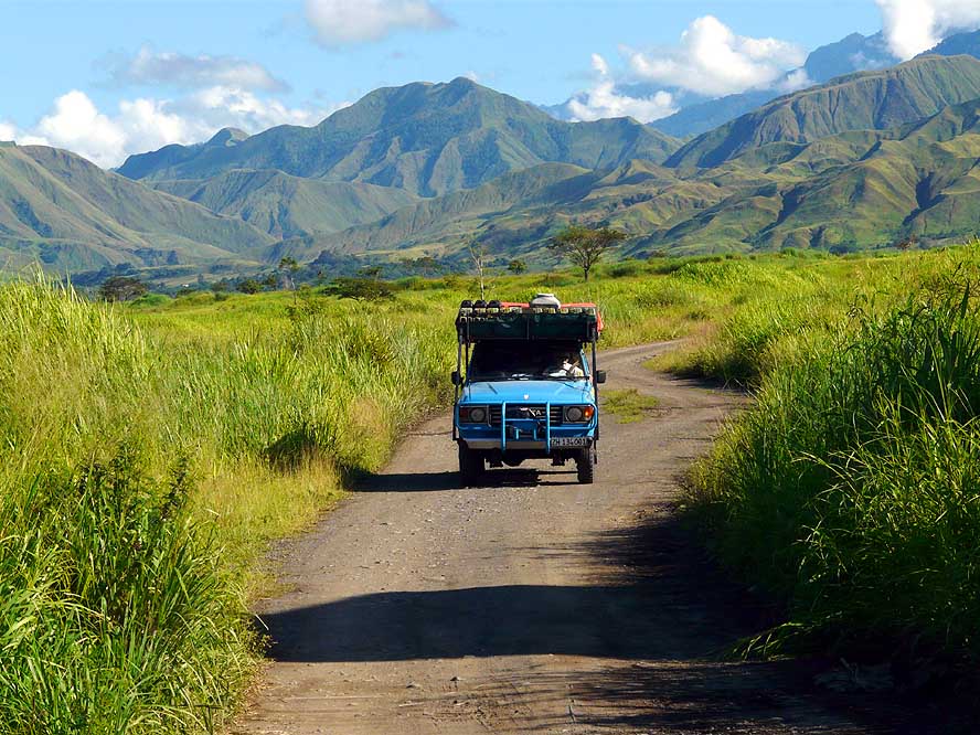
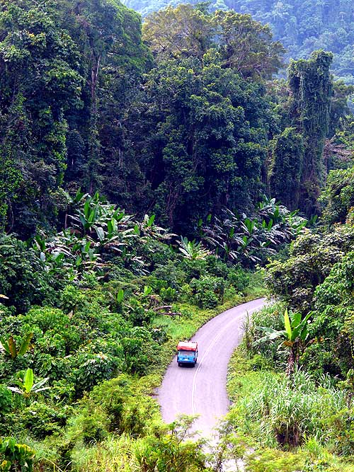
Leaving Lae for Madang, we
- drive through the wide Ramu Valley
- towards the strange mountain scenery
- of the Finisterre Range, caught in
- the soft morning light
|
- 62
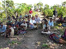
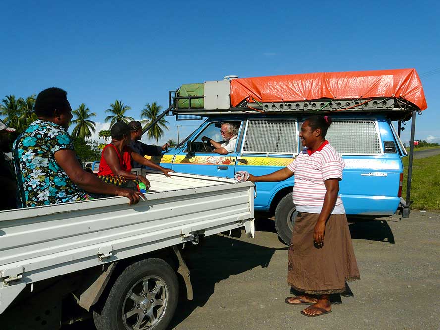
Not a single case: Again and again
- people who read about us in the
- newspaper “The National“
stop along
- the road to shake enthusiastically hands
- and give us a warm welcome
|
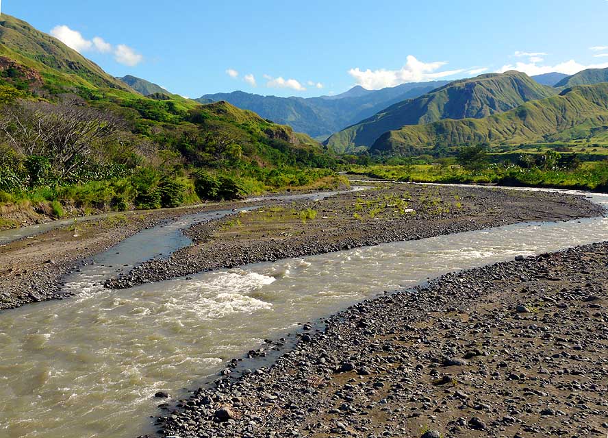
- 63
We cross wide, slow flowing
- rivers – here the Leron River, a feeder
- of the huge Markham River (PNG part 1- picture 51) –
in an open landscape that
- provokes the sensation of freedom.
- Couldn’t it be also in Alaska?
|
-
- The wonderful kindness of PNG’s people is one side, but unfortunately there is also
a less pleasant side: The safety! It is not only a problem in cities like Lae or Port Moresby where everybody is discouraged to walk around. It
concerns also driving overland where assaults on busses, trucks and cars by so called
“raskols” (bandits) are common. We know and knew about this danger! But we also
know that certain risks are part of our adventure. Nevertheless, we are a bit worried
about the 200 miles of uncertainty lying in front of us until we reach Madang. The
firsthand story of a young Polish couple arriving from Madang the day before our departure
doesn’t help either to make us feel more relaxed: They tell us that there was a huge
tree blocking the road at a narrow passage but that their driver managed to go around it
and escape. Did the trunk just collapse or was it logged purposely? How should we behave
in a similar situation?
|
-
-
-
-
|
-
-
|
-
-
-
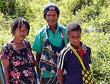
-
|
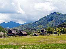
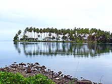
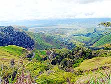
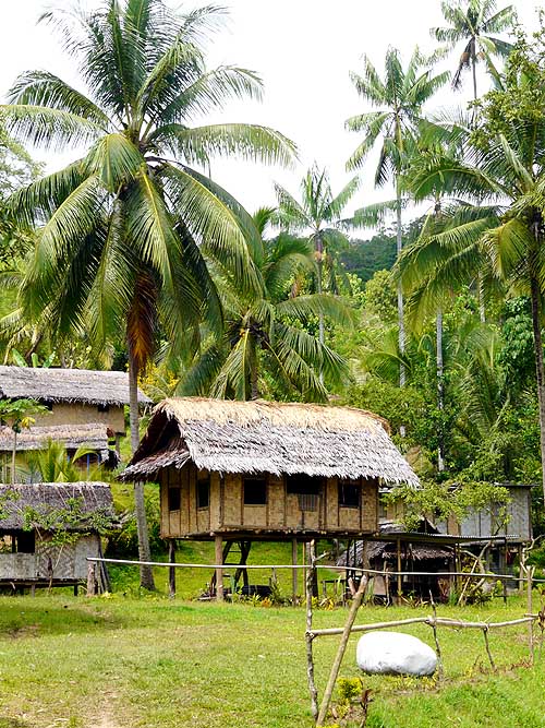
- 64
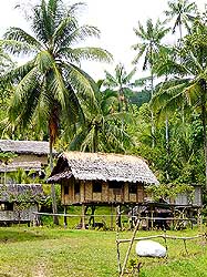
Scattered modest hamlets appear
- now and then in the beautiful mountain
- scenery: In the upper Markham valley
|
- 65
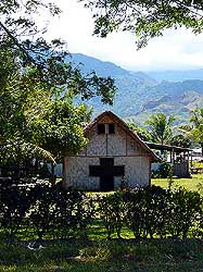
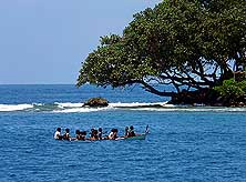
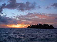
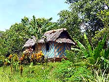
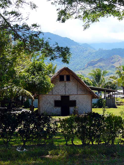
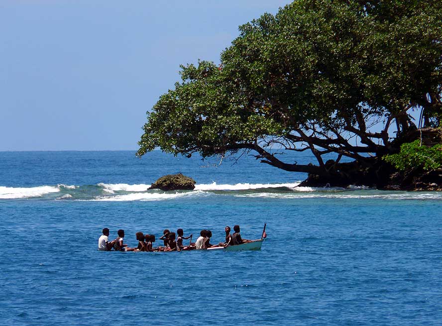
Adapted to the indigenous
- construction style: A modest church
- made of woven pit-pit grass
- (miscanthus floridulus) in a tiny
- village in the Ramu valley along
- the route Lae-Madang …..
|
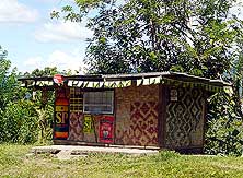
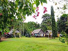
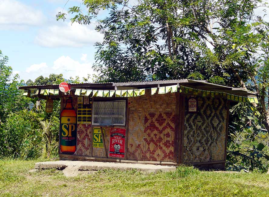
- 66
….. and a bottle shop of the same
- “architecture – a common sight in rural
- areas. This one lies in the province of
- Madang where all have been closed
- down, while in the province of Morobe
- they stay open for 7 days a week,
- because the brewery is in Lae
|
-
- It is Monday morning, August 30th, 2010, 7am – clear skies promise a beautiful day.
We are ready for our next leg. There is just one last phone call we want to make: To the
“Guard Dogs” – one of the many security companies – to ask if they
know of any irregularity along the Ramu Highway. “Should be OK” – is their
appeasing reply. At this early morning hour, Lae is crowded with people walking along the
streets and accumulating at bus stops. Bicycles and motorbikes have not found their way
yet into this “last frontier” country. When we leave the bustling city, the road
becomes lonely – and with it more dangerous, at least the next 25 miles until the
airport, which is a stretch famous for hold-ups. Therefore, we decide to drive with the
grilles on, which is quite normal in PNG. Only when we leave the airport behind us, the
stress drops off little by little, the window screens get removed and seeing the beauty of
the landscape and the bizarre mountain scenery lying in front of us, the joy of traveling
takes over.
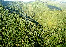
|
-
-
|
-
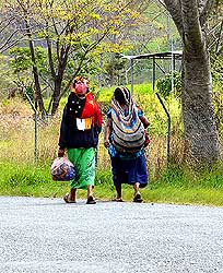
-
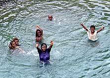
|
-
-
|
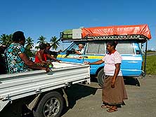
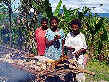
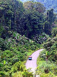
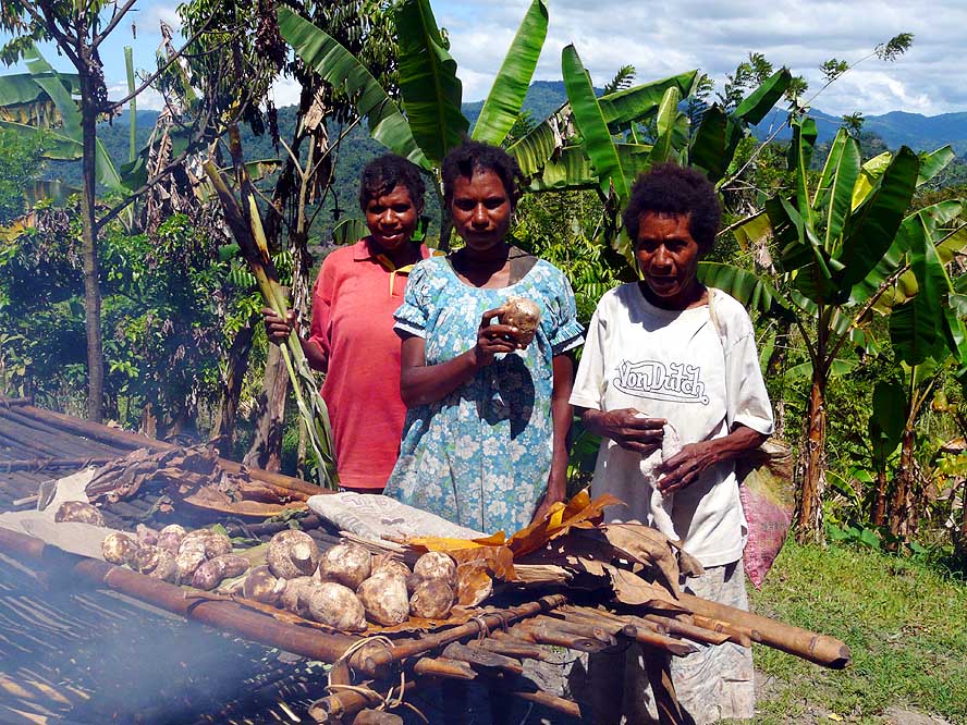
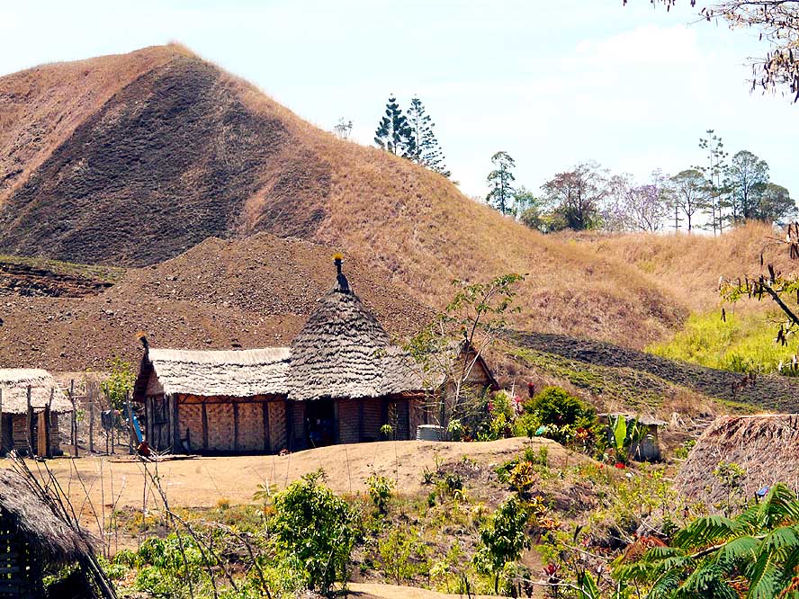
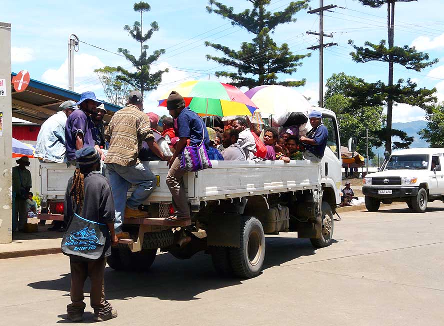
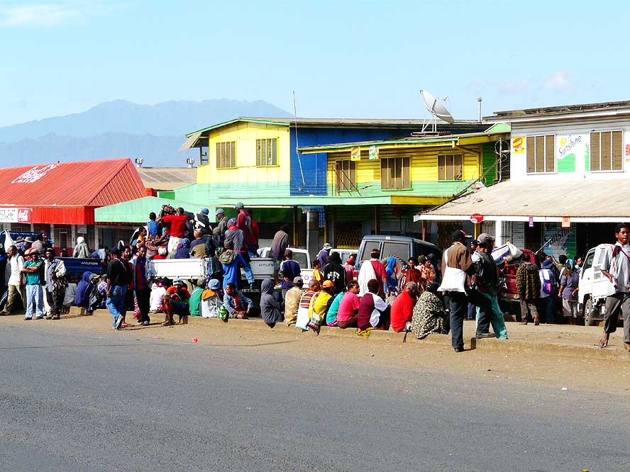
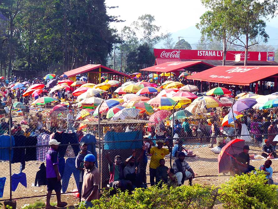
- 67
In a mountain village of the
- Finisterre Range where also the
- busses stop for a short refreshment,
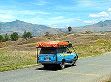
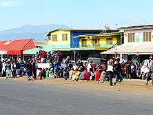
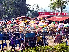
- three girls are selling taro
|
- 68
The carburetor gets too hot and
- produces bubbles – the engine dies and
- gives no sign of live anymore. The police
- stops and tries to help us – unsuccessfully.
- There is talk of towing us to Madang
- when Emil spots the “corpus delicti”:
- A control wire to the starter felt off coincidentally at the same time
|
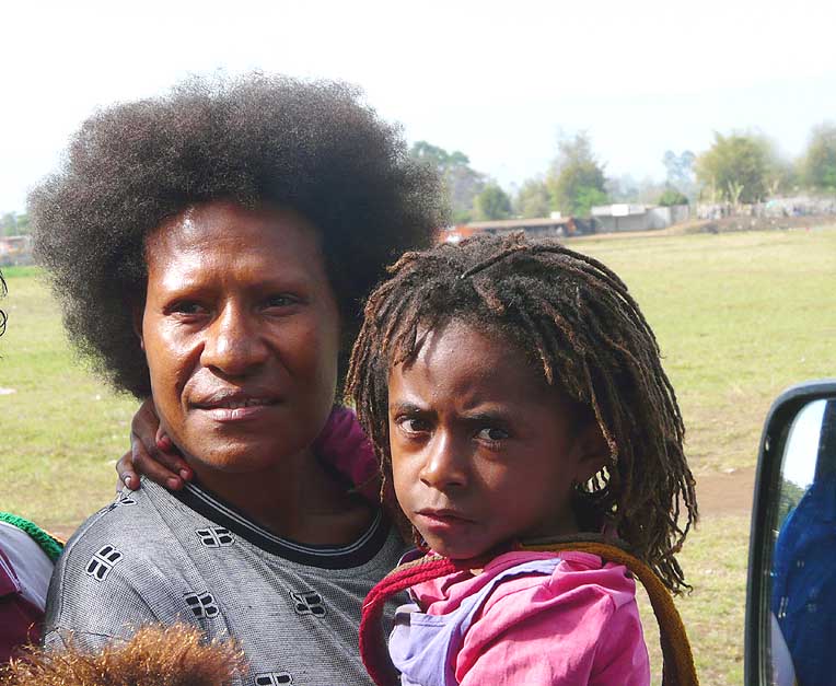
- 69
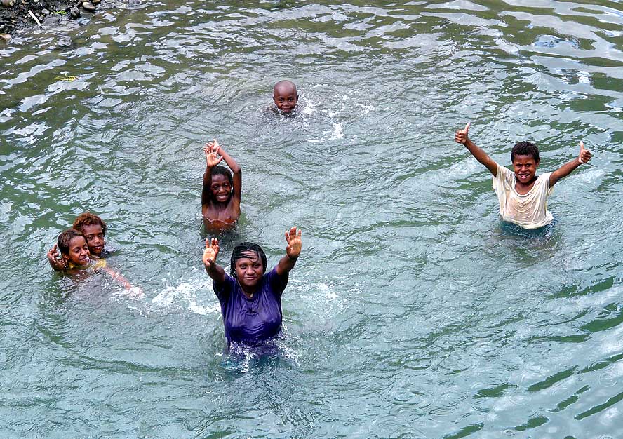
Wherever we stop, curious
- faces surround our LandCruiser
|
-
- Herds of cows - called “Ramu Beef” - graze peacefully in the treeless Ramu
Valley, single dome-shaped trees stick out majestically from the plain, birds of prey
circle above our heads and the hills that frame the valley glow in green, brown and red
colors in the softness of the morning sun. A long missed sense of openness takes over on
the dead straight good tarmac road. Again and again we pass small colorful markets,
clusters of simple thatched huts scattered in the plain. Women carrying heavy
“Bilum” (string bags) walk along the street where there is not a single dwelling
in sight far and wide.
|
-
-
|
-
-
|
-
-
|
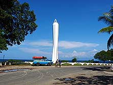
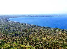
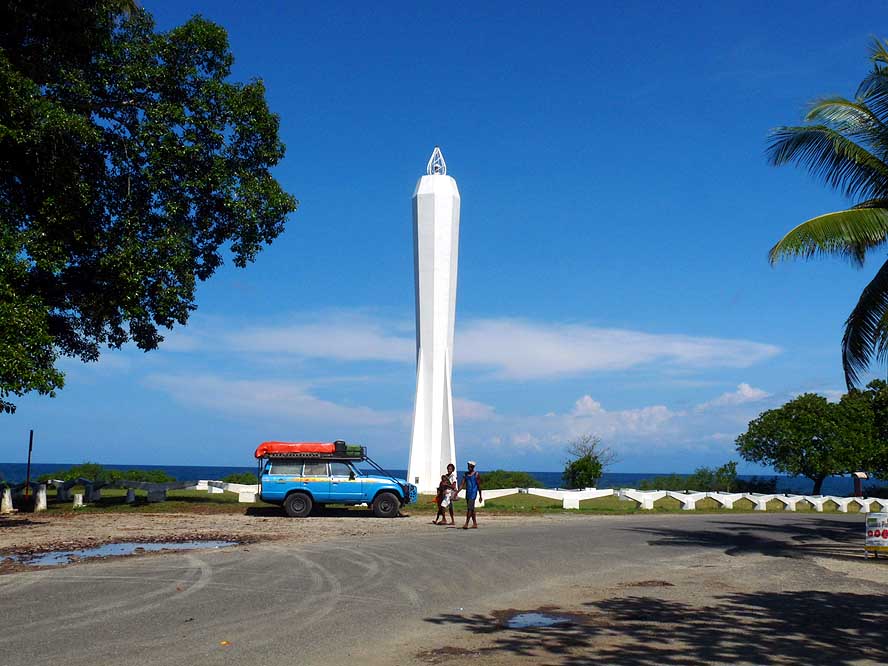
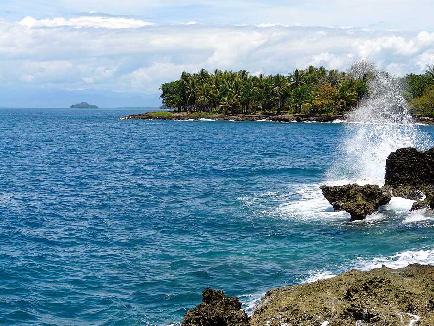
- 70
The 100ft high Coastwatchers‘
- Memorial at Kalibobo Point is
- Madang’s landmark. It is said to be
- visible as far as 15 miles from the sea
|
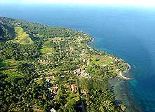
- 71
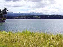
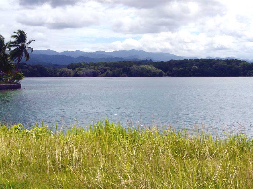
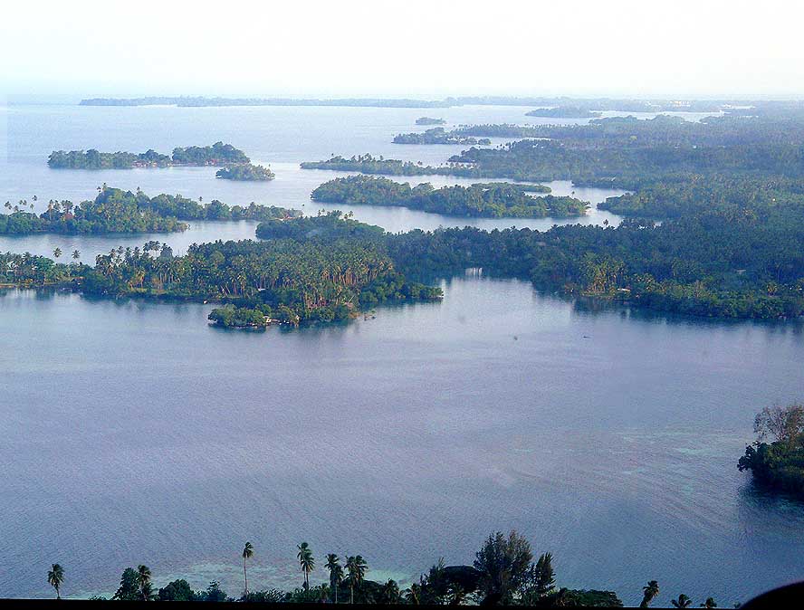
View from the Madang Lodge
- over the coast towards the Bil Bil Island
|
- 72
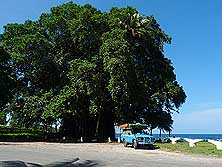
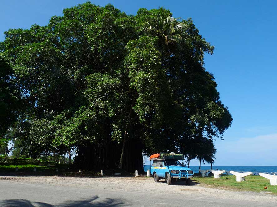
The huge Banyan tree along the
- Coastwatchers’ Avenue provides
- shade in the tropical heat
|
-
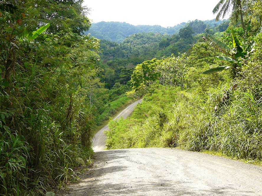
- At some point, we shift from the Province of Morobe to the Province of Madang. It gets
drier. Cacao fields with its yellow-brownish fruits appear, followed by widespread
“Ramu Oil” palm oil plantations and “Ramu Sugar” sugar cane fields,
which are partly harvested and newly planted. We make good progress and manage an average
speed of 30 miles/h until the moment where the road branches off Eastwards and follows the
“Ramu Nickel” wastewater pipeline towards the spectacular jungle that covers the
Finisterre Range, which has to be crossed. From its very beginning the good road changes
into a washed-out narrow gravel road with countless very steep ascents. At some stage, our
heavily loaded LandCruiser manages the steepness only in low gear with the result that
– due to the lack of cooling air – the carburetor overheats and produces air
bubbles. We have only one option: To cool it slowly down with wet rags. When we want to
re-start the engine, it remains silent.
|
-
-
-
-
|
-
-
|
-
-
-
-
|
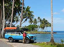
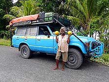
- 73
Emil and our LandCruiser pose for
- a picture at Madang’s Coronation Drive
- that stretches beautifully for some miles
- along the coast. Lined with wind curved
- palm trees, it deserves its noble name
|
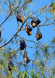
- 74
Madang is also known as
- “bat’s city”. They populate the
- towering casuarinas trees
- around the city. Apparently
- 7’000 are living here
|
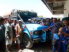
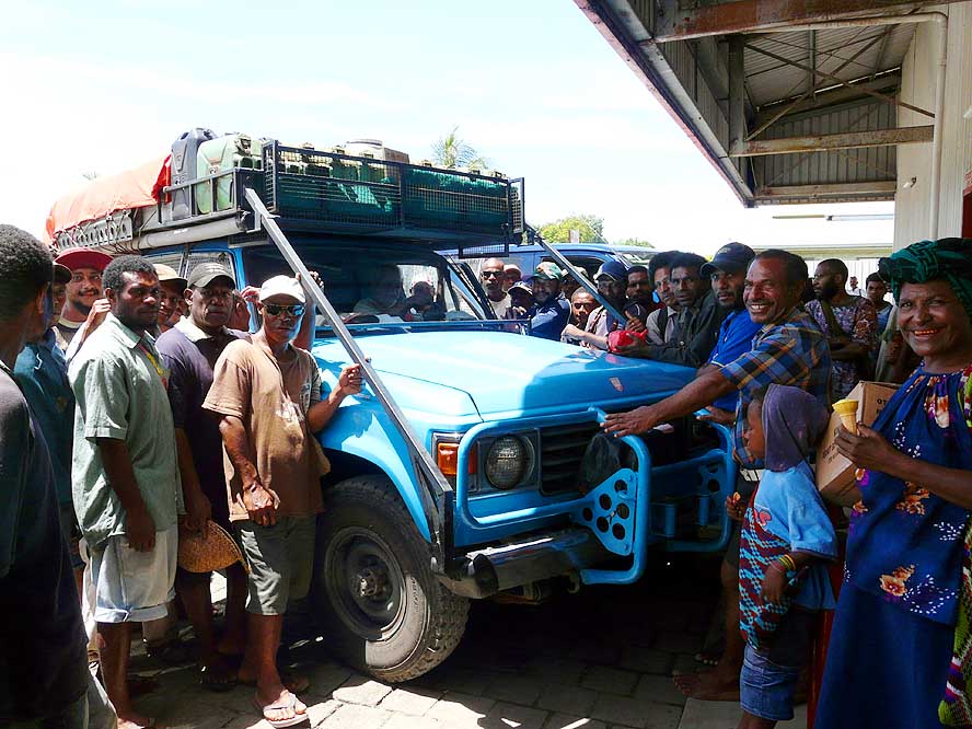
- 75
Our LandCruiser is the star in
- front of the supermarket in Madang.
- People’s interest on our epic
- journey is overwhelming
|
-
- At this very moment a police vehicle from the opposite direction arrives and stops.
That’s the last thing we need! Three men jump out of the car and walk straight away
towards us. “What is the problem” we are asked. After we explain that the
starter doesn’t work anymore, they simultaneously put their heads into the hood and
debate for a while what to do. However, none of them finds a solution. Finally they decide
that we have to be towed to Madang. “We don’t want to leave you behind with a
breakdown in this infamous region” is their unanimous comment. They already stop the
next truck. Emil with his head still deeply under the hood yells at the same time
excitedly: “I possibly got it!” He discovered a small loose cable. “Let
this be the cause”, I pray. And, thanks heaven, it is! Re-connected, the “sound
of music” of our engine fills our ears again! The police share our joy. They
didn’t ask for the papers that we don’t have! Their only concern was to help us.
|
-
-
|
-
-
|
-
-
|
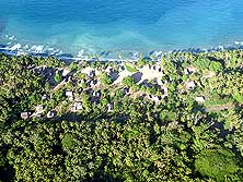
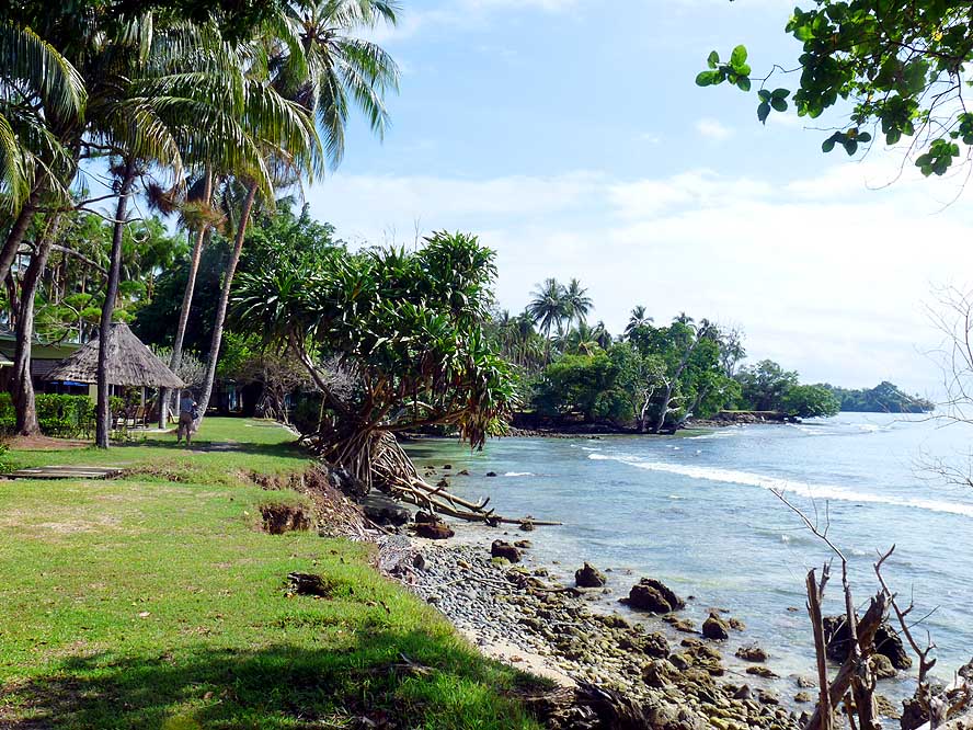
- 76
At the “Jais Aben
Resort”, situated
- 12 miles to the North of Madang, we find
- a touch of South Pacific charm …..
|
- 77
..... watching a heavily
- overloaded canoe heading to
- the small offshore island …..
|
- 78
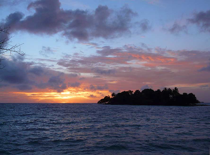
..... and the sun rising beautifully
- behind the tiny island
|
-
- The following few remaining dusty ascents turn out to be an easy task for our car, and
the only river that needs to be crossed before we reach the tarmac road doesn’t cause
problems either, due to the low water level. Then we finally find ourselves rolling
relaxed and happy through the coastal plain towards Madang. For the 210 miles from Lae to
Madang that a minibus usually covers in 6 hours, we needed 8� hours net driving time. We
stay also here at the Lutheran Guesthouse like in Lae and eat the untouched sandwiches
that we prepared in the morning because we were too busy with driving to be hungry. Then
we shower the dust from our bodies and at 8pm we already turn off the lights. Nervous
tension, heat and dust took their toll!
|
-
-
-
-
|
-
-
|
-
-
-
-
|
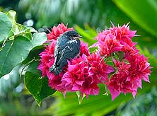
- 79
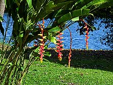
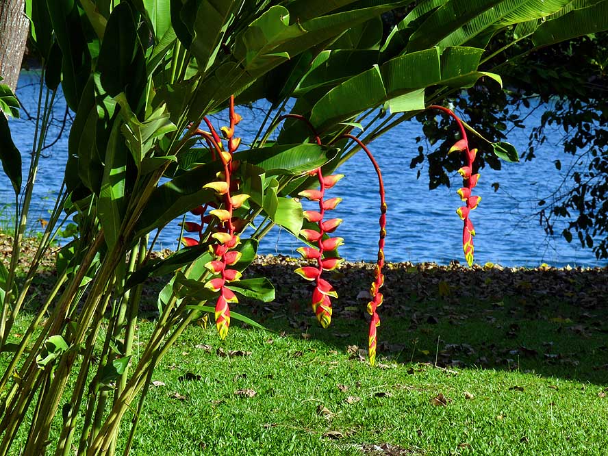
In the well kept garden of the
- “Jais Aben Resort” tropical flowers
- grow in abundance, also the Heliconia,
- one of our favorite flowers …..
|
- 80
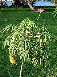
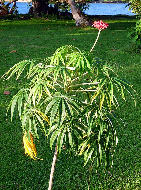
….. and another flower
- where its beauty lies in its simplicity
|
- 81
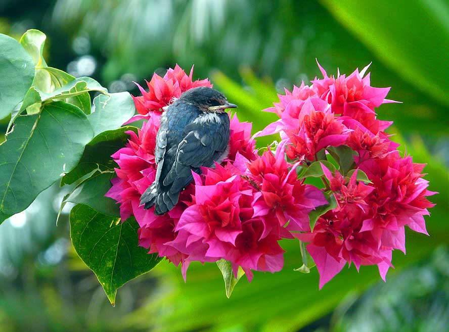
A young swallow is recovering
- from its first (?) flight attempt on
- shiny red blossoms
|
-
- Madang, the city of the flying foxes, how it is also called, lives up to its name
already the first morning. Shortly after 6am, huge swarms darken the sky. The birds arrive
from every direction towards their roosting place. Much to our joy, some choose the tall
casuarinas right besides our guesthouse, and immediately, the tree is full of those
hanging and chattering fellows. It is said that there are around 7’000 populating
this city.
|
-
-
|
-
-
|
-
-
|
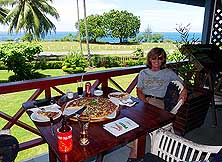
- 82
A good reason for a smile: Liliana is
- looking forward to enjoy the Jumbo Pizza
- at the Coastwatchers’ Hotel in Madang
|
- 83
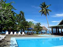
The swimming pool of the “Jais
- Aben Resort”, overlooking the lagoon
- and the small offshore islands …..
|
- 84
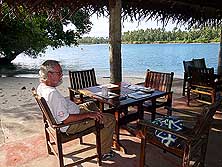
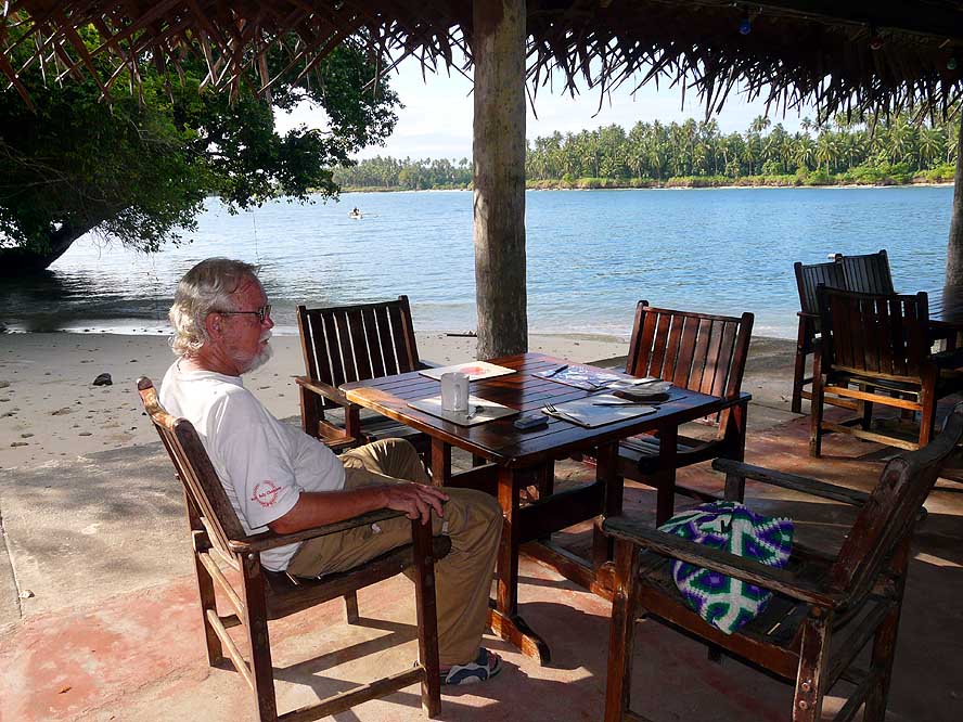
….. Emil is sitting at the restaurant, where
- we take breakfast, lunch and a ‘sundowner’,
- enjoying each time the atmosphere of the Pacific
|
-
- According to Lonely Planet, Madang has the reputation to be called “the prettiest
town in the Pacific” and the place in PNG where it
is safe to walk around, what was not the case in our previous three city-destinations of Port Moresby, Mount Hagen and Lae. Is it not weird that our
feelings are – as it often happens – exactly the contrary? The badly potholed
streets in downtown and the little appealing buildings do not live up to this reputation.
Neither does the fact that we have to be alert all the time of pickpockets who work in
groups and chose us as target. Nor does the first-hand story from a German sailor who
anchored near the Madang (Boat) Club since a couple of days and was robbed last night.
“Madang is not anymore what it was two years ago”, confirm quite a few locals
with whom we talk about it.
|
-
-
|
-
-
|
-
-
|
- 85
A peaceful small rural village in
- a clearance along the road to Bogia
|
- 86
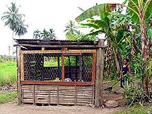
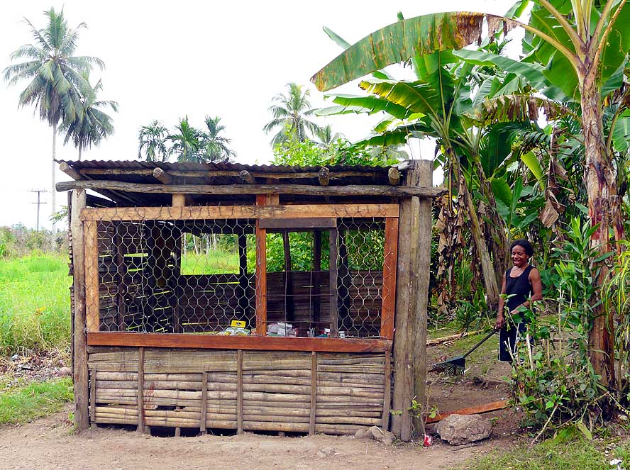
Even the tiniest ‘shop’ is protected
- with grills. Here on the access road
- to the “Jais Aben Resort”
|
- 87
A woman carries the ripe Papayas to
- our car, which we bought from her roadside
- stall for 2 Kina each (=US$0.80)
|
-
- But the tourist oases do exist within the city and the contrast could hardly be starker,
be it the Madang Resort, the Madang Lodge or the Madang Club where we love to shuttle back
and forth for a seaside lunch – be it an Asian or Western meal. If we need to access
the internet, we drive to the Coastwatcher’s Hotel at Kalibobo-Point, where we are
attracted especially by their mouthwatering jumbo pizza. Opposite sits the 90ft. high
Coastwatcher’s Memorial – Madang s landmark – which is said to be visible
as far as 15 miles offshore. What we however like the most is the Coronation Drive that
runs along the coast for about two miles. With its wind bent palm trees, it lives up to
its name.
|
-
-
|
-
-
|
-
-
|
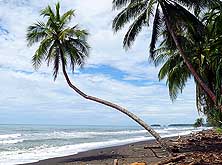
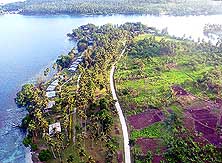
- 88
A long drawn-out black sand beach
- at the “Malolo Plantation Lodge”, about
- 26 miles North of Madang along
- the road to Bogia
|
- 89
Palm tree coves, which often are
- used to produce copra, are in abundance
- along the road to Bogia – together with
- the mountain backdrop a scenic sight
|
- 90
A lagoon at Alexishafen, a
- place that was badly
- damaged during WWII …..
|
-
- After six days we continue towards Bogia – a seaside village lying 125 miles
Northwest of Madang, where the road ends shortly afterwards at the Ramu River. But we do
not make it so far. After 9 miles the sign “Jais Aben Resort” arouses our
interest. We branch off the main road and struggle for more than a mile through a badly
potholed earth track and think already of turning round and going back when we spot
another very promising sign: “This way to paradise”. Who can withstand the
temptation? We end up at a lovely bungalow resort with a touch of South Pacific flair and decide to stay for a few days:
Bogia doesn’t run away! No doubt our guardian angels were once more involved when we
took that decision: Exactly the night we would have spent in Bogia, the village was
ravaged by a gale-force storm, causing two deaths and 19 destroyed homes, among them also
our booked guesthouse!
|
-
-
-
-
|
-
-
|
-
-
-
-
|
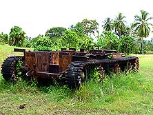
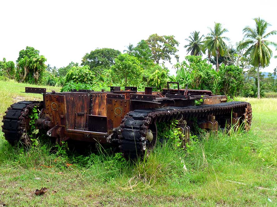
- 91
….. a rusting reminder
- of WWII at Alexishafen
|
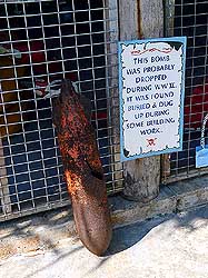
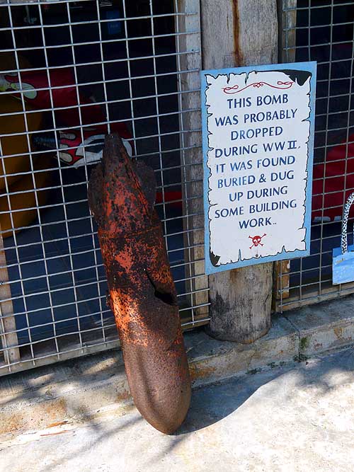
- 92
..... a bomb that was found during
- the construction of the “Jais Aben Resort”
|
- 93
Peaceful scenery at the
- Alexishafen Catholic Mission
|
-
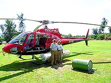
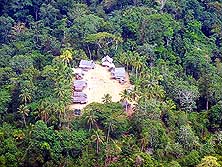
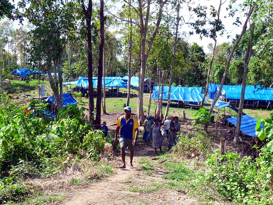
- That we still get to see Bogia, though from the air, is another story: At the “Jais
Aben Resort” we meet the captain of a US Army Team (Joint POW/MIA Accounting Command)
that currently is searching for bones and sculls of missing people around the place of an
American airplane wreck from World War II near Bogia. Their tent camp is in a bush
clearing and once a week, a helicopter stationed at “Jais Aben Resort” is flying
there with food supplies and other necessities. And we lucky people are invited to join
one of those flights, one way taking 50 minutes. What a unique experience looking down to
the rugged deeply forested mountains below us and the tiny bush settlements in the middle
of nowhere. How do this people live, how do they survive? All too fast the blue canvas of
the camp and the marked position of the airplane wreck come into view. We reach our
destination and land near the camp.
|
-
-
|
-
-
|
-
-
|
- 94
At “Jais Aben Resort” we are invited
- by the US Army to join a supply
flight by
- helicopter to a camp Northwest of Bogia,
- where a team is searching for bones of
- missing people at an American plane
- wreck of World War II …..
|
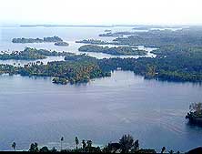
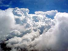
- 95
..... from the air we enjoy the
- stunning view of the tiny offshore
- islands near Jais Aben …..
|
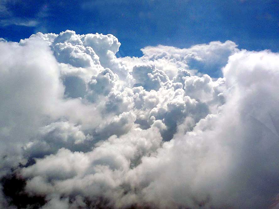
- 96
..... and fly towards white
- clouds that are piling up
|
-
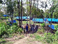
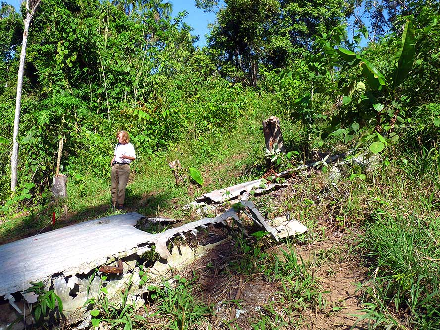
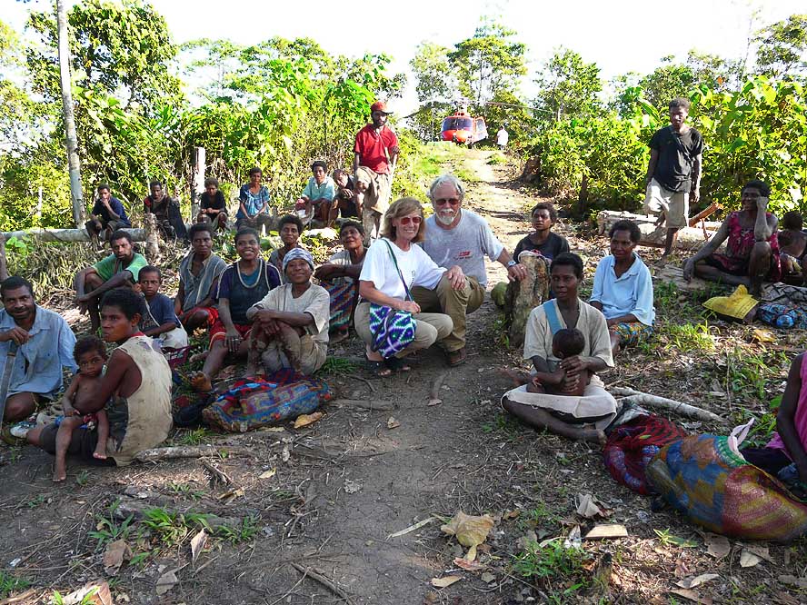
- Mothers sitting around with partly naked children are greeting us a bit shyly. They are
from a village about an hour’s walk away. After the supplies are unloaded, we are
allowed to visit the wreck of the bomber and the “soil washing device” where
indeed the “bonemen” found sculls from the crew of the crashed plane – tiny
pieces we would not even recognize as such. They are recovered with the help of the
villagers in a hard, time-consuming work by washing the soil through a grid with pumped-up
river water (like gold panning). The bush mission of the 15-head team lasts 30 days. Then
they will return to Hawaii, their current army base. After an hour, always followed by the
eyes of the locals, we take off again and the friendly pilot of the US Air Force flies
some extra circles for us: Over the small settlement of Bogia with the background of the
stunning, perfectly formed volcano of the nearby island of Manam, to the palm fringed
coast and the many offshore islands – a wonderful experience!
|
-
-
|
-
-
|
-
-
|
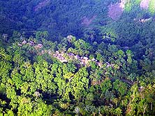
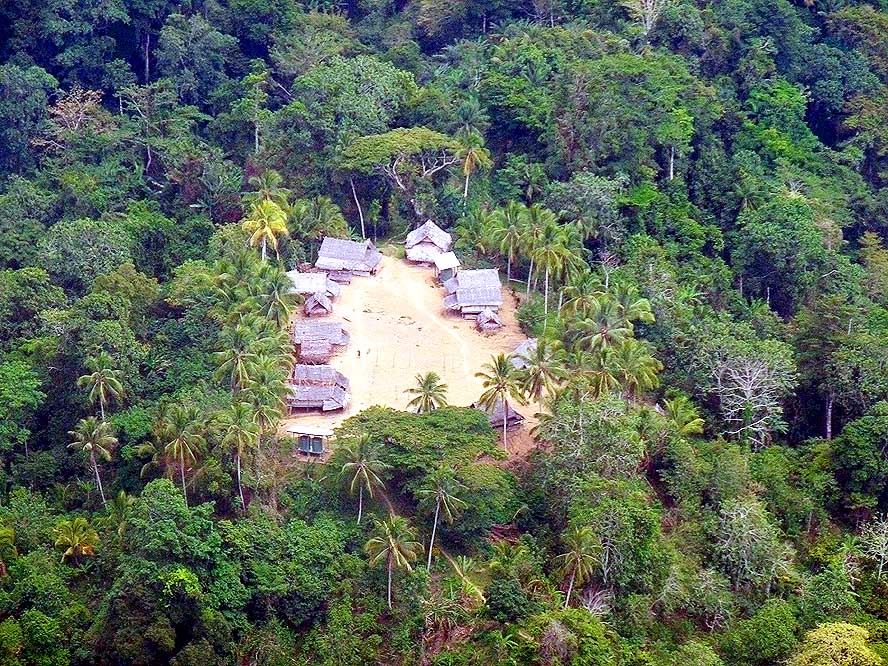
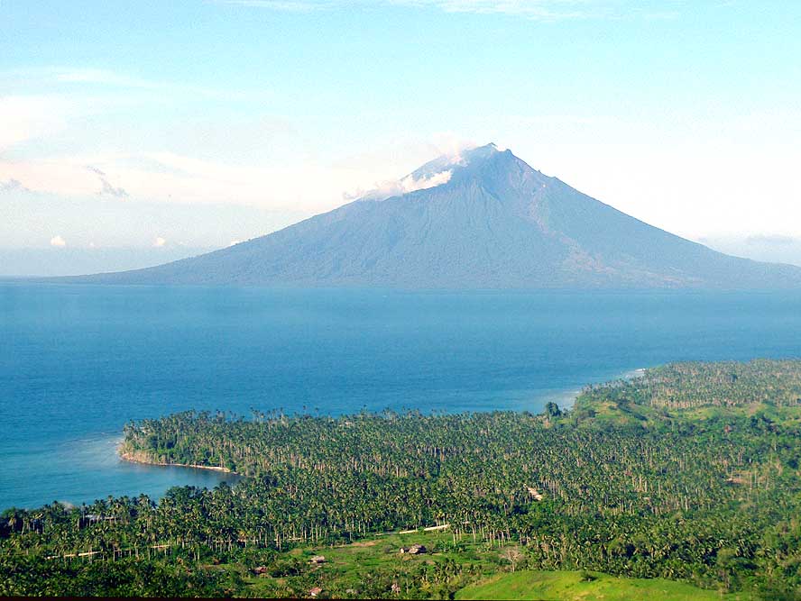
- 97
A cluster of huts in a forest
- clearing situated in the “nowhere”.
- How do the people survive? .....
|
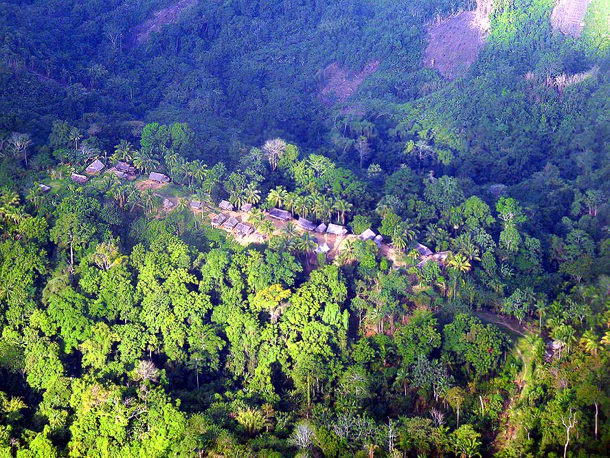
- 98
..... another settlement
- surrounded by nothing
- else than dense jungle …..
|
- 99
..... the tent camp of the
- “bone men“ near Bogia
|
-
- “Riots close down Goroka town!“ and “The Lae Chamber of Commerce and
Industry has advised its members to exercise extreme caution when traveling along the
highway” are the headlines in the “Post-Courier” of Friday, September 10th,
2010 – exactly three days before our planned departure to Goroka. At the same time
there are reports of fierce fighting between two warring tribes that caused the temporary
closure of the highway. What now? We decide to return to Madang on the following Sunday
and investigate once more on Monday about the current security situation.
|
-
-

|
-
-
|
-
-
|
- 100
The remains of a wing at the
- crash site of an American airplane
- in World War II near Bogia …..
|
- 101
.…. Liliana stands in front of the
- „soil washing installation“ in Bogia: It’s
- hard work to recover remains of bones
- in the soil by washing it with pumped-up
- river water – analog gold panning …..
|
- 102
….. a picture of remembrance
- with some villagers at the camp. They
- live about an hour walking distance
- away and assist the “bone team”.
- In the back is “our” chopper
|
-
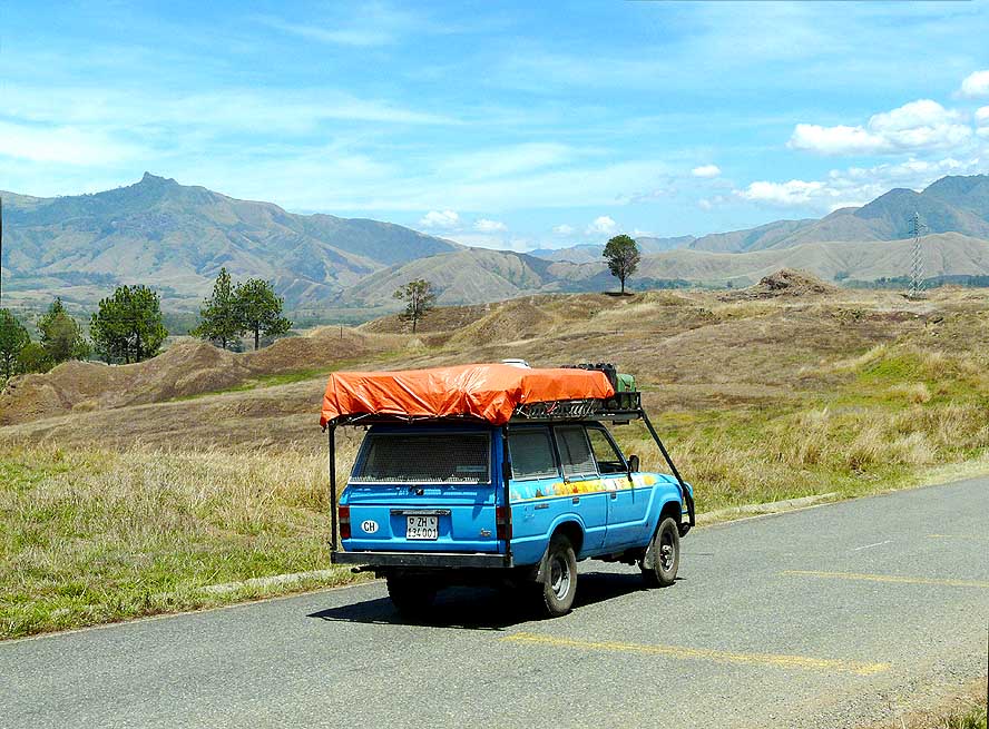
- The information is not bad. Therefore we start early morning to our second crossing of
the Finisterre Range and its following Markham Valley, this time in opposite direction. In
Watarais we branch off and the climb to the Eastern Highlands begins. Immediately the road
starts to twist and turn to the Kassam Pass at an altitude of 5’250ft., revealing
beautiful views back to the Markham Valley. Continuing through the rolling hills thatched
round huts appear, recalling Africa. Everywhere vegetables
grow, even on the steepest slopes.
|
-
-
|
-
-
|
-
-

|
- 103
On the return flight, the captain
- makes some loops. Below us lies the palm
- fringed Hansa Bay near Bogia …..
|
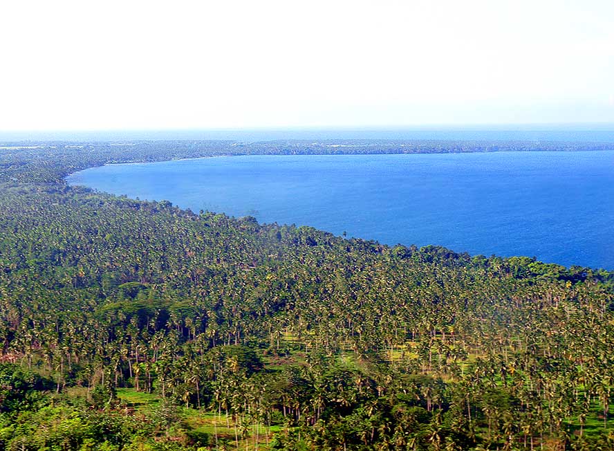
- 104
..... and.the small coastal
- village of Bogia, situated
- 115 miles Northwest of Madang
|
- 105
..... in the East rises the 5’928ft.
- high and beautifully formed volcano of
- „Manam Island“, which erupted last time
- in 2004 and displaced 6’000 people
|
-
- We are about 130 miles from Madang when drivers coming from the other direction make
“funny” hand gestures. Alarmed, we stop one of the vehicles to get some
information. “There is looting going on in the next town of Kainantu”, we are
warned and advised to inquire about the situation at the next police station in Yonki,
about 16 miles before Kainantu. When we arrive there the officer tells us that they just
received the all-clear message. With us is also a convoy of about 20 fuel tankers that had
parked along the road. It just starts moving again. Also a convoy with heavy construction
machinery gets on its way. This reassures us in some way. Nonetheless we are not very
comfortable when we see the scary crowd of people hanging around, when we reach Kainantu.
|
-
-
|
-
-
|
-
-
|
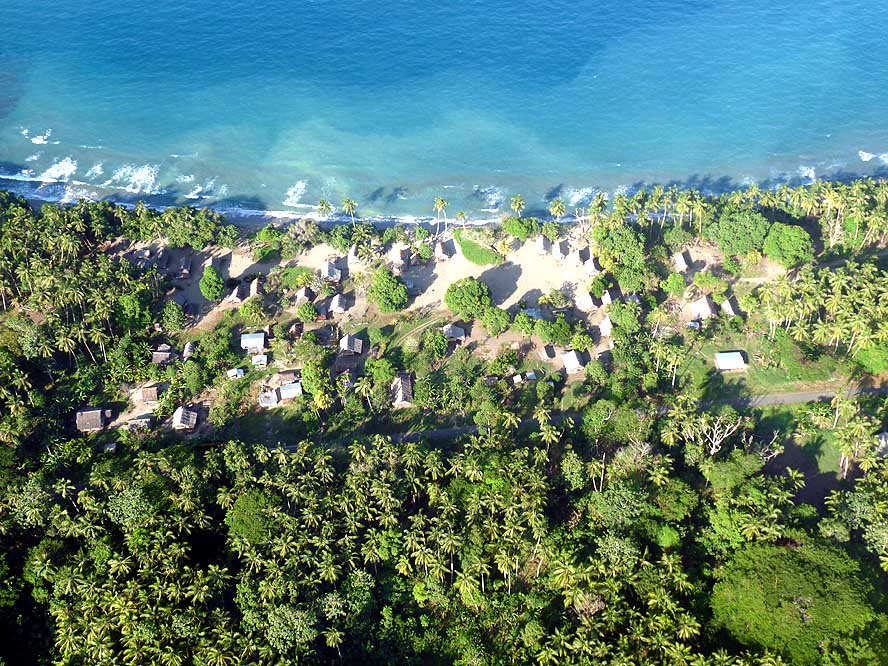
- 106
A small settlement along the
- Northwestern coast, nestling
- between palm groves
|
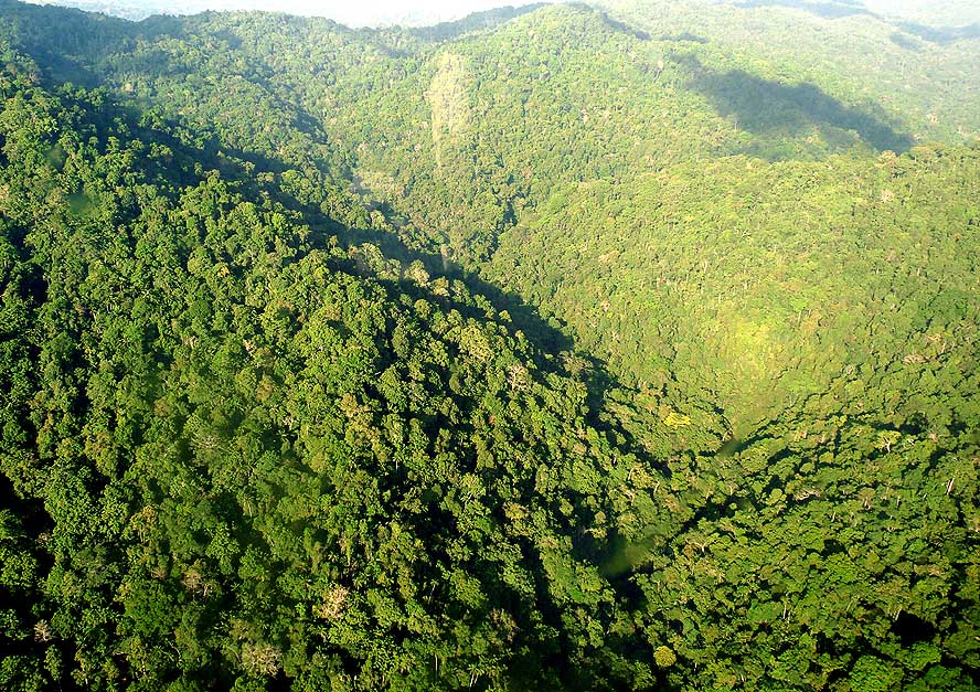
- 107
Large parts of the highland
- region are still covered
- with impenetrable forest
|
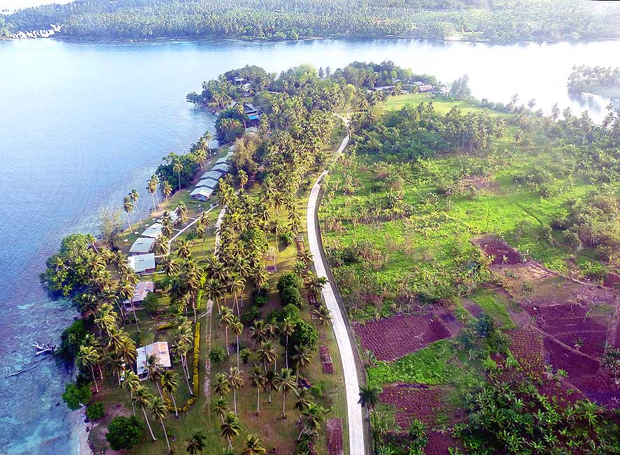
- 108
Birdseye-view of the “Jais Aben
- Resort” before landing. In one of the
- bungalows, we spent a relaxing week
|
-
- Luckily, in the middle of the town, the road branches off to Ukarumpa, the 5 miles away
“Little America”, as the PNG headquarters of the
American founded “Summer Institute of Linguistics” (SIL) is also called. There
we booked two nights in their guesthouse, because the more than 200 miles long journey
from Madang to Goroka is definitely too long for us to be driven the same day. Ukarumpa is
a fenced-in Western-style village of a mission organization that set itself the goal to
translate the bible in as many languages of the world as possible. Worldwide there are
6’912, and PNG alone has 820.
|
-
-
|
-
-
-
-
|
-
-
-
-
|
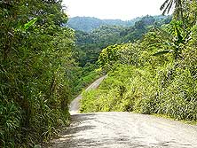
- 109
‘Hitting the road’ again from
- Madang to Goroka: Our Land-
- Cruiser climbs towards the tropical
- Finisterre Range – here still paved …..
|
- 110
..... and constantly up and
- down hill on a rough road through
- lush vegetation …..
|
- 111
..... towards the flat and wide
- Ramu Valley with a good tarmac road
|
-
- The missionaries, mostly a man-wife team, are flown to remote bush villages by
helicopter or plane for three months in a row (the first time with an allowed weight limit
of 725 pounds per person, including the own body weight!) – where, with
interruptions, they learn the people’s language during the period of 15 to 20 years.
In the course of this, they develop an alphabet and translate then the bible into a
language not written before. Enjoying a strawberry (!)-pineapple fruit salad and a home
baked banana cake at the home of the Swiss family Irene and Roland, we learn more about
their pioneer life in the remotest bush. Looking at their pictures, we can nothing but
admire them!
|
-
-
-
-
|
-
-
|
-
-
-
-
|
- 112
Where the Ramu Valley meets
- the Markham Valley near Watarais,
- the road to Goroka climbs steeply in
- switchbacks towards the Kassam Pass
- (3’480ft.) and the Eastern Highlands
|
- 113
Two highlander ladies
- walking along the road with
- their traditional “Bilum” –
- strong and expandable string
- bags – full of merchandise
|
- 114
Even from the water,
- we are greeted enthusiastically
|
-
- After two nights, we continue towards Goroka. Just outside Ukarumpa, we see a parked
police car. Spontaneously we approach it and investigate about the security situation for
the coming 55 miles to Goroka. What we hear is not really motivating. The tension for the
next 25 miles from Kainantu to Henganofi is still very high after there has been more
looting in Henganofi last night, we are told. “Do you want us to escort you?”
the police ask. “Is it that bad?” Emil wants to know. When they relativize it we
decide to continue on our own. It gets very quiet in our car, none of us feels like
talking. Our senses are always on the alert. Who knows what is expecting us around the
next corner.
|
-
-
-
-
|
-
-
|
-
-
-
-
|
- 115
|
- 116
|
- 117
|
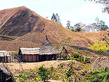
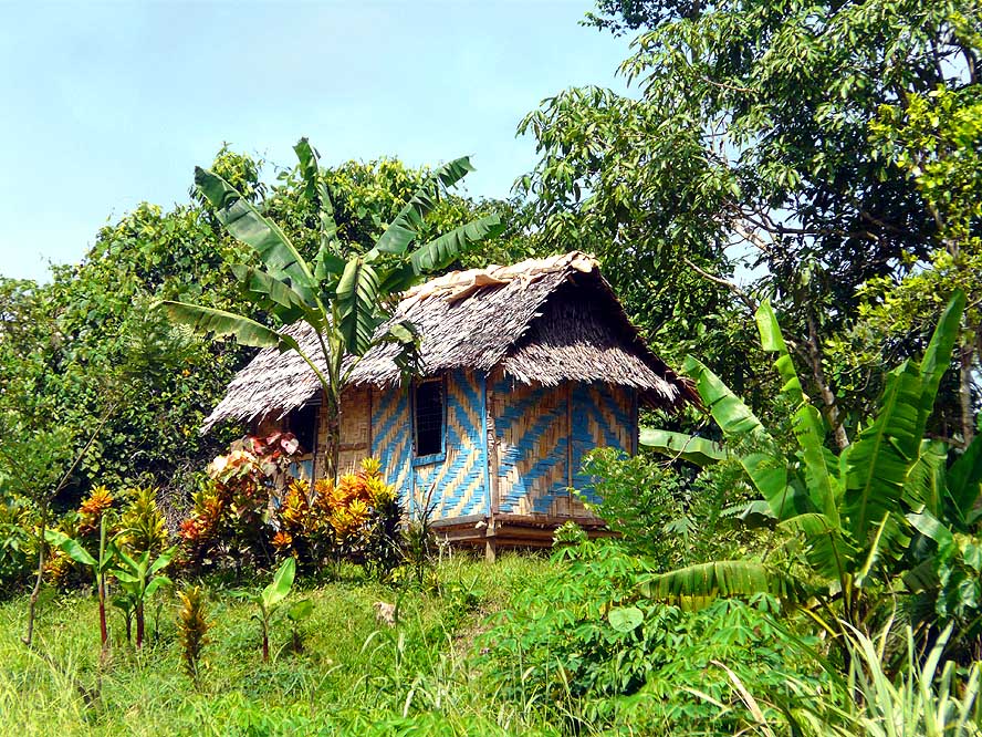
- Homes made of bush material have different sights, but all fit well into their
surroundings
|
-
- We are driving through a heavily populated region – through the notorious Kompri
Valley. Along the road there is one thatched hut after the other and the street is crowded
with people. Some wave friendly, others glare at us close-lipped or shout something after
us. Our first feeling is that here in the highlands people are less friendly than in the
lowlands (later on it shows that it is just the case in the trouble section of the Kompri
Valley). With the exception of a few broken-up spots, the tarmac road is good –
luckily. Thus we do not have to drive at snail’s pace through this conflict area.
This probably safes us when, driving downhill, a group of youngsters, equipped with
machetes and sticks, comes along in the middle of the street and wants to force us to
stop. Too bad, here we are fast enough! Emil pushes the gas pedal, honks and they disperse
in all directions.
|
-
-
|
-
-
|
-
-

|
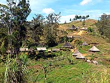
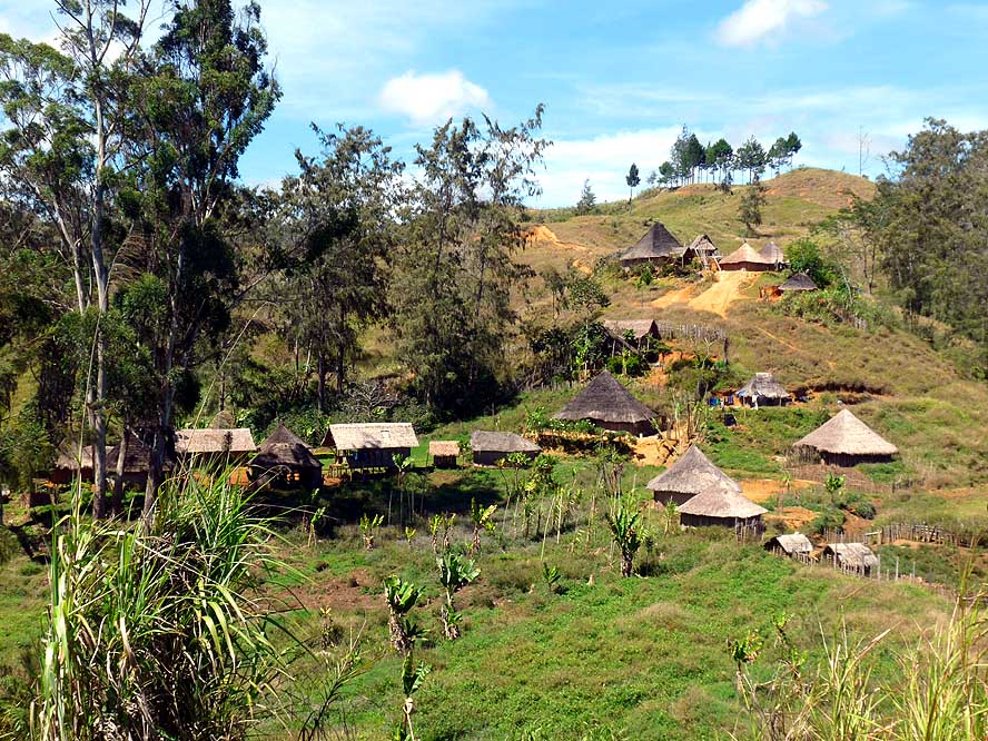
- 118
A village of simple thatched huts
- nestles along a hill between Henganofi
- and Goroka in the Eastern Highlands
|
- 119
The landscape gets drier and the hills
- are bare, as we drive towards Goroka, the
- capital of the ‘Eastern Highlands’ province
- (>20’000 people, 5’250ft. altitude)
|
- 120
Mother and child have a look
- through the window into our car
|
-
- Our tension is still high when we reach the troubled village of Henganofi. But
surprisingly the situation seems now to be under control. “How safe is the
continuation to Goroka?” we wonder. At the next one-lane bridge we ask a driver
coming from the opposite direction. “If you made it up here, you are now safe!”
he replies with a bright smile and we smile back at these good news. We have still 30
miles to go until Goroka, which is situated at an altitude of 5’250ft. and is the
main city of the Eastern Highlands. And this stretch is now really craving for water:
Yellow grass, dead pine trees – a barren landscape that inspires us little. When mid
afternoon we arrive unharmed at our destination and check into the Lutheran Guesthouse, it
takes a load off our mind. Immediately we feel comfortable in our room with own bathroom
for K150 a night (= US$56), including breakfast. Slowly we begin to relax and the thrill
of anticipation of the forthcoming Goroka Show takes over.
|
-
-

|
-
-
|
-
-
|
- 121
Trucks are a common mean
- of public transport (PMV) and
- always packed to the brim
|
- 122
A shopping street in Goroka.
- Everywhere is a crowd of people. They
- come from their villages and spend
- mostly the whole day in the city while
- shopping and “people watching”
|
- 123
The open air market under
- colorful umbrellas in Goroka.
- These markets are always
- packed with people
|
-
- More websites from Papua New Guinea:
-
-
|
- Articles in newspapers about us in Papua New Guinea:
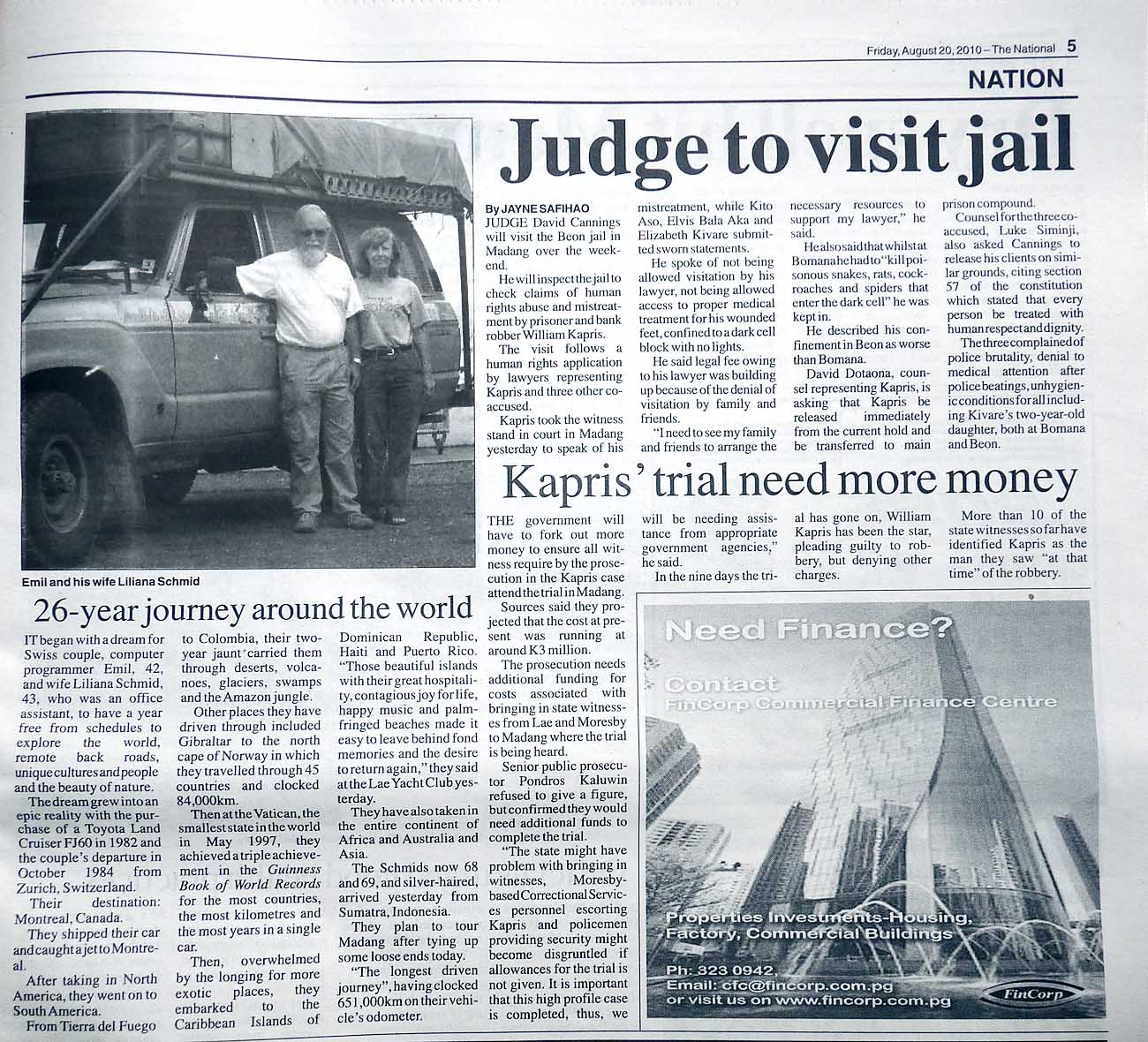
- Article: "26-year journey
around the world", Daily Newspaper "The National"
- August 20, 2010
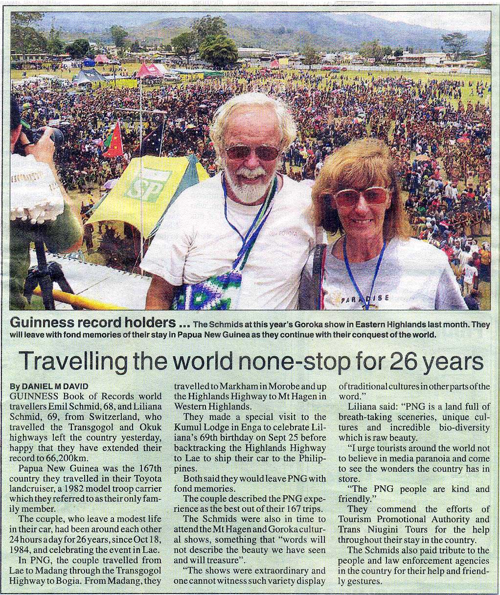
- Article: "Travelling
the world none-stop for 26 years", Daily Newspaper "The
National" - October 21, 2010
|


