-
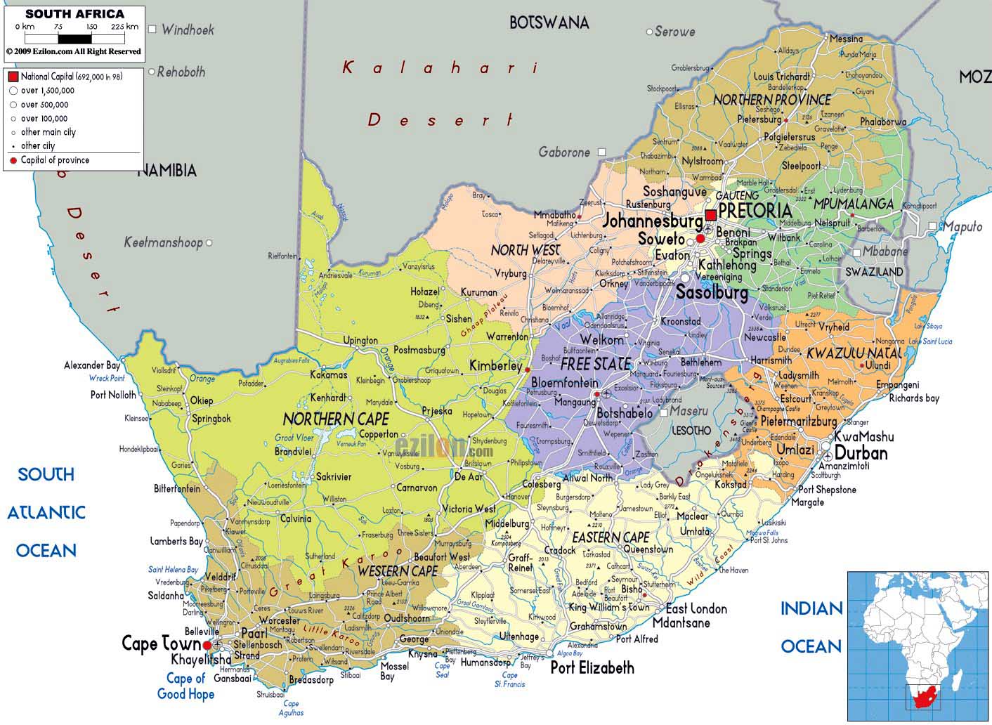
- South Africa Map
|
-
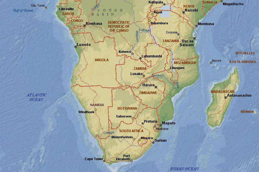
- Southern Africa Map
-
|
|
-
|
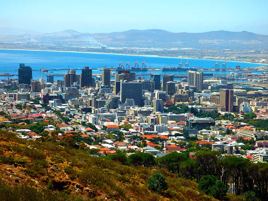
- latest picture:
February 24, 2015
|
-
-

|
-
-
|
-
-
|
-
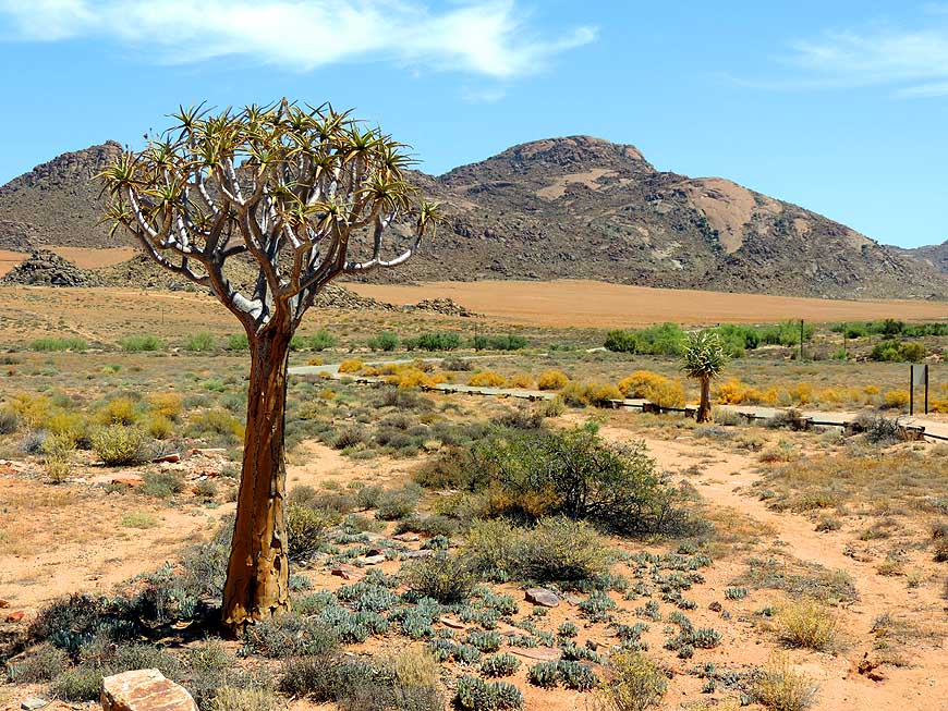
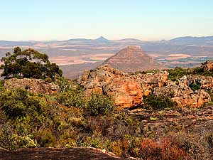
001 View from the Goegap Nature
- Reserve, 9 miles [15km] east of Springbok
- over the semi desert of Namaqualand,
- which transforms into a beautiful flower
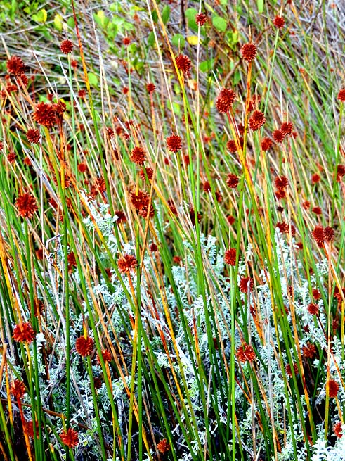
- carpet in springtime (mid Sept.→ Oct.)
|
-
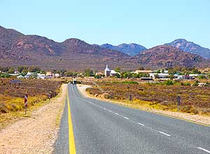
002 No hectic: The little quiet
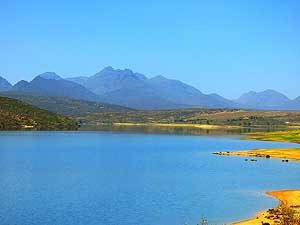
- village of Kamieskroon in the
- Northern Cape along the road
- Windhoek/Namibia-Capetown
|
-
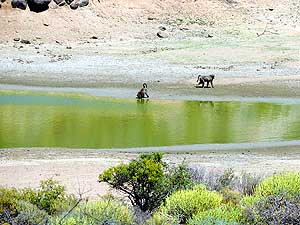
003 Chacma Baboons (Papio
- ursinus) quench their thirst at a
- little pond along the main road.
- Monkeys never live far from
- a water source
|
-
|
-
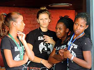
-
-
-

|
-
-
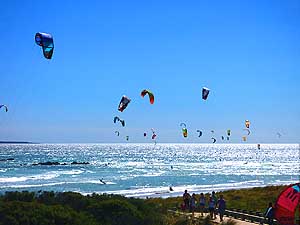
|
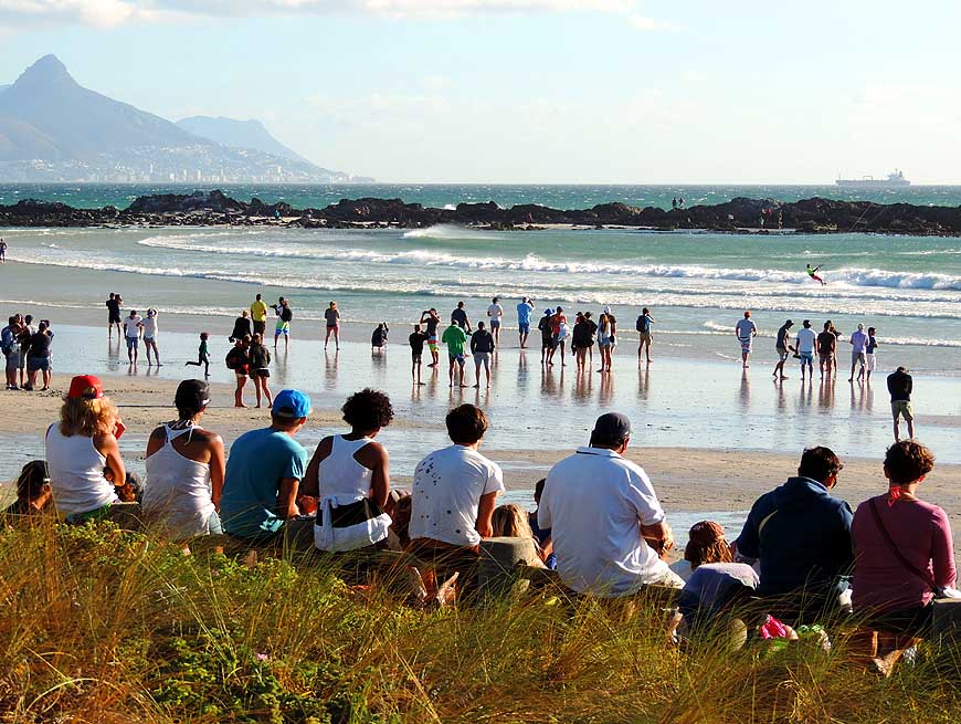
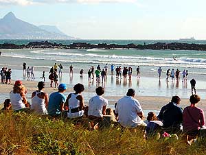
-
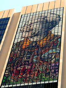
-
-
-
|
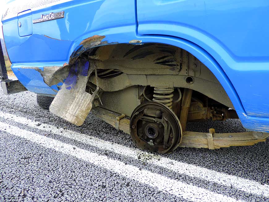
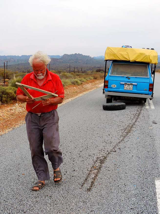
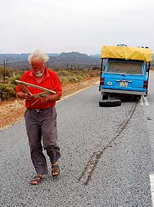
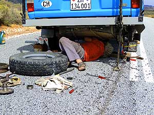
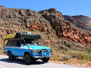
- On the ride from Clanwilliam to the Cederberg Mountains, it
crashes again – after only 2’312 miles [3720 km] since the
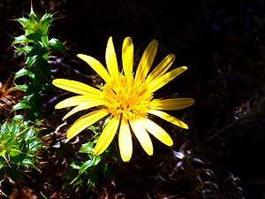
first axle fracture
- in Angola. The rear right wheel
breaks off. Emil secures the spot with a triangle, followed by long
hard work underneath the
car
|
-
004 This time
we are stuck again
- without wheel after only 93.2 driving
- hours in the middle of the road
- to the Cederberg Mountains .....
|
-
005 ….. already in his
“fatigues”,
- Emil secures the spot with a triangle.
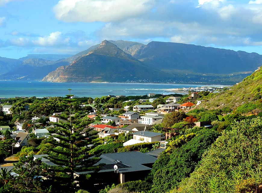
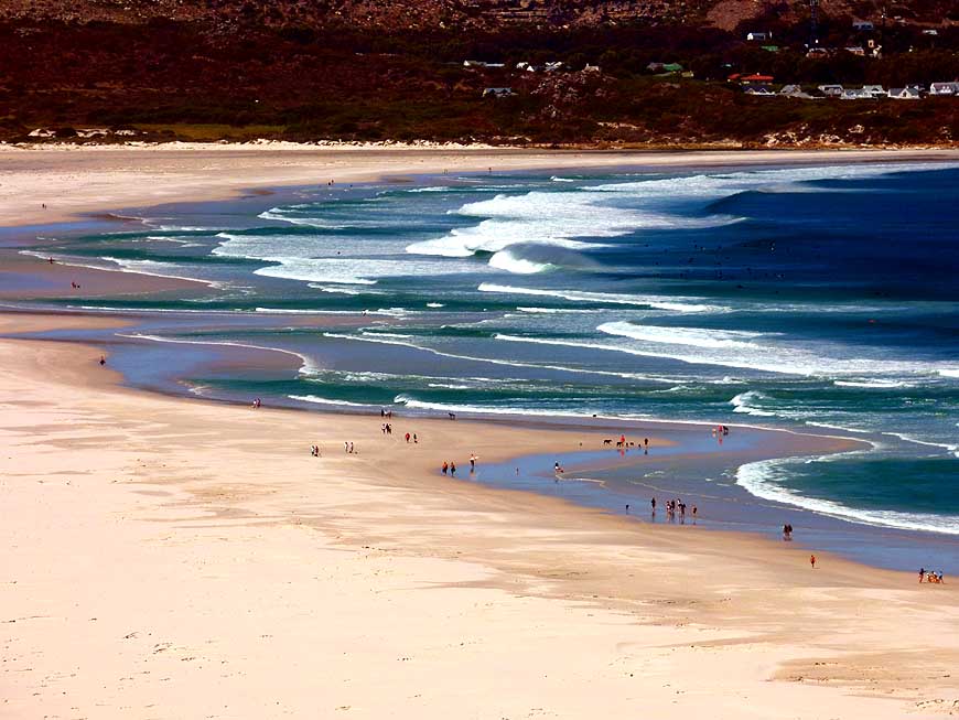
- Fortunately it is on a straight
- mountain stretch with little traffic …..
|
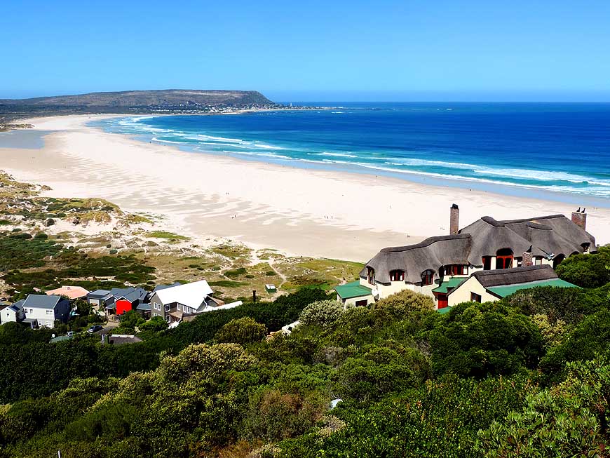
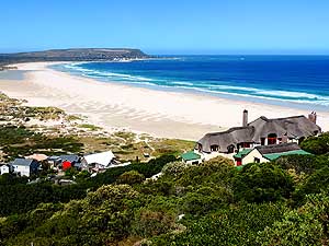
-
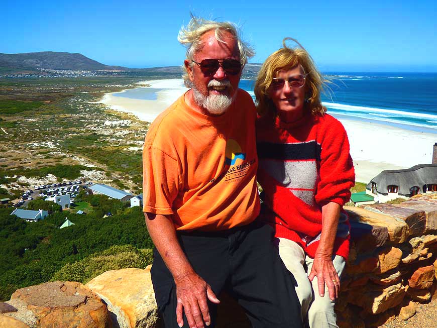
006 ….. then Emil starts
his work
- underneath the LandCruiser. At
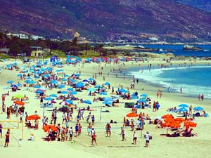
- least this time it is on stable ground.
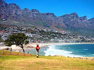
- Around a dozen cars stop
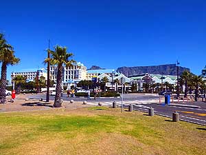
- offering us help
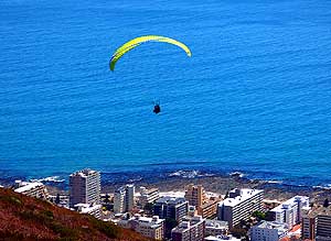
|
-
|
-
-
|
-
-
|
-
-
|
-
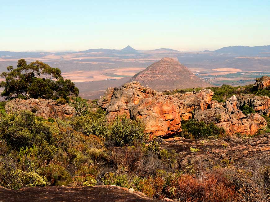
007 At the small
“Kleinkliphuis” Nature
- Reserve in the Cederberg Mountains,
- where we recover from the axle fracture
- and its repair, the view reaches the
- plain of the Olifantsrivier valley …..
|
-
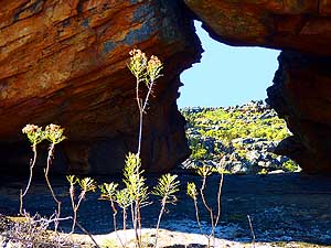
008 ….. and shows nature
at its
- finest: A natural “window”
- at a craggy rock formation
|
-
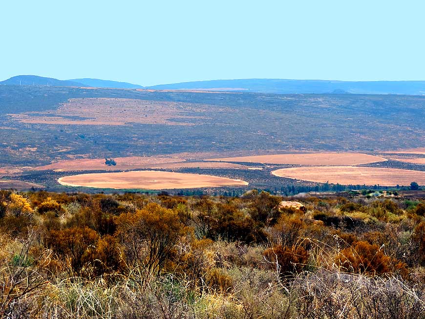
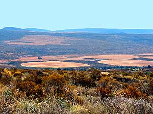
009 The “round plates” in
the plain
- of the Olifantsrivier valley near
- Clanwilliam have been formed by
- the method of irrigation of the fields
|
-
|
-
-
|
-
-
|
-
-
|
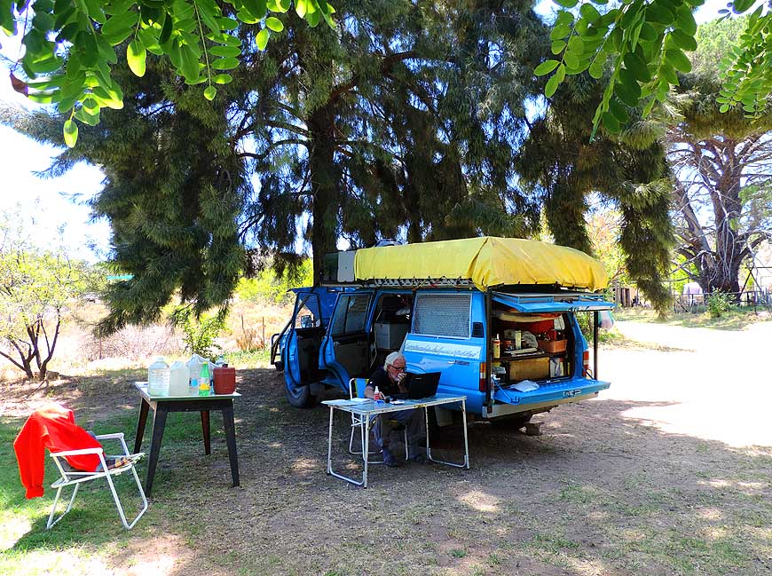
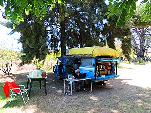
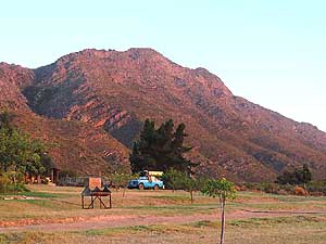
-
010 We set up camp at the
small
- private “Kleinkliphuis” Natur Reserve.
- Emil is working on the laptop …..
|
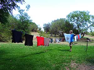
-
011 ….. while Liliana
hangs up
- the clothes she washed by hand
|
-
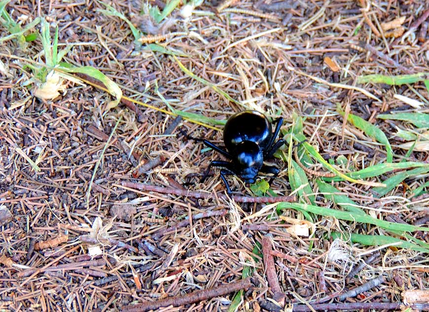
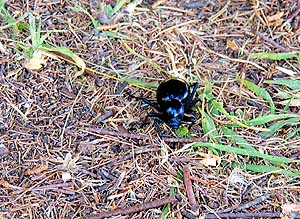
012 We baptized it
“Oscar”, the black
- dung beetle (Circellium bacchus) that
- in all our years of travelling shows up
- on and off and became our mascot
|
-
|
-
-

|
-
-

|
-
-

|
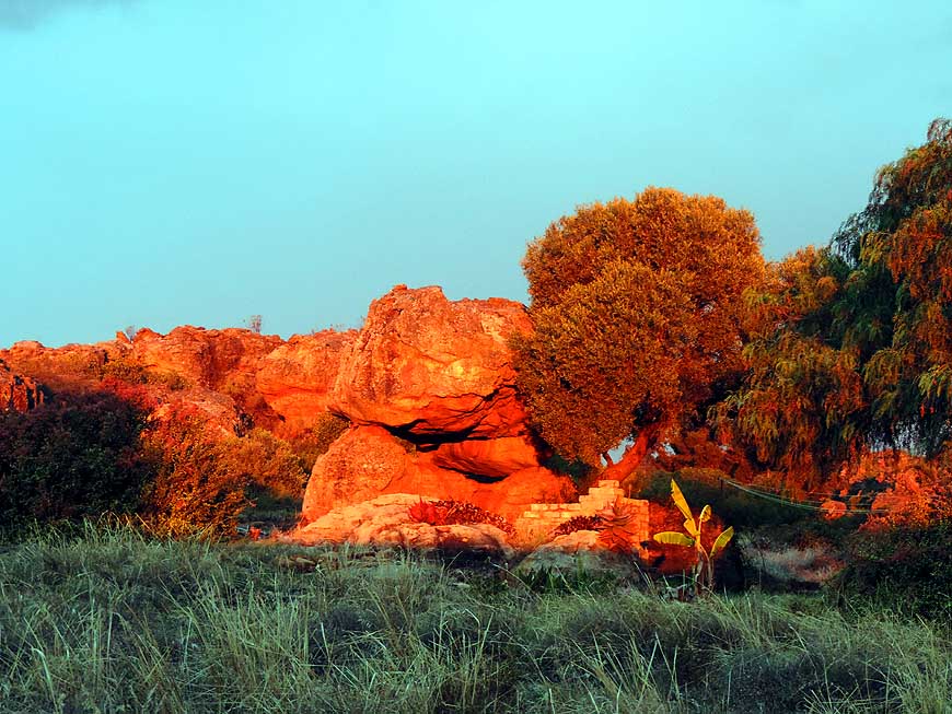
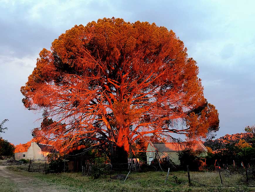
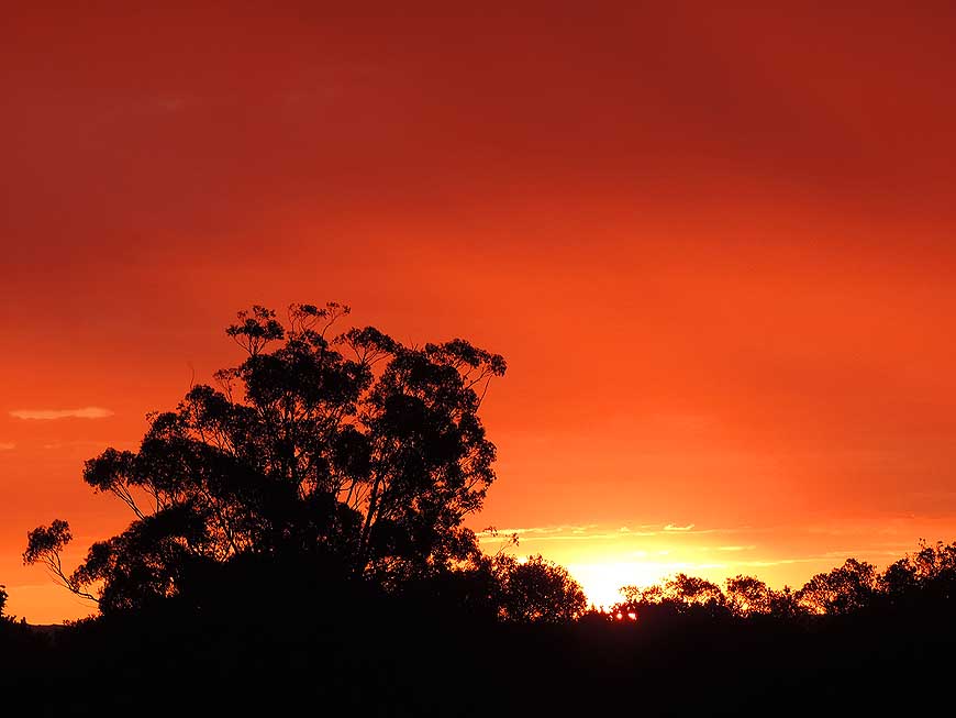
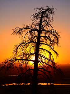
- The setting sun sets rocks, trees and the sky around our peaceful
“Kleinkliphuis” camp on fire
|
-
013
|
-
014
|
-
015
|
-
|
-
-

|
-
-
|
-
-
|
-
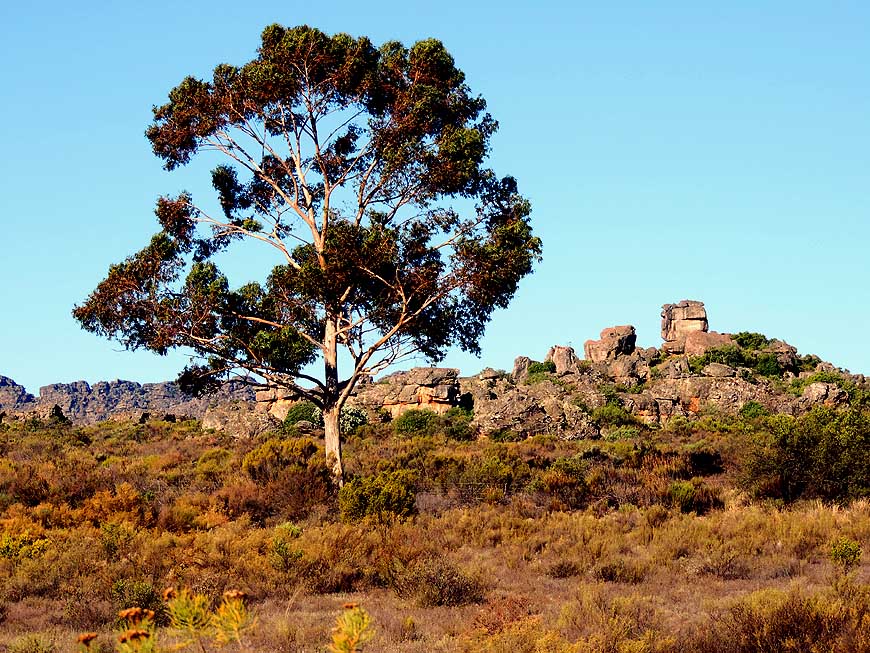
016 A single tree towers
over the rock
- formations of the Cederberg Mountains at
- the “Kleinkliphuis” Nature Reserve …..
|
-
017 ….. a desert cabbage (Kalanchoe
- tetraphylla), a succulent plant, sprouts
- from the rocky arid terrain …..
|
-
018 ….. half hidden below
the scrub
- golden barrel cacti (Echinocactus
- grusonii) are growing
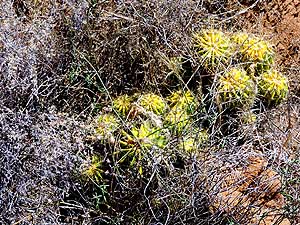
|
-
|
-
-
|
-
-
|
-
-
|
-
019 Our LandCruiser rolls
over the
- lonely and spectacular 3’025 ft. [922m]
- high Pakhuis Pass over the Cederberg
- Mountains, also a popular hiking area
|
-
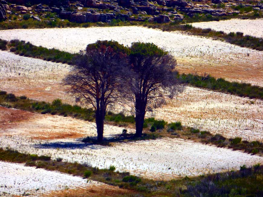
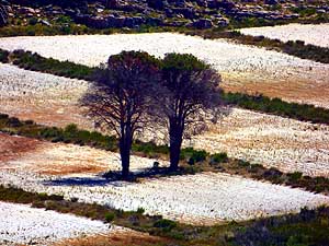
020 Close to the Pakhuis
Pass two
- leafless trees stick out ghostly from
- interestingly “silted” fields
|
-
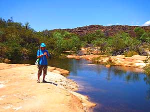
021 On the “Sevilla Rock
Art Trail” in
- the Cederberg Mountains Liliana studies
- the rock art flyer of the Bushmen at the
- Brandewyn river. The three miles [5km]
- long trail starts at the “Traveller’s Rest", 21
- miles [34km] northeast of Clanwilliam
- along the Wupperthal road
|
-
|
-
-
-
-
|
-
-
|
-
-
-
-
|
-
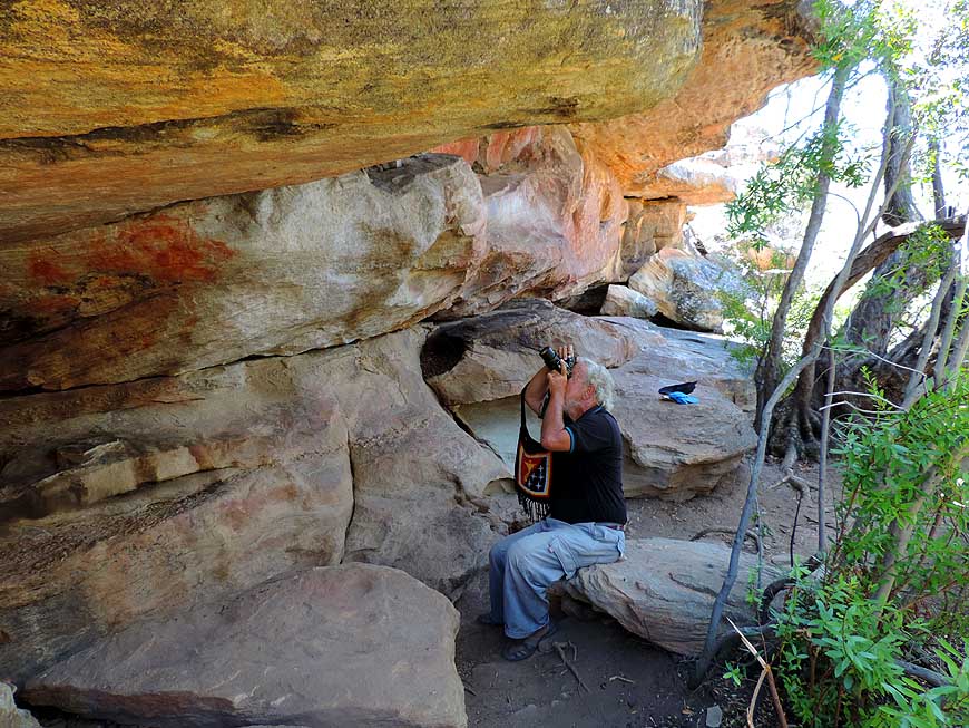
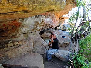
022 In a cave Emil takes a
picture of rock
- paintings of the “San” people – the Bushmen
- who inhabited this area before ten of thousands
- of years. Today they do mostly farming
|
-
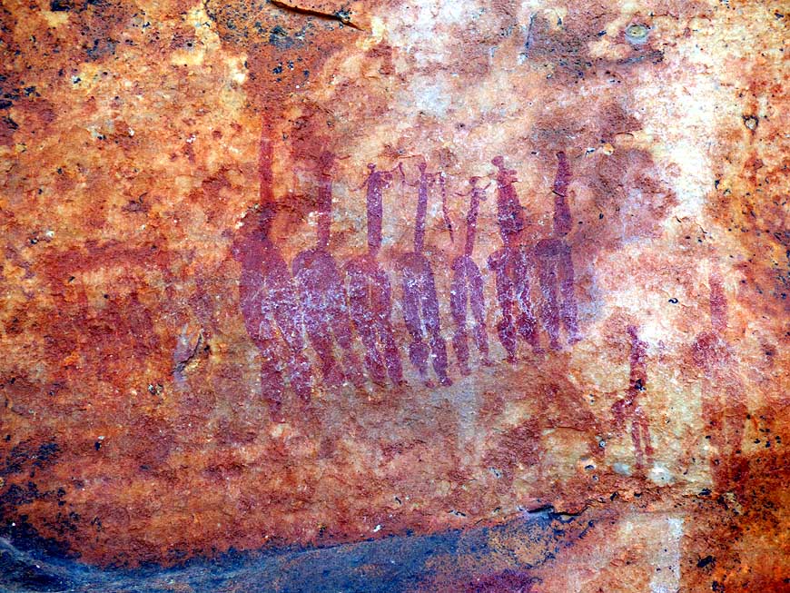
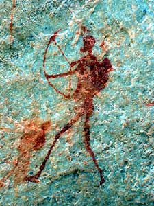
023 On the 5km long
“Sevilla Rock
- Art Trail” in the Cederberg Mountains
- we admire: The "archer" …..
|
-
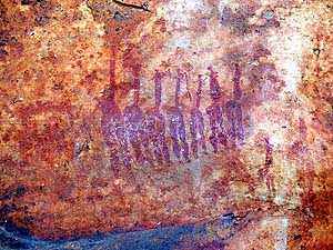
024 ….. the group of
dancing ladies …..
|
-
|
-
-

|
-
-
|
-
-
|
-
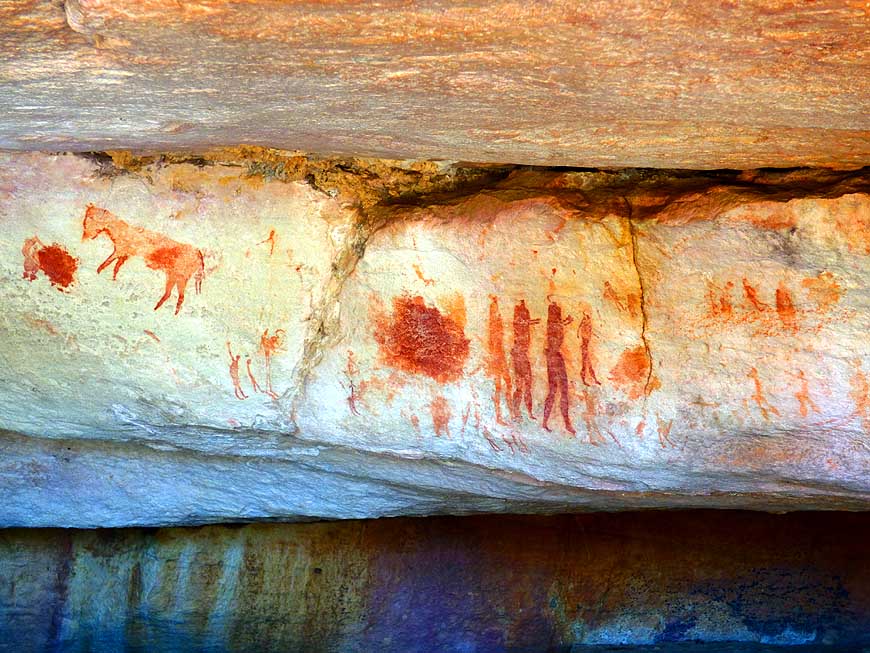
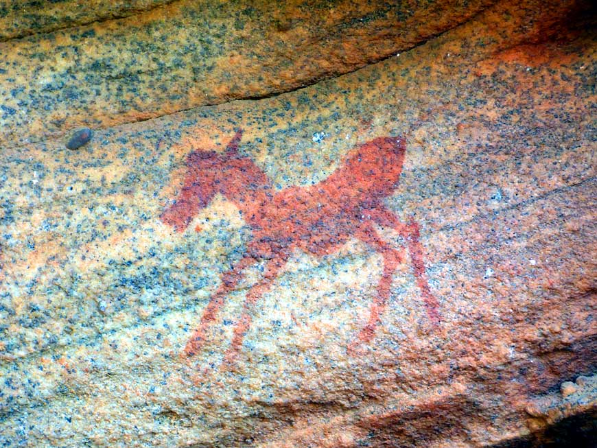
025 ….. various images of
- animals and people
|
-
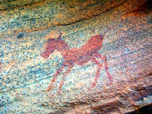
026 ….. and the zebra cub
|
-
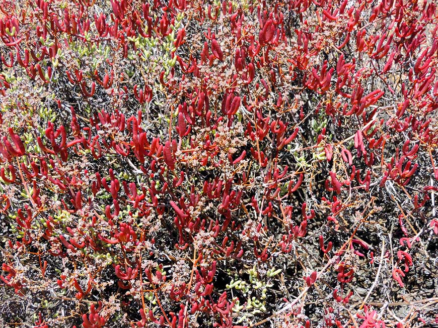
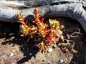
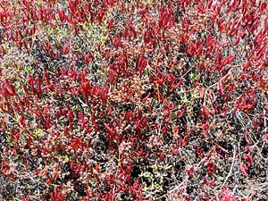
027 A carpet with red
succulents – a plant
- that can store water – revives the rocky
- landscape at the “Sevilla Rock Art Trail”
|
-
|
-
-
|
-
-
-
-
|
-
-
-
-
|
-
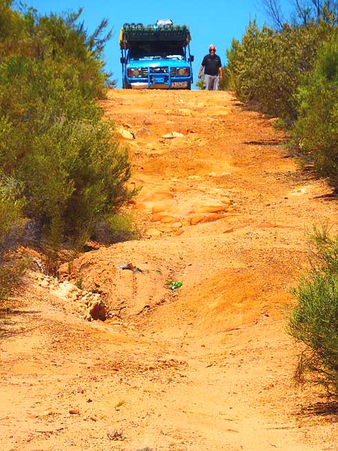
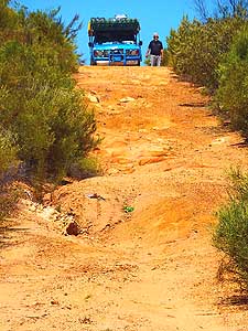
028 Shall we risk it or
not? Emil is
- inspecting the piste leading to the “Soldier’s
- Head” in the Cederberg region …..
|
-
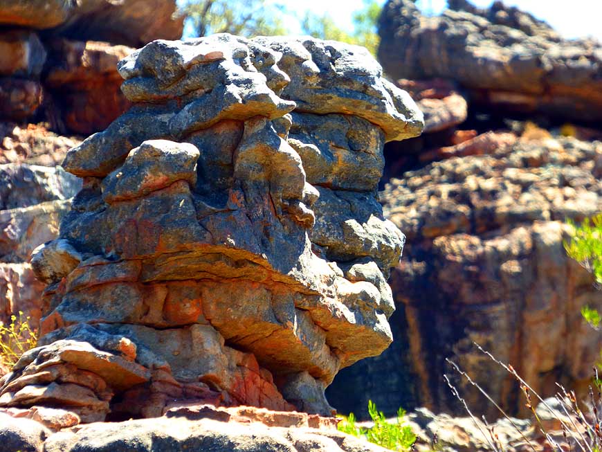
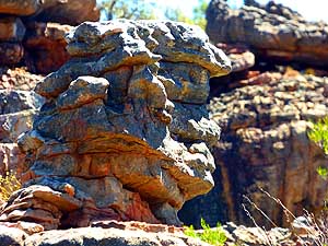
029 ….. the stone of the
- “Soldier’s Head” (looks to the right)
|
-
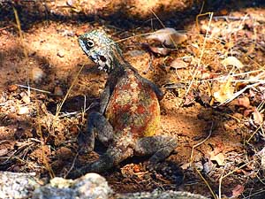
030 Perfectly camouflaged
lizard: A
- southern rock agama (Agama atra) in the
- stony terrain of the Cederberg Mountains
|
-
|
-
-
|
-
-
|
-
-
|
-
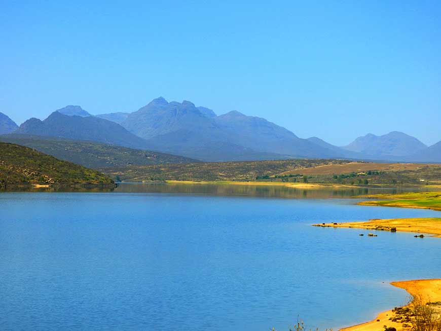
031 The Clanwilliam Dam
Reservoir
- staunches mainly the Olifants river and
- irrigates the agriculture downstream. In
- the background the Cederberg Mountains
|
-
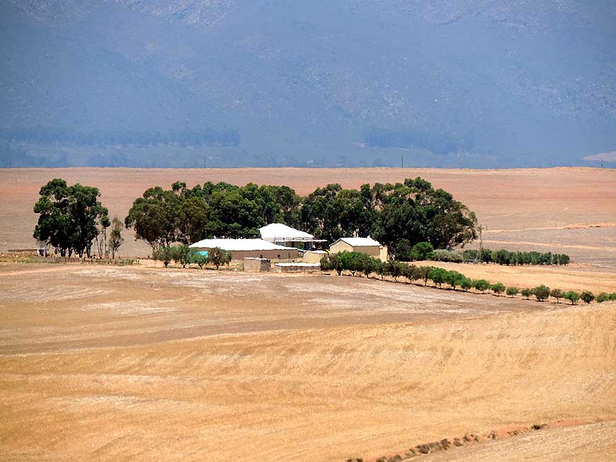
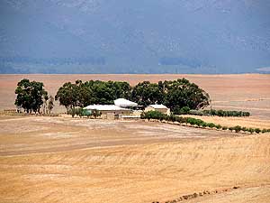
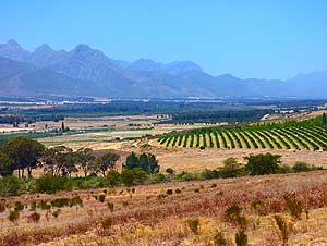
032 Between Piketsberg and
Porterville
- in the Western Cape a small farm nestles
- between the huge harvested wheat fields
|
-
033 Is there a more magic
name than
- “Peace of Africa”? The campsite
- in Porterville attracts us irresistibly
|
-
|
-
-
-
-
|
-
-
|
-
-
-
-
|
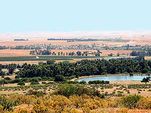
-
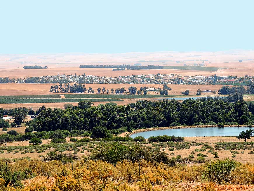
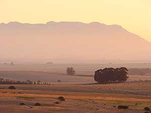
034 From our camping
“Peace of Africa”
- in Porterville we overlook the Swartland plain
- with clusters of trees, farms and ponds …..
|
-
035 ….. and enjoy the
beautiful sunset …..
|
-
036 ….. and the mystic
mood at
- sundown over the Swartland plain
|
-
|
-
-
|
-
-
|
-
-

|
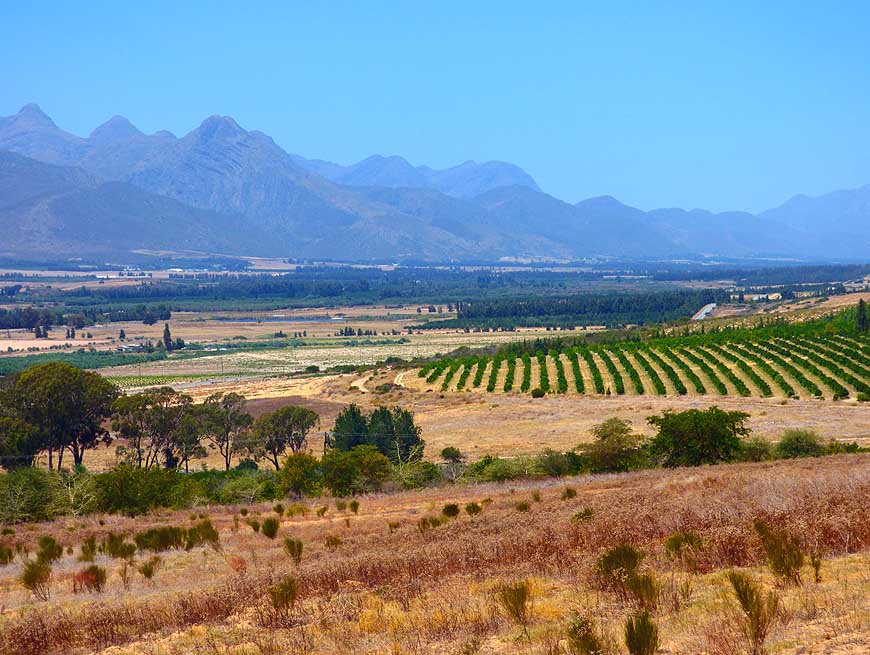
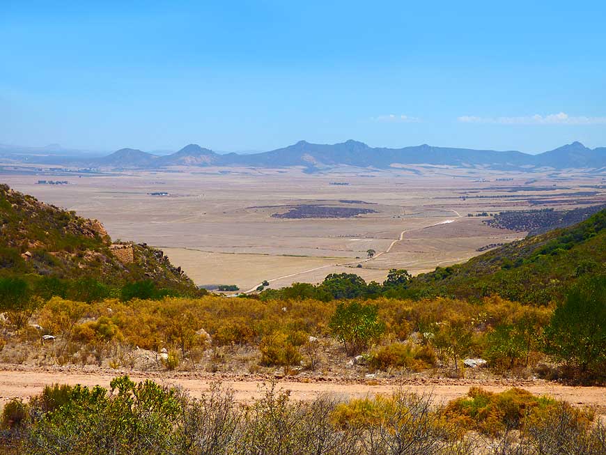
- Views from the 1'760 ft. [536m] high Piekenierskloof Pass,
- which lies between the Olifantsrivier valley and the Swartland
plain:
|
-
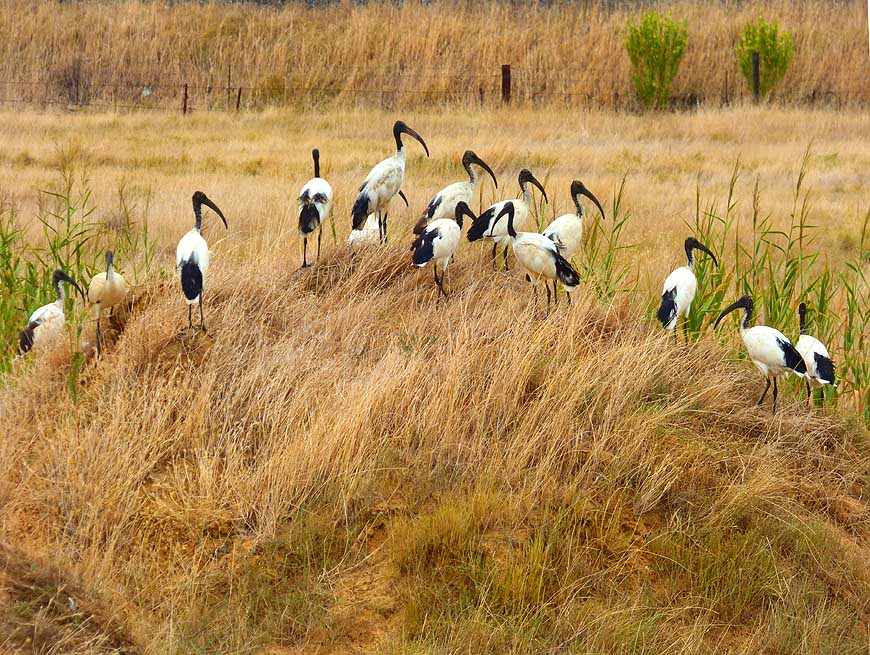
039 A flock of African
sacred ibises
- (Threskiornis aethiopicus) gather
- on a mound in the dried up steppe
|
-
037 Eastern view towards
- the Cederberg Mountains
|
-
038 Southern view
- towards the Swartland
|
-
|
-
|
-
-

|
-
-
|
-
-
|
-
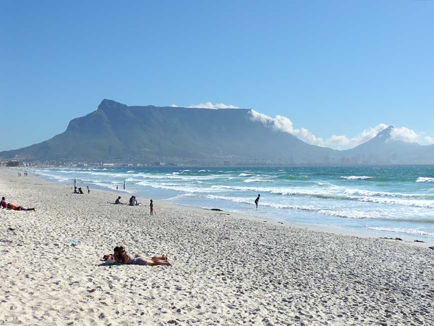
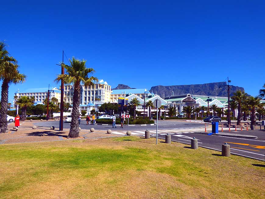
040 View from the beach at
Milnerton,
- about 7 miles [11km] north of
- Capetown, to the Table Mountain
- – the landmark of Capetown
|
-
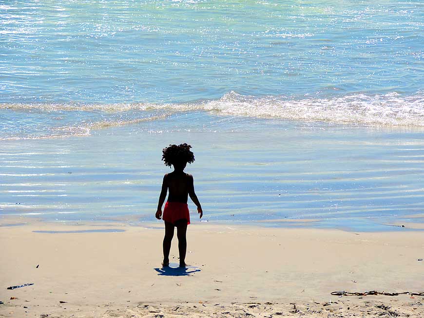
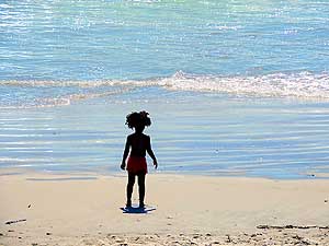
041 “Shall I go into the
water or not?”
- – A little girl with a frizzy mane
- of hair is looking to the sea
|
-
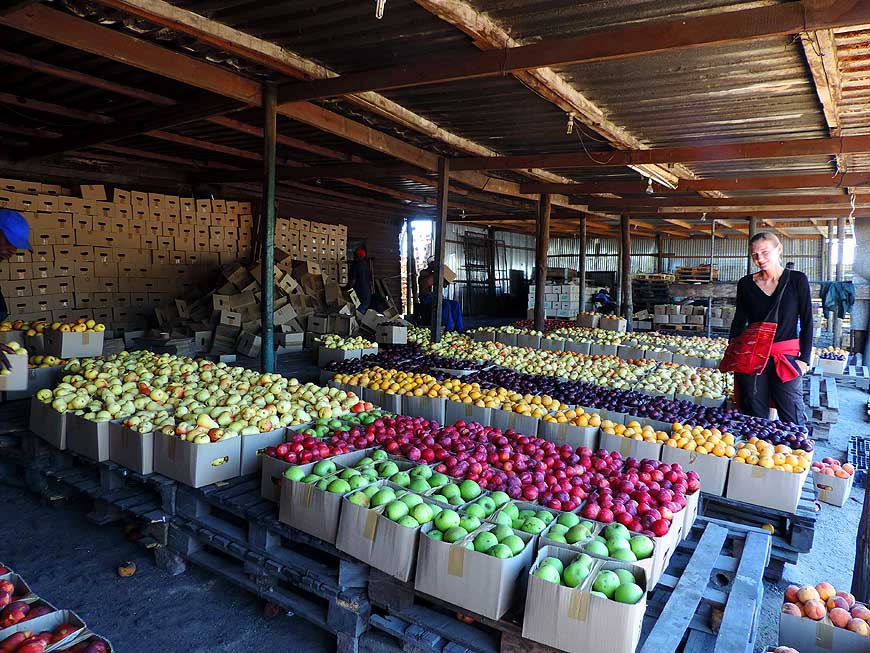
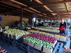
042 Alexandra on the fruit
market
- near Milnerton: Grapes, plums, peaches,
- apples, pears are sold in 5kg boxes
- for 20 to 30 Rand (=US$1.80-2.70)
|
-
|
-
-

|
-
-
|
-
-
|
-
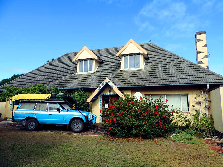
043 The owner of the
“Cologne
- House” in Milnerton allows us
- to camp in his garden …..
|
-
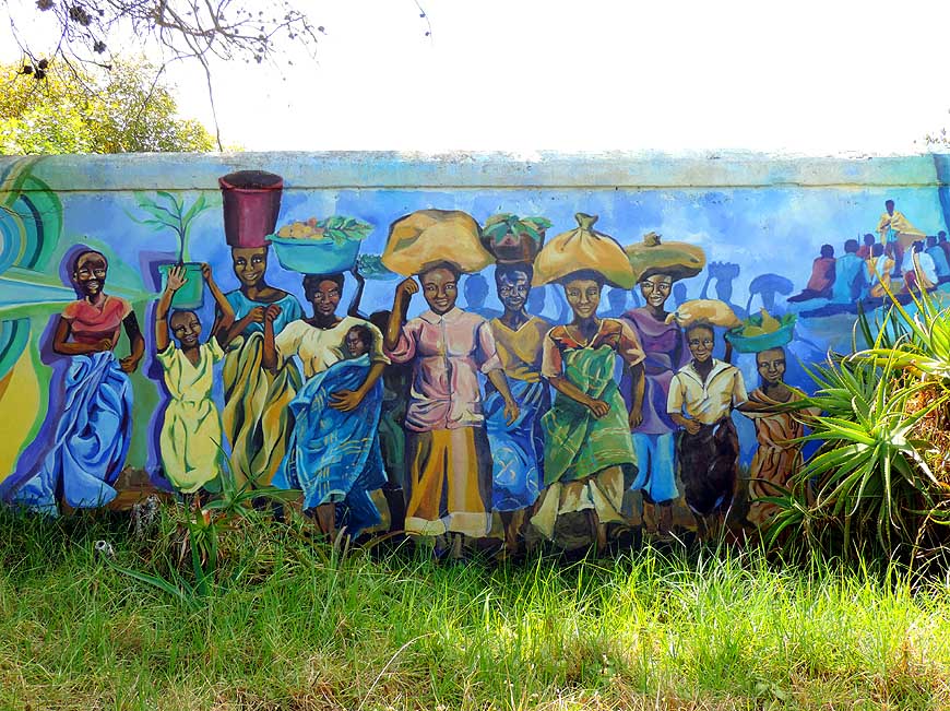
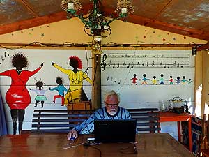
044 ….. Emil’s favorite
place for
- computer work is the summer
- house with its African mural
|
-
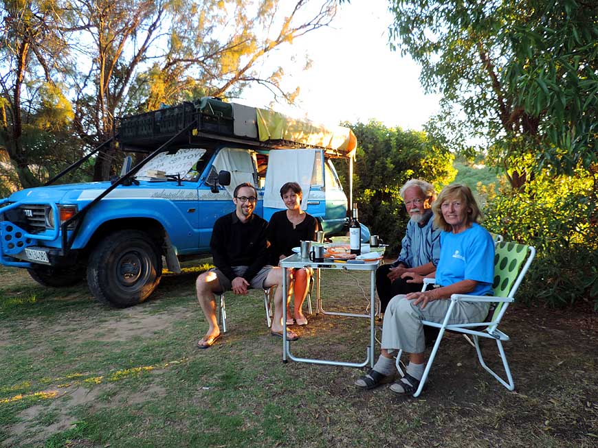
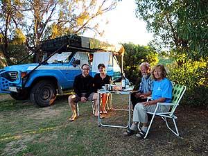
045 Serej and Manuel from
Switzerland
- visit us on February 17th, 2015, on our
- „Ou Skip” Camping in Melkbosstrand.
- We were their guests in Goroka Papua
- New Guinea on October 24th, 2010
|
-
|
-
-
|
-
-
|
-
-
|
-
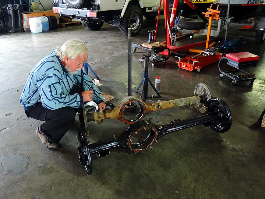
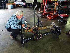
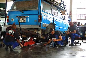
- After the loss of the wheel in Angola,
Emil studies our old and the sponsored axle housing at the workshop of
“J.B’s Auto Repairs” in Capetown.
- Our LandCruiser is jacked-up and Johann, the workshop owner,
is getting ready to replace it. The complete
repair is free of charge.
- A huge thank you to our supporters of
the LandCruiser Club Southern
Africa
|
-
046
Our damaged and the donated axle
- housing: Our axle casing ran over 442’733
- miles [712’509km] (=
19’719 driving
- hours). How many miles might
- have the donated one?
|
-
047 Our LandCruiser is jacked-up by
- Johann jun. of J.B.’s Auto Repairs and
- his workshop employee. Johann sen. is
- supervising it
|
-
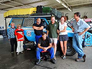
048 A
huge thankyou to our supporters
- regarding the axle housing in the workshop
- of J.B.’s Auto Repairs: (from right) Bennie
- Smit, Ellen and Adolf Hüster and
- Johann sen. In front: Johann jun.
|
-
|
-
-
|
-
-
|
-
-
|
-
049 At the Bloubergstrand
with its
- garden restaurants we meet members of the
- LandCruiser Club Southern Africa …..
|
-
050 ….. the waitresses of
“our” restaurant
- in Bloubergstrand are ‘mixed’,
- as is ‘right and proper’
|
-
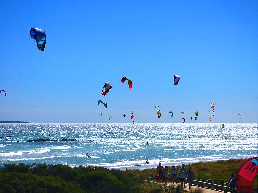
051 Bloubergstrand is
famous for
- kitesurfing – here the Red Bull
- competition on February 15th, 2015
|
-
|
-
-
-
-
|
-
-
|
-
-
-
-
|
-
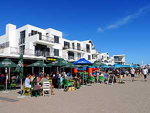
052 People enjoy the sunny
day and
- the entertainment at the Bloubergstrand,
- 15½ [25km] miles north of Capetown
|
-
053 Nelson Mandela is
looking down
- from the Civic Center to Capetown’s
- southeastern city center
|
-
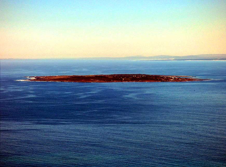
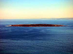
054 Robben Island (2.00
sq.mi. [5.18 km²]):
- At its (political) prison, Nelson Mandela
- was jailed for almost two decades in a
- 43 sq.ft. [4m²] small solitary cell
|
-
|
-
-
-
-
|
-
-
|
-
-
-
-

|
-
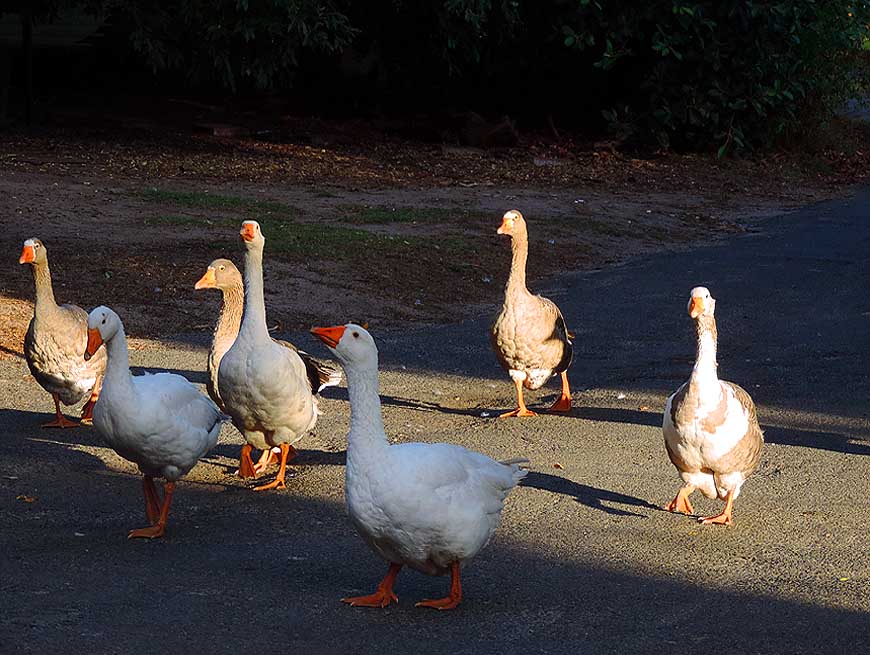
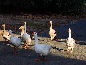
055 Loud cackling geese
are on a stroll
- at the “Chapmans Peak Caravan Park” in
- Sunvalley, 16 miles south of Capetown
|
-
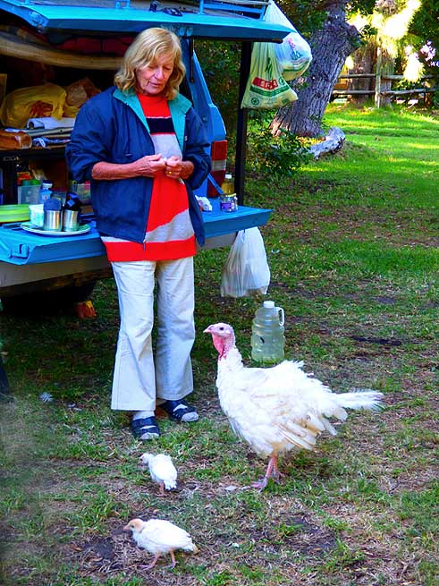
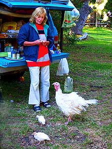
056 ”Hello, here we are
again”! The
- turkey mother with her two chicks shows
- up regularly to beg for food …..
|
-
057 ….. also the cute
squirrel
- can be spotted now and then
|
-
|
-
-
|
-
-
|
-
-
|
-
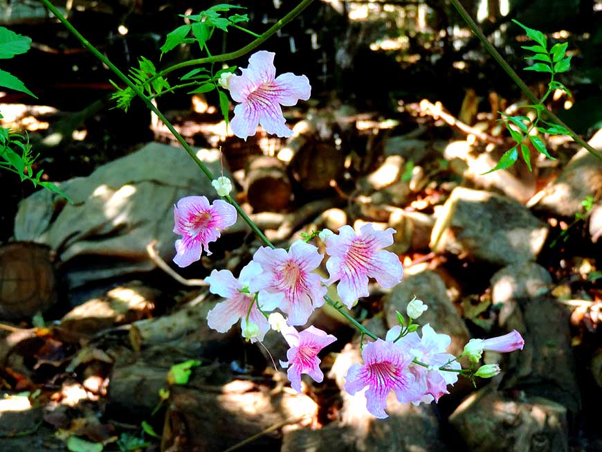
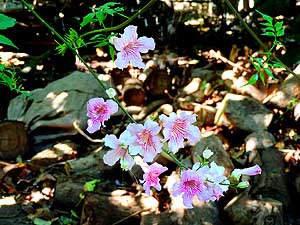
058 Delicate flowers
blossom on this
- wild “Violet Trumpet Vine” (Clytostoma
- callistegioides) – a flower from the
- violet family (Violaceae)
|
-
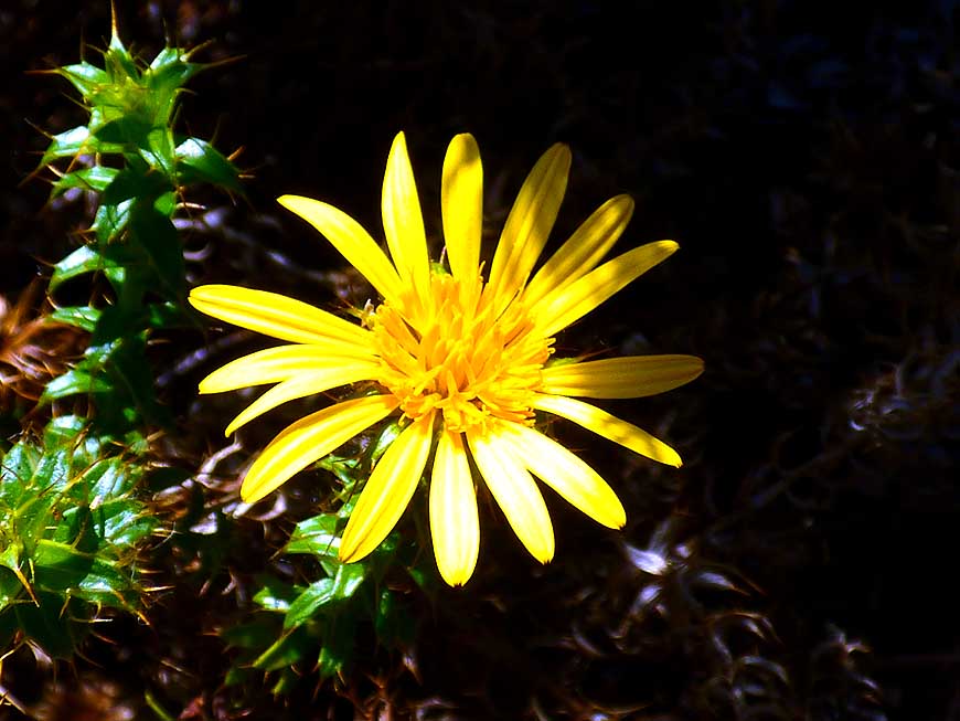
059 A golden spot in the
green bushland:
- A bright “African Bush Daisy” (Euryops
- chrysanthemoides)
|
-
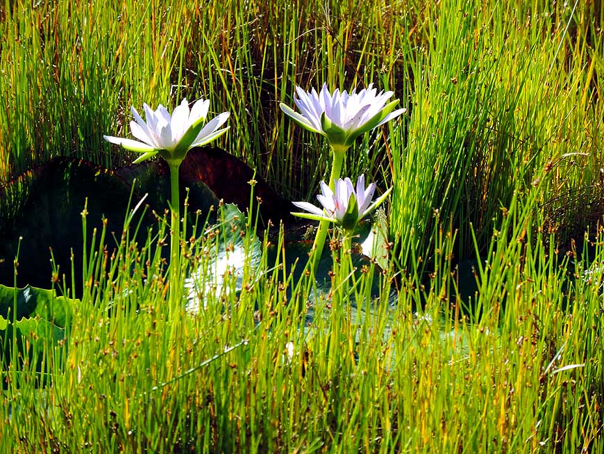
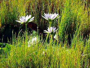
060 Long-stemmed water
lilies, also
- called “star lotus” (Nymphaea nouchali)
- raise their heads towards the sun
|
-
|
-
-
|
-
-
|
-
-

|
-
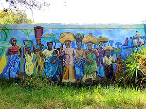
061 Smiling African faces
on the
- Ubuntu mural of Lisa Martin
- in Noordhoek
|
-
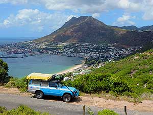
062 We stop on the „Glencairn
Expressway“
- to enjoy the panorama over Simon’s Town
- at the shore of False Bay in the east
- of the Cape Peninsula
|
-
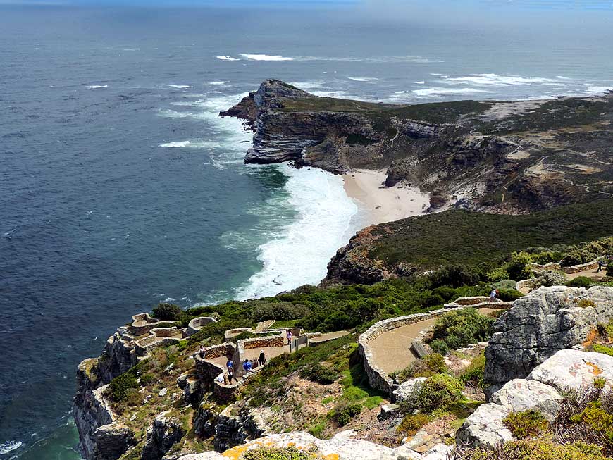
063 View to the „Cape of
Good Hope”,
- the southwestern most point of the
- African continent.
- In the foreground the Diaz Beach
|
-
|
-
-

|
-
-
|
-
-
|
-
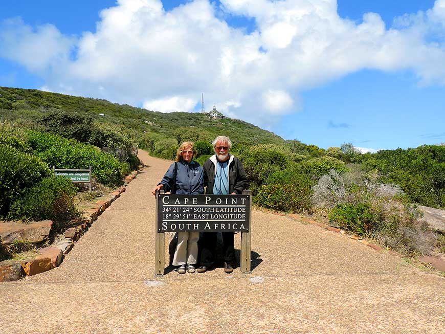
064 Here it does not go
any further:
- Liliana in front of the rock “Cape Point”
- that forms the ‘end’ of the Cape Peninsula
|
-
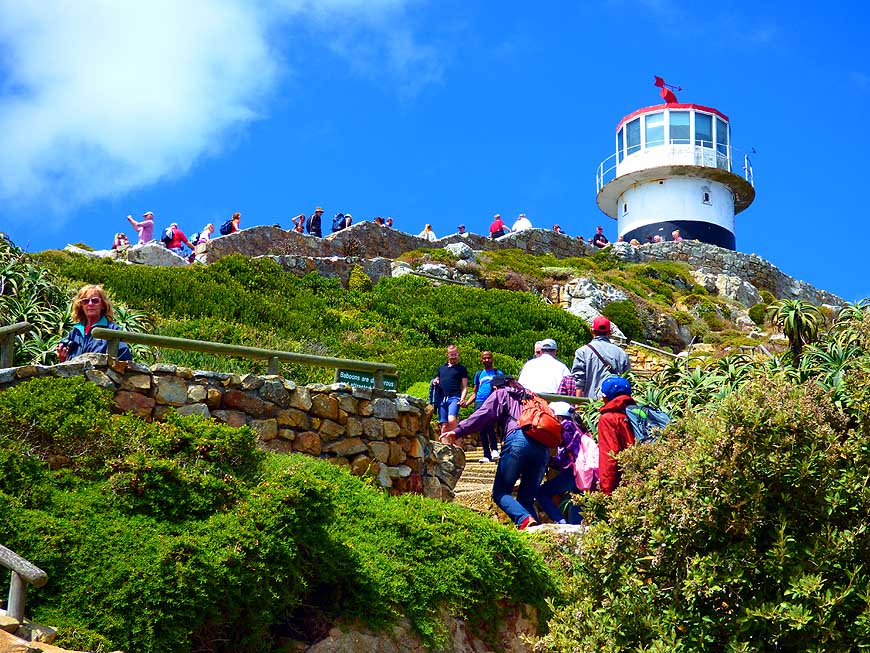
065 Crowds are wandering
up to the
- “Cape Point” lighthouse, erected 1859
- and lying 780 ft. [238m] above sea level
|
-
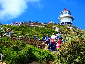
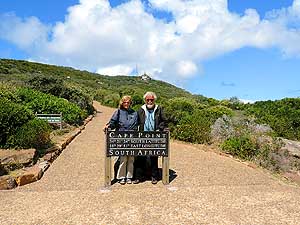
066 For a remembrance
picture
- we also pose (like everybody)
- behind the “Cape Point” sign
|
-
|
-
-
-
-
|
-
-
|
-
-
-
-
|
-
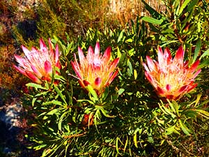
067 To the Fynbos
vegetation
- of the Cape region belongs also
- the beautiful protea …..
|
-
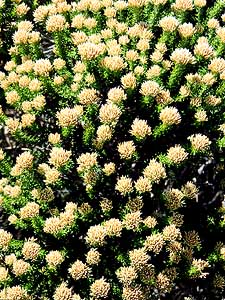
068 ….. as well as this
flowering bush
- Bruniaceae (Nebelia paleacea). It
- grows in southern South Africa between
- Port Elizabeth and Lamberts Bay
|
-
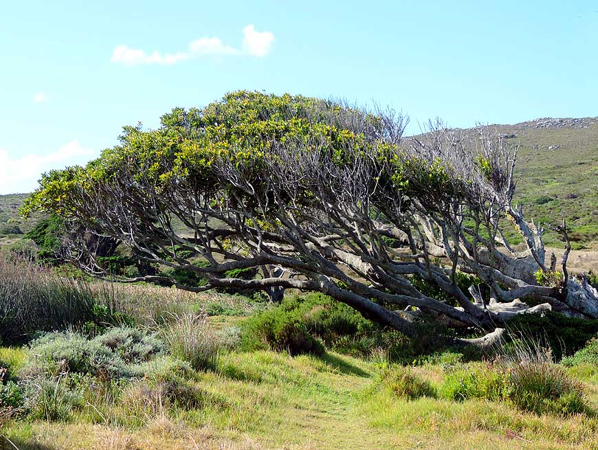
069 The permanently
blowing
- fierce wind bends the trees
- on the Cape Peninsula
|
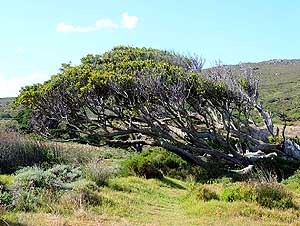
-
|
-
-
|
-
-
|
-
-
|
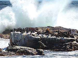
-
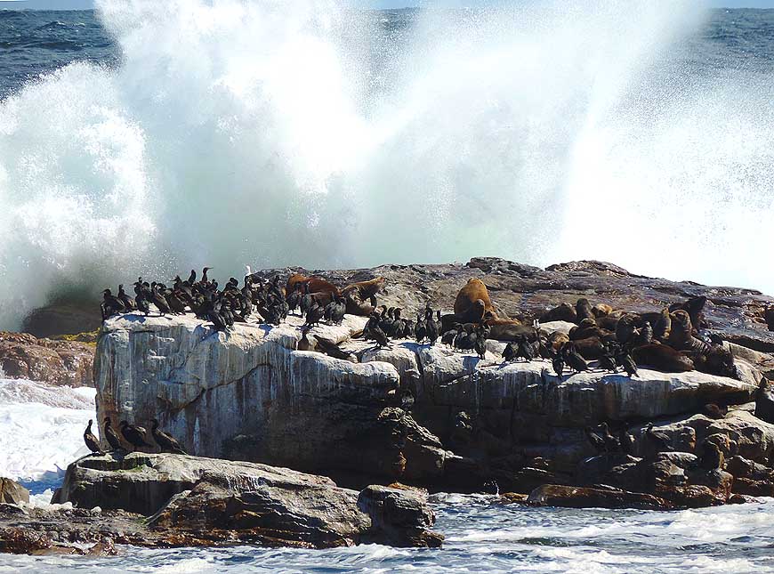
070 Cape cormorants (Phalacrocorax
- capensis) and Cape fur seals
- (Arctocephalus pusillus) have
- settled on the windswept offshore
- rock at the Cape of Good Hope
|
-
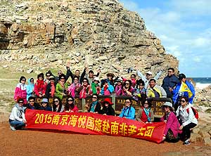
071 On 28.2.2015 our
LandCruiser stands
- for the second time at the “Cape of Good
- Hope” on our epic journey, before we
- drive North on Africa’s eastern side. The
- first time was on 5.3.1992, after we arrived
- on the western side from the North
|
-
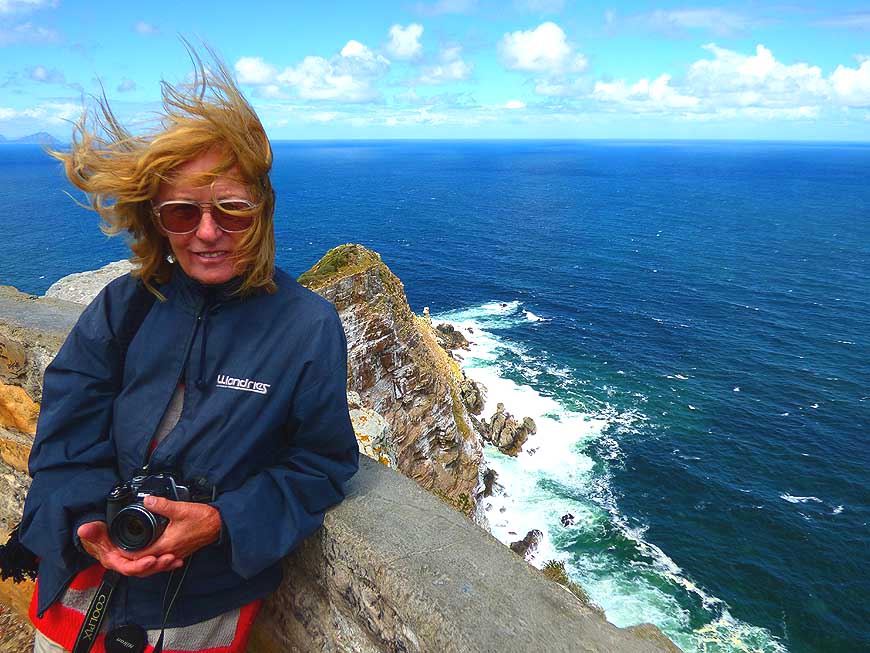
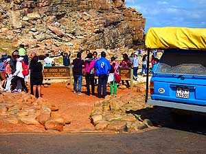
072 Smile! Chinese
tourists position
- themselves for a remembrance photo
- at the “Cape of Good Hope”
|
-
|
-
-
|
-
-
-
-
|
-
-

|
-
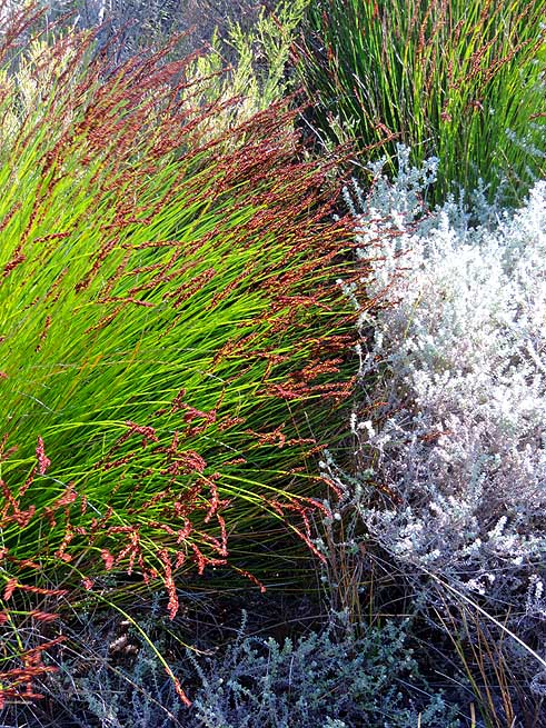
073 The Fynbos kingdom in
the
- Cape Region is a real treasure box
|
-
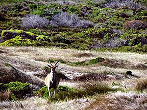
074 An eland (Taurotragus
oryx) makes
- its appearance at Buffelsfontein in the
- “Table Mountain National Park”
|
-
075 The diversity on South
Africa’s
- Fynbos plants is high, about
- 9’000 species can be found
|
-
|
-
-

|
-
-
|
-
-
|
-
076 View from the coastal
road
- over Kommetjie – the most southern
- townlet of the African Atlantic coast
|
-
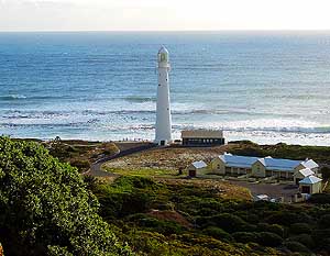
077 The 111½ ft. [34m]
high Slangkop
- Lighthouse lies south of the Noordhoek
- Beach near Kommetjie on the western
- side of the Cape Peninsula
|
-
078 The play of the waves
- at Noordhoek Beach
|
-
|
-
-
|
-
-
|
-
-
|
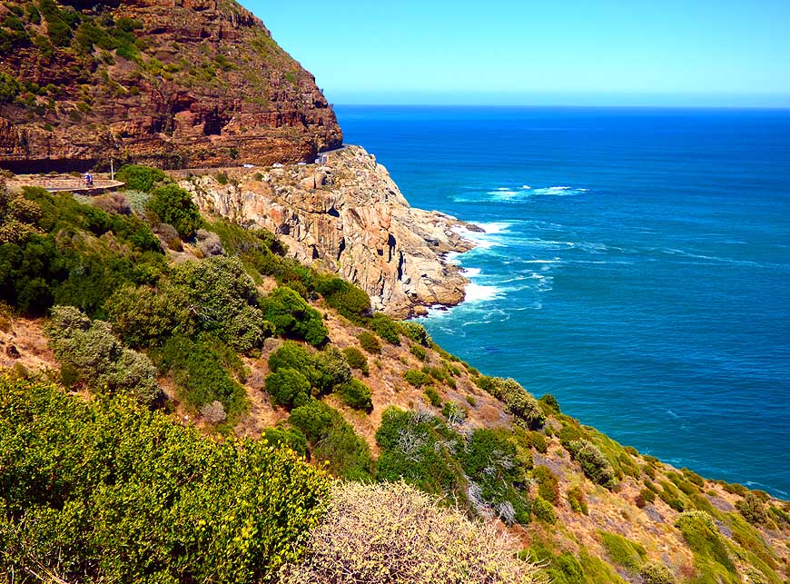
-
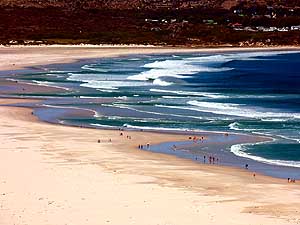
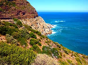
079 The “Chapman’s Peak
Drive”
- between Noordhoek and Capetown follows
- the Atlantic coast and offers magnificent
- views: Here to the “Monkey Valley Resort”
- and the 5 miles [8km] long Noordhoek Beach
|
-
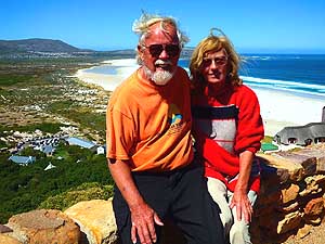
080 Liliana and Emil enjoy
the
- views to the Noordhoek Beach
|
-
081 The sheer drops up to
525 ft.
- [160m] to the sea are a scenic highlight
- along the “Chapman’s Peak Drive”
|
-
|
-
-
|
-
-
|
-
-
|
-
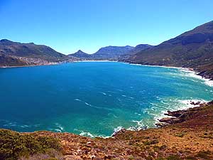
082 View from “Chapman’s
Peak
- Drive” to the lovely Hout Bay. It was
- built between 1915 and 1922
|
-
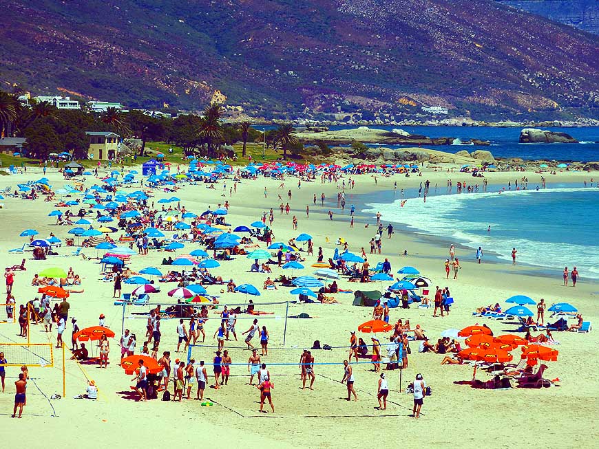
083 Blue umbrellas shape
the picture of Camps
- Bay, a popular but rather ‘cold’ beach resort
- southwest of Capetown. The water temperature
- is during the whole year only 56°F [13°C]
|
-
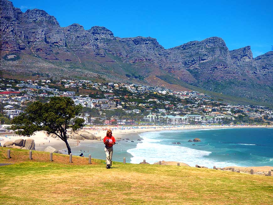
084 The mountain peaks of
the
- “Twelve apostles” – part of the
- Table Mountain range –
- tower over Camps Bay
|
-
|
-
-
|
-
-
|
-
-
|
-
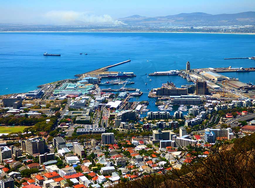
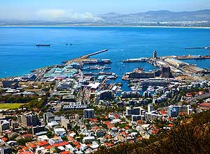
085 Cape Town’s
“Waterfront” with
- the backdrop of the Table Mountain
- is popular for strolling and shopping
|
-
086 A paraglider sails
from the 1’150 ft.
- [350m] high Signal Hill to the coast
|
-
087 View from Signal Hill
- over Cape Town’s harbor
|
-
|
-
-
-
-
|
-
-
|
-
-
-
-
|
-
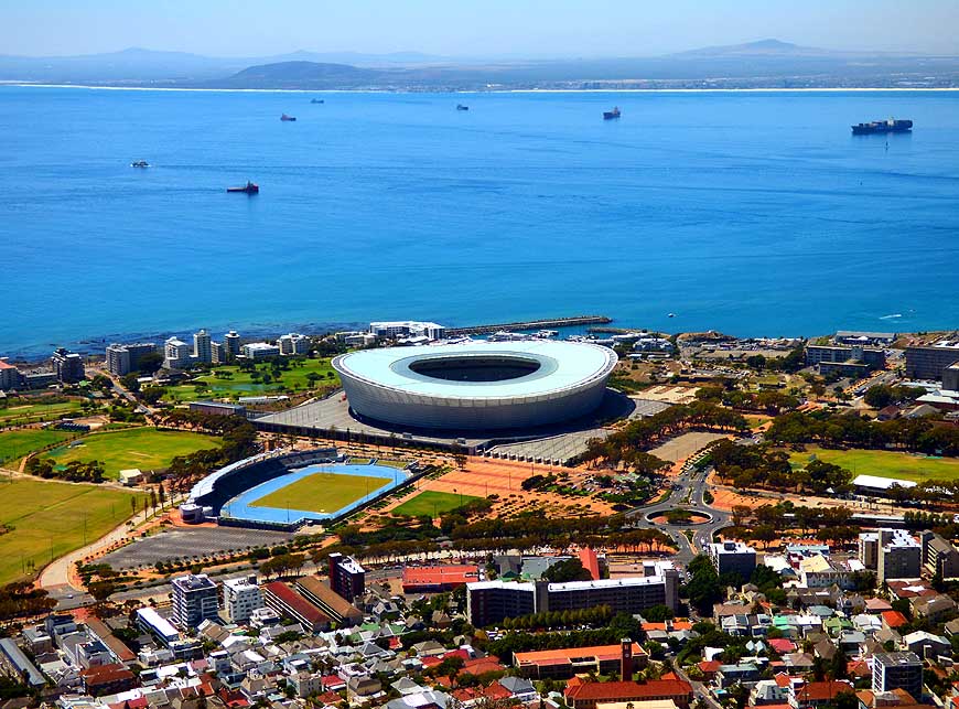
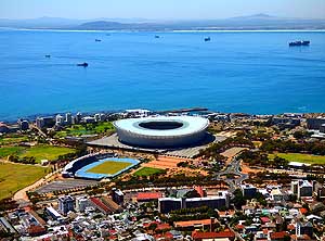
088 The Cape Town Stadium,
built
- for the World Cup 2010, was holding
- 64’100 people (currently its 55'000).
- It is the eye-catcher from Signal Hill
|
-
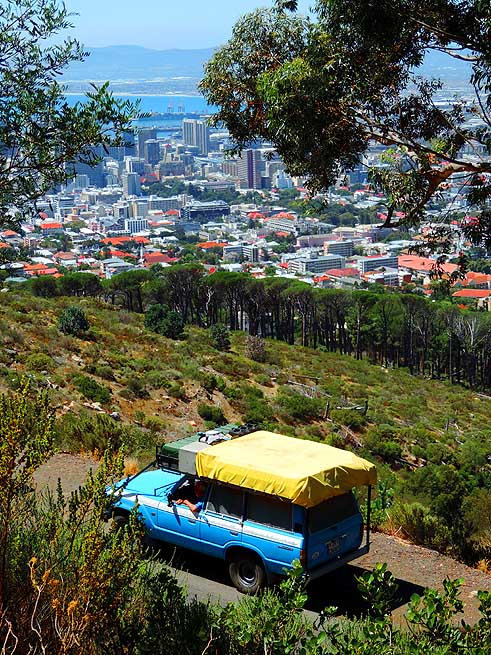
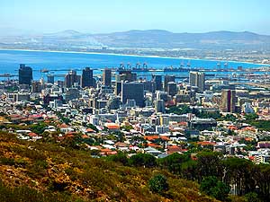
089 We drive up to Signal
Hill and
- admire Capetown’s city panorama
- extending below us. The city has a
- population of about 3.8 millions
|
-
090 Magnificent view from
Signal Hill
- over Cape Town’s city center
- and the Atlantic
|
- Continuation to the next South African page:
South Africa Part 2
–
February 24th to March 13th, 2015, from Capetown to Tsitsikamma
National Park
|
-
|
-
- The African trip
2013-15:
- CapeVerde: Santiago/Praia
part 1 – November18th to December 13th, 2013
- CapeVerde: Fogo
– Dezember13th to 23rd, 2013
- CapeVerde: Brava
– December 23rd to 26th, 2013
- Cape Verde: Santiago/Praia
part 2 – December 26th, 2013 to February 28th, 2014
- Cape Verde: São Nicolau – February
28th to March 13th, 2014
- Cape Verde: São Vicente/Mindelo part 1
– March 13th to 20th, 2014
- Cape
Verde: Santo Antão/Eastern side part 1 –
March 20th to April 7th, 2014
- Cape
Verde: Santo Antão/Western side part 2 –
April 7th to 10th, 2014
- Cape
Verde: São Vicente/Mindelo part 2 –
April 10th to 29th, 2014
-
Namibia Part 1 –
from Walvis Bay to Windhoek
- Angola Part 1
–
September 26th to October 4th, 2014
- Angola Part 2 –
October 4th to 22nd, 2014
-
Namibia Part 2 –
from Windhoek to the Angolan border, back again and on to
South Africa
- 3rd Major Repair of our
LandCruiser FJ60 - 1982 (due to two broken sideshafts)
|