-
-
- Cape Verde Map
|
-
 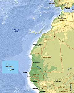 -
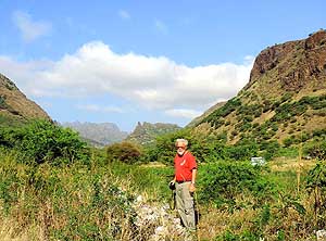
- Santiago Map
Northwest Africa Map
-
|
|
-
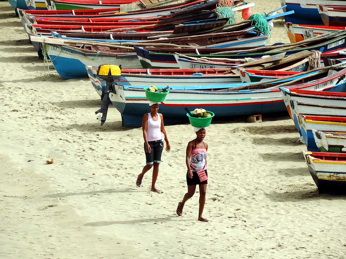
|
- latest picture: February 21, 2014
|
-
-
|
-
-
-
-
|
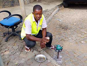
-
-
-
-
|
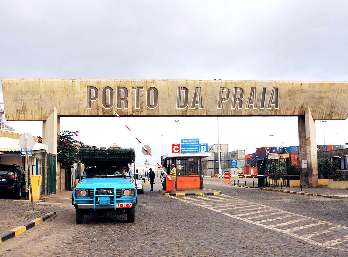
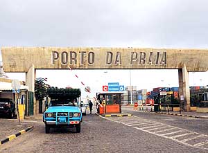
- 001
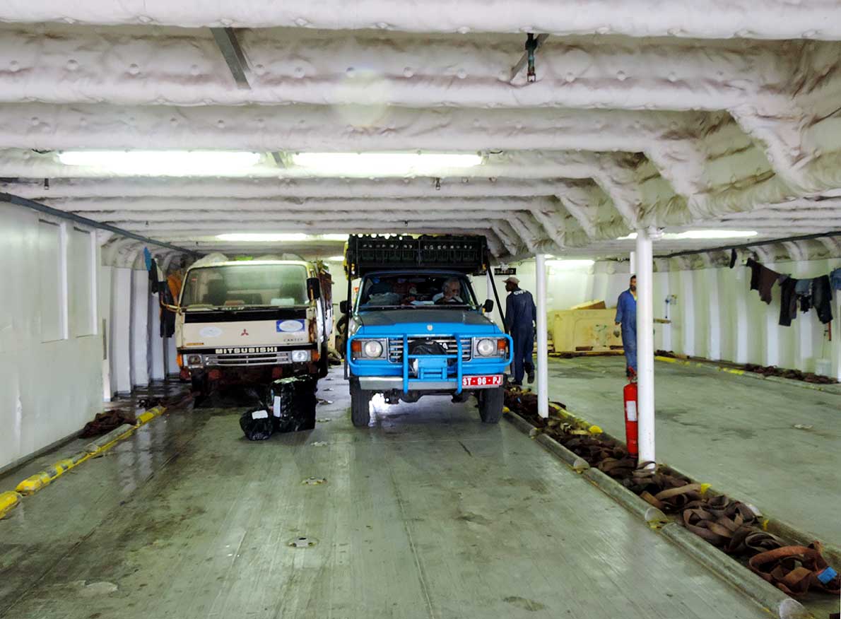
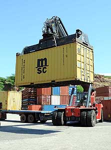
November 12th, 2013: Our
- MSC-container that arrived from the
- Ukraine on 10/26/2013 is finally allowed
- to be unloaded in the Port of Praia, the
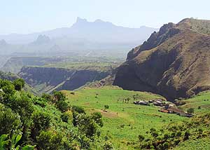
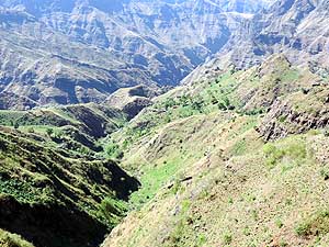
- capital of the Cape Verde archipelago.....
|
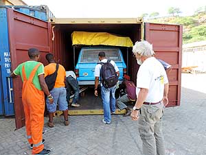
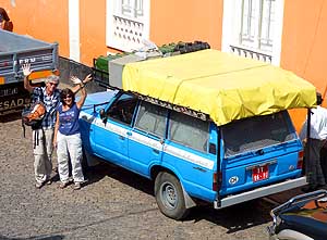
- 002
..... nothing beats the feeling to
- see our LandCruiser after 53 days
- including 3 transshipments “safe and
- sound” in front of us and to
- be reunited again
|
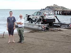
- 003
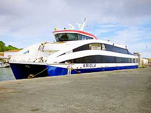
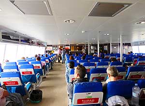
November 21st, 2013 - 5.30pm:
- Emil drives our car after 25 days of
- “enforced stay” out of the harbor area
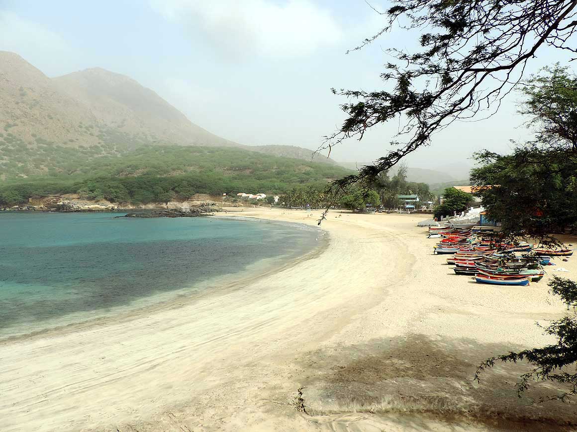
- of Praia. The help of the Ministry
- of Tourism and our patience
- were the key to success!
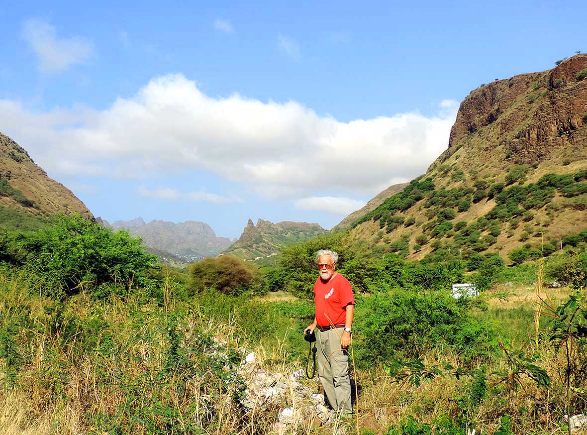
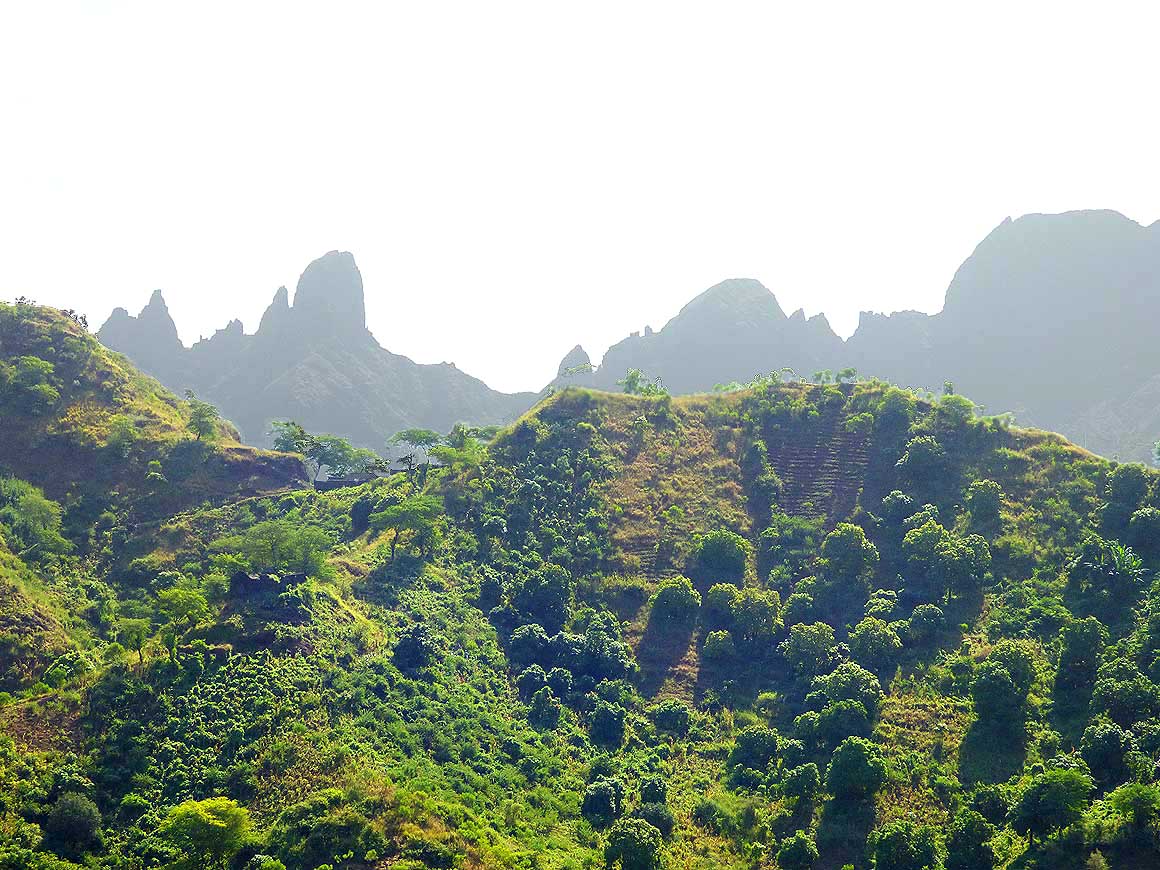
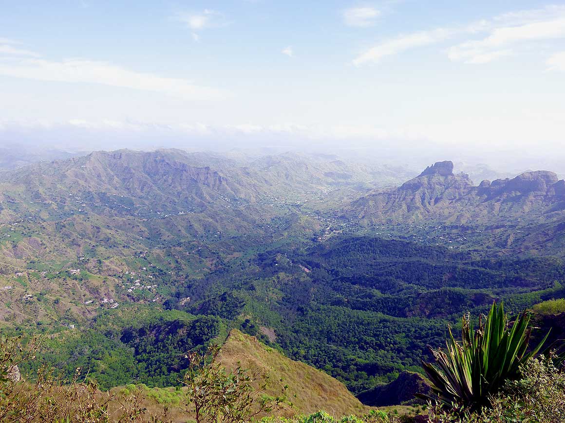
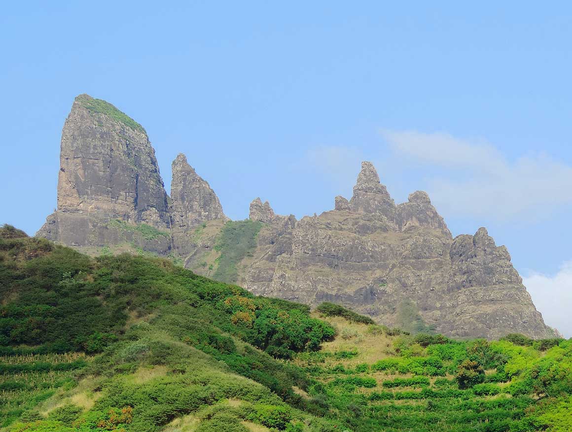
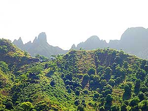
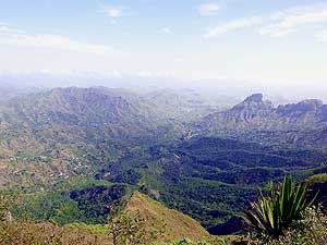
|
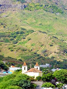
- We squeeze our heads closer against the small airplane window and
gaze to the lights that sparkle below us in the Atlantic Ocean.
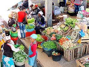
They
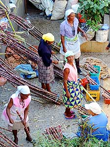
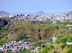
belong to Praia, the capital of Santiago, the biggest of the ten
islands of the archipelago of Cape Verde comprising 1’557 sq. mi., 360
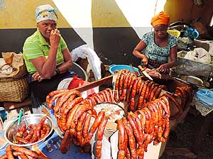
miles off the coast of Senegal. A bit of an
ungentle landing of Air Maroc
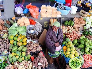
catapults us onto African soil, the starting point of our second
African adventure. It is 10.50pm of
October 8th, 2013.
|
-
-
|
-
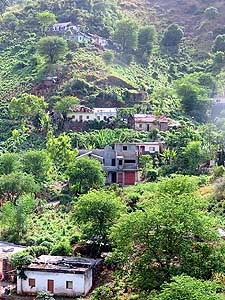
-
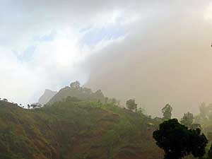
|
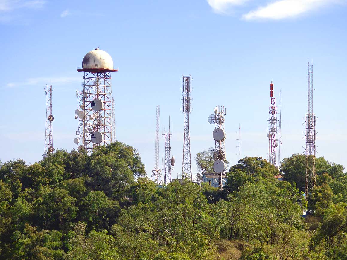
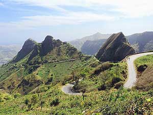
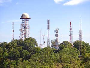
-
-

|
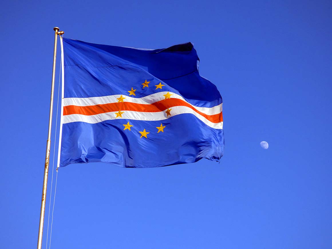
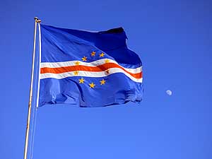
- 004
The blue of the flag of Cape
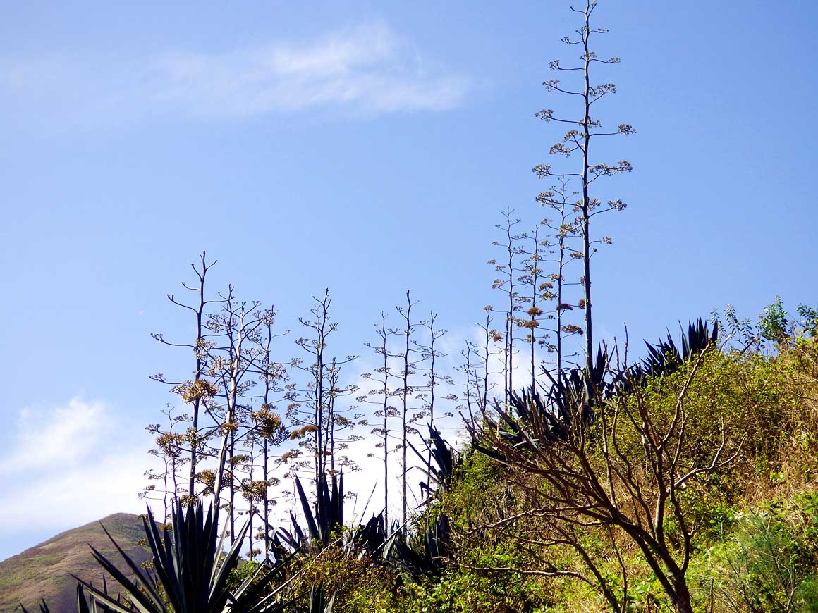
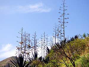
- Verde competes with the blue of the
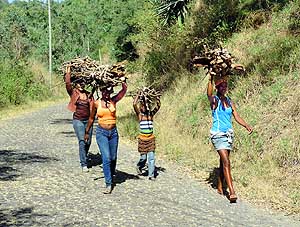
- sky and the ocean. Cape Verde
- consists of 10 islands
|
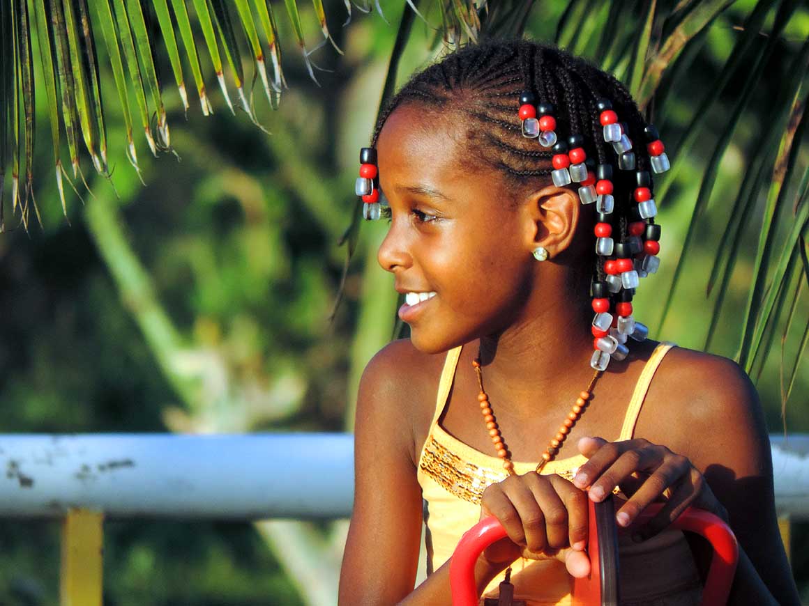
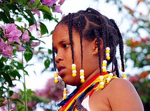
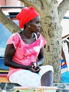
- 005
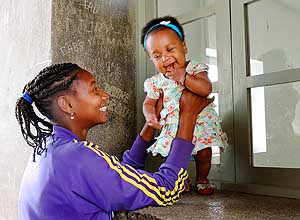
The African character is evident,
- even if the people in general are not as
- dark as on the continent: A little girl in
- Praia with decorative beads in her hair
|
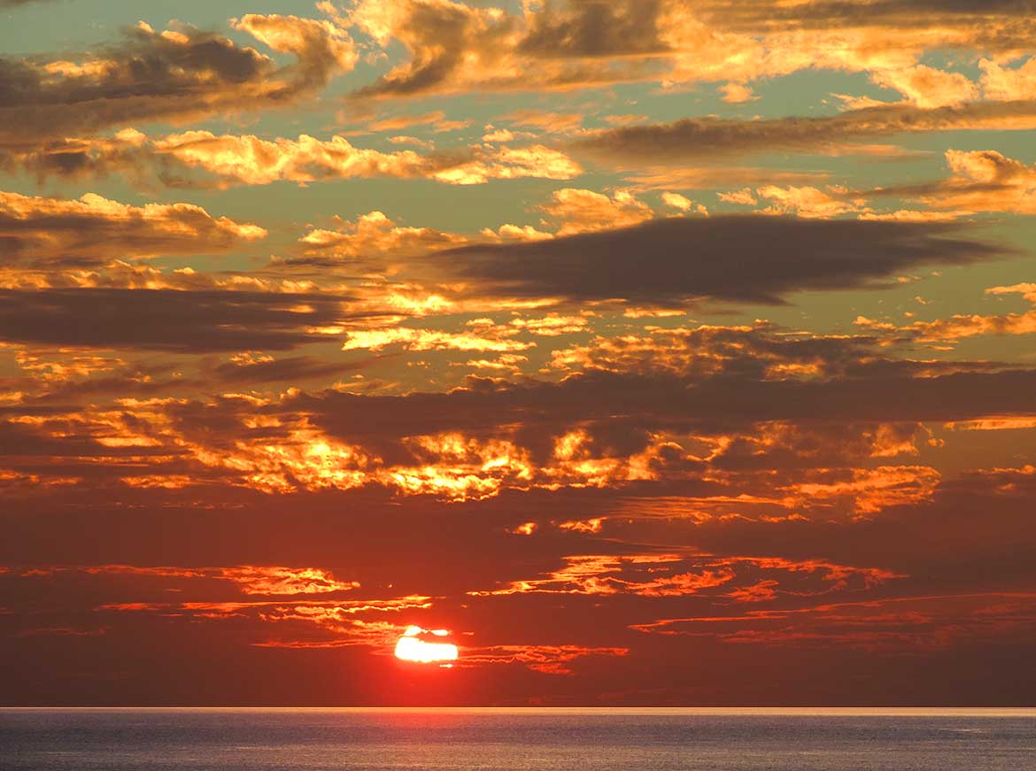
- 006
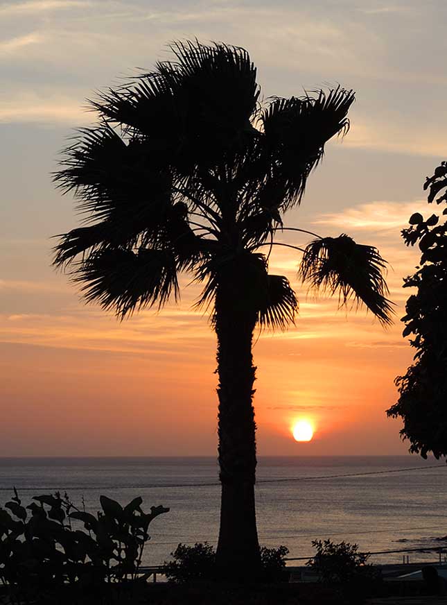
The setting sun puts the skies
- ablaze. View from the Johannes Paul II
- Square in “Achada Santo António“
- in Praia
|
- At one of the immigration counters with only one lady officer
attending there is a long queue. It is the one for “Visa on arrival”.
The other booths are long-since empty, but our lady “Sra. Ana Paula
Gomes Antunes de Pina” doesn’t get any reinforcement. Her name is even
mentioned on the visa that is issued for US$ 35 per person. We need
local money for the taxi. The ATM at the airport doesn’t accept the
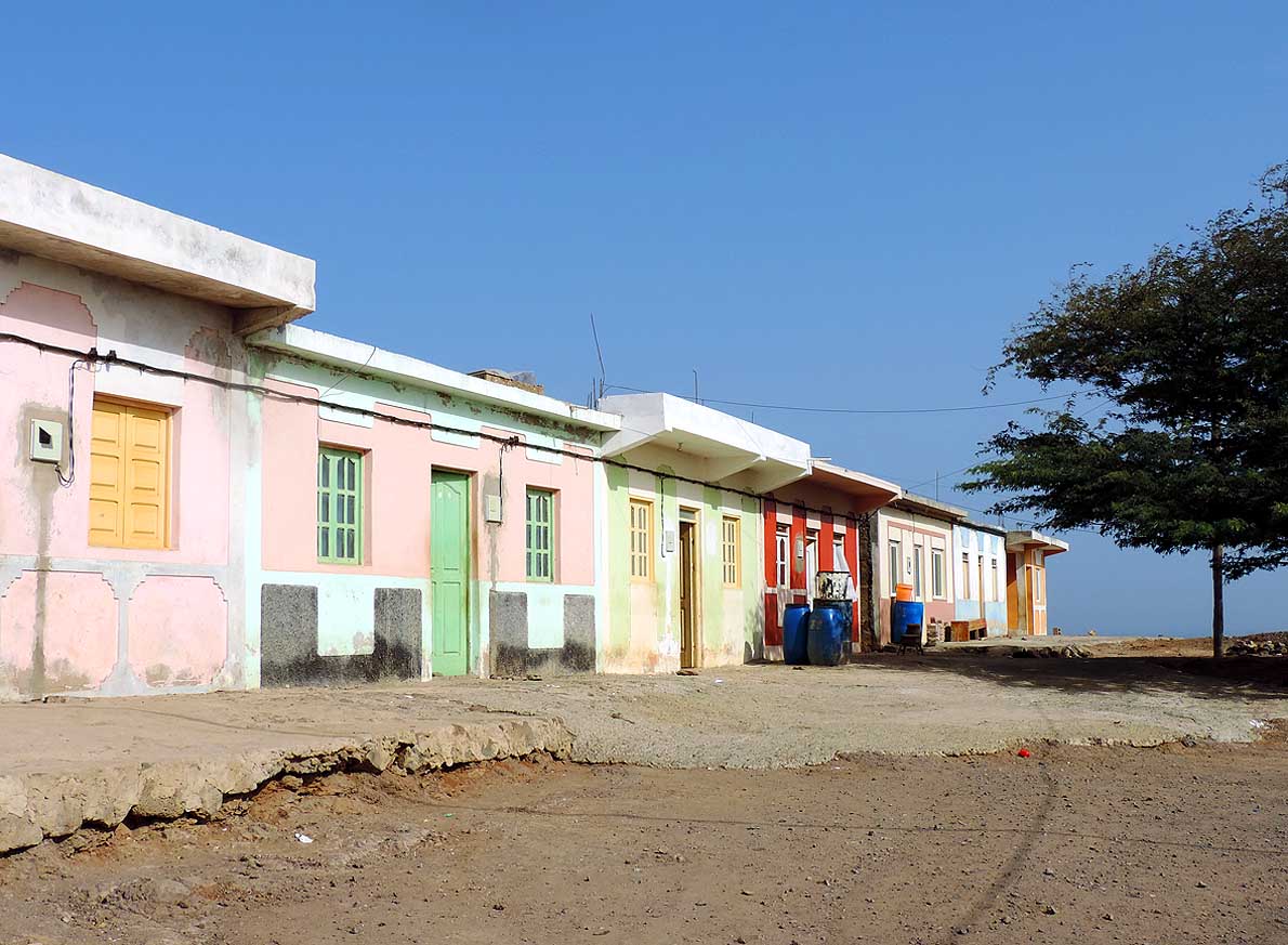
Maestro card and Visa has a limit of 20'000 CVE (Cape Verde Escudos),
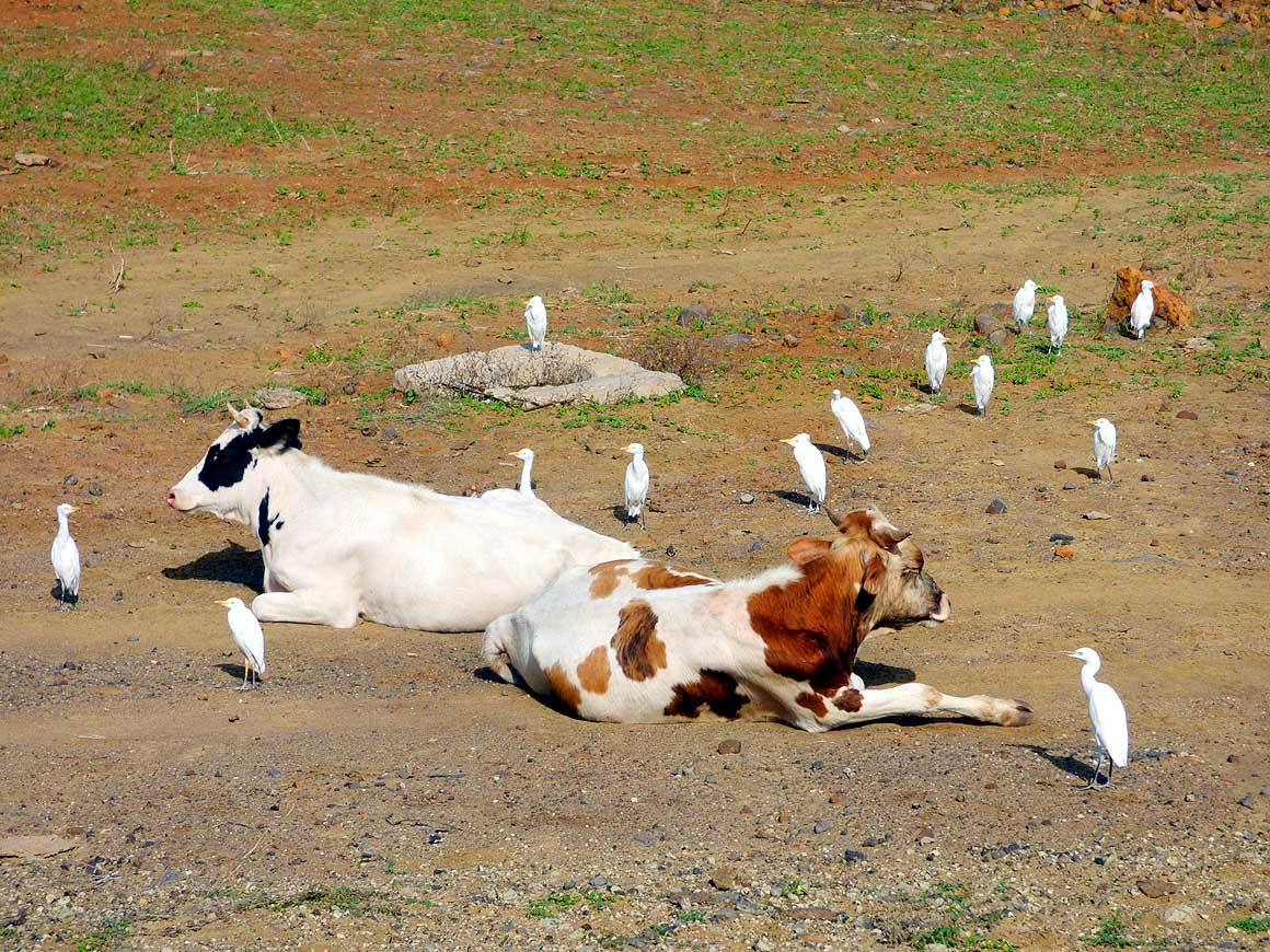
that’s about US$ 240. This was the case always everywhere during our
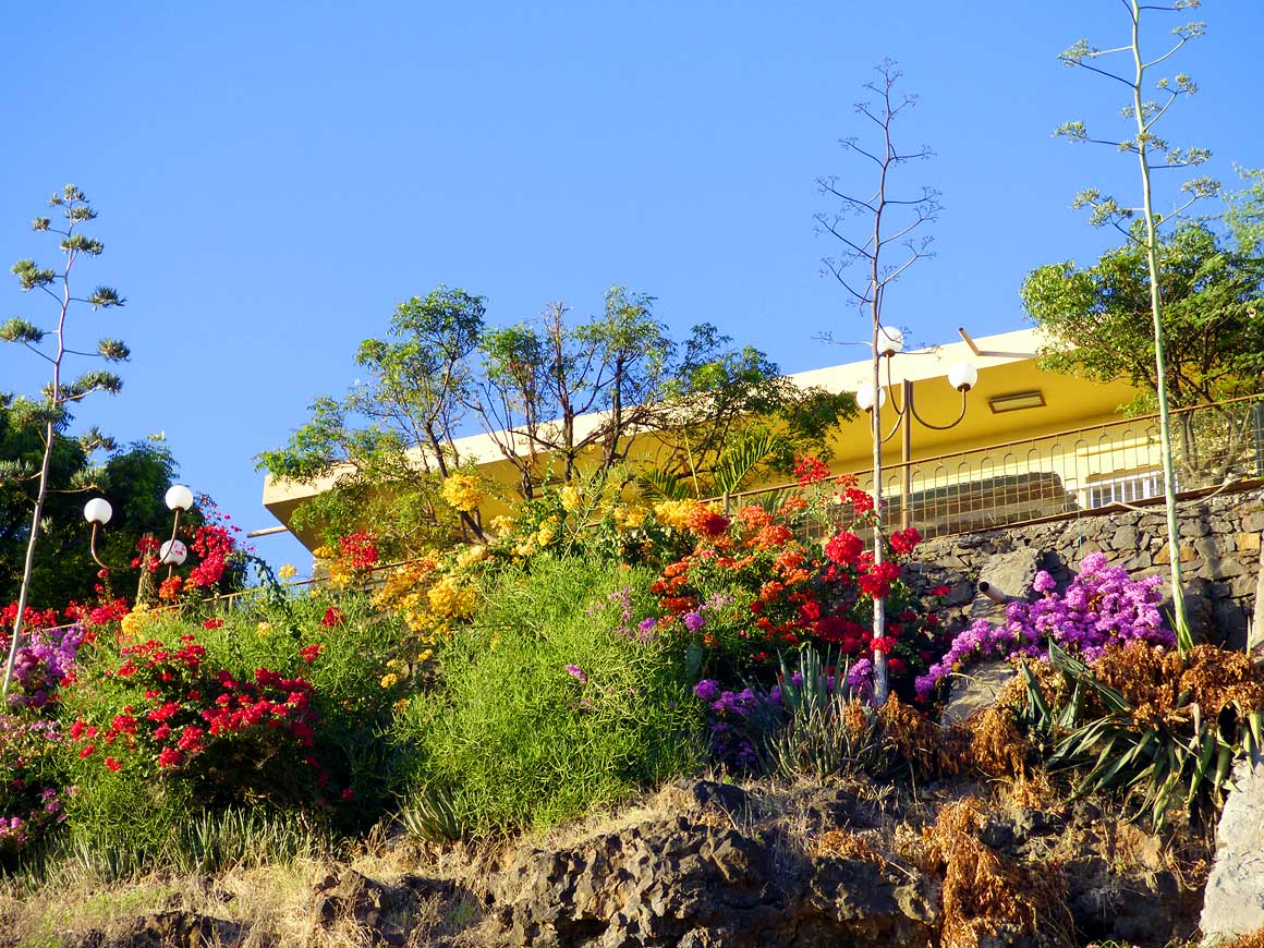
whole stay.
|
-
-
|
-
-
|
-
-
|
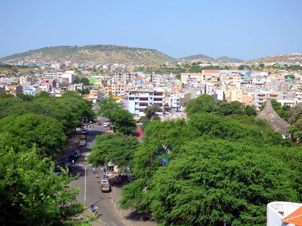
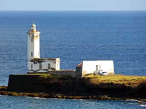
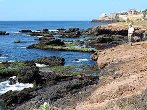
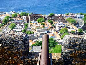
- 007
View from the elevated Plateau,
- the historic quarter, to the sprawling
- district below of “Bairro Craveiro Lopes”
- and towards the “Sucupira Market”
|
- 008
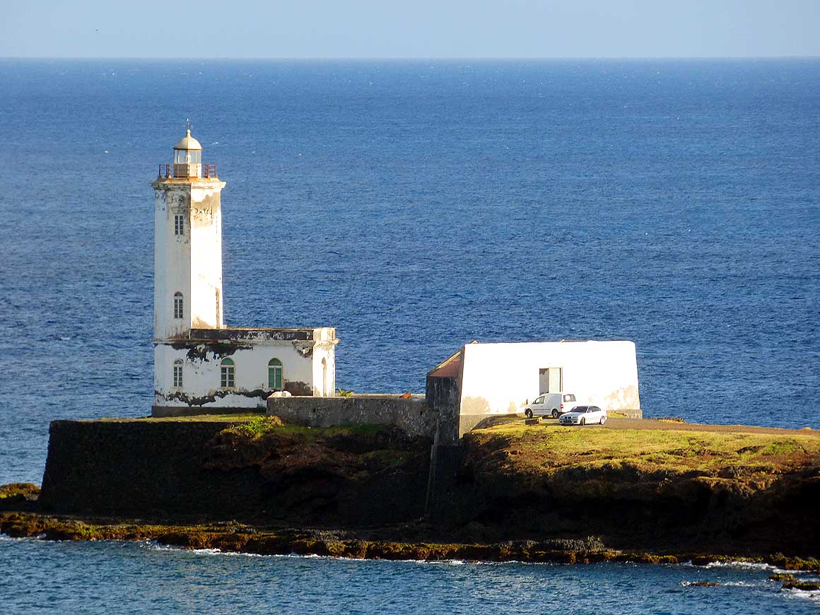
The disused lighthouse of Praia
- at “Punta Temerosa” is now just a
- reminder of the nostalgic past
|
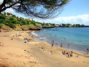
- 009
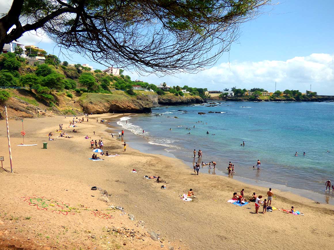
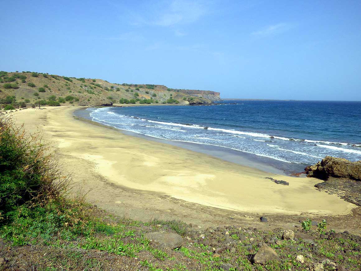
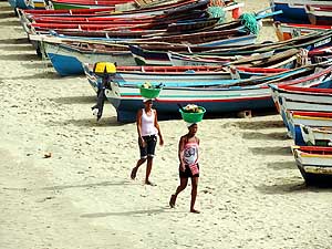
The beach of “Quebra Canela”
- gets busy with families on weekends
|
- It is 1.30am on October 9th, when we finally carry our voluminous
luggage into the sticky hot room of the prebooked guesthouse “O Jardim
do Vinho” in the “Achada Santo Antonio” region of Praia. The aircon
doesn’t work, only a “mini” fan is turning slowly, but not giving any
relief. We hastily open the window and get the second shock. All we
see is a tall naked wall that shields any outside view. The night air
that now enters through the window doesn’t make us feel better either;
it brings in just some mosquitos. Bathed in our own
sweat we pull an
all-nighter until daybreak.
|
-
-
|
-
-
|
-
-
|
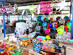
- 010
Looking for household articles?
- You will find them at the popular
- “Sucupira Market”
|
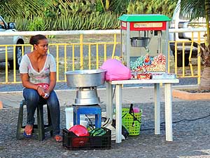
- 011
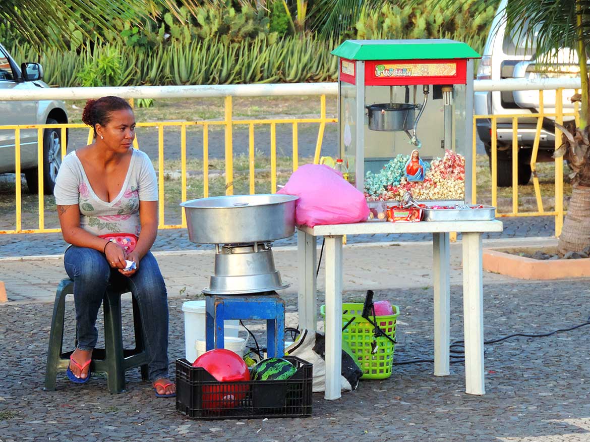
At weekends popcorn and cotton
- candy is sold at the Pope John Paul II
- Square in Praia. Having a playground, the
- recreational park is popular with families
|
- 012
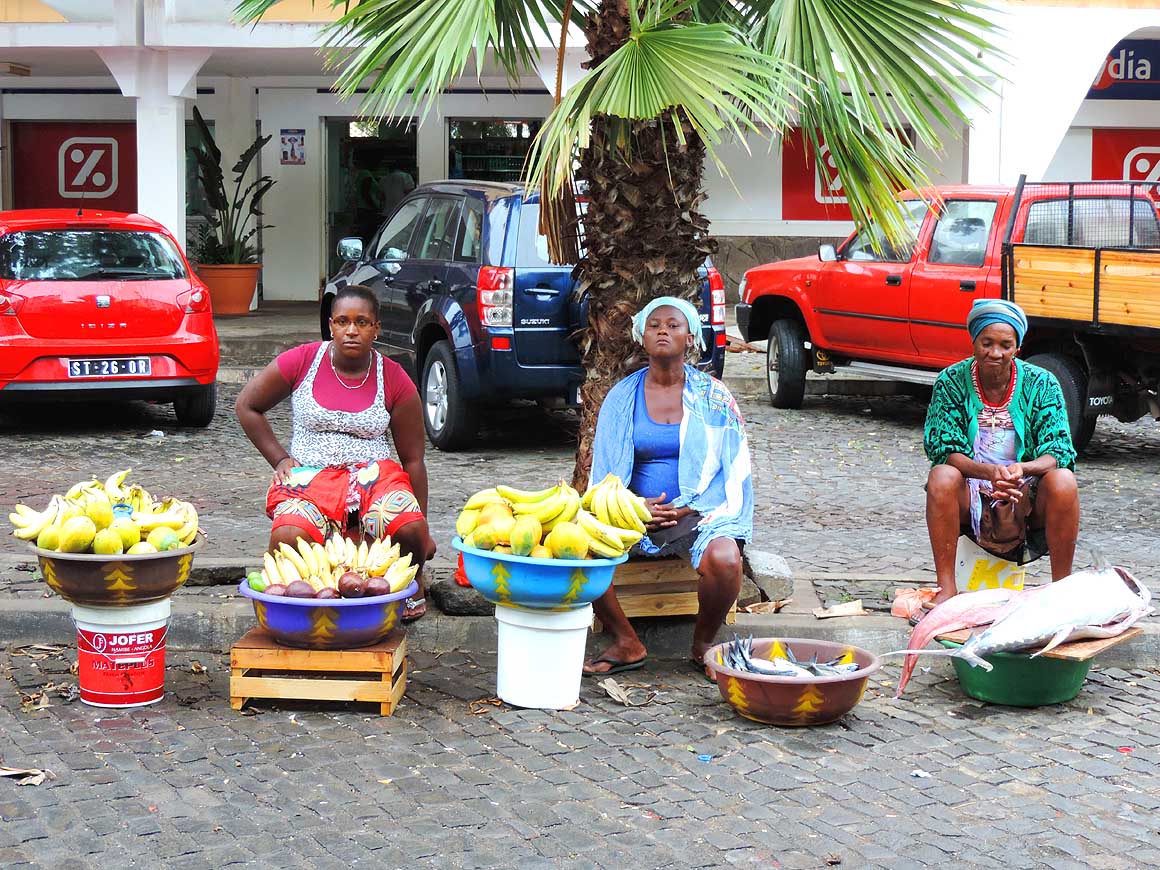
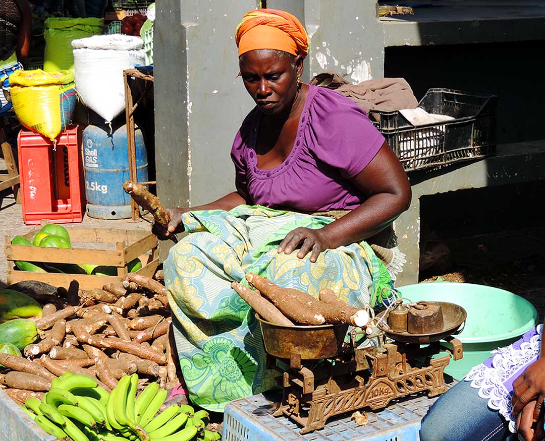
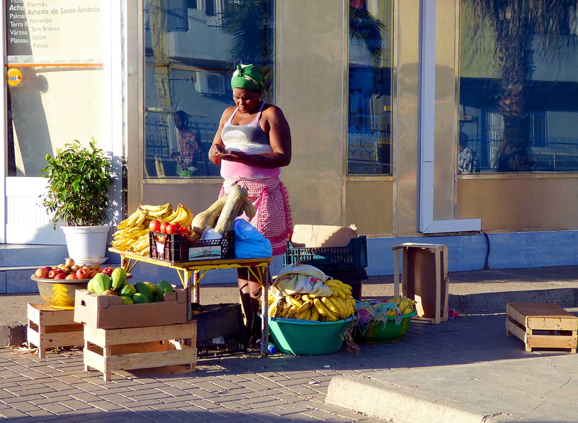
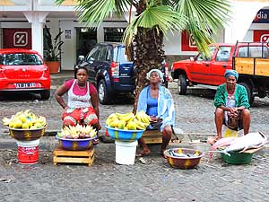
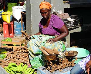
Each day the same women show
- up at the same spot to sell bananas,
- papayas, lemons, avocados and fish.
- Liliana is a loyal avocado customer
|
- At 6.30am we get up. At 7am it knocks on the door. The owner's
lady complains that we would talk too loudly. But it is not yet the
trigger that makes us look for another place. When Emil later sits at
the laptop and benefits of the offered ‘free’ wireless, the lady nags
that it is only meant for checking emails, not for surfing, because
internet on Cape Verde is expensive. This is the final straw. We check
out. After all we pay US$ 55 for a night with shared bathroom.
|
-
-
|
-
-
|
-
-
|
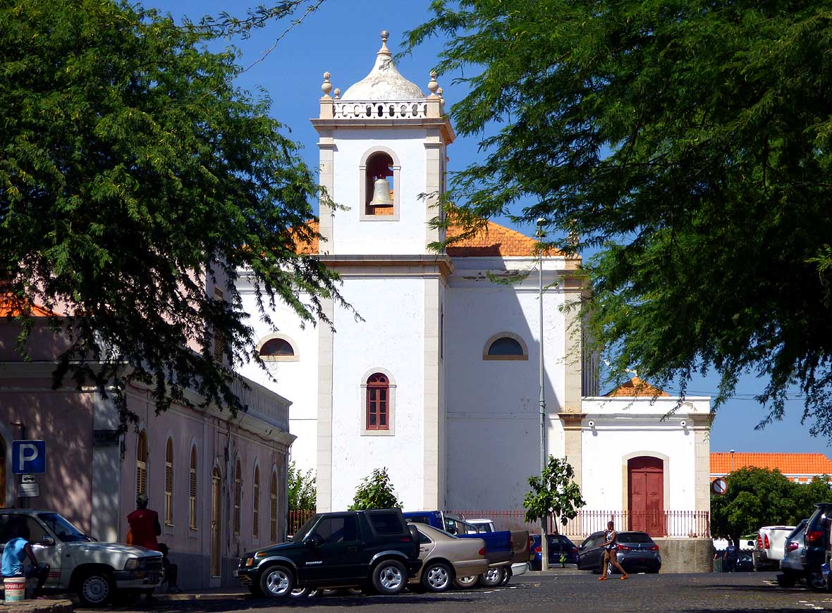
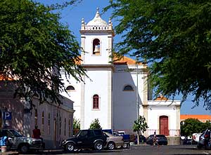
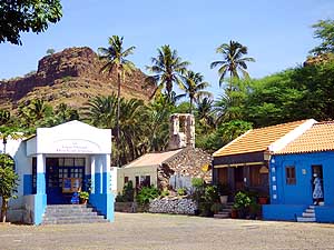
- 013
The Pro-Cathedral ”Igreja Nossa
- Senhora da Graça“ on the "Platô“
- (= Plateau) – the historical center of
- Praia – has a typical island character
|
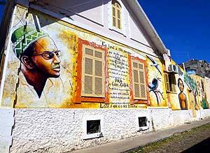
- 014
Inspiring mural with Amilcar Cabral,
- the fighter for independence for Guinea-
- Bissau and Cape Verde from Portugal, with a
- "love declaration" for Cape Verde in the side
- street “Rua Tenente Valadim” on the Plateau
|
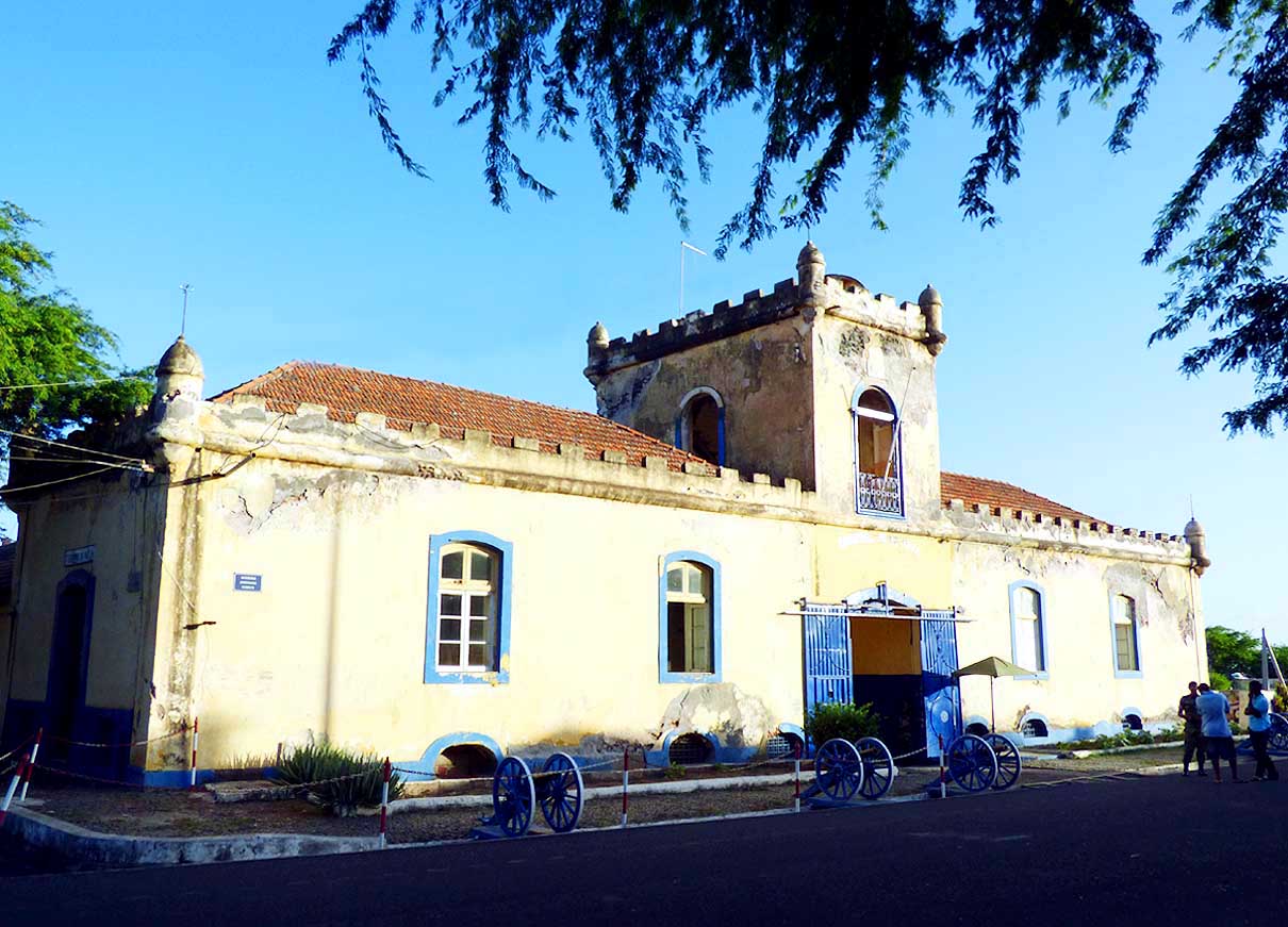
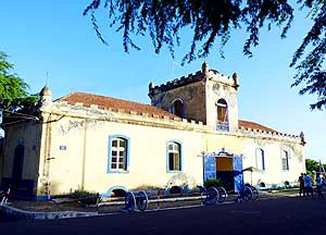
- 015
One of the oldest buildings in
- Praia – the “Jaime Mota Barracks”
- (Quartel Jaime Mota), dating
- from 1826 on the Plateau –
- shot in the warm evening light
|
- One day later we are happy again. For only 0.75 US$ more we sit at
the large front window of an air-conditioned room on the 1st floor
with an own bathroom and fridge and a nice breakfast buffet at the
Hotel America in the city center and watch the street life.
Supermarket and fruit store are just beside. And the colorfully
dressed African mamas, who each morning appear at the same corner
balancing bananas, pawpaw, lemons, avocados and fish on their heads
are tuning us for Africa. At 6pm this part
of the city gets quiet. Then only the many street dogs are roaming
around, barking, defending their territory and not leaving a single
garbage bag in place.
|
-
-
|
-
-
|
-
-

|
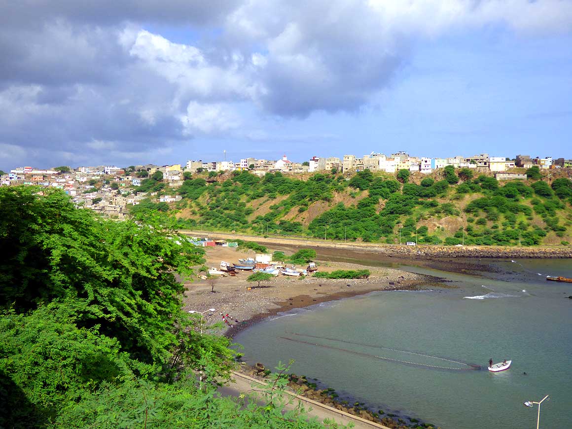
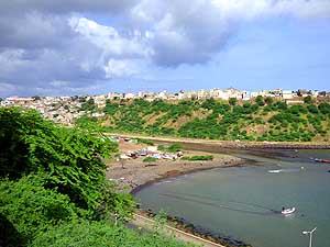
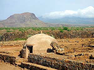
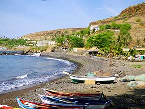
- 016
View from the Plateau down to the
- Trindade River (Ribeira de Trindade), the
- Black Beach (Praia Negra), the urban quarter
- of Achada Grande and the Port of Praia
|
- 017
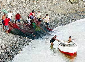
Fishing nets are pulled back in
- the Port of Praia. The catch
- seems to be meager
|
- 018
Gamboa Beach (Praia Gamboa)
- opposite of the port and the islet of
- Santa Maria (Ilhéu Santa Maria)
|
- Our shipping agency Portmar is situated on the 130 ft. high
plateau, the historic quarter of the capital. The narrow cobble stone
alleys, the colorfully painted houses and the whitewashed church –
everything bears the imprint of a peaceful island. At Portmar, we want
to get some information about the customs clearance procedure for our
LandCruiser. “The worst case scenario would be to have to make an
insurance for about US$ 400, which would cover a required guarantee”
is the guess of Joăo, the boss. This conversation takes place on
October 11th. But in the end everything goes a different way. A bond
of US$ 12'500 has to be placed for our 31 years old vehicle, which
luckily the Ministry of Tourism takes over thanks to our
Guinness Worldrecord title, having in mind a promotional campaign.
Thus, we don’t see anymore a problem. Not a bit of it! …..
|
-
-
|
-
-

|
-
-

|
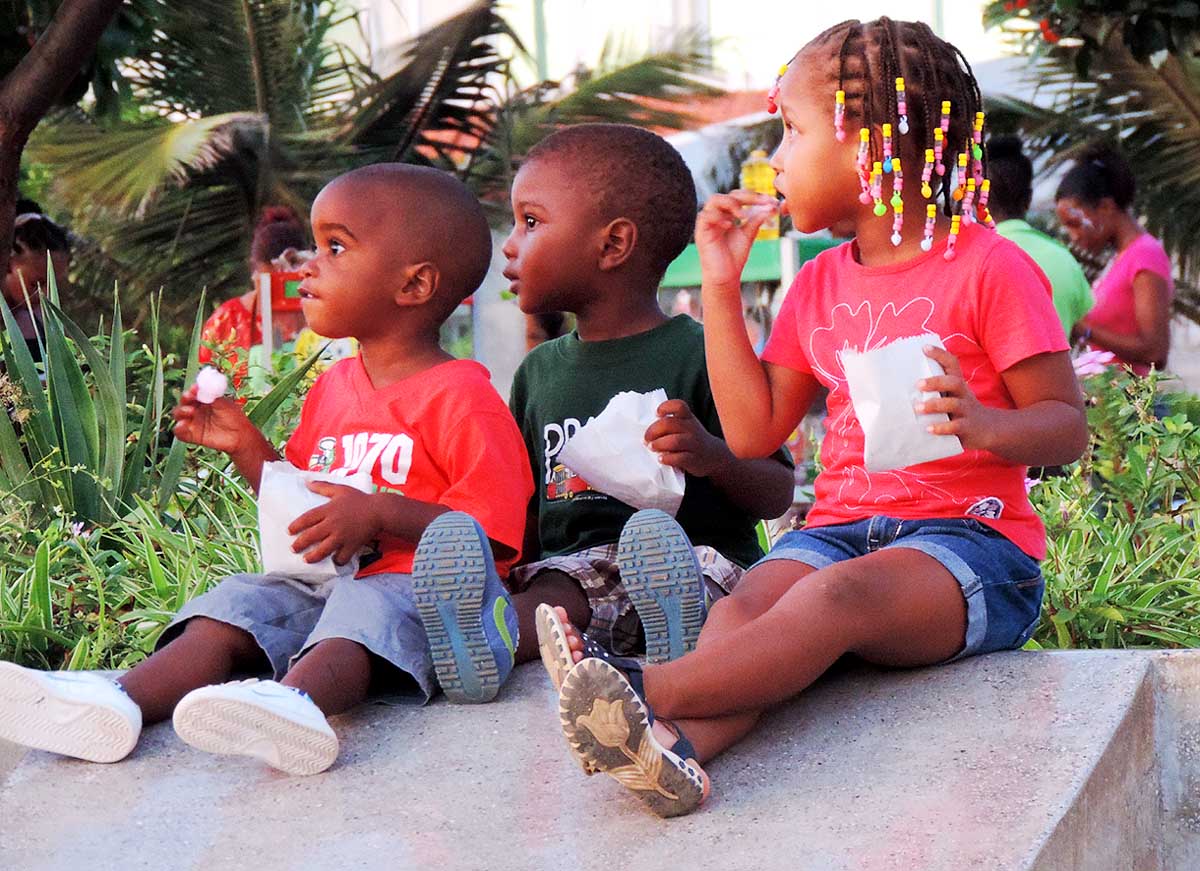
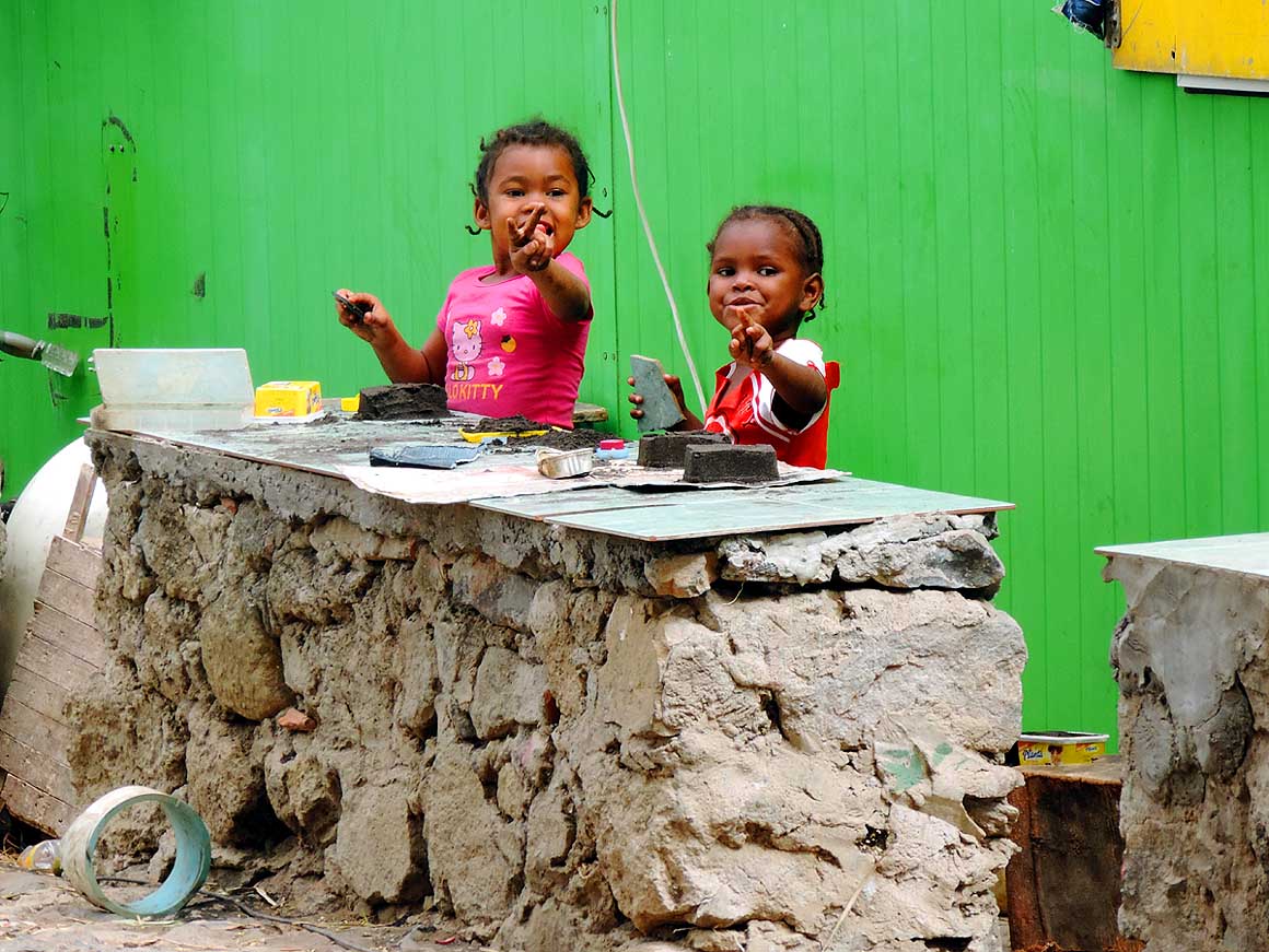
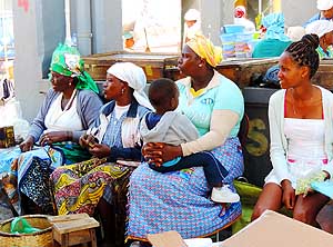
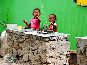
- People of Cape Verde are children lovers. According to a study they figure among the
‘TOP-5’ child-friendliest African states
|
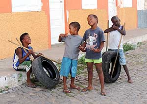
- 019
Boys are playing with old tires
- – where can and want they to do
- this in Western countries?
|
- 020
A girl sits on a seesaw
- at the playground
|
- 021
Sweet children's faces. What
- are they probably wondering about?
|
- On Saturday, October 24th, the freighter of Portline, a feeder
line of MSC, is arriving on schedule from the Canary Islands and docks
at the Port of Praia. Monday, 10/26/2013, the containers are
discharged. But from Francisco, the broker recommended by Portmar, we
don’t hear anything until the following Sunday evening. Then, we get
his following email: “Last week I was busy unloading other containers.
Tomorrow I will take care of your problem”. We are speechless! To cut
a long story short: Only on November 12th, we are allowed to open our
container. It is 3pm. Nothing can beat the feeling to see our
LandCruiser “safe and sound” in front of us and to be reunited again.
But our joy is only short living. If we thought that after customs
inspection we were allowed to leave the port, we are completely wrong,
because the customs papers and registration haven’t been orgenized at
all.
|
-
-
|
-
-
|
-
-
|
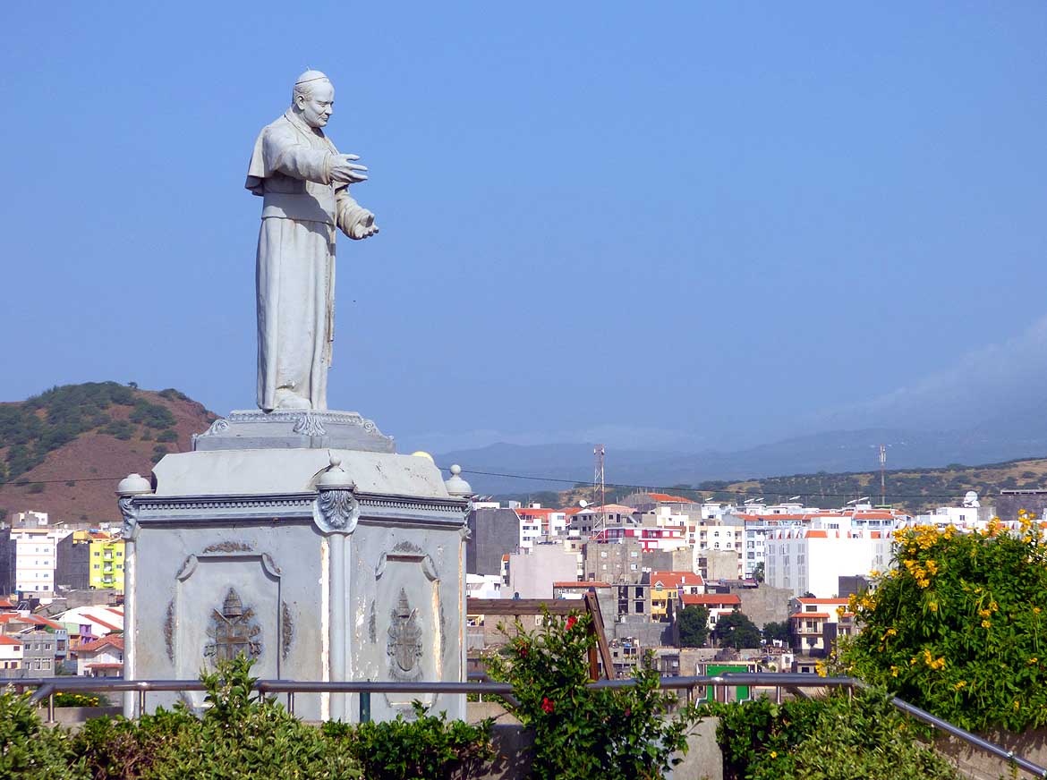
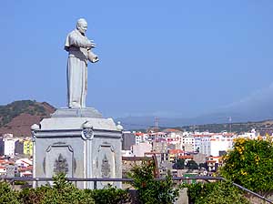
- 022
Monument of the visit of Pope
- John Paul II to Cape Verde from 1/25
- to 1/27/1990, inaugurated on
- May 19th, 2007. The square is named
- after him: “Praça Papa Joăo Paulo II“,
- and is popular for watching the sunset
|
- 023
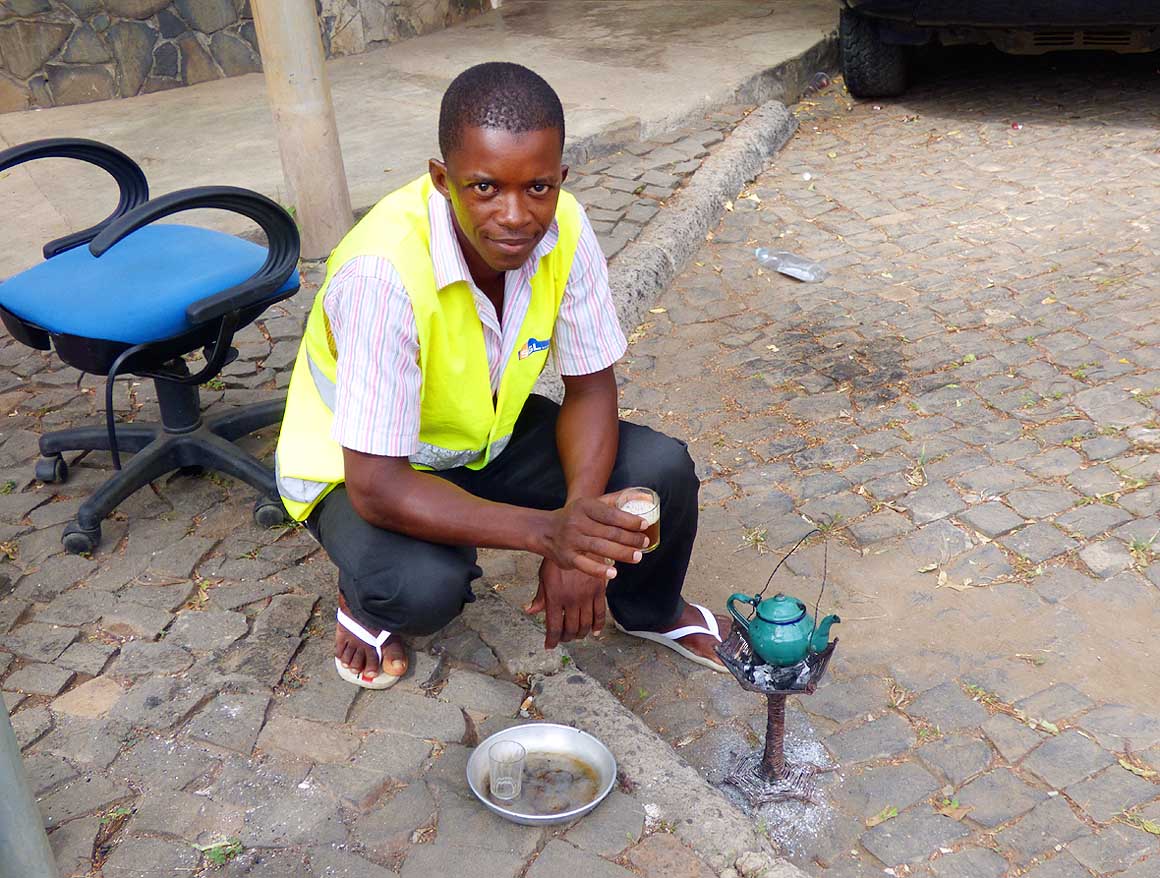
A watchman is heating water
- for a cup of tea. The security business
- is booming in Praia – anything and
- everything is guarded
|
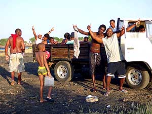
- 024
A group of young people are
- posing happily for a picture. They
- are returning home after spending
- a Sunday at Praia`s
- “Quebra Canela Beach”
|
- That means our LandCruiser has to remain in the port and, as it is
otherwise the rule for empty cars, we have to surrender the keys to
the port authority and have no access to our personal belongings
(sounds familiar to Saint Lucia in
the Caribbean!). We fight tooth
and nail to avoid it, but to no avail. “Your ‘house’ is now the
‘house’ of the port” an unfriendly guy declares in an aggressive tone.
He is supposed to be one of the bosses. Emil is freaking out totally.
He threatens to reload the LandCruiser immediately into the container
and to divert it to a friendlier country. I feel it: He is bloody
serious. Only at the last moment I can convince him to obey and to
hand over the keys to the boss of the port, making him at the same
time responsible should we miss just one small item. (We heard later
that this involved a watchman guarding always the car!) On this
evening Emil needs quite a number of Strela beers to dampen his
frustration and anger just a little.
|
-
-
-
-
|
-
-
|
-
-
-
-
|
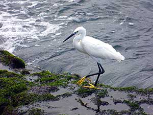
- 025
Always looking for food: A white
- Little Egret (Egretta garzetta) with
- its yellow feet at the coast near
- Praia`s shopping mall
|
- 026
Always different: Another sunset
- at Pope John Paul II square in Praia
|
- 027
Emil is enjoying the ocean view
- on our morning walk along the coast
- (Praia de Coragi) west of the
- Praia Shopping Mall
|
- The release procedure continues for further nine nerve-wracking
days. Yet on November 21st, 2013, at 5.30pm, the wonder still happens:
After 25 days we are able to drive our LandCruiser out of the port –
without further inspections (no wonder, they had the key long enough
to scrutinize it thoroughly!). It now carries a shiny red local
license plate with the number SP 96-PJ. The support of the Ministry of
Tourism and our patience were finally the key to success. We remember
that in Madagascar we vowed “to
exercise never again so much patience” when the release took nine
days. And yet – we did it again! Other than five frayed out and
leaking cans of Ukrainian beer in our Engel fridge, our “household”
has survived unharmed the 53 days lasting sea journey from the
Ukraine, including three transshipments
onto other vessels in Italy, Portugal and Gran Canaria. However the
still intact cans are standing in a smelly beer sludge. “What a pity
for the beer” Emil moans – “What a mess” I complain when cleaning up!
|
-
-
|
-
-
|
-
-
|
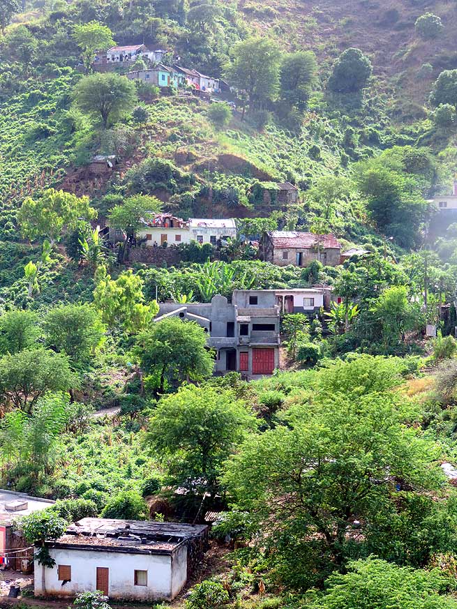
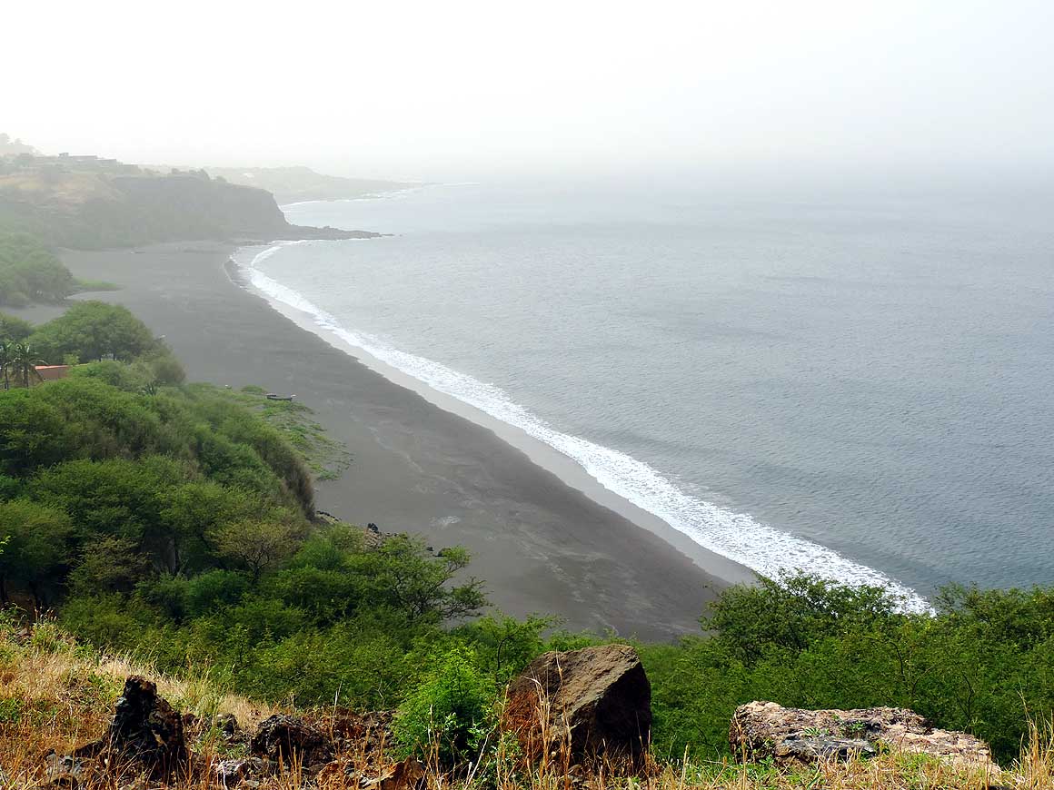
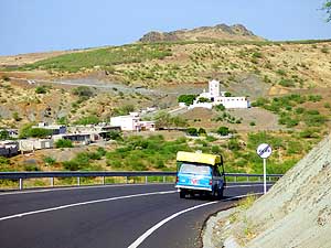
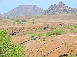
- 028
Yellow grass and thorny acacia
- dominate the landscape west of Praia
- towards the municipality of Ribeira
- Grande de Santiago. On a mound sits
- the church of Săo Martinho Grande
|
- 029
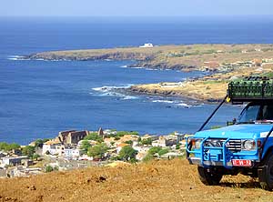
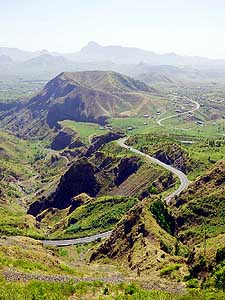
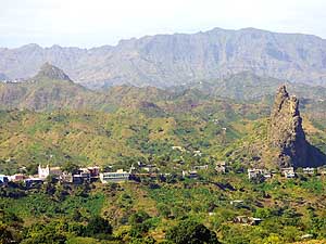
9 miles from Praia, on the plateau
- of the "Fortaleza Real de Săo Filipe", we
- admire the coastline and village of Cidade
- Velha (= Old City). In 2009 it received
- UNESCO World Heritage status as the
- first European settlement in the tropics
|
- 030
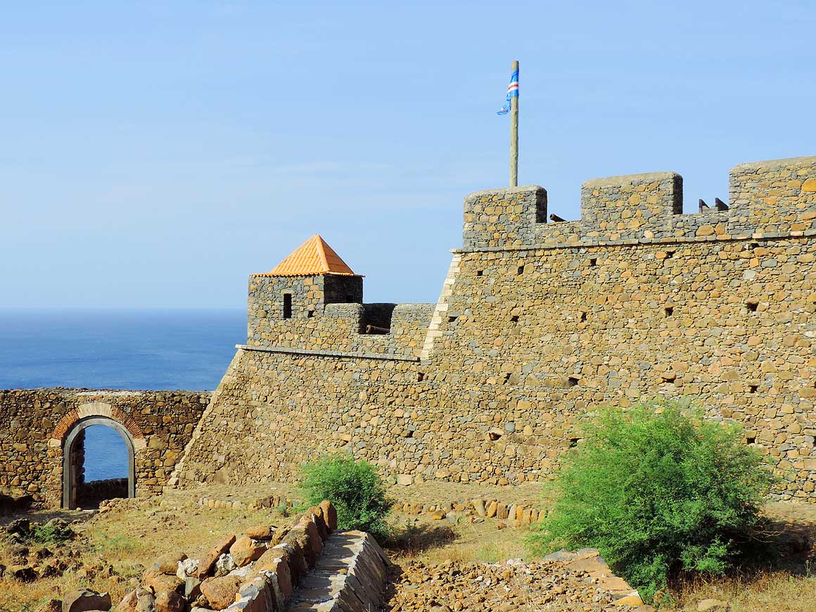
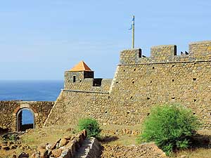
The well restored "Fortaleza
- Real de Săo Filipe" overlooks the
- Atlantic Ocean. It was built in the
- 16th century and watches
- over Cidade Velha
|
- With 383 sq. mi., the island of Santiago is the biggest of the
Cape Verde Archipelago. It is also the most “African”
with the most dark-skinned people – many from its former ally
Guinea-Bissau. Blessed with less outstanding features than its
neighbour islands, it attracts fewer tourists. It is situated at the
same latitude as the Caribbean
Islands (exactly as Martinique/Dominica)
with the sun shining every day. We are eager to leave Praia, we
finally want to go on a journey of discovery. But first we need to
wait for the concept of the promotion campaign, announced by the
Ministry of Tourism. At least we think so and feel obliged to do so
due to their support. After stopping by several times during the
following two weeks and being put off from day to day – either because
the boss is out of the country or the concept is not yet finalized –
we have reached the limit of our patience. Are they really serious
about it? Slowly we doubt it. We give them notice and finally do
what we have come to Cape Verde for: To visit the islands.
|
-
-
|
-
-
|
-
-
|
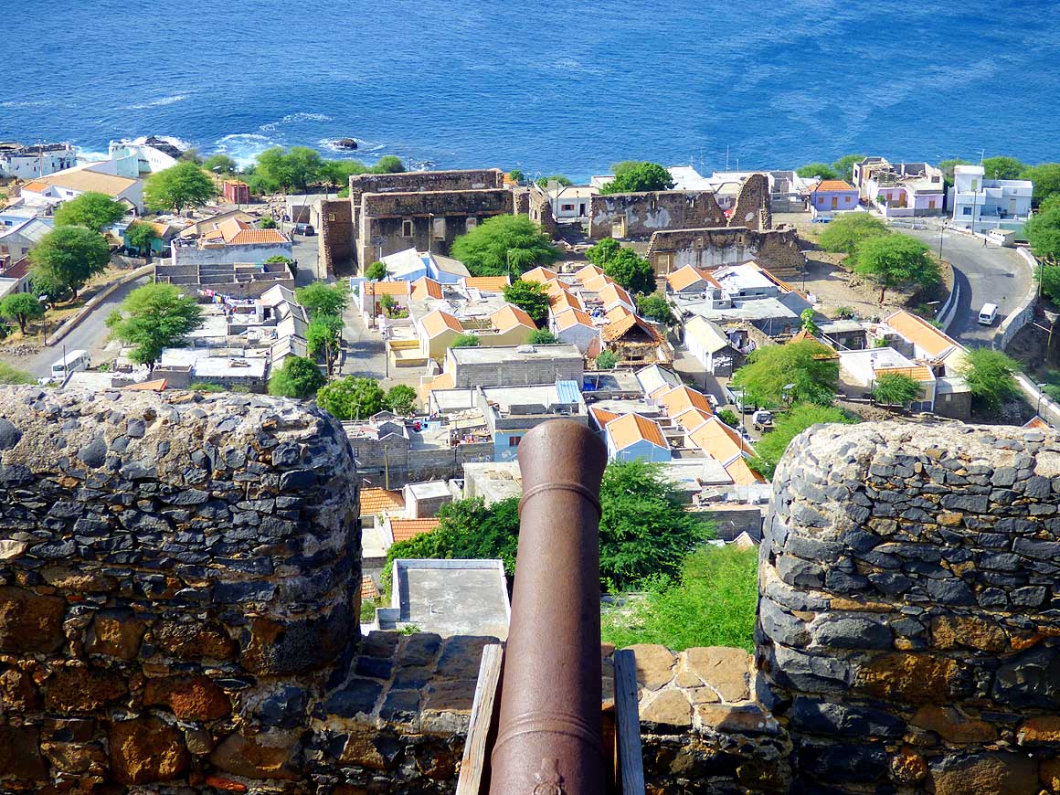
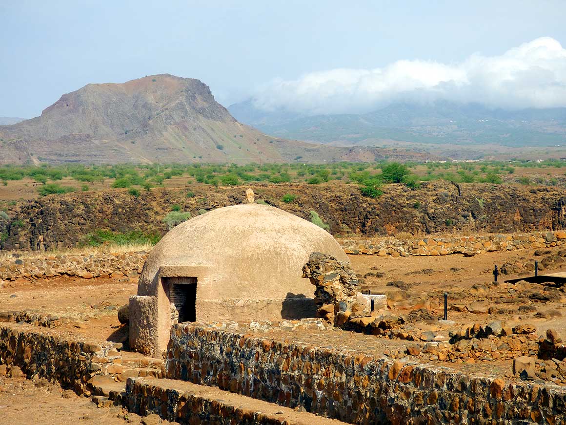
- 031
View from "Fortaleza Real de
- Săo Filipe" over Cidade Velha – the
- historic heart and former capital of
- Cape Verde. The ruins of the huge
- "Sé Cathedral" are clearly visible
|
- 032
The cistern of the "Fortaleza Real
- de Săo Filipe – today not anymore the
- original – has always had a central location
- at the " Praça de Armas". The circular
- form was taken over from the construction
- style of castles at the Iberian Peninsula
|
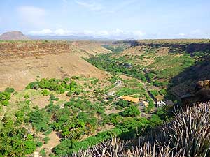
- 033
Inland of Cidade Velha a small
- green fertile ribbon meanders through
- the Ribeira Grande Canyon. Thanks
- to irrigation it remains green all year
- over. (View from the fortress
- “Real de Săo Filipe")
|
- Past a dry landscape with high yellow grass and thorny acacia
trees we drive to Cidade Velha, the historic heart and former capital
of Cape Verde, situated nine miles west of Praia. It received UNESCO
World Heritage status in 2009 as the “first European settlement in the
tropics”, and Christopher Columbus stopped here in 1498 during his 3rd
voyage to the Americas. Our first
and best view over the old capital is from the plateau of the well
restored “Fortaleza Real de Săo Filipe”, built in the 16th century,
which watches over the historic town at the Atlantic coast. Its neat
houses in the old colonial style, its cobble stone streets, its little
bay with the colorful fishing boats and the couple of high palm trees
paint the picture of an island idyll.
|
-
-
|
-
-
|
-
-
|
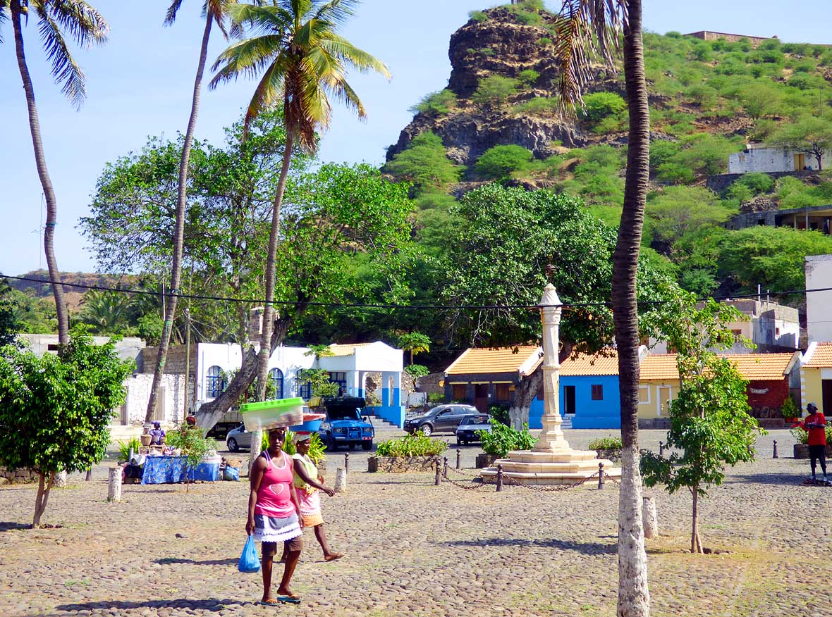
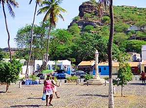
- 034
The main square of Cidade Velha
- spreads a sense of peaceful island life
- today. However, the column in the middle
- of the square was the pillory – erected
- 1520 – where the slaves on their way
- from West Africa (Guinea Bissau/
- Sierra Leone) to the Americas (Brazil/
- Caribbean) have been chained up
|
- 035
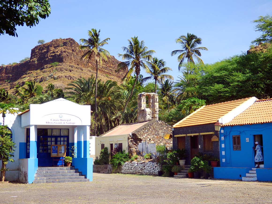
The old colonial style of the houses,
- its warm blue facades and the high palm
- trees are part of the charm of Cidade
- Velha. How might Christopher Columbus
- have felt 1498 when he stopped here
- during his 3rd voyage to the Americas? –
- or one year before Vasco da Gama
- when sailing to India?
|
- 036
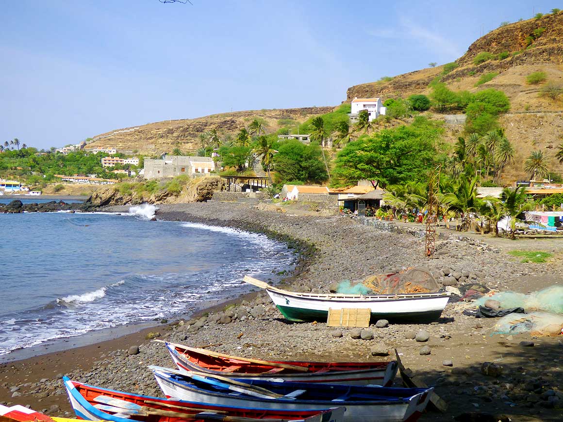
Colorful fishing boats are lined up
- at the bay of Cidade Velha. The territorial
- water of Cape Verde is rich on fish
- resources and measures over 232`000
- sq mi. EU countries like Portugal, Spain
- and France are currently also allowed
- to fish in Cape Verde waters
|
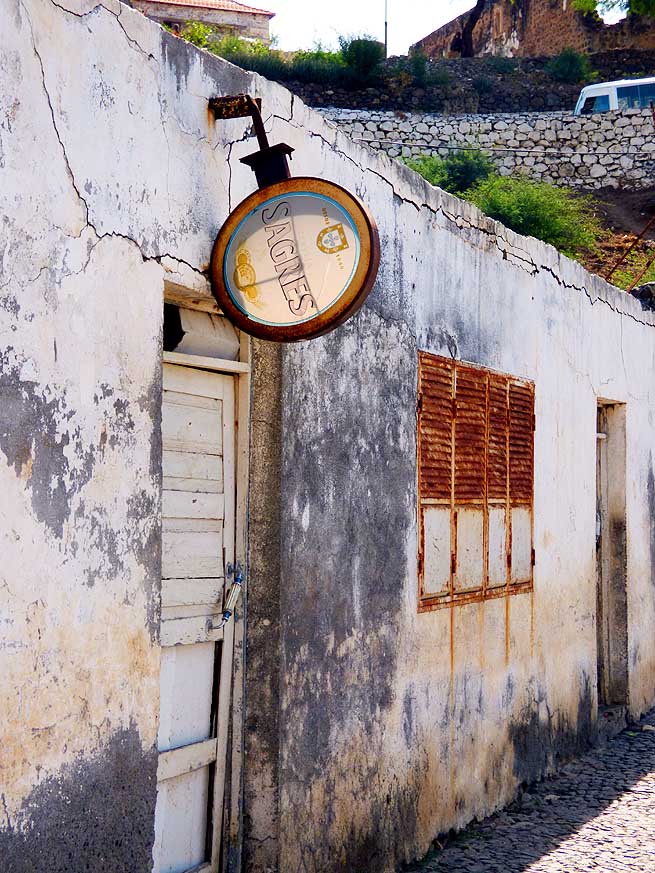
- But it was not always like it seems. The “Pelourinho”, the pillory
in the middle of the main square, erected in 1520, gives evidence. It
served to chain up and display slaves on their way from West Africa to
the Americas. Due to the convenient location between
Africa, Europe
and America the place became the hub for
the slave trade. On our stroll through the ruins and the narrow alleys
we discover, however, also a nostalgic remnant from the Portuguese
area: A rusted “Sagres” beer sign hanging above the door of a former
bar.
|
-
-
|
-
-
-
-
|
-
-
|
- 037
Young and beautiful: A banana
- vendor under the big tree of the village
- square of Cidade Velha – her cell
- phone always “ready”
|
- 038
Cobbles belong to the picture of
- historic Cidade Velha (but is seen also at
- many other places in Cape Verde, though
- they are more and more tarred over) .....
|
- 039
..... on our stroll we discover a
- nostalgic beer sign from the Portuguese
- area – here must have been a bar during
- colonial time (before July 5th, 1975),
- which sold the Portuguese beer
- “Sagres” from Lisbon
|
- Then we leave behind the cradle of the Cape Verdean roots, and are
immediately surrounded again by the dry landscape recalling the Sahel
Zone of West Africa. After two miles the coastal road continues
inland. We turn and drive back to Praia. Next day, in a blitz we book
the ferry to the western neighboring island of
Fogo – 35 miles beeline or about twice so much for the ferry. We postpone the North of Santiago to after our return. Then
we will have plenty of time for it until a transport possibility to
the northern islands arises.
|
-
-
|
-
-
|
-
-
|
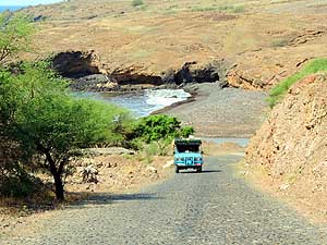
- 040
About 2 miles west of Cidade Velha
- we are again back in the nature. The hill to
- the left is the 1’510 high Monte Graciosa,
- an ancient volcano. The dryness recalls
- the Sahel Zone of West Africa
|
- 041
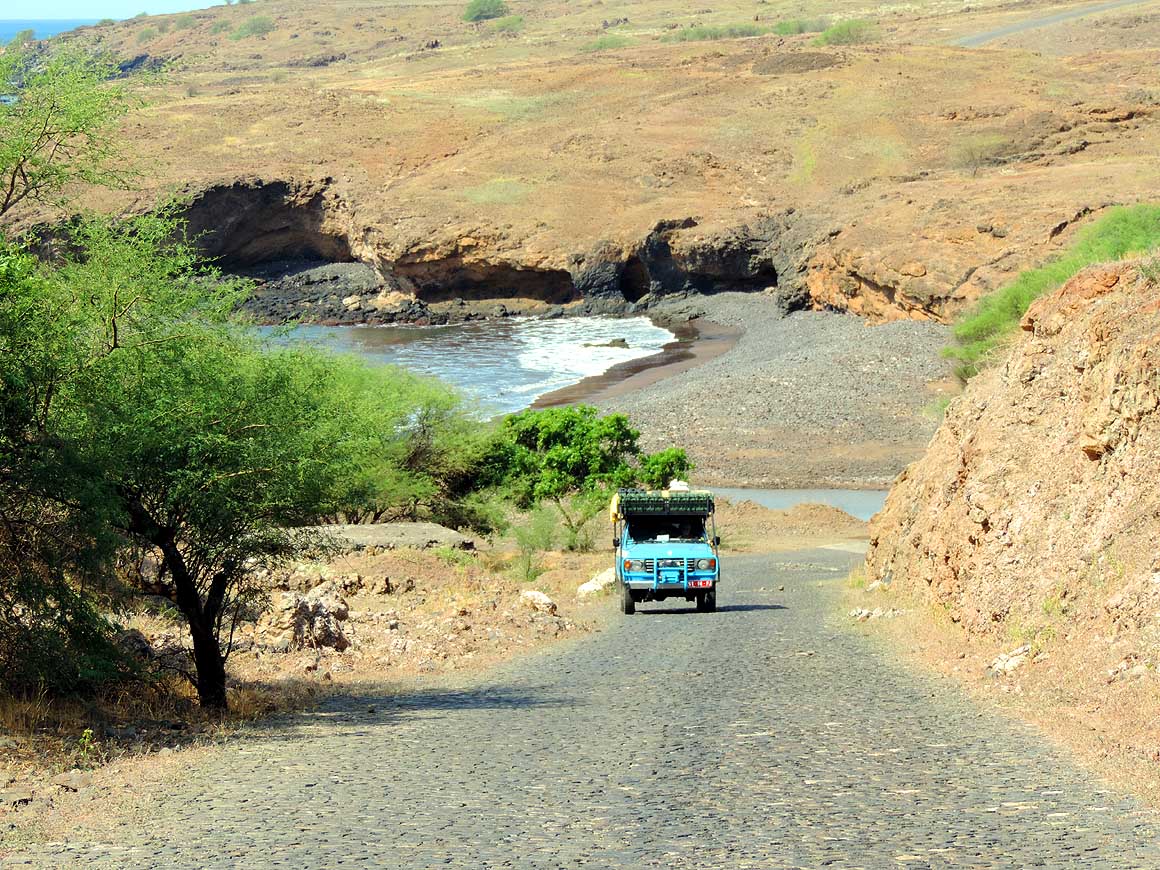
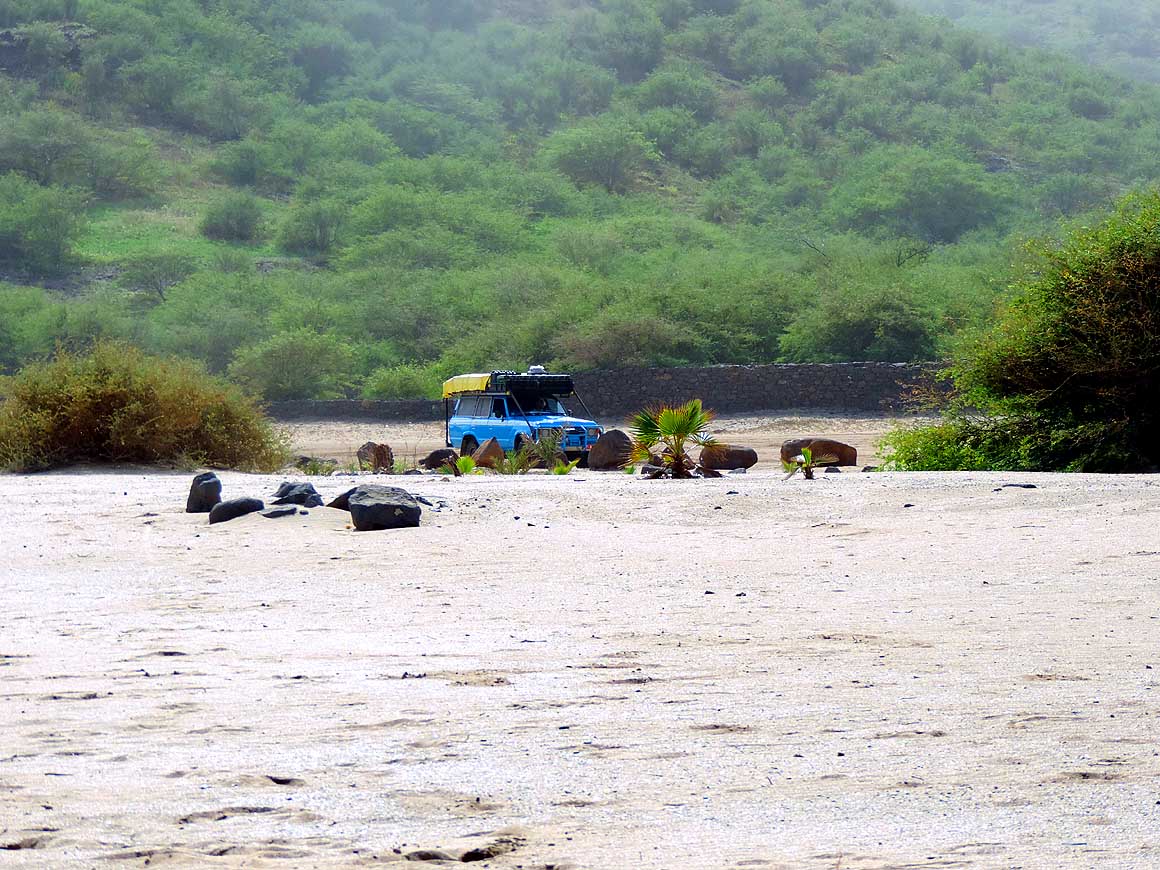
Our LandCruiser is climbing back
- from the little black sandy beach west of
- Cidade Velha. The water temperatures is
- between 72 and 77°F throughout the year
|
- 042
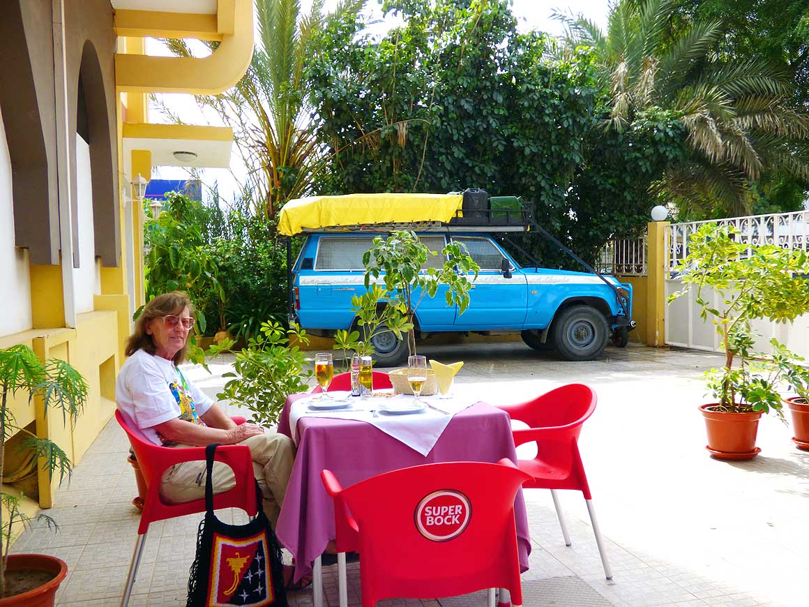
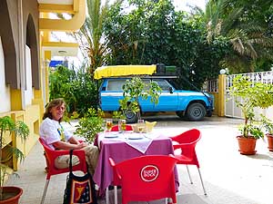
Liliana is enjoying a Strela Beer at
- the newly opened "Rincón de Juan" at the
- Hotel America in Praia waiting for her
- "Cachupa" meal to be served (a local
- dish of pea and corn with fish or ham)
|
-
|
- We visited from December 13th to 23rd, 2013, the island of Fogo and from December 23rd to 26th,
- the island of Brava, before we
explored the East, North, West and the Interior of the island of Santiago
|
-
-
|
-
-

|
-
-
|
- 043
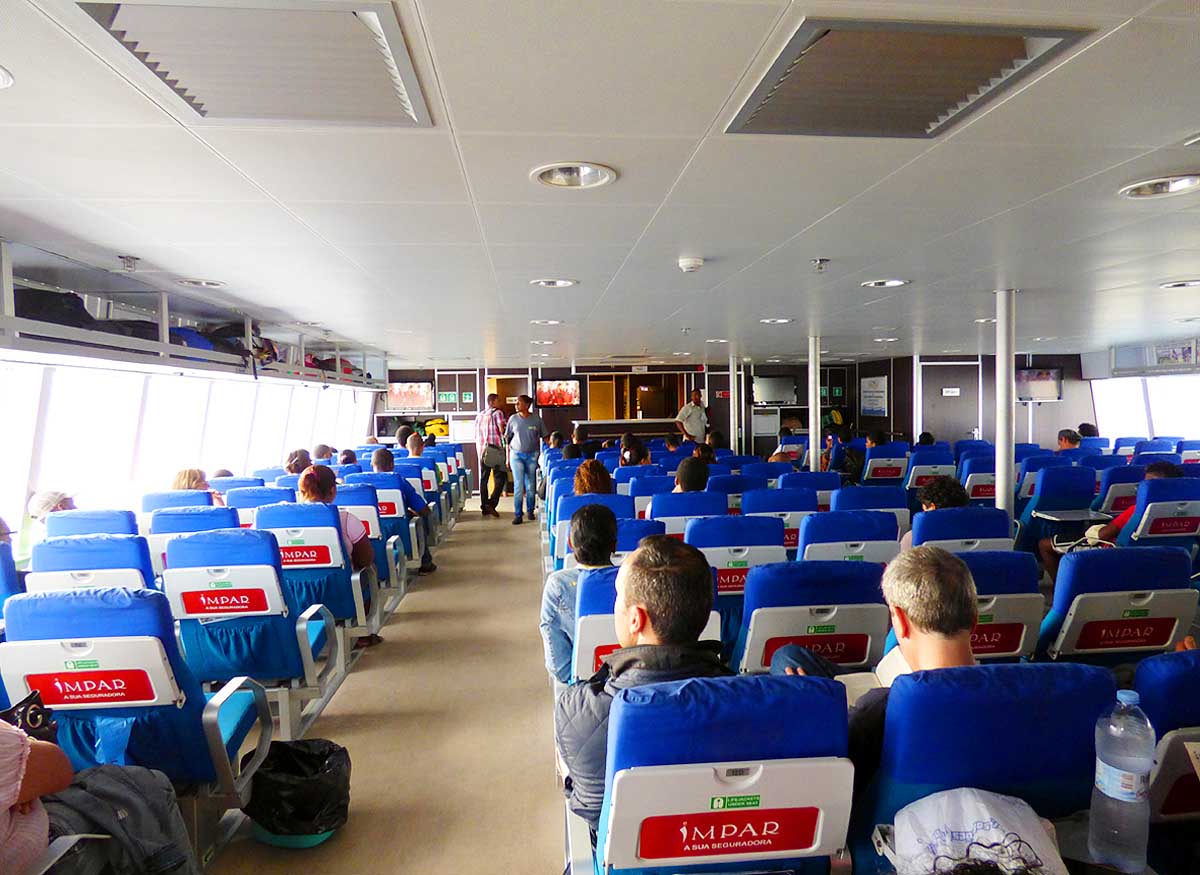
Friday, the 13th: Departure from
- Praia on the island of Santiago with the
- FastFerry "Kriola" to the neighbor island
- of Fogo. The 4-hour passage is famous
- for being very choppy what it also is.
- Liliana can only "survive" with pills
- against sea sickness
|
- 044
We are lucky. The height of the hull
- of the FastFerry is limited to 7'5". After
- we lay down our “showering” jerry cans
- and take our "washing machine" jerry
- can down to the front seat, it just fits
|
- 045
The interior of "Kriola" is very clean
- and comfortable. There are two hostesses
- who distribute vomiting bags and clean
- off continuously the mess. The majority of
- the maximal 164 passengers get seasick
|
- “Down at the beach there is a similar equipped car as yours“ Joăo
from the reception of our hotel informs us one day. Becoming curious
and always ready to meet same-minded people, we head straight down to
the beach. We don’t have to search for long. The crowd of people
indicates the place. It must be something really special, we think.
Yes, it indeed is! This is how we get to know Mait Nilson from Estonia
with his Amphibear
Mobile (a LandCruiser floating on two pontoons). He needs to do some
welding and is waiting for the low tide.
|
-
-
|
-
-
|
-
-
|
- 046
"Praia de Săo Francisco" – a
- ‘white’ sandy beach – stretches along a
- lovely bay about 12 miles northeast of
- the capital Praia, which has a
- population of about 125’000 .....
|
- 047
..... during the week we are almost
- alone. We resist to camp there for the
- night. Beaches have never belonged to
- the spots where we would pitch up a
- wild camp (when we are alone)
|
- 048
In Praia we meet Mait from
- Estonia with his Amphibear Mobile (a
- LandCruiser floating on two pontoons).
- He needs to do some welding and is
- waiting for the low tide. He arrived by
- sea from Dakar/Senegal and wants to
- continue to Brazil (20 days). But shortly
- after Cape Verde he had to be rescued
- in the Atlantic. According to his blog
he
- abandoned now his ambitious project
|
- He tells us that he arrived “sailing” about 420 miles (365
nautical miles) from Dakar/Senegal and intends to continue to Brazil,
exactly the island of Fernando de Noronha, counting 20 days for the
crossing of about 1’430 miles (1’240 n.m.). Knowing the caprices of
the Atlantic from our journeys with the FastFerry to
Fogo and
Brava, we are concerned, the more that he is solo on his own. We
just hope that everything is going well. Later, however, we read in
his blog that shortly after leaving Cape Verde in southwesterly
direction he had to be rescued after about 110 miles (96 n.m.).
Apparently the damage on the pontoons was so big that he had to
abandon his ambitious project.
|
-
-
-
-
|
-
-
|
-
-
-
-
|
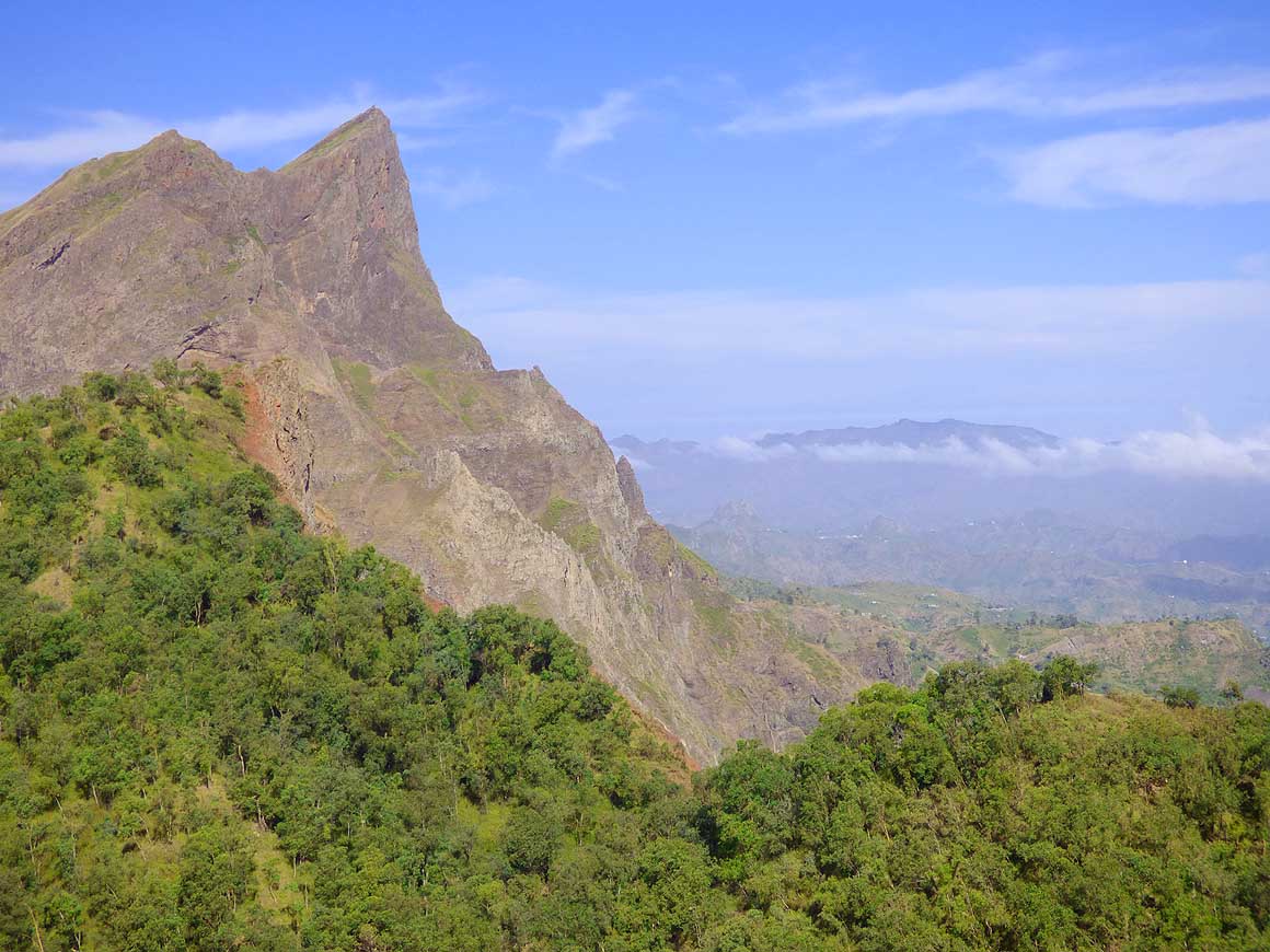
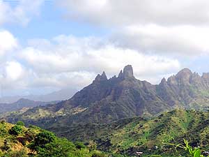
- 049
Emil whips out the camera. The
- first peaks in the interior are luring in the
- distance. “Pico Antónia“ (left side, 4'574 ft.)
- is the highest and also coldest spot on the
- island, dropping to 48°F
|
- 050
The village church of Săo Domingos
- in the mountainous interior. Religion plays
- an important role on Cape Verde. About
- 80-85% of the population belongs
- to the Roman Catholic Church
|
- 051
The jagged silhouette of the impres-
- sing mountain range with the 4'574 ft. high
- “Pico Antónia”, the highest mountain on the
- island of Santiago, which has a population
- of about 240’000 and measures 627 sq.mi.
|
- Tarrafal with its white sandy beach in the hotter Northwest is our
goal on New Year’s Day 2014. We chose the longer road via the east
coast. There is very little traffic and few people are on the streets.
Some wave us with a bright smile, others shout for “money“. It gets
greener. The first small palm coves and cultivations of vegetable,
maize and sugar cane appear as we roll from Cancelo for many miles on
the bumpy cobble stone street north.
|
-
-
-
-
|
-
-
|
-
-
-
-
|
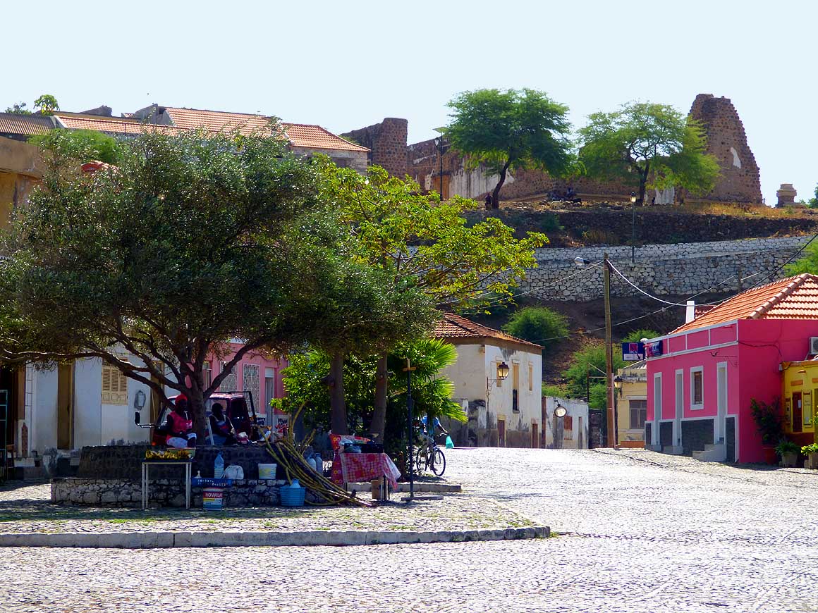
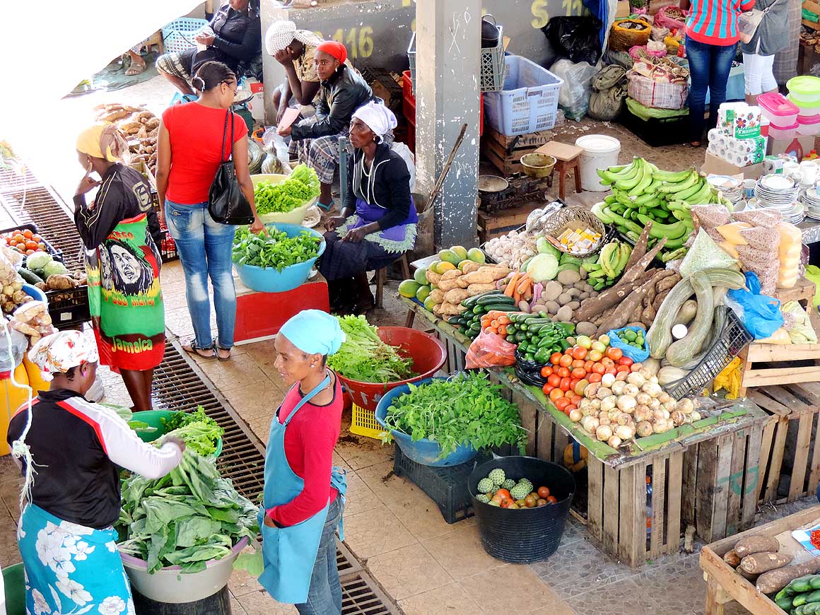
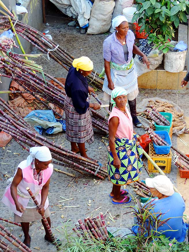
- Assomada's Saturday market, the second largest town on the island of Santiago, is
especially lively and colorful.
- The vendors with their colored head scarves add to the brightness. Typical regional
produce is displayed
|
- 052
Salad, herbs, vegetable –
- everything fresh from the garden
|
- 053
Sugar cane that is also
- offered peeled in small pieces
|
- 054
Lemon, coconut, pawpaw
- besides all kind of vegetables
|
- We pass some small villages that all look deserted on this New
Year’s morning. It is lunch time when we arrive at the white sandy
picture book beach of Tarrafal with its turquoise sea and swaying palm
trees. It is also deserted. Even the colourful fishing boats that give
the semi-circular bay its special charm are resting today. In the
village the shops are also closed.
|
-
-
|
-
-
|
-
-
|
- 055
There are also hot sausages
- fresh from the pot
|
- 056
There is always time for a
- break and a little chat
|
- 057
No market lady without a balance:
- Here she weighs cassava roots
|
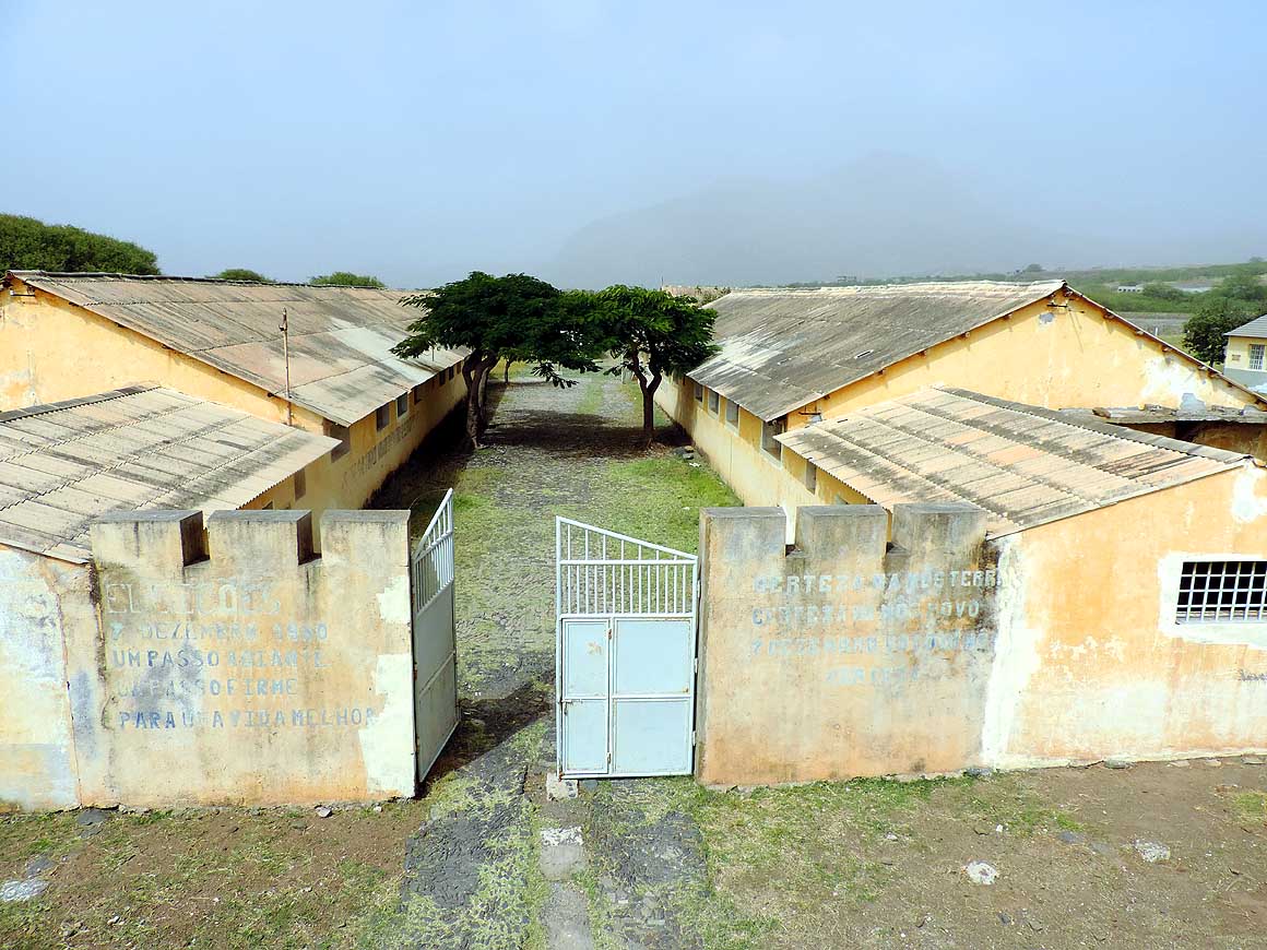
- But the museum of the former concentration camp “Campo de
Concentraçăo do Tarrafal“, 1˝ miles south of Tarrafal, has its door
open. It was built by the Portuguese in 1936 and closed in 1954.
Children besiege the entrance and shout for “money”. For many years
the fascist regime of Salazar tortured and murdered here resistance
fighters and critics. In the tiny museum there are pictures and
documents of the atrocities. The labelling, however, is only in
Portuguese.
|
-
-
-
-

|
-
-
|
-
-
-
-
|
- 058
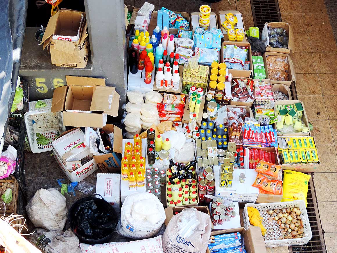
From onions to tooth paste, from
- toilet paper to margarine, from oil to fruit
- juice – at the market in Assomada
- almost everything is available
|
- 059
There is nothing that cannot be
- transported on the head! Outside
- the market of Assomada
|
- 060
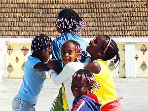
The joy to play is visible on the
- faces of these girls. The colorful beads
- in the hair give them the special cute look
|
- On our way back, we decide to follow the western coastal road
winding for around 3 miles through a lovely mountain scenery with
stunning coastal views. At the deserted black sandy beach of “Ribeira
da Prata“, engulfed by a green vegetation belt, is the tiny camping
“Chez Louis“. When the sign appears it is a bit of a disappointment to
see that there is only a foot path, no possibility for vehicle
travelers.
|
-
-
|
-
-
|
-
-
|
- 061
Judith and Philipp from Switzerland
- wave good-bye. We first met on the island
- of Fogo and it was lovely to see them again
- in Assomada and share some stories
|
- 062
Assomada is situated in the center
- of the island. With more than 12’000 people
- it is Santiago's second largest city, lies on
- an altitude of 1’106 ft. and is known for
- its colorful market days
|
- 063
"Look at this funny car
- and the funny people"
|
- Emil parks along the roadside and I walk to the beach hoping to
find any car access. But to no avail. So we stop only briefly and then
move on. Shortly after we come across the newly built road to Assomada,
the second largest city of the island in its middle. It runs inland –
there is no western through road along the coast, only cul-de-sac. The
haziness does not allow us any views. But that does not really bother
us because we still have plenty of time ahead to explore the region
again. Therefore we head straight back to the capital Praia.
|
-
-
-
-
|
-
-
|
-
-
-
-
|
- 064
The jagged mountain range is the
- most apparent feature of the island center
- and pops up from different spots. Left
- the 2’477 ft. high “Monte Joăo Teves“,
- right the 2'444 ft. high “Mato Ferreira“
|
- 065
Modest dwellings are nestling on
- a steep mountain slope. The mountain region
- has the most share of the little rain falling on
- the island. It looks green, flowery and
- produce is growing
|
- 066
Is a storm gathering – a
- mystical mood that we like very much
|
- Since we returned from the two southern neighbour islands of Fogo
and Brava, we have to take care about
two things: A shipping connection from the main island of Santiago to
the northern island of Săo Nicolau and another from
Săo Nicolau to its neighbouring island
of Săo Vicente. It is a difficult
task. Currently there is just one possibility: The freighter
“Pentalina“ that now and then calls at these islands, but only very
irregularly and unreliably. Thus it could well happen that we get
stuck on Săo Nicolau for weeks. Apart of that it is shockingly
expensive: CVE 58‘000 = US$ 775 (!) for our LandCruiser plus CVE 3‘800
per person. Is there no other possibility?
|
-
-
|
-
-

|
-
-
|
- 067
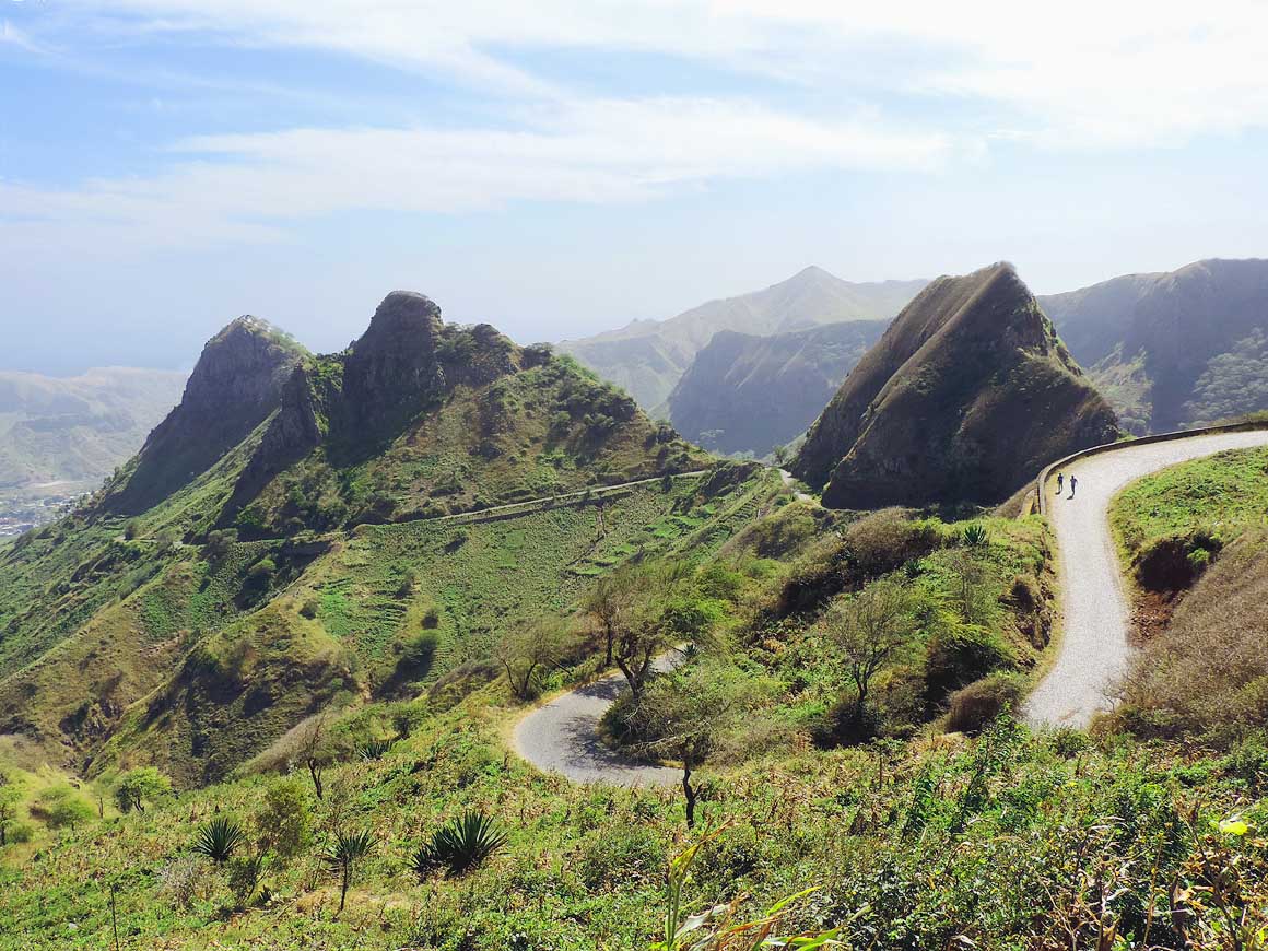
The 6 miles long mountain road from
- Săo Domingos to the antenna close to
- “Monte Tchôta“ is twisting up through the
- hills and reveals a beautiful scenery to
- mountain peaks and the valley below
|
- 068
“Pico d'Antónia” with its height of
- 4'574 ft. is the highest peak of the island
- of Santiago – seen from the antennas at
- 3'550 ft. near “Monte Tchôta“
|
- 069
Panorama of the “antenna farm”
- at 3'550 ft. near “Monte Tchôta“
- to the East, i.e. “Săo Domingos"
|
- Luck has it that we get the name of the big boss of “CV
Fast Ferry” that regularly plies between the southern islands of
Santiago, Fogo and
Brava. As Mr. Paiva tells us, he will
start to run his only ferry “Kriola“ (a second one named “Liberdadi”
is ordered and on its way from Singapore)
fortnightly from Santiago to Săo Nicolau
and during carnival time beginning of March he will also make a
special trip from Săo Nicolau to Săo
Vicente. Hope is rising again!
|
-
-

|
-
-
|
-
-
|
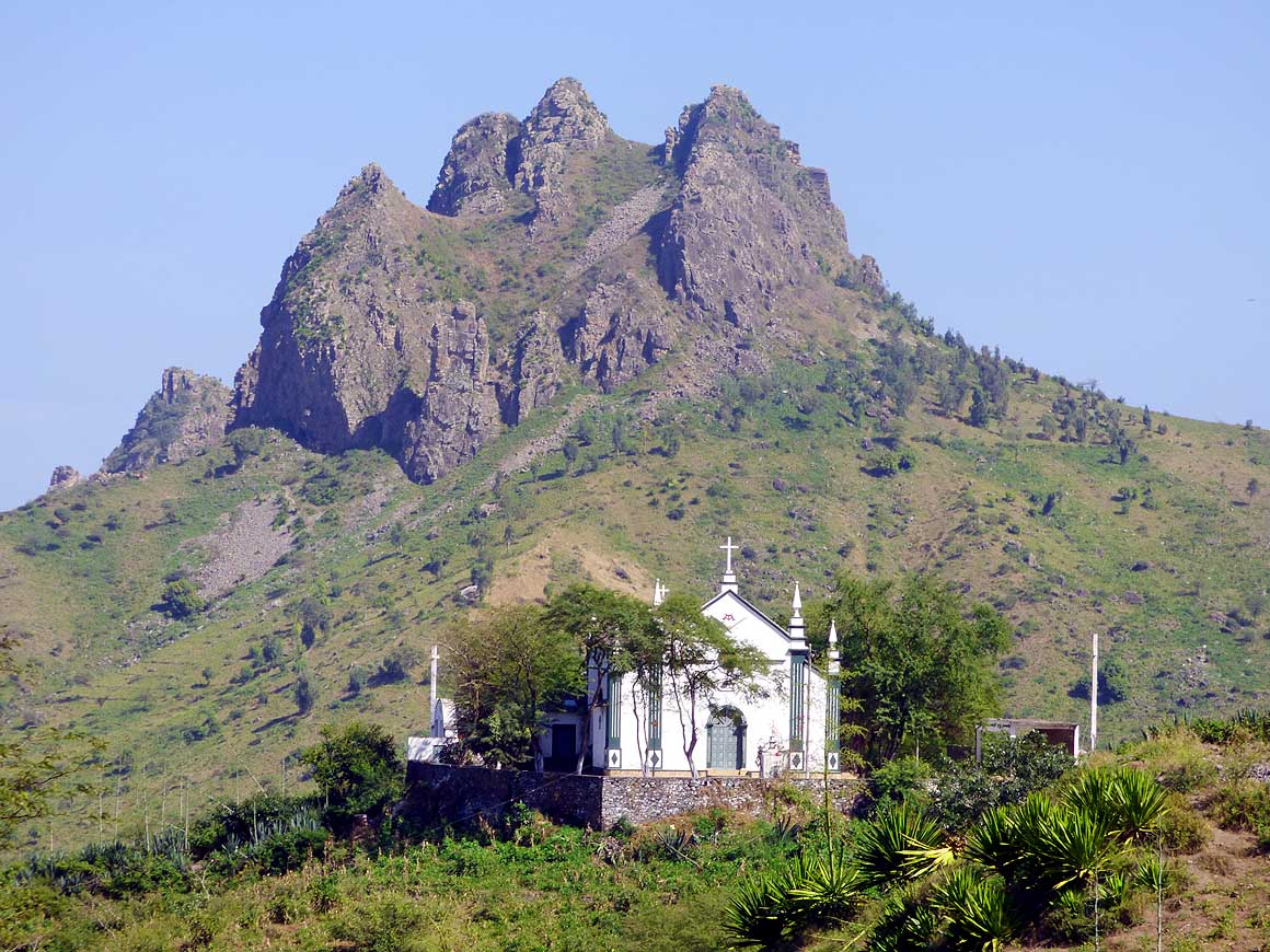
- 070
The rising mountain peaks in the
- interior towering into the blue sky (here
- the 2’339 ft. high “Pedra Branca” south
- of “Săo Domingos") look impressing .....
|
- 071
..... so does the “antenna farm”
- at “Monte Tchôta“ .....
|
- 072
..... and the sisal agaves along
- the mountain road to the antenna
|
- Mr. Paiva is ready to grant us 50% discount if we agree to carry
around the logo of Fast Ferry on our LandCruiser. Of course we do! But
there is still a snag to it: In Mindelo on
Săo Vicente Fast Ferry cannot unload our LandCruiser due to the
lack of a suitable ramp (it still has to be built). But Mr. Paiva is
able to convince Mindelo’s port boss to arrange a crane. It sounds
good. Hence we don’t object to add the logo of the harbor –
Enapor – to the
one of the Fast Ferry.
|
-
-
-
-
|
-
-

|
-
-
-
-
|
- 073
That’s Africa all over: Gathering
- wood and transport it home seems to be
- still the women's work. This group crosses
- us on the mountain road to the antenna
|
- 074
We descend the narrow twisting
- cobble stone road from the antenna to
- “Săo Domingos". Almost all side roads
- are cobbled streets. The vegetation
- around us presents itself lush green
|
- 075
No pollution, no traffic noise: A
- little hamlet on a green plateau with a
- lovely panorama on our way to the
- “Serra Malagueta” on an altitude of
- about 3’000 ft. The mountain in the
- background is again the 4’574 ft.
- high “Pico d'Antónia”
|
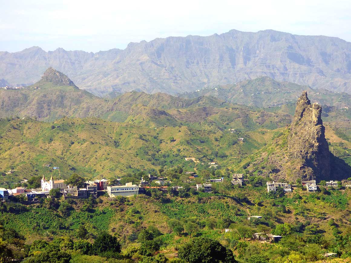
- The next two planned fortnightly trips to
Săo Nicolau are cancelled due to a
heavy sea. Slowly I am going stir-crazy. Therefore, on a Saturday we
once more get on our way north, to the centre of the island. In
Assomada, a city of 12‘000 people on an altitude of 1’100 ft. is
market day. We start early. Jagged mountain peaks appear soon, modest
houses nestle on steep mountain slopes, and it gets green and fertile.
Most of the scarce rain on the island is mainly falling in the
mountain region. For the 25 miles trip we need fully two hours
because we are enjoying the scenery and stopping for pictures.
|
-
-

|
-
-
-
-
|
-
-
|
- 076
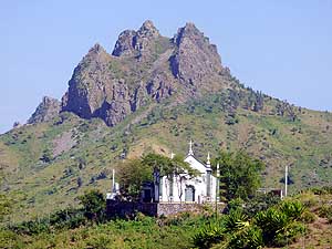
“Serra Malagueta” is proclaimed a
- nature reserve. Prior to the building of a
- road in the 1980s through the rugged
- mountain range, the more than 3’300 ft.
- high peaks cut off the North from the
- southern part of the island
|
- 077
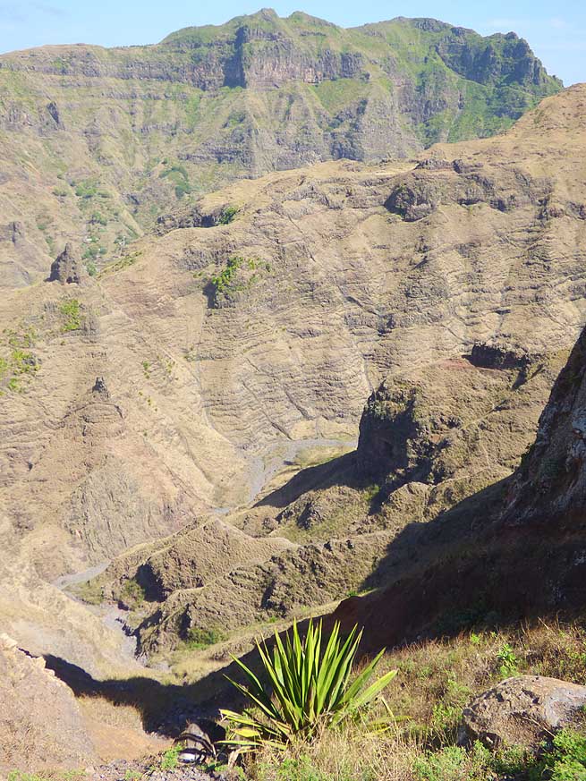
The canyon-like landscape of the
- “Serra Malagueta” offers some hiking trails
- of different degrees of difficulty. People are
- living even in the stony narrow valleys
|
- 078
Quite an impressing sight: The
- good tarmac road meandering from the
- “Serra Malagueta” through a scenic land-
- scape southward. On the right side of
- the picture the village of Fundura
- besides the 2’280 ft. tall “Monte Jagau”
|
- The lively market in Assomada offers also enough photo motifs. The
lady vendors wearing different head scarves contribute much to the colorful scene. Seldom have we seen such a huge display of regional
produce. At one corner there are fresh vegetables, salad, sweet
potatoes, cassava-, manioc- and yam roots as well a whole range of
herbs. At another area mango, pawpaw, banana, lemon and coconut is
piled up. Besides sugar cane is peeled and cut into small pieces.
Coincidentally we run into Judith and Philip from Switzerland again.
We earlier met them on the island of Fogo.
Now they are on their final days of their five weeks holiday. We enjoy
talking to them while sipping cold beer. They also are well traveled
people.
|
-
-

|
-
-
|
-
-
|
- 079
This is the view from “Serra
- Malagueta” to Tarrafal in the Northwest
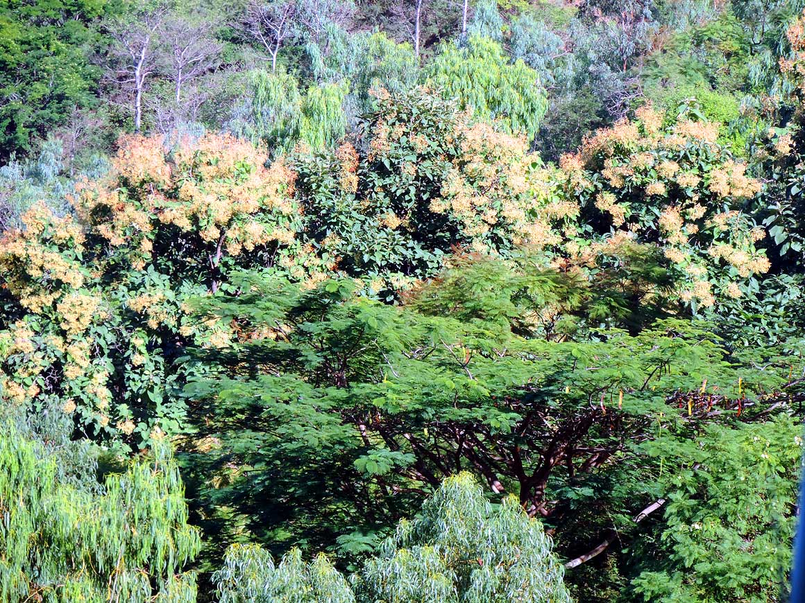
- of the island with its 7’500 people
|
- 080
Coconut vendors walk determined
- past the colored fishing boats that give
- the bay of Tarrafal its unique appearance
|
- 081
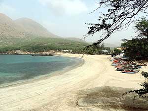
The white sandy beach protected
- from the wind in Tarrafal attracts locals
- and foreign tourists alike
|
- Our third and last trip to the north is dedicated to the “Serra da
Malagueta” – a canyon-like dramatic landscape and nature reserve with
more than 3’300 ft. high peaks and trails of different difficulty
degrees. However, access to the park is only for pedestrians. Where do
we park our LandCruiser? To leave it for a longer period unwatched
along the road seems us too risky.
|
-
-

|
-
-
|
-
-

|
- 082
The former concentration camp
- "Campo de Concentraçăo do Tarrafal"
- 1˝ miles south of Tarrafal at “Chăo Bom”
- was built by the Portuguese in 1936 and
- closed in 1954. For many years it was a site
- of atrocities by the fascist regime of Salazar
|
- 083
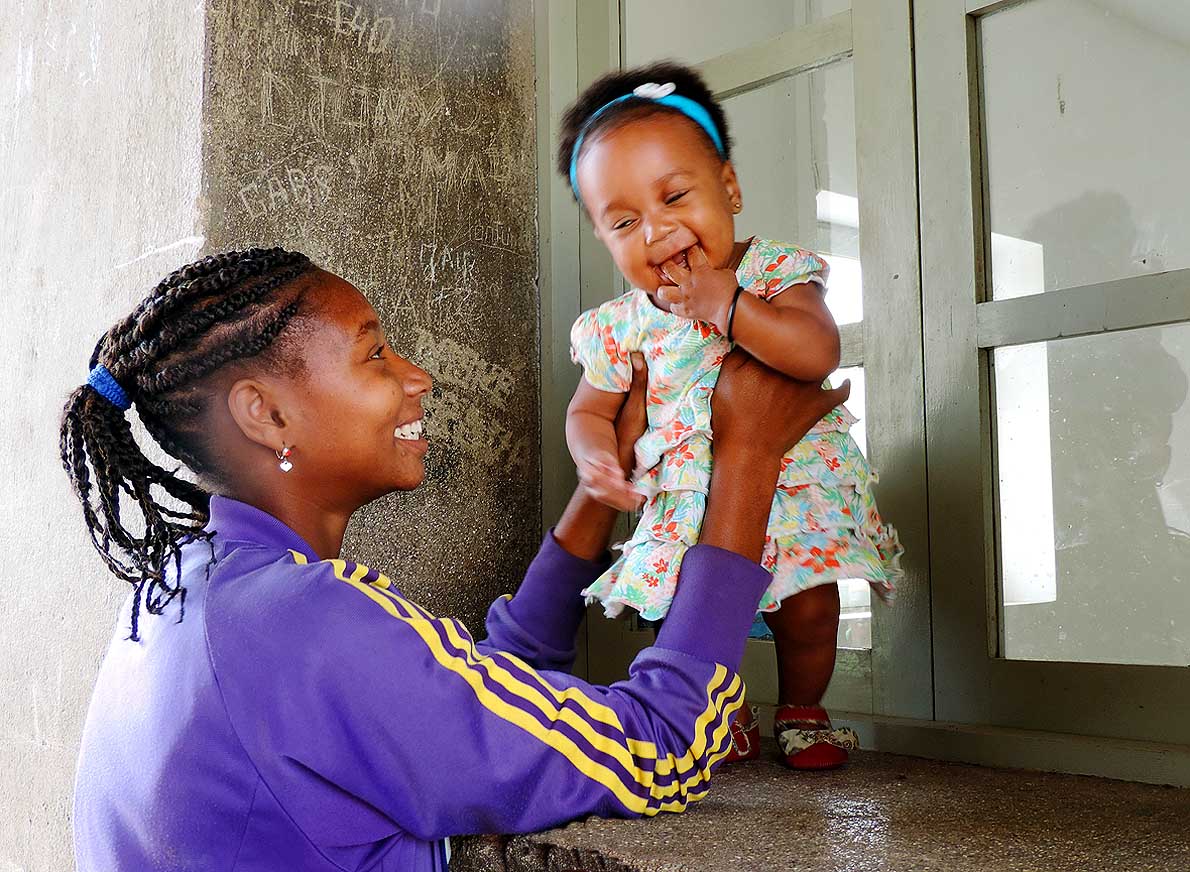
The young mother in Tarrafal
- basks in the happiness of her baby
|
- 084
The deserted black sandy beach
- of “Ribeira da Prata” south of Tarrafal
- is an insiders' tip
|
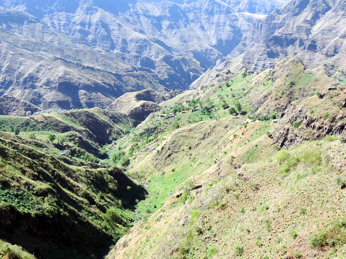
- Thus we forget about hiking and just enjoy the fantastic scenery
to little hamlets, green valleys and around the rugged “Serra da
Malagueta”. Only when Tarrafal and its Bay comes into sight, we
turn. Prior to cut a road through the mountain range in the 1980s,
there was no connection from the southern to the northern part.
|
-
-

|
-
-
|
-
-
|
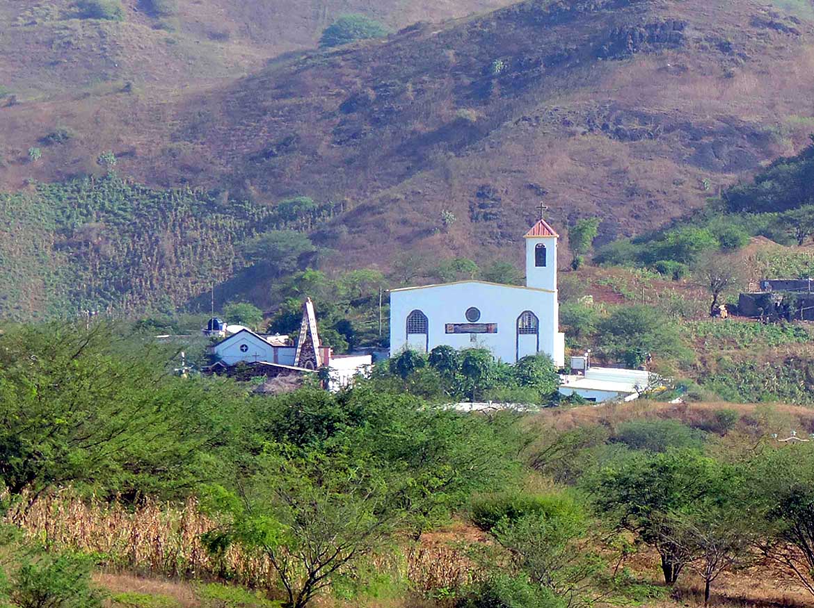
- Everywhere lovely churches pop up, be it in the middle of a farming area or with a
bizarre mountain backdrop
|
- 085
Church of Variante near “Ribeirăo
- Chiqueiro”, north of Praia at the main
- intersection to Assomada and Salinas
- at the east coast
|
- 086
Church of Picos, some miles
- before Assomada along the main
- road from Praia
|
- 087
Church of Santa Catarina, just
- north of Assomada, along the main
- road to Tarrafal
|
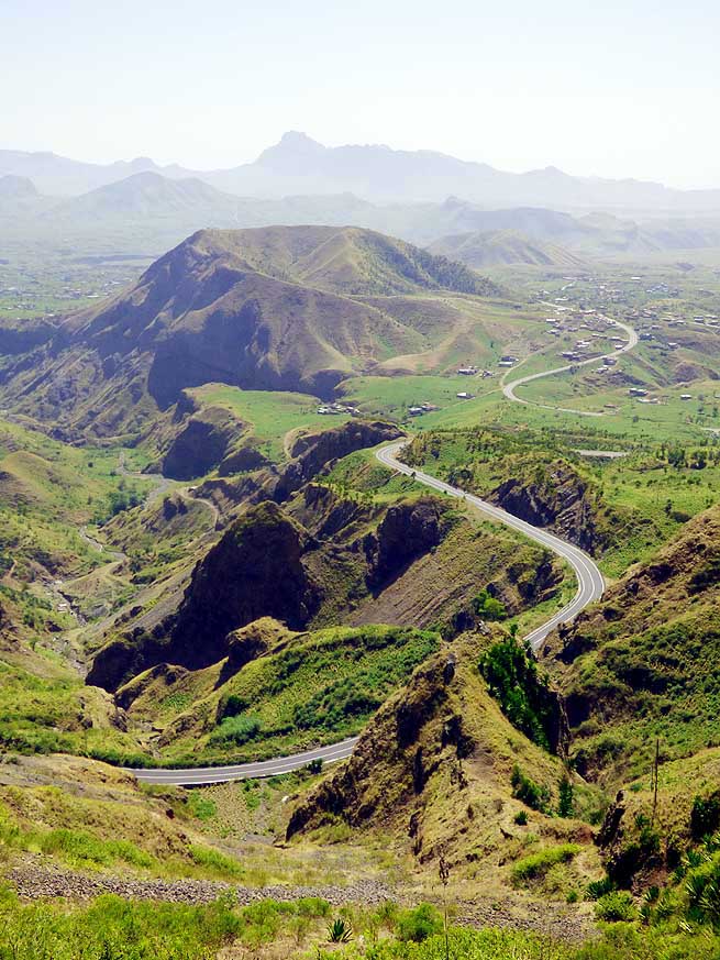
- Soon afterwards, our LandCruiser is twisting from Săo Domingos up
the hills on a narrow cobble stone track to the 3’550 ft. high Monte
Tchôta with its many antennas. Neatly dressed church goers are
crossing us. They are on their way to the Sunday mass. Some of them
even take along a stool or a chair, because often churches
cannot take in all faithful – there are too many.
|
-
-

|
-
-
|
-
-
|
- 088
Lush and green is the landscape
- in the region of the ‘National Botanic
- Garden’ in “Săo Jorge dos Orgăos“
|
- 089
With a little explorer spirit we always
- find a lovely spot for a picnic and camping.
- Here close to the ‘National Botanical
- Garden’ in “Săo Jorge dos Orgăos“ .....
|
- 090
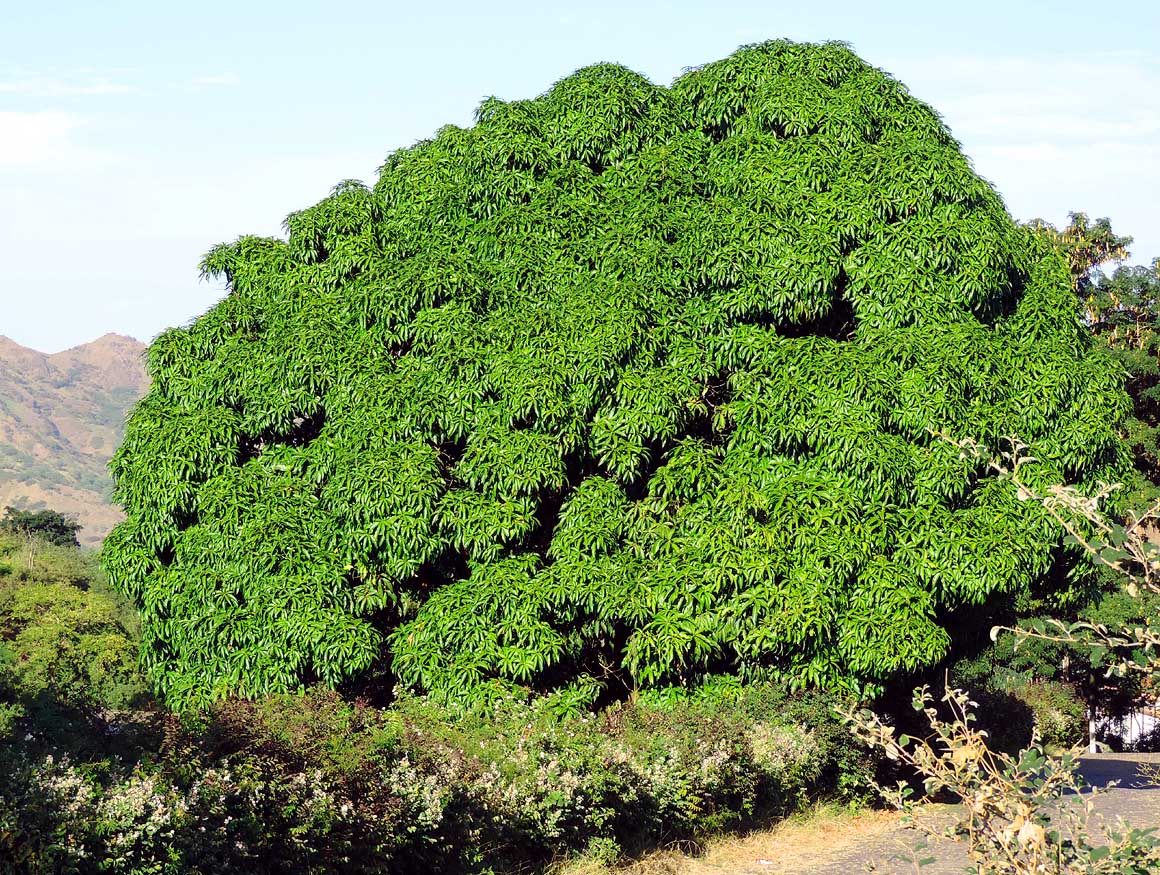
..... in the same region we discover
- also this huge mango tree. Mango trees
- are really true shade providers
|
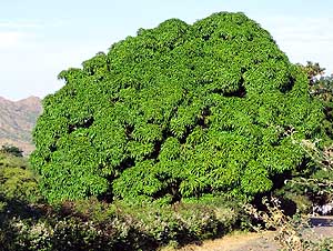
- The vegetation gets greener and lusher. After six miles, the road
ends in front of the gate to the “antenna farm”. While Emil walks
through the forest in search of panorama views, I simply ask the gate
guard if he lets me pass. He does and even escorts me to the places
with the best views over mountain peaks and valleys. On our way back
to the main road, women and girls carrying loads of wood on their
heads walk home. Africa remains Africa!
|
-
-

|
-
-
|
-
-
|
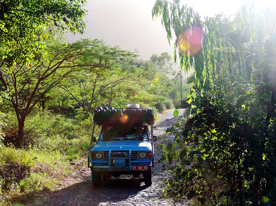
- 091
Our LandCruiser is rumbling over
- the cobble stone track through lush vege-
- tation that leads to the ‘National Botanical
- Garden’ south of “Săo Jorge dos Orgăos“
|
- 092
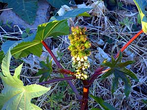
A plant that attracted our attention:
- Castor oil plant (Ricinus communis),
- called also palm of Christ or simply ricinus
|
- 093
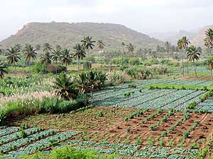
Vegetable gardens interrupted by
- palm trees in a fertile valley north of Praia
- on the way to Pedra Badejo at the east
- coast. Besides vegetable especially
- maize, fruits and sugar cane is cultivated
|
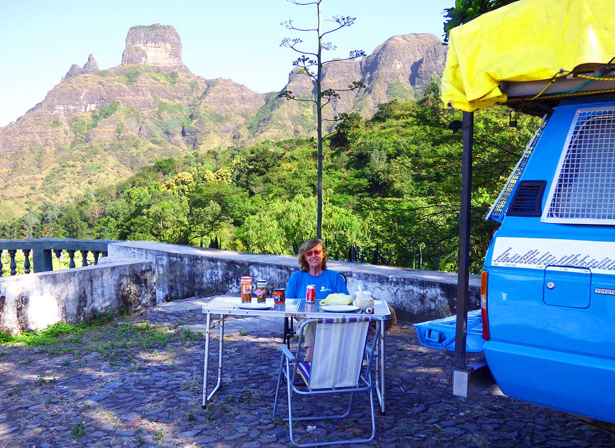
- On February 28th, our departure day dawns. We pack our bags at the
Hotel America and head to the port of Praia. Despite that we are more
than happy to finally be able to move on, our departure is also filled
with sadness and emotions. During the total 128 days we spent on this
island – only interrupted by our trip to the islands of Fogo
and Brava – it became in a way a kind
of “home“ to us. We knew the faces of the people around us and the
people new us.
|
-
-
|
-
-
|
-
-
|
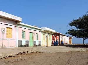
- 094
Yellow, green, rust red, blue: The
- pastel-colored houses of the village of
- "Vale da Custa" shine in all shades. The
- hamlet is just besides the enormous
- construction project of ‘Sambala’,
- north of the airport of Praia
|
- 095
They live peacefully in symbioses:
- Cows and their cattle egrets
|
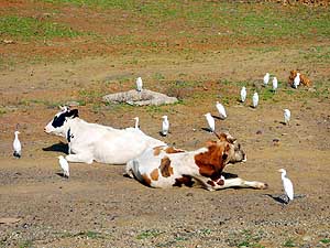
- 096
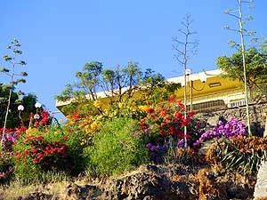
A picture to enjoy: Bougainvilleas
- in a beautiful color combination along
- Praia's seashore
|
- Be it at in the supermarket, among the street sellers, at the
“Rincón de Juan“, where we often took the menu of the day, at the
“chicken house”, where we ordered grilled chicken and fries, at the
pizzeria where they knew very well that I insisted on a lot of cheese
or at the daily evening run along the sea promenade. We even knew
parts of the peaceful street dogs and they knew us. To two of them we
got really attached. They knew exactly at which time we would arrive
and waited for us, even crossed the road to greet us. Of course it was
also for the food we brought them, but still – it was nice. Now new
land is waiting for us – Săo Nicolau,
our fourth island of Cape Verde.
|
-
-

|
-
-
|
-
-
|
- 097
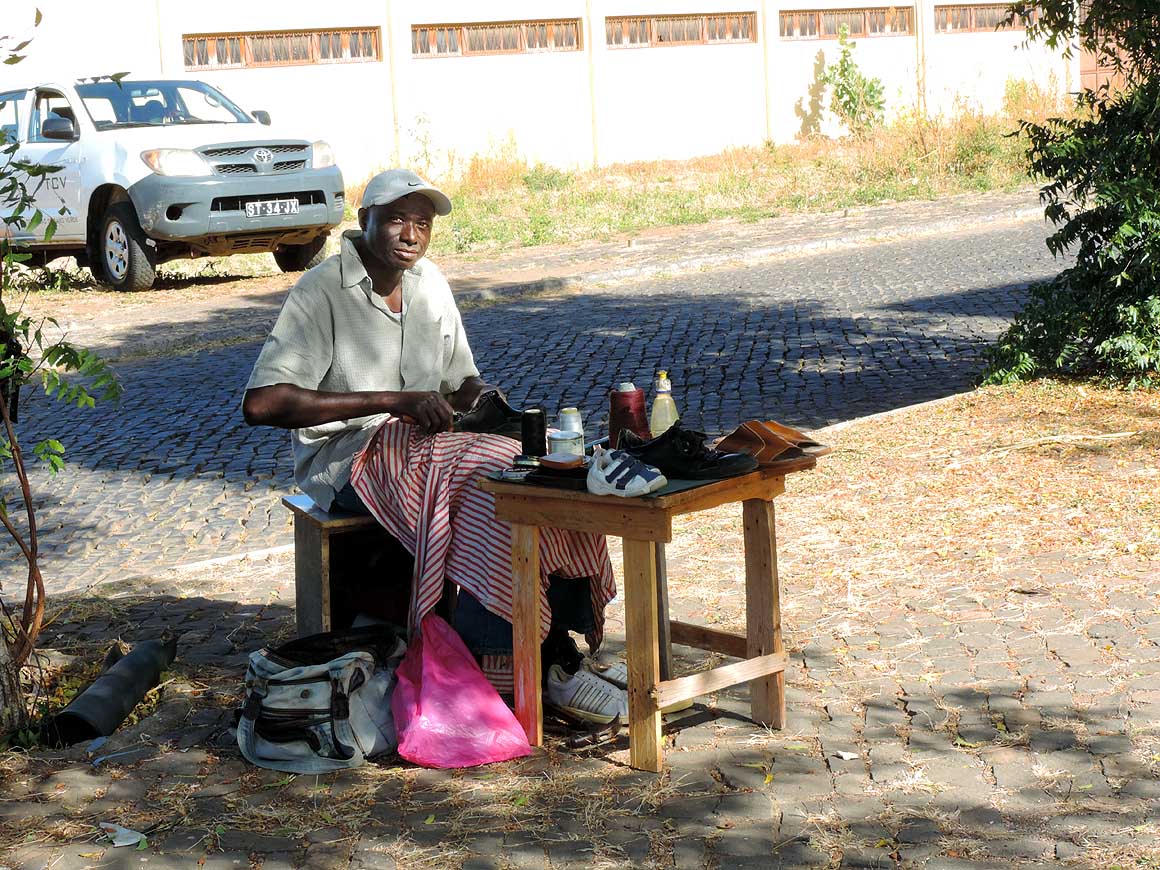
He does not have to pay any rent:
- A mobile shoemaker in Praia
|
- 098
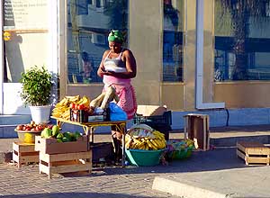
Ok? The street vendor in Praia
- recounts the escudos she just got for
- a bunch of bananas
|
- 099
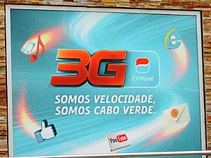
"Somos Velocidade – Somos
- Cabo Verde" = "We are velocity – we
- are Cape Verde". Each time we see
- this logo, it makes us smile while remem-
- bering that the release of our LandCruiser
- took 25 days in the port of Praia!
|
-
|
-
- The "Greater"-Middle East trip 2012/13:
- Sharjah/Dubai/1st Traveler's Festival/Emirates
National Auto Museum - UAE with
car Nov. 2012 to Jan. 2013 - part 1
- Western UAE - Liwa - United Arab Emirates with car in January 2013 - part 2
- Oman 2013 – Part 1 - February
2013: Musandam Peninsula
- Oman 2013 – Part 2 - February
2013: Sohar - Muscat - Rustaq - Nizwa
- Oman 2013 – Part 3 - March
2013: Sur - East Coast - Island of Masirah - Dhofar
- Oman 2013 – Part 4 - March
2013: Salalah & Surroundings (Dhofar) - Nizwa
- Oman 2013 – Part 5 - March 2013: Western Hajar
Mountains
- Al Ain, Eastcoast & Ras al Khaima - United
Arab Emirates with our car in April 2013 -
part 3
- Iran - part 1: Ferry Port Bandar Abbas-Shiraz-Persepolis-Pasargad (between Persepolis and Yazd)
– May 2013
- Iran - part 2: Pasargad
(excl.)-Yazd-Esfahan – May 2013
- Iran - part 3: Esfahan
(excl.)-Chelgerd-Hamadan-Sanandaj-Orumiyeh – May 2013
- Turkey: Iran Border - Esendere - Hakkari -
Van - Dogubayazit - Kars - Ardahan-Hopa - Georgia Border – May
28 to June 4, 2013
- Georgia: part 1: Ajaria - Gori - Tbilisi - Kakheti - Azerbaijan Border –
June 4 to 13, 2013
- Azerbaijan: Georgia
Border - Balakan - Seki - Lahiç - Baku - Xinaliq - Quba - Laza - Baku - Ganca -
Georgia Border – June 13 to 24, 2013
- Armenia part 1: Georgia
Border - Akhtala - Haghpat - Dilijan - Lake Sevan - Selim - Arates - Nagorno-Karabakh – July 2 to 9, 2013
- Armenia part 2: Nagorno-Karabakh - Goris - Tatev - Noravank - Khor Virap - Echmiadzin
- Geghard - Gyumri - Georgia – 17
to 22, 2013
|
-
- Articles in newspapers about us on Cape Verde:
- Article: "Estăo
em Săo Nicolau: Emil e Liliana há 30 anos ŕ volta do mundo", Online Newspaper
"Jornal de Săo Nicolau" - March 6, 2014
- Article: "Cabo
Verde na Volta ao Mundo de Emil e Liliana Schmid", Daily
Newspaper "ASemana" - March 9, 2014
|