-
-
-
|
-
-
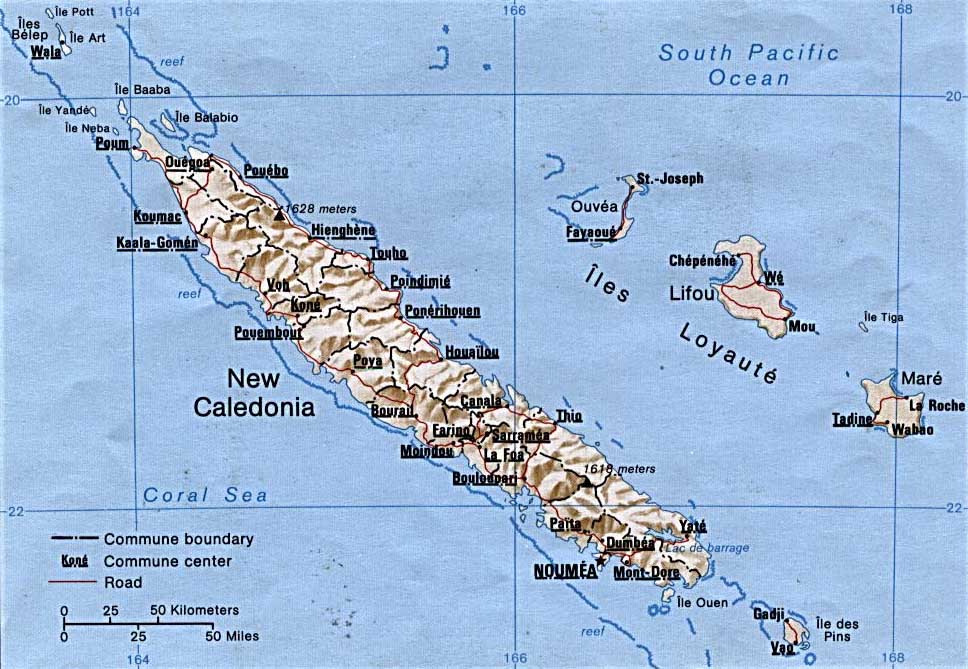
- New Caledonia Map
-
|
-
-
-
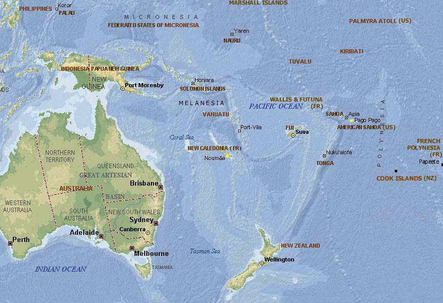
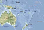
- Map of
- the Pacific
-
|
|
|
- latest picture: August 20, 2008
- click a picture to see details
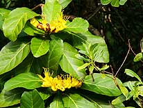
|
-
-
|
-
-
|
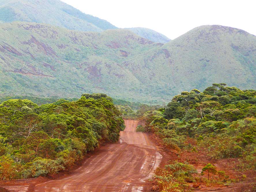
-
-
|
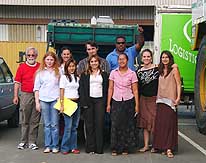
- 01
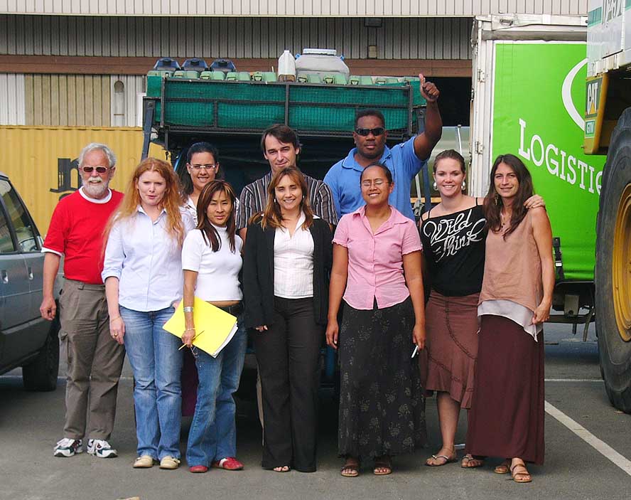
The team of our shipping agent
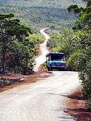
- “Logistique et Transit Martin” gathers
- around our LandCruiser in the port of
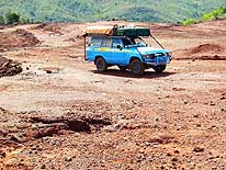
- Nouméa, after the customs released it
|
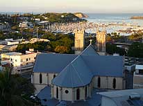
- 02
From the hill of the “Auberge
- de Jeunesse“ (Youth Hostel) we enjoy
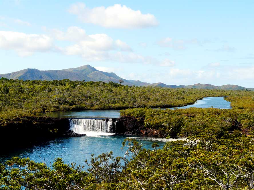
- a beautiful view over St. Joseph
- Cathedral and the yachting marina
|
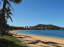
- 03
Anse Vata with its Mediterranean
- flair is one of the two most popular
- beaches in New Caledonia’s
- capital Nouméa
|
-
|
-
-
|
-
-
-
-
|
-
-
|
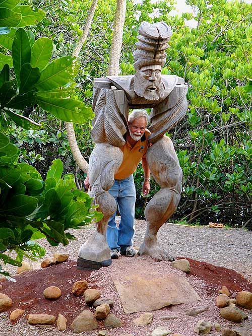
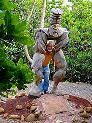
- 04
Emil poses with an impressive
- carved figure at “Tjibaou’s
- Cultural Centre” in Nouméa
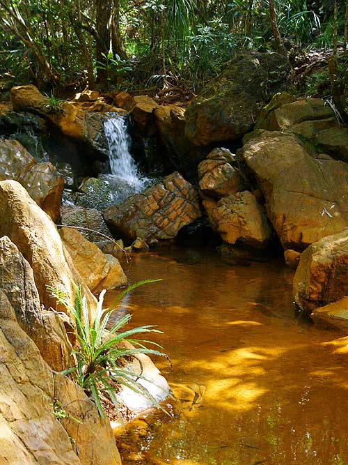
|
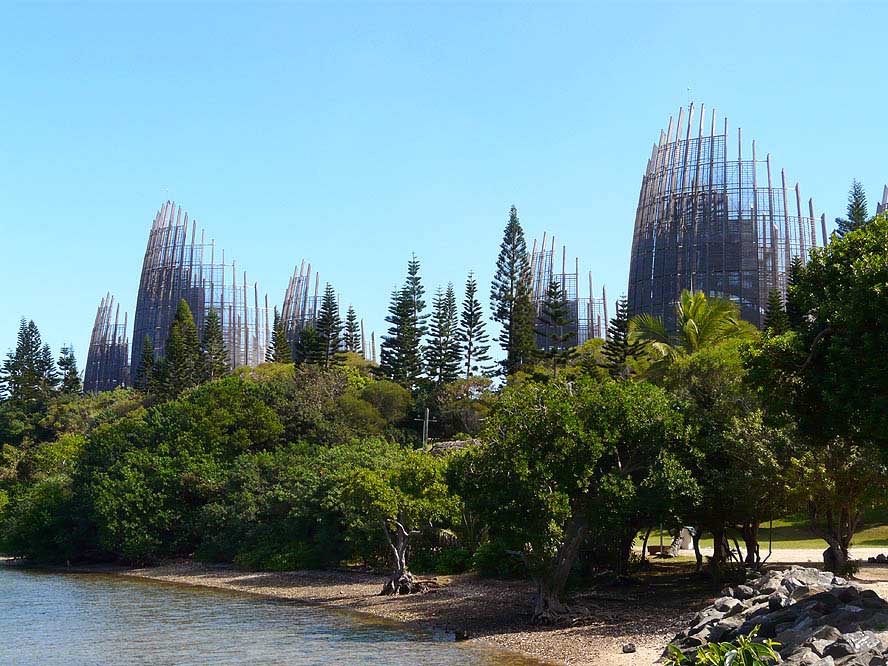
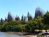
- 05
The “Tijabaou Cultural Centre”
- in Nouméa is a magnificent work of
- architecture. It was built by Renzo Piano
- and has a surface of 8’000 sq.yd.
|
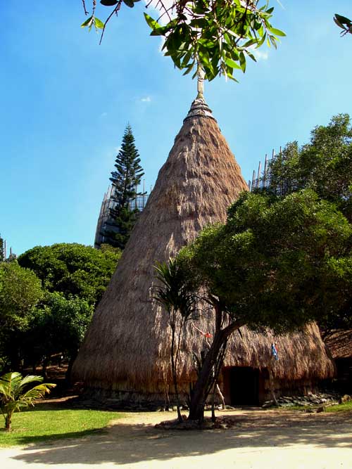
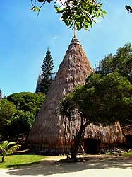
- 06
This conical straw hut in
- the “Tijabaou Cultural Centre”
- in Nouméa represents the
- traditional house in the South
|
-
|
-
-
-
-

|
-
-
|
-
-
-
-
|
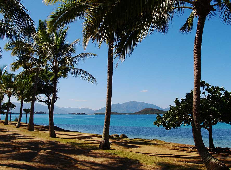
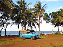
- 06
The palm fringed seashore of
- the Bay of Boulari near Nouméa
- spreads the charm of the Pacific
|
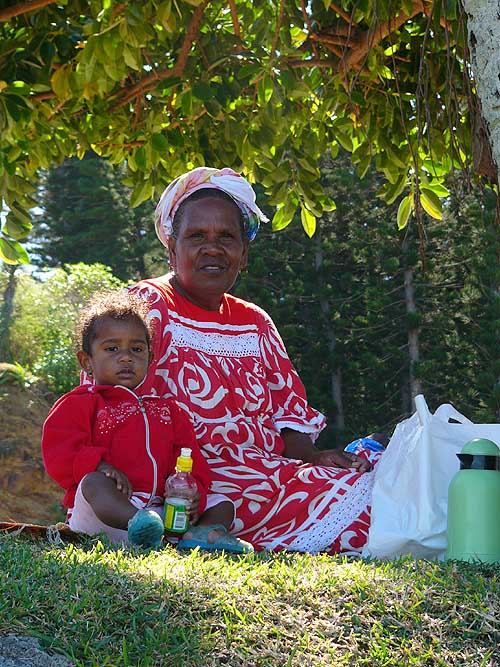
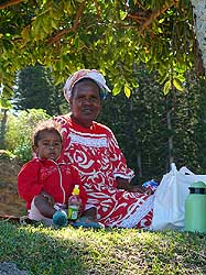
- 07
A mother is picnicking
- with her child at Anse Vata Bay
|
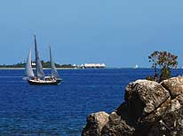
- 08
A sailing boat passes in front of the
- luxury hotel complex „Coral Palm Island
- Resort“, situated on the tiny islet Maître
|
-
|
-
-
|
-
-
|
-
-

|
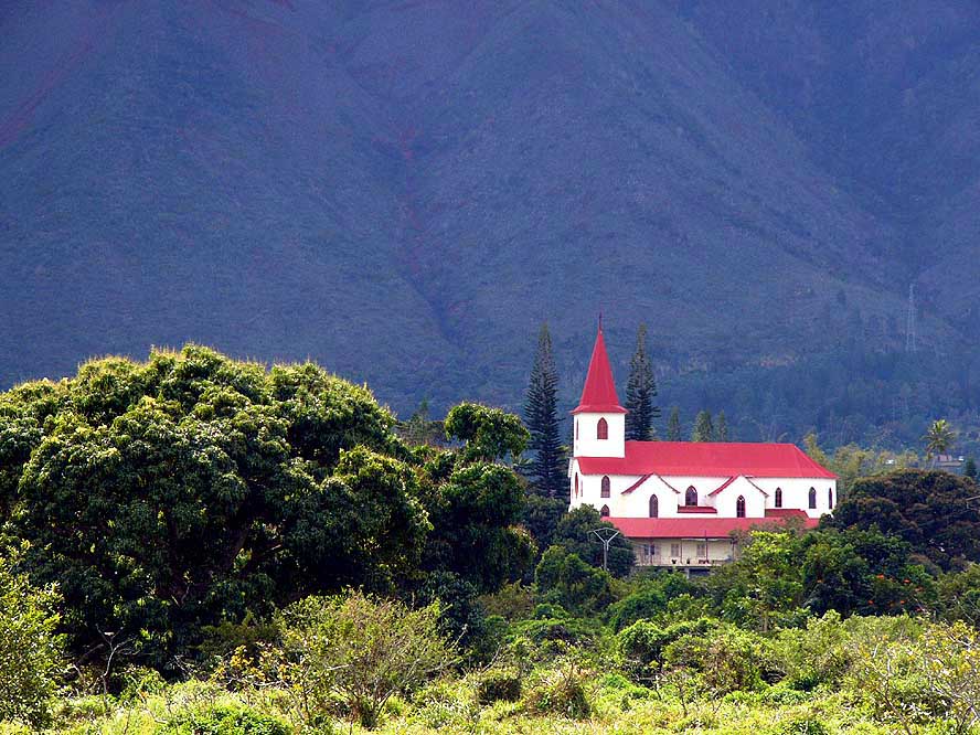
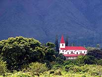
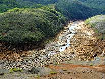
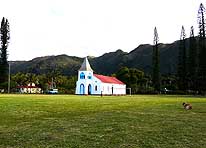
- 10
In Saint-Michel – about 10 miles
- East of Nouméa – the lonely church
- squeezed against the mountain of
- Monts Koghis is an eye-catching sight
|
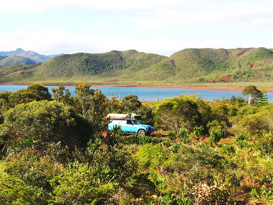
- 11
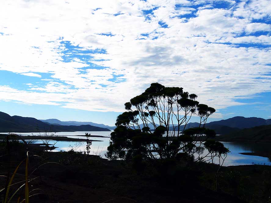
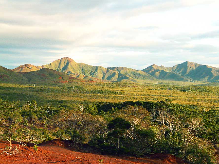
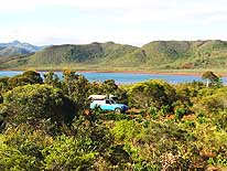
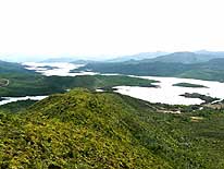
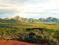
We are heading towards the
- “Blue River Park” in the South of the
- mainland of Grand Terre. The vast
- natural reserve was created in 1980
- and stretches over 22’350 acres
|
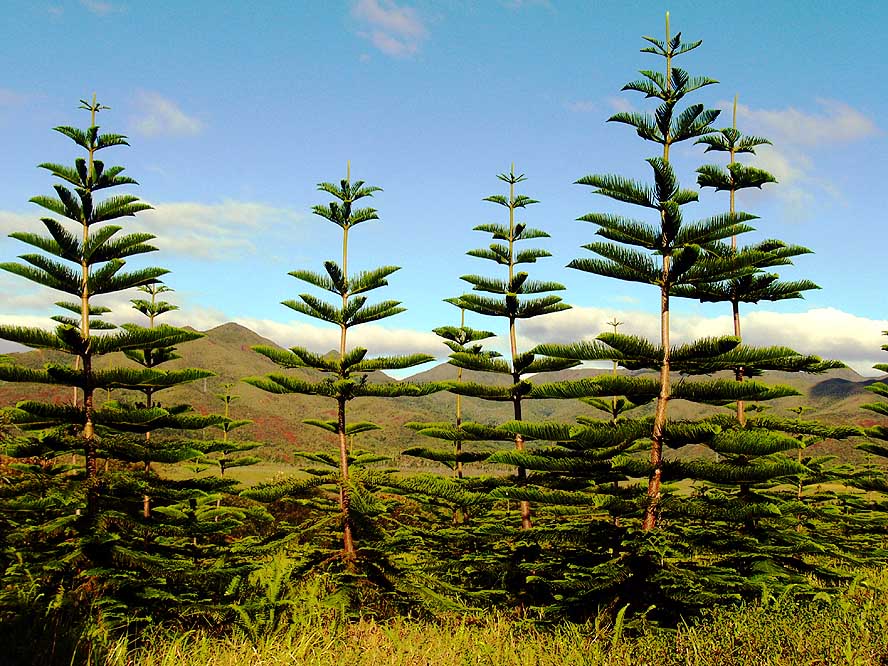
- 12
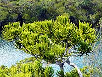
Impressive forests of Araucaria
- trees dominate the plains in the
- “Blue River Park” with its two
- river valleys, the “Blue River”
- and the “White River”
|
-
|
-
-
|
-
-

|
-
-
|
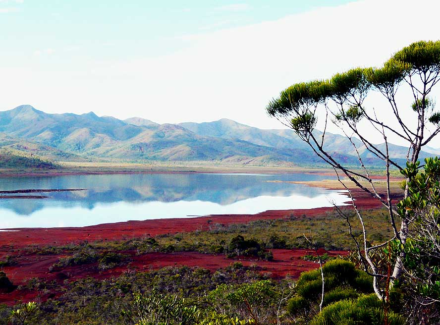
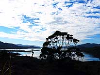
- 13
Morning atmosphere in the
- “White River” Valley, as we drive
- along the Yate Lake
- with our LandCruiser .....
|
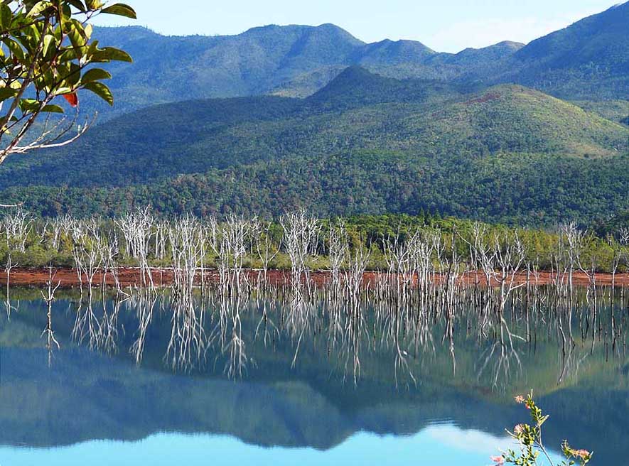
- 14
..... after the Perignon Bridge we
- have to take the compulsory shuttle bus.
- Our first stop is the “Drowned Forest”,
- whose bleached branches are
- wonderfully reflecting in the calm
- waters of the damned Yate Lake .....
|
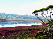
- 15
.....a peaceful moment along the
- Yate Lake in the “White River” Valley
|
-
|
-
-
|
-
-
|
-
-
|
- Diversification and richness of the flora and fauna in the “Blue River Park”
are unique:
|
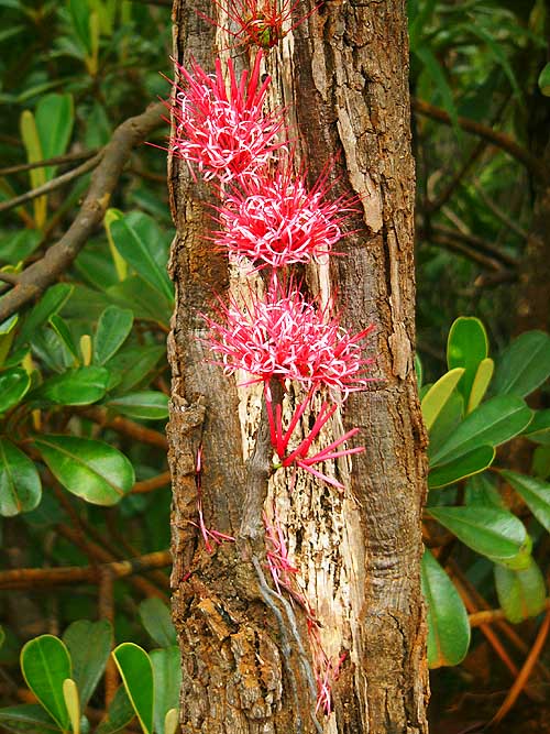
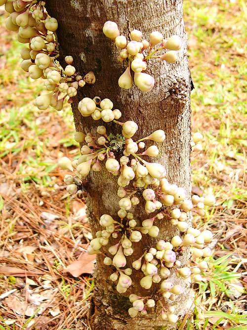
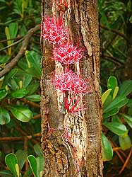
- 16
The deep red “Amyema
- Scandens“ – a kind of misteltoe –
- grows directly from the trunk .....
|
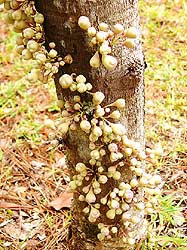
- 17
..... and pear shaped buds,
- whose name we do not know
- (we have seen a similar looking
- tree in Hong Kong: line 7 right)
|
- 18
One of the delicate
- flowers that has grown
- back in the mining areas
|
-
|
-
-
|
-
-
-
-
|
-
-
|
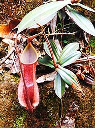
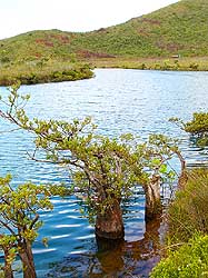
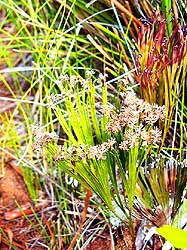
- 19
The carnivorous “Pitcher Plant“
- is filled with liquid. This “pitcher” has
- a lid to prevent rain diluting the liquid
- within. Insects attracted to the plant
- by the humidity fall into the liquid and
- are digested to release nutrients to the
- plant [we have seen similar plants in
- Sarawak (Northeast = picture line 10 left;
- South = picture line 8 middle) on
- Borneo (= picture No. 44)]
|
- 20
The golden „Oxera coronata“
- is common at the Pacific coast
|
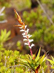
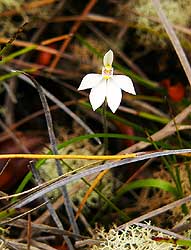
- 21
Between all the scrubs we
- discover this tiny white orchid
|
-
|
-
-
-
-
|
-
-
|
-
-
-
-
|
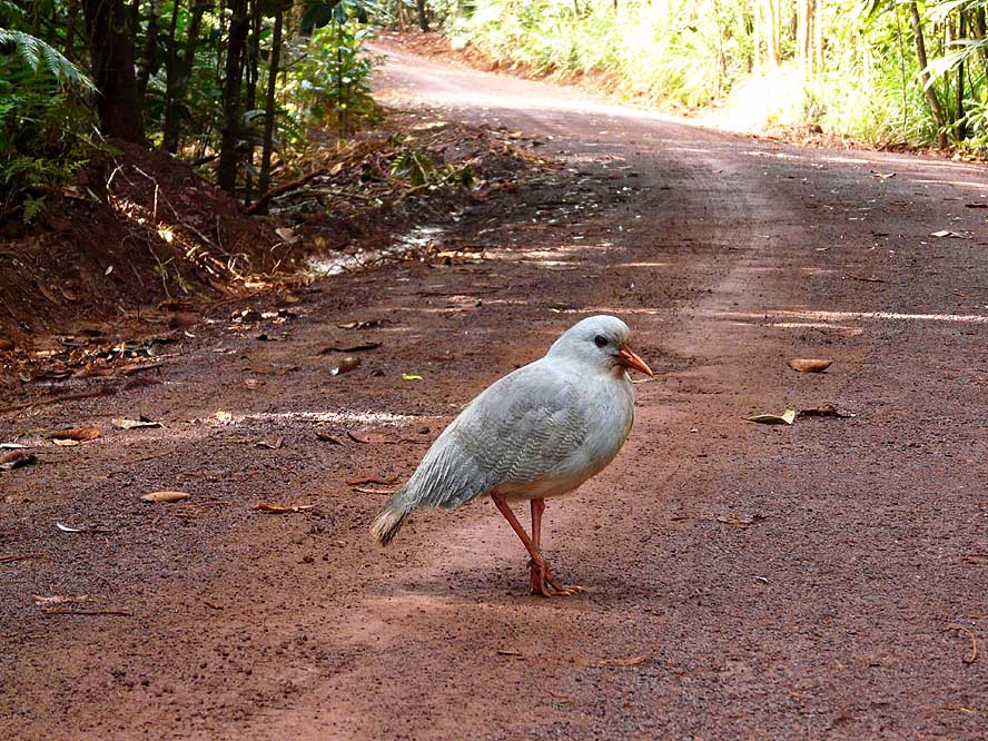
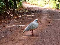
- 22
The Cagou is an endemic bird from
- New Caledonia and the National emblem.
- It is a bird that cannot fly, lives in dense
- rainforest and can reach in the wild an
- age of more than 20 years. It lays only
- one single egg once or twice a year. That
- is why it belongs to the extremely
- endangered species
|
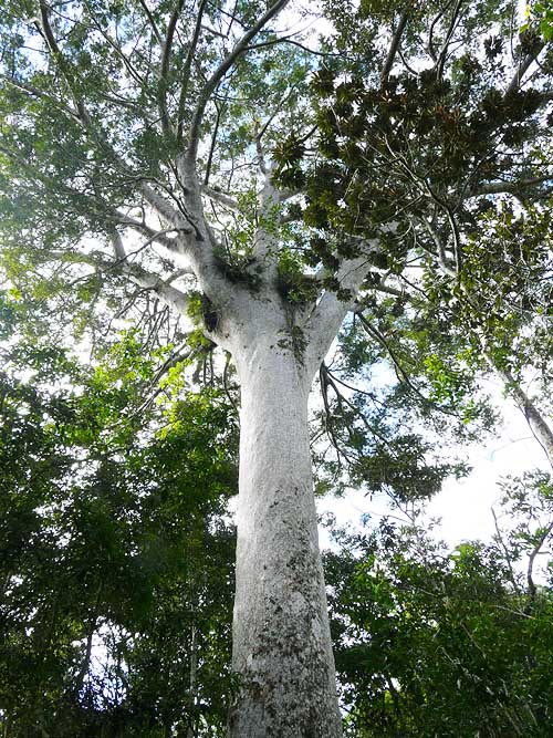
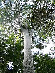
- 23
This giant Kaori tree is the
- biggest in New Caledonia. The
- diameter of its trunk reaches
- 2.70m. As to how old it is: .....
- it was already here over 1’000
- years ago! We have seen an even
- older species on the North island
- of New Zealand (picture No. 378)
|
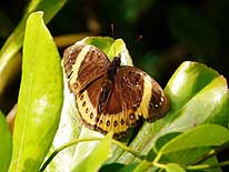
- 24
A butterfly rests on a leaf
|
-
|
-
-
|
-
-
-
-

|
-
-
|
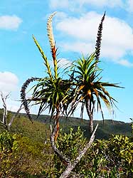
- 25
The “Dracophyllum ramosum“,
- the dragon-leaf, is towering above
- the scrub. When blooming, the
- flower is white, it then changes
- to brown and black
|
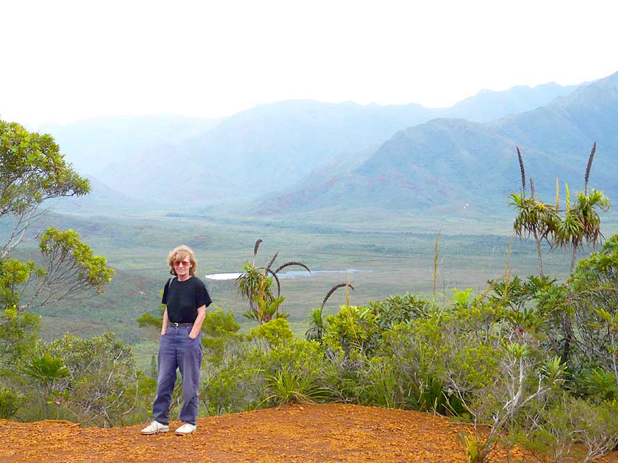
- 26
Liliana poses for a picture in the
- White River Valley of the
- “Parc Provincial de la Rivičre Bleue“
|
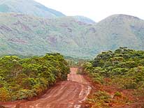
- 27
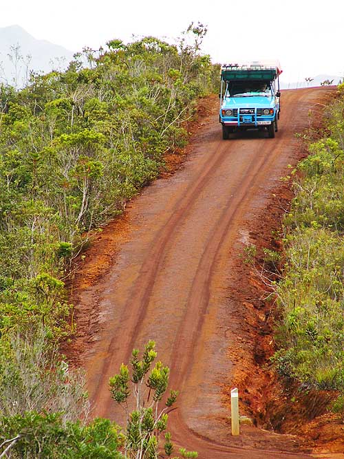
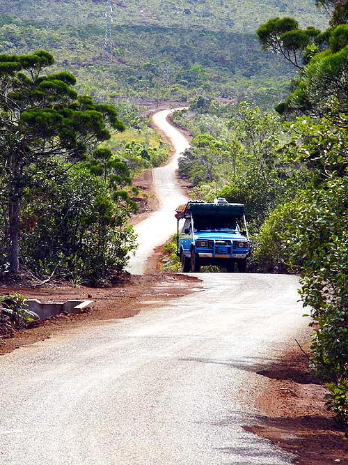
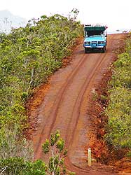
A touch of adventure: This
- ‘African-like’ red earth track
- leads to the highest point of
- the White River Valley –
- by rain extremely slippery
|
-
|
-
-
|
-
-
-
-
|
-
-
|
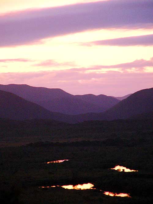
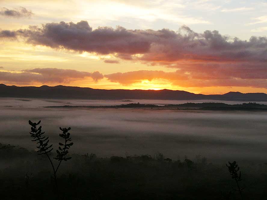
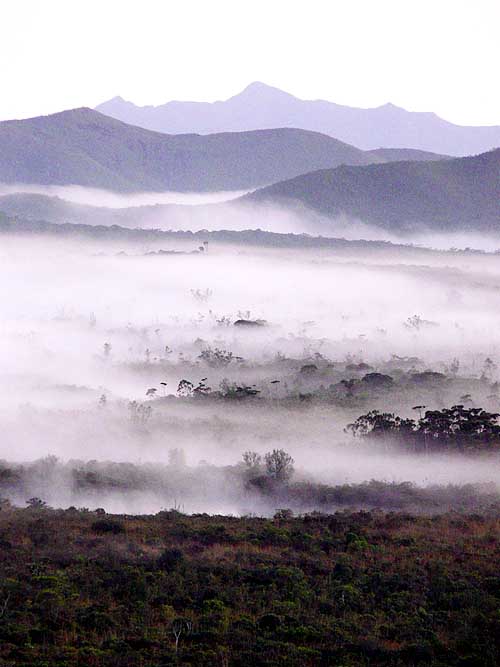
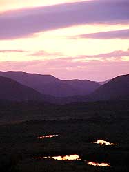
- Moods from our lonely hill bush camp towards the „Plaine des Lacs“:
|
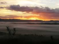
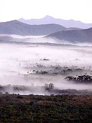
- 28
Three red colored lakes at sunset
|
- 29
The sun is rising behind the hills
|
- 30
Morning fog covers the plains
|
-
|
-
-
-
-
|
-
-
|
-
-
-
-
|
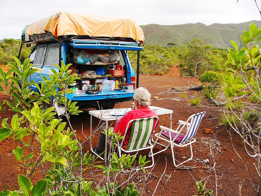
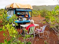
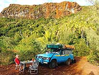
- 31
Alone with nature: A perfect
- bush camp in the deserted
- land of the South .....
|
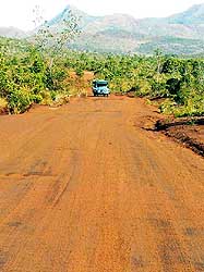
- 32
..... one of the many red laterite
- earth tracks that lead through the bush
- of the South – who isn’t thinking more
- of Africa than of the Pacific? .....
|
- 33
..... for 4x4 freaks all kind
- of challenges; here a rocky track
|
-
|
-
-
-
-
|
-
-

|
-
-
-
-
|
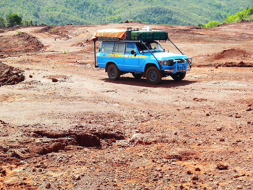
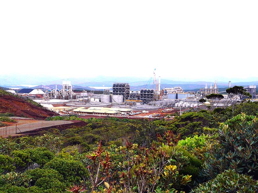
- 34
Due to road constructions, the road
- to the seashore on the East coast ends
- for as at the Goro Nickel Mine .....
|
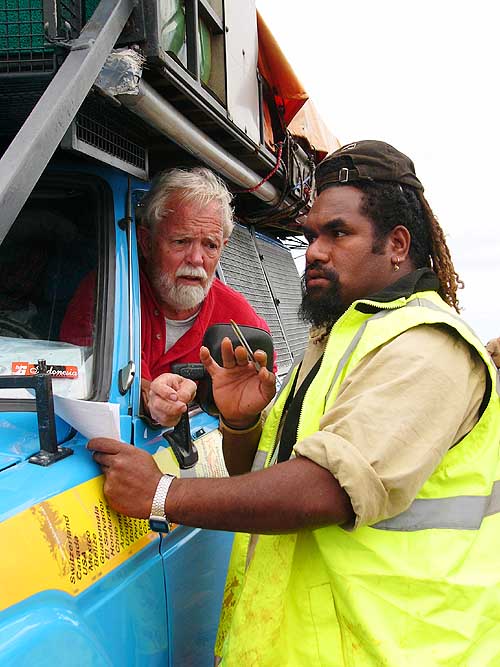
- 35
..... a helpful worker draws
- Emil a map of an alternative road .....
|
- 36
..... what means that we are
- challenged with more adventurous trails
|
-
|
-
-
-
-
|
-
-
|
-
-
-
-
|
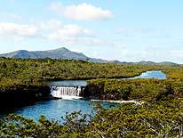
- 37
The Madeleine Waterfall is
- situated in a wonderfully untouched
- natural environment and is one
- of the highlights of the South
|
- 38
The “Retrophyllum minor” is
- native to New Caledonia and is
- called here „Bois bouchon“. It is
- found standing in the water at river-
- banks, here in the “Special Botanical
- Reserve of the Madeleine Waterfall”
|
- 39
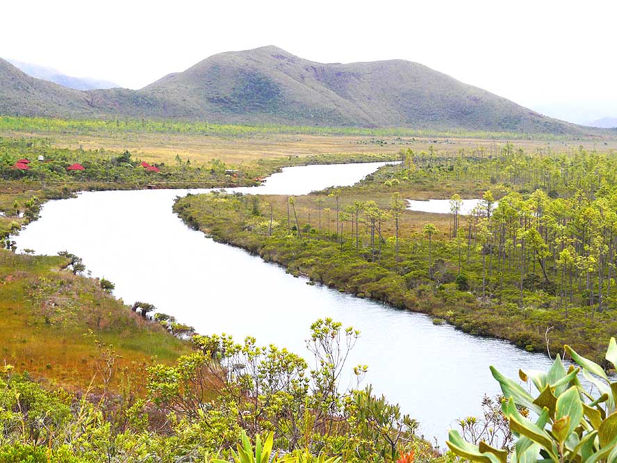
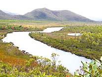
The ”River of the Lakes”
- meanders through intact natural
- environment at the Netcha campsite
|
-
|
-
-
|
-
-
|
-
-
|
-
40
41
|
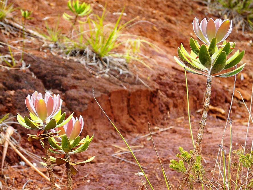
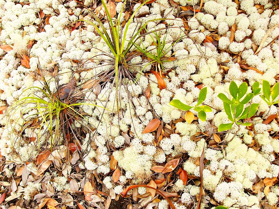
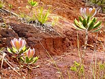
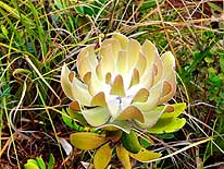
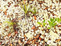
- The variety of plants that grow in the barren – but rich of minerals – earth
of the South
- is astonishing. We discover this amazing flower opposite of the Netcha campsite
|
- 42
White lichen grows widespread
- in the red soil and often forms entire
- carpets. Touching them gives a
- feeling of a humid sponge
|
-
|
-
-
-
-
|
-
-
|
-
-
-
-
|
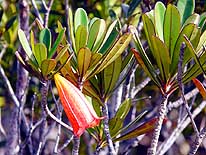
- 43
In the surroundings of the
- Madeleine waterfall we see the
- red bell „Bikkia campanulata“ .....
|
- 44
..... this unusual grass with
- the brownish looking seeds .....
|
- 45
..... and the endemic „Neocallitropsis
- pancheri“ with its wood rich on oil.
- It was used for perfume what resulted
- in the nearly extinction of it. Since 1942,
- this kind of coniferales is now protected
|
-
|
-
-
|
-
-
|
-
-
|
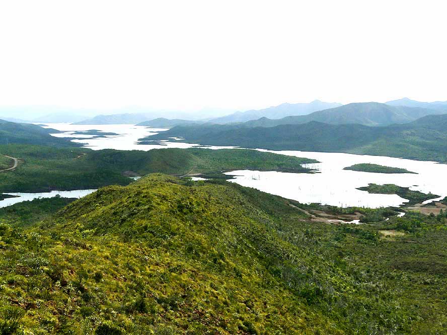
- 46
View over the damned Yate Lake.
- It provides the hydro-electric power
- for the whole region of Nouméa
|
- 47
The stony, due to the Yate dam
- nearly dry bed of the Yate River
|
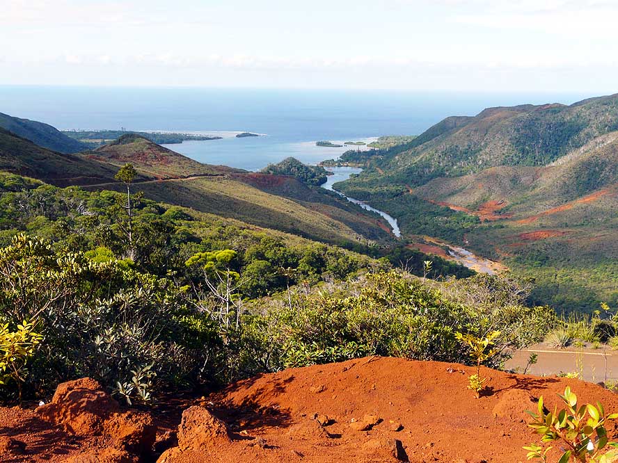
- 48
Descent to the Pacific Coast
- with the Yate River mouth and
- the tribal village of Wao
|
-
|
-
-
|
-
-
|
-
-
|
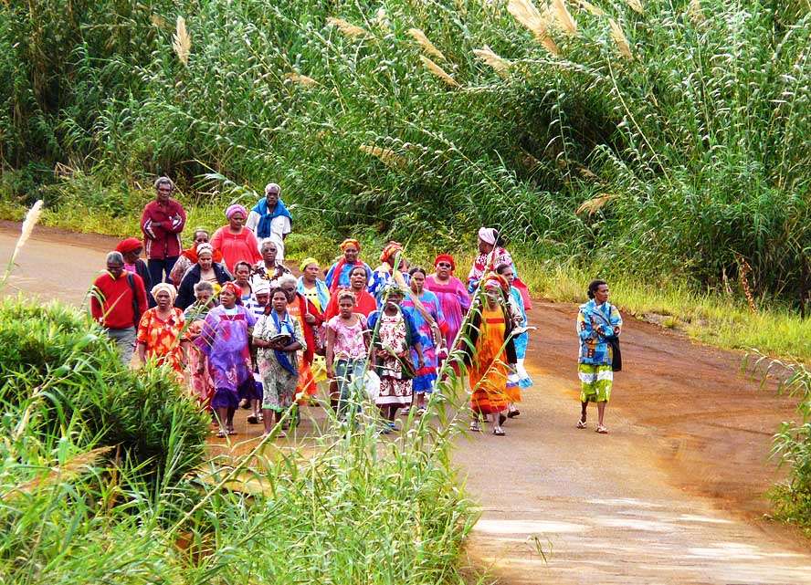
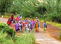
- 49
A group of traditionally dressed
- Kanak people walks praying through
- the narrow and windy island road
- towards the village of Touaourou .....
|
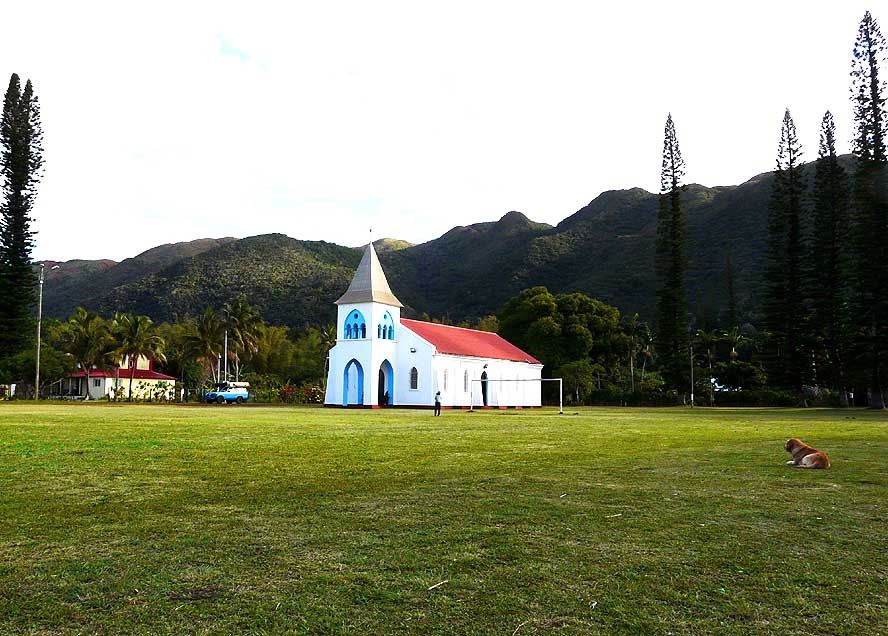
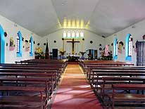
- 50
..... the white-blue church of
- the mission of Touaourou lies in the
- warm light of the afternoon sun –
- together with the palm trees the
- perfect South Pacific setting
|
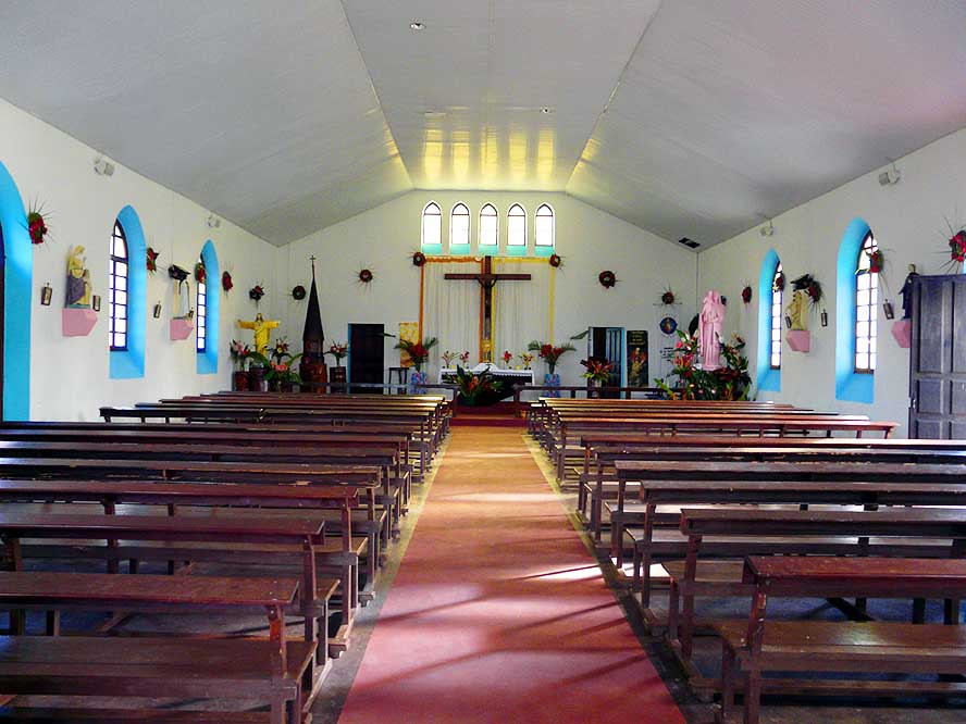
- 51
The decorated interior
- of the mission of Touaourou
|
-
|
-
-
|
-
-
|
-
-
|
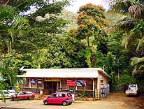
- 52
All there is in Yate is a shop and
- two petrol pumps, although the name is
- printed in bold letters on the map. But
- its setting in tropical surroundings
- along the same named river is beautiful
|
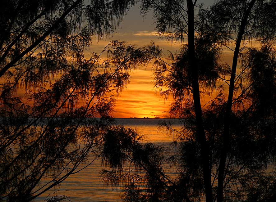
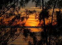
- 53
At our bush camp on the Pacific
- Coast we enjoy an amazing sunrise
|
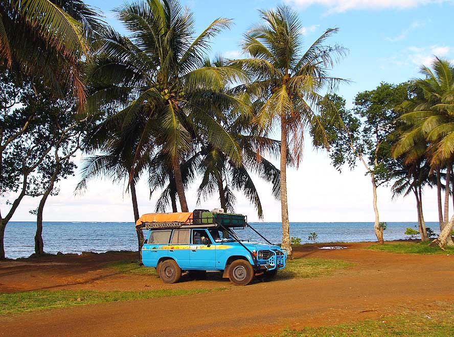
- 54
A blue sea and palm trees swaying
- in the wind – what more do we want?
|
-
|
-
-
-
-
|
-
-
|
-
-
-
-
|
- 55
We camp at an idyllic spot at the
- southernmost tip of New Caledonia
- near the village of Goro
|
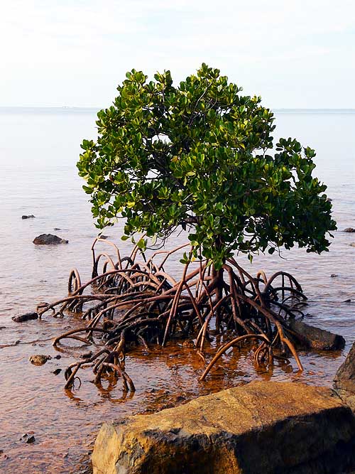
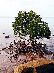
- 56
A mangrove tree shows
- its wide spread-out roots
|
- 57
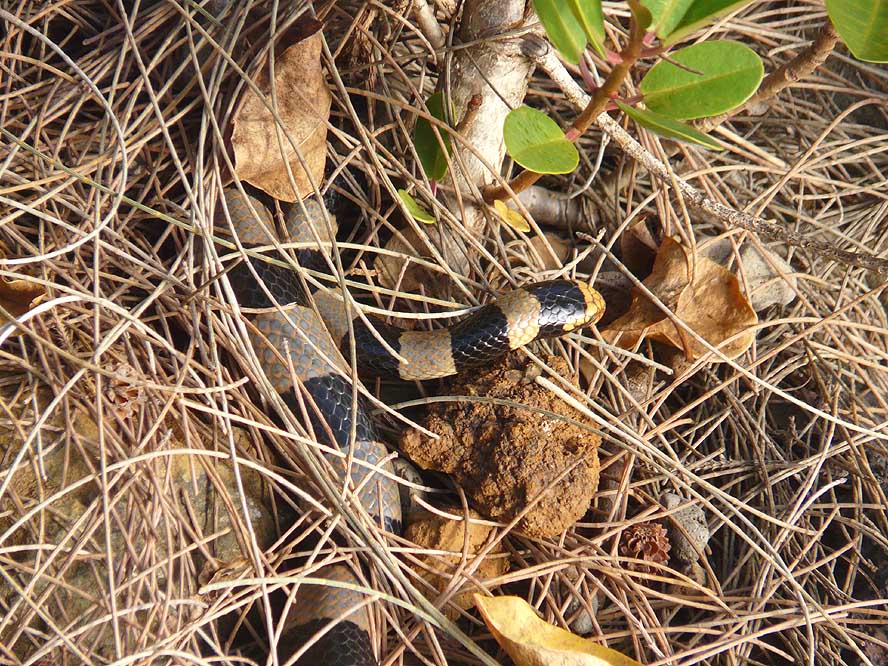
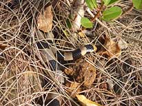
On our camp in Goro we discover
- this black and white rayed snake with
- a yellow head. It’s a poisonous Yellow-
- lipped Sea Krait that is preying at sea
- and digesting on land
|
-
|
-
-
-
-

|
-
-
|
-
-
-
-
|
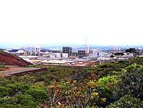
- 58
Remains of a former Japanese
- Chrome mine near Goro, abandoned
- at the begin of the 2nd World War
|
- 59
We are driving towards
- Prony Bay in the deserted South
|
- 60
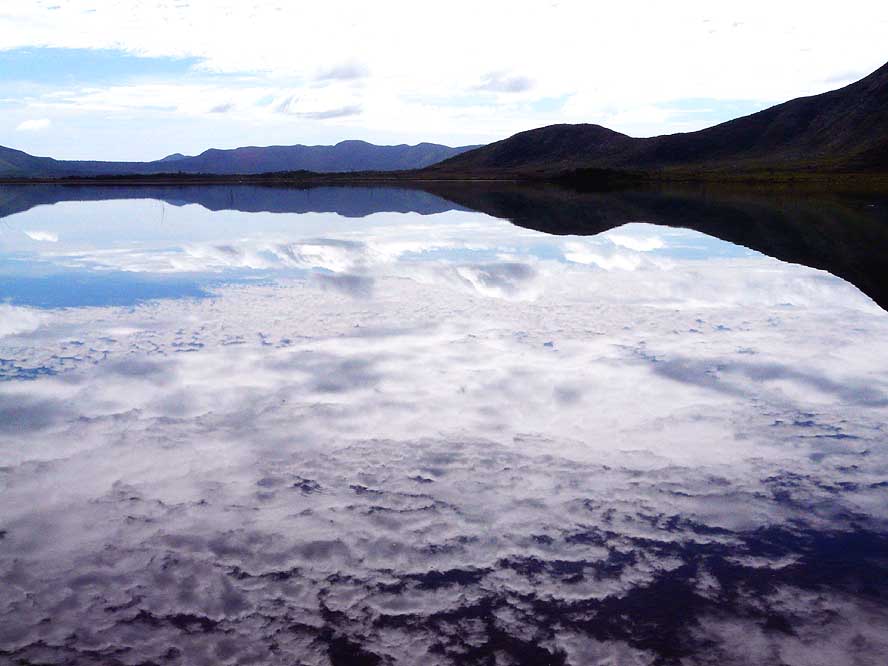
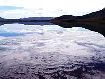
The water of the “Lac en Huit”
- on the “Plaine de Lacs” is so calm
- that the whole sky is reflecting in it
|
-
|
-
-

|
-
-

|
-
-

|
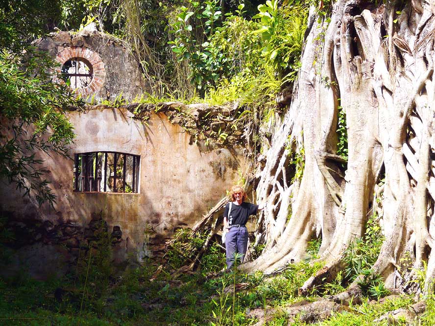
- 61
Liliana poses for a picture in front
- of the former penal colony at Prony. The
- prison is more and more overrun by the
- roots of fig trees. It was used as deportation
- center of convicts, more or less like the
- one on the islands of “Iles du Salut“ in
- French Guiana (= picture line 10 middle)
|
- 62
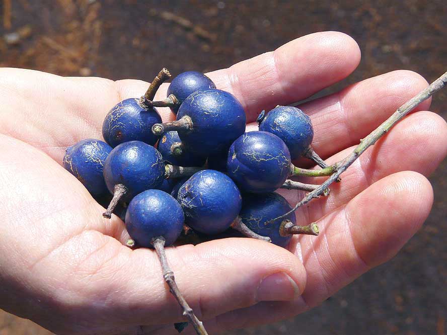
These blue cherries have fallen
- from a tree growing near the former
- penal colony at Prony. They grow
- between India and the Central
- Pacific and are edible too, a bit
- farinaceous though
|
- 63
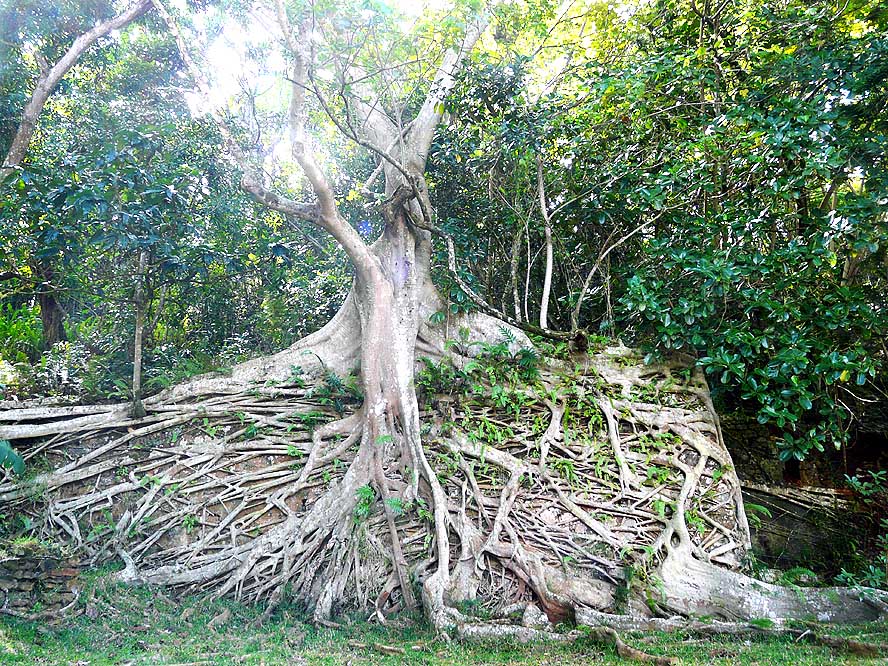
This fig tree in Prony shows how
- immensely its roots can spread out
|
-
|
-
-
-
-
|
-
-

|
-
-
-
-

|
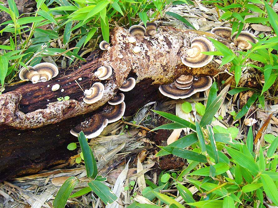
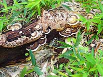
- 64
Mushrooms on a dead trunk
- at the former penal colony at Prony
|
- 65
The clear creek with its tiny waterfall
- in Prony where we fill up our water
- bottles. Luckily nearly in all of
- New Caledonia the water is drinkable
|
- 66
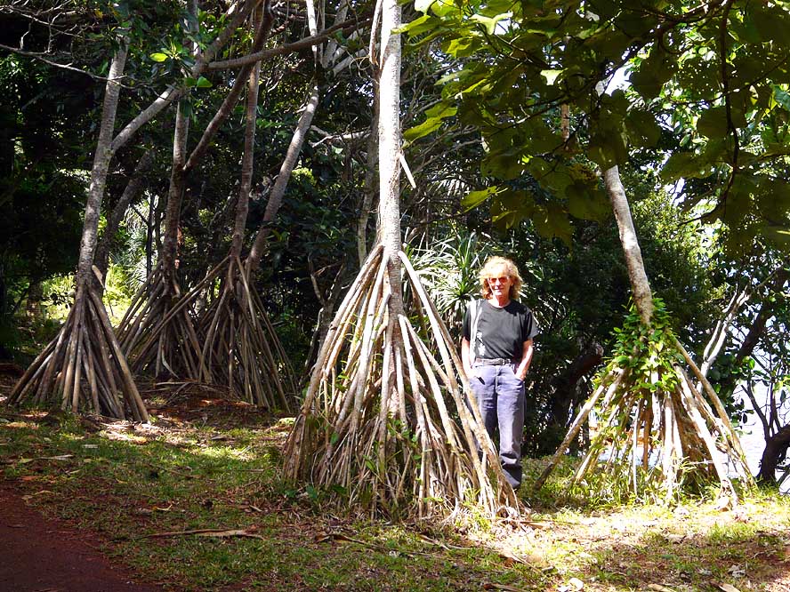
The roots of the Pandanus
- tree are nearly as tall as Liliana
|
-
|
-
-
|
-
-
|
-
-
|
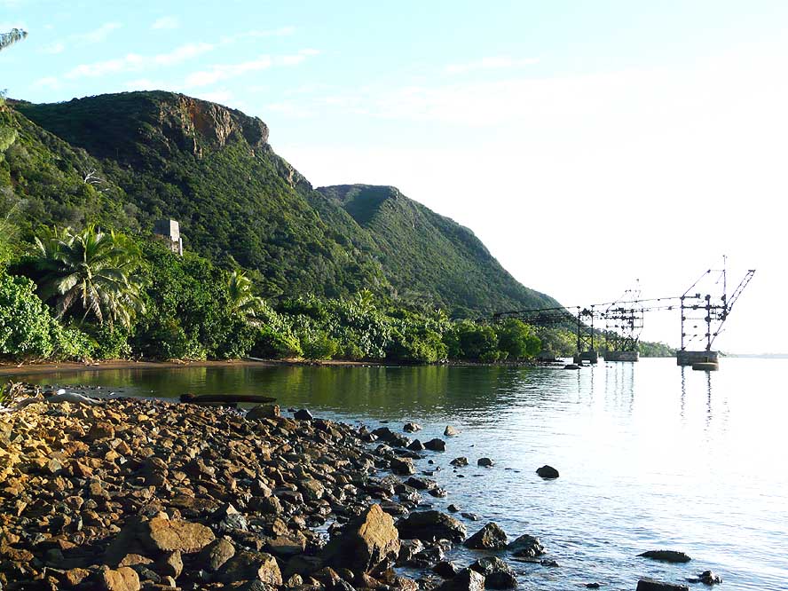
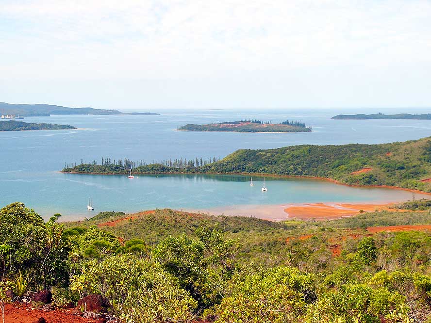
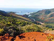
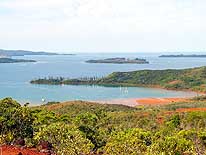
- 67
View over the Bay of Prony.
- The sailing ships are anchoring
- in the “Baie de la Somme“
|
- 68
Through the red land of the South,
- which we liked so much, we drive over
- the Prony Pass back to Nouméa
|
- 69
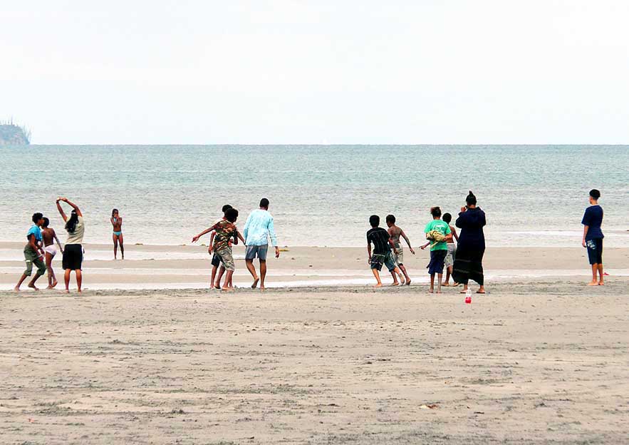
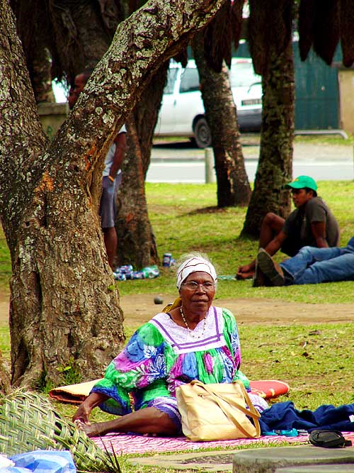
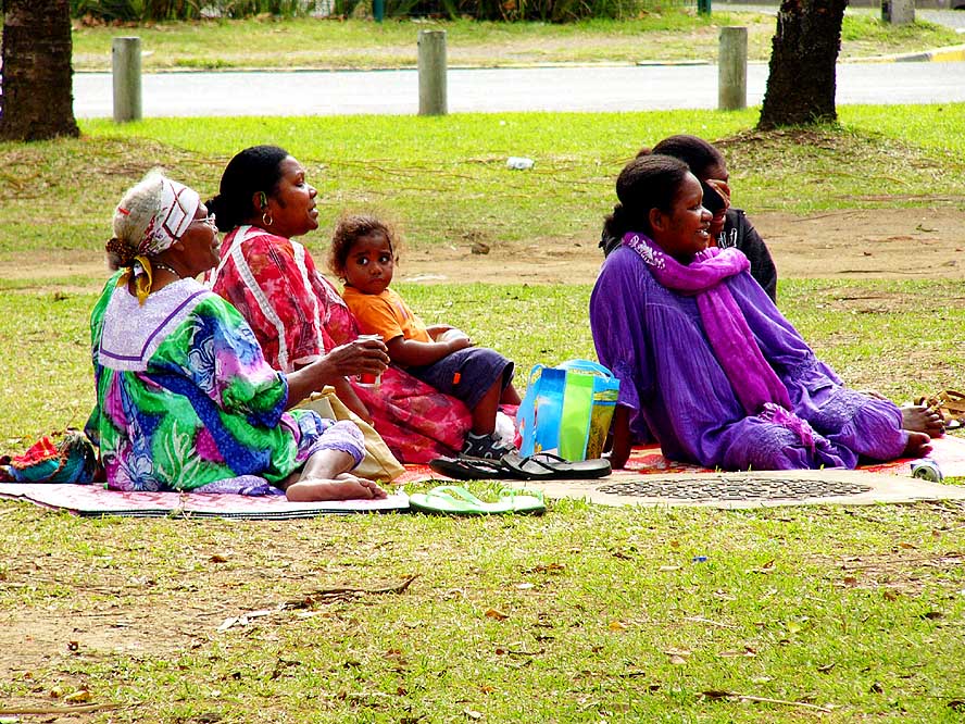
A local family is having fun at
- low tide at Nouméa’s Magenta Bay
|
-
|
-
-
|
-
-
-
-
|
-
-
|
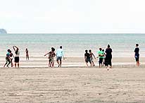
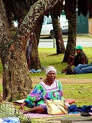
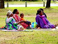
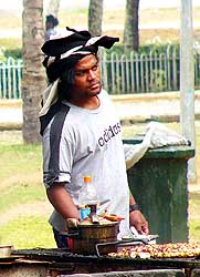
- 70
|
- 71
|
- 72
|
- Local (Kanak) families are enjoying the weekend at Magenta Bay near Nouméa
|
- Continuations:
|
- Articles in newspapers about us in New Caledonia:
- Article: "Un voyage sans fin", Les Nouvelles Calédoniennes - August 27,
2008
|