-
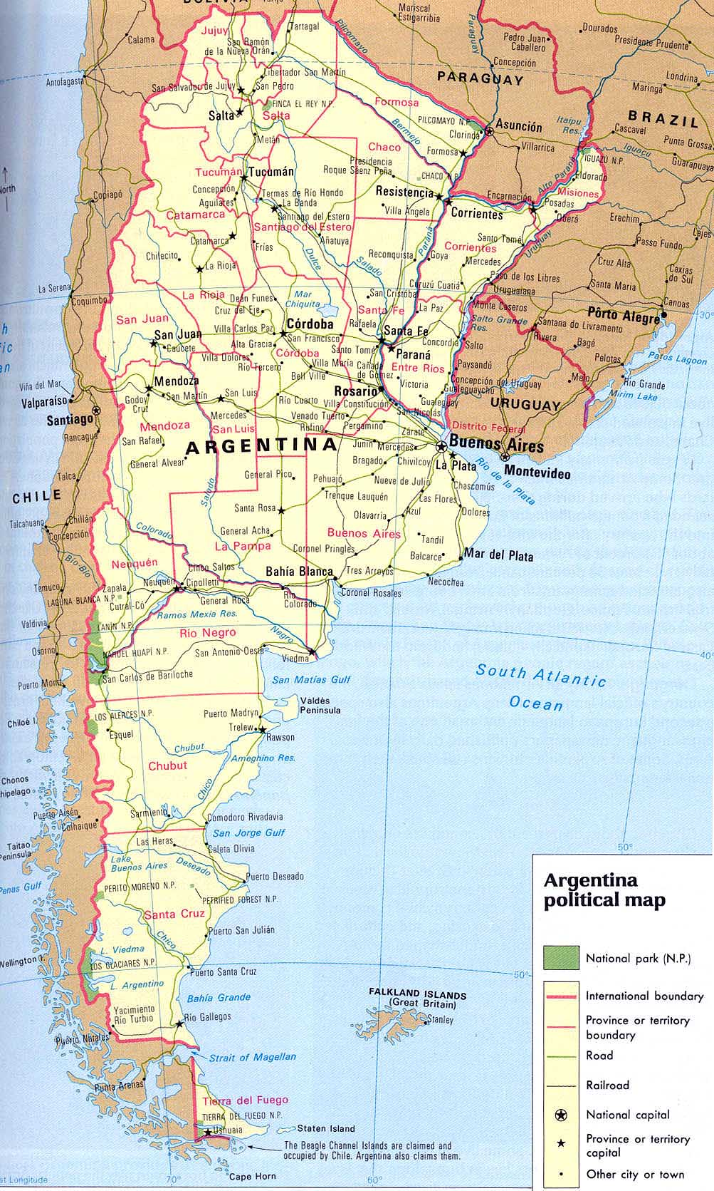
- Argentina Map
|
-
-
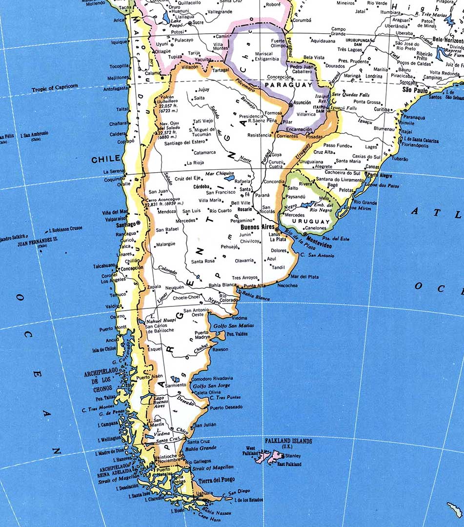
- Map from southern
South America
|
|
-
|
- latest picture:
March 29, 2019
|
-
-

|
-
-
|
-
-

|
-
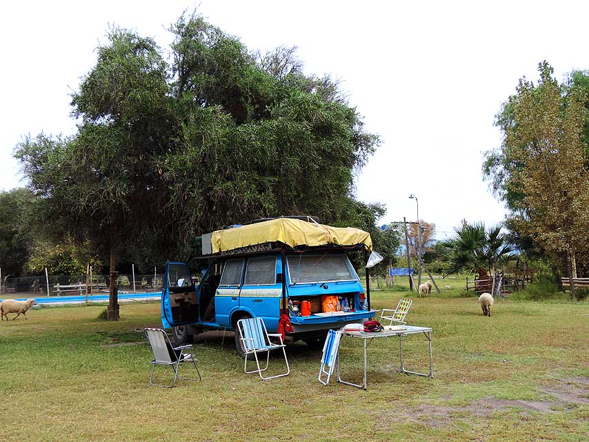
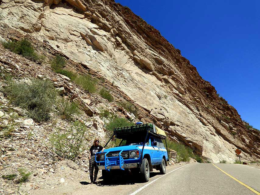
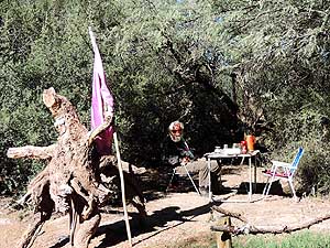
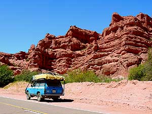
076 Our quiet night spot below a
- 100-year-old
olive tree at the ôLos Hornosö
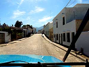
- Camping in San JosÚ de Jßchal
(Province
- San Juan) with tables and benches,
- barbecue places,
electricity and wifi
|
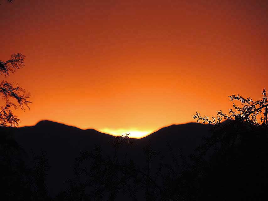
-
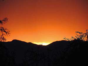
077 Vivid sunset at San JosÚ de Jßchal
|
-
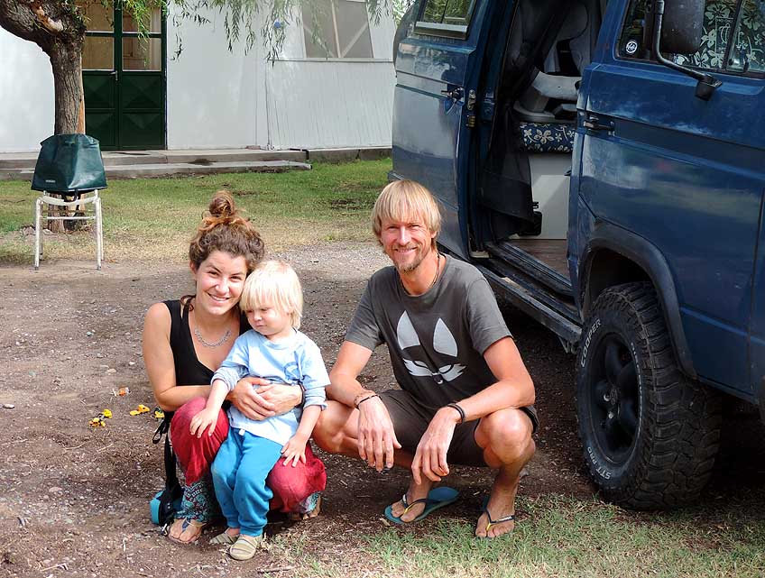
078 Encounter with Florian
and Elena
- from Konstanz/Germany with their
- 2 years old son Hannes.
They plan to
- travel for one year in South America
- with their
Volkswagen Bus
|
-
|
-
-
|
-
-
|
-
-
|
-
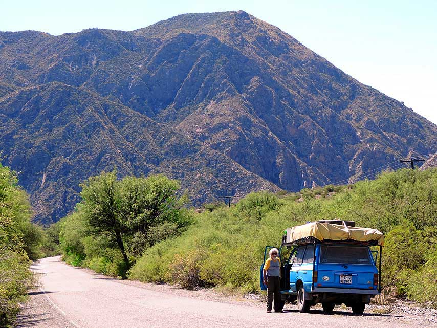
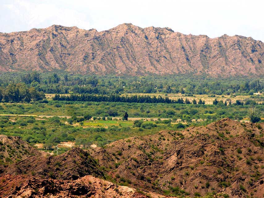
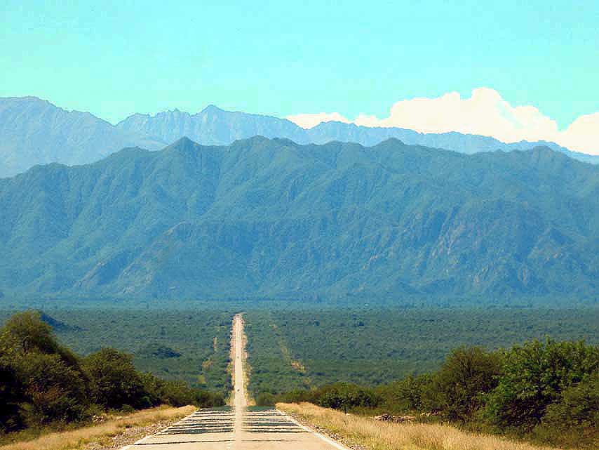
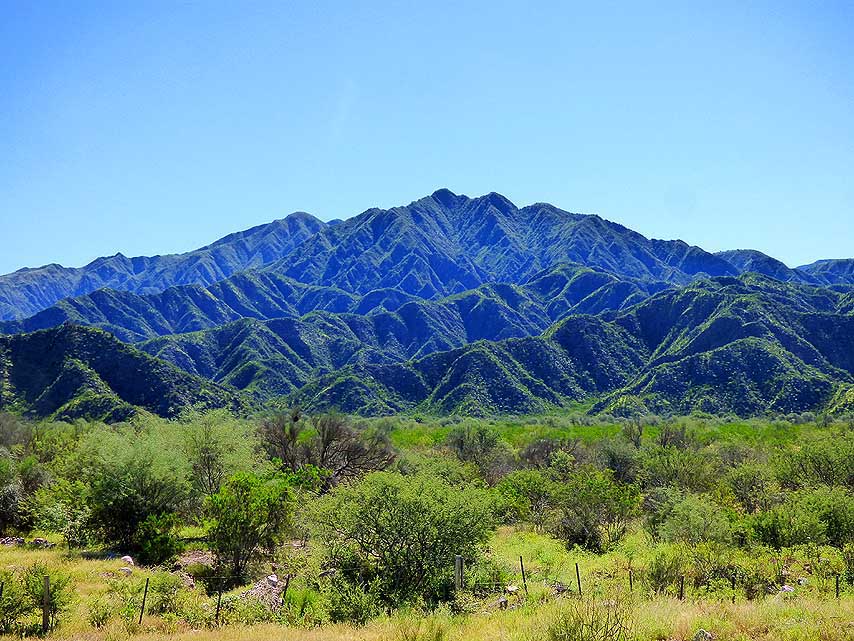
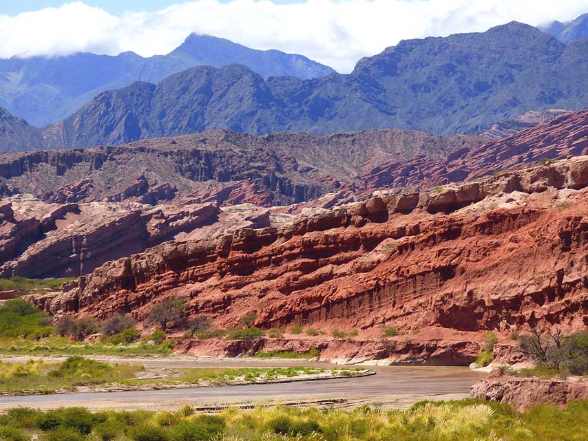
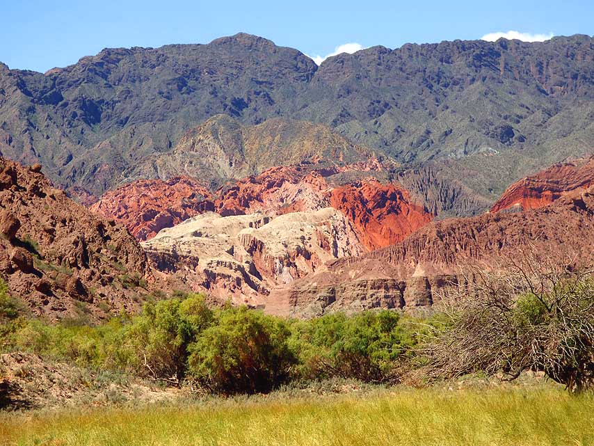
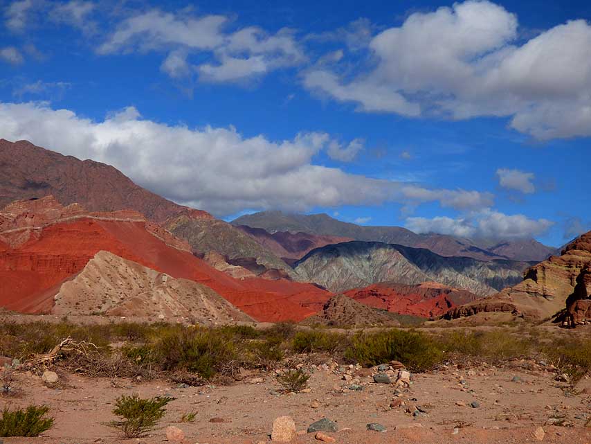
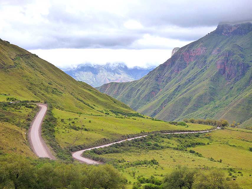
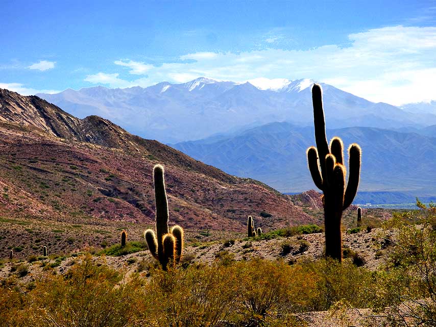
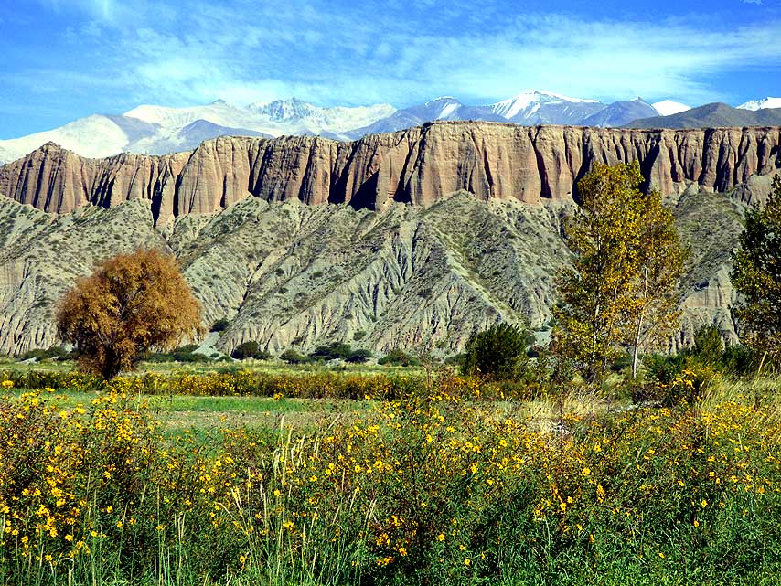
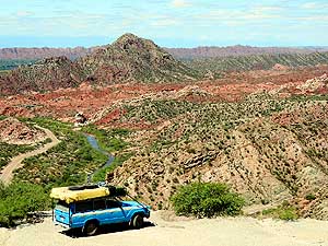
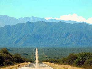
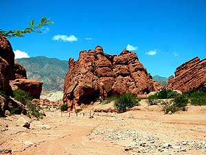
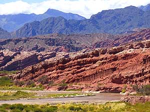
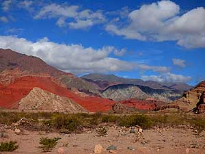
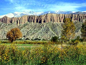
079 The impressive mountain scenery
- of the La
CiÚnaga nature reserve on the
- RP49, a worthwhile shortcut to the
- ôRuta 40ö, is getting closer and closer
- and tempts to stop for a
photo
|
-
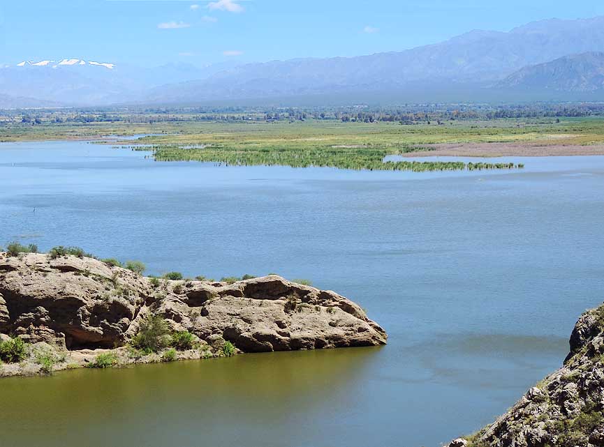
080 View from the fine asphalt road
- RP49 over the
Cauquenes reservoir in
- the scenic La CiÚnaga nature reserve,
- 12¢ ms
[20km] northeast of San JosÚ
- de Jßchal in San Juan province
|
-
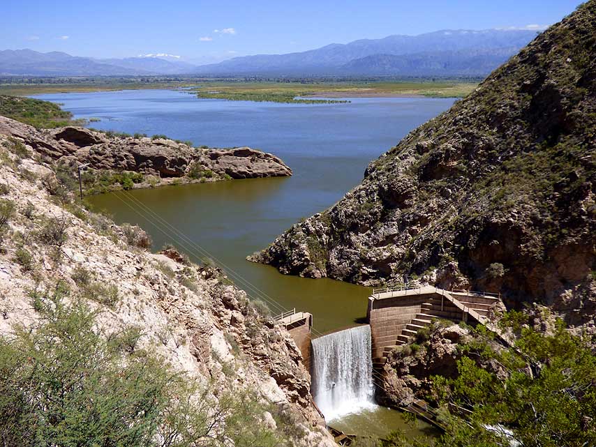
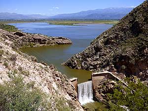
081 The dam at ôBoca de la
Quebrada
- (= mouth of the Gorge). In the back-
- ground the 20'603ft.
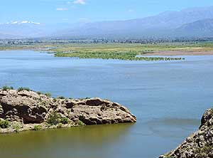
[6'180m] high
- ôCerro de la Majaditaö mountain range
|
-
|
-

|
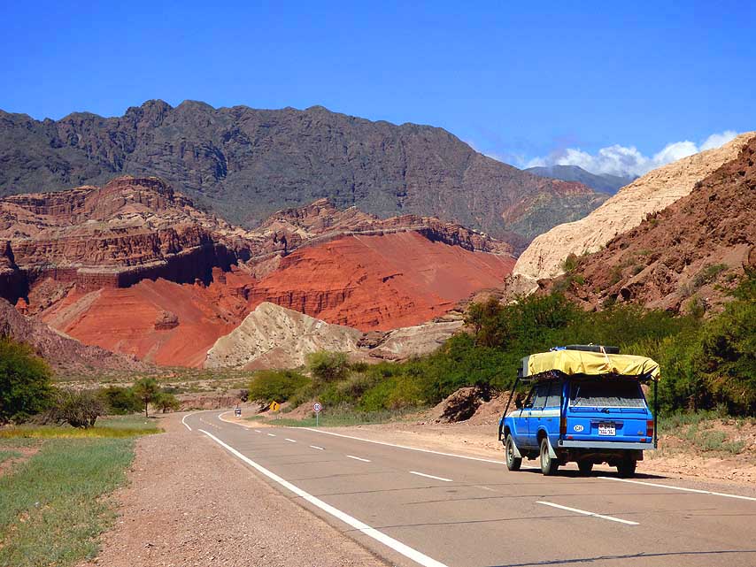
-
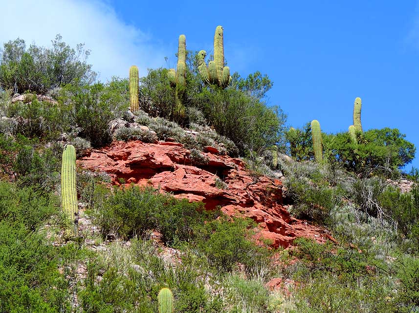
-
|
-
|
-
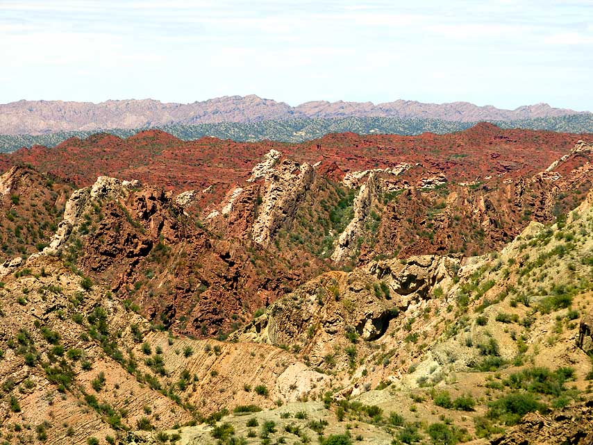
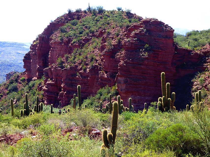
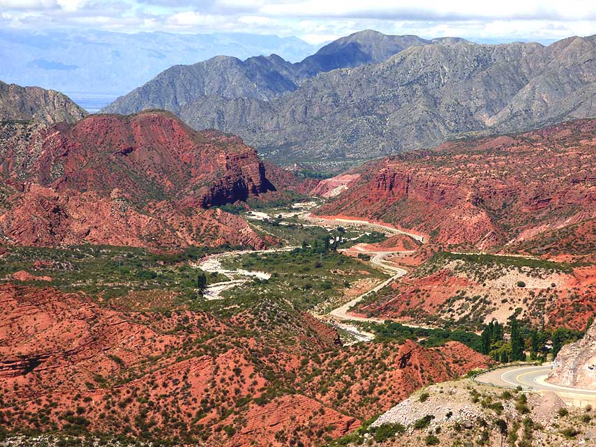
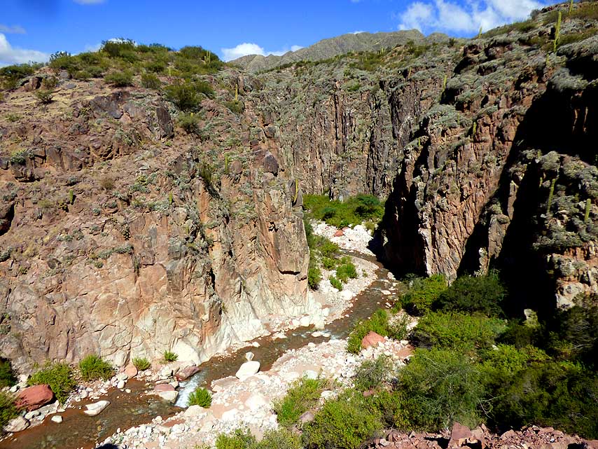
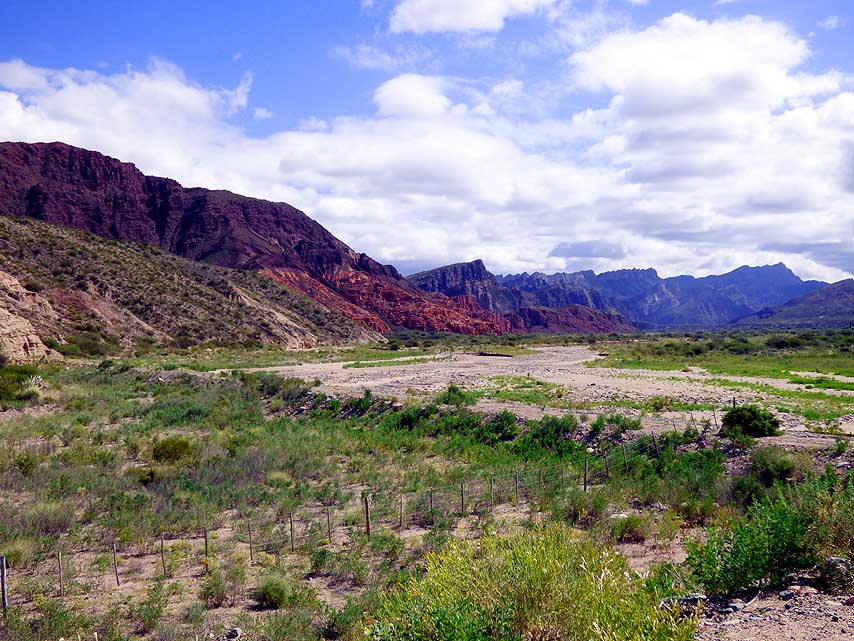
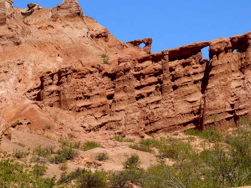
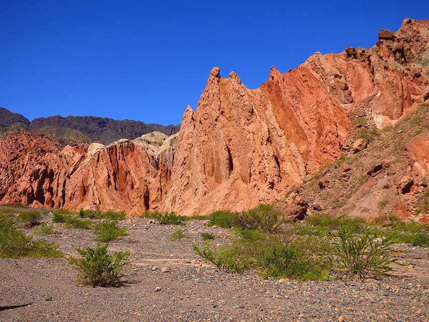
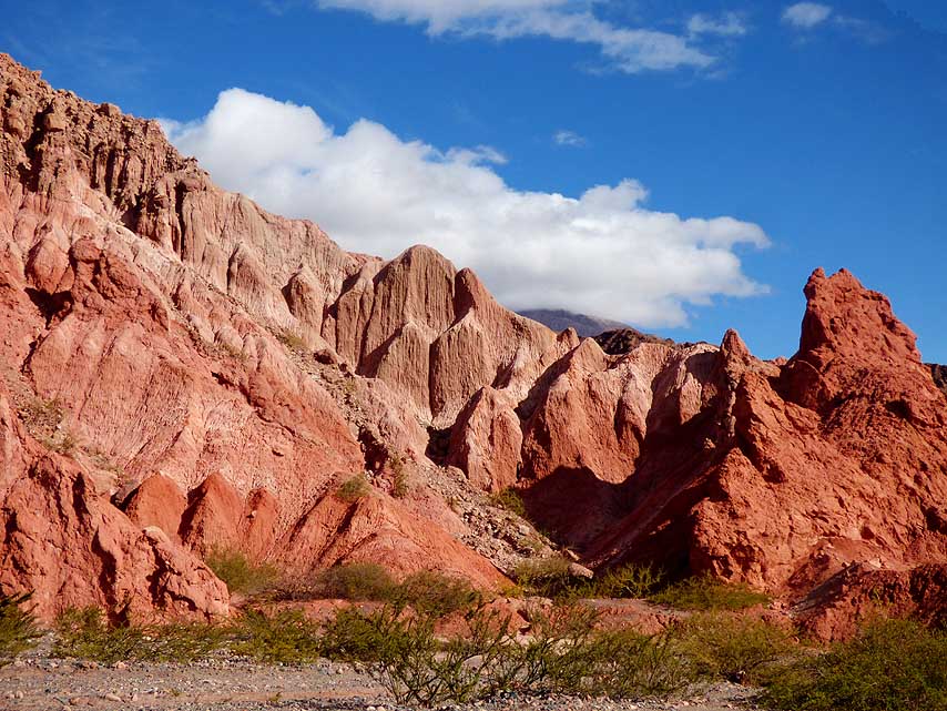
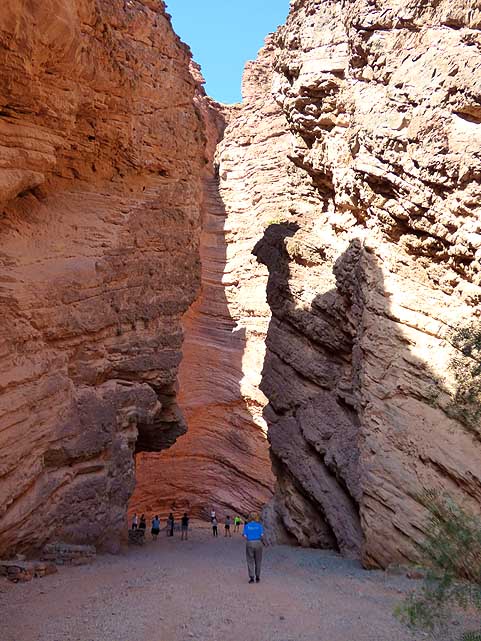
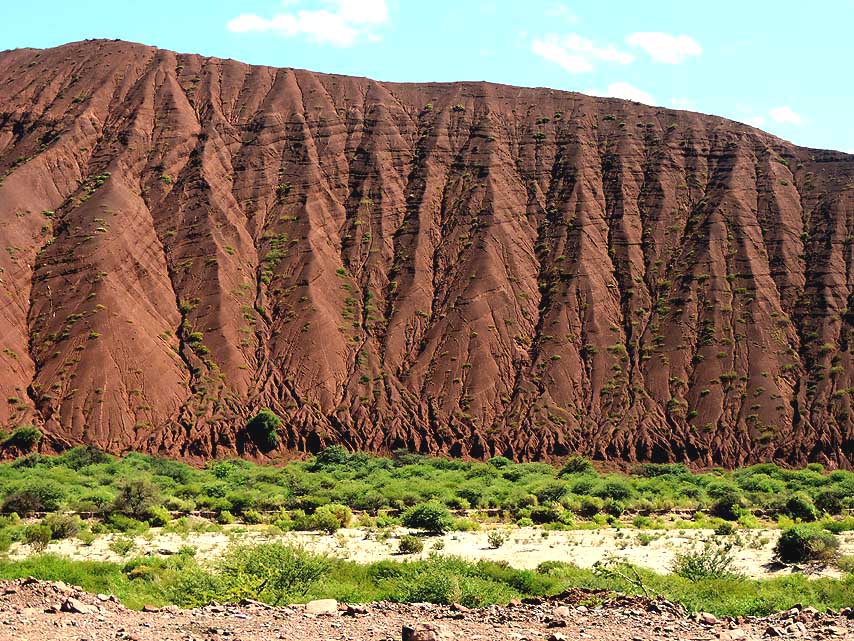
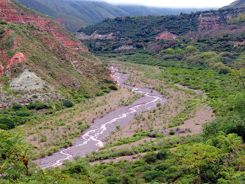
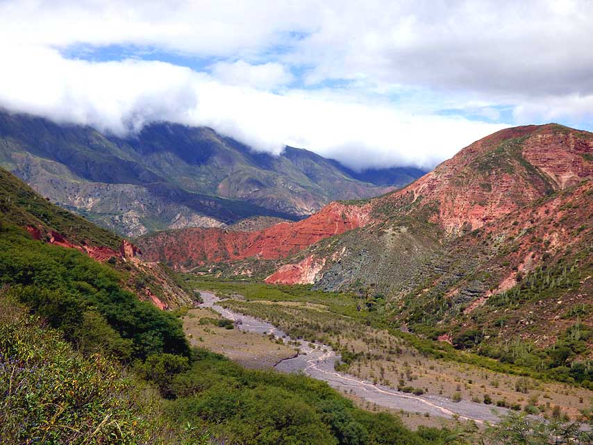
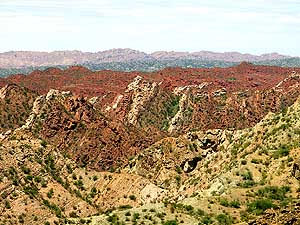
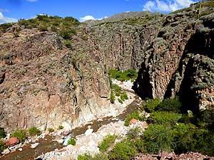
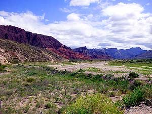
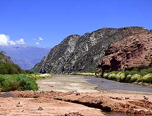
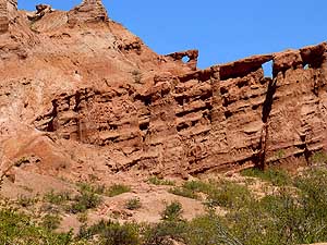
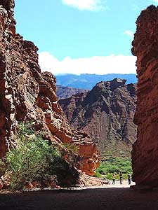
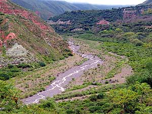
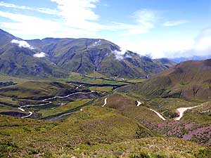
082 Alone along the RÝo Huaco canyon
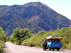
- through the
impressing scenery of the
- La CiÚnaga nature reserve with its
- bizarre
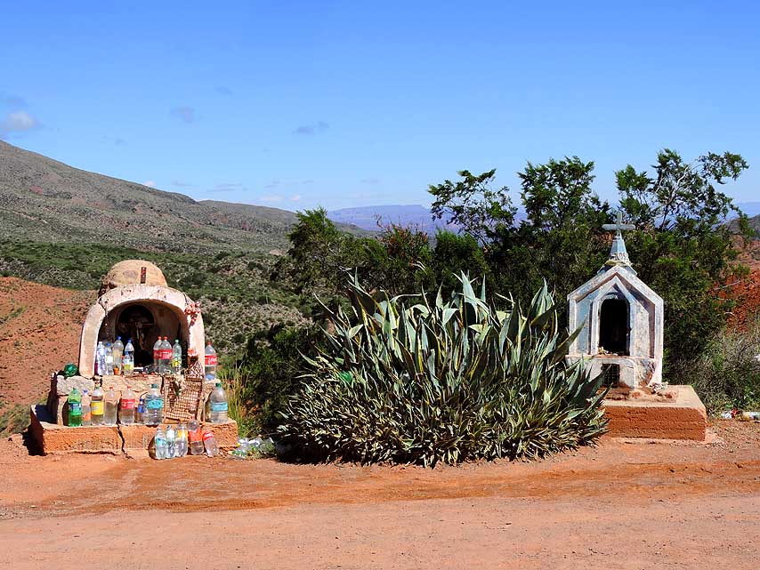
rock formations
|
-
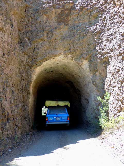
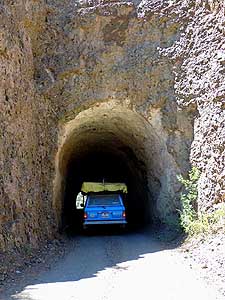
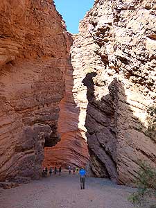
083 The short tunnel cut through the
- rocks at the
La CiÚnaga nature reserve is
- high enough for our LandCruiser.
Shortly
- before, the road narrows to 13ft. [4m]
|
-
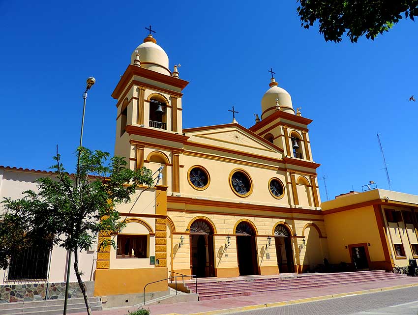
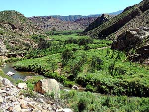
084 After the short tunnel
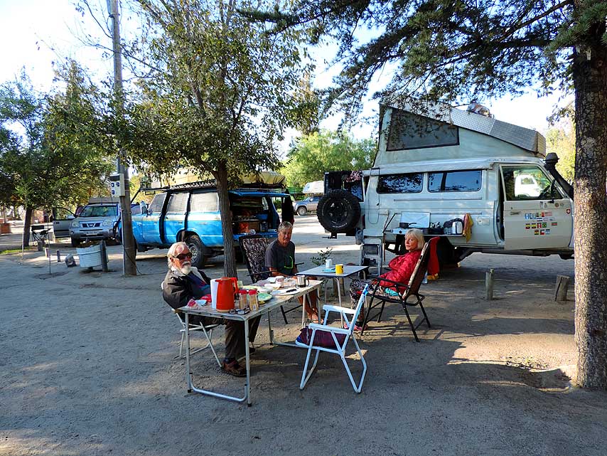
in the
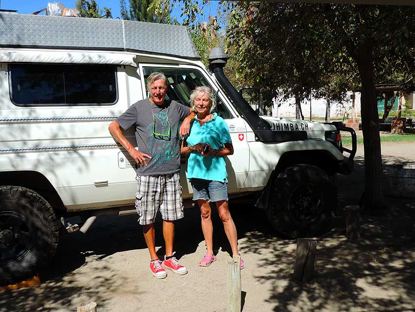
- La CiÚnaga nature reserve a green
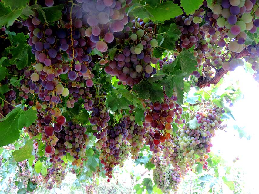
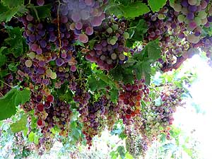
- valley along the meandering
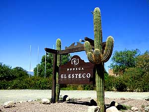
river
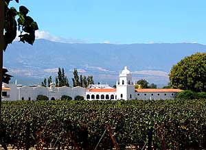
- RÝo Huaco opens up
|
-
|
-
-
|
-
-
|
-
-
|
-
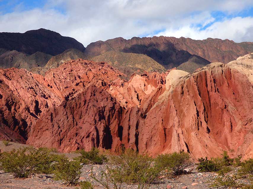
085 Grandiose view from the ôMirador
- de Huacoö
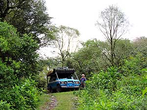
over the green ribbon of the
- fertile valley, framed by desert
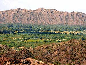
mountain
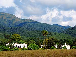
- ranges, in the La CiÚnaga nature reserve
|
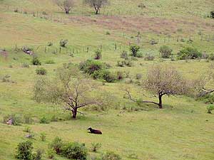
-
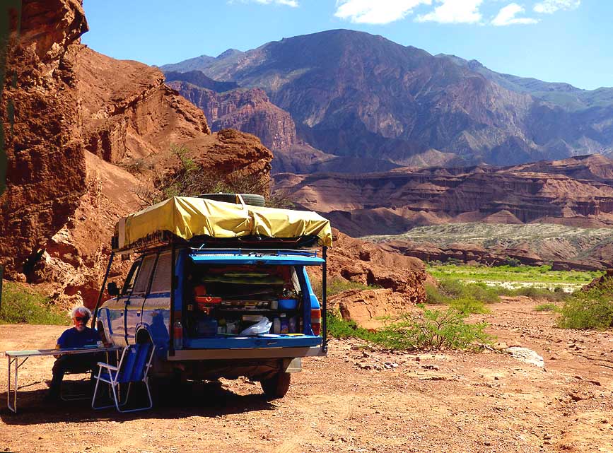
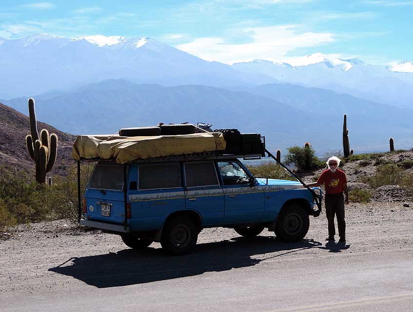
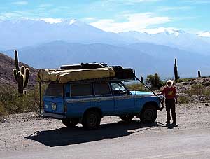
086 Our Landcruiser at the viewpoint
- of ôCuesta Huacoö with RÝo Huaco and
- the provincial road RP49, at the end
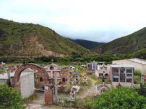
of
- the 20ms [33km] scenic La CiÚnaga
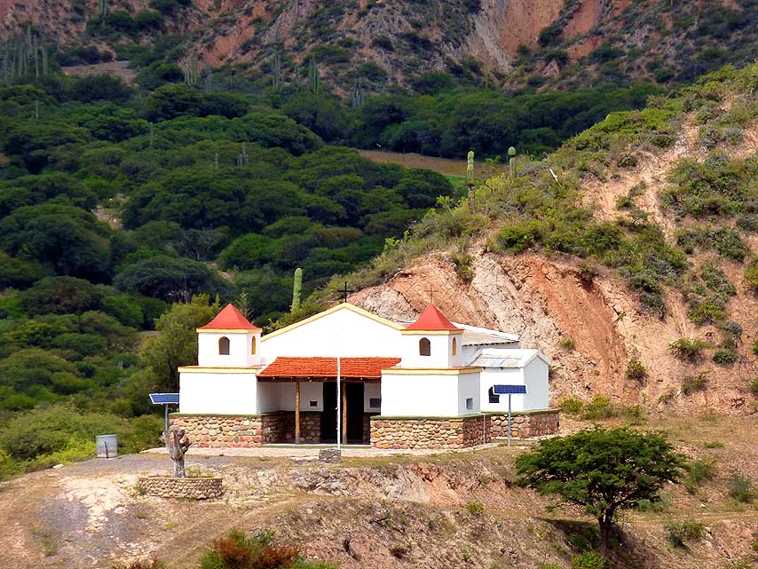
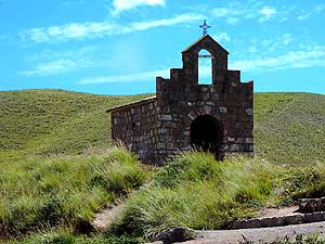
- nature reserve east of San JosÚ de Jßchal
|
-
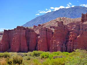
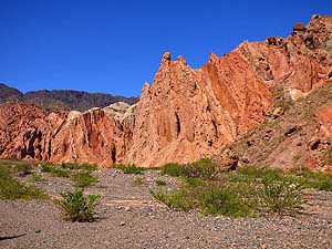
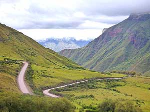
087 A last view to the
reddish rock
- formations at the La CiÚnaga nature
- reserve before we
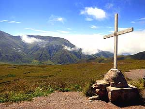
rejoin the legendary
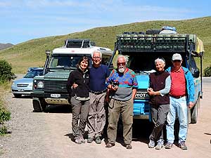
- ôRuta 40ö
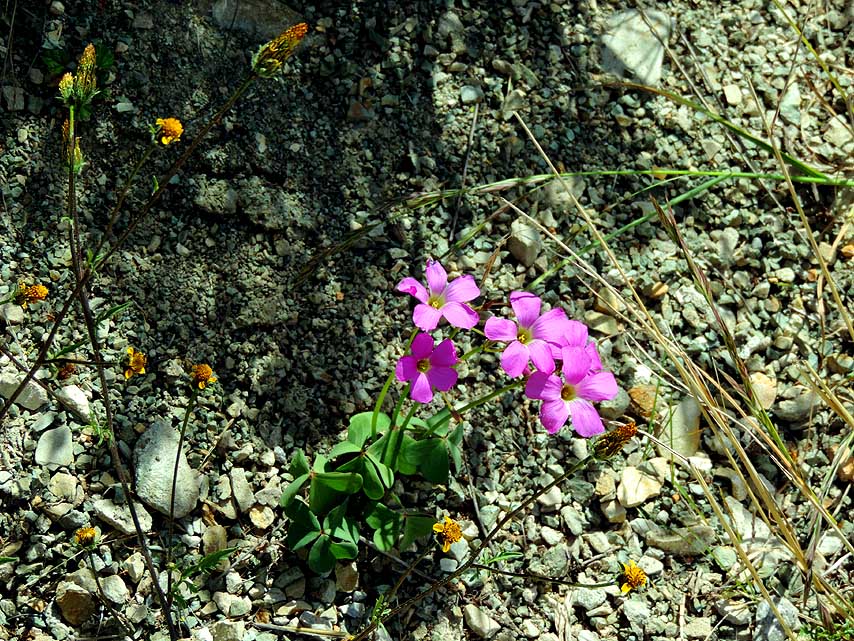
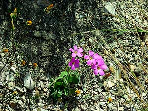
|
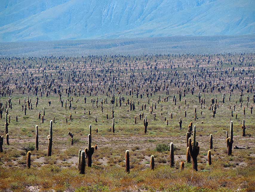
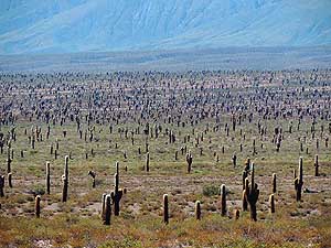
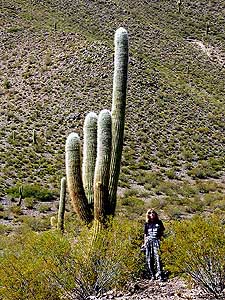
-
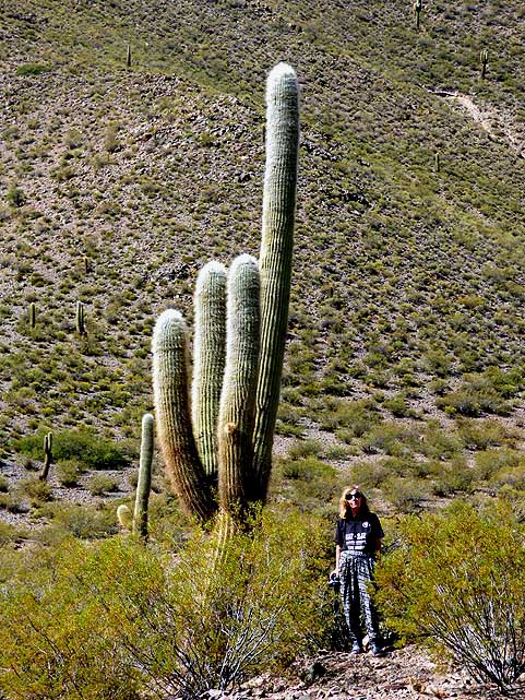
|
-
-
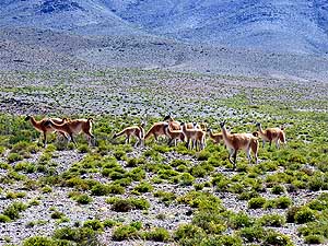
|
-
-

|
-
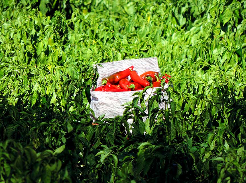
-

|
-
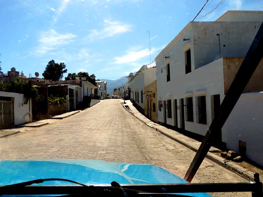
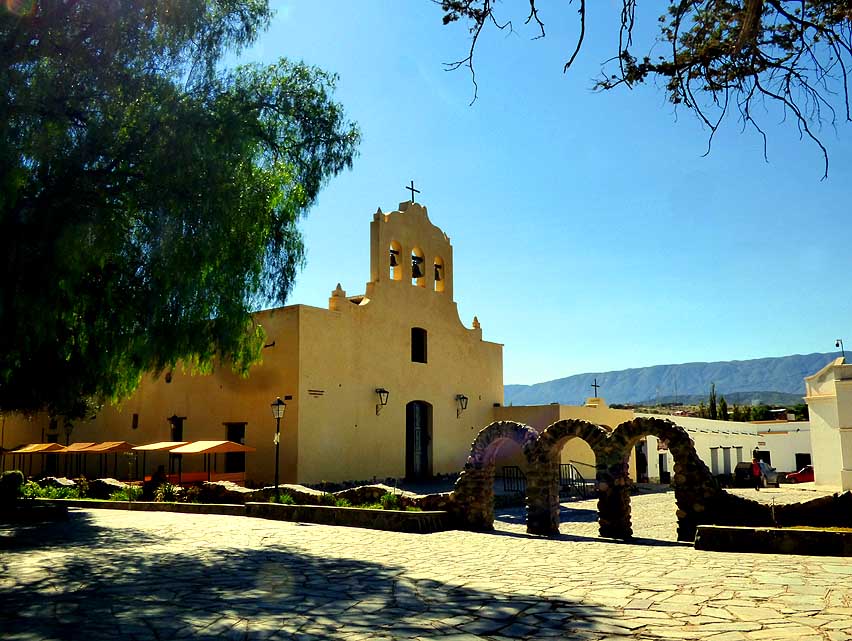
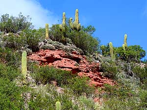
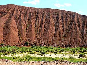
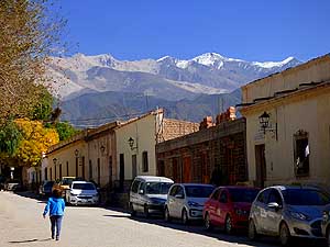
088 Shiny eroded red rocks and stately
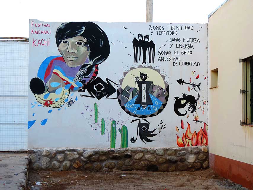
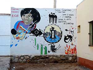
- candelabra
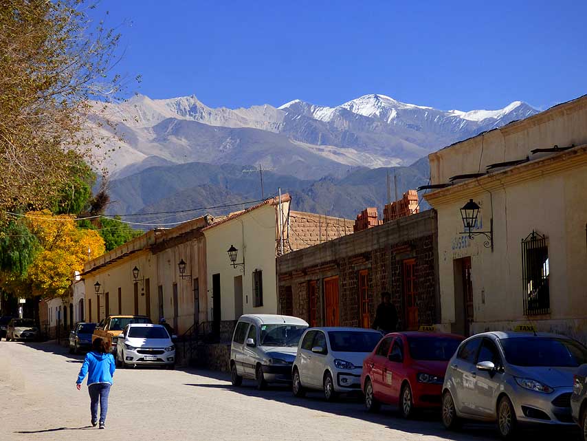
cacti dominate the scenery
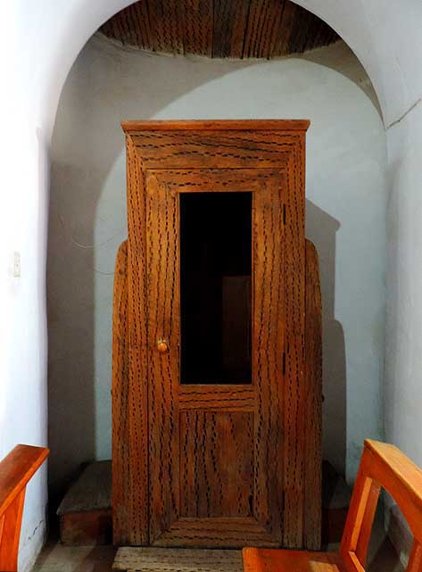
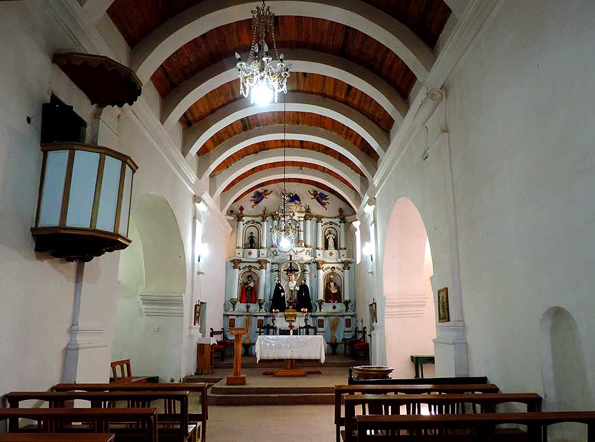
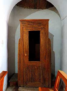
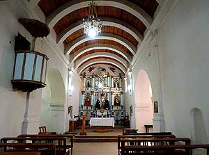
- over the 7'050ft. [2'040m] high ôBordo
- Atravesadoö pass to Chilecito (La Rioja
- province) à..
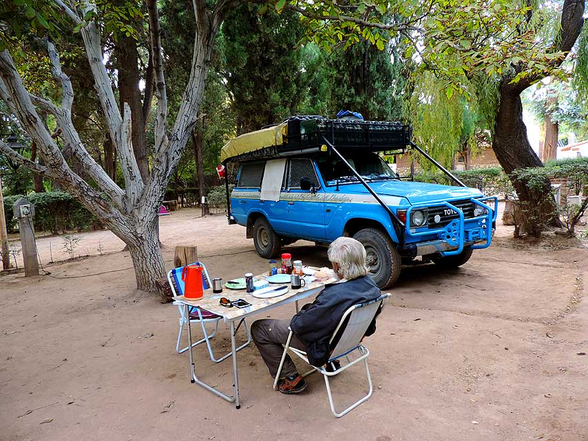
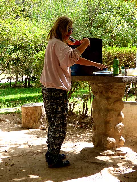
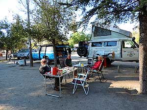
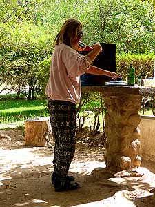
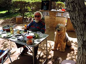
|
-
089 à.. one of the many rocky outcrops
- and cacti
pointing to the blue sky along the
- winding road to the pass summit
in the
- ôCuesta de Mirandaö slope à..
|
-
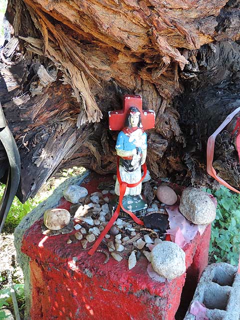
090 à.. where there are
two little
- ômini shrinesö
- (see also picture No. 98 and 99)
|
-
|
-
-

|
-
-
|
-
-
|
-
091 Sweeping panoramic view to the east
- from the
top of the ôCuesta de Mirandaö
- slope over the reddish rocky terrain
|
-
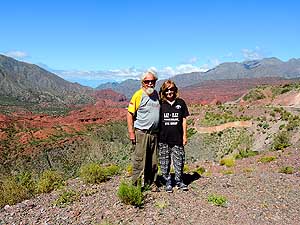
092 A souvenir picture from the
- ôCuesta de
Mirandaö slope with
- its beautiful panorama
|
-
093 Down the valley
towards Nonogasta
- (18ms [29km]) we admire a narrow gorge
- with high
vertical walls
|
-
|
-
-
|
-
-
|
-
-
|
-
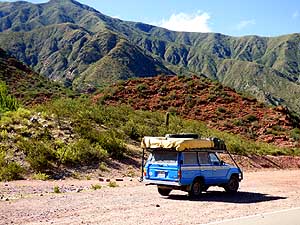
094 Our LandCruiser along the almost
- empty ôRuta
40ö between Villa Uni¾n and
- Chilecito with its beautiful cliff
scenery
|
-
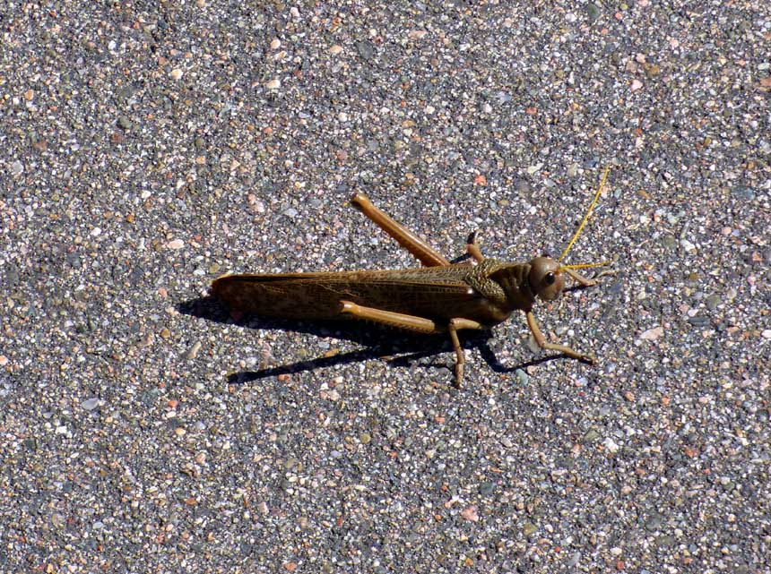
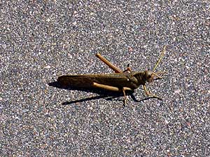
095 The giant grasshopper ôTucura-
- Quebracheraö
(Tropidacris collaris)
- becomes 4 to 5 inches [10-13cm] long and
- is
declared a plague in northern Argentina
|
-
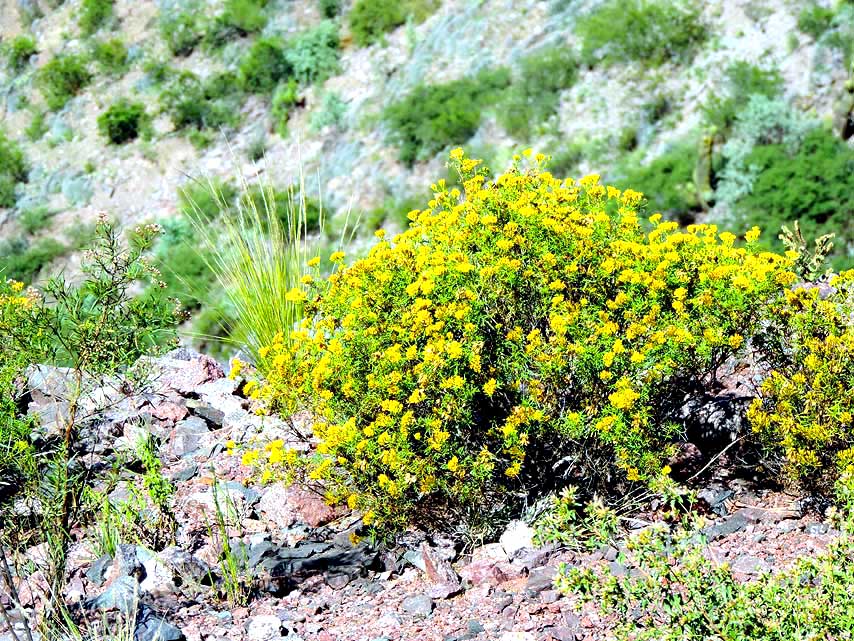
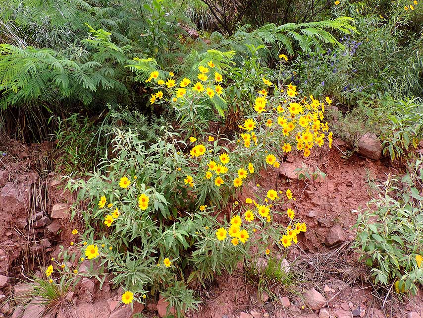
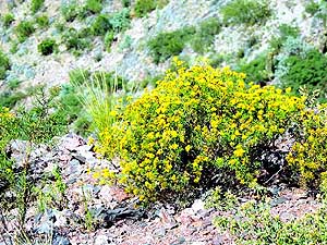
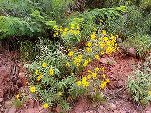
096 The glowing yellow
flowers are
- a beautiful splash of color in the red-
- brownish cliff
scenery of the
- ôCuesta de Mirandaö
|
-
|
-
-
|
-
|
-
-

|
-
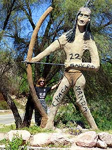
097 ôWild Westö atmosphere: An
- Amerindian with
bow and arrow after
- the Sauces River bridge in San Blas de
- los
Sauces, La Rioja province.
- Liliana looks just tiny next to it
|
-
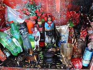
098 Empty bottles belong to the
- offerings at the
ômini shrineö near the
- bridge over the dry Sauces River .....
|
-
099 à.. and another tiny
ôchapelö
- just next to it with statues of saints
- and decorated with
artificial flowers
- (see
Gauchito Gil)
|
-
|
-
-

|
-
-
|
-
-

|
-
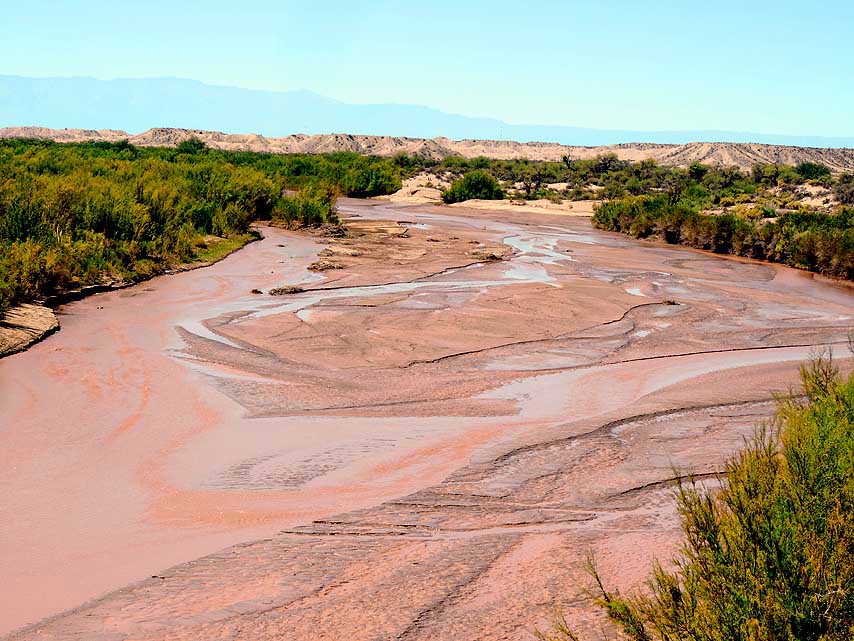
100 Wide riverbed in a landscape of dunes:
- We
cross a river with now three names
- between the provinces of La Rioja
and
- Catamarca: RÝo Salado, RÝo Colorado or
- RÝo Bermejo, but which is
called
- RÝo Abaucßn about 40km to the west
|
-
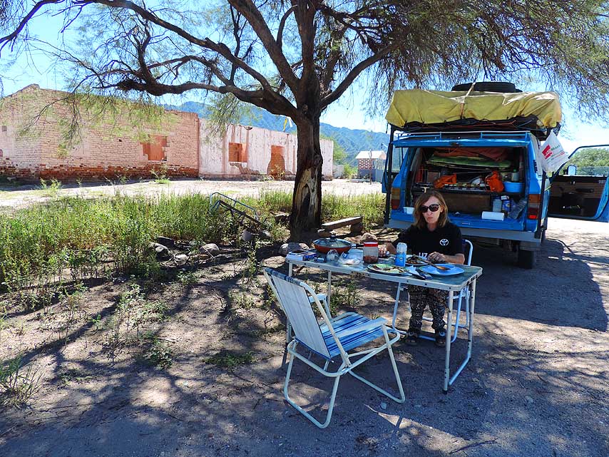
101 Lunch break at a ruin under
- a shady tree
along ôRuta 40ö
|
-
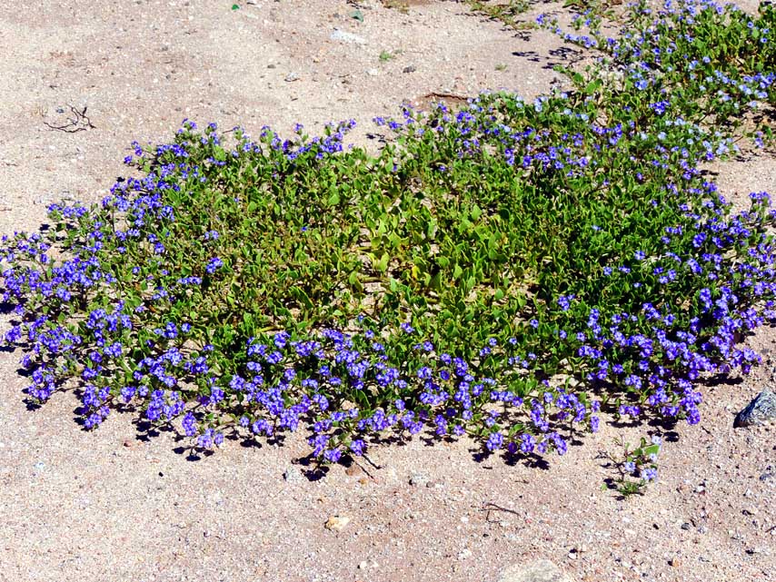
102 ôCreepingö lilac
flowers with
- lush green leaves are spreading wreath-
- shaped on the
dry desert ground
|
-
|
-
-
|
-
-
|
-
-

|
-
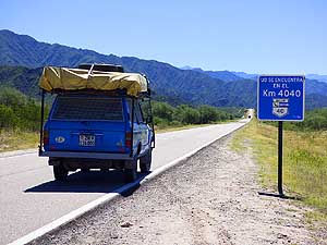
103 Our LandCruiser hits kilometer 4040
- on the
legendary ôRuta 40ö. It leads about
- 3'230ms (ca. 5'200km) from Punta
Loyola
- near RÝo Gallegos along the Andes moun-
- tains to La Quiaca at
the Bolivian border
|
-
104 Impressing: 20km [12¢ms] after
- the 4040 road
sign, the ôRuta 40ö climbs
- from the dead straight plain before
Londres
- towards the mountain massif of the
- ôSierra de BelÚnö à..
|
-
105 à.. the region is lush
green, even
- on the top of rugged mountain ranges
|
-
|
-
|
-
-

|
-
|
-
106 RÝo HualfÝn near the confluence
- of RÝo San
Fernando before the village
- of HualfÝn
|
-
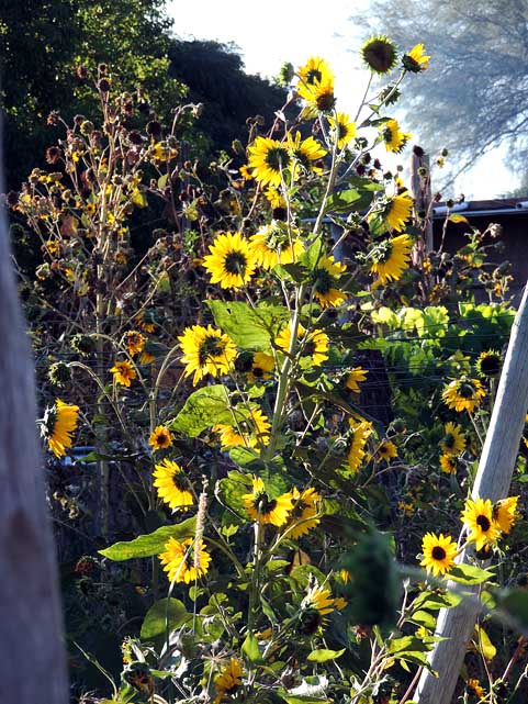
107 Sun flowers (Helianthus annuus),
- which always
spread cheerfulness. They are
- very light-dependent. Its growth
depends on
- the light intensity. It has the peculiarity of
- always
turning to the sunlight
|
-
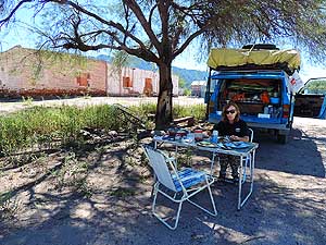
108 Breakfast in the sun
at the camping
- ôEl Solö on the east bank of the
- Santa MarÝa river in
Santa MarÝa
|
-
|
-
-
|
-
-
|
-
-

|
-
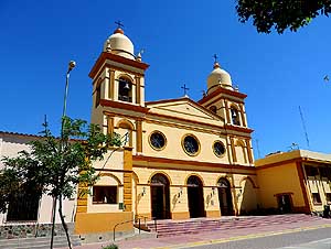
109 ôCathedral of Our Lady of the
- Rosaryö of the
19th-century in Cafayate
- in the Province of Salta
|
-
110 Breakfast at the camping ôLuz y
- Fuerzaö in
Cafayate with the Swiss Christine
- and Felix with their LandCruiser
HZJ78 à..
|
-
111 à.. Christine and
Felix in front of
- their white LandCruiser HZJ78. Website:
-
https://www.jhimba.ch/sitemap/
|
-
|
-
-
|
-
-
|
-
-
|
-
112 Ripe sweet grapes hanging from
- a pergola
|
-
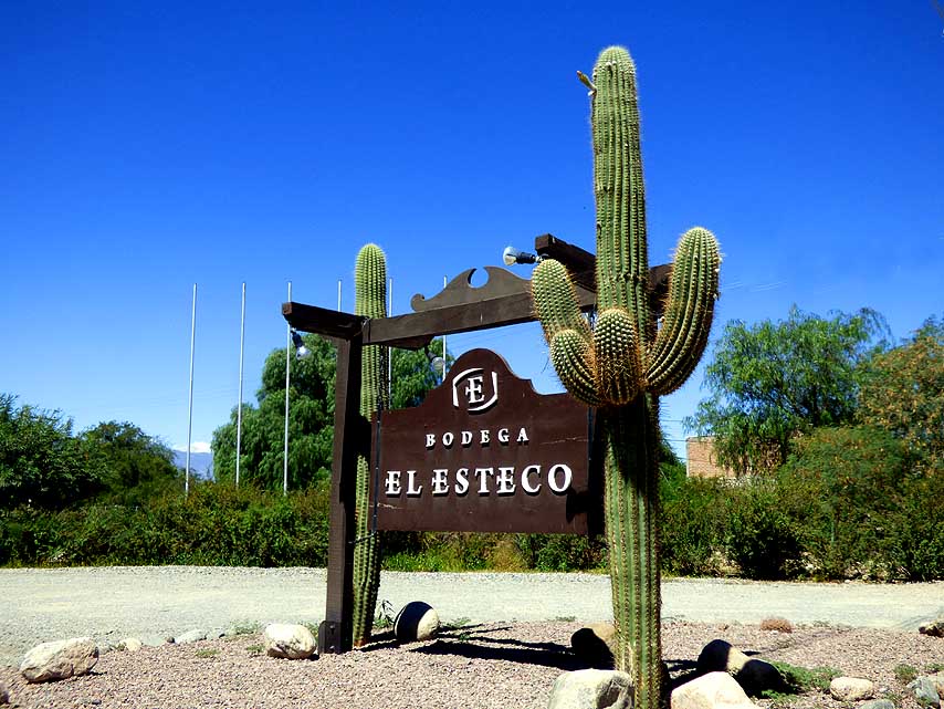
113 Signpost to the vineyard ôBodega
- El Estecoö
on the outskirts of Cafayate
- (corner ôRuta 40ö and RN68 to Salta)
à..
|
-
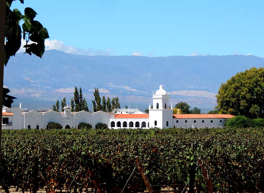
114 à.. the stately
whitewashed vineyard
- behind the vine branches is open for
- degustation. It's one of the bigger bodegas
- in this region
(the CalchaquÝ Valleys)
|
-
|
-
-
|
-
-
|
-
-
|
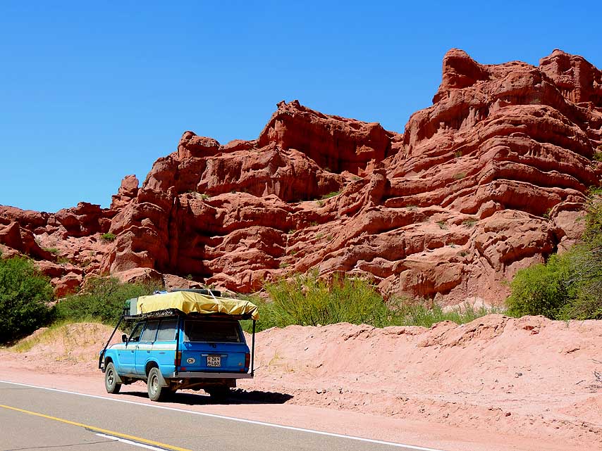
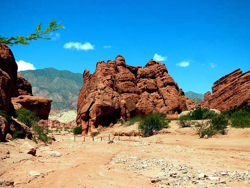
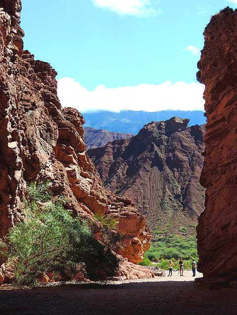
- The grandiose world of sandstone formations of different shapes
and colors in the CalchaquÝ Valleys. It's situated between
- TafÝ del
Valle in the south and the 16'312 ft. [4'972m] high pass ôAbra del
Acayö, the highest passage of the ôRuta 40ö.
- Here the following 17
pictures (from No. 115 to 131) in the nature reserve ôQuebrada del
RÝo de las Conchasö, called also
- ôQuebrada de Cafayateö which
extends from Cafayate towards Salta for about 40ms [ca. 60km]
|
-
115 Our LandCruiser along the
- spectacular
landscape of the
- ôQuebrada del RÝo de las Conchasö
|
-
116 In the river valley of the
- RÝo las Conchasö
it's partly lush green û a
- wonderful contrast to the rocky landscape
|
-
117 An especially
impressing red
- sandstone cliff, carved out by the
- ôRÝo de las
Conchasö and its feeder rivers
|
-
|
-
-
|
-
-
|
-
-
|
-
118 Standing tall above the green valley
- floor. Years of erosion created impressive
- columns and towers known as
- ôThe
Castlesö (Los Castillos)
|
-
119 View of the different colored
- sandstone
layers
|
-
120 ôThe Windowsö in the
ôQuebrada
- del RÝo de las Conchasö (Las Ventanas)
|
-
|
-
-

|
-
-

|
-
-
|
-
121 Our LandCruiser on one of the most
- beautiful
rocky landscapes of Argentina û
- the ôQuebrada del RÝo de las
Conchasö à..
|
-
122 à.. the bright red and white of the
- rocky
landscape stands out particularly
- dramatically à..
|
-
123 à.. and the cliffs of
red sandstone
- are witness to the creativity of the water
|
-
|
-
-
|
-
-
|
-
-

|
-
124 Nature as a sculptor: The red
- sandstone
formations in the ôQuebrada
- del RÝo de las Conchasö present
- themselves sometimes jaggedly à..
|
-
125 à.. sometimes in gently rolling hills
|
-
126 Pinnacles and turrets
give the
- landscape in the ôQuebrada del RÝo de
- las Conchasö its
majestic appearance
|
-
|
-
-
|
-
-

|
-
-
|
-
127 The ôamphitheaterö (El Anfiteatro) û
- an
approx. 164ft. [50m] large rock cauldron
- of the ôQuebrada del RÝo de
las Conchasö,
- carved from red stone, is surrounded by
- 66ft. [20m]
tall walls à..
|
-
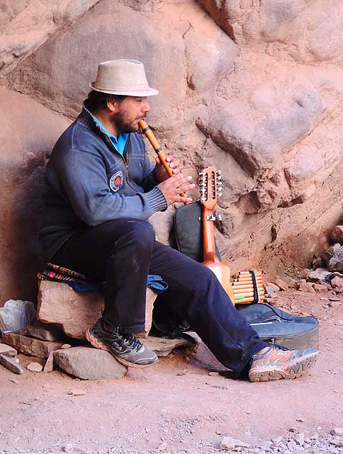
128 à.. a musician is entertaining the
- visitors;
the acoustic in this natural
- wonder is near to perfect à..
|
-
129 à.. and the view from
the
- natural amphitheater to the
- outside is impressive
|
-
|
-
-

|
-
-
|
-
-

|
-
130 A track leads us to the middle of
a red
- rock formation of ôQuebrada del RÝo de las
- Conchasö. Is there a
nicer place for lunch?
- Fortunately not everything is locked (yet)!
|
-
131 From the creek bed of the ôRÝo de
- las
Conchasö a massive furrowed wall
- rises against the blue sky at the
north-
- eastern entrance of the ôQuebradaö
|
-
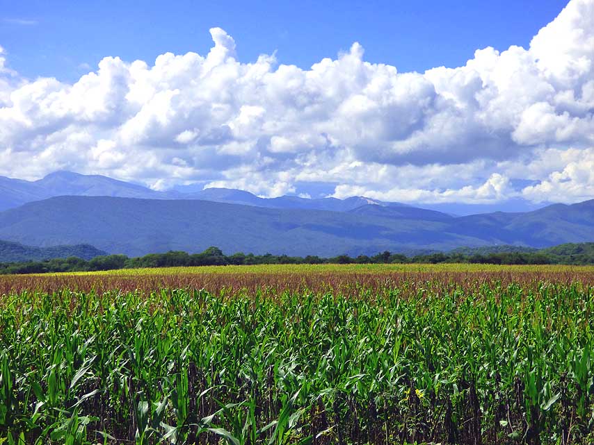
132 Large cornfields shape
the landscape
- between the ôQuebrada del RÝo de las
- Conchasö and
Salta
|
-
|
-
-
|
-
-

|
-
-
|
-
133 A farmhouse in Spanish architectural
- style at
the foot of a deeply wooded hill
- near Salta
|
-
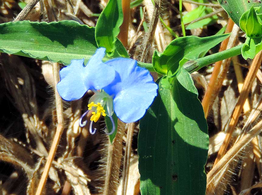
134 A lonely blue dayflower, also called
- Asiatic
dayflower (Commelina communis),
- in many places classified as weed,
is hidden
- between dead and fresh leaves
|
-
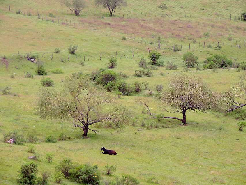
135 A single cow on lush
pastures as
- far as the eye can see û at the foot of the
- ascent to
the ôPiedra of the Molinoö Pass
- (ôCuesta del Obispoö)
|
-
|
-
-

|
-
-
|
-
-
|
-
136 Our LandCruiser on the ascent
- towards the
ôCuesta del Obispoö i.e.
- ôPiedra del Molinoö Pass to Cachi along
- the
tarred Salta provincial road 33 à..
|
-
137 à.. the RÝo de Escoipe River
- with its zigzag
course à..
|
-
138 à.. and our cozy
little lunch
- spot on the way up
|
-
|
-
-
|
-
-

|
-
-

|
-
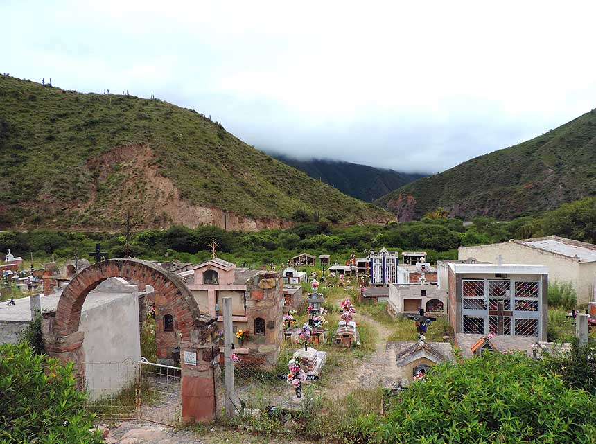
139 A well kept cemetery in a beautiful
- mountain
setting 1 mile [1¢km]
- south of the Parador Sunchal
|
-
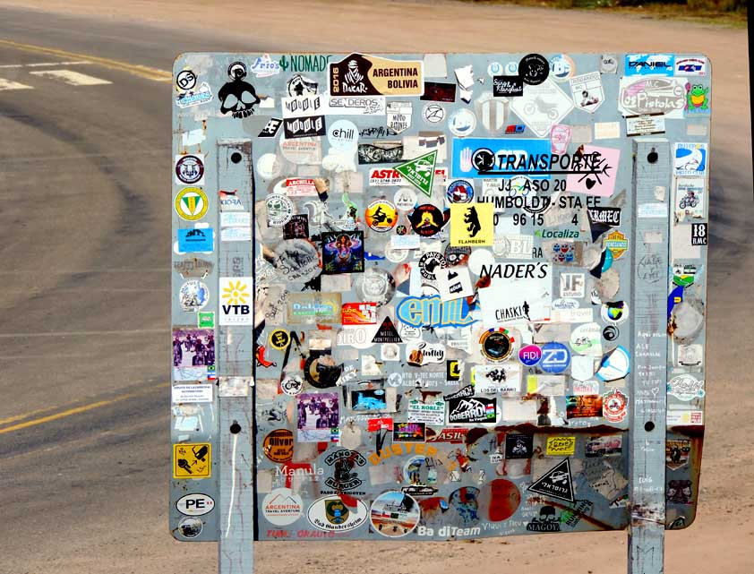
140 A sign with stickers of people
- who drove up
the ôCuesta del Obispoö
- to the ôPiedra del Molinoö Pass
|
-
141 The small secluded
church (at the
- same time also school) of ôSan Fernando
- de Escoipeö,
on the slopes of the
- ôCuesta del Obispoö on the ascent
- to the ôPiedra del Molinoö Pass
|
-
|
-
-

|
-
-
|
-
-
|
-
142 Fascinating landscape along
- Escoipe River
while driving up to
- the ôPiedra del Molinoö Pass
|
-
143 Probably a school along the
- Provincial Road
33 to the ôCuesta del
- Obispoö and the ôPiedra del Molinoö Pass
|
-
144 The spectacular
ôCuesta del Obispoö
- (Bishop's slope) with its picturesque
- twisting
hairpin road to the
- ôPiedra del Molinoö Pass
|
-
|
-
-

|
-
-

|
-
-
|
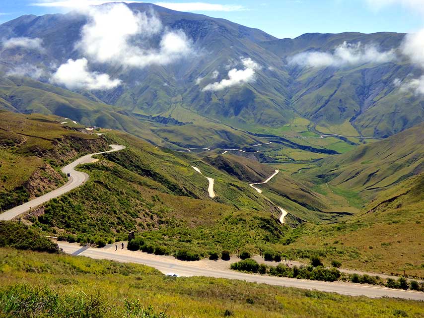
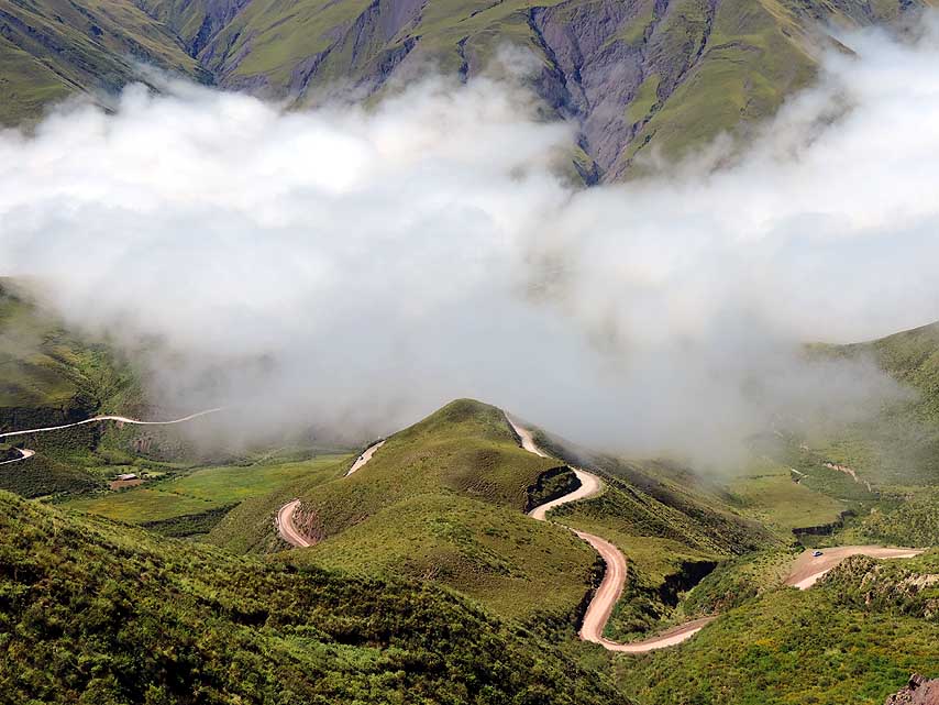
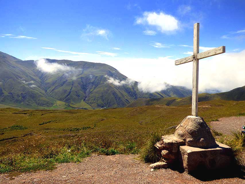
- Fog sails between the green mountain hills on the picturesque
hairpin road to the ôPiedra del Molinoö Pass at 11'342ft. [3'457m]
|
-
145
|
-
146
|
-
147
|
-
|
-
-
|
-
-
|
-
-
|
-
148 The chapel San Rafael on the
- ôPiedra del
Molinoö Pass at 11'342ft.
- [3'457m] altitude
|
-
149 Souvenir photo with Swiss people
- on the
11'342ft. [3'457m] high ôPiedra del
- Molinoö Pass: Left: Isabella and
John with
- their Landrover and on the right Anna
- and Koni, who
emigrated to Uruguay
|
-
150 Delicate flowers defy
- the barren landscape
|
-
|
-
|
-
-
|
-

|
-
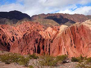
151 Argentinean Saguaro-cactus forest of
- the most
bizarre shapes and different sizes
- in the plateau of ôLos Cardonesö
National
- Park, opened in 1996, on the descent from
- the ôPiedra del
Molinoö Pass to Cachi
|
-
152 Liliana next to a huge Argentinean
- Saguaro
cactus (Echinopsis terscheckii
- with its unlimited variety of
branches.
- It can grow up to 40ft. [12m]:
- Life time 250-300 years
|
-
153 Argentinean
Saguaro cacti with the
- backdrop of the 20'930ft. [6'380m] high
- snow-covered ôNevado de Cachiö massif.
- These cacti grow with
preference on
- heights up to about 11'000ft. [ca. 3'400m]
|
-
|
-
-
|
-
-
|
-
-
|
-
154 A souvenir photo with the Argentinean
- Saguaro
cacti on the "Los Cardones" plateau
- in front of a snow-covered
- ôNevado de Cachiö massif
|
-
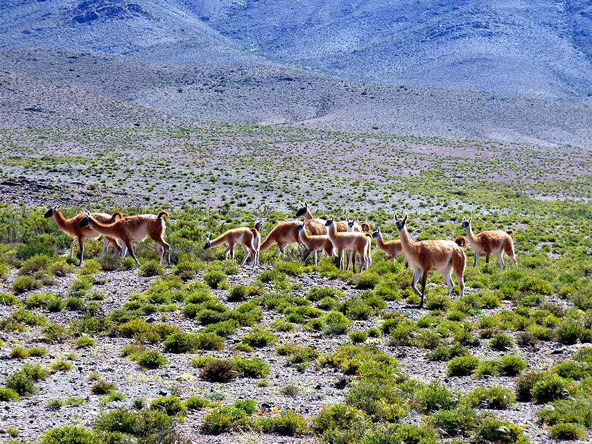
155 Guanacos (Lama guanicoe) are
- roaming the
altiplano. They are native
- to South America and have a lifespan
- of 20 û 25 years
|
-
156 Holy Cross along the
provincial road
- RP33 over the ôPiedra del Molinoö Pass
- from Salta to
Cachi (exactly from El Carril,
- 23ms [37km] south of Salta, to
Payogasta,
- 8ms [13km] north of Cachi)
|
-
|
-
-
|
-
-
|
-
-

|
-
157 Halfway from Payogasta
to Cachi an
- enchanting landscape: Blooming flowers,
- bizarre escarpments with its
screes and the
- snow-covered ôNevado de Cachiö massif
|
-
158 Nature blooms even on
- the barren gravel: A
bunch of
- yellow marguerite daisies
|
-
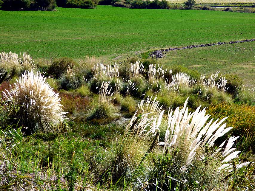
159 The white glittering
reed grass
- against the lush green willow
- displays a special charm
|
-
|
-
-
|
-
-

|
-
-
|
-
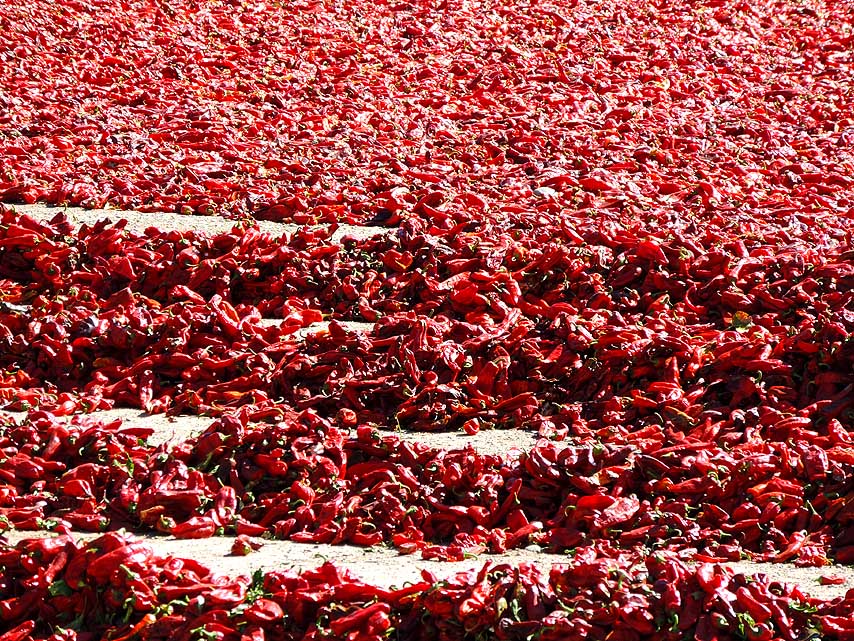
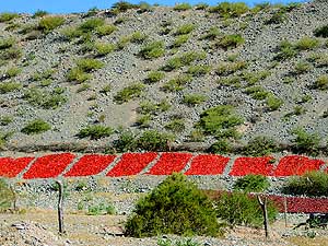
160 At the little village of El Quip¾n
- before
Cachi large red chillies are
- dried behind an adobe wall à..
|
-
161 à.. here they are being harvested à..
|
-
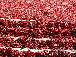
162 ..... and here they
are spread
- out to dry in square fields
- on the slope of a hill
|
-
|
-
-
|
-
-
|
-
-
|
-
163 Entrance to the charming mountain
- village of
Cachi (about 3-5'000 people),
- located at an altitude of 8'304ft. [2'531m],
- with its low white-painted adobe houses in
- the prov. of
Salta in northwestern Argentina
|
-
164 ôStreet artö in Cachi
|
-
165 Quiet street in Cachi
at the foot of
- the 20'930ft. [6'380m] high snow-capped
- mountain
ôNevado de Cachiö
|
-
|
-

|
-
-
|
-
|
-
166 The Iglesia San JosÚ, a church
- built 1796 in
Spanish colonial style,
- in the center of Cachi à..
|
-
167 à.. the confession booth is built
- entirely
from the porous wood of the
- Argentinean Saguaro cactus
- (Echinopsis
terscheckii) .....
|
-
168 à.. and the graceful
vaulted
- ceiling is also made of cacti wood
|
-
|
-

|
-
-
|
-
|
-
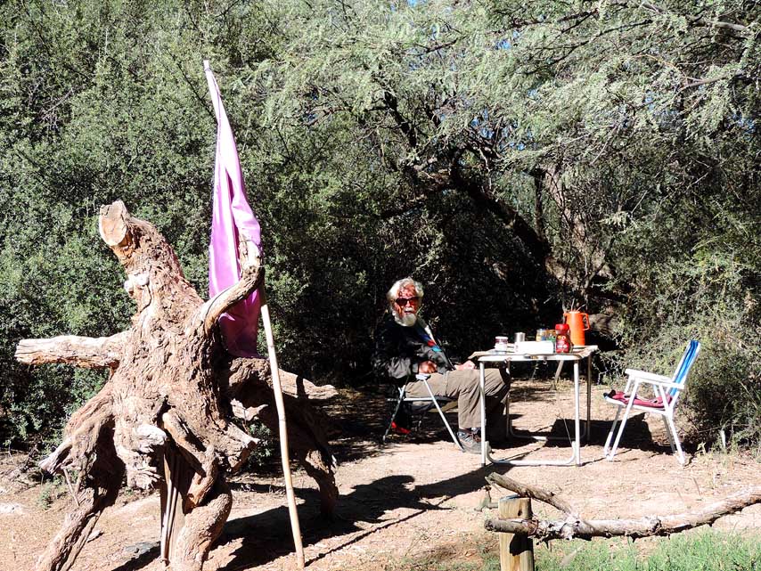
169 Breakfast under trees at the
- Municipality
camping in Cachi. Everyone
- has his own plot of land with electricity
- and the barbecue area, which is
- indispensable in Argentina à..
|
-
170 à.. there is also a stone table,
- where
Liliana is cooking lunch à..
|
-
171 à.. and a friendly
shaggy dog
- that wants to make friends
- for sharing the meal
|
-
|
-
Next website from
southern South America:
-
Argentina Part 3
û from Cachi
in CalchaquÝ Valley to Clorinda
at the Paraguay border
û March 30th, to May
4th, 2019
|
- The African trip
2013-16:
- CapeVerde: Santiago/Praia
part 1 û November18th to December 13th, 2013
- CapeVerde: Fogo
û Dezember13th to 23rd, 2013
- CapeVerde: Brava
û December 23rd to 26th, 2013
- Cape Verde: Santiago/Praia
part 2 û December 26th, 2013 to February 28th, 2014
- Cape Verde: SÒo Nicolau û February
28th to March 13th, 2014
- Cape Verde: SÒo Vicente/Mindelo part 1
û March 13th to 20th, 2014
- Cape
Verde: Santo AntÒo/Eastern side part 1 û
March 20th to April 7th, 2014
- Cape
Verde: Santo AntÒo/Western side part 2 û
April 7th to 10th, 2014
- Cape
Verde: SÒo Vicente/Mindelo part 2 û
April 10th to 29th, 2014
-
Namibia Part 1 û
from Walvis Bay to Windhoek
- Angola Part 1
û
September 26th to October 4th, 2014
- Angola Part 2 û
October 4th to 22nd, 2014
-
Namibia Part 2 û
from Windhoek to the Angolan border, back again and on to
South Africa
-
South Africa
Part 1 û
from Namibia border to Capetown û
January 22nd to February 23rd, 2015
- 3rd Major Repair of our
LandCruiser FJ60 - 1982 (due to two broken sideshafts)
-
South Africa Part 2 û from Capetown to Tsitsikamma National Park û
February 24th to March 13th, 2015
- South Africa Part 3 û from
Addo National Park to the Lesotho border û March
13th to April 7th, 2015
-
Lesotho û April 7th to 15th, 2015
-
South Africa Part 4
û from the Lesotho to the Swaziland border û
April 15th to 23rd, 2015
-
Swaziland û April 23rd to 28th,
2015
-
South Africa Part 5
û from the Swaziland to the Botswana border
û April 28th to May 15th, 2015
-
Botswana
-
Zimbabwe
-
Mozambique
-
Malawi
-
Armed Robbery in Malawi on July
31st/August 1st, 2015
-
Tanzania
-
Kenya
-
Ethiopia Part 1 û from Kenya to
Djibouti –
October 25th to November 18th, 2015
-
Djibouti –
October 18th to 27th, 2015
-
Ethiopia Part 2 –
from
Djibouti to
Sudan –
November 27th to December 9th, 2015
- Sudan –
December 9th, 2015 to January 8th, 2016
-
The continuation in Asia 2016-18:
-
Saudi Arabia – January 9th
to 12th, 2016
- United Arab Emirates – January
12th to April 10th, 2016
- Iran – April 11th to
May 6th, 2016
- Turkmenistan – May 6th to
10th, 2016
-
Uzbekistan – May 10th to
31st, 2016
-
Tajikistan Part 1 – from
Uzbekistan border to Dushanbe û May 31st to June 18th, 2016
-
Tajikistan Part 2 – from
Dushanbe to the Kyrgyzstan border û June 19th to 27th, 2016
- Kyrgyzstan – June 27th to August 9th, 2016
-
Kazakhstan û August 9th to 21st, 2016
- Russia Part
2a û from Tretyakovo at
Kazakhstan border via Lake Teletskoye to Gorno Altaysk û August 21st to September
26th,
2016
- Russia Part 2b – from
Gorno Altaysk to the Mongolia border and back to the Ukraine border at Krupets
û Sept. 26th to Nov. 11th, 2016
-
Ukraine Part 3 û November
11th to December 8th, 2016
- 3rd Rejuvenation of our
LandCruiser FJ60/1982 in
Miri/Sarawak/East
Malaysia from 2/6 to 5/3/2017
-
Sarawak-Kalimantan-North Sulawesi Part 1 û Miri
- Kuching/Sarawak/Malaysia -
Balikpapan/Kalimantan, by
ferry to Sulawesi
-
North-Sulawesi Part 2 û
Tomohon and surroundings to Tangkoko NP and onwards to Bitung with ferry
to Ternate on North Moluccas
-
North-Moluccas Part 1
û Ternate and Tidore and onwards by ferry to
Sofifi on Halmahera on North Moluccas
-
North-Moluccas Part 2
û Halmahera and onwards by ferry to Sorong in
West Papua Part 1 (Irian Jaya)
on western Bird's Head Peninsula
-
West Papua (Irian Jaya)
Part 1
û Sorong, éTrans Papua RoadÆ and onwards by
ferry to
Seram in Moluccas (Central)
-
Moluccas (Central) Part 1 û Seram and onwards by ferry
to
Ambon in Moluccas
-
Moluccas (Central)
Part 2 û Ambon and onwards by ferry
to Serui on Yapen in Papua
-
Papua
Part 1 û
Yapen and onwards by ferry
to Biak in Papua
-
Papua
Part 2 û
Biak and onwards by ferry
to Manokwari in West Papua
Part 2
(Irian Jaya) on eastern Bird's Head Peninsula
- West Papua
(Irian Jaya)
Part 2 û Manokwari,
éTrans Papua RoadÆ and onwards by ferry
to Makassar
in South Sulawesi
-
South Sulawesi-Kalimantan-Sarawak
Part 2 û Makassar
South Sulawesi by ferry to Batulicin/South Kalimantan, Kuching - Miri in Sarawak
- Continuation of
3rd Rejuvenation of our LandCruiser FJ60/1982 in Miri/Sarawak/East
Malaysia
from 7/16
to 9/22/2018
|